
Starting the trip at Maxon Road
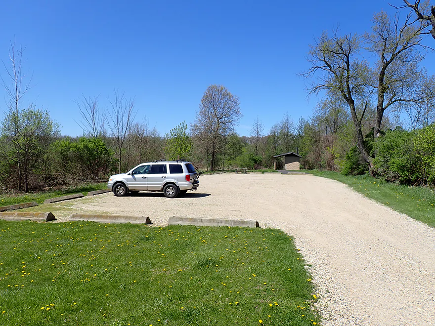
Public parking lot to the north
Welcome to Illinois!
Walking back to the bridge from the parking lot
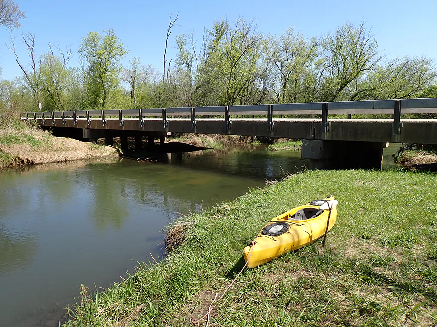
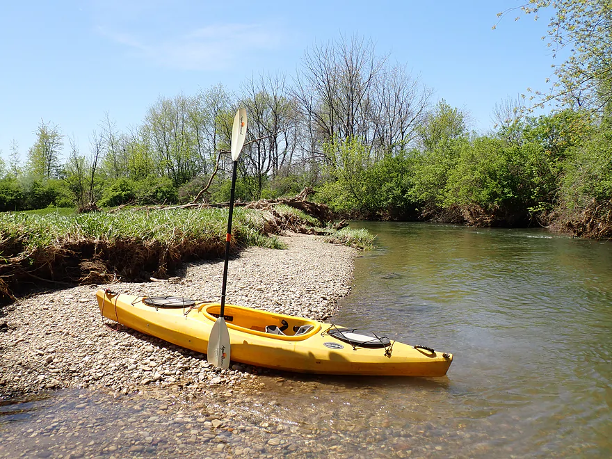
Maxon Road is an ok bridge access

Bench is part of a public fishing access
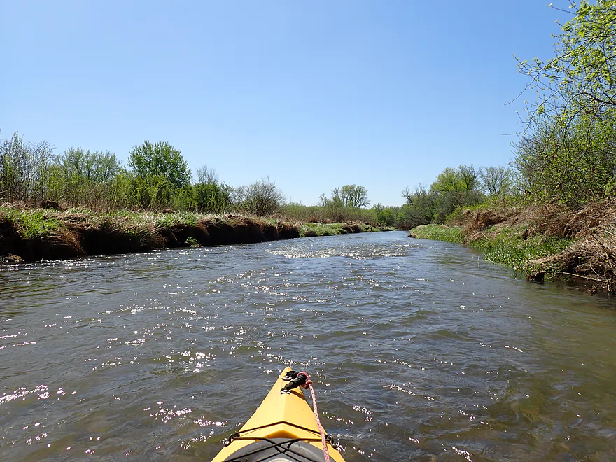
Surprisingly fast current

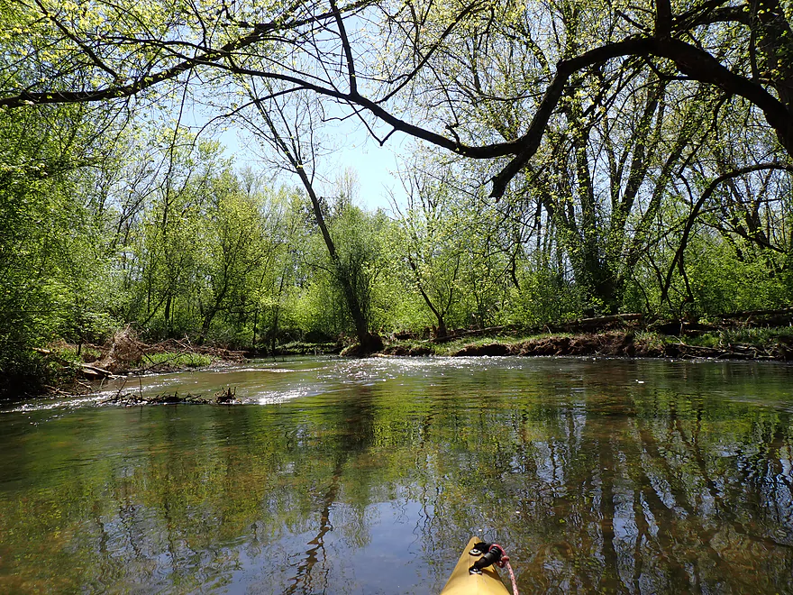
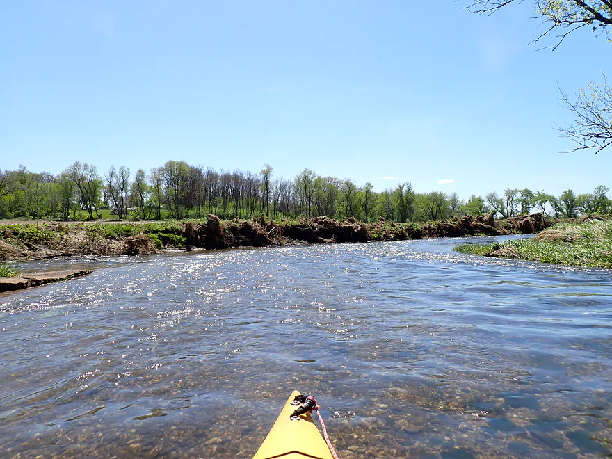
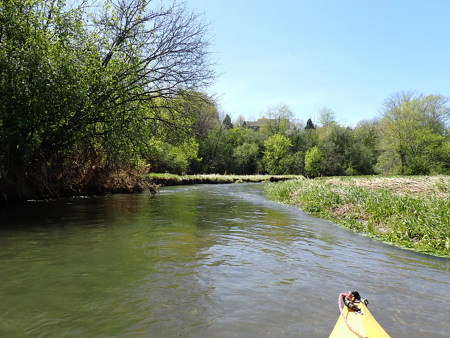
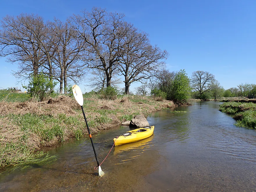
Getting out for pictures
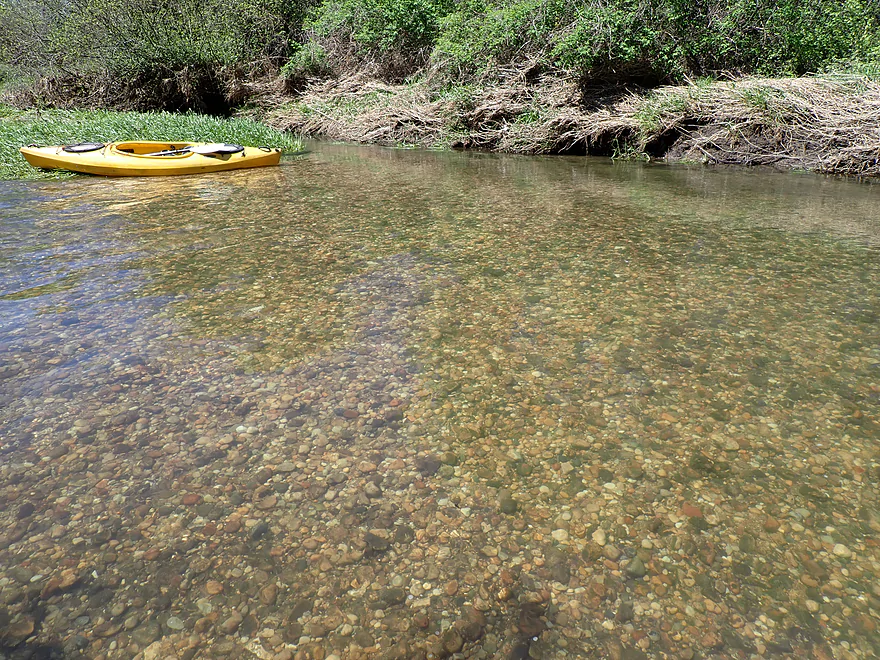
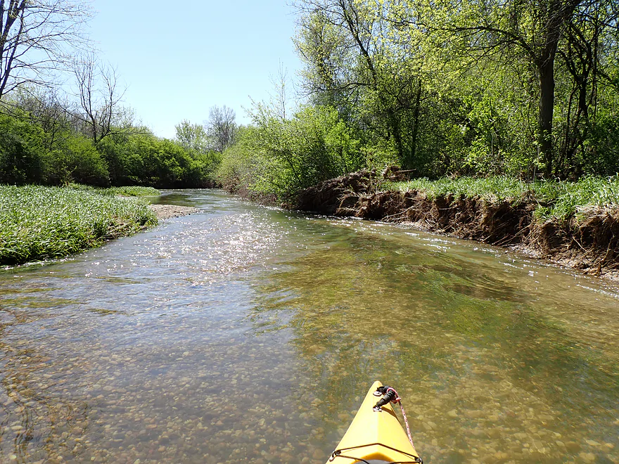
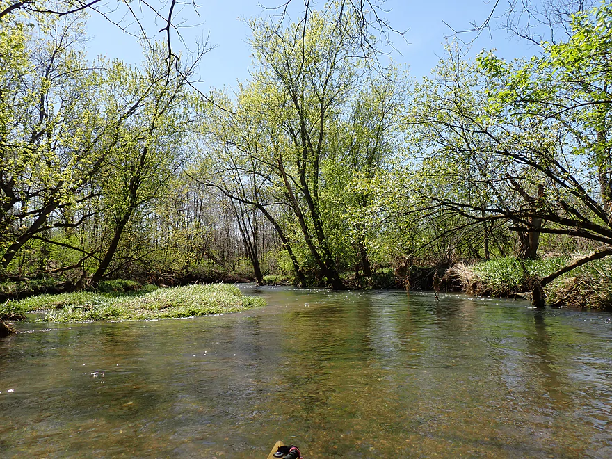
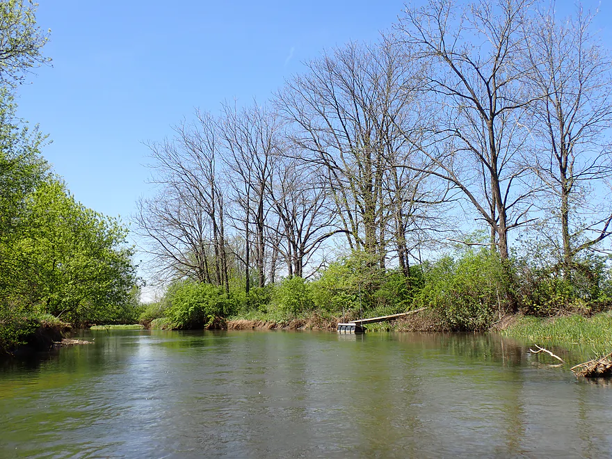
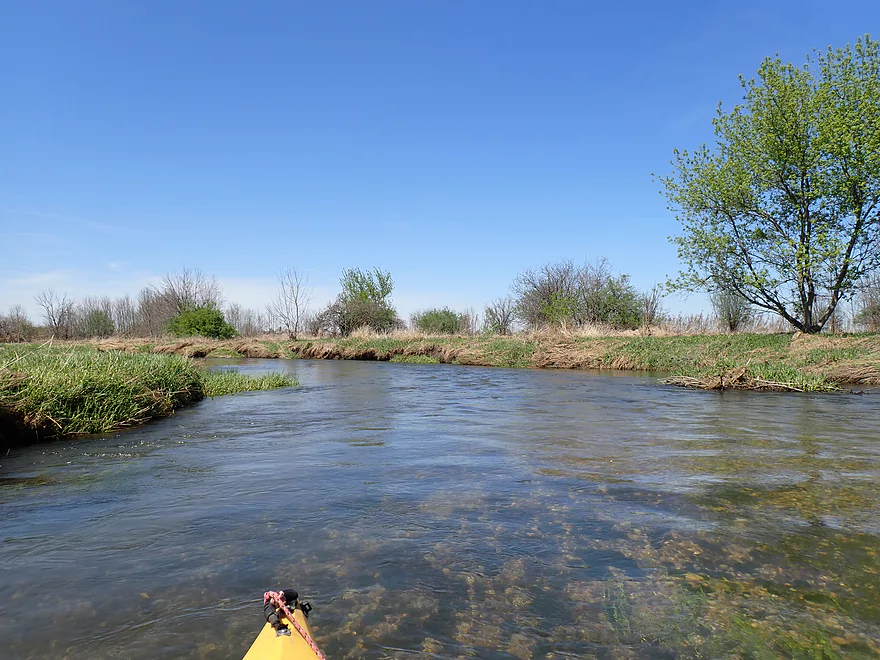
Fantastic glacial gravel and water clarity
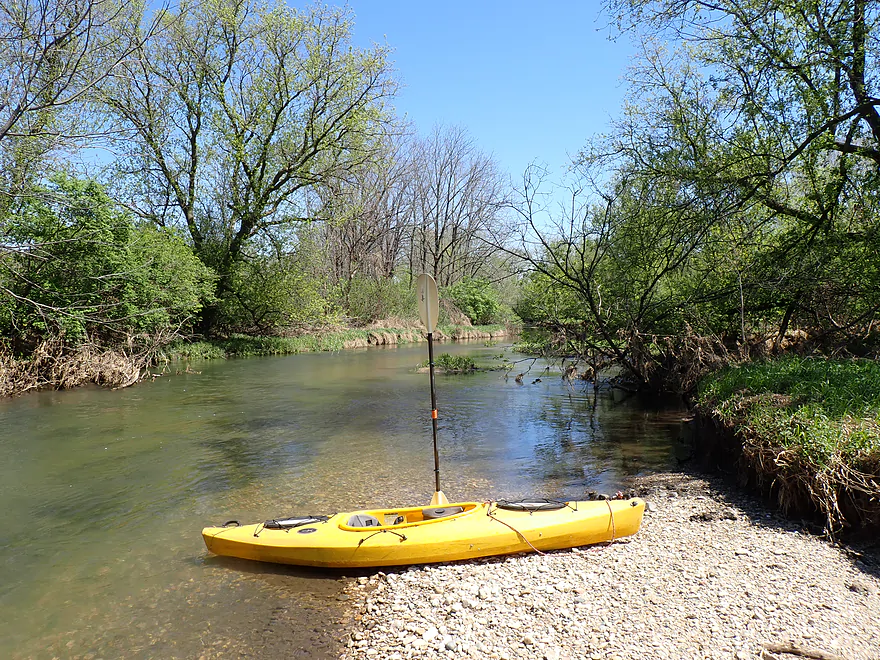
Reverse view
Lots more rapids

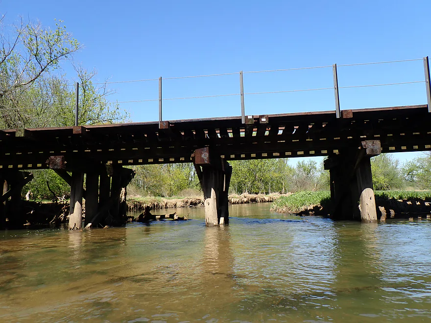
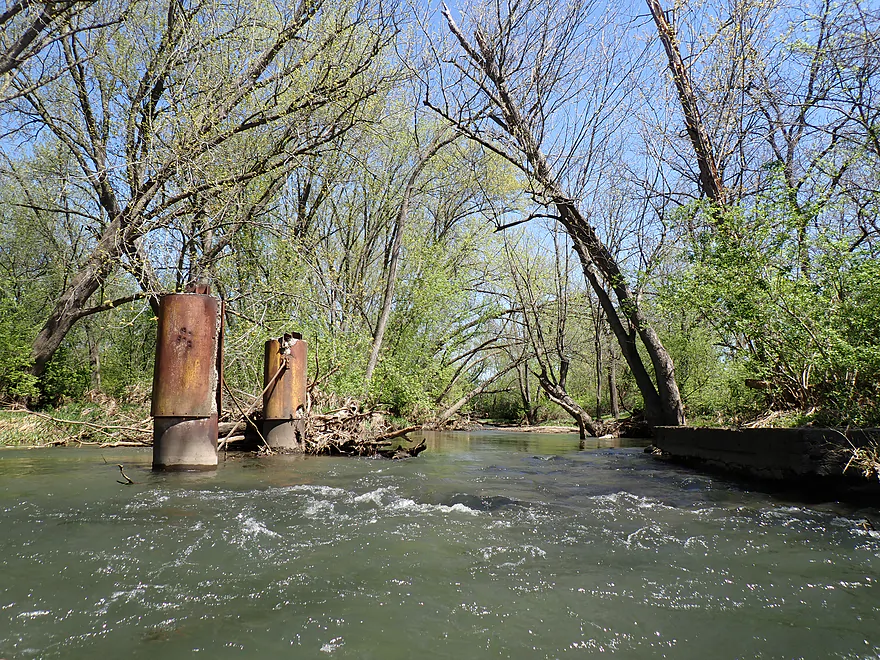
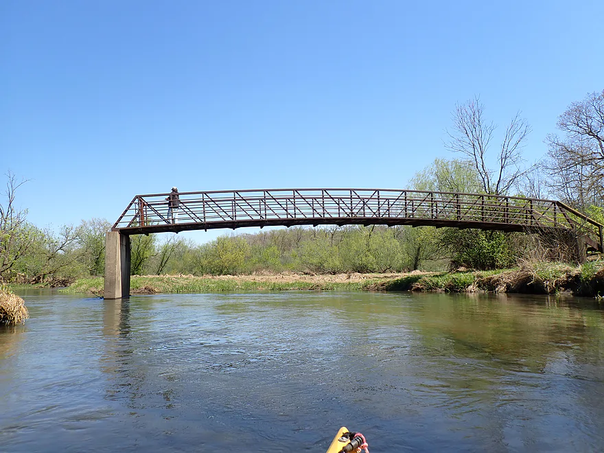
Old railroad bridge
Part of Beck’s Woods (an Illinois Conservation Area)…very nice
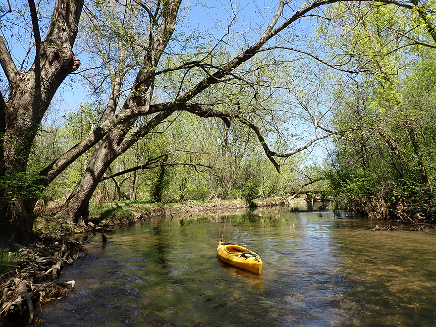
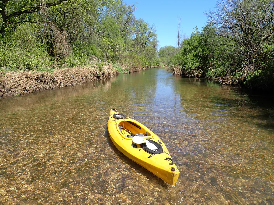
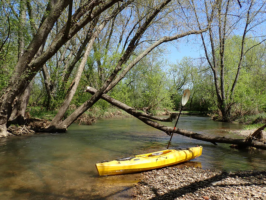
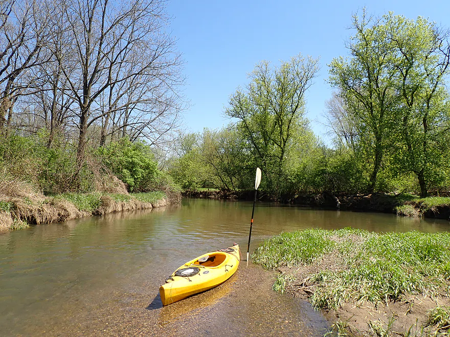
Using my kayak for photographic scale
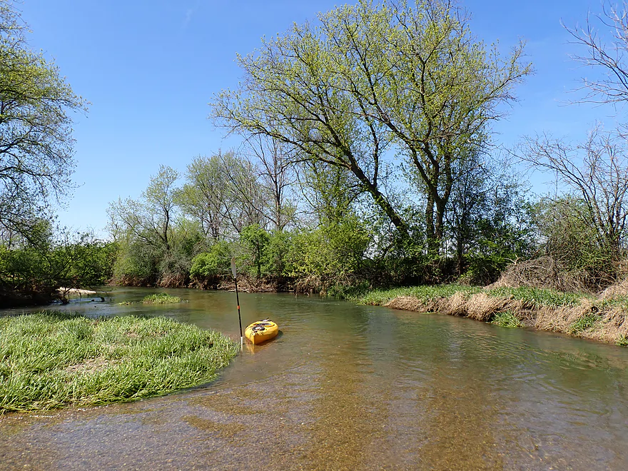
Cool gravel island
This feels like central Wisconsin
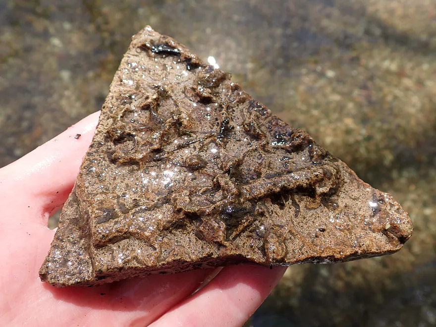
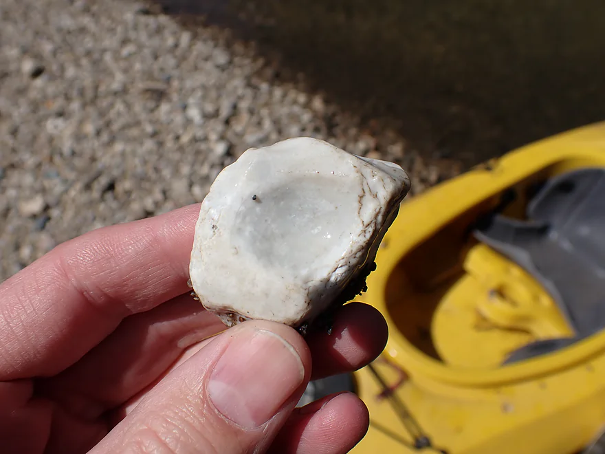
Found a fossil
Reverse view
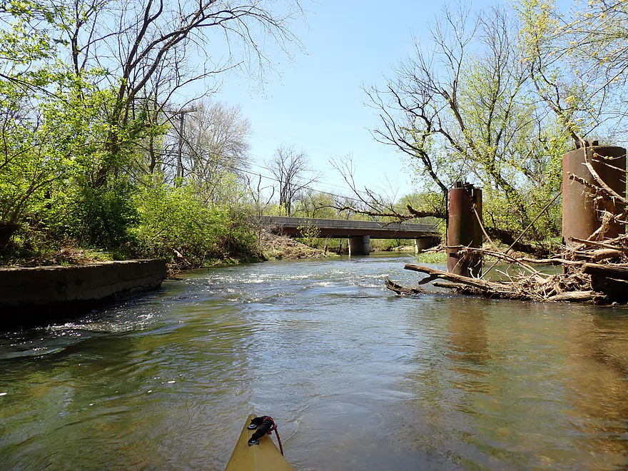
Rapids next to old bridge remains
Reverse view
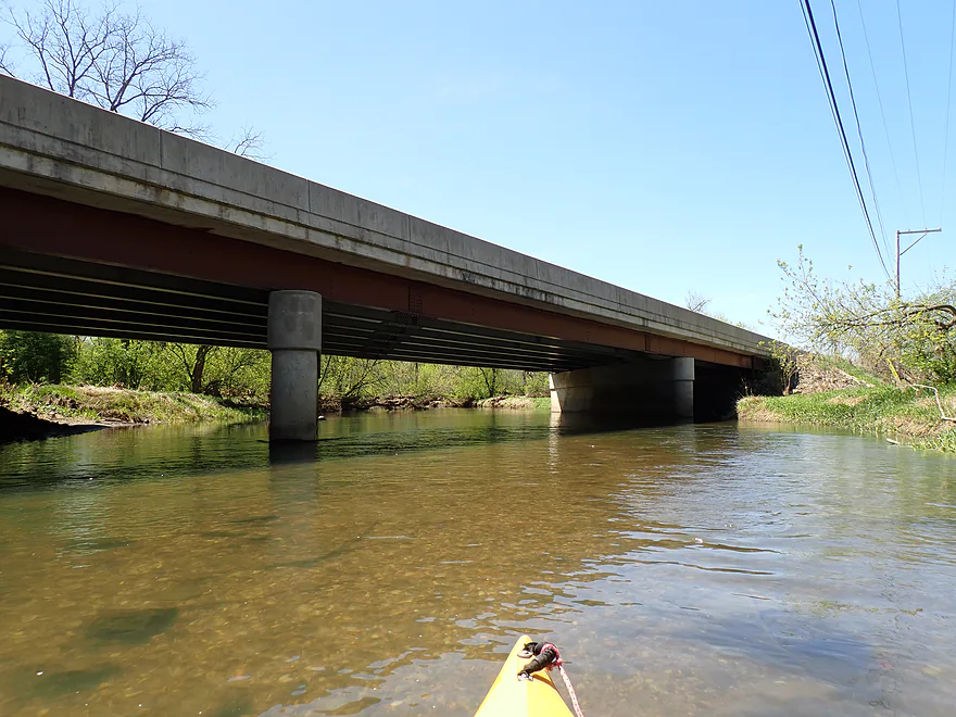
Hwy 173
Current stays fast
This bridge seems to be missing something…
Now leaving Beck’s Woods
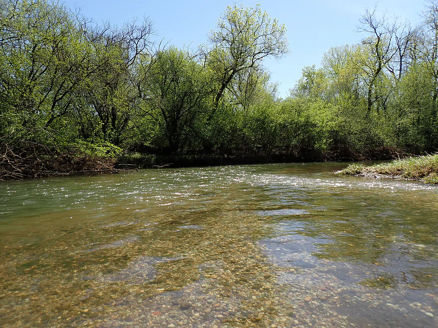
Clarity stays good though
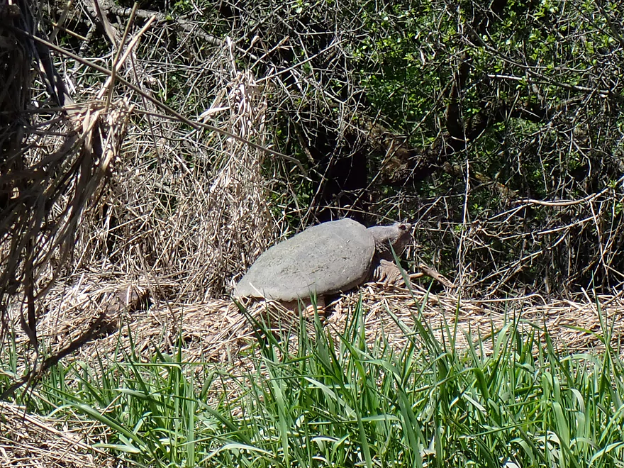
A huge snapping turtle
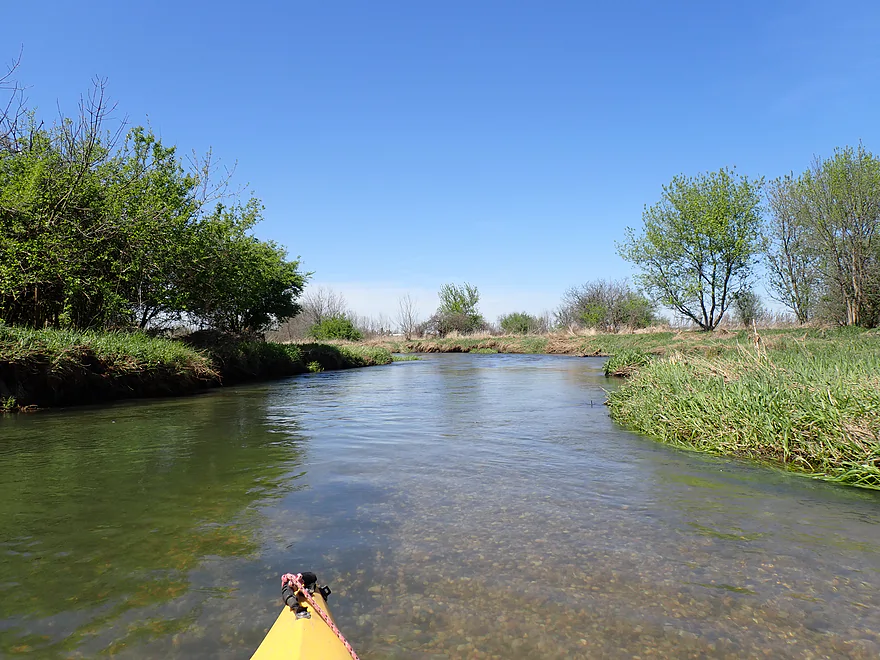
Nice river bend
Natural quartz
One of the larger gravel bars
Reverse view
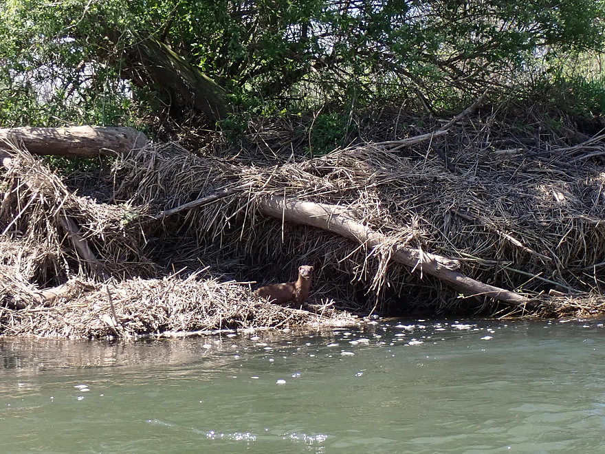
Mink was nice enough to stay still for a quick photo
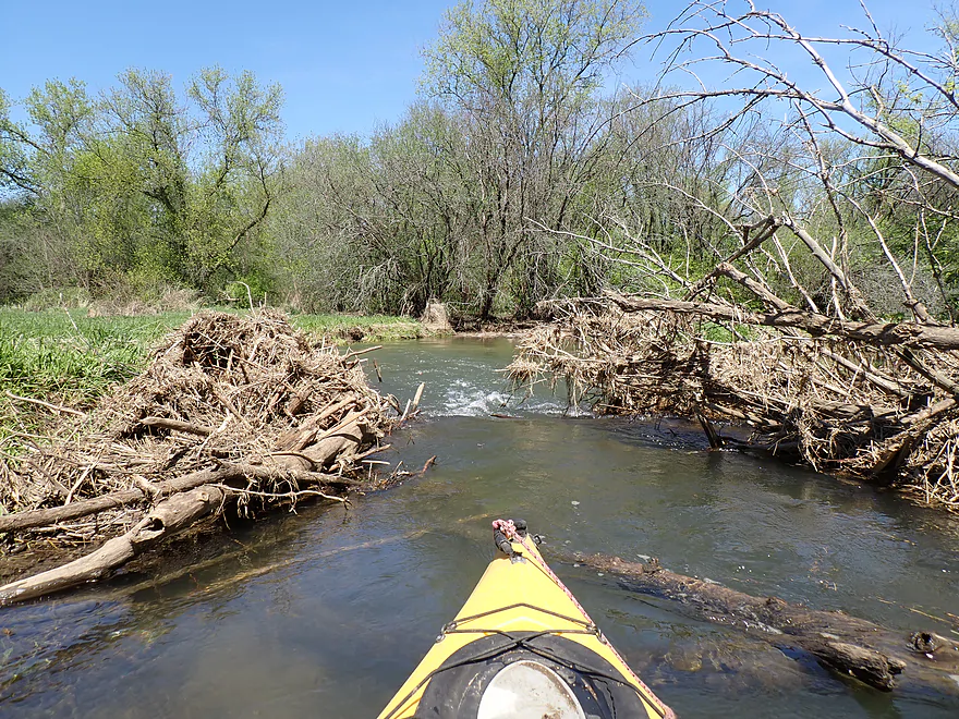
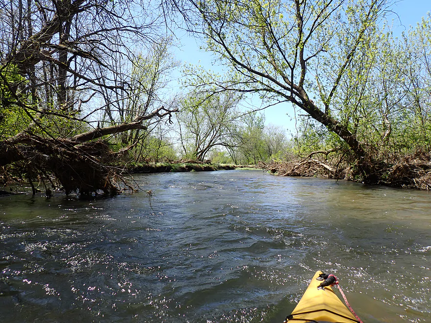
Not too many logjams, but there were a few constrictions
Only logjam I had to portage (easy)
Checking out a scenic side channel
Creek starts to open up
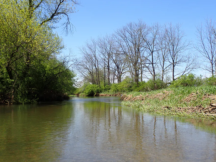
Some great oak groves near the end of the trip
Getting out for pictures
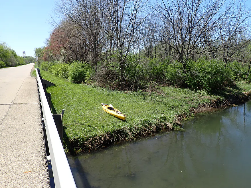
A side creek
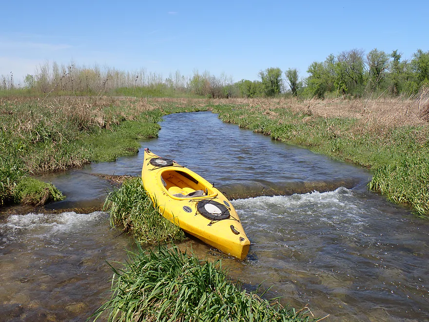
Ending the trip at Streit Road (steep banks but doable)
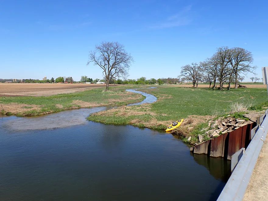
Pastoral view of a tributary creek from the bridge
Piscasaw Creek

Piscasaw Creek (pronounced “Bish-kah-SAH” by the native Potawatomi) is a rare Illinois trout stream located northeast of Rockford. It’s been on my to-do list for a long time, and I finally decided to check it out despite concerns about high water (which, thankfully, proved not to be an issue).
Upstream from Chemung, the Piscasaw splinters into branches that are too small to navigate, effectively making the Chemung area the northernmost limit for a trip. This narrowed my options to the three public access points at Beck’s Woods Conservation Area. However, the southernmost gate was locked and the middle access required a dauntingly long walk, so I opted for the bridge at Maxon Road as the most practical starting point.
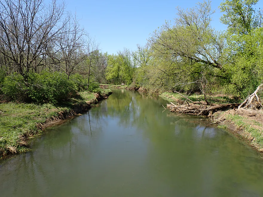
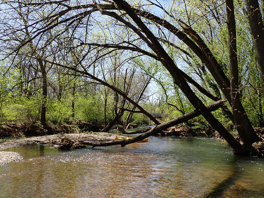
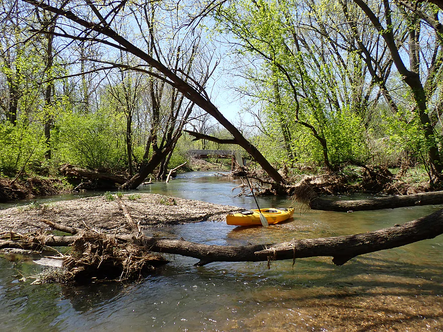
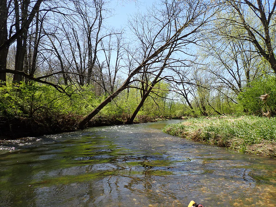
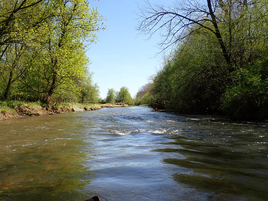
The first mile of the trip was easily the best. Here the creek flows through the Beck’s Woods Conservation Area, a public wooded corridor where the water is surprisingly clear and the current stays brisk with a number of light riffles. The sun reflects beautifully off a substrate of clean glacial gravel, making it easy to spot clam shells, schools of fish, and the occasional fossil.
Unlike the flat, unsorted “till” and muddy bottoms found across most of Illinois, the Piscasaw corridor is a geological rarity known as a valley train. 15,000 years ago, this valley served as a high-energy spillway for the melting Wisconsin glacier. The Marengo Moraine to the east acted as a dam, forcing roaring torrents of meltwater to wash away the fine silt and leave behind a deep, concentrated bed of glacial outwash. This created a substrate of clean, beautiful gravel, a feature so rare in the region that the creek feels more like a clear Northwoods stream than a typical Illinois river.
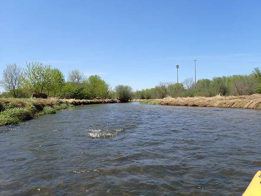
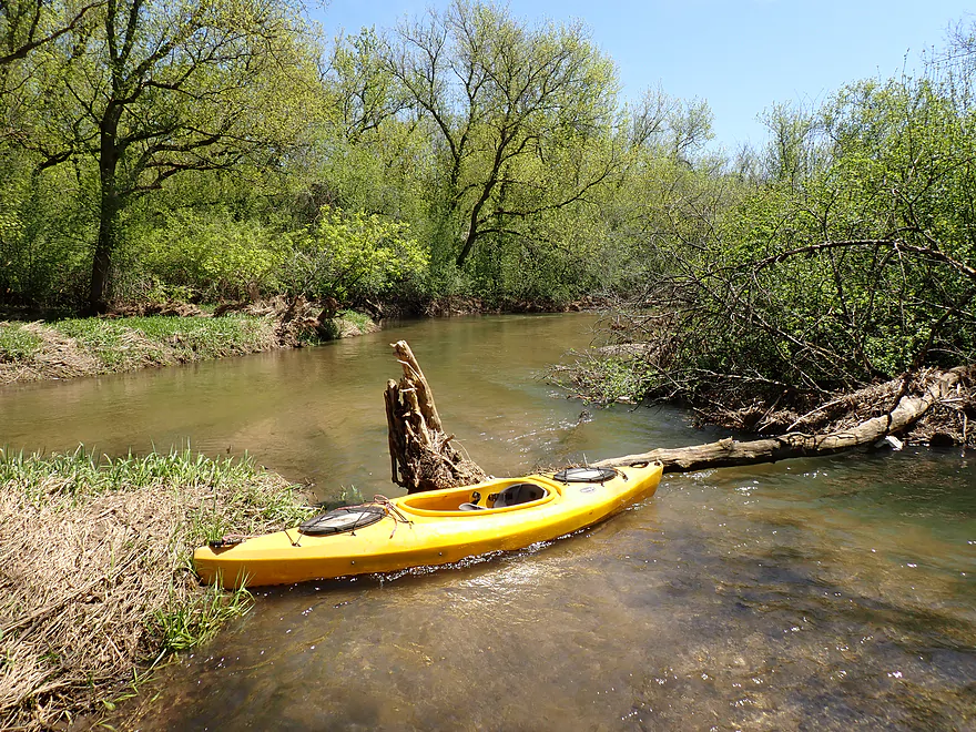
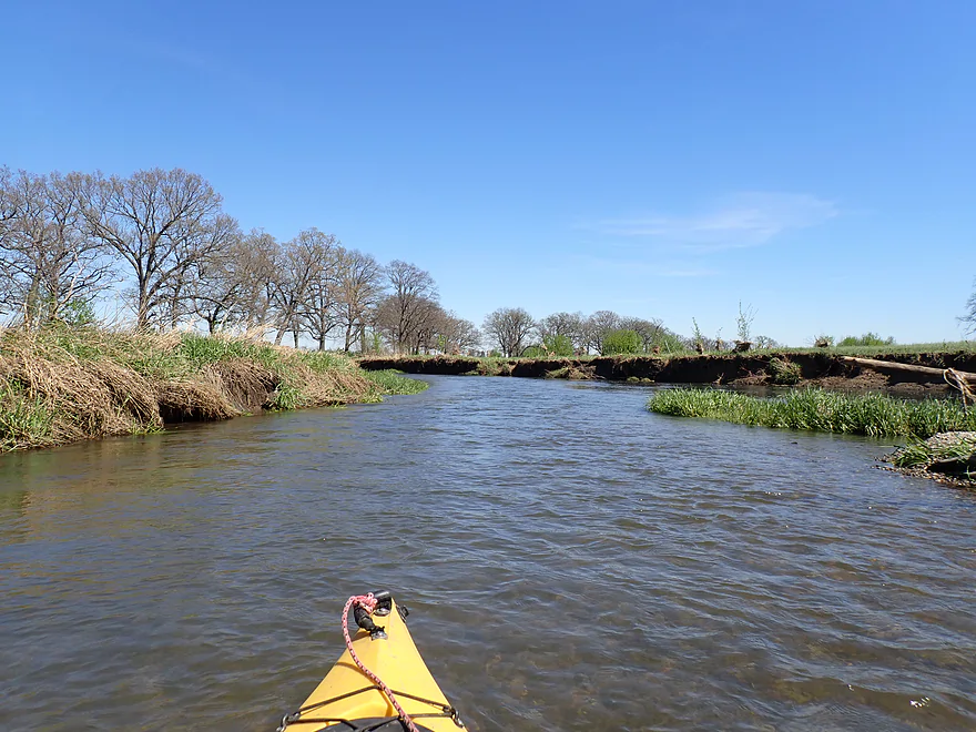
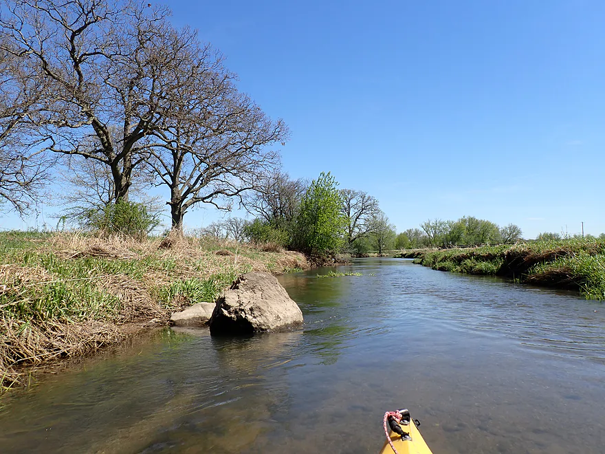
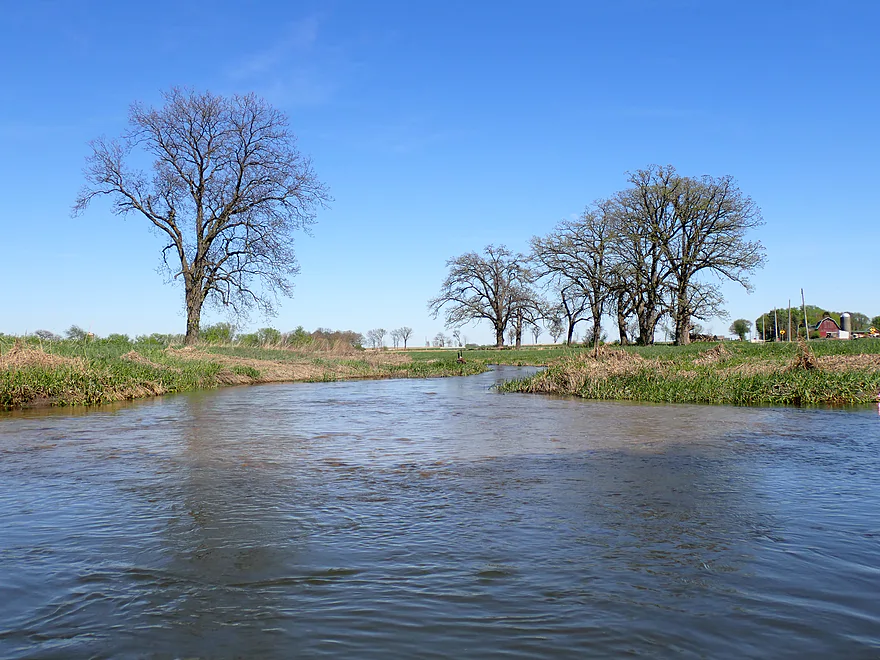
After leaving the conservation area, the creek moved into a flatter, more open landscape with fewer trees. While this stretch wasn’t as scenic, the current, water clarity, and gravel substrate remained excellent. Transitioning out of public lands can be a bit nerve-wracking in Illinois due to the state’s antiquated water access laws. Public status is often tied to whether a river was historically navigable by commercial vessels – literally how far upstream a steamboat could reach. This leaves the small Piscasaw in a legal gray area; while locals clearly paddle and maintain the creek (I even saw evidence of recent logjam clearing) a legal dispute could still favor a landowner. As always, treat waterways and the local landowners with the utmost respect and courtesy.
After passing several cool side creeks and attractive oak groves, the trip came to an end at Streit Road (a bit tricky for a bridge access…more on that later). All in all, this was a great trip and my favorite of 2026 so far. If the whole run had stayed like that first mile, it would have been five stars. The key to enjoying the Piscasaw is timing. You don’t want water levels to be too high, or you won’t be able to see all the cool glacial gravel, but you don’t want them too low, or you will be grounding out a lot. Paddlers could certainly continue on from Streit Road for a longer trip, which I personally hope to explore in the future.
This was a surprisingly good trip for wildlife. Sightings included schools of fish, which I think were trout (this is one of Illinois’ rare Class A streams). I also saw a huge dead fish (maybe a carp), cranes, herons, a huge snapping turtle, a mink, an owl who photobombed my video, geese, and a raccoon who was too busy digging something out of the creek to see me. There were many clam shells, but I didn’t see any living specimens.
Maxon Road: There was an ok launch spot southwest of the bridge. But, note shoulder parking is tight and traffic is fast. What I suggest is unloading your boat at the bridge (might have to double park a bit), then drive 1000′ north where there is a public parking lot, then hike back to the bridge where you can start your trip.
Alternate Put-ins:
- Becks Woods Conservation Area – South Access: (1.1 miles downstream from Maxon Road) You could start a trip here…this is part of a larger public park and a trail leads to the water by the pedestrian bridge. However, you would have to lug your boat 1100′ down the hill, and starting here precludes the Beck’s Woods Stretch which was my favorite. I recommend launching from Maxon Road.
Streit Road: This was a doable bridge access point, but the shoulders are very steep and the road has a decent amount of fast traffic. Parking isn’t easy; however, if you are determined, you could leave your car further east (about 800 ft), closer to Pagles Road.
Alternate Take-outs:
- OO Steims Memorial Park: (2.6 miles downstream from Streit Road) This is a nice public park with riverside access, and I believe it should be a decent option for paddlers.
Bike Shuttle – Streit Road to Maxon Road: 3.6 miles with 62′ of ascent. This was an easy bike shuttle.
Logjams: This was mostly a clear trail, although there were a few downed trees. Most were not difficult to navigate and would be easy to portage if necessary. I did have to get out at one spot, though it was an easy portage.
Strainers: There were strainers in the fast current. Most paddlers should have little difficulty avoiding them, but in high, pushy water, they might be more challenging.
Current: Surprisingly quick with many riffles. There were light rapids, but nothing major.
Closest Gauge: Piscasaw Creek @ Walworth
Trip Depth: 5.76′ or 4.2 CFS
Navigability Estimates: These may not be accurate, as Piscasaw Creek splinters into multiple sub-creeks upstream of Chemung, and this gauge is located on a smaller branch in Wisconsin. In reality, actual flows are probably three times what is shown on the gauge and may lag the Walworth reading by a day. The following are only rough estimates:
- <2 CFS: Likely too low.
- 3 CFS: Low; you might have to wade a few sections. Otherwise, I believe most of the creek should still be navigable and clarity should be great.
- 4 CFS: Nice depth.
- 5 CFS: On the high side. Clarity won’t be as good, and the current and strainers might become pushy at this level.
- 6 CFS: Very high depth. Likely only suitable for expert paddlers with good boat control.
- 7+ CFS: These may be flood conditions; I would advise staying off the creek.
- Upstream from Maxon Road: The creek splits into two here. The west branch (Upper Piscasaw Creek) is small, overly straight, and flows through farm fields; I don’t think it’s a great prospect. The east branch (Lawrence Creek) is also small and flows through a small community. Privacy and public access look poor, so I don’t recommend that either.
- Maxon Road to Streit Road: 5.0 miles.
- Maxon Road to Beck’s Woods Conservation Area: 1.1 miles. A terrific stretch through Beck’s Woods with clear water, fun riffles, and an attractive gravel substrate.
- Beck’s Woods Conservation Area – South Access to Streit Road: 3.9 miles. Not as nice as the previous stretch, with fewer woods, but still great with a peppy current, good clarity, and lots of glacial gravel. There were a few snags on this stretch, but nothing I considered major (one required an easy portage).
- Streit Road to OO Steims Memorial Park: 2.6 miles. A good prospect. This starts flat and more open but becomes more wooded closer to OO Steims Memorial Park. There are several small ledges on the creek located upstream from Boone-McHenry County Line Road.
- OO Steims Memorial Park to Capron Road: 3.1 miles. A flatter and wider stretch, though it should still be nice. Here is a cool streetview image from Capron Road.
- Capron Road to Denny Road: 2.0 miles. Another good prospect. This section is more wooded and meandering, and the current can be stronger as well.
- Denny Road to Russellville Road: 1.6 miles. This is likely a decent prospect. I’m not certain if Russellville Road is a good access point, but I believe it is.
- Russellville Road to Squaw Prairie Road: 7.1 miles. Not recommended as there is a significant and dangerous fence in fast current that isn’t easy to get around.
- Squaw Prairie Road to Marengo Road: 1.6 miles. This is more wooded and is likely an okay prospect.
- Marengo Road to Red Horse Bend Canoe Launch: 1.8 miles. The last leg before the mouth is densely wooded. There might be downed trees, logjams, and strainers; otherwise, I think it could be nice. If you do this stretch, time it for when the creek is low so it’s less pushy.
Trip Map
Overview Map
Video
Photos Size: