
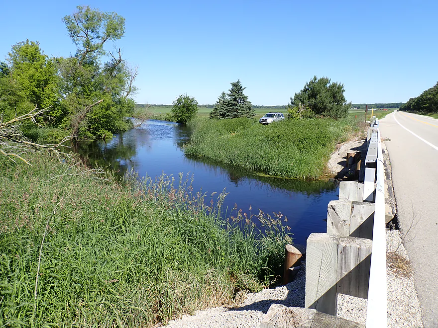
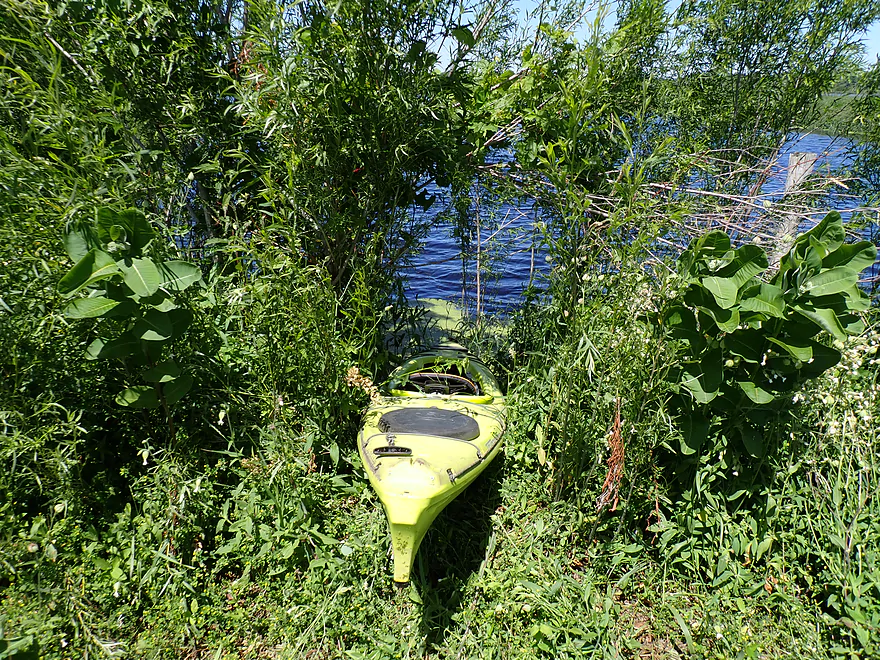
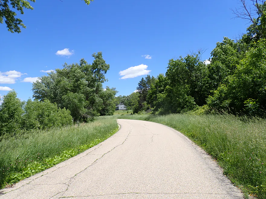
Starting at Hwy 106
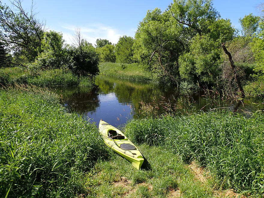
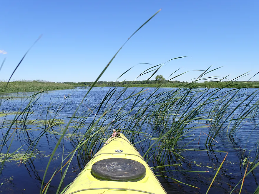
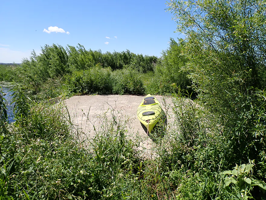
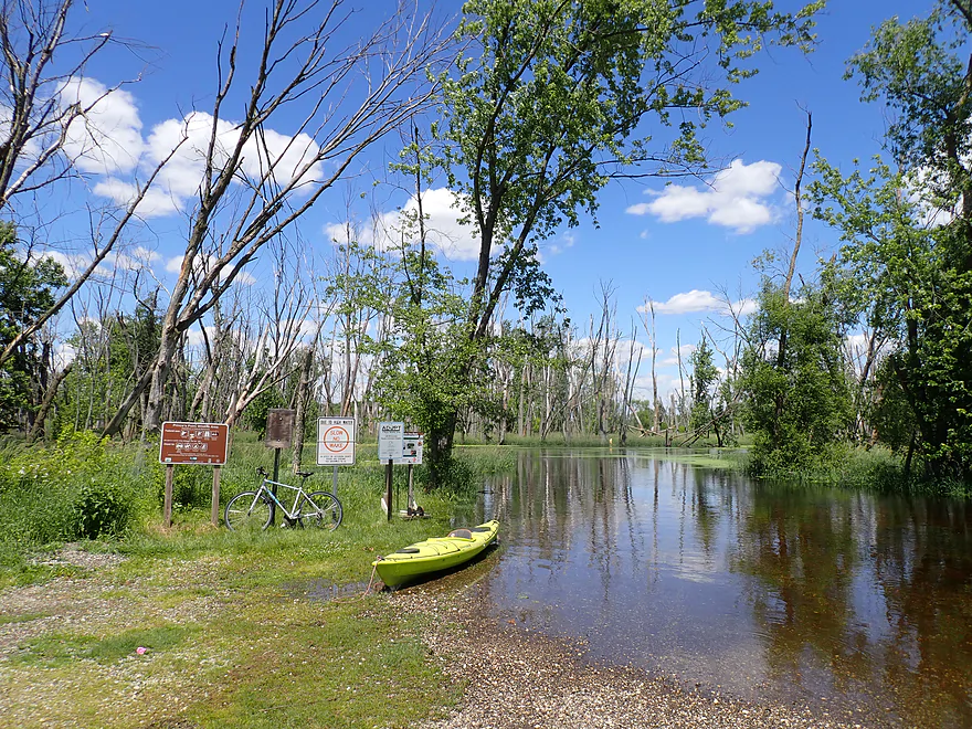
Great put-in
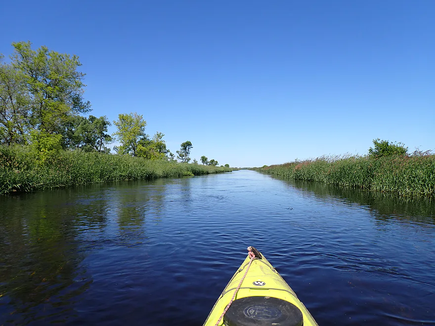
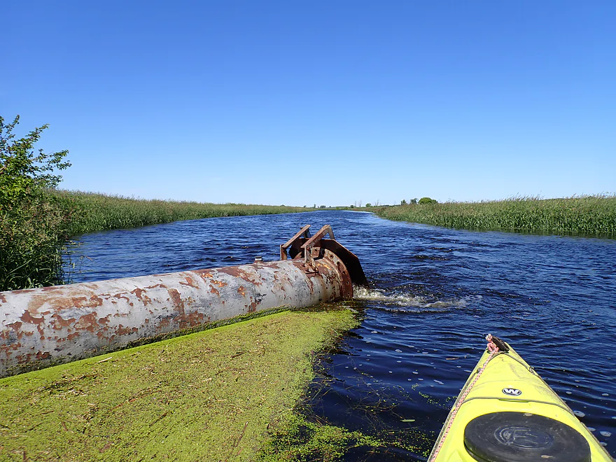
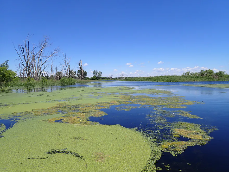
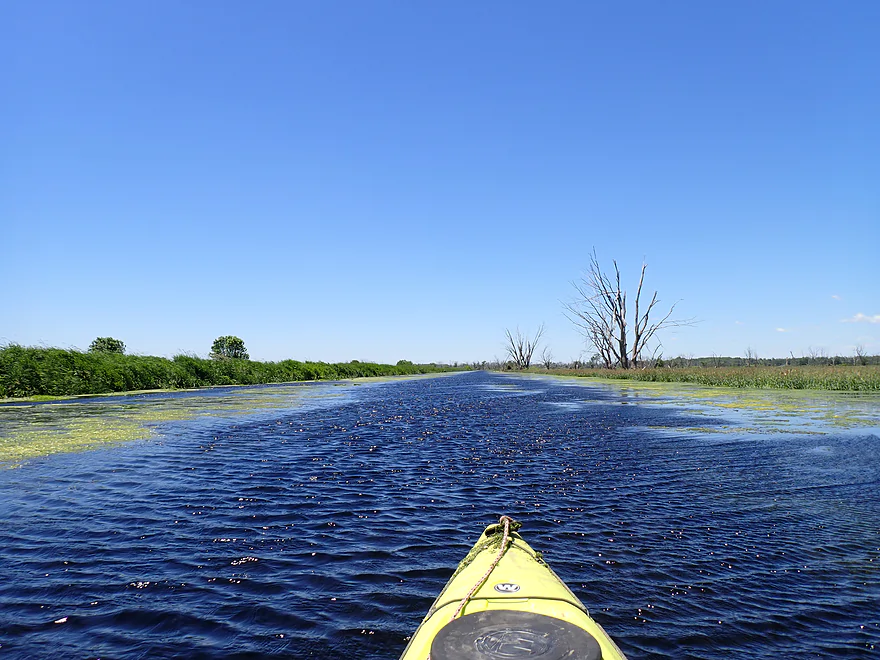
Most of the trip had long, straight (channelized) sections
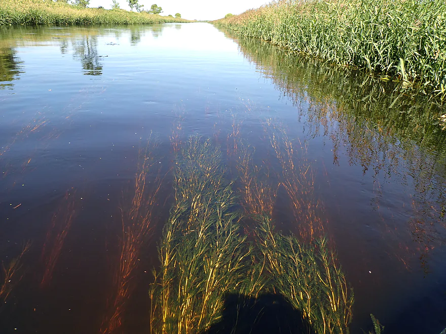
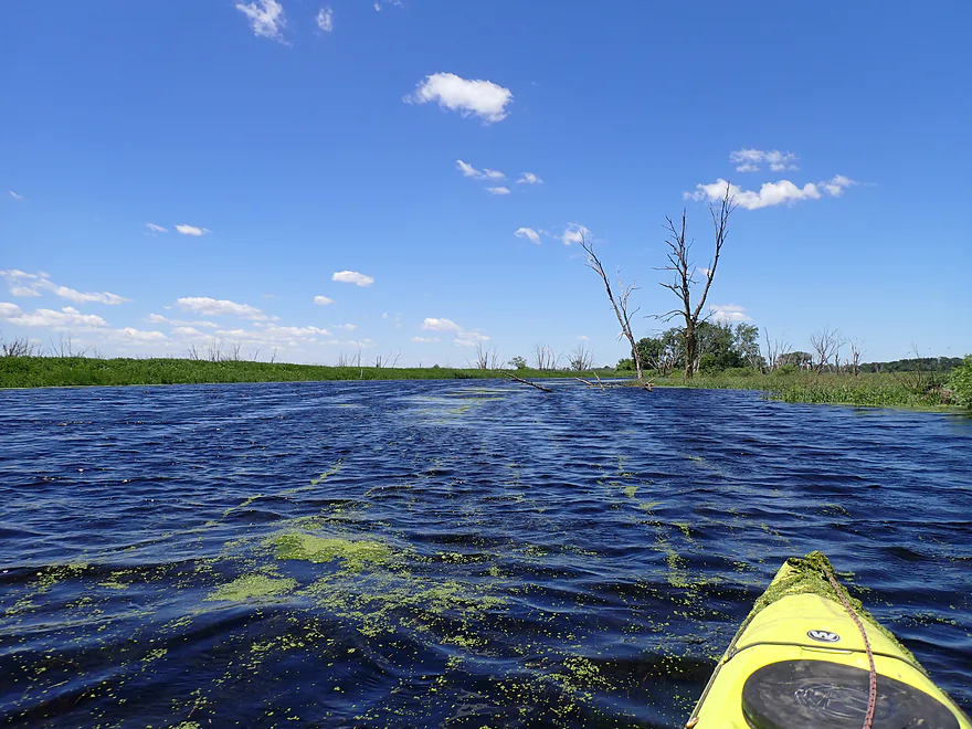
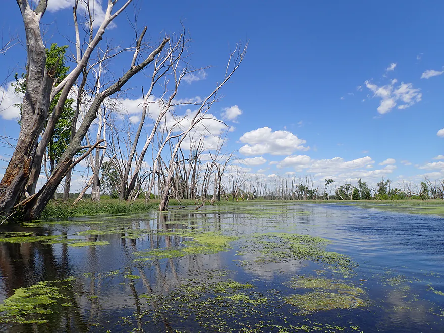
Despite being deep, clarity wasn’t bad
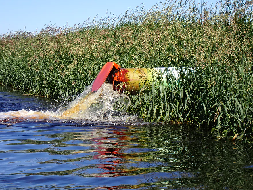
Drainage pipe barfing out water
Done throwing up (the pump kicked off)
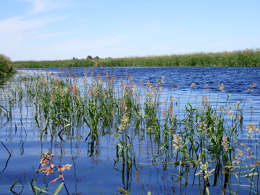
An attractive group of flowering grasses
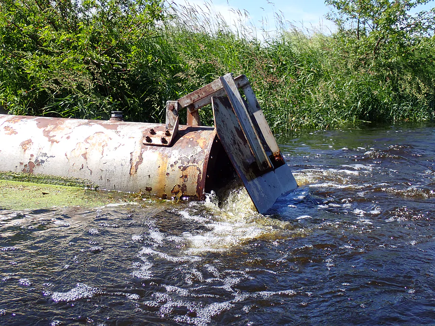
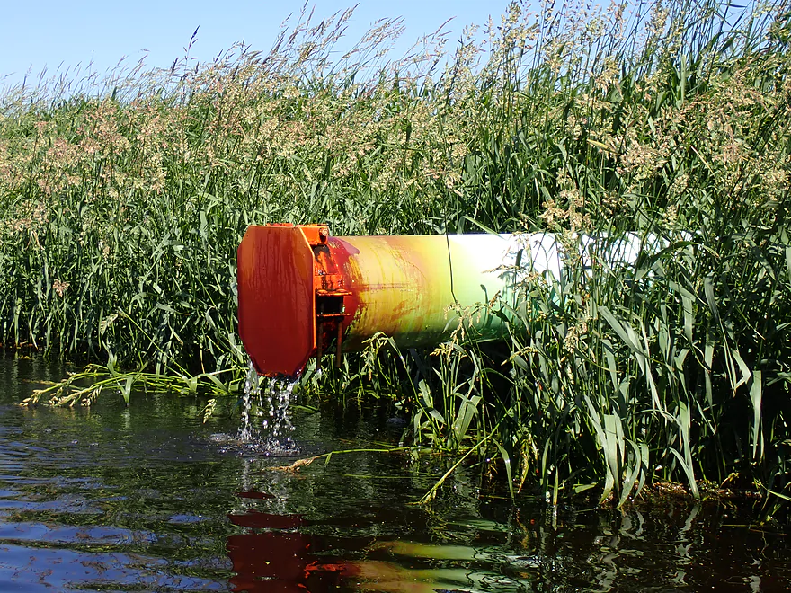
This pipe was stuck open so water kept pouring back in…pump would constantly run
I did this trip at high levels…maybe 2′ above normal
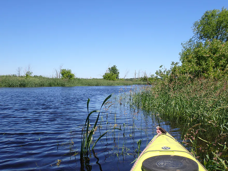
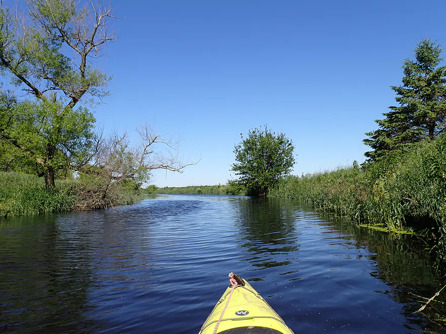
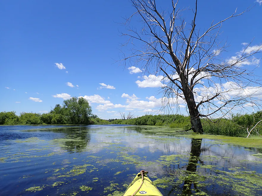
A rare bend in the river
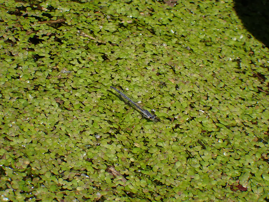
Damselfly balanced on duckweed
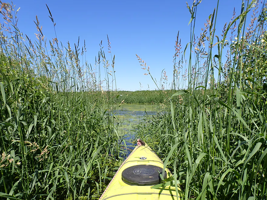
Checking out the adjacent sloughs
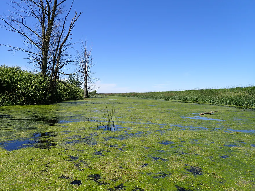
Most were pretty weedy and mucky
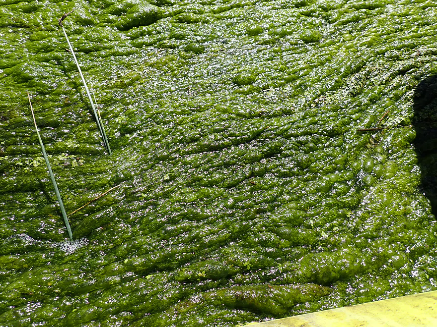
Yum
Water so high I could paddle over the dike into adjacent lakes
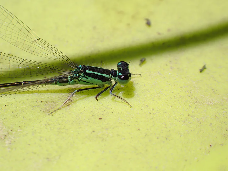
Great day for damselflies (this one is a forktail)
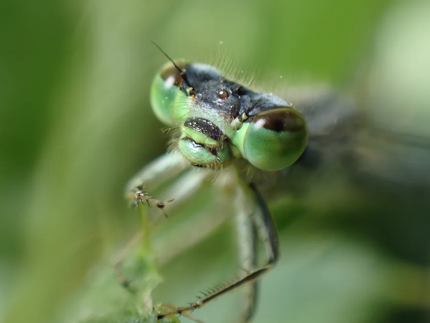
Check out that hairy face
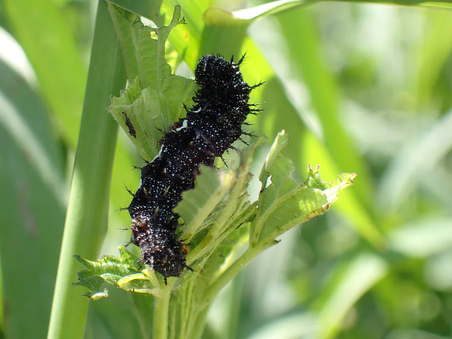
This spiky caterpillar might turn into a mourning cloak butterfly
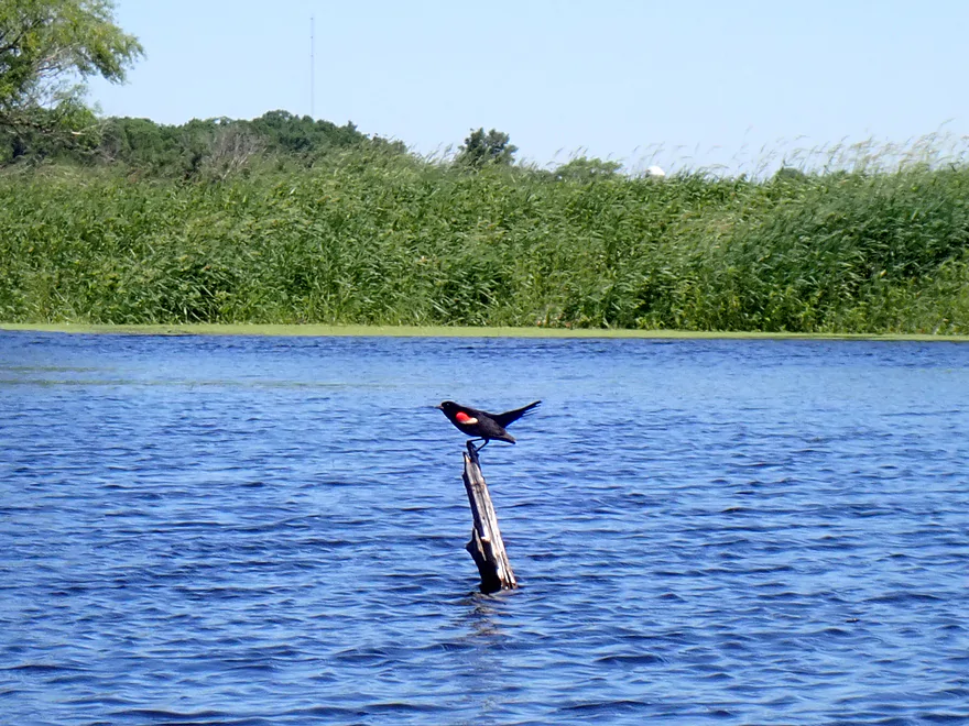
A lot of territorial red-winged blackbirds
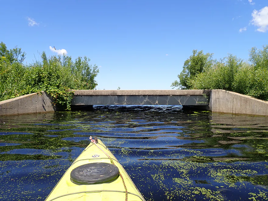
Coming up on an old bridge
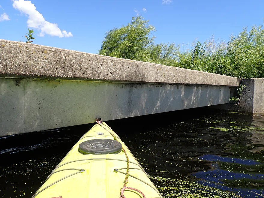
Not getting under this one…I had to portage
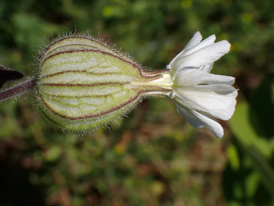
A closeup of a bladder campion flower
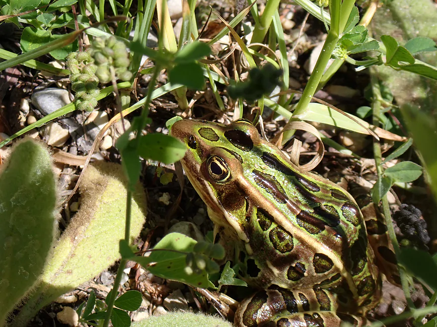
A well-camouflaged leopard frog
A literal bridge to nowhere…it connects to nothing
Tricky portage reentry
Finally back on the water
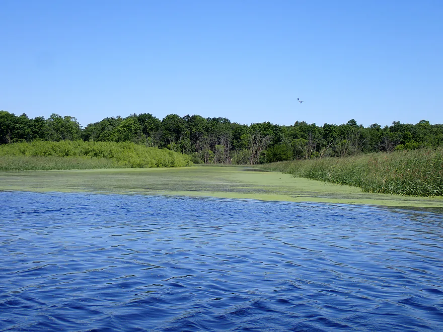
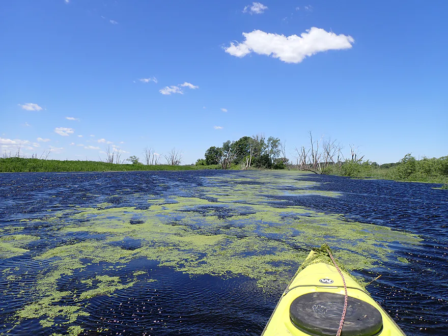
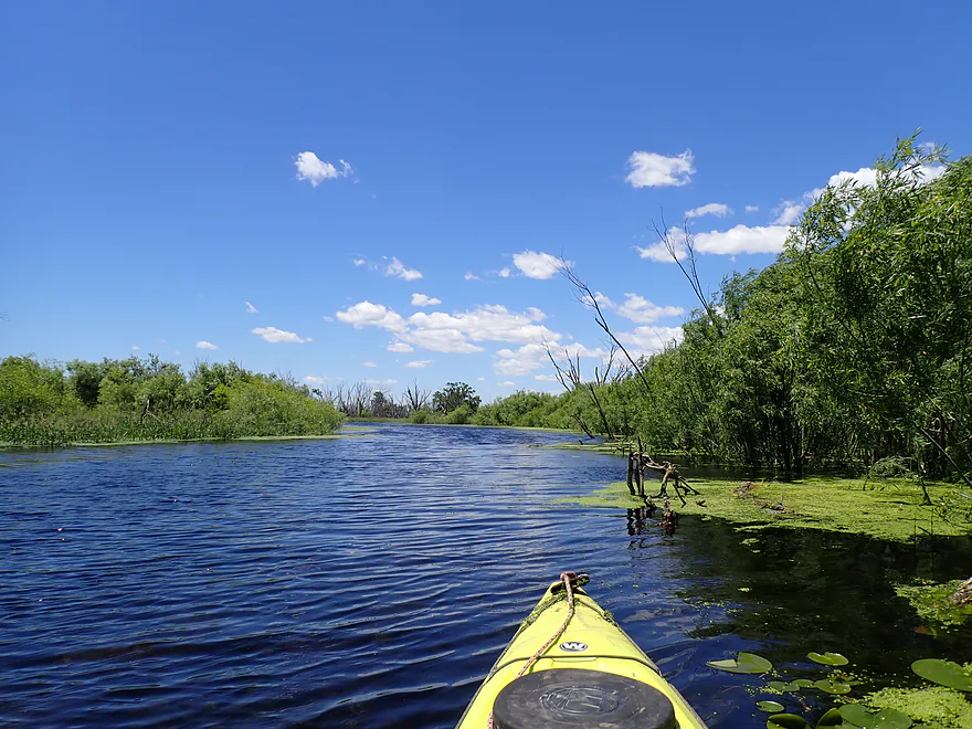
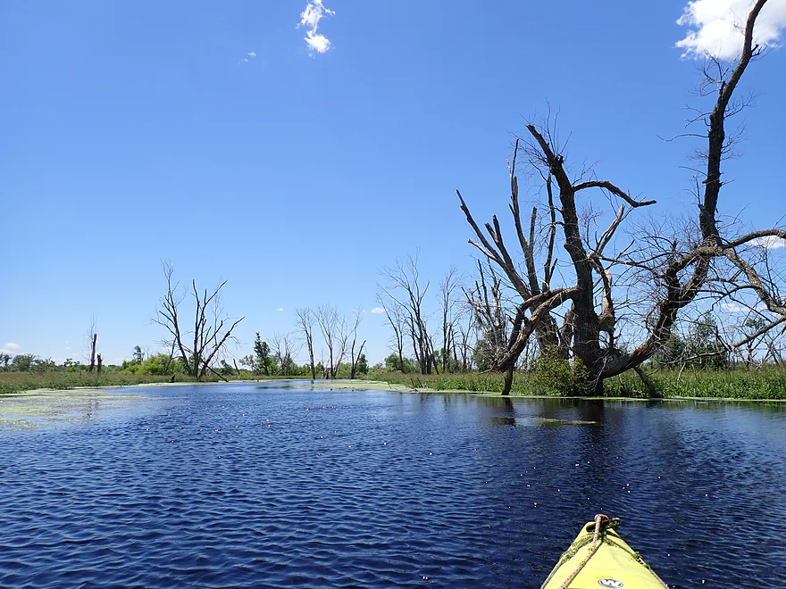
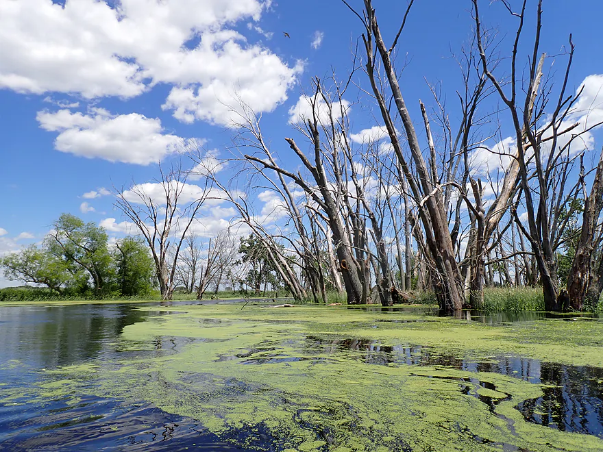
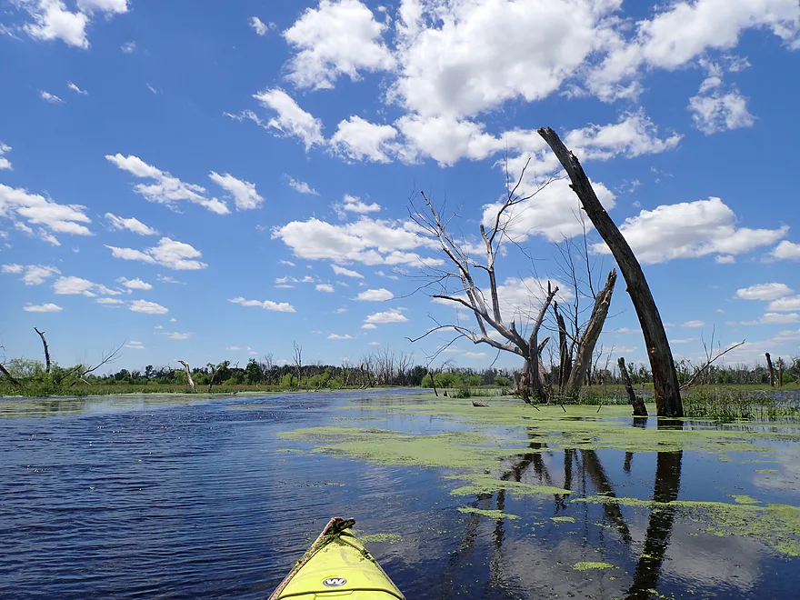
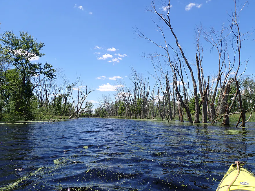
The river is sometimes a maze…avoid the side channels with duckweed and algae
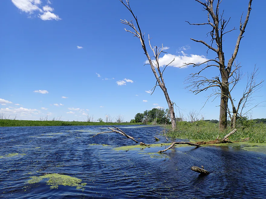
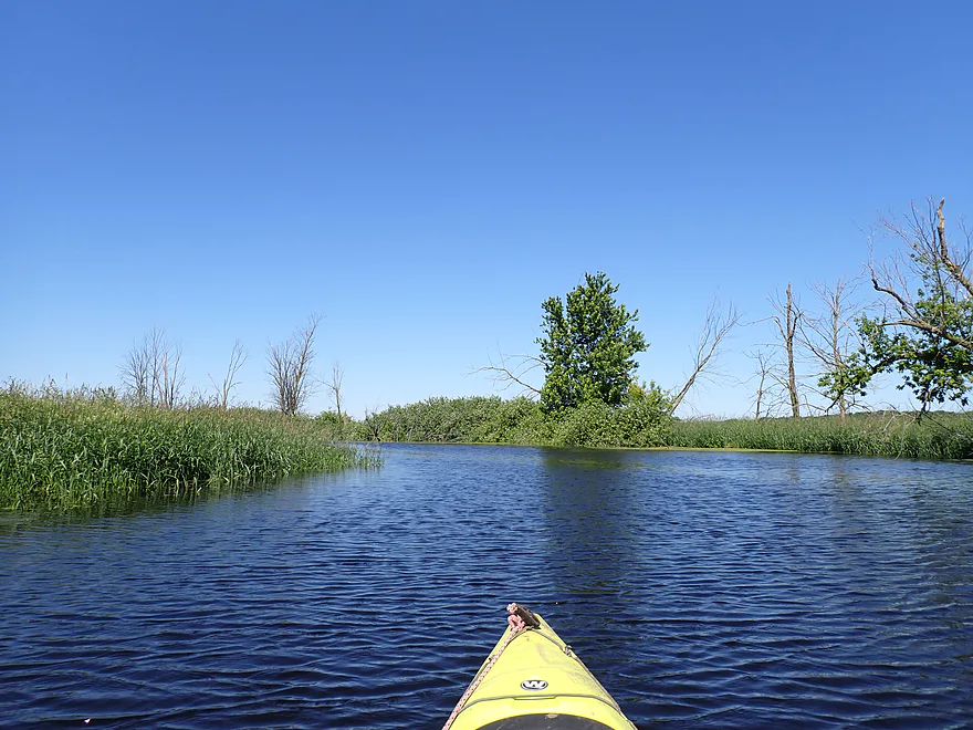
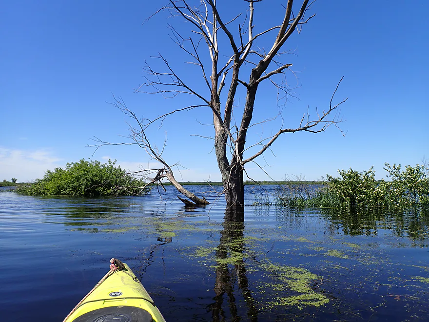
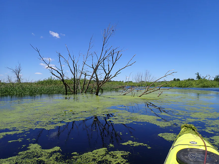
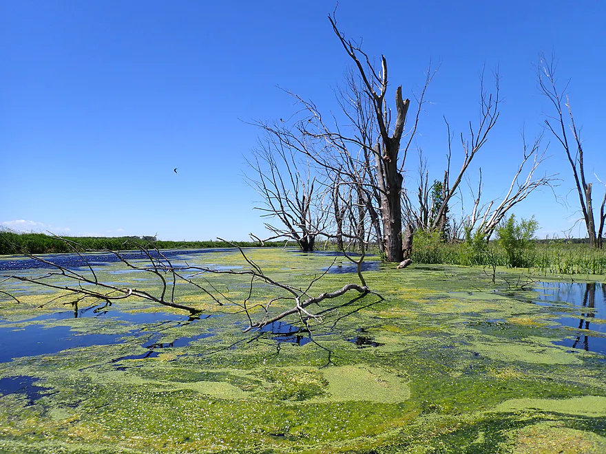
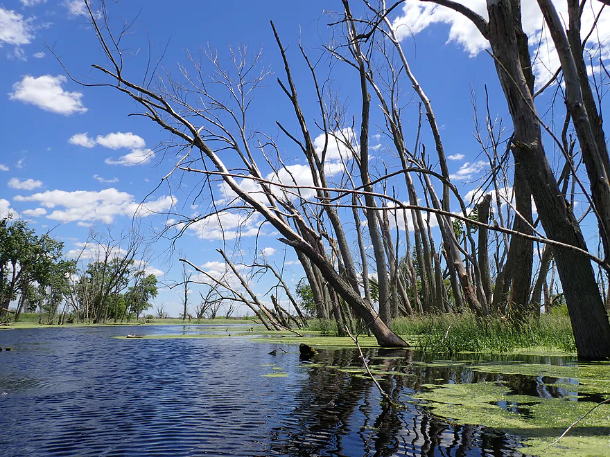
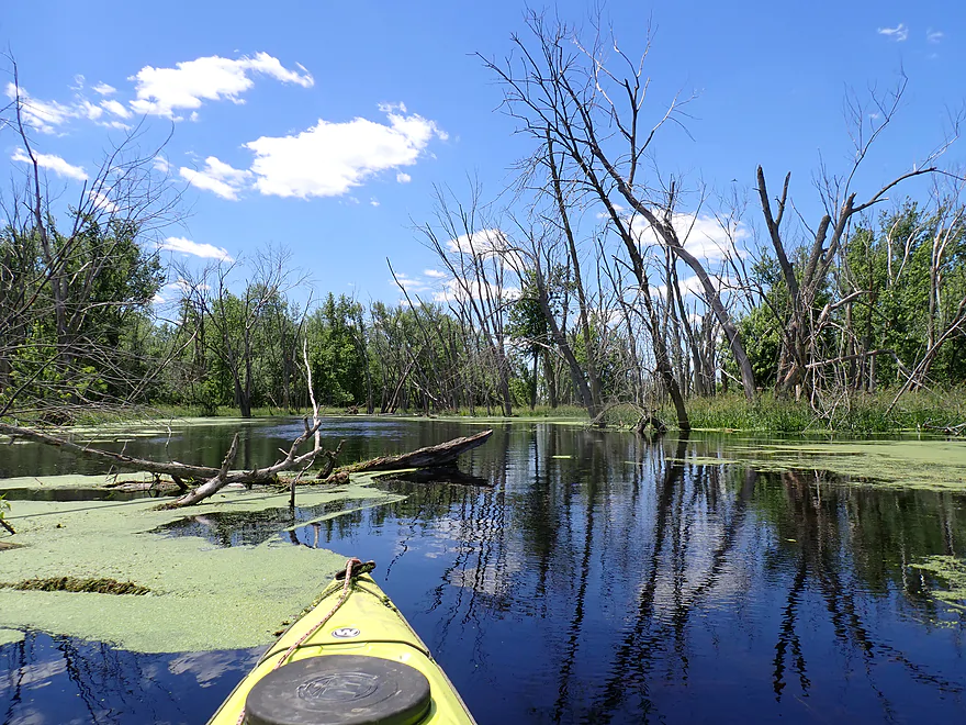
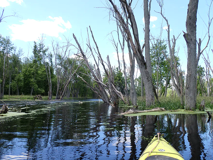
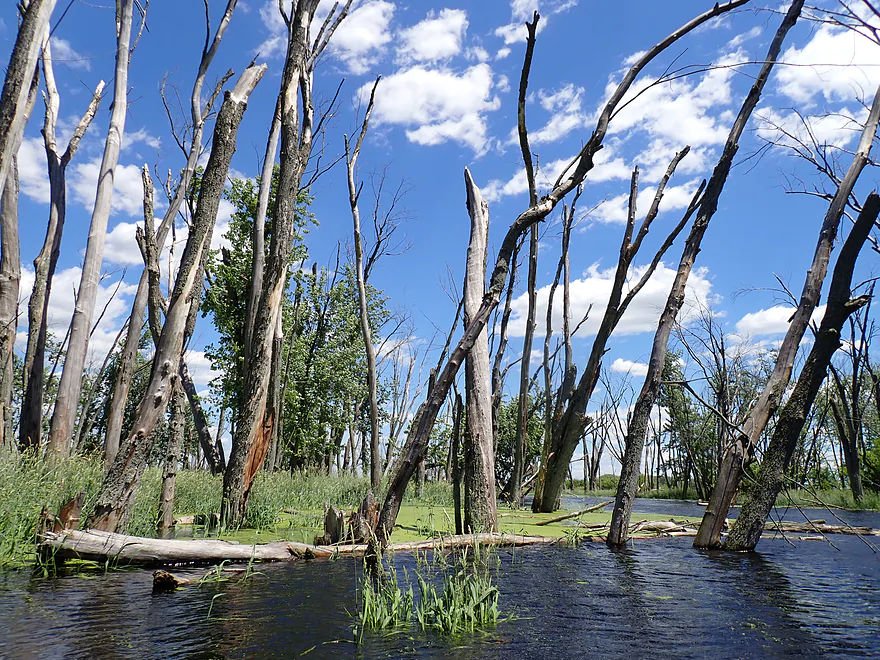
90% of the trees were dead
Getting temporarily lost on a side channel
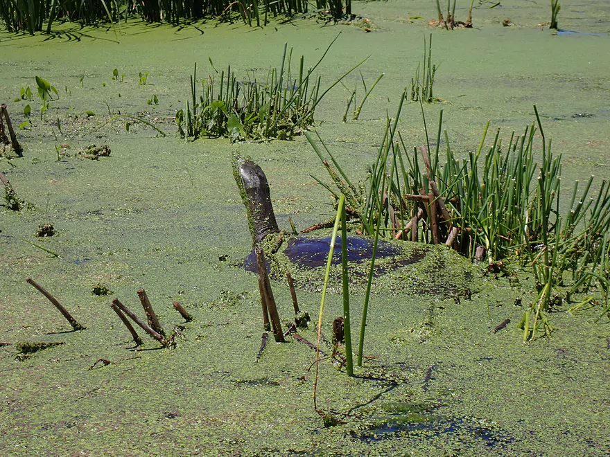
Large softshell turtle using duckweed as camouflage
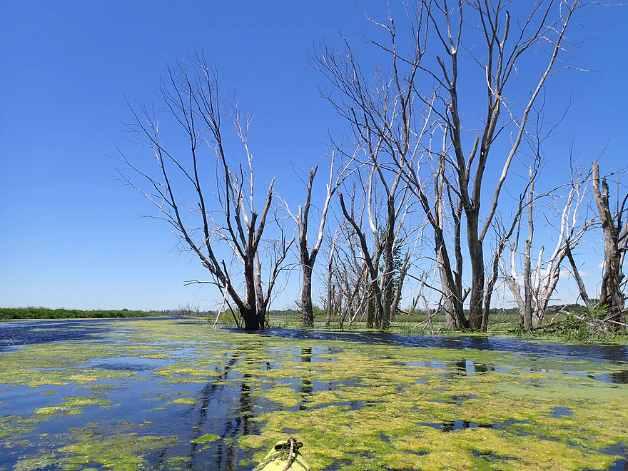
The dead trees would whistle in the wind like tuning forks…really cool
Wind gusts were crazy strong…I struggled to keep going forward
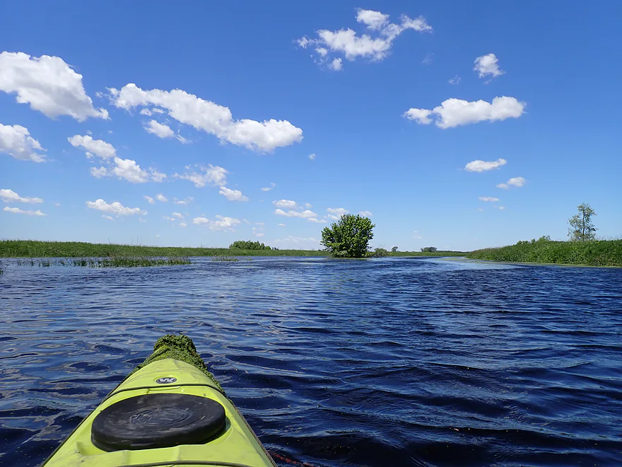
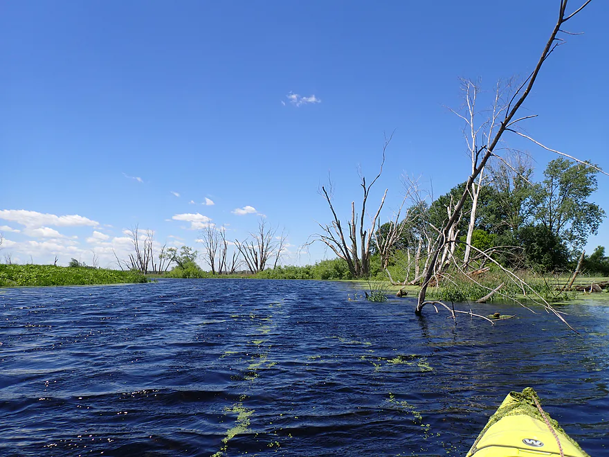
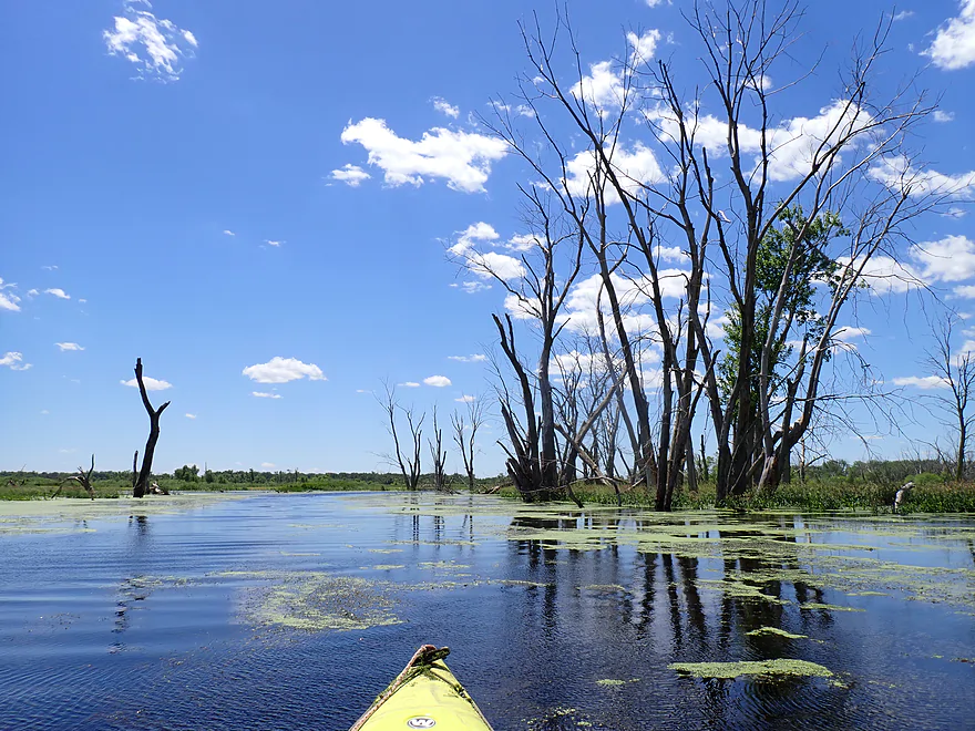
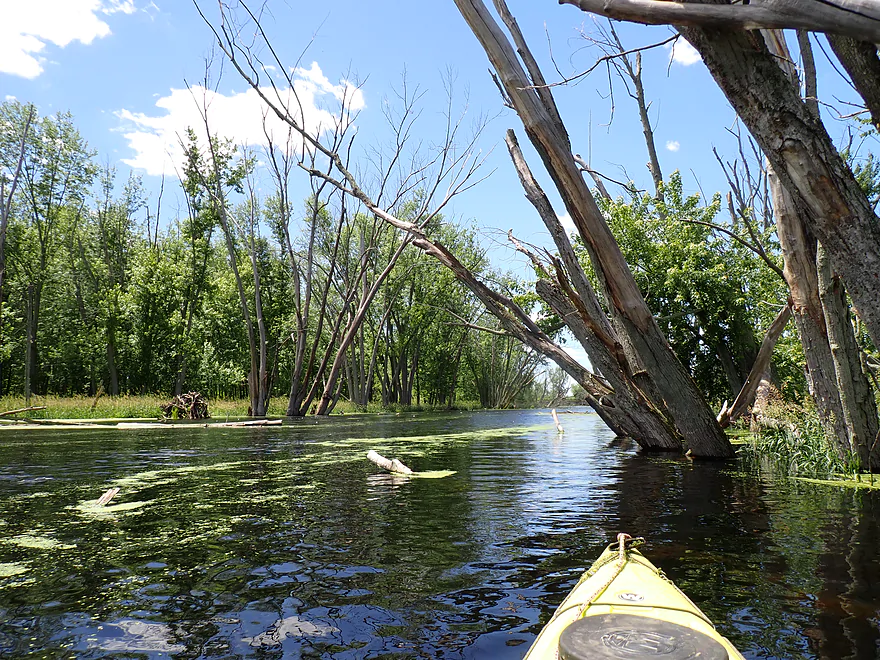
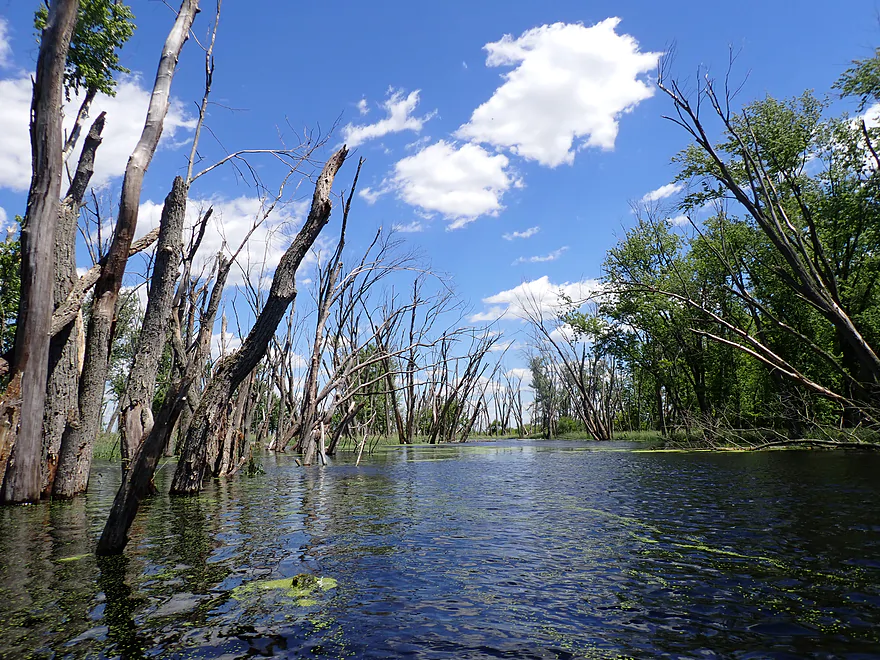
Finally leaving the dikes and entering a natural meandering stretch
So nice not to see dikes
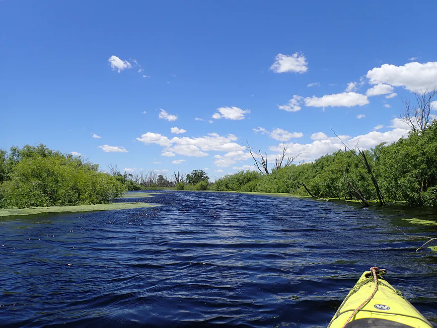
Favorite part of the trip
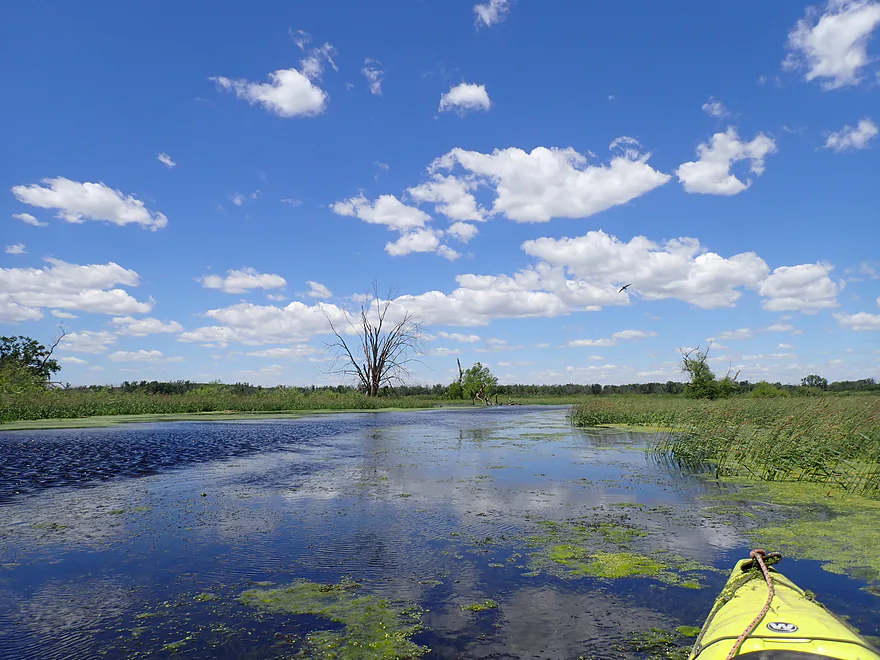
Great cloud day
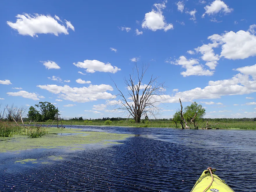
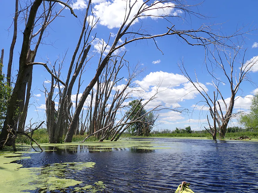
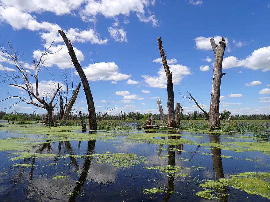
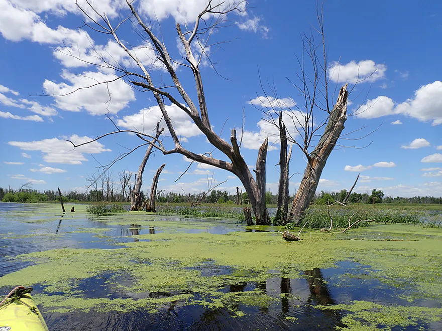
All the dead trees made this a unique paddle
Very slow…I think you could do round trips on this leg
With less wind there would have been more nice reflections

Hard to see…but the Bark River is joining up from the right
Now on the combined rivers
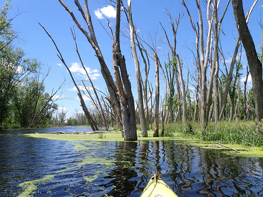
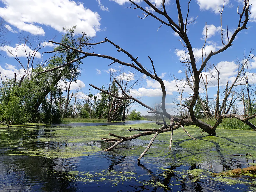
A tree graveyard
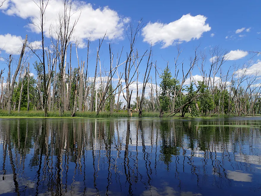
I think a lot of trees have been killed on the lower Bark by flooding
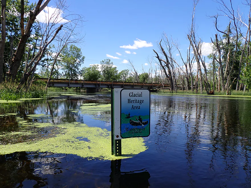
Glacial Heritage Area sign marks the take-out
Ending the trip at Prince’s Point Landing
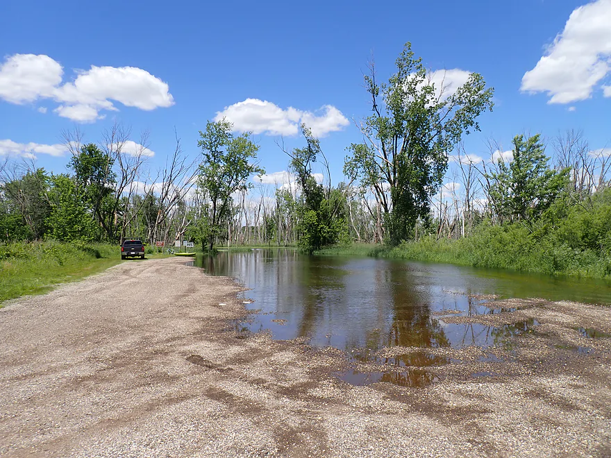
Which was very flooded…but still usable
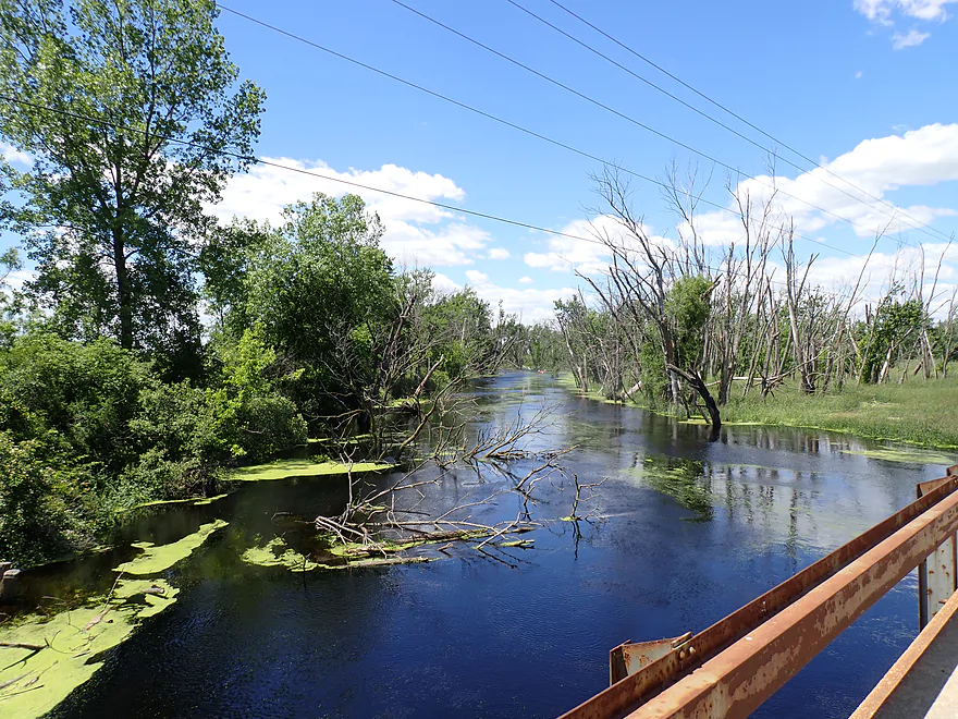
Nice view of the Bark from my bike shuttle
Bike shuttle was surprisingly nice
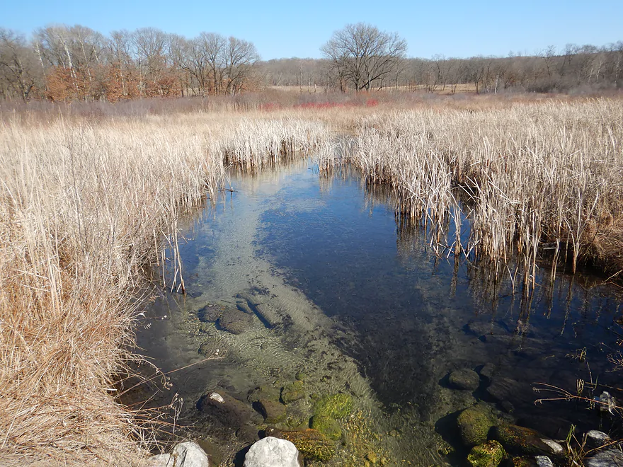
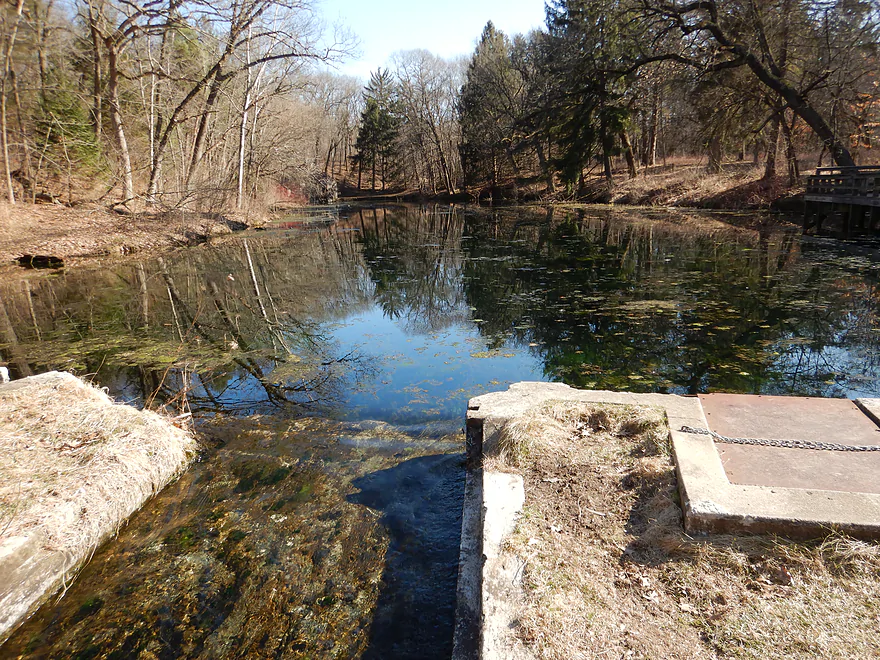
About 20 miles upstream is the Scuppernong Springs Nature Trail
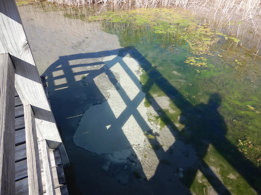
It is super cool
A boardwalk system goes over clear water and srpings
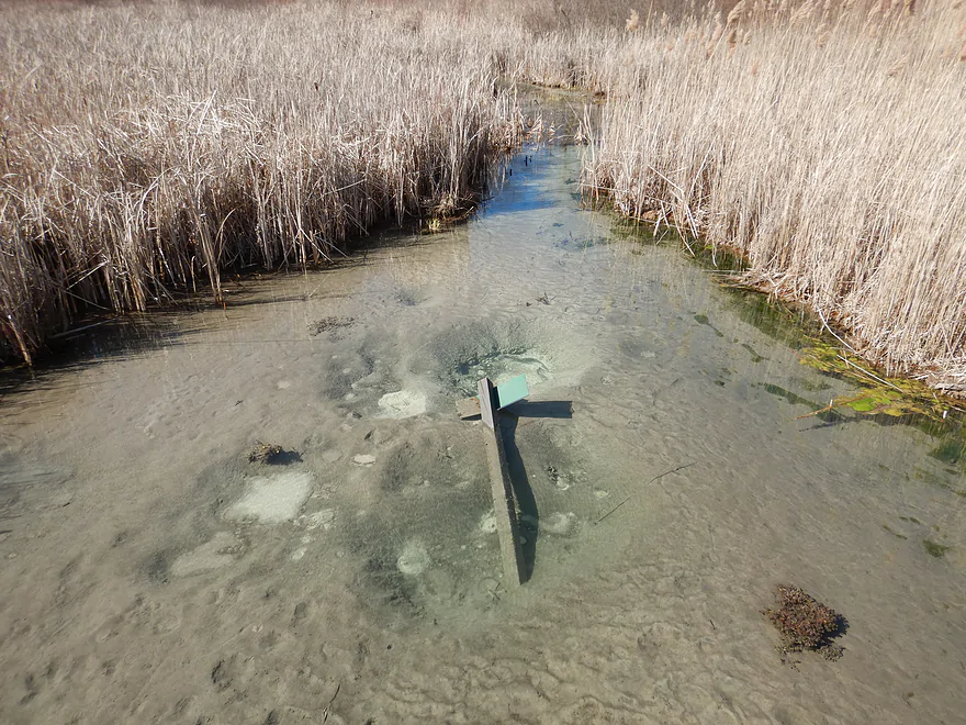
Many of the springs are highlighted by the trail
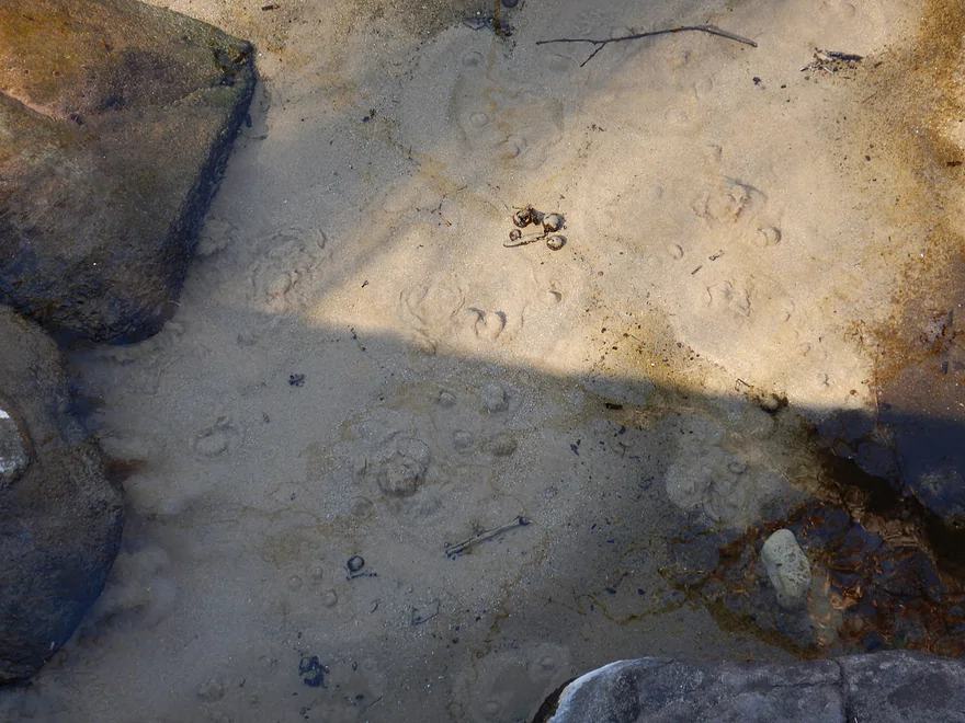
You can see water coming out of the ground via “boils”
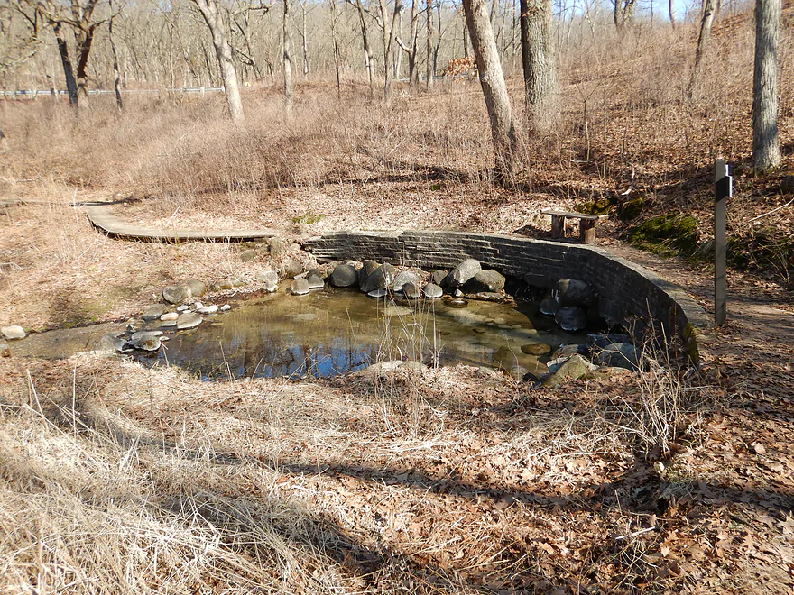
Paradise Springs is nearby and is also worth checking out
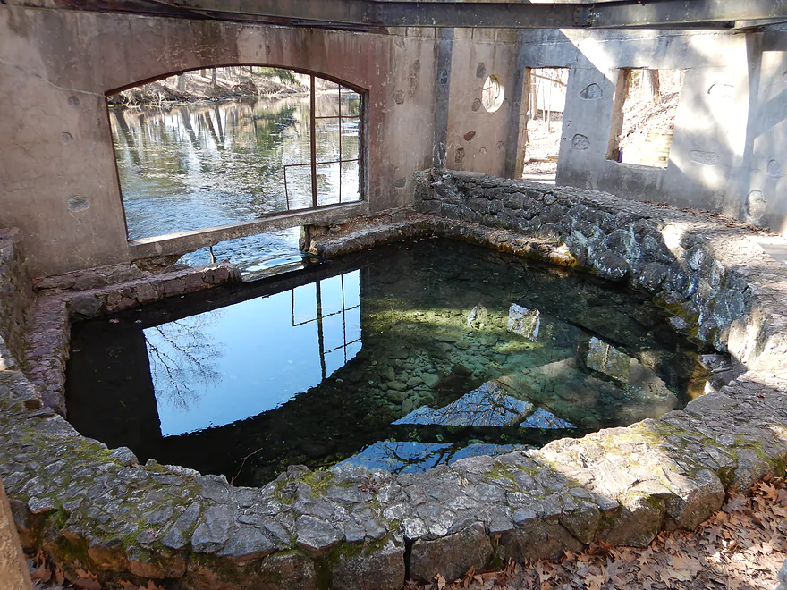
It has a famous spring house
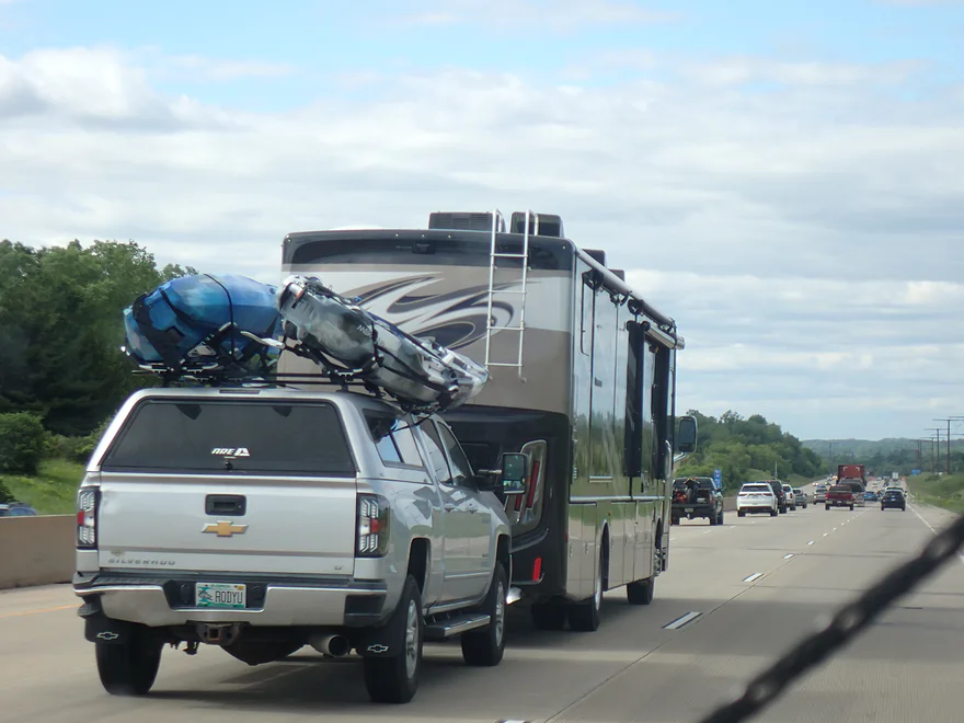
Driving home and seeing a kayak almost come off…remember to properly secure your boat!
Scuppernong River – Hwy 106


The Scuppernong is an obscure tributary to the Bark River located in SE Wisconsin. Its headwaters are fed by incredible springs. From there it flows through partially ditched marshes before encountering a couple of dams in Palmyra and then a brutal stretch of logjams. Its last leg leading to the Bark is the most viable which is what I chose for this trip.
I started at the Hwy 106 bridge where there was a great paddling access (not sure many use it though). The first half mile of the trip wasn’t so nice though…it was straight as can be. The river had been significantly ditched (likely by farmers) which made it relatively wide (~50′), deep (~5′), and lacking in turns or tree cover. Despite this water clarity was good and I could see pretty far down despite the river being in flood stage (about 2′ above normal). Google which doesn’t have a good track record of accurately labeling rivers/creeks, incorrectly calls this Mud Creek, but it is indeed the Scuppernong River.
Along the bank were elevated drainage pipes. Every now and then you would hear an electric motor kick on, and the backflow gate would open up and water would come barfing out. Looking at a satellite map, the network of drainage ditches, dikes, pumps, and access roads is vast. I’m not sure it is all worth it and it would be cool to see what the river would look like reverted to a natural meandering marsh. Because of the flood, one of the backfill gates was stuck open at the water line. The electric motor never stopped running…as water was pushed out, it just flowed back in. Not exactly a well engineered system.
Finally the river started to “meander” a little bit which was a welcome reprieve. Every now and then there were gaps in the dikes and you could kayak through to see what was on the other side (mostly open ponds filled with algae).
About halfway into the trip I encountered a low concrete bridge. Typically you would be able to get under, but because of the high water not even my kayak would fit under, so I had to portage. This was not easy…the banks by the bridge were steep and filled with dense and annoying shrubs. When I got up on top, it was interesting to see that this was a “bridge to nowhere”…literally. The south end was overgrown and blocked by shrubs and there was no connection to the north. I suspect this was a decades old access road that was used to construct the dike system and long ago abandoned.
Something to be mindful on a trip like this is you can get lost…especially when the water is high which opens up a lot of false side channels. Generally speaking if you stay west and follow the south bank, you’re ok. Typically the false channels will have more algae and be less open. Sometimes the main channel will have a bit of current which will point the pondweeds in the right direction. Ultimately though you should have a GPS and/or map with you.
The wind for this trip was brutally strong. The nearby Palmyra airport reported 35 mph wind gusts. I was paddling DIRECTLY into this…I can’t understate how annoying this was. If I didn’t paddle, I would be blown upstream at about 4 mph. Thankfully I had a fast boat and fast paddle on me…it helped when I could duck into the cockpit and could make headway. Had I known the wind would have been this strong, I would have picked a different river (although most rivers in Wisconsin were either buffeted by wind or experiencing some flooding).
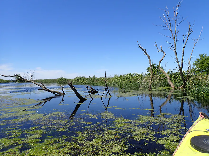
After getting somewhat lost and inadvertently going over a dike wall (without knowing it since the water was so high), I finally reoriented myself and left the dike system to paddle the last few miles through floodplain forest. Most of the trees were dead…not sure why…maybe floods…maybe the emerald ash borer. But it was crazy to see so many dead tree skeletons. They looked cool in the sunlight though and gave the river a unique, stark beauty. When the gusts picked up they made an eerie whistling sound like crying animals (I caught some of this on video).
The final stretch was very enjoyable…finally the river meandered and flowed naturally with somewhat organic banks. The Bark River soon joined the Scuppernong. At the confluence was a large and scenic floodplain forest (again everything was dead).
The take-out at Prince’s Point Landing was crazy flooded. I had locked my bike to the main signpost, which was almost by the water line. I had worried that water levels would continue to rise during my paddle and dip my bike but thankfully that wasn’t the case, and levels actually fell. It was interesting to see a motorboat use the launch despite the flooded parking area. They are known to go upstream into the Scuppernong River, but during floods the county posts no wake signs.
In summary this was a mediocre trip. There were too many channelized and ditched sections which was unfortunate, and the wind was awful. But besides that the trip had a zen-like simplicity that provided some appeal. I think I perhaps would have enjoyed the trip more had it not been flooded. This is more a trip for local paddlers as it’s an easy and flexible trip to do with great access points and can be done at any water level.
Sights included territorial blackbirds, deer on the dikes, carp, and a great blue heron. Many of the grassy banks were filled with interesting insects including damselflies (who were likely hiding from the wind gusts). The highlight of the trip was a huge softshell turtle that was trying to hide itself in the duckweed.
Prince’s Point Wildlife Area: Most of the trip flows through this public state natural area. It’s not exactly a bucket list destination for eco-tourism…mostly just generic wetgrass marsh. There are multiple pull-offs on the north side which I think are just used by hunters. The DNR recently added 1800 acres to the area and is doing heavy some heavy wetland restoration work on the south side that is scheduled for completion in 2025.
Scuppernong Springs Nature Trail: This is a really cool and popular natural area. Basically it is a system of boardwalks and trails located near the headwaters of the Scuppernong River. Here you can see a number of springs and a crystal clear Scuppernong River. I highly recommend this.
Paradise Springs: A short trail leads up to an old rustic spring house. The springs here ultimately feed the remnants of an old mill pond and a small creek that eventually empties into the Scuppernong. It’s very photogenic and chances are you’ve seen a photo of the spring house before without knowing it.
Hwy 106 Wayside: Just north of the Island Road intersection is a nice pull-off and public launch area. This is a great access. Note, the river here is labeled Mud Creek on Google Maps, but because of channelization, it is essentially the Scuppernong at this point. You are in the right place.
Alternate Put-ins: None really. I suppose you could launch from the second Hwy 106 bridge located a quarter mile upstream, but the wayside is better. The previous legs by Palmyra have many logjams and likely aren’t viable.
Prince’s Point Landing: This is a terrific access. Note, it’s actually a small boat ramp, so you should be considerate in how you park so you don’t block trailers. During my trip it was maybe 80% underwater, but still usable.
Alternate Take-out:
- Burnt Village Park (7.1 miles downstream from Prince’s Point): This would be a mediocre bonus stretch on the Bark River. There are a lot of dead flood-bottom trees…which actually in the right light can look kind of cool. Burnt Village Park as an access should be pretty good.
Bike Shuttle – Prince’s Point Landing to Hwy 106: 6.2 miles with 75′ of ascent. The first mile on Hwy D isn’t great with narrow shoulders and fast cars. But after that, Koch Road is really nice with narrow shoulders and good scenery. It had a rustic road vibe and was a pleasant shuttle.
Logjams/Fences: None.
Wind: This is a very open paddle with few trees. Prevailing winds from the west can be challenging. I did this during a windy day in which the nearby Palmyra airport reported gusts reaching 35 mph. 15 mph is borderline for open kayaking…20mph is too much…30+ is crazy! Live and learn.
Bridges: There is only one bridge on the trip. Typically you can get under no problem, but because of the high water I didn’t fit and had to portage. The portage is tricky because of the thick shrubs. Pick your portage path carefully.
Current/Rapids: Current does exist, but it is extremely slow and at times not noticeable. This does make a round trip feasible from Prince’s Point, going upstream and then back to the landing.
Getting Lost: You can’t really rely on the current as a telltale and there are many divergent canals and dikes. You really should bring GPS technology with you…especially if you do this during high water. I paddled over a dike wall and into a nearby lake without realizing it because of the water levels.
Closest Gauge: Bark River @ Rome
Trip Depth: 160 CFS or 2.57′
Navigability Estimates: Generally speaking this stretch can be paddled at any depth.
- < 30 CFS: Low end…should still be navigable.
- 31-35 CFS: Average levels.
- 36-60 CFS: Above average.
- 61-100 CFS: High levels.
- 101-200 CFS: Very high levels with some flooding. Still plenty viable for paddling (except for one bridge that will have to be portaged).
- 201+ CFS: The take-out at Prince’s Point might not be usable at these very high levels. Otherwise the river should be viable for paddling (as a giant lake).
Click here to see an overview map of the Scuppernong River.
- Hwy 67 Shoulder to County Road N: 4.5 miles. Sketchy access by the Scuppernong Springs Nature Trail. River to start is clear, small and attractive. The river then flows through a large marsh which may have serious cattail obstructions. This should only be done in high water (if at all).
- County Road N to Hwy Z: 2.8 miles. Nice stretch. First half is artificially straightened. Most of this flows through open marsh but there could be a logjam or two. Hwy Z has posted signs nearby. I think you’re ok if you stay within the DOT right-of-way, but it’s not an ideal situation.
- Hwy Z to Kettle Moraine Scenic Drive: 1.5 miles. First half is a nice stretch with marsh and woods. Second half is an impounded river. Illinois investors purchased the dam and because of this, they thought (incorrectly) they owned this section of the Scuppernong River. They even posted a no-entry sign to the lake. The DNR has told them to stop doing this, but you may still be harassed if you paddle this portion of the lake. The dam shouldn’t be difficult to portage but it is by the hostile owner’s establishment.
- Kettle Moraine Scenic Drive to Spring Lake North Ramp: 1.1 miles. About half of this is a twisty stretch of river with maybe a logjam or two. The second half is Spring Lake which is likely a generic millpond. You can also get out by the beach.
- Spring Lake North Ramp to Jefferson Street: 0.8 miles. You could portage either dam…the east channel is a bit more open, but the west channel has a lot of snags. Both have just too many logjams to even consider attempting a paddle.
- Jefferson Street to Hwy 106 Wayside Access: 4.7 miles. Just too many logjams.
- Hwy 106 Wayside Access to Prince’s Point Landing/Bark River: 5.5 miles. This is likely the most viable stretch on the river for paddling. This flows through a marsh and mostly by artificially straight banks and dikes. Locals may enjoy it, but it is not an elite water trail.
Trip Map
Overview Map
Video
Photos Size: