Montello River
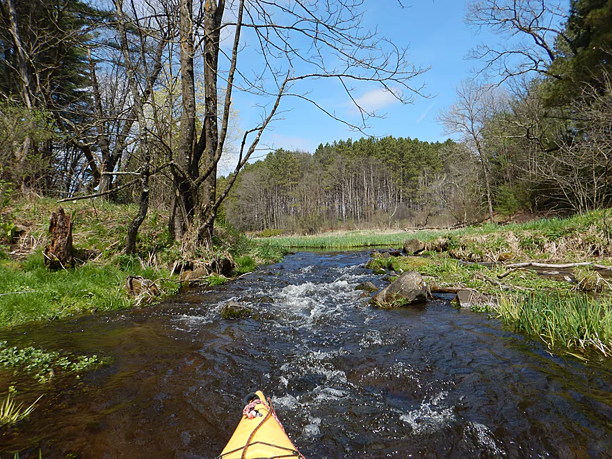
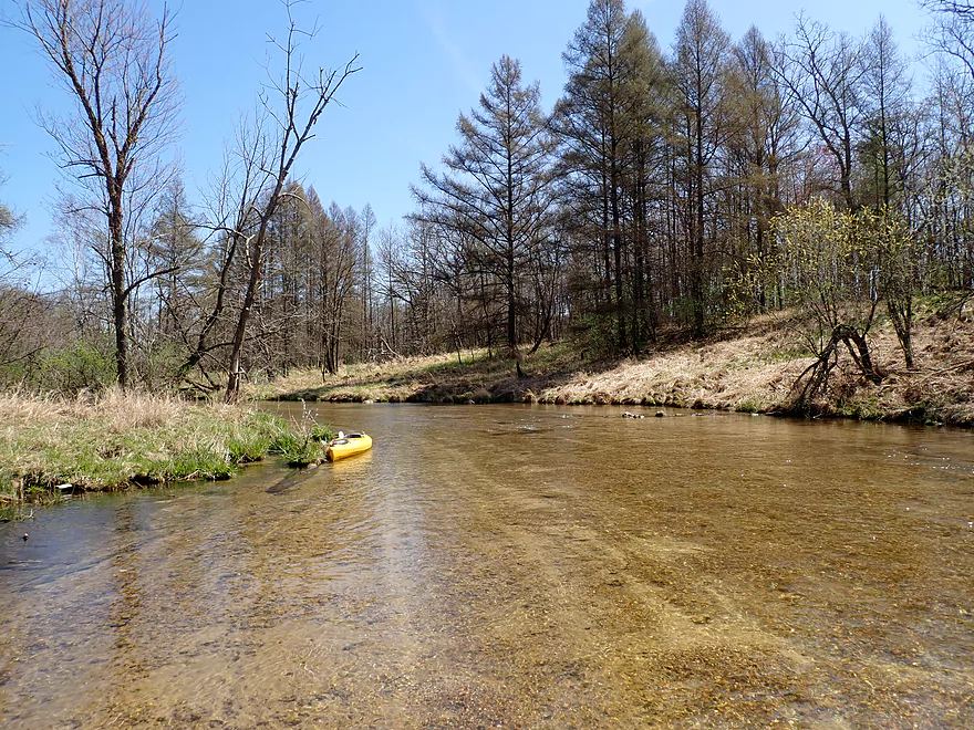
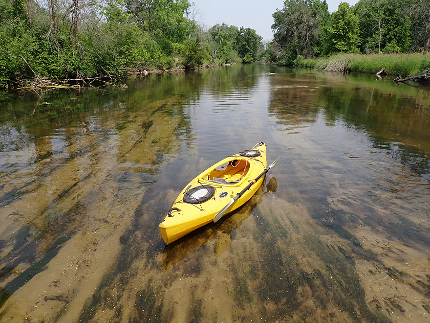
This is a somewhat obscure central Wisconsin Trail, but is nice with clear sandy water. On the downside, logjams can be an issue.
Trip Reports
1st Ave Bridge to Lawrence Lake

Date Paddled: April 23rd, 2016
Distance: 2.91 Miles
Time: 3 hours 8 minutes
A fun trip for a creek I didn't even know about until a week ago. Highlights include good current, good vegetation, and, best of all, fantastic water clarity.
Read More...Hwy A to Pioneer Memorial Park

Date Paddled: April 16th, 2021
Distance: 5.1 miles
Time: Expect 2-3 hours
Incredible clarity and huge schools of fish highlight this obscure water trail.
Read More...Hwy J to Ember Lane

Date Paddled: June 17th, 2023
Distance: 5.3 miles
Time: Expect 3 hours
Logjams sabotage what otherwise would have been a fantastic trip with impressive water clarity and terrific wildlife.
Read More...11th Road to Lake Montello Ramp

Date Paddled: May 1st, 2016
Distance: 3.74 Miles
Time: One hour 56 minutes
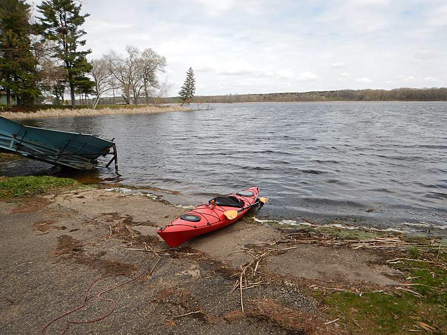
A return to the Montello River for honestly its weakest section. This is still not a bad stretch though and is a simple prospect to consider for locals looking for a new adventure.
Read More...Overview Map
Detailed Overview
- Headwaters to 1st Ave: 1.0 miles. In theory, there should be a spring located at the headwaters a mile upstream from 1st Ave. This might be more viable as a roundtrip.
- 1st Ave to Lawrence Lake (North Ramp): 3.0 miles. Technically Lawrence Creek, this is a small paddle with some logjams, but is really nice with stunning water clarity and virtually no mud. A very underrated paddle.
- Lawrence Lake (North Ramp) to Lawrence Lake Dam: 0.8 miles. A simple lake paddle.
- Lawrence Lake Dam to Pioneer Memorial Park: 5.6 miles.
- Lawrence Lake Dam to Westfield Veterans Park: 4.8 miles. A terrific paddle because of the incredible clarity and natural springs. Only downside are a few logjams, but they are easy portages.
- Westfield Veterans Park to Pioneer Memorial Park: 0.8 miles. The river here is faster, deeper, more wooded and less clear. It's a scenic stretch flanked by steep clay banks.
- Pioneer Memorial Park to Hwy E(by Charles St): 0.6 miles. A nice little prospect. Mostly within earshot of busy I39.
- Hwy E(by Charles St) to Hwy E/B(by Maynard Dr): 5.1 miles. Maybe 15-20 logjams.
- Hwy E/B(by Maynard Dr) to 10th Lane: 1.4 miles. This section should be mostly clear with I believe the only jam being the one you’ll see from the Hwy E bridge.
- 10th Lane to Hwy E: 0.7 miles. Nice open marsh paddle. Good access at both the put-in and take-out.
- Hwy E to Water Street Dam: 1.7 miles. A boring flowage.
- Water Street Dam to Hwy J: 600'. There are cool rapids between the two bridges in this short stretch, but a nasty strainer and a No Tresspassing sign by the dam make this a difficult leg to access.
- Hwy J to Ember Lane: 5.1 miles. A very scenic stretch of river with clear water and a sandy bottom. Currently there are too many logjams here to recommend, but it may get cleaned out in the future.
- Ember Lane to 11th Rd: 4.0 miles. Likely a scenic stretch of river, but I bet it has too many logjams.
- 11th Rd to Lake Montello (park on south shore): 3.7 miles. A simple section with some lake paddling.
- Montello Dam to the Fox River: 0.6 miles. A nice little urban stretch.
Nearby Guages
Videos
Comments
Yeah, not a five star stretch but not awful. I think the Montello upstream from this put-in though is very good.
We did the same section you reviewed on August 29, 2021. It was a beautiful day for a paddle. While it was not my favorite paddle it certainly was enjoyable. We had no issues with downed trees that we could not navigate around. The stretch of the lake was rather unexciting and lots of algae and lake weeds. Water clarity was good the first half to two thirds of the trip until you got to the deeper water. We saw turtles, various fish, a few vultures, a couple egrets and the guys saw a water snake! The smell by the boat ramp was awful but an easy take out!
I didn't know about the breach (which would explain the subsequent over-engineered banks that now follow the dam). If you do this trip, let me know how it turns out. Sadly things are kind of overgrown now on the creek, so it may not be as scenic. It could be a cool paddle to save for October when things have thinned out.
Back around 1986 the dam at Laurence lake failed, washing out Cty rd E. They ended up draining the lake (Laurence). Not sure but I don't recall much damage to Westfield or Harrisville from the sudden surge of water. Also Westfield had a water contamination problem from a local Manufacturer dumping solvent on the ground for several years. I will definitely do this trip. Thanks for the review. Your site is so well layed out with Pics Vids and river gages, it's the first place I go when planning a trip. Thanks again.
If you do a cleanup, can you let me know so I can update this website?
The Budsin adventure club took 3 kayaks down the creek on saturday and what a gorgeous creek, the water clarity is phenomenal and the ice cold seeps coming out of the banks along the way were neat to see and refreshing on a hot sunny day. Lots of small fish seen. The water is shallow enough especially in the wooded section where there are about 6+ portages over and around downed trees. This creek would be perfect with a little clean up which we plan to do.
Yes, you can use these. I'll followup via email here as well.
I'm wondering who took these photos of Lawrence Creek! I'm with the DNR, and we're looking for user photos of our public lands to share on our website and in news releases.
I'm hoping to contact the photographer to ask permission to use these photos.
Thanks!
That's too bad. I appreciate the update though Mary.
July 2019 still quite a few downed trees throughout
Sorry Jacqueline for the delay in approving your comment, as I just discovered it. The updates about the logjams are appreciated. If you discover anything anything feel free to share it. I might still risk a paddle on this very segment later this year.
Three of us kayaked the montello River on 5/5/19 starting out at Ember Lane. After 2 hours and 3 log jams that we had to get out of our kayaks and go over we met a couple who were taking a walk on their land that runs along the river. We we're going to 11th drive , they stated that there are many more log jams since last year's rain and high winds and we were not quite half way there. Seeing it was 2:30 and we had dogs at home we took up their offer to take us to our car so we could load up the kayaks. We had to walk 1/4 mile to where the car could pick them up. Had it been earlier we may have gone the rest of the way. I would like to hear from anyone that has been on the river since last year.
The river is beautiful! Seen a bald eagle in a tree that watched us paddle down the river. Kingfishers, geese, ducks , woodpeckers.
I wonder what Tim is up to? I'll help you maintain it!
Thanks for the comment! It's too bad to hear about the down trees. Hopefully somebody will clear these out in the future as this could be an amazing prospect.
Definitely do not recommend river tubing for the majority of this creek due to the downed trees, but it sure is fun! We lost 2 tubes out of 5 but mainly due to some branches that were avoidable. Strongly recommend getting out at the Eagle Ave bridge since it's a nice easy spot to get out. Any closer to the lake, and you may encounter some really shallow areas.
Have not attempted to kayak the route, but plan to in the future. The rapids are very minor but fun in tubes, I can only imagine in a kayak!
The creek is VERY cold because it is spring fed, so I personally recommend going on a hot summer day.
We saw some young trout, which was pretty neat. Watch out for some of the plants though since there are some sharper ones that could scratch.
All in all, a great trip. We went between the two parking lots for the fishing area and the Eagle Ave bridge.
How did your trip turn out? Questions or comments? Feel free to leave your feedback.
SUBMIT COMMENT!
