
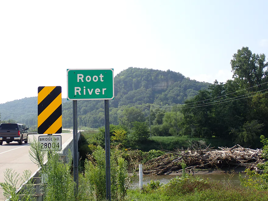
Welcome to the Root River
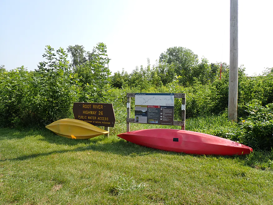
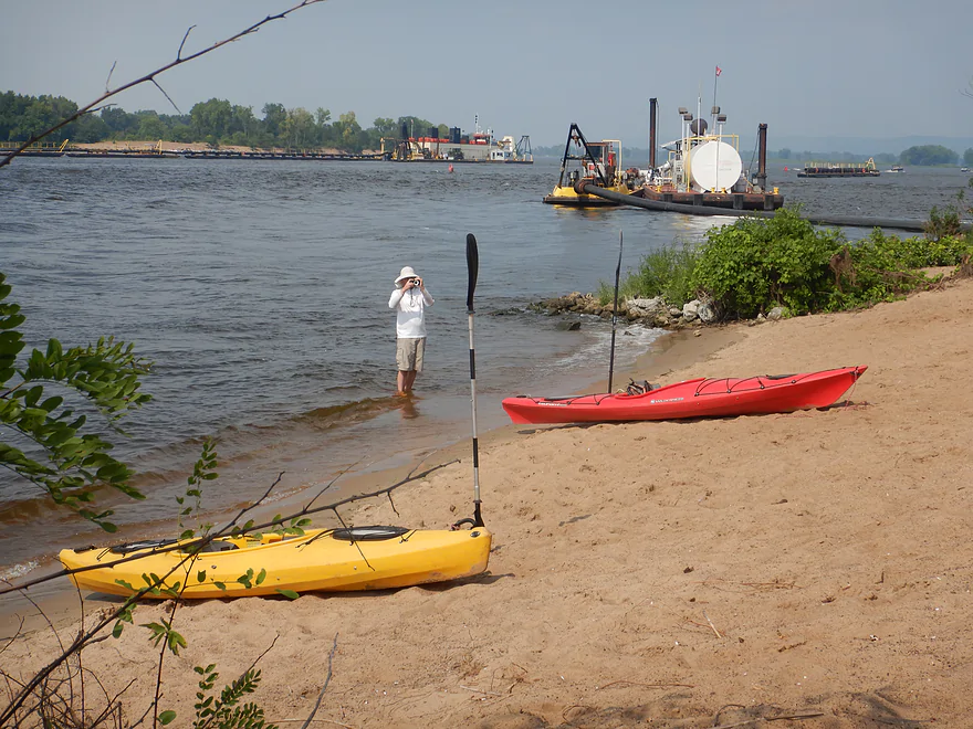
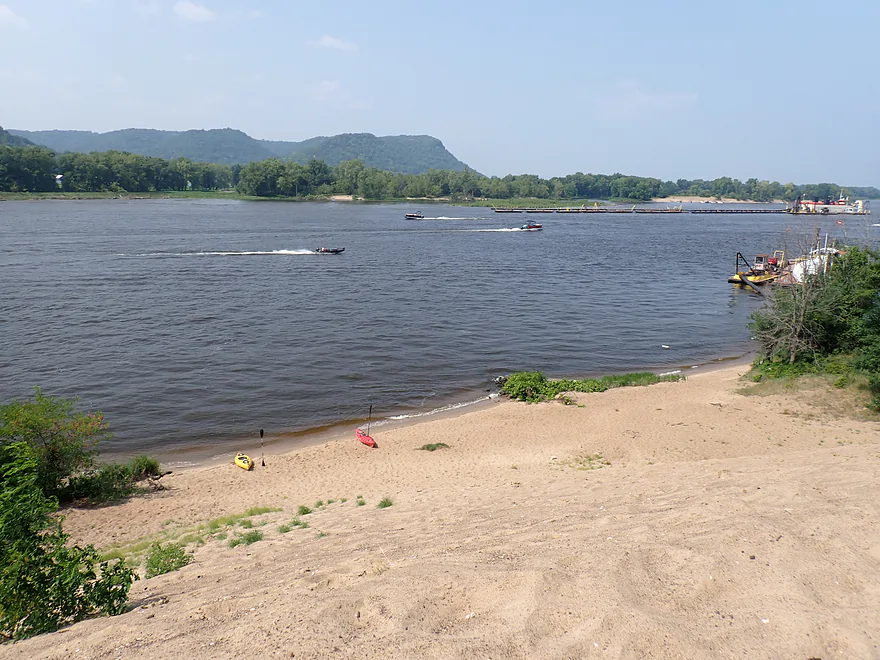
Great public access off of Great River Road
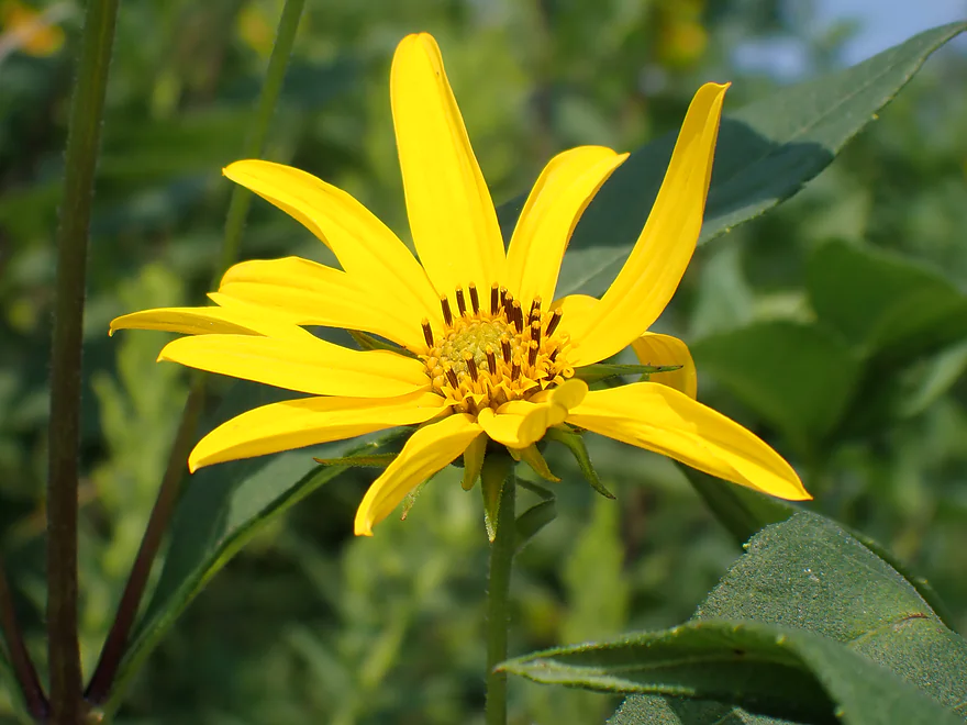
Cut-leaf coneflower
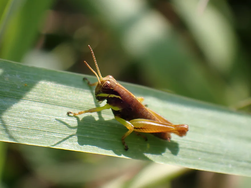
A grasshopper nymph
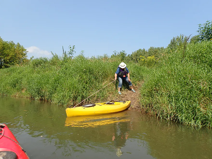
Ok launch area but a bit muddy
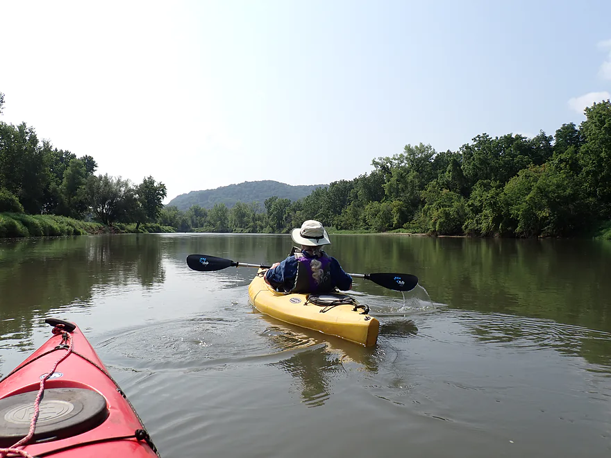
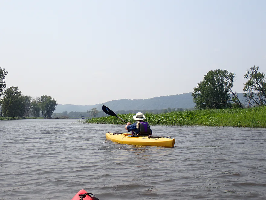
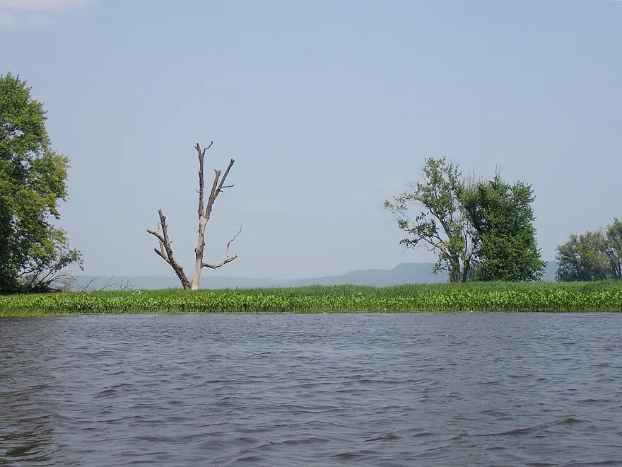
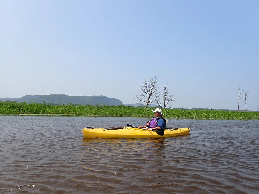
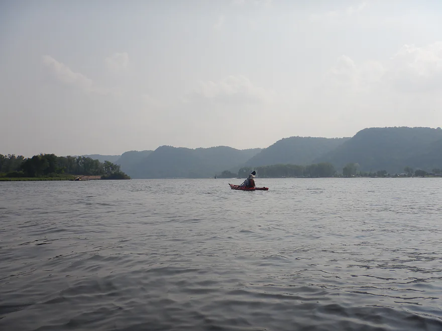
View upstream on the Root
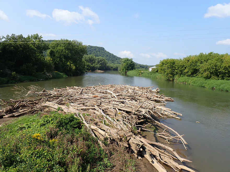
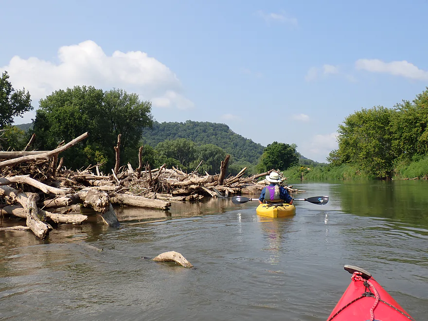
One massive log pile
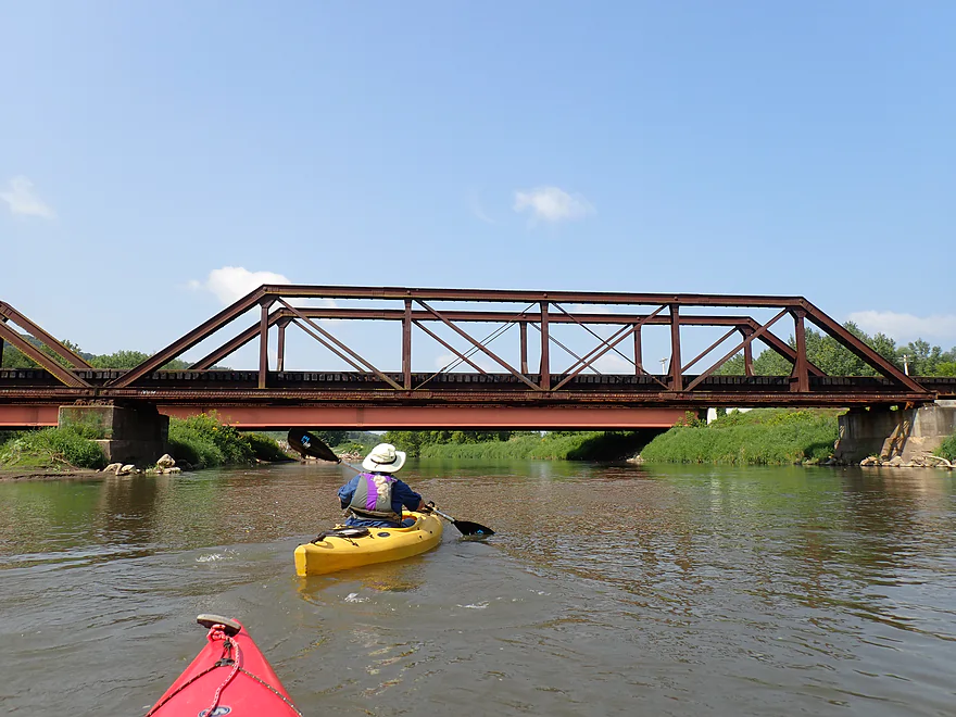
Railroad tracks
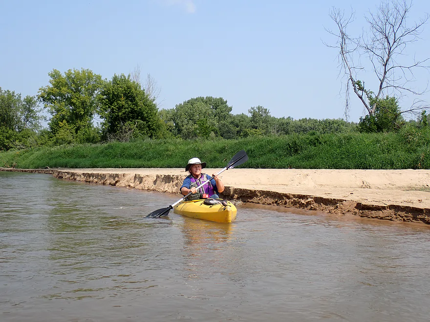
Not visible, but the current here is flying
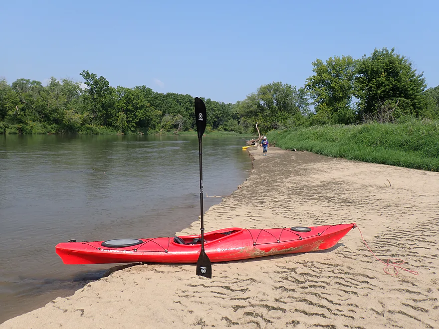
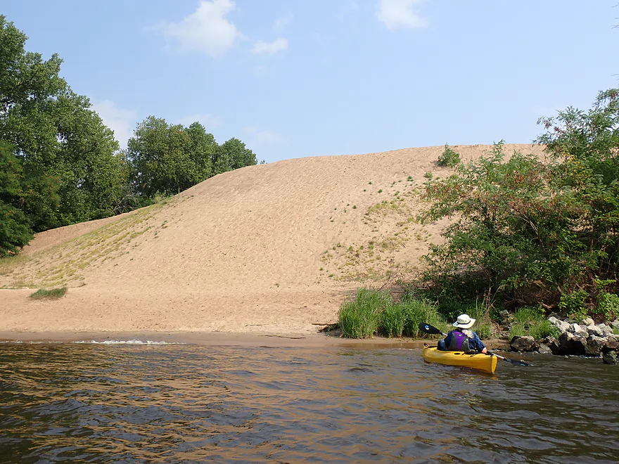
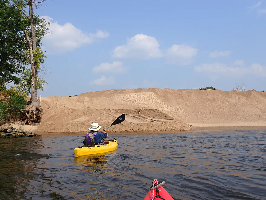
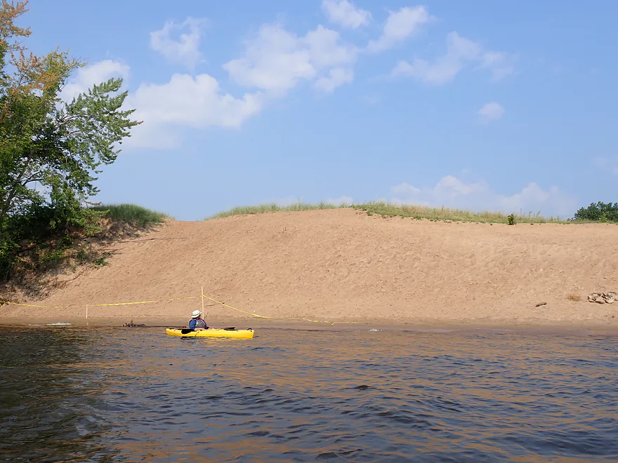
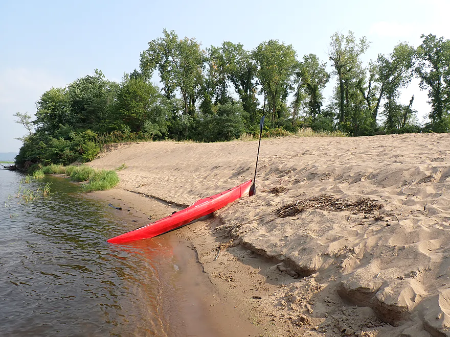
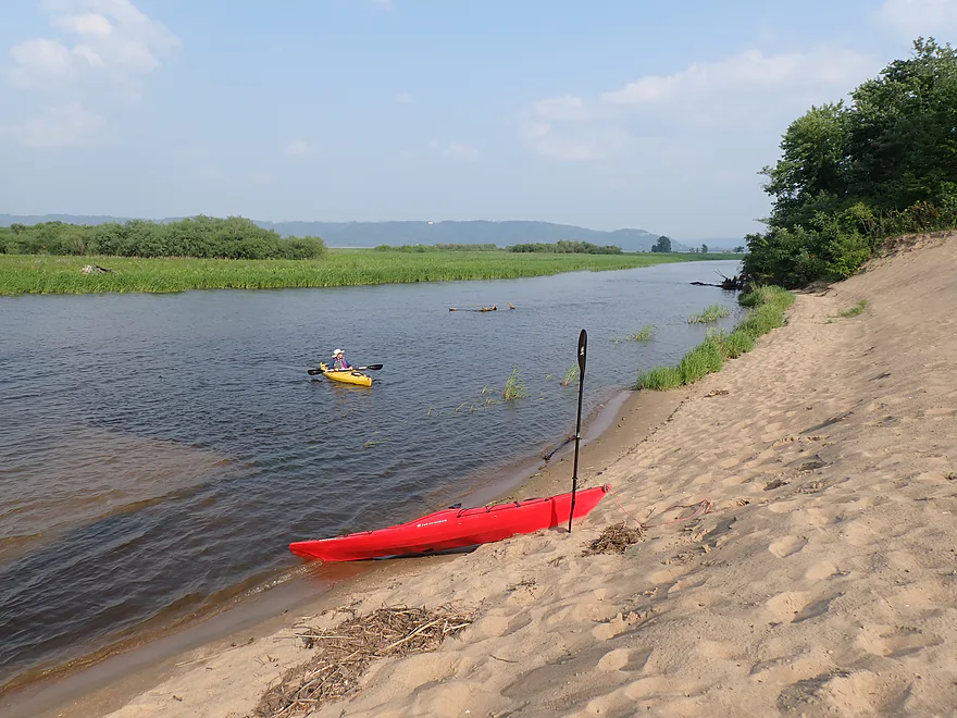
Great sandbar
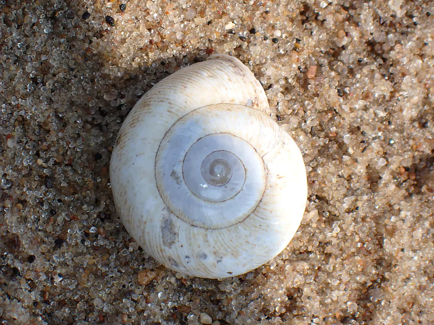
These are called ramshorn snails
This might be a nice camping spot
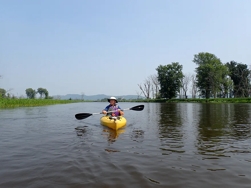
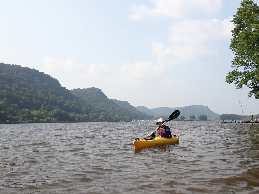
Scenic river bluffs in the background
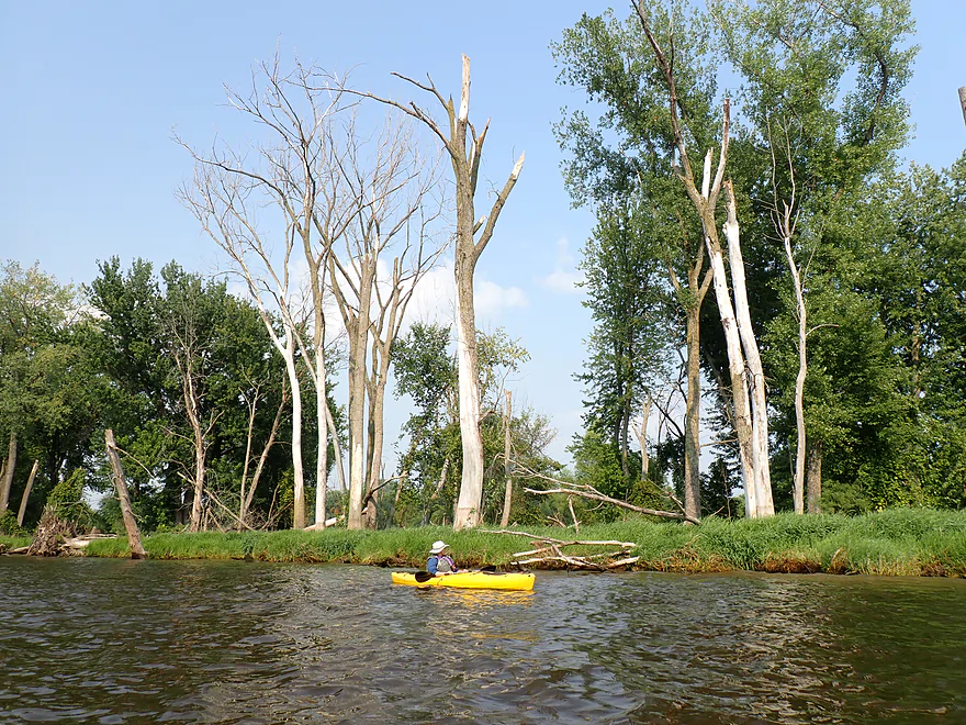
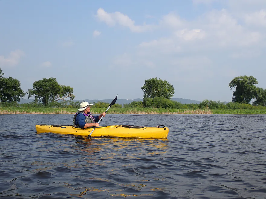
Lots of silver maples–typical bottomland scenery
Reaching the mouth of the Root River and entering the Mississippi
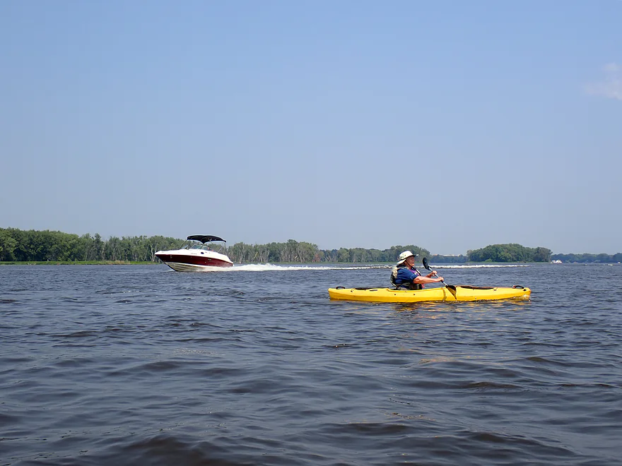
Dodging speed boats on our way across the main channel
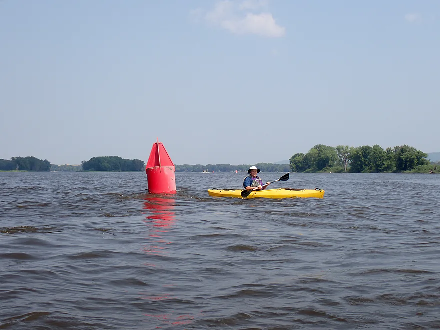
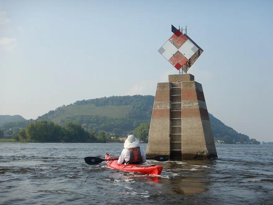
Navigation buoys…the saying goes red, right, returning
Away from the crazy main channel and into the nice protected sloughs
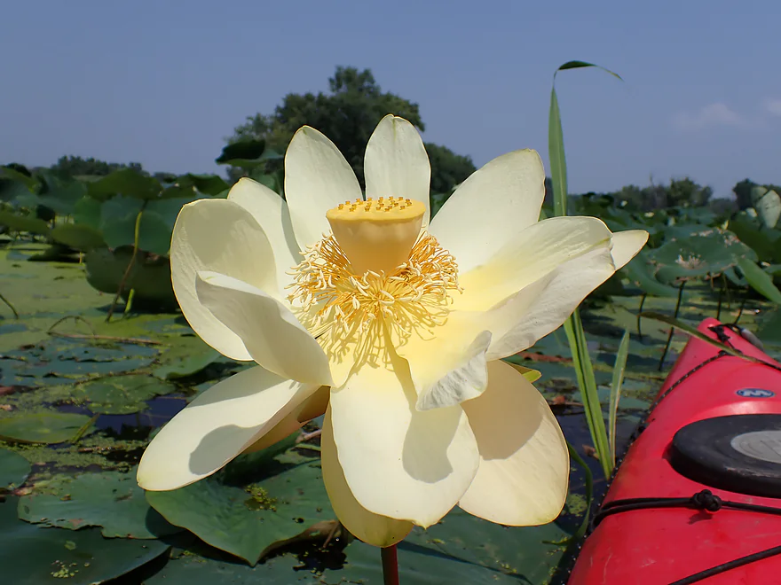
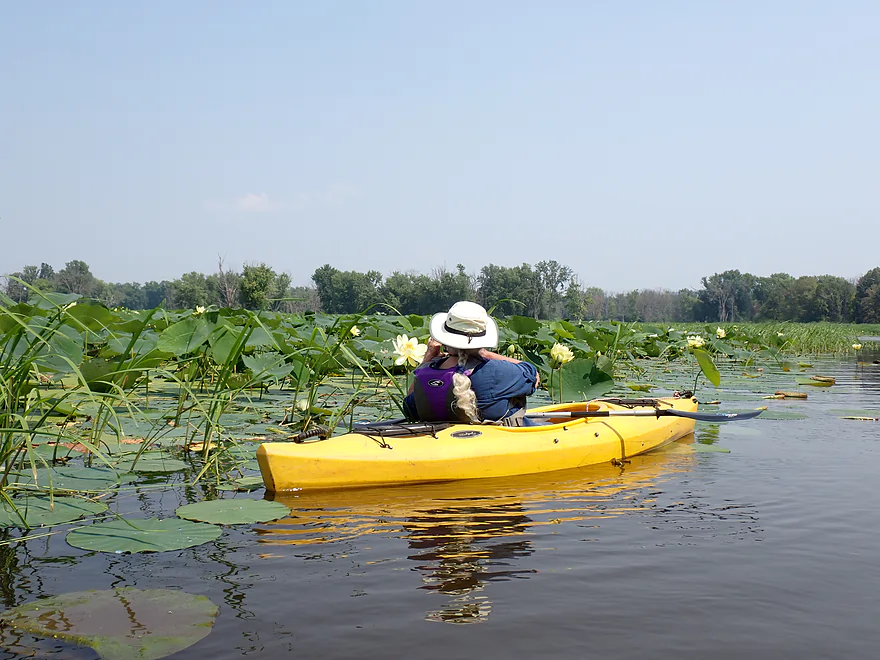
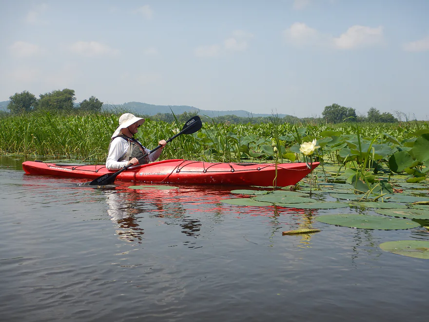
A large lotus flower with a developing seed pod
Really nice marshy area here
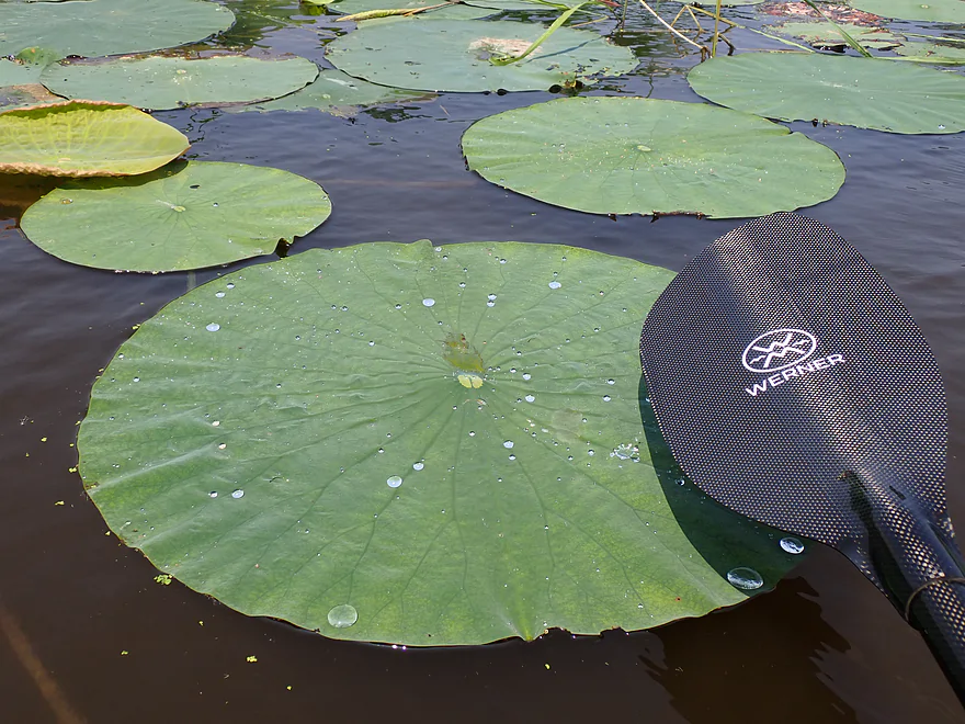
Lily pads on the Mississippi can grow to epic sizes
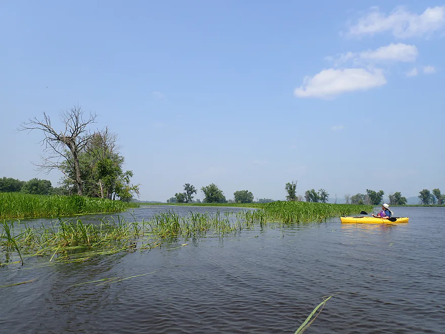
Heading south down a vast island and slough network
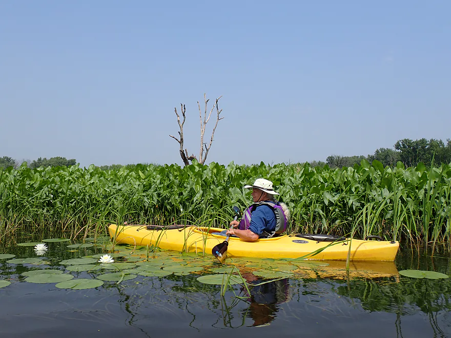
Nice stretch of arrowheads
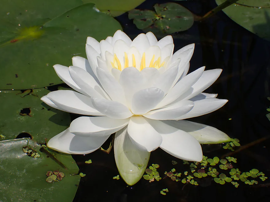
A white water lily flower
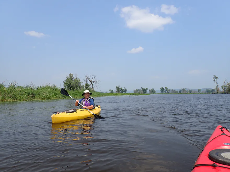
Continuing downstream
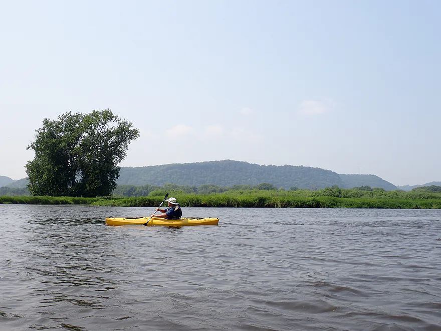
Minnesota bluffs in the distance
Wisconsin bluffs also visible to the east
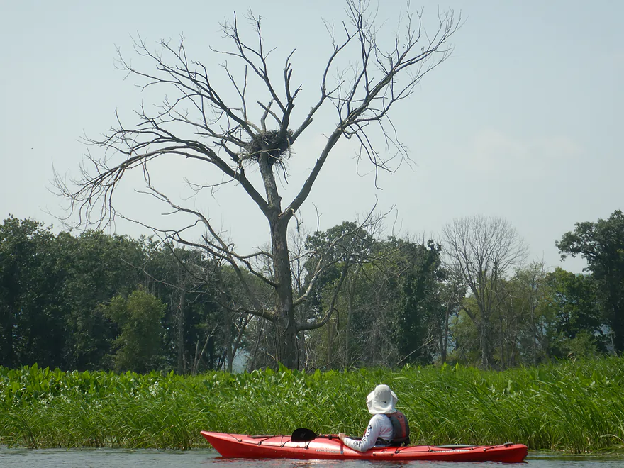
One of two eagle nests we passed
A slough on slough confluence
Mississippi bluffs looking hazy because of Canadian smoke
Exiting the sloughs to reenter the main channel
This popular sandbar is on a peninsula which separates the main channel from Lawrence Lake
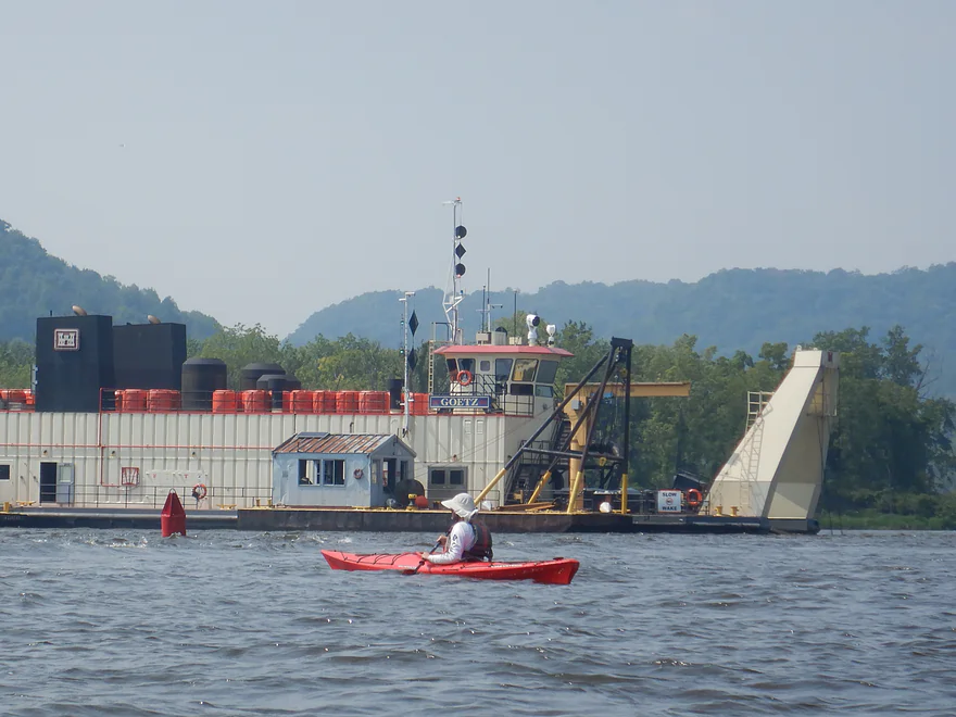
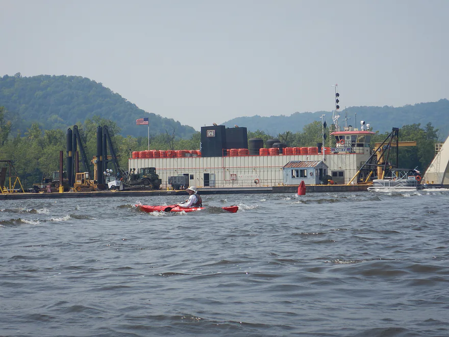
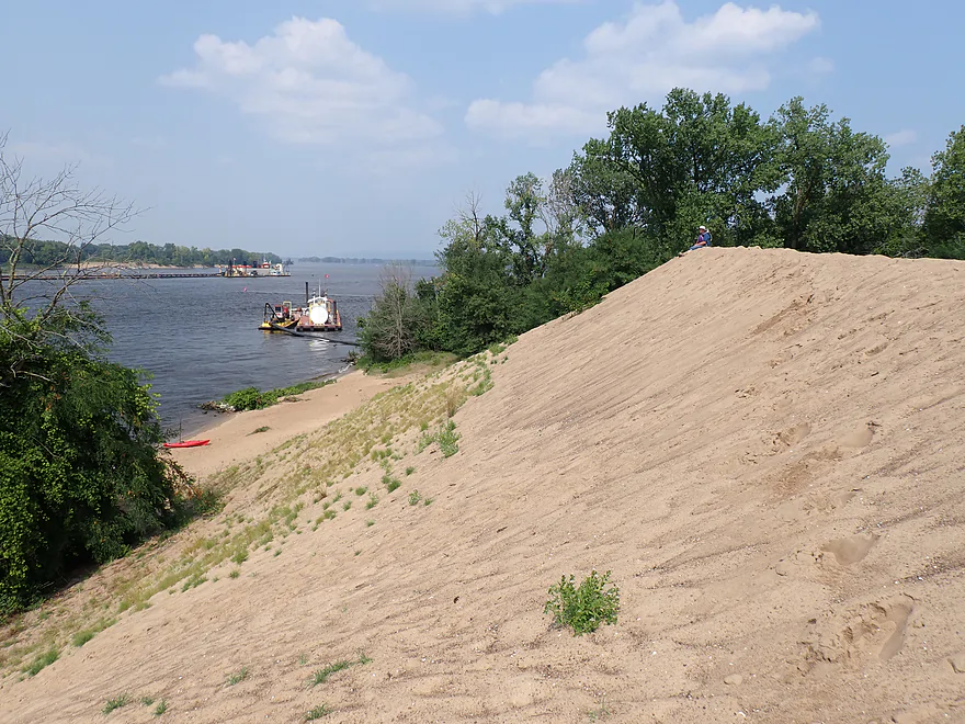
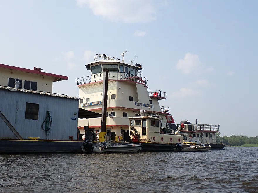
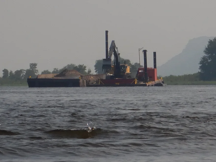
This is the “Goetz,” a massive dredge boat that is 225 ft. long
Passing over a wing dam…shortly after this photo the waves grew to epic sizes
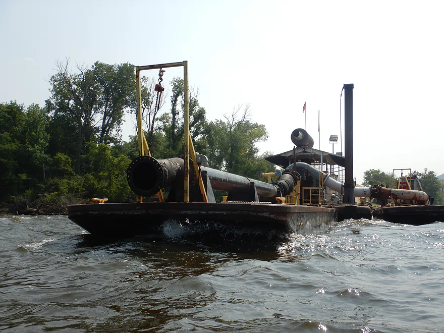
A smaller barge with a dredge pipe was parked nearb
Pulling up on the northwest corner of Crater Island
A mini diesel tank barge in the background
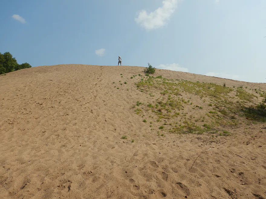
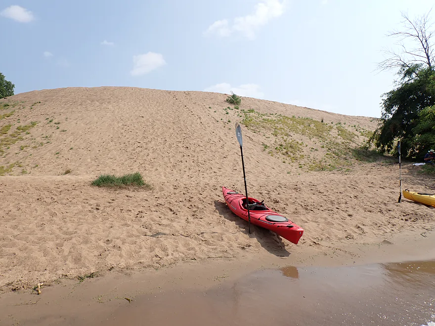
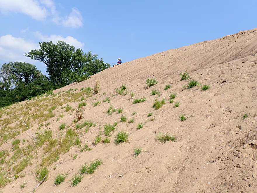
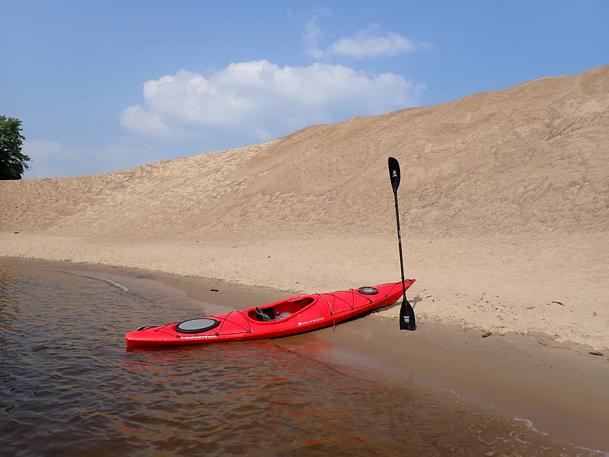
Climbing the 50-60′ sand dune (dredge spoil pile)
Climbing the mountain
Great view from the top
The entrance to Lawrence Lake is directly across the channel
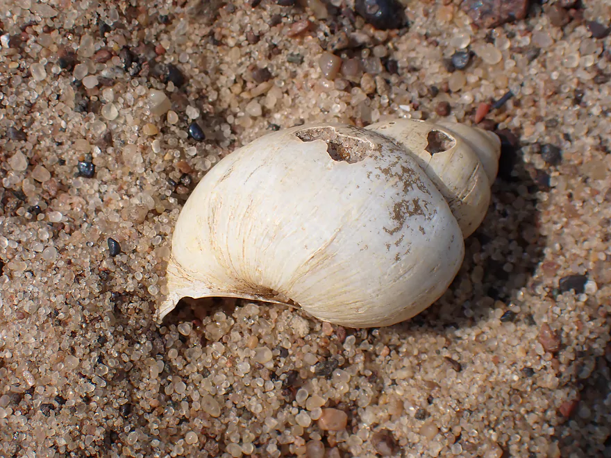
The shell of a common pond snail
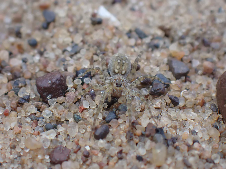
A very well camouflaged sand spider
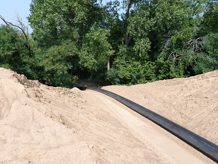
A dredging pipe snaking over the edge of Crater Island
Very long…deposit area is on the east side
View south toward the island’s center lagoon (aka Party Cove)
Side view of the highest point on the island
Very cool
Leaving the beach
Another dredging barge heading upstream
One of the larger tugs and barges
Paddling south into the main crater area
Locals call this the Party Cove–bands have even been known to play here
The banks are much bigger than usual though…
Thanks to this guy
Sadly some of this sand will be moved to Minnesota so the island will shrink in size
Here is a picture of the cove before dredging began (credit Jamie Norton-July 2023)
credit Jamie Norton
Exiting the bay…personal boat coming ashore
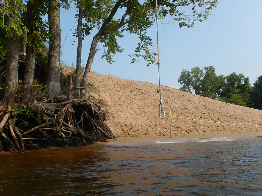
Looks like a fun swing rope
More large sand dunes
Heading south past some large tree skeletons
View upstream (sky is still very hazy)
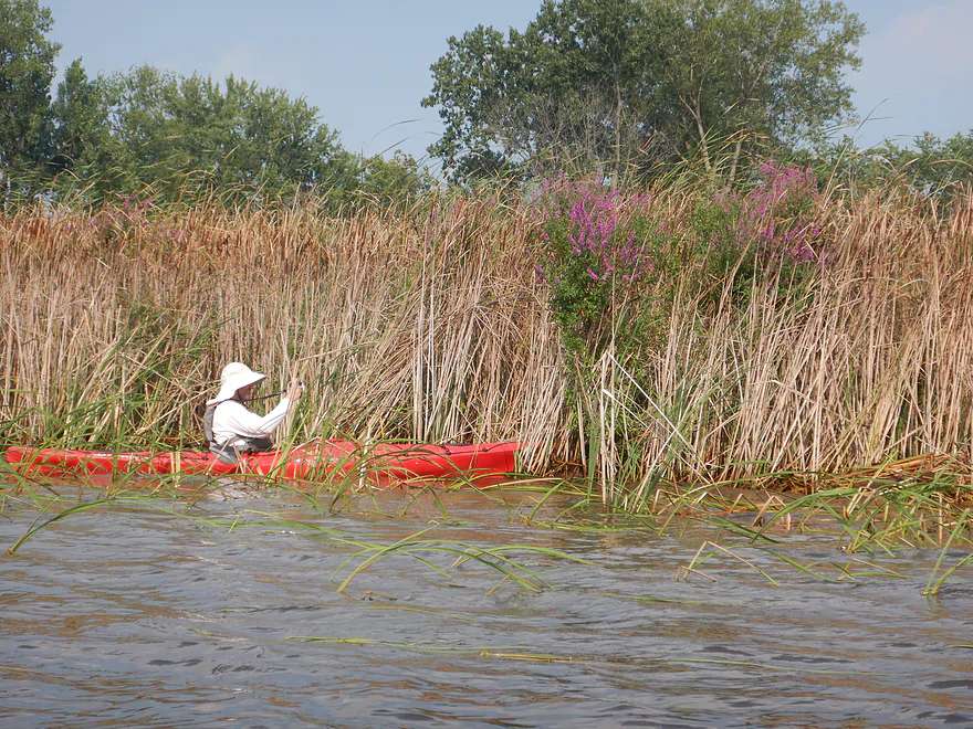
A dense stand of cattails with purple loosestrife
Looking at Goose Island and the Wisconsin side in the distance
Minnesota side in contrast
Taking another sandbar break
Great sandbar and side slough
FWS allows camping on these islands but you must follow their rules
Line of boats parked along the sand banks
Yet another dredge barge
Crossing the channel to our landing–there is an impressive goat prairie in the background
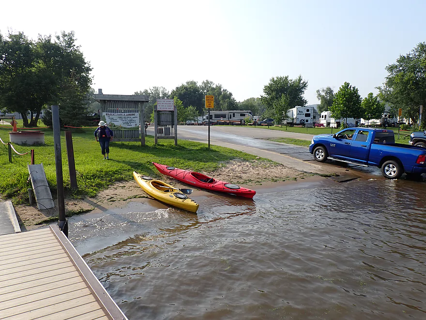
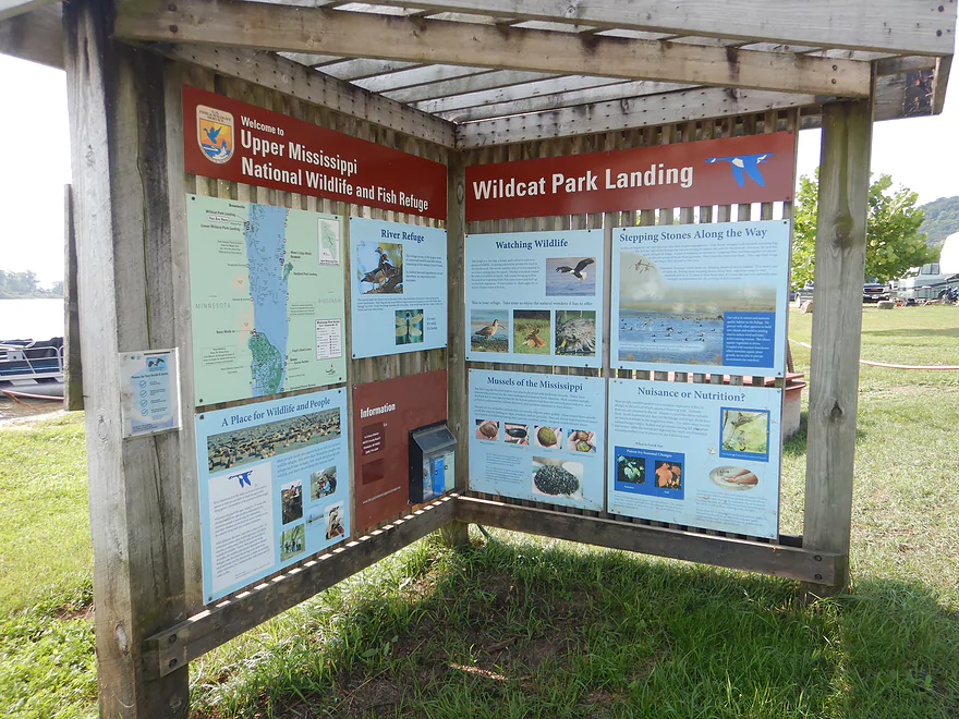
Taking out at Wildcat Landing
This is a great spot for wildlife…especially in the fall
Mississippi River – Crater Island


Crater Island (aka Party Cove) is a popular dredge spoil island located on the Mississippi southwest of La Crosse. Kayakers can get to Crater Island from several different access points (eg Goose Island), but the idea for this trip was to include it as part of a longer one-way trip starting on the Root River.
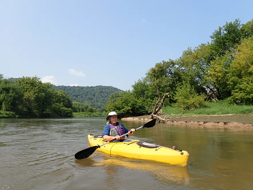
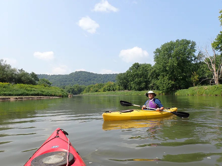
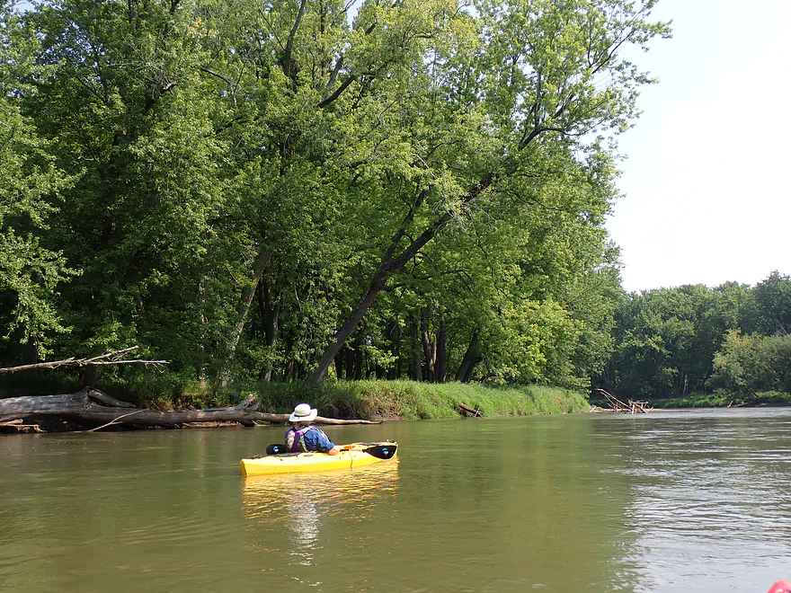
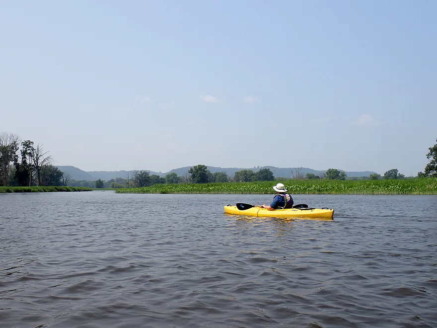
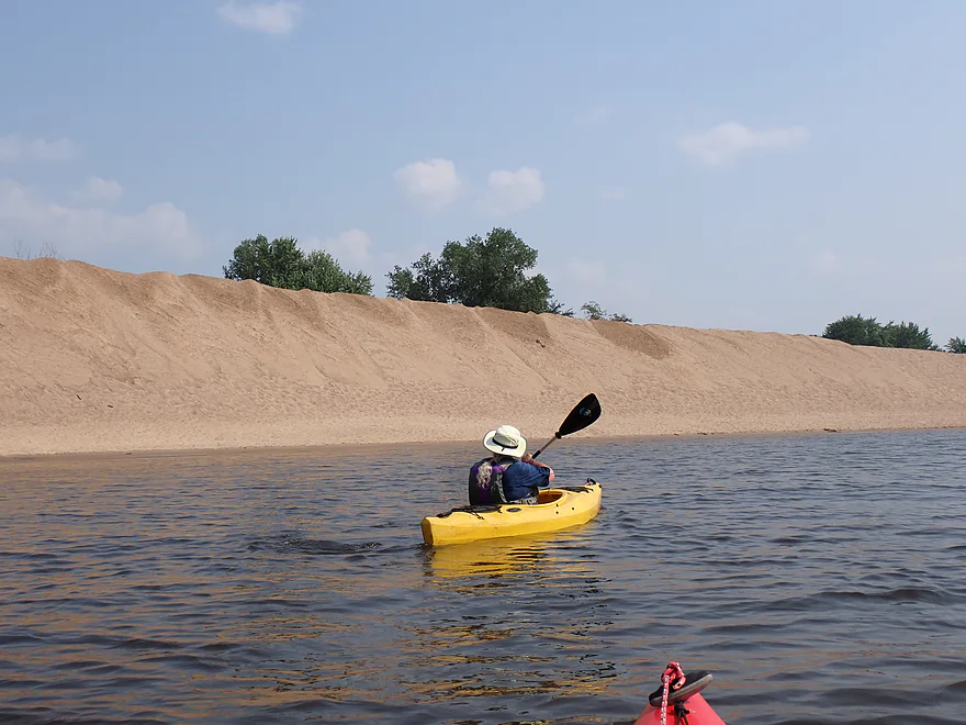
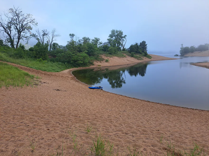
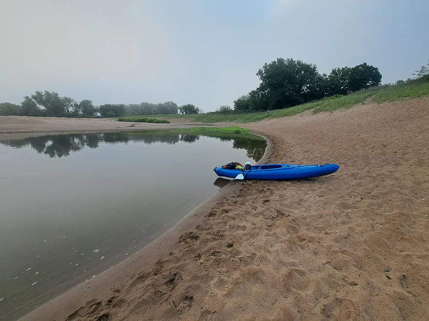
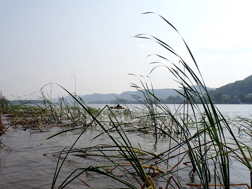
The trip began at a nice public access off Great River Road just a couple miles south of La Crescent, Minnesota. To reach the Mississippi we would have to paddle three miles down the Root River, which honestly wasn’t super exciting, but wasn’t bad. It was mostly beat-up bottomlands, messy floodplain forests, and weedy banks. But…the current was incredibly fast (and fun). There were occasional nice vistas of the Minnesota bluffs in the distance and a couple of the sandbars were surprisingly nice. In theory motorboats could power up the Root, but we didn’t see any (maybe they were scared away by the No Wake signs).
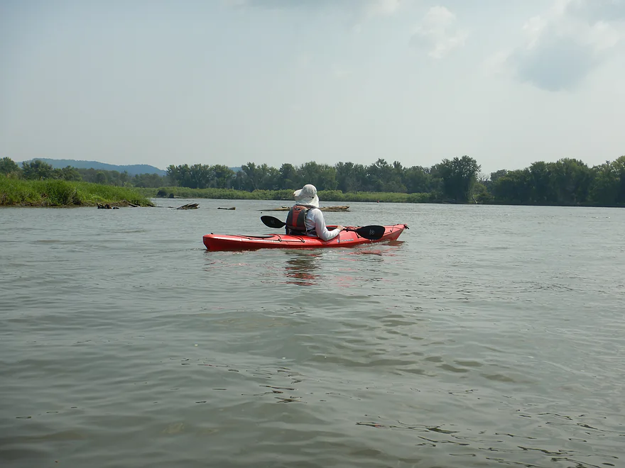
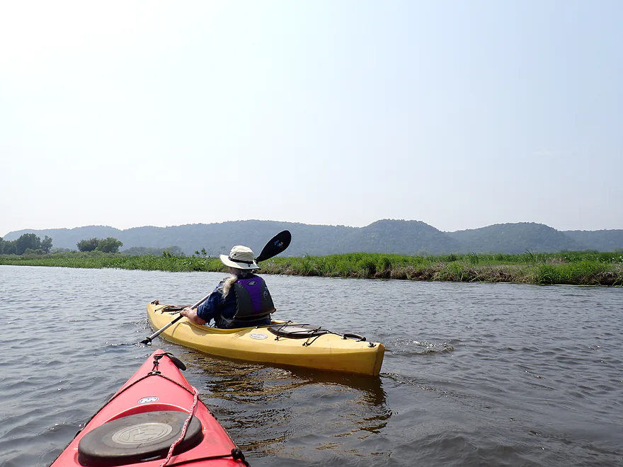
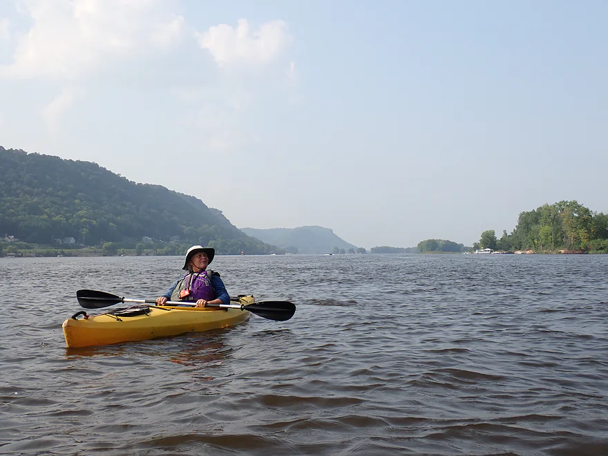
After about an hour we reached the main channel of the Mississippi. There we enjoyed some more nice bluff vistas through the hazy skies (Canada’s forest fires are never ending). River traffic though was busy, fast, and loud, with annoying waves. This had been anticipated though, so after dodging motorboats to cross the channel, we simply took an alternate route south through the protected side sloughs.
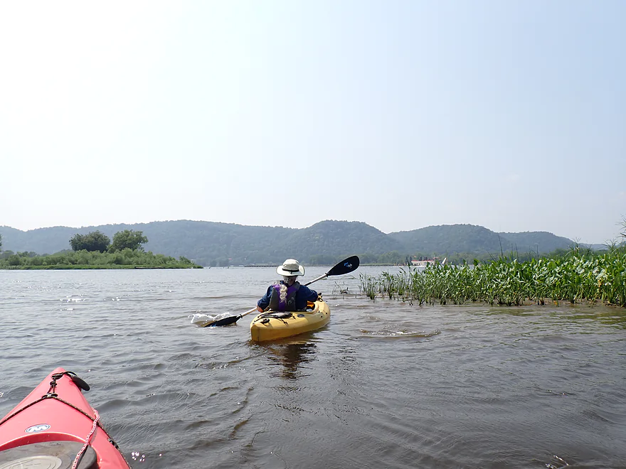
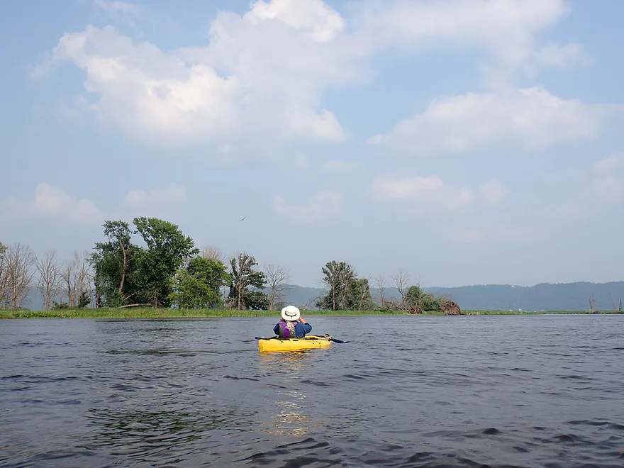
Sandwiched between the main channel and Goose Island, is a massive labyrinth of islands and side sloughs. It’s quite peaceful, in stark contrast to the main channel, and is a great spot for paddlers to explore. Before dams ruined the Mississippi, much of the upper river was like this…braided islands and countless attractive side channels.
Paddling highlights on the sloughs included some terrific marsh plants (lotus flowers, arrowheads, wild rice, and monster-sized lily pads). Wildlife was good as well with a number of terrific bird sightings (eagles, cormorants, pelicans) and two eagle nests. I’m sure during fall migration it’s an amazing spot to paddle. Pack a GPS though, as it would be easy to get lost in this maze without one.
There were several “on-ramps” from the slough network where we could have rejoined the proverbial water freeway (the main channel). We would have to take one eventually to reach Crater Island, but we deliberately waited until the last possible exit to avoid the intense channel traffic and heavy wakes.
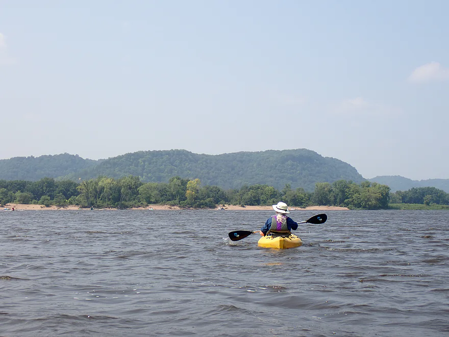
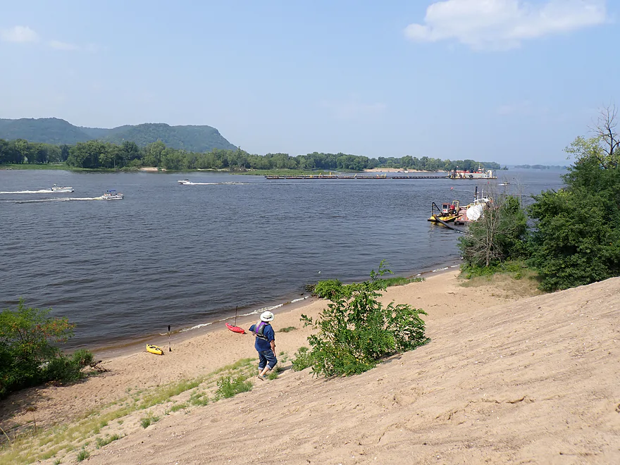
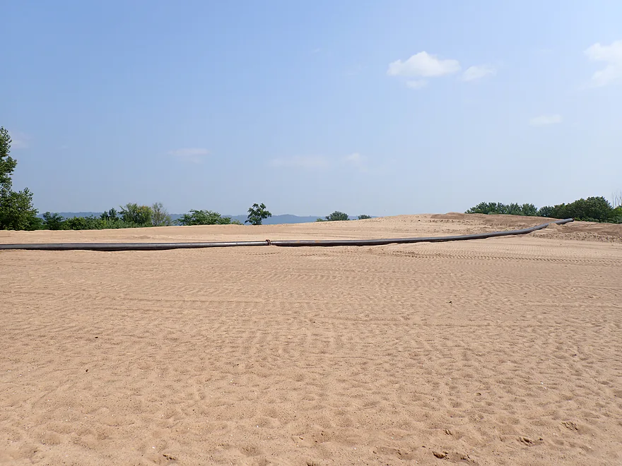
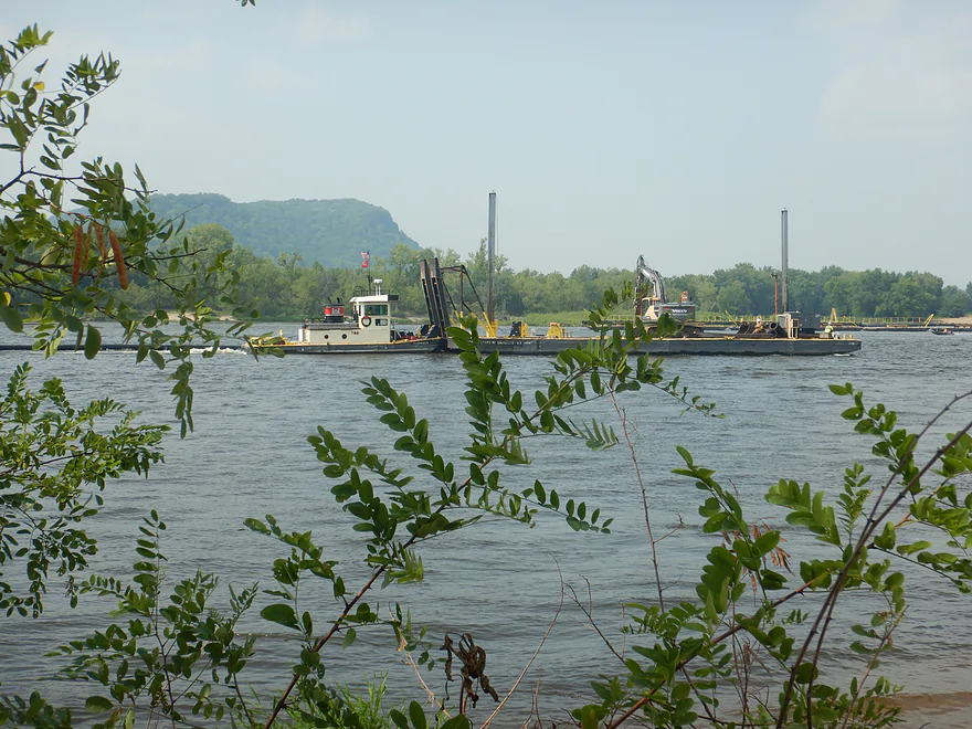
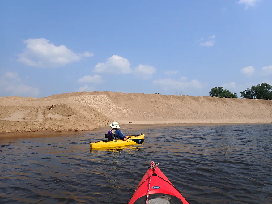
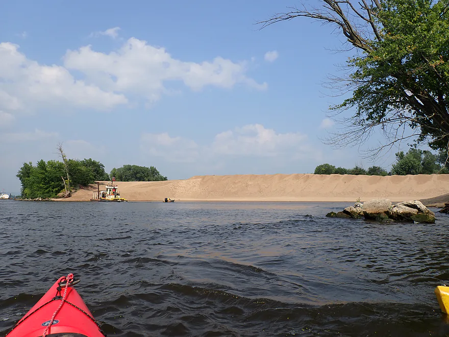
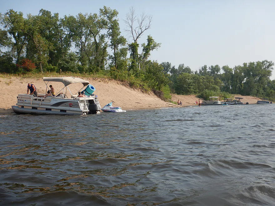
About two miles above Brownsville we finally came out on the main channel and into view of the tip of the two mile-long peninsula that separates Lawrence Lake from the main channel. Along the peninsula were a series of attractive sandbars packed with boaters. A private marina could be seen to the left of this which might be an access option for paddlers (if you get permission). Just south of this were several dredging barges and a couple of long dredging pipes. And to the left of these was a giant pile of sand–our first view of Crater Island.
Crater Island was tantalizingly close, but to get there we still had to cross some heavy boat traffic. In general Upper Mississippi waves are annoying but manageable for paddlers if dealt with correctly. But, unbeknownst to me at the time, I passed over a wing dam. This, combined with a sudden surge in boat traffic and waves bouncing off the nearby dredging barges, created freak waves…the strongest I’ve EVER faced. At times these were at 45 degree angles and at least 3-4′ in height while coming in from multiple directions. I’ve faced big waves on Lake Superior and on the Dells with the jet boats…but these were much worse, and for a brief moment I thought I was going under.
In hindsight though I wish I had packed my tripod and took a video. Typically waves in this area aren’t that strong and it was probably mostly unlucky timing on my part. Hopefully this gets better when the barges and dredging pipes leave. But regardless, paddlers should be careful around high traffic areas, wing dams, shallows that cause waves to break, and any barge/vertical wall that can reflect waves. If ever a spot needed a No Wake zone…
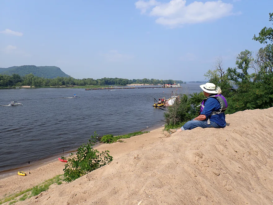
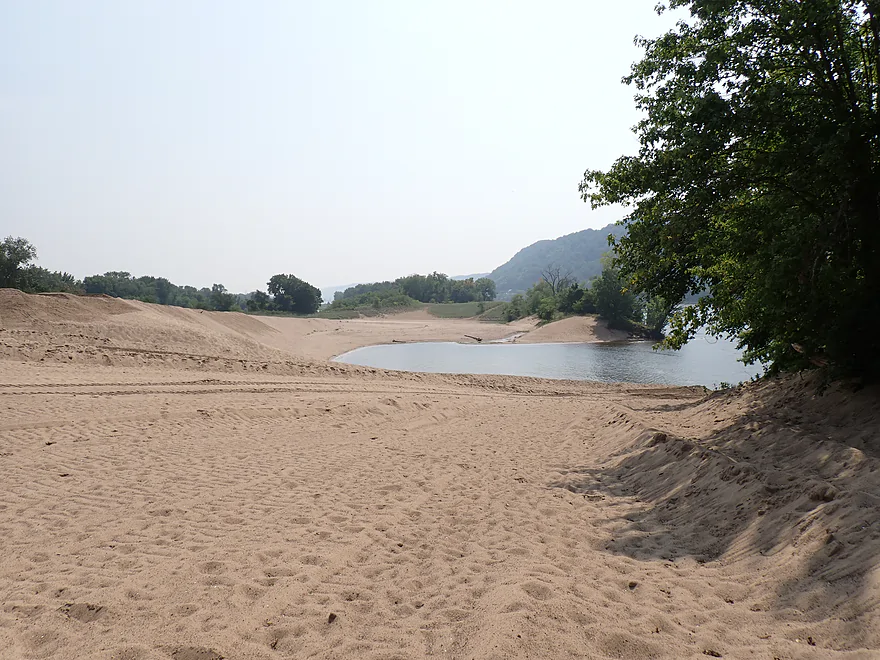
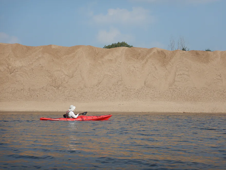
Thankfully we finally cleared the waves and landed at the northern tip of Crater Island. Facing westward was an impressive sand bank…perhaps the largest artificial sand dune in the state, at least 50-60′ high. I figured much of it used to be Root River sand (and former Root River outcrops) as the upstream dams on the Mississippi likely act as sediment traps for sand from further upstream. We climbed to the top of the sand bank where there was a fantastic view of the Mississippi to the west and the island interior to the east. It was a giant proverbial sandbox.
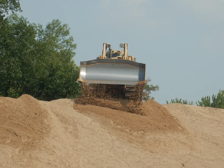
What was odd though was that despite this being a busy weekend, nobody else was on the island. Did they know something we didn’t? A clue to this mystery was provided when we discovered a bulldozer at the back of the island shoving newly dredged sand into the island’s open center. The island was apparently closed to the public while this work was being done, but we didn’t know that and there were no signs on the north side of the island prohibiting entry. What’s ironic is WE DID check ahead of time on the internet to see if dredging would be an issue, but only found an article from 2023.
The bulldozer could clearly see us (as could the dredging crew on the barges) but they didn’t seem to care, which was a good sign. Regardless, you probably shouldn’t be on an island taking in dredge sand (even though we were far from the heavy equipment). After a break on this massive sand dune, we hopped back in our boats and headed downstream a short distance to the main cove.
Crater Island is shaped like a “crater” impact zone with steep sand dunes encircling a large bay area. Typically this bay would be packed with boats, but not today, which was eerie given how popular the island usually is. We didn’t loiter, but did paddle in the bay a bit to take photos. It’s not clear how this dredging operation (which typically happens every 10 years) will impact the island. The added sand could make the dunes larger, but the Army Corp is also transporting a lot of sand (50,000 cubic yards) to Minnesota which could shrink the island. Ideally they would try to make the island as big and tall as possible…imagine instead of a 50′ high circle of sand there was a 100′ mountain of sand! That would be really cool and could be an epic tourist attraction. The island has certainly changed so far with the recent dredging.
The following are examples of what the island looked like before the most recent dredging operation. Note the south lobe pictured has since been completely filled in.
- 2016 – Panorama
- 2017 – Drone video taken during active dredging
- 2017 – Aerial shot from the north
- 2017 – South facing shot
- 2020 – East facing shot
- 2021 – West facing aerial shot
After our quick interior excursion, we exited the crater to complete the final few miles of the trip. It was tempting to backtrack around to the east side of Crater Island, which likely would have had some cool hidden sloughs, but that would have meant crossing the wing dam and its big waves again. So we stayed on the main channel, which was mostly uneventful and easy paddling. “Crater Island” is actually part of a larger very long and narrow island with some small sandbars where we found more parked boaters. I’m sure they would have preferred to be in “Party Cove”.
Just east of Brownsville we saw a second (and third) dredging operation. Along the Brownsville bank was another impressive “sandbox” where sand was being unloaded from dredging barges. Supposedly the sand here is free and locals will come by to pick some up for their kids’ sandboxes.
By Brownsville there were some fantastic river bluffs on the Minnesota side, including one just north of Brownsville that had a massive goat prairie. To the east the last islands and sloughs of the vast Goose Island archipelago could be seen and it would have been fun to explore them more. To the south was the massive “Pool 8” (a vast, slow and boring lake created by the Genoa dam). We ended the trip at Wildcat Park and Landing, which was a popular public landing (perhaps too popular).
In summary this was an enjoyable but long trip. The Root River was “mid”. The Goose Island back channels were fun to explore, but the main highlight was Crater Island and its impressive “sand dunes”. Hopefully in the near future the Army Corp of Engineers wraps their dredging up so the public can enjoy it properly again. Paddlers wanting shorter trips should consider launching from Goose Island (Wisconsin side) or the Lawrence Lake Marina (Minnesota side).
Dredging update: According to a couple of locals, it sounds like the Army Corp will be pulling out this week or shortly after. This should open the island to normal boat traffic again for the rest of the summer.
Sights included two cranes, two adult eagles, 4 immature eagles, one clamshell, two nice eagle nests (in very short trees), 2 softshell turtles (plus occasional turtle heads poking above the surface), a couple of wood ducks, 7-8 blue herons, a few flopping fish, two swans, two pelicans, and 9-10 cormorants flying in a V formation.
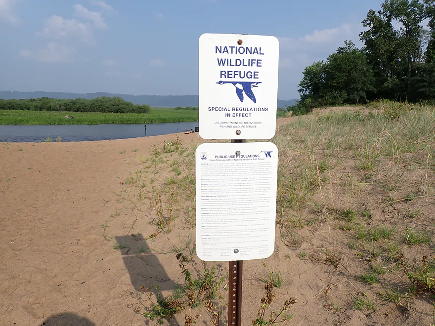
Hwy 26 Carry-In Access: Located on the Root River this is an excellent public access. The only downside is it’s a bit steep and has some mud, but it’s all manageable.
Alt Put-ins: There are many…see trip map for locations. The following are some main options.
- Lawrence Lake Marina: This is a private marina and ramp. It is located within eyesight of Crater Island which is convenient but…their hours are challenging. The marina is closed Monday and Tuesday. And the boat ramp closes Friday to Sunday (likely to minimize congestion with marina customers). Maybe as a kayaker and not needing a big boat ramp your options are more flexible? Contact them for more information.
- La Crosse Area Ramps: You could launch from either the Green Island or French Island ramps. This would mean a slightly longer trip and a bit more open water paddling, but would provide the opportunity to access the massive Goose Island archipelago from the top.
Goose Island Ramps: There are six access options on Goose Island. Launching here and then crossing the maze of islands and sloughs to reach Crater Island would be a great trip and scenic. A good question is if you can return back because of the current. Some kayakers do indeed do this, but you need to plan your return route carefully. The current is strongest on the far west end of the Mississippi and in the narrowest channels. So if you return east and on open water, maybe upstream paddling wouldn’t be so bad? Really though, if you want to launch from Goose Island your best bet would be to do it as a one-way trip and return to the Wisconsin side to take out at Stoddard.
Wildcat Park: This is a popular boat landing. It is public, but you must pay $5 to use the landing. A self-pay station is located by the ramp or you can pay at the office if it is open. Restrooms and snacks are available. All in all a good access, but it can be crowded and a little chaotic during peak times.
Alt Take-outs: There are many…see trip map for locations. The following are some main options.
- Lawrence Lake Marina: This is a private marina and ramp. It is located within eyesight of Crater Island which is convenient but…their hours are challenging. The marina is closed Monday and Tuesday. And the boat ramp closes Friday to Sunday (likely to minimize congestion with marina customers). Maybe as a kayaker and not needing a big boat ramp your options are more flexible? Contact them for more information.
- Goose Island Ramps: Note: these are upstream from Crater Island. The west side of the river is fast, so maybe it is easiest to paddle against the current on Pool 8 at the east end? I’m not sure though if a round trip and back-paddling against the current would be enjoyable. It might also depend on water levels (higher = faster). For those launching from Goose Island, Stoddard (just downstream) is likely a better take-out.
- Stoddard Boat Ramp: If you launch from Goose Island you could tag Crater Island and then take out at Stoddard. The advantage of this is you stay on the Wisconsin side and avoid a long MN/WI shuttle north to reach the next bridge.
Many of the La Crosse area Mississippi islands are managed by FWS and they allow dispersed camping on the islands. This is an attractive option, especially for the islands with sandbars. However, if you do camp on the Mississippi, you should read up on FWS camping rules.
Note also, the lower Root River has a few decent sandbars and camping on them might be viable as well.
Bike Shuttle – Wildcat Park to Hwy 26 Carry-In Access: 7.0 miles with 10′ of ascent. Hwy 26 is a fast road and 7 miles is on the long side for a bike shuttle, but the lack of any hills should make this very manageable. The shuttle route along the Mississippi and Lawrence Lake is scenic.
Rideshare: This route is in essence inside the La Crosse metro area, so ridesharers like Uber should be an option. Just cable lock your boat at the put-in, drive to the take-out and have a taxi or rideshare shuttle you back to the put-in to start your trip.
Wind: This is an open water trip so wind speed and direction are important. Monitor the forecast and definitely don’t do a trip with an appreciable headwind.
Current: The Root River was shockingly fast. If there were rocks there would have been rapids. The lower Root is plenty safe, but there are occasional submerged logs you should stay clear of. The Mississippi wasn’t as fast, but still moved at a good clip…especially on the main channel and in narrow spots. The sloughs were a bit slower, but still enjoyed decent current. Generally speaking the further west of Goose Island you go, the faster the current. Note: current will vary depending on water levels (high = fast, low = not as fast).
Logjams: None.
Waves: On the Root River there are no waves (in fact it has No Wake signs). The Mississippi sloughs are peaceful and generally devoid of waves. But the main Mississippi channel is a zoo. While the waves there are frequent and annoying, they are mostly manageable for paddlers with decent boat control. However…there are select spots on the river where waves can suddenly develop to large sizes and form complicated interference patterns. These “sweet spots” are usually in shallow areas, over hidden wing dams, and by parked barges. Just northwest of Crater Island is such a spot with all three elements. This created the largest and worst waves I’ve ever paddled (3-4′ and at 45 degree angles). I briefly thought I was going for a swim. But just a little while later it completely calmed down. I really wish the US Army Corp would put up no-wake zones by their dredging barges to avoid issues like this.
A great trick for Mississippi paddling? Avoid weekend afternoons. Setting your alarm clock for an early start can help as even on weekends, the river will be pretty placid before 10:00. Another trick…simply stick to the sloughs, which are always safe.
Wing Dams: These are hidden and submerged walls located at the edge of a main channel. Their purpose is to create focused and fast current…fast = deep = navigable for barges. The Mississippi south of the Root River has many wing dams. You won’t experience these on the sloughs but will on the main channel. Sometimes these can be challenging or dangerous for paddlers and sometimes not. It depends on water levels, current, and location. In spots they can cause unpredictable and large waves to form (like northwest of Crater Island). Boaters avoid wing dams by traveling between the red and green buoys, but obviously most kayakers aren’t enthused about paddling in the middle of the channel. You can download maps that show the locations of wing dams on the Mississippi from the US Army Corp. Here is the pdf map for the section by Crater Island. Each slanted line is a wing dam.
Life Jackets: On some rivers and lakes you can get away with not wearing a life jacket. The Mississippi though isn’t one of those and you definitely want to have your jacket on at all times.
Big Boats: The main channel does get barge traffic. They don’t move very fast, so are super easy to avoid. What’s more of a problem are the jet skis and motorboats. Most drive at max speeds and some seem to have somewhat oblivious drivers. You should be fine, but just stay vigilant and visible. Staying off the main channel and paddling the sloughs is highly advised.
Dredging Operations: The highlight of this trip was Crater Island (a massive hill of sand wrapped around a bay), but paddlers should note this can sometimes be closed because of dredging operations. The US Army Corp of Engineers doesn’t do a good job of posting when/where this happens, so you could come across a dredging operation by chance. If you see active bulldozers, chances are good the island is closed. Sometimes dredging notices will be posted on the US Army Corp of Engineers news release section.
Getting Lost: The Goose Island archipelago is a vast maze and getting lost is quite possible (and part of the fun). Bringing a GPS with is highly recommended.
There is a nearby gauge on the Mississippi at Brownsville which will accurately reflect water levels. Below is my rough depth guide:
- < 30.5 CFS: A shallow depth common for late fall. The main route should be navigable. It’s possible a few side sloughs might be a bit shallow though.
- 30.6-31.5 CFS: A good depth. My trip was done at 31.3 CFS.
- 31.6-32.0 CFS: Starting to get on the high side. Should be doable, but the high, dirty water and accompanying fast current may make trips less enjoyable.
- 32.1+ CFS: Very high levels for this stretch of the Mississippi. River is likely navigable but maybe not as appealing for paddling.
Note also: the Root River flows independently of the Mississippi. It was at 820 CFS per the Houston gauge for our trip, which was high. This resulted in fast but manageable current.
Detailed Overview
The Mississippi is both a blessing and a curse for paddlers. While rich in beauty and majesty, it can be problematic to paddle due to high wind, current, wakes, powerboats, and barges. The Upper Mississippi is frequently dammed and subdivided into “pools”, of which there are roughly 11 in Wisconsin. Generally speaking, just upstream of a dam the river is the least interesting (few islands, deep, monotonous, few sloughs, and a wide channel). But on the downstream side of pools there are often many sheltered islands and sloughs that offer unique paddling experiences.
For a list of Mississippi water trails see my overview map or use the bullet list below. Thanks to the US Fish and Wildlife Service for many of these suggestions. Check out their website for more details. Water trails are listed in order from north to south.
—
Chippewa River Trail: 6.8 miles. Chippewa River Landing to Tim’s Slough Landing. Basically the last part of the Chippewa River that connects with a slough on the Mississippi. Avoid in high water.
Nelson-Trevino Trail: 4.5 miles. South of the Chippewa River, Hwy 25 cuts across the river through a slough and over a grade. Many landings to pick from. Most paddlers venture south and then back north to one of the landings. The main water trail is roughly the biggest loop you can take south of Hwy 25 while remaining in the slough. Avoid in high water and high wind.
Finger Lakes Trail: 6.1 miles. North of the Zumbro River mouth, there is a sheltered collection of sloughs and lakes you can paddle. The main water trail skirts the south edge. In low water, some portages may be required. For a launch/take-out, use Pioneer Landing in Minnesota.
Halfmoon Trail: 5.1 miles. Mixture of paddling on open sloughs, narrow, and on the main channel. Use Halfmoon Landing for an access. Difficult in high water and when vegetation is out in late summer.
Verchota Trail: 11.3 miles. A long upstream paddle up the main slough then you double back mostly on the same trail. Use Verchota Landing for an access. Difficult because of its long length and upstream paddling.
Aghaming Trail: 6.7 miles. Start at the park in the main channel and float downstream until you find a gap in the slough which you can paddle upstream to explore. Turn back when done. Access at Latsch Island Park and Landing. Some upstream paddling in the main channel. Not usable in high water.
Voyageurs Canoe Trail/Perrot State Park: 6.5 miles. Your best bet is to do a one-way trip from Hwy 35 to S. Park Road. Very scenic. Completely sheltered from the main channel and is technically the Trempealeau River.
Long Lake Trail: 5 miles. A counter-clockwise circle through mostly backwater sloughs. Long Lake is mediocre and French Lake is boring and weedy. But the main channel is nice with good sandbars and bluff vistas. When in season, Big Marsh can contain scenic wild rice corridors.
Brown’s Marsh Canoe Area: More of a lake paddle and a way to experience Brown’s Marsh. Access at Lytle's Road.
Lake Onalaska Trail: Technically the last few miles on the Black River. Been on my to-do list for a while… Lytle's Road to Fred Funk Landing is 4 miles, while Lytle's to Mosey Landing is 8 miles.
Root River to Crater Island: This is mostly attractive slough paddling inside the vast Goose Island archipelago. It does include a bonus stretch on the fast Root River and some main channel paddling by Brownsville. The highlight is "Crater Island," a large man-made sand island.
Goose Island Trail: 8 miles. A nice paddle around Goose Island. Mostly simple sloughs but there are nice bluff views .
Reno Bottoms Trail: 3-14 miles. Put in on the Minnesota side and float down a long slough. Many intermediate take-out options. Access at Reno/Hwy 26 and New Albin. Some of the launches can be under water during high depths.
Blue Heron Trail: 9 miles. Located south of the Minnesota/Iowa border, this water trail features a fantastic labyrinth of islands and side sloughs. A trip highlight is being able to paddle up to the historic Black Hawk Bridge.
Ambro Slough: 8 miles. Very similar configuration to Wyalusing. You can paddle up the slough then downstream on the main channel if you wish. The upstream slough by Harper’s Ferry also looks interesting. Access is at North Ambro Road. 8.2 miles if you do a full loop on the main channel.
Yellow River to McGregor: ~4 miles. A scenic stretch featuring impressive river bluffs and a large arched bridge.
Wyalusing: 5 miles. A marked trail starts at the lower Wyalusing State Park landing, then weaves through bottomland before heading back to the landing. One of the neater areas on the Mississippi and it’s always fun to visit the park.
Johnson Slough: 6.2 miles. Just downstream of Wyalusing on the Iowa side is another nice slough to explore. Most launch at the landing, cut north through the slough, and then float back on the main channel. Some current to paddle against.
Jay's Landing to West Haven: 4.6 miles. This is a nice leg with many islands that protect paddlers from the main channel. Highlights include scenic bluffs.
Cassville Bluffs/McCartney Lake: 4.17 miles. There is a protected series of sloughs and islands on the Wisconsin side that features many scenic bluffs and outcrops.
Dubuque Water Trail: 9 miles. Start south of the dam by A.Y. McDonald Park. Float down the western shore by urban Dubuque, past the Mines of Spain to Massey Station Road. Easy to subdivide or to do round trip loops. For further information see the official webpage for the trail.
Trip Map
Overview Map
Video
Photos Size: