
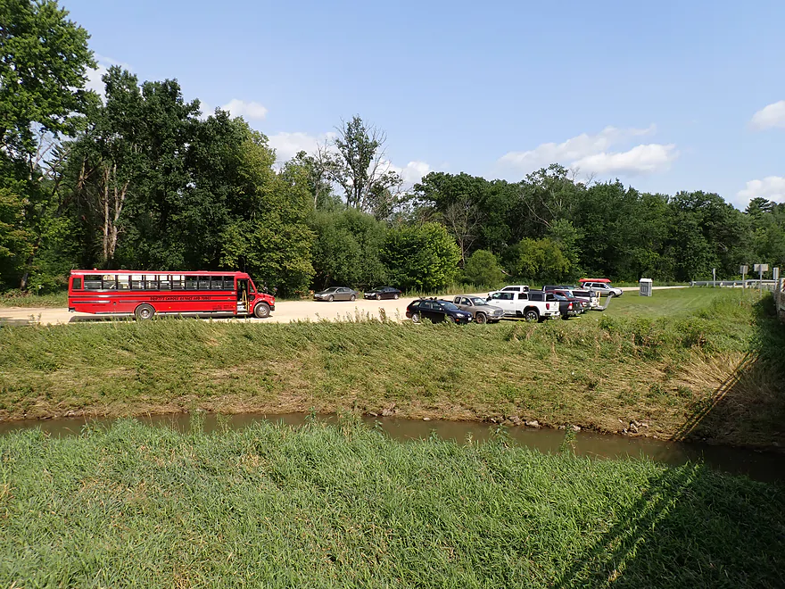
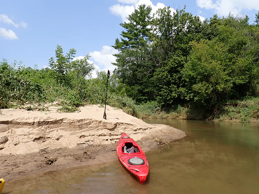
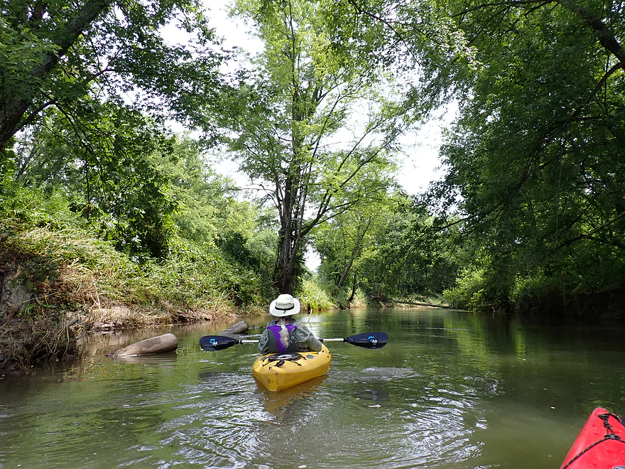
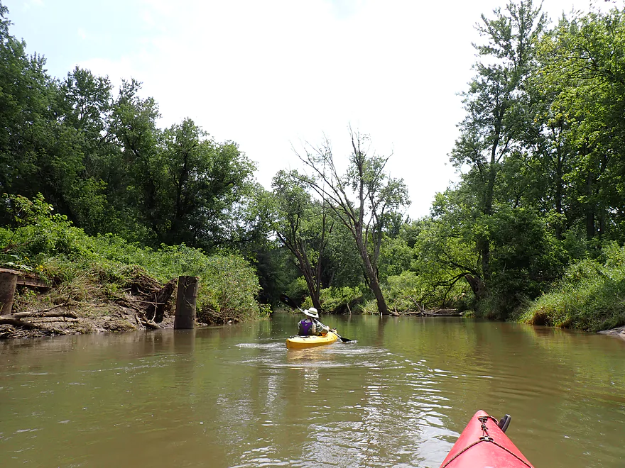
Starting the trip at the busy Bridge 7 landing
Good access…but current is fast by the ramp
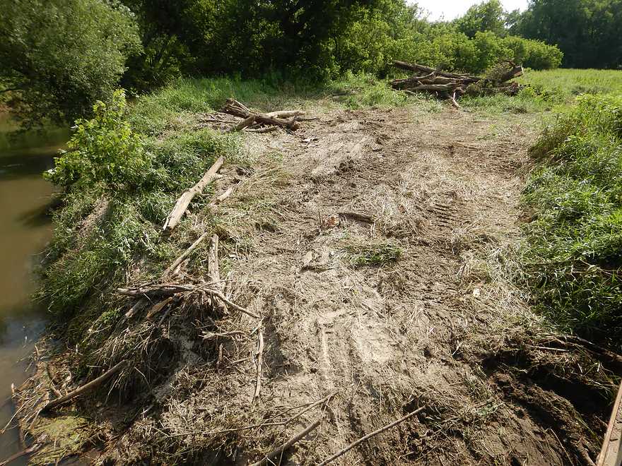
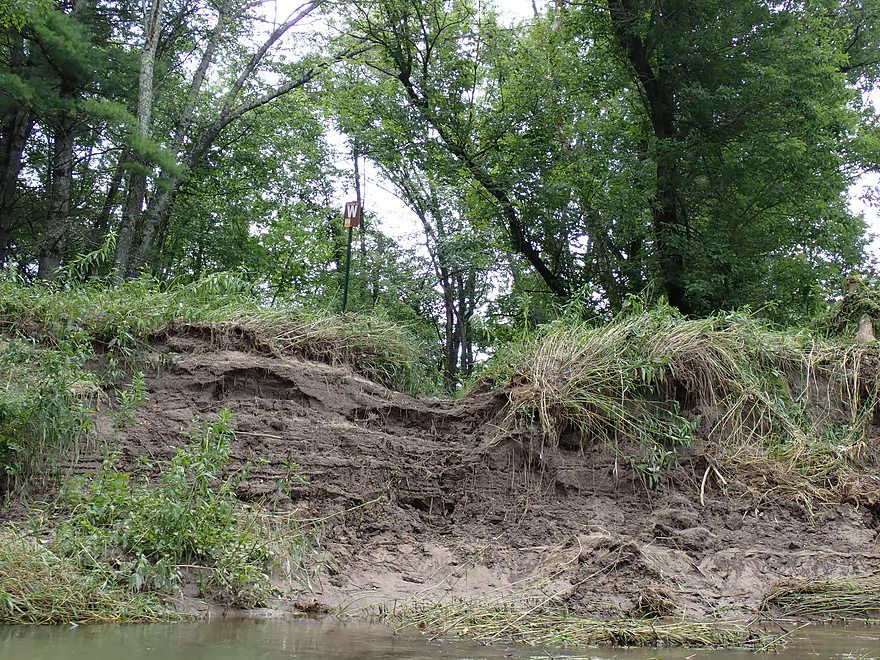
Landing was recently cleared of flood debris
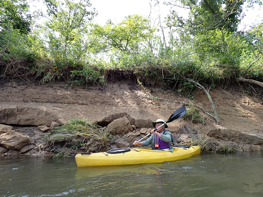
Bank erosion on the Kickapoo has gotten worse in recent years
First of many
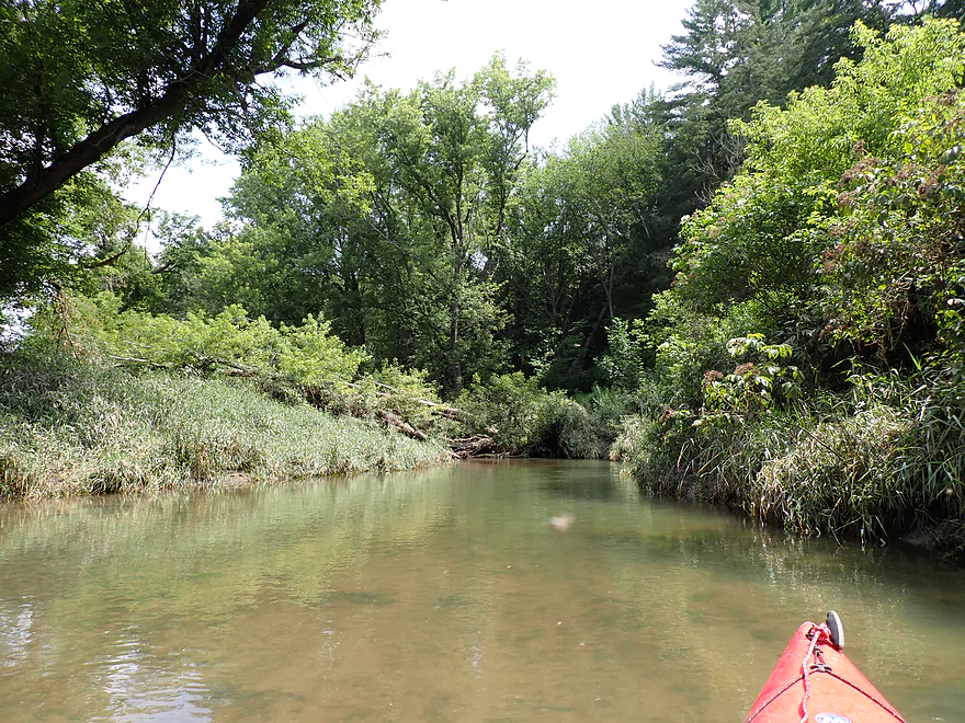
Lots of new deadfall along the river
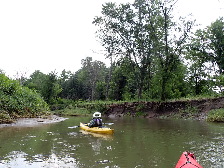
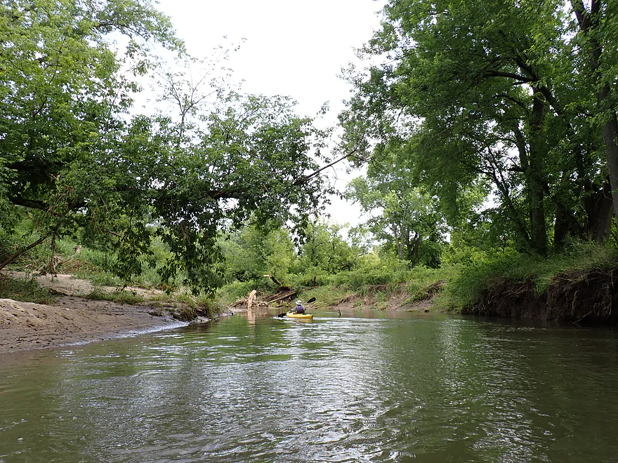
More muddy banks
But also a number of small but nice sandbars
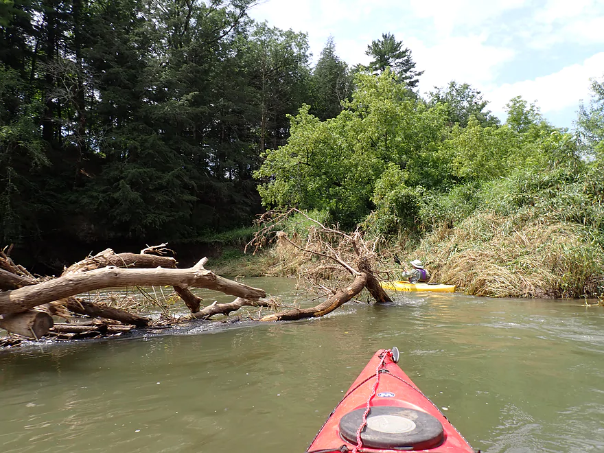
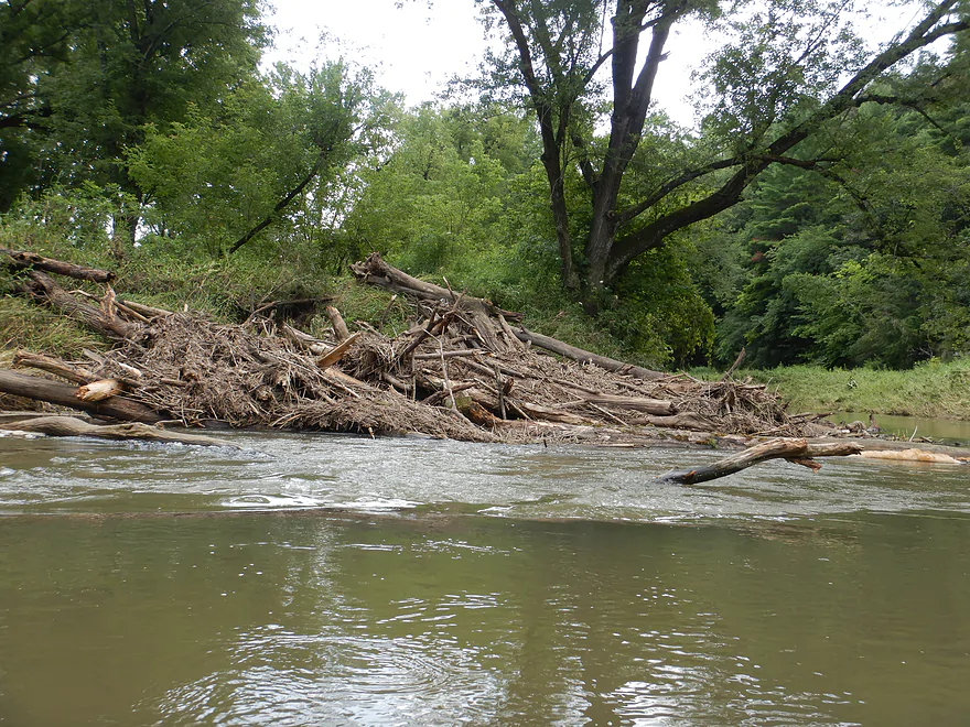
Checking out the mouth of Billings Creek….hate to see that logjam
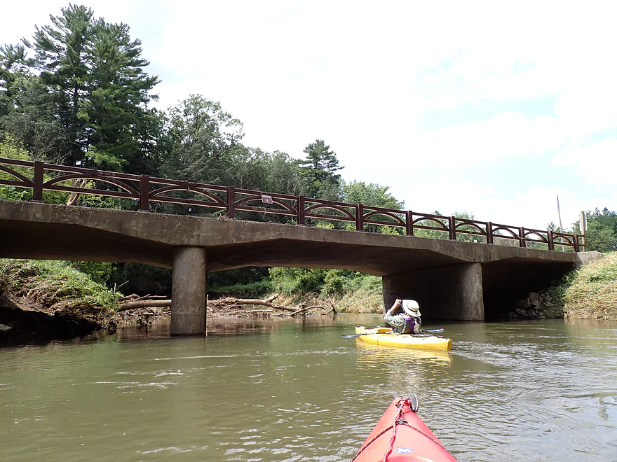
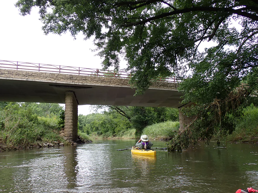
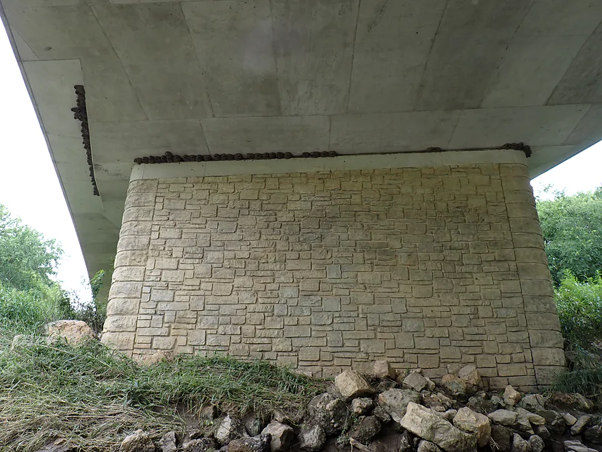
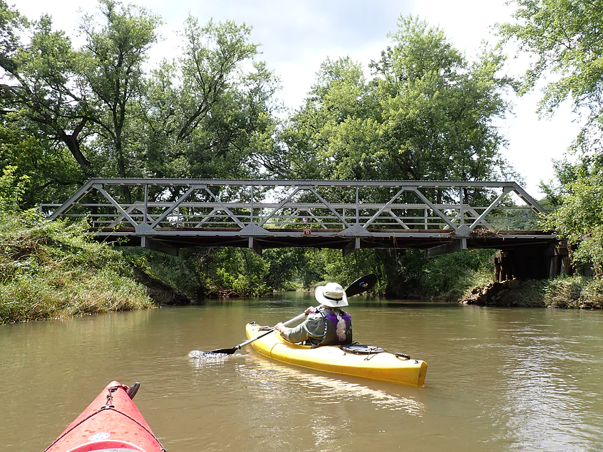
Bridge 8
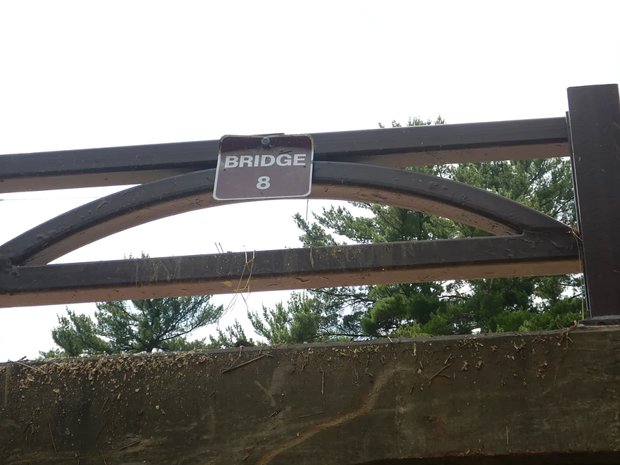
The bridges have helpful signs on them for paddlers
A strainer in fast current…hopefully this gets cleared out later
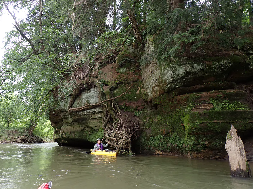
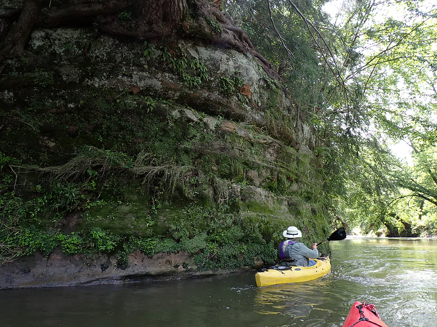
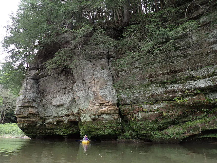
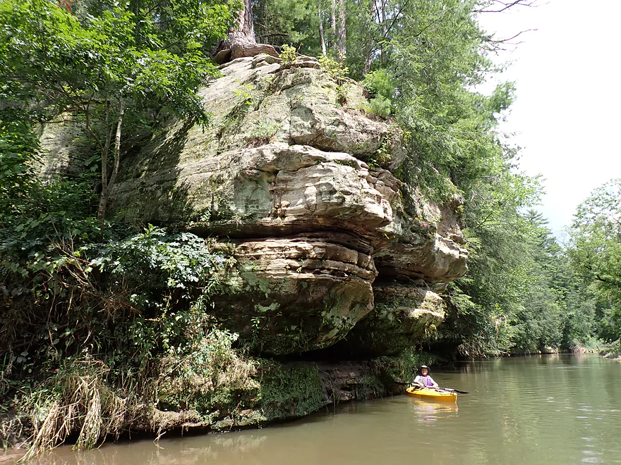
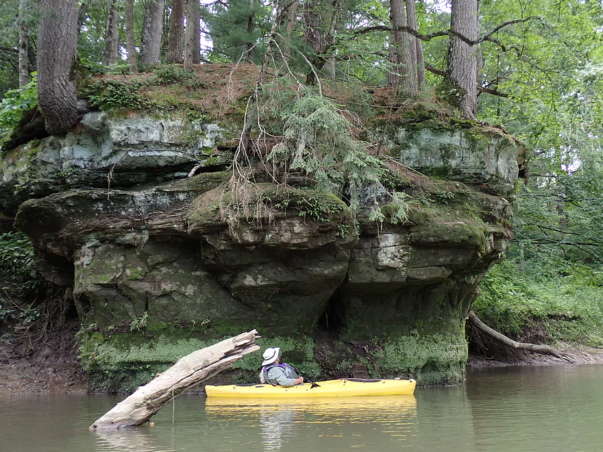
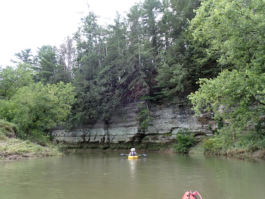
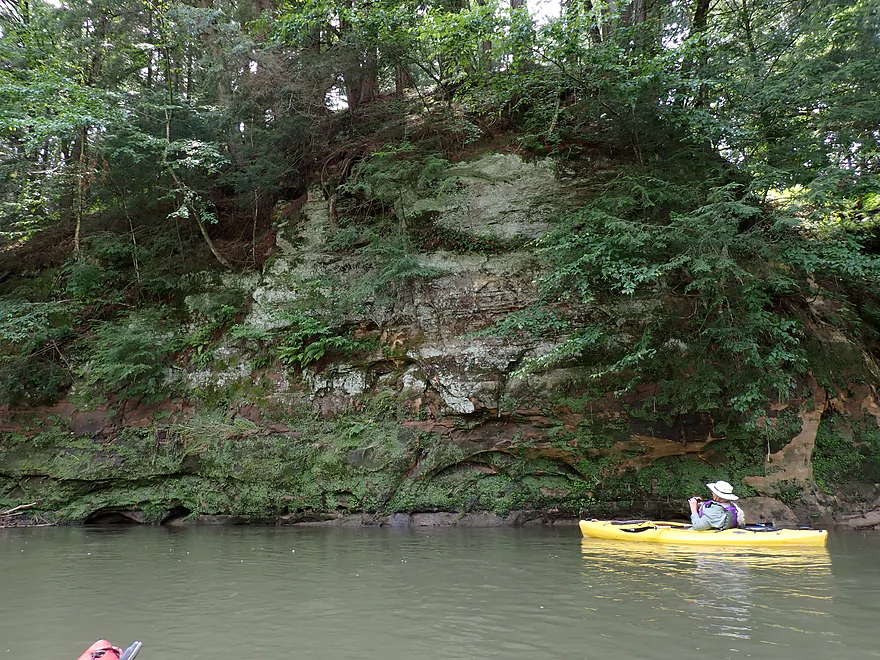
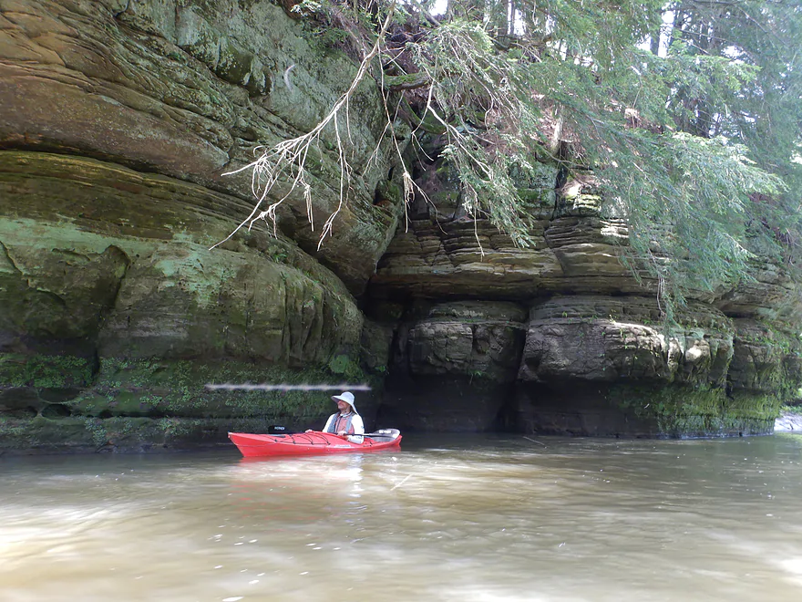
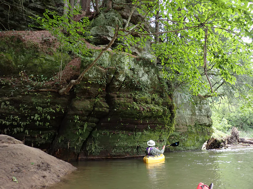
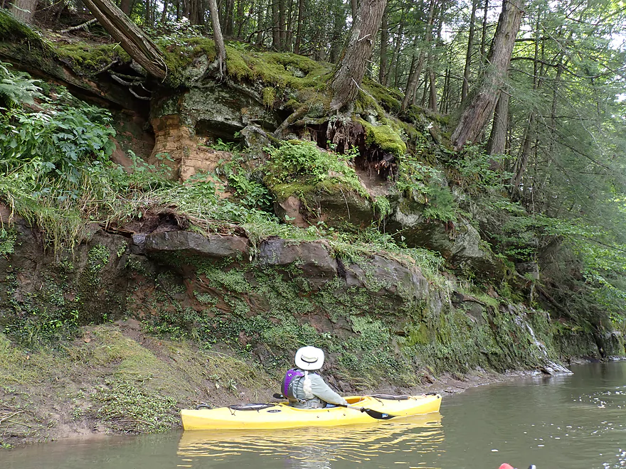
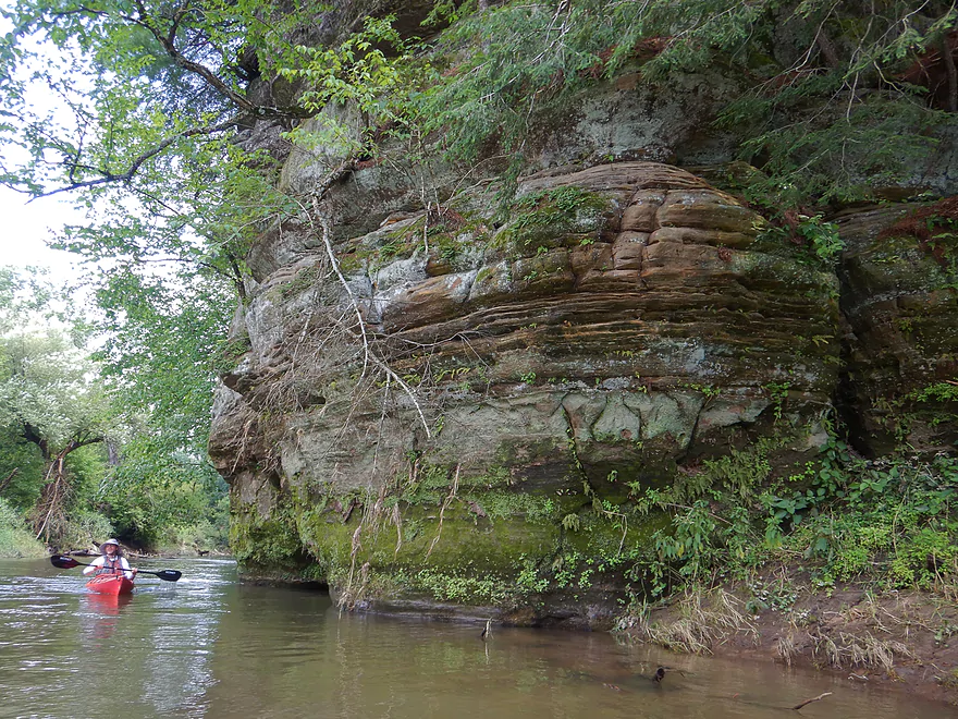
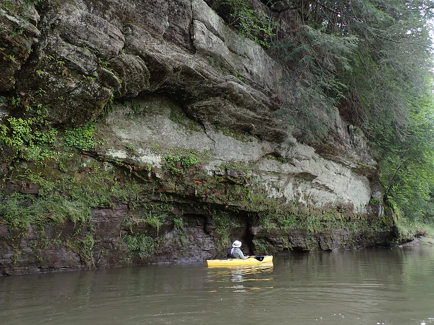
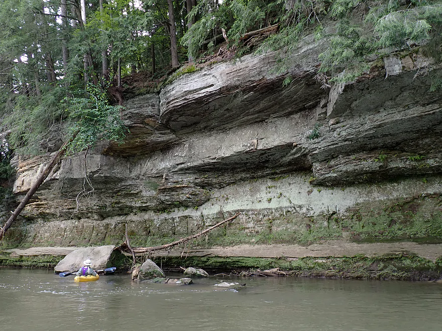
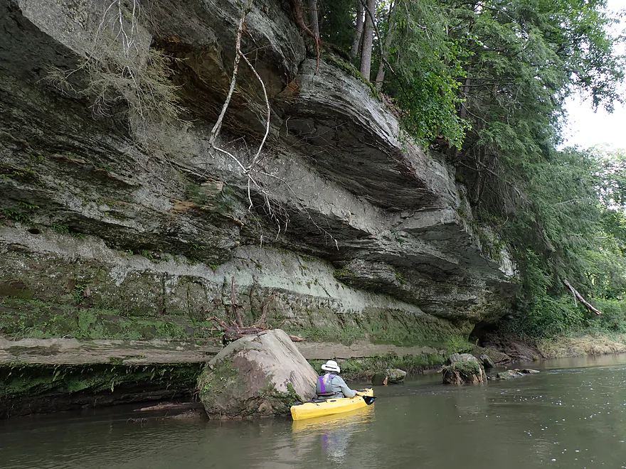
Photogenic outcrop just downstream from Bridge 8
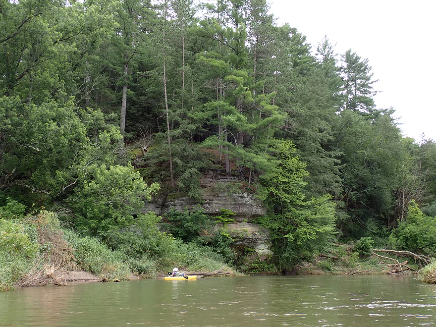
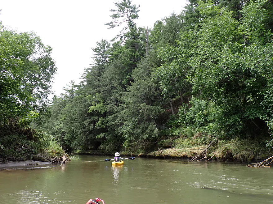
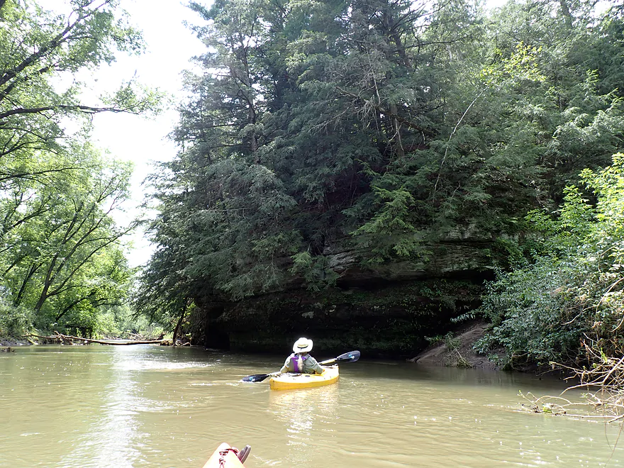
Terrific pine trees
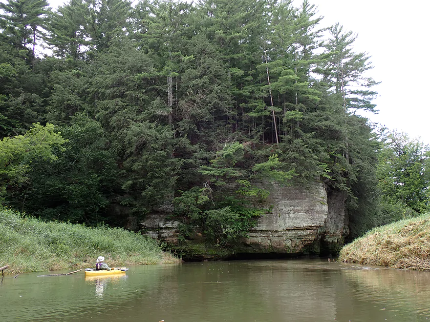
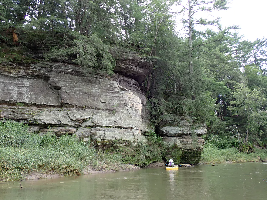
Outcrops starting to get bigger
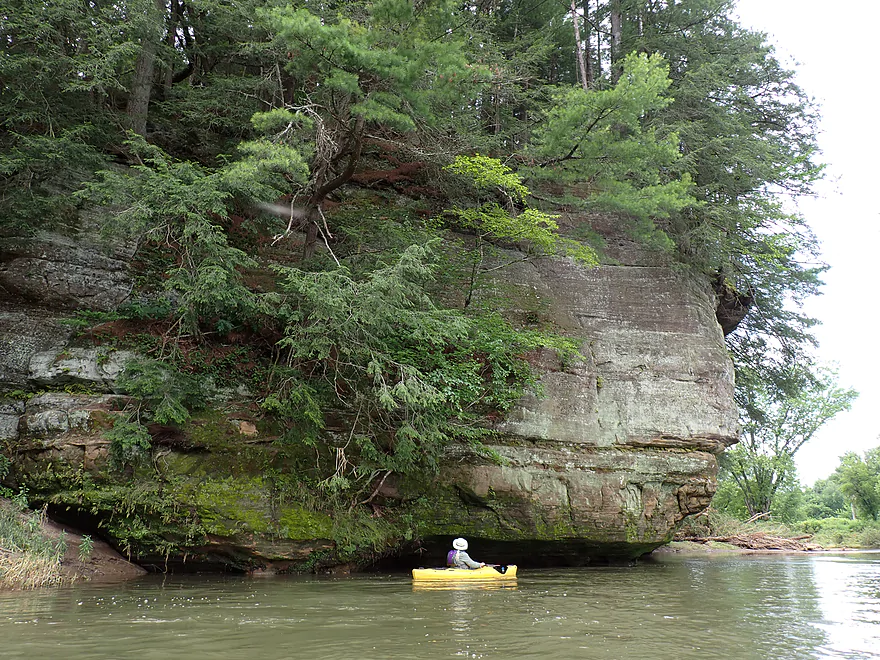
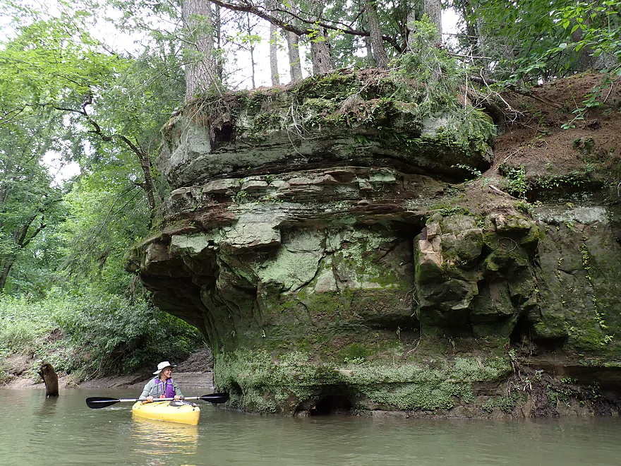
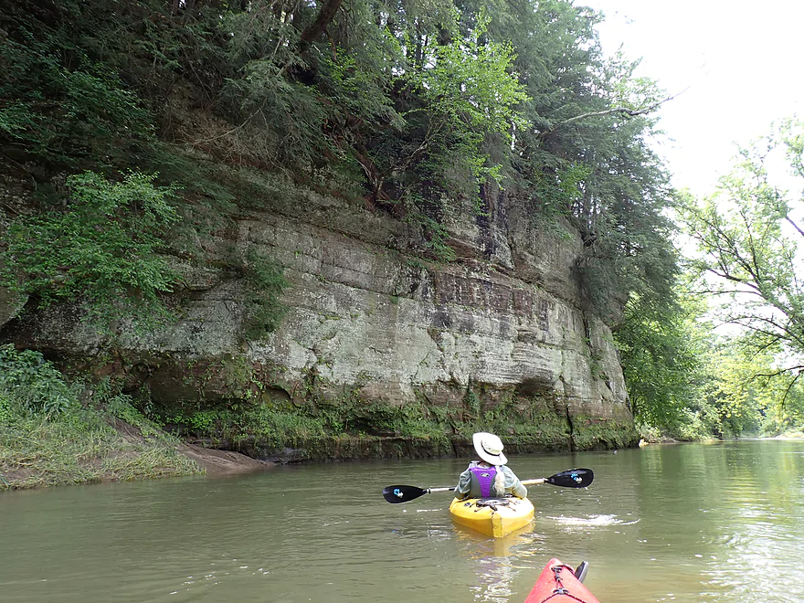
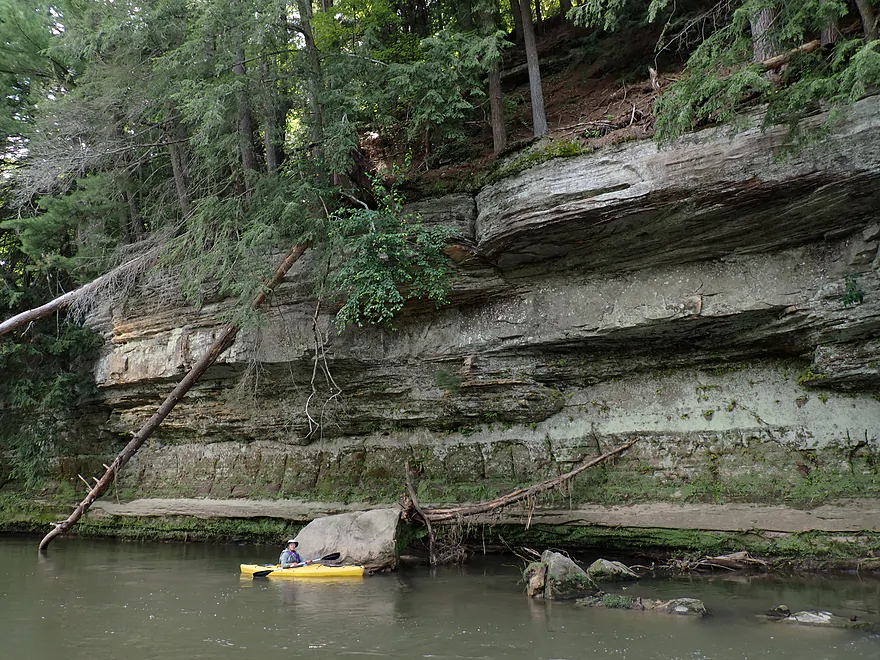
Reverse view
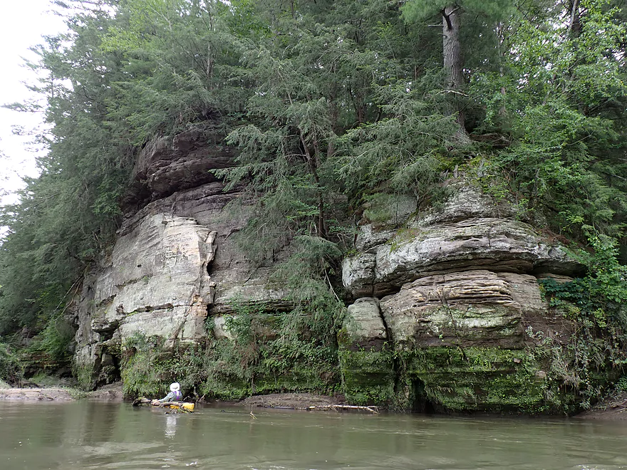
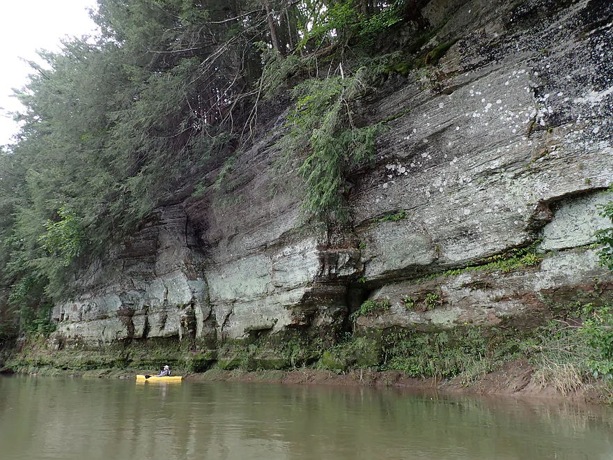
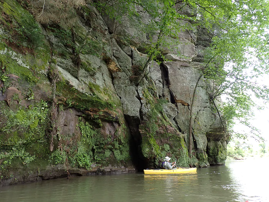
This was one of the nicer ones
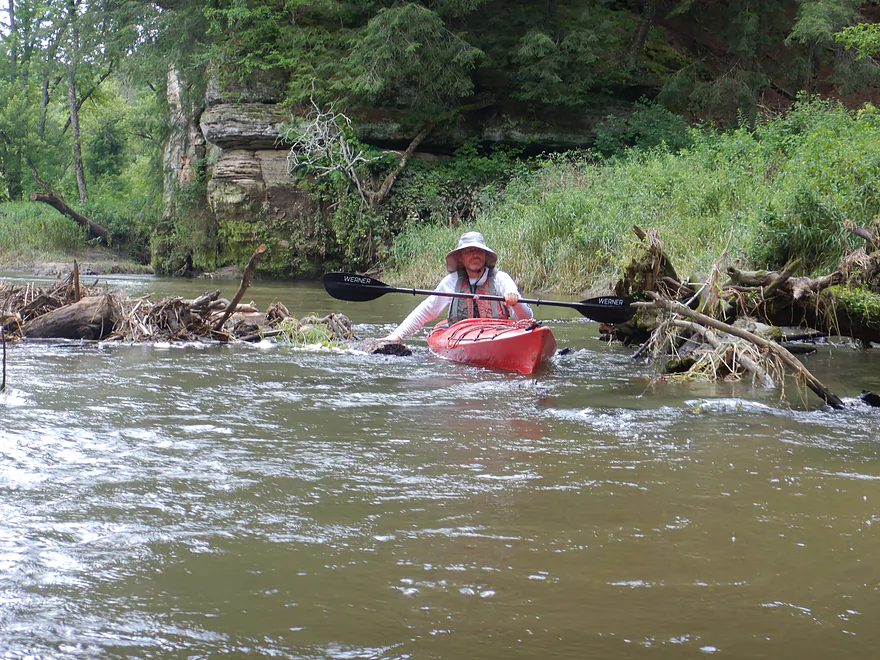
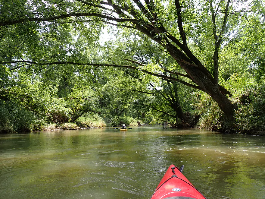
More snag dodging…hopefully this gets cleaned up too
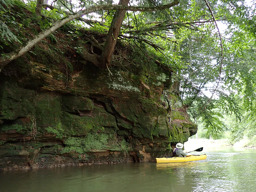
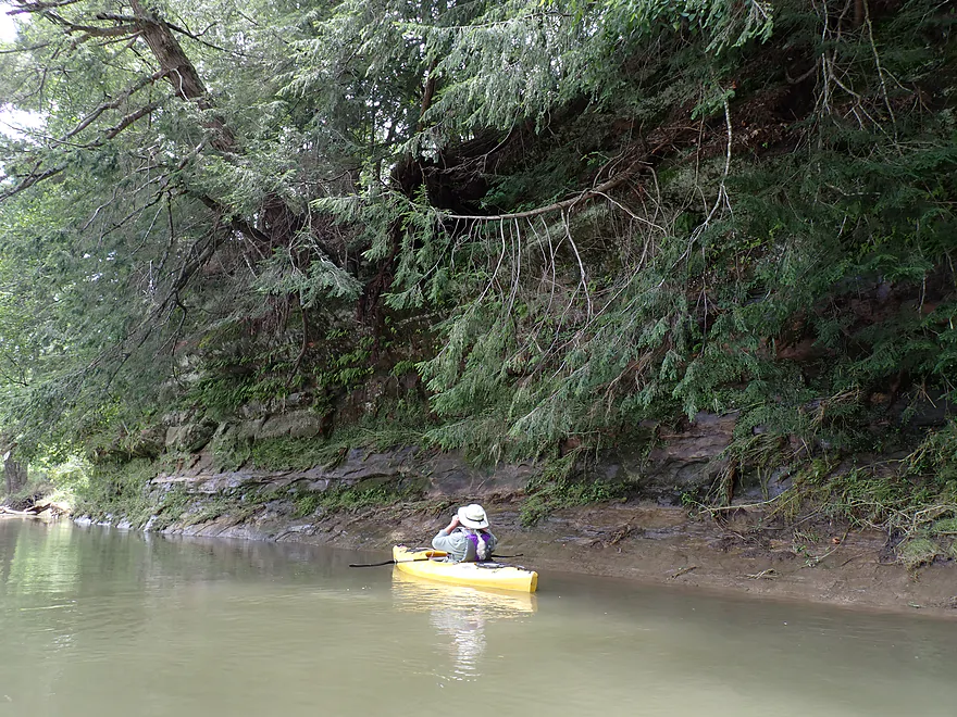
Hemlock branches often draped down from the blufftops
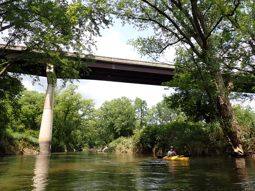
Bridge 9
Home to many swallows
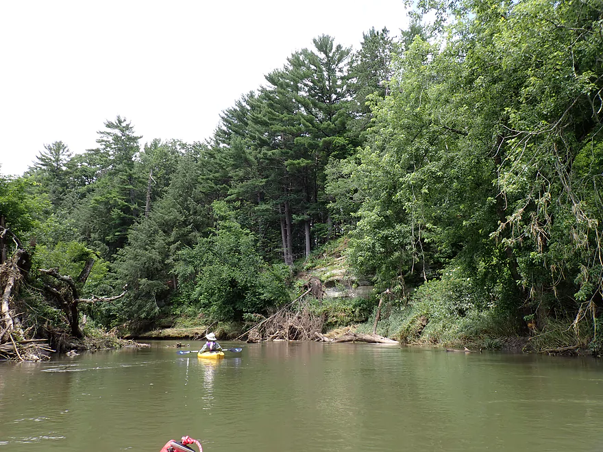
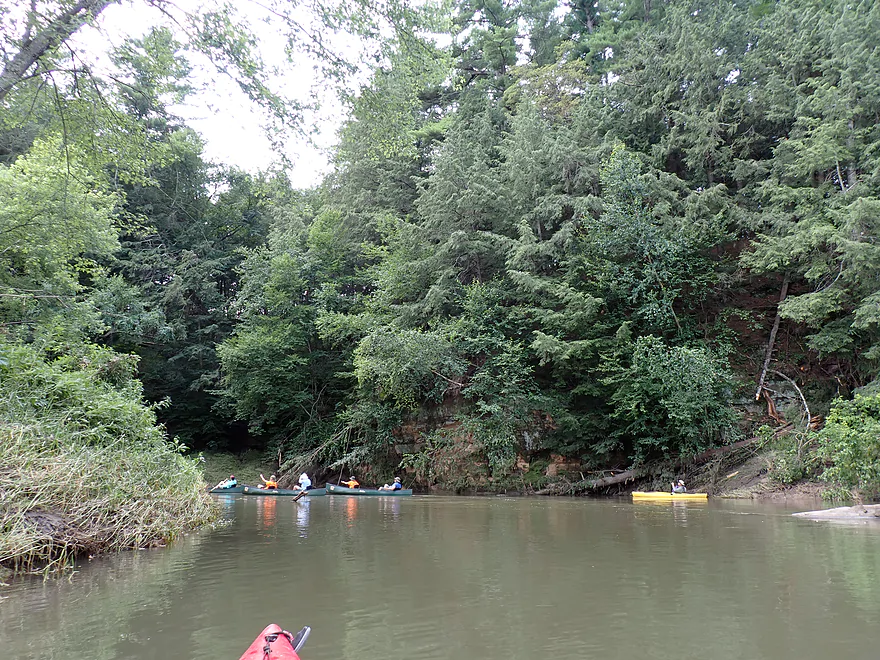
Groups of tall pines always signaled the next sandstone bluff
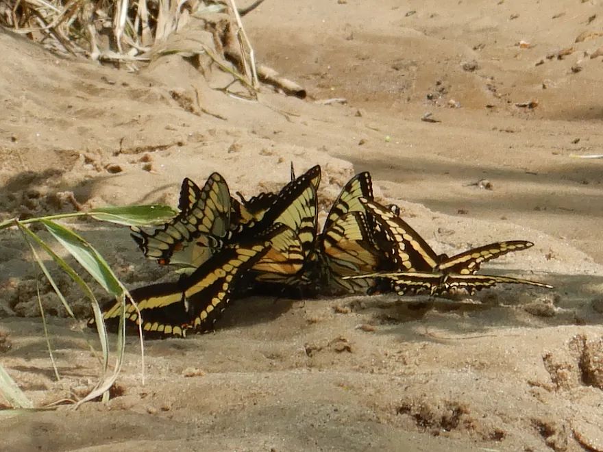
Swallowtail butterflies feeding on minerals in the sand
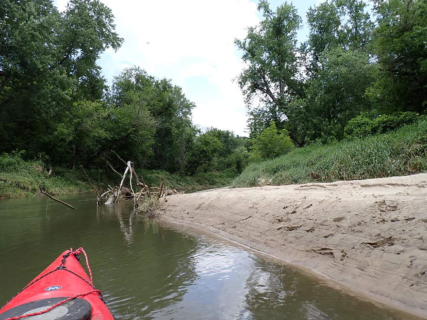
Another sandbar
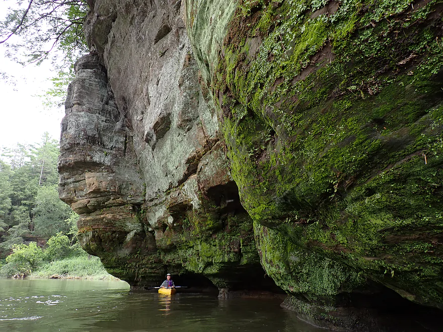
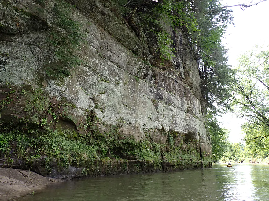
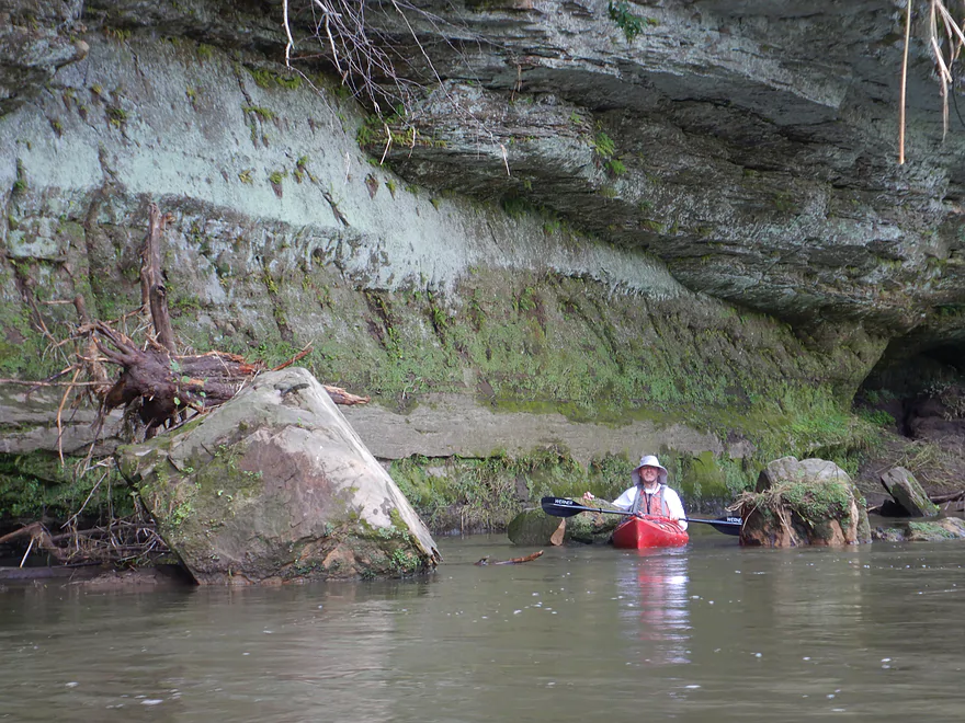
Cool how the rock is being undercut
A letter sign marks a shoreside campsite…most of these appeared muddy and weedy
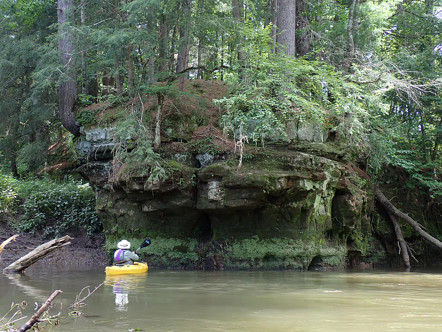
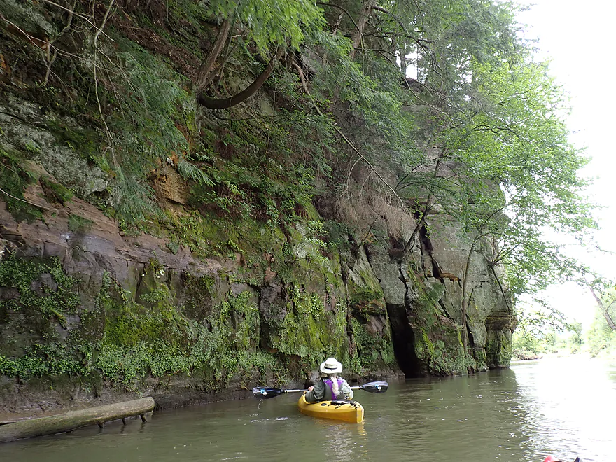
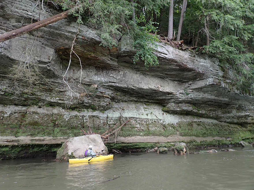
Approaching another large outcrop
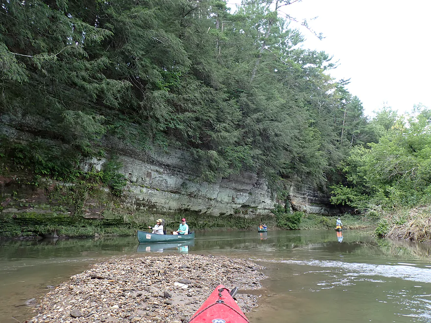
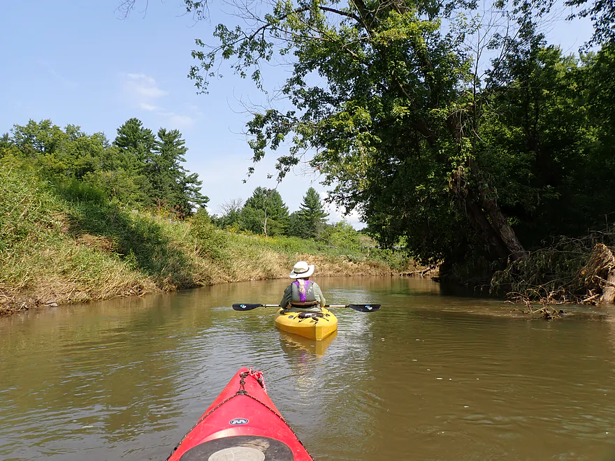
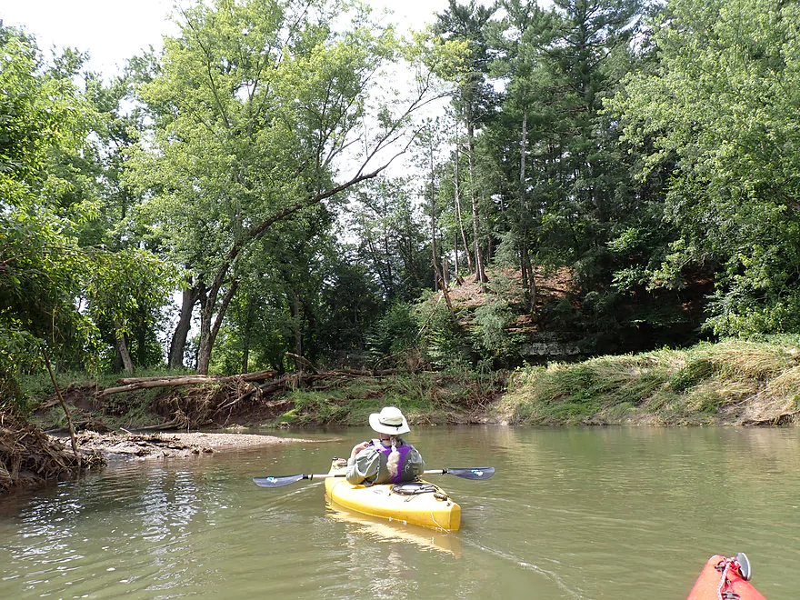
Reverse view…surprised we didn’t see more paddlers like this on the river
Getting passed by a canoe convoy
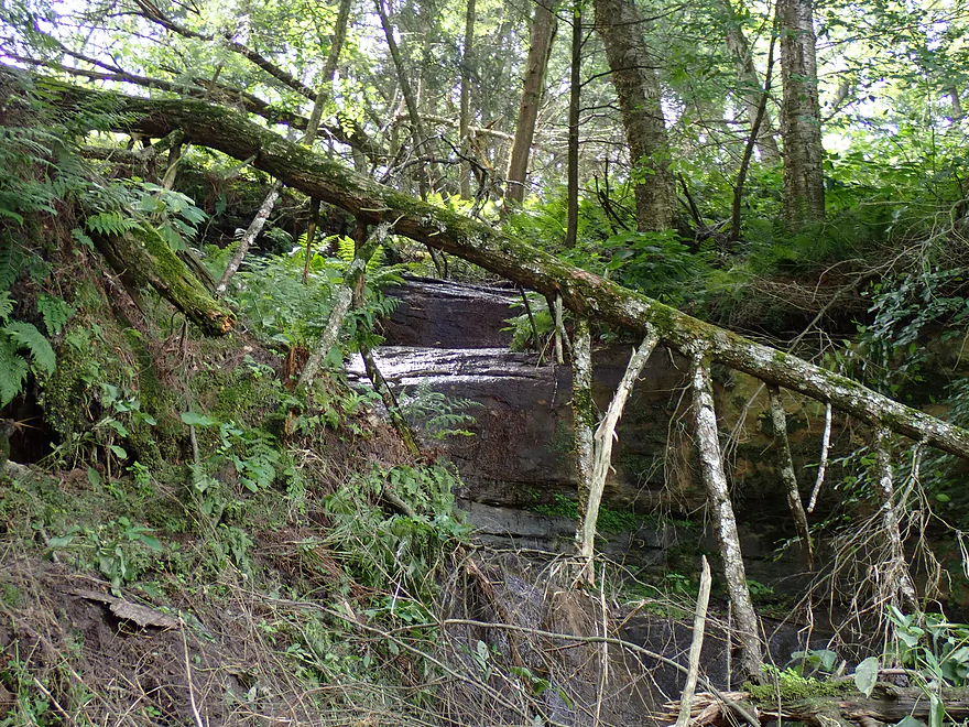
One of several “trickling seeps” on the trip (these will make fantastic ice flows in the winter)
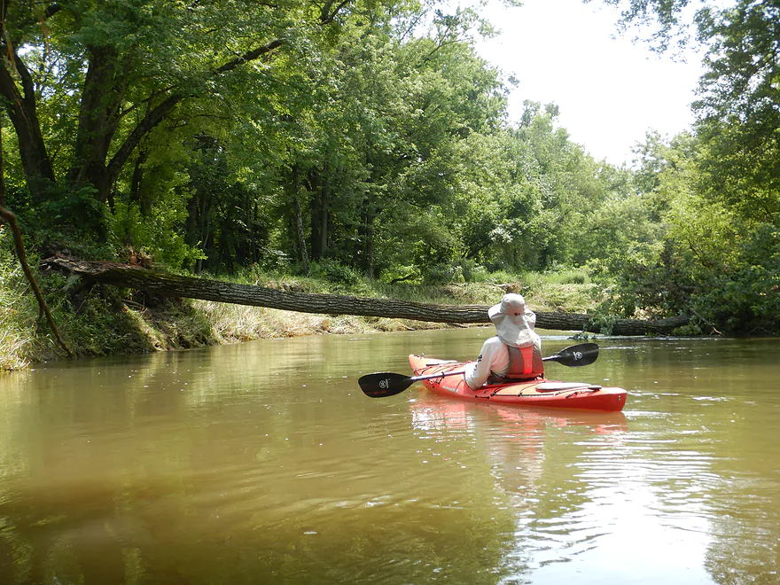
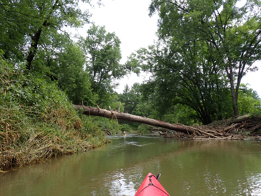
Downed tree easy to duck under
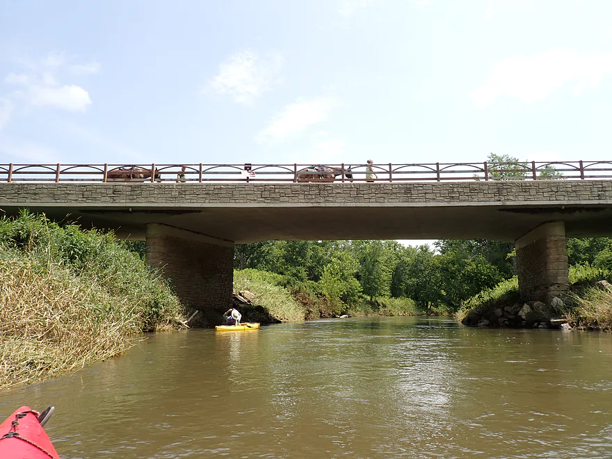
Bridge 10 (the Kickapoo Valley Reserve has several horse trails)
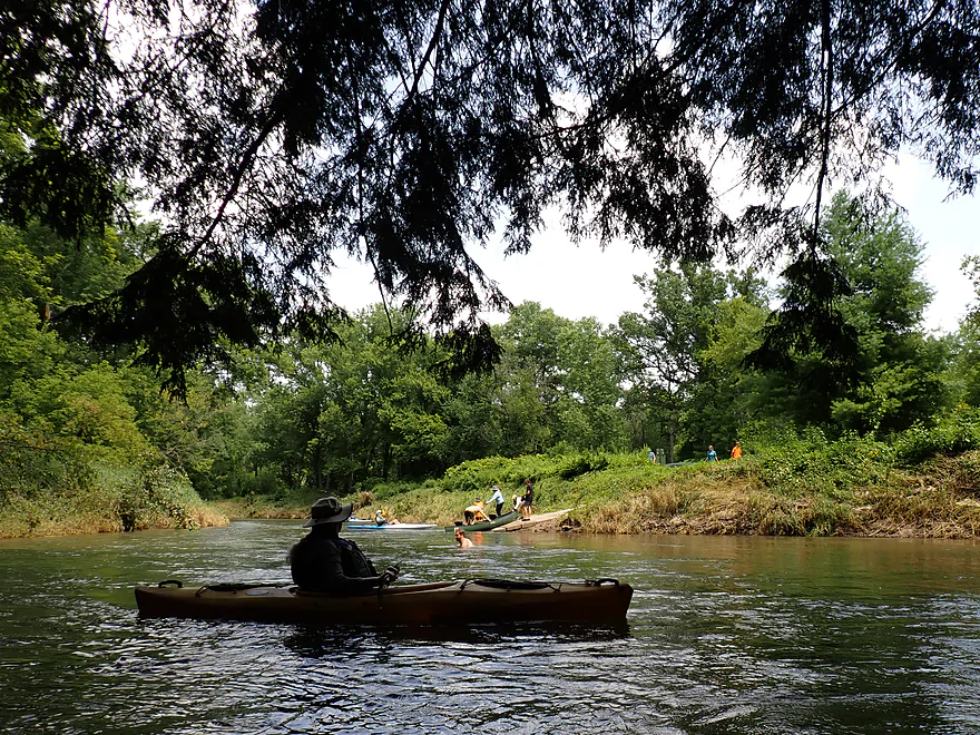
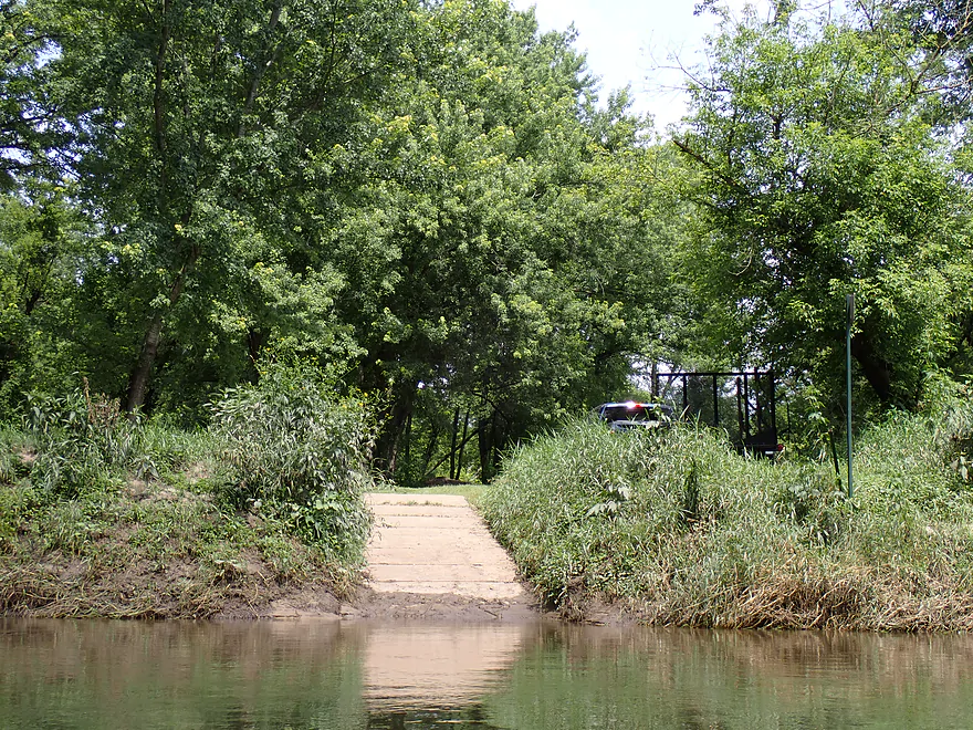
Landing 10…very busy
Thought it was cool how this outcrop curved outward at the base
That white line by my head is a midge photobombing the picture
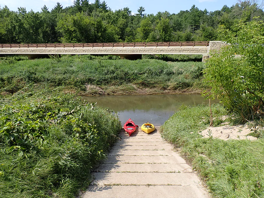
Bridge 11 (this is the Rockton bridge)
It’s very high (there is no landing here)
Lot of great ferns and mosses on the cliffs
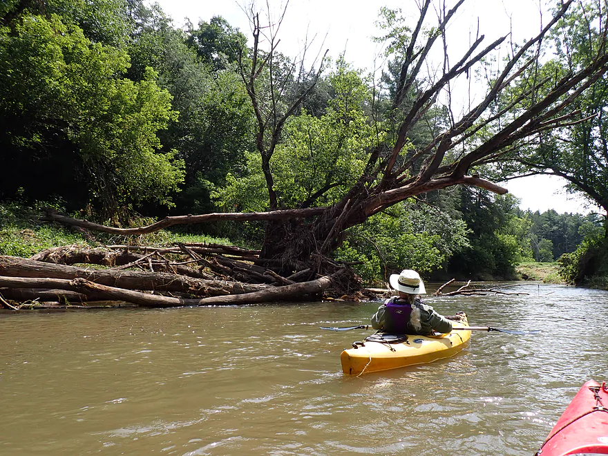
Recent flood debris was common and unsightly…but there was always a way around it
Landing 12 (good access)–there is no Bridge 12
I don’t mind these kind of downed trees
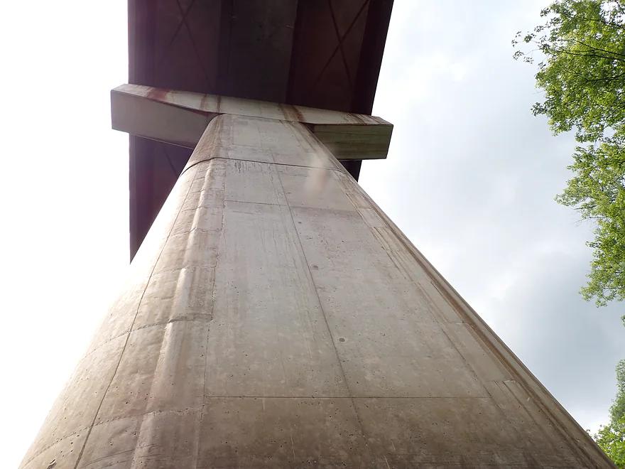
Old bridge pylons
Another large outcrop
Reverse view
Followed by another big one
Really nice
Reverse view
Bridge 13 (notice the flood debris on the right side of the bridge)
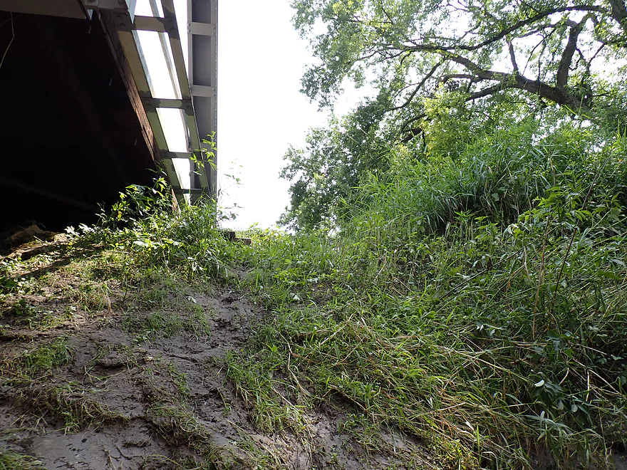
The access here looks muddy and difficult
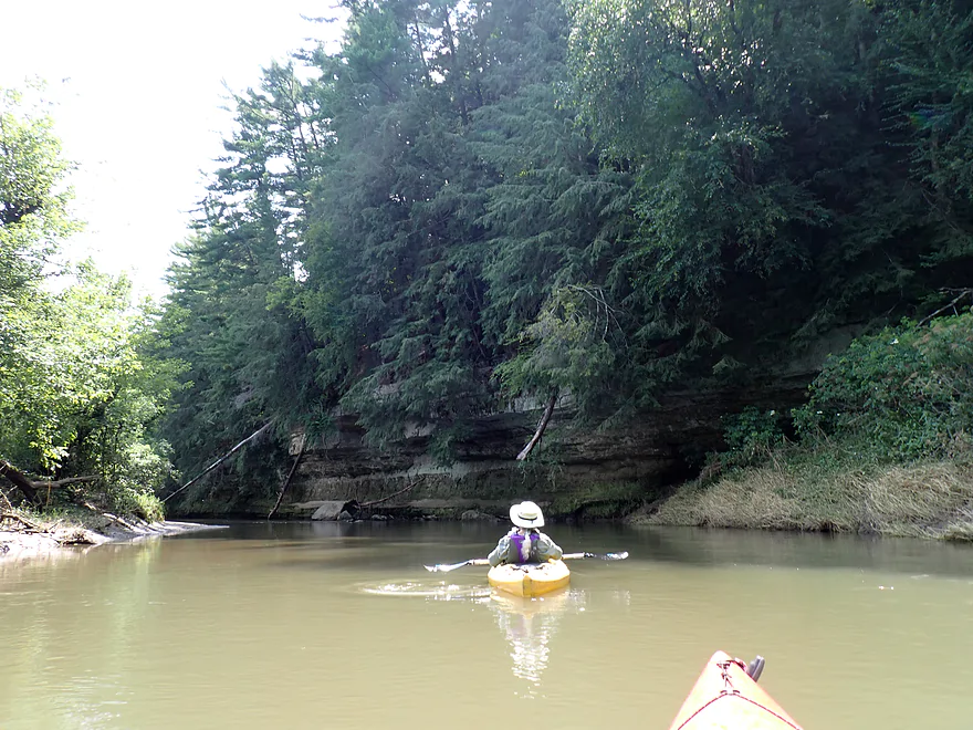
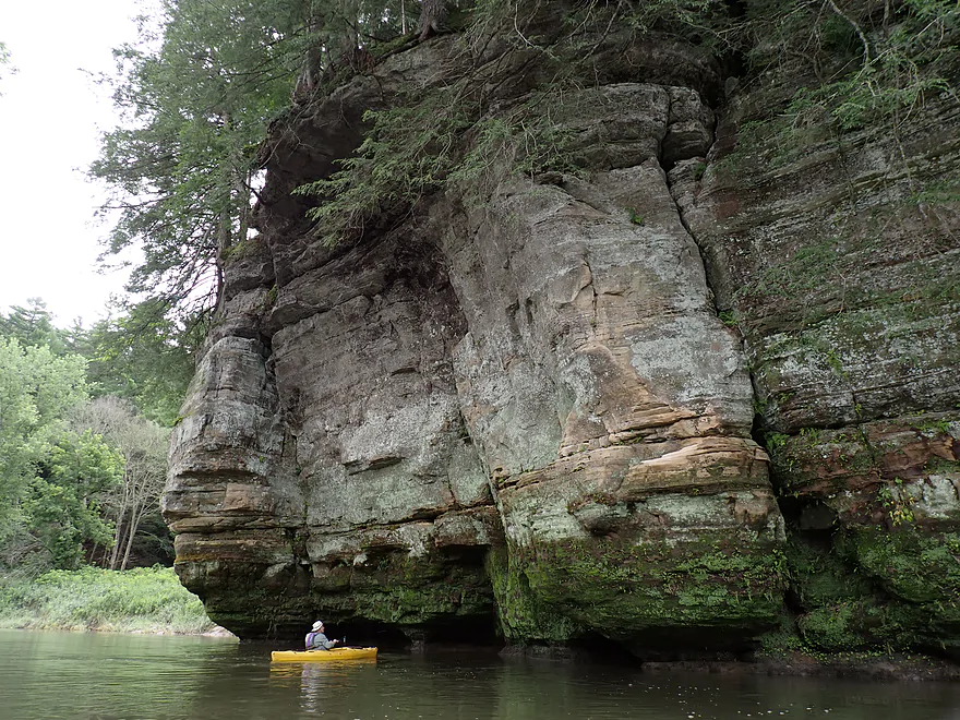
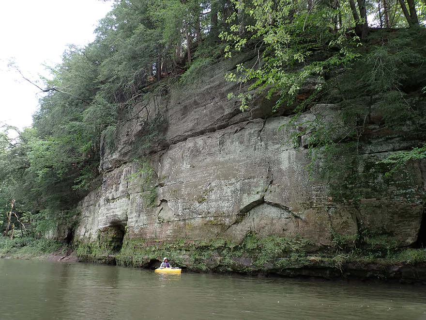
Approaching the last cliff of the trip
This one was my favorite
Fantastic undercut erosion
Large boulders in the water
Reverse view
Bridge 14
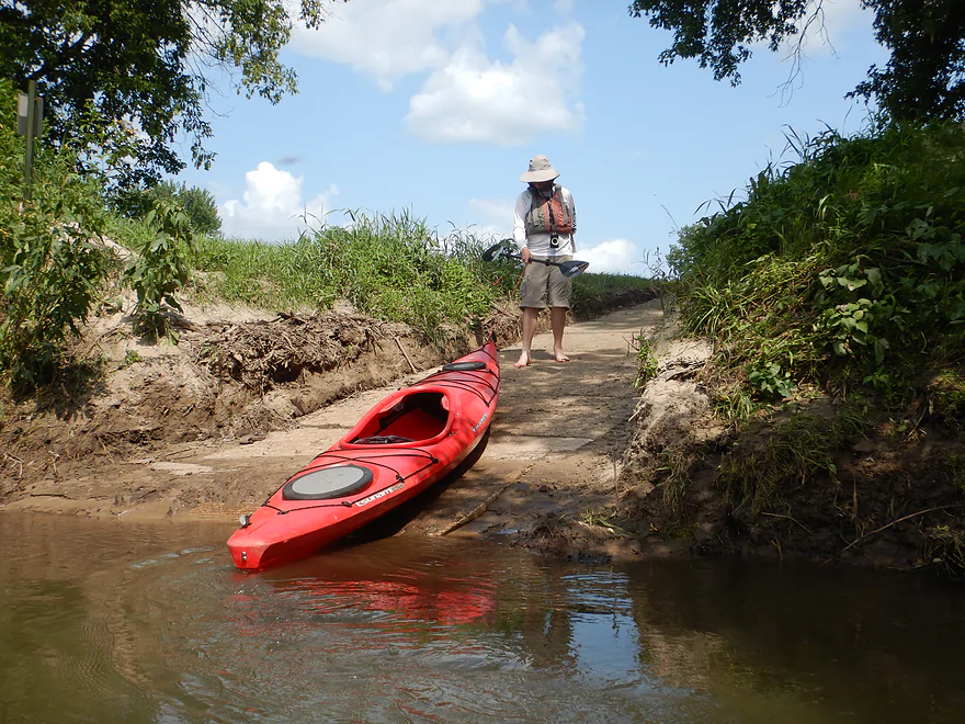
Landing 14
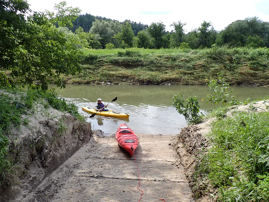
Good access…a skid steer recently cleaned the ramp of mud and sand
Kickapoo River – Bridge 7 to Bridge 14

The Kickapoo, known for its scenic sandstone outcrops, is one of Wisconsin’s most well-known paddling rivers. Most kayak from Ontario down to Bridge 7 (plus or minus a few bridges). Some paddle the stretch further downstream by La Farge, but an overlooked tweener stretch is the segment by Rockton which I wanted to explore in depth for this trip. This entire segment is within the Kickapoo Valley Reserve, a huge area of state-owned land with great landings and many paddler-friendly amenities.
This trip started at Bridge 7 just south of Wildcat Mountain State Park, which for most is actually a popular take-out (not as often a put-in). The landing was large, busy (lots of cars), and scenic with outcrops visible both upstream and downstream from the bridge. Massive tree debris had been recently bulldozed to the side of the parking area, which testified to the scale of recent flooding.
Bridge 7 to Bridge 8: (1.2 miles) This was a mediocre stretch (relative to the rest of the river), but was nice, with three medium-sized outcrops and several small but attractive sandbars. Unfortunately its high mud banks were in poor shape. Most were covered with invasive grasses that were flattened by recent flooding and looked dirty. Dead tree limbs and trunks were piled at river bends and in a few spots open dirt banks bled huge chunks of soil directly into the river. We passed the mouth of Billings Creek (an underrated paddling prospect I did in 2016). It was disheartening to see a logjam at its mouth…it’s possible deadfall is now a serious problem on much of the creek, thanks to recent storms.
Bridge 8 to Bridge 9: (1.0 miles) This was a slightly nicer stretch that also featured three noteworthy outcrops, two of which were pretty large. We had been warned of deadfall in the channel and major logjams. The upper Kickapoo is regularly cleared of deadfall, but new ones can and do pop up after storms. Below Bridge 8 was the first major logjam cluster we encountered, but thankfully there was an open slot on the right we could use to sneak around. There would be a few more logjams on the trip, but none that required portaging, which was good news.
Bridge 9 to Bridge 10 Landing : (1.6 miles) This was an attractive leg with roughly three medium-sized outcrops and one large outcrop. Here we started to see a few paddlers, but were actually surprised there weren’t more. Maybe this was due to the recent storms or because most people just prefer the upstream Ontario legs. What was cool (literally) were the cold seeps that trickled down the face of cliffs and rained onto the river below. Not so cool was the condition of the riverside campsites. Most looked weedy, muddy, and “sus”. I know some paddlers do enjoy using these campsites to split up long Kickapoo trips over multiple days, but they’re not appealing and do suffer from periodic flooding. The Bridge 10 Landing wasn’t nearly as busy as Bridge 7, but it was the second busiest access we saw that day and looked like a good take-out.
Bridge 10 Landing to Bridge 11: (1.1 miles) Highlights included three medium-sized outcrops. This was a weaker leg with more degraded shoreline and mud. If it wasn’t for the cliffs (and wonderful pine and hemlock trees), I’m not sure the Kickapoo here would be that popular. It’s a bit of a one-trick pony…but it (the outcrops) is an exceptional trick! Bridge 11 (by Rockton) is very tall and there is no immediate landing by it.
Bridge 11 Landing to Landing 12: (0.3 miles) This was a short stretch with just one medium-sized outcrop. Most of the official numbers on maps and signs correspond to bridges, but whoever came up with the numbering system cheated and skipped a bridge (there is no Bridge 12).
Landing 12 to Bridge 13: (1.7 miles) This was an attractive leg with two medium-sized outcrops and two large ones. Here we encountered a bit more deadfall, but there was always a way around it. The water was fast and pushy though…paddlers should have good boat control before attempting the Kickapoo (especially when it is on the high side as it was for this trip). Bridge 13 looked very “sus” as a take-out with a steep muddy bank, despite a sign on the bridge telling paddler they could take out on the left bank.
Bridge 13 to Bridge 14: (0.7 miles). The last leg of the day only featured one noteworthy outcrop, but it was massive and my favorite of the trip. The cliff face was terrific…it was being undercut by the river so arched slightly over the channel. Massive boulders had broken off the cliff and dotted the river. At the top of the bluff were lots of hemlocks and white pines, which were incredibly scenic.
We ended the day at Bridge 14, which had a nice landing. It looked like somebody recently used a skid steer to clear mud and logjams from the landing and parking area, which was appreciated. We were surprised to be the only ones there (aside from two bikes for shuttles).
In summary this was an enjoyable trip with incredible rock outcrops…among the best you’ll see in Wisconsin. However, if you’re new to the Kickapoo I would advise prioritizing the upstream legs instead (Ontario to Bridges 4, 5, or 7). Those upper stretches have better bank/water quality and a higher density of rock formations. They will also have fewer snags to deal with. However…the “Rockton legs” aren’t bad and while there aren’t as many outcrops, some are impressive and larger than what you’ll see on upstream legs. The other advantage of doing the “Rockton legs” is you won’t deal with as many paddlers and it can be more peaceful. On summer weekends, the stretch upstream from Bridge 7 can be packed and noisy with countless paddlers.
Sights included a woodchuck, a muskrat, a deer, cedar waxwings, some yellowthroats and a pileated woodpecker. The highlight was a group of swallowtail butterflies that were feeding on mineral deposits in the riverside mud.
Wildcat Mountain Overlook: Wildcat Mountain State Park, just north of the Kickapoo Valley Reserve, has a number of overlooks, but the best and most popular is located at the west end of the park. Here you have a terrific view of the Kickapoo and can wave to the distant paddlers.
Ice Cave Trail: A short trail leads to a sandstone outcrop/cave that can feature spectacular ice flows. The best time to visit is late February or early March.
Kickapoo Valley Reserve Visitor Center: Part nature center and part museum, the visitor center does a good job of providing background info on the Kickapoo River and its unique history. They are closed on Sundays.
Organic Valley: This is the largest organic dairy cooperative in the US. Many of their products, including those rarely seen in grocery stores, can be purchased at their outlet store in La Farge. Unfortunately they are closed on Sundays.
Wildcat Mountain State Park: The park has a nice campground. Reservations are suggested.
Kickapoo Valley Reserve Campsites: KVR is not part of the nearby state park, so it has separate rules and fees you must abide by. Several of the KVR campsites are located along the Kickapoo River and are an attractive option for those wanting to do multi-day paddles on the river. But be warned most bankside campsites are lacking in facilities, weedy, filled with bugs, and muddy. Some are within flood zones and every couple of years you hear a story about a camper who has to be saved from the flash flooding river (although these sites have apparently been closed this year). Reservations are required. Shore-side locations are marked on the overview map.
La Farge Village Park: If Wildcat Mountain is filled up and you don’t want to rough it on a KVR campsite this is actually a surprisingly nice option that few use. This campground, while close to the river, is not located immediately next to it.
Bridge 7: This is a popular and good access. A KVR day pass is required ($5) and you can use the self-pay station. Note: during our trip, the payment box was sealed shut and we couldn’t deposit money (perhaps done because of the flooding). The river by the ramp is deceptively fast and deep. Be careful when launching. Remember…no glass is allowed on the river. Also be careful where you park so you don’t block the many trailers and shuttle buses that use this access. An outhouse is available at the landing. A sign reminds visitors to carry out all garbage.
Alternative Put-ins: (The Kickapoo has many landings to choose from!)
- Bridge #1/Ontario (9.7 miles upstream from #4): Just northeast of the main Ontario bridge (Hwy P) is a nice public access for launching. An outhouse is available as well as a public parking area. This is a popular landing, but most Ontario paddlers actually launch from one of the private liveries which have their own landings. The leg below Ontario is the busiest part of the river.
- Bridge #4 (6.1 miles upstream from #7): Bridge #4 has a great public parking lot and a nice ramp for launching your boat. No parking fees are required but there is no outhouse on site. This is one of the less popular “super landings” so isn’t as crowded. It’s a great spot to start a trip as the next six miles has the highest density of cliffs on the entire river.
- Wildcat Landing (3.0 miles upstream from #7): This is part of Wildcat Mountain State Park , so you won’t need a KVR pass, but will need a state park sticker. This is a good access.
- Bridge #5 (2.1 miles upstream from #7): This is a good public landing and is popular.
- Bridge #10 Landing (3.7 miles downstream from #7): This is a good access and is popular.
Note: Because Hwy 131 crosses the Kickapoo so often, it’s more helpful to refer to the bridge names by their number. The numbers are posted on the upstream side of each bridge for paddlers to see, as well as on Google maps, and on the trip maps I create.
Bridge 14: This is a very nice KVR landing. A $5 fee is required. When you park make sure you don’t block the turnaround area. Part of the landing is a bit muddy, but it’s not bad. Few use this access, so you’ll probably have it to yourself. An outhouse is on site.
Alternative Take-outs: (The Kickapoo has many landings to choose from!)
- Landing #12 (2.4 miles upstream from #14): This is a good landing. Note: it’s not located by the bridge but instead is a few hundred feet downstream from it and on a dead-end road. A KVR pass is required and a self-pay station is on site.
- La Farge Landing (8.0 miles downstream from #14): This is a good access with outhouses. Some of the largest outcrops on the river are located on this leg. You will also get to paddle past the remnants of the abandoned dam that would have ruined the river. (See this article for an excellent history of the project.)
Because Hwy 131 crosses the Kickapoo so often, it’s more helpful to refer to the bridge names by their number. The numbers are posted on the upstream side of the bridge for paddlers to see, they are listed on Google maps, and I list them on my maps.
Bike Shuttle – Bridge 14 to Bridge 7: 4.8 miles with 174′ of ascent. This would be a hilly, but scenic shuttle. About half of this can be done on the Old Hwy 131 Trail.
Rentals/Shuttles:
- Kickapoo Wild Adventures: (608) 337-4522 – 30352 State Hwy 131, Norwalk, WI 54648
- Drifty’s Canoe Rental: (608) 337-4288 – Highway 33 & 131, North Ontario, WI 54651
- Fred Flasher’s Canoe Camping Trips: (608) 435-6802 – PO Box 114, Wilton, WI 54670
- Mr. Ducks Canoe Rental: (608) 337-4711 – 100 Main Street, Ontario, Wisconsin 54651
- Titanic Canoe Rental: (877) 438-7865 – 300 State Highway 131, Ontario, WI 54651
Current: The current, because of recent rains, was surprisingly strong and fast. There were strainers in spots and paddlers should be careful. Those in unwieldy and unmaneuverable boats (like canoes) might want to wait for lower and less pushy levels before attempting the river.
Logjams: There was a large amount of deadfall piled in spots along the banks, and in a few spots in the channel. Typically you could paddle around the logjams and portaging isn’t required. However, paddlers should stay vigilant. New logjams can appear unexpectedly. Definitely portage any cluster that looks too dangerous to get through. Note: KVR posts weekly “recreation” updates on their facebook page where new logjams and their locations are posted.
Rapids: There are no rapids, but there are a few fast chutes and tricky strainers. I advise wearing a life jacket on this river.
High Water: The Upper Kickapoo can rise dramatically after a rainfall. During these times, the river can become very fast and pushy, and paddling is not advised.
Alcohol: Many paddlers drink on the river. This is not advised as you need your reaction time and judgment to get around deadfall. Also, drunk paddlers tend to be noisy paddlers, which annoys everybody else.
Closest Gauge: Kickapoo River @ Ontario
Trip Depth: 8.9′ or 106 CFS
Navigability Estimates: The following are just estimates. Always use your own judgement.
- < 8.5′: Maybe too shallow for paddling.
- 8.5-8.6′: Very shallow with maybe some wading required.
- 8.6-8.7′: Shallow but a good depth.
- 8.7-8.8′: Average depth…good target range.
- 8.8-8.9′: Above average but a decent range.
- 8.9-9.1′: A high depth with turbid water and pushy current, but likely manageable for seasoned paddlers.
- 9.1-9.4′: A very high depth only suitable for expert paddlers.
The key to enjoying a good trip on the Kickapoo is good timing. Below are some helpful tips:
- Avoid the Crowds:
- Try Weekdays: The weekends get crazy busy with a lot of drunk and noisy paddlers/tubers (especially Ontario to Bridge #7).
- Try Early Morning: If you have to do a weekend, try to get out onto the river before 9 or 10 to beat much of the crowd.
- Summer is the Worst: Doing a trip prior to Memorial Day or after Labor day will significantly reduce the crowds you see.
- Ice Flow Paddles: The Kickapoo produces fantastic ice flows, but timing a trip to see them is difficult. Usually your best bet is the last week of February or the first week of March.
- Fall Color Paddles: This area of the state is famous for its fall color. Paddling the Kickapoo during this time can be a special experience. Ideal timing is usually between October 7th and October 20th.
- Leafless Paddle: Summer paddlers don’t realize they aren’t seeing many outcrops in all their glory because the cliffs are covered up by leaves. Doing a leafless paddle (prior to, say, May 10th or after October 15th) can be a really neat experience.
- Winter Paddle: While I haven’t done it, I’ve heard the Kickapoo mostly stays open in the winter because of its many springs and can be a unique experience.
- Avoid High Water: The Kickapoo commonly experiences significant flooding. Ideal levels will be below 9.1′. At 9.4’+ the river may start to burst over some of its banks.
- Overcast vs Sunny: Try timing a trip for overcast skies. It will make the cliffs more vibrant and photogenic. When sunny, it can be difficult to photograph the cliffs because of extreme glare and contrast.
- First Time Paddlers: This is a great river for introducing a friend to paddling because of the number of landings, liveries, the lack of obstacles, and the current which is brisk but not too unsafe. The river is also super scenic. If they’re not hooked on kayaking after the Kickapoo, then there is no hope for them.
Quick Overview
- Wilton to Ontario: 12 miles. This stretch is seldom paddled, but is cleaner and faster than downstream legs. Those willing to endure weedy bridge accesses and occasional snags will be rewarded with spectacular outcrops. A very underrated part of the river.
- Ontario to Rockton: 13.5 miles. This is the most popular section for kayaking on the river (if not the entire state). Highlights include many spectacular sandstone outcrops. This stretch can easily be subdivided. Shuttle services are plentiful, but this leg can get crowded and noisy during summer weekends.
- Rockton to La Farge: 11 miles. This is the second most popular stretch of the river. While the outcrops here aren’t as numerous as the Ontario leg, they do tend to be larger and more impressive.
- La Farge to Mouth: ~90 miles. After La Farge there are few rock outcrops and the river becomes much less interesting. The Lower Kickapoo is a generic hardwood floodplain that is at best a mediocre paddle.
- Tributaries:
- Kickapoo River – West Fork: While lacking the outcrops of the main branch and a bit shallow in spots, this is a very underrated river with many fun rapids.
- Billings Creek: I actually like this creek better than the main river itself. There are just as many outcrops, and the water and banks are much cleaner.
- Tainter Creek: While not very big and lacking in outcrops, it’s still a cool creek with very swift current.
Detailed Overview
- Upstream from Lincoln Ave: The river is likely too small and degraded by open pasture to have much appeal for kayaking. Although "Kickapoo Springs" (the primary source of the river and a public DNR area) might be interesting.
- Lincoln Ave to Keystone Road: 2.5 miles. The river is small here (likely too small for most paddlers) and more scruffy with fewer outcrops. Figure 1-2 logjams and 3 outcrops. Several of the Elroy-Sparta Trail bridges over the river are quite scenic/rustic. High water will be required to do this stretch.
- Lincoln Ave to Hwy 131 (East of Midge Road): 6.3 miles.
- Lincoln Ave to Hwy 71: 1.6 miles. Section includes five outcrops, including one really nice one. River is shallow here with many Class 1 rapids. There is one strainer that has to be portaged, but no other logjams. I encountered a bull on this stretch (here) which might be a deal breaker for most paddlers. You could possibly portage around the farm in question along the Elroy-Sparta Trail but it would be a long and difficult portage.
- Hwy 71 to Wilton Campground/Library: 0.7 miles. A nice stretch with ~3 mediocre outcrops and one really nice one. Water clarity is stunning here. There is a low tree that requires some tight ducking to get under.
- Wilton Campground/Library to Hwy 131 (by Posey Creek): 1.4 miles. Less attractive stretch but still ~4 mediocre outcrops. There is a serious logjam by Water Street that must be portaged.
- Hwy 131 (by Posey Creek) to Hwy 131 (by Mica Rd): 1.3 miles. A terrific stretch with scenic pine trees, several mediocre outcrops and one fantastic sandstone outcrop.
- Hwy 131 (by Mica Rd) to Hwy 131 (East of Midge Rd): 0.7 miles. More of a scruffy stretch, but still a few mediocre outcrops. The Black Valley hills in the distance are very scenic from this leg.
- Hwy 131 (East of Midge Road) to Hwy 131 (near Nicollet Ave): 4.1 miles.
- Hwy 131 (east of Midge) to Hwy 131 (by Michigan Ave): 0.5 miles. A good leg with one nice set of outcrops.
- Hwy 131 (by Michigan Ave) to Hwy 131: 0.6 miles. Another good leg with 3 outcrops. Some minor rapids, including a 4-6" ledge.
- Hwy 131 to Hwy 131 (by Nisswa Rd): 0.6 miles. One of the best legs on the Upper Kickapoo which features 6 noteworthy outcrops and terrific ice flows in February and early March.
- Hwy 131 (by Nisswa Rd) to Hwy 131 (by Nordale Ave): 1.1 miles. Not as scenic as other legs with messy shorelines and eroded banks. There are still a few nice outcrops.
- Hwy 131 (by Nordale Ave) to Hwy 131 (by Nicollet Ave): 1.3 miles. Another one of the Upper Kickapoo's best legs with ~6 outcrops, including a small natural bridge you can paddle through.
- Hwy 131 (near Nicollet Ave) to Ontario: 5 miles.
- Hwy 131 (by Nicollet Ave) to Hwy 131 (Oil City): 2.3 miles. Two long stretches of bluffs contain great outcrops.
- Hwy 131 (Oil City) to Hwy 131 (Kickapoo Wild Adventures): 1.4 miles. Terrific stretch with two major outcrops. One set of Class 2 rapids.
- Hwy 131 (Kickapoo Wild Adventures) to Ontario (Brey Valley Road Park): 1.5 miles. Three sets of outcrops.
- Ontario to Hwy 131/Bridge #4: 3.6 miles. A more open and flatter stretch of the Kickapoo. There are still 3-4 outcrops. This is THE most popular leg on the entire river.
- Bridge #4 to Bridge #7: 6.0 miles.
- Bridge #4 to Wildcat Landing: 3.1 miles. A super popular stretch and the most scenic on the Kickapoo. River flows past steep hillsides and many outcrops (at least 16).
- Wildcat Landing to Bridge #5: 0.9 miles. River opens up a bit, but still has three super sandstone outcrops.
- Bridge #5 to Bridge #7: 2.1 miles. A good stretch with seven major outcrops and one cave.
- Bridge #7 to Bridge #14: 7.7 miles.
- Bridge #7 to Bridge #8: 1.2 miles. From bridge #7 onward, the Kickapoo becomes much less interesting. There are still some good spots though. This stretch has maybe 3 outcrops.
- Bridge #8 to Bridge #10: 2.5 miles. A good stretch with 5-6 outcrops.
- Bridge #10 to Rockton/Landing #12: 1.4 miles. This stretch is more open, and less interesting. But there are still 3-4 mediocre outcrops.
- Rockton to P/Bridge 14 Canoe Landing: 2.4 miles. A scenic stretch with 5 noteworthy outcrops–three of which are huge.
- Bridge #14 to La Farge: 8.0 miles. A great stretch with a covered bridge and 4-5 outcrops...several of which are huge (the largest on the river).
- La Farge to Hwy 131 (by Ski Hill Road): 6.8 miles. Nice section but with a few jams.
- Hwy 131/Ski Hill Road to Viola (Banker Park): 7.0 miles. Maybe 2 bluffs, but mostly open I think. Have been told there are 26 portages between La Farge and Viola, so beware.
- Viola to Hwy 131 - Bridge 1: 5.8 miles. Maybe one outcrop and 14 major logjams.
- Hwy 131 - Bridge 1 to Hwy 131 - Bridge 2: 4.3 miles. Maybe one outcrop and 13 major logjams.
- Hwy 131 Bridge 2 to Readstown Tourist Park: 3.0 miles. Maybe one outcrop and three major logjams. The river grows significantly with the addition of the West Fork.
- Readstown Tourist Park to Soldiers Grove: 6.9 miles.
- Readstown to Hwy 61: 3.1 miles. A surprisingly nice stretch with impressive hills and good current. On the downside there is a lot of tree debris although it is always avoidable. Hwy 61 is not a good access.
- Hwy 61 to Soldiers Grove: 3.8 miles. Not as good as the previous leg with fewer hills, muddier banks, and slower current, but still not bad. The highlights include a few impressive bluffs and two minor rapids in Soldiers Grove.
- Soldiers Grove to Hwy B: 9.0 miles. I doubt there are logjams, but I think this stretch would not be very interesting. The river flows through one of the wider flood bottoms on the river.
- Hwy B to Hwy S: 8.6 miles.
- Hwy B to Gays Mills: 4 miles. Fast stretch with some strainers. Bank quality is poor, but the bluffs are attractive. A dam in Gays Mills slows the last mile of this leg.
- Gays Mills to Hwy S: 4.6 miles. A pleasant but not elite leg with some nice bluff vistas.
- Hwy S to Haney Valley Road: 5.8 miles.
- Haney Valley Road to Taylor Ridge Road: 3.6 miles. Likely an ok prospect. Note, Taylor Ridge Road is aggressively fenced by the local farmer and would be a difficult access.
- Taylor Ridge Road to Steuben Landing: 5.0 miles. A good prospect with likely some nice bluffs. Note, Taylor Ridge Road is aggressively fenced by the local farmer and would be a difficult access.
- Steuben Landing to Hwy 179: 2.9 miles. A mediocre prospect.
- Hwy 179 to Plum Creek Landing: 11.8 miles. A good prospect with nice bluffs.
- Plum Creek Landing to Hwy 60: 6.7 miles. Starts uninteresting with fast current, but features some surprisingly nice bluffs and overall was a decent trip.
- Hwy 60 to Lowell Geitz Memorial Boat Landing: 2.7 miles. This stretch mostly lacks interesting bluffs but does feature wetgrass and floodplain forests as part of the Wauzeka Bottoms State Natural Area.
- Take-out options on the Wisconsin River:
- Lowell Geitz Memorial Boat Landing to Adiantum Woods State Natural Area: 2.5 miles. This is mostly a downstream trip on the Wisconsin River.
Trip Map
Overview Map
Video
Photos Size:
I so love your entries. Beautiful photos, excellent narration on all things while paddling.
Thank you!
KVR is warning of a huge logjam between Landing 12 and Landing 14. Hopefully this gets cleared out in the future. http://kvr.state.wi.us/Documents/Bridge%2013.pdf