
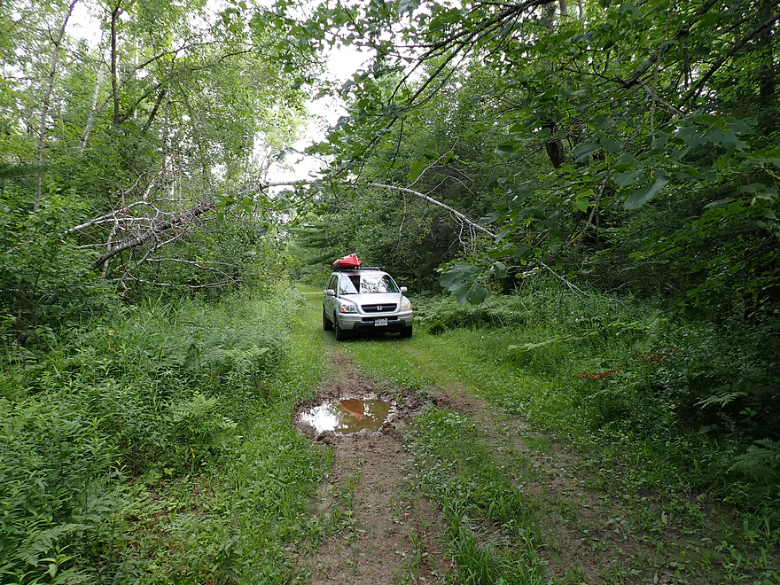
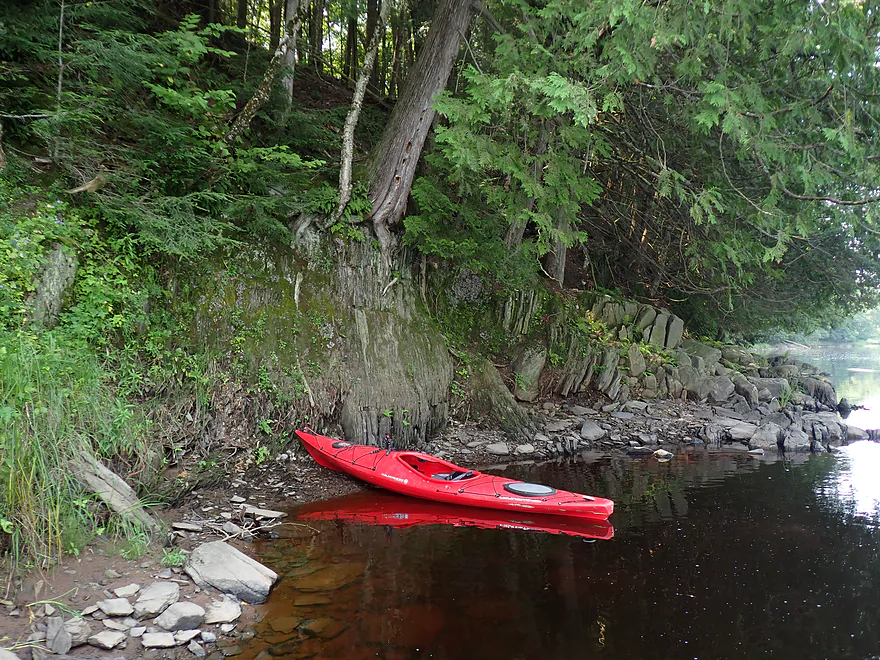
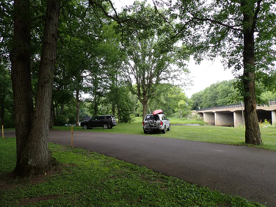
Rough access by County Road M
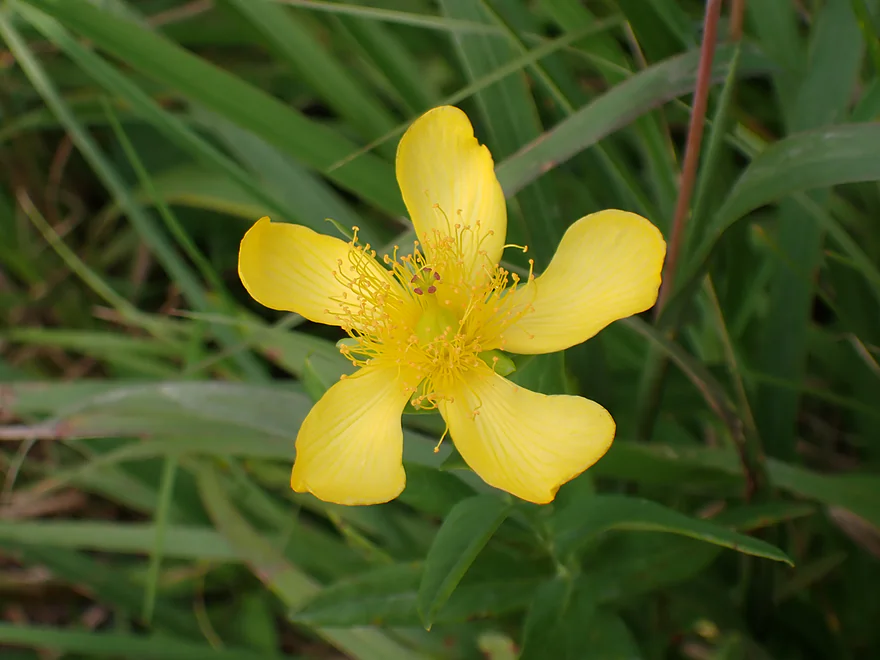
A St. John’s wort flower
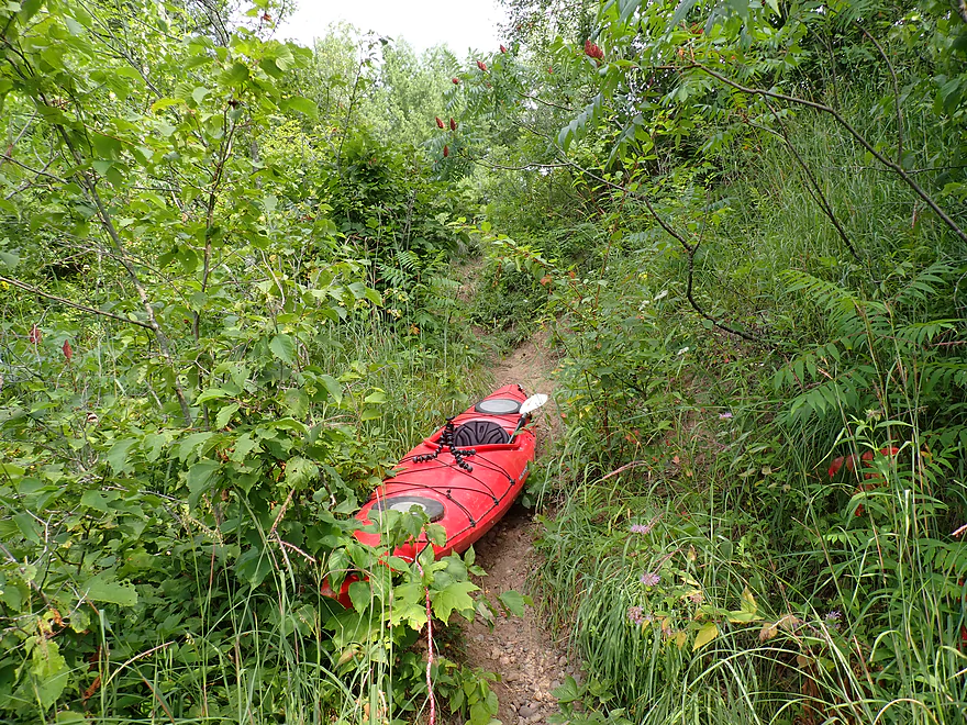
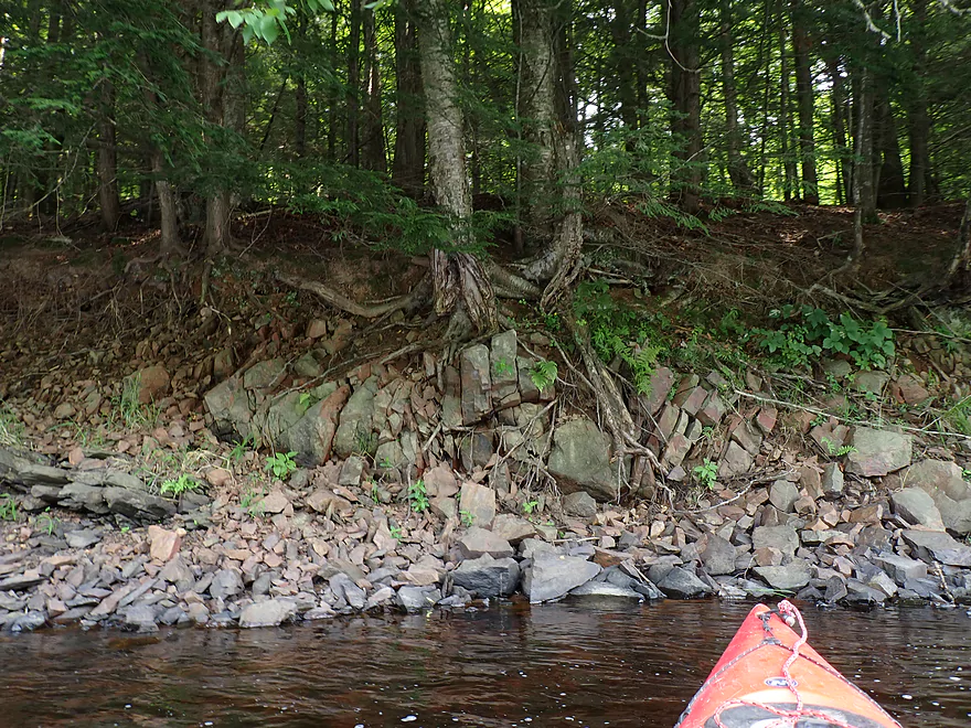
Faint dirt trail leads down a small hill
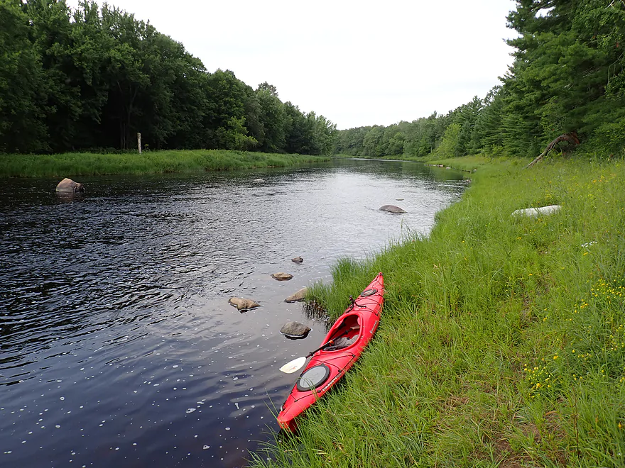
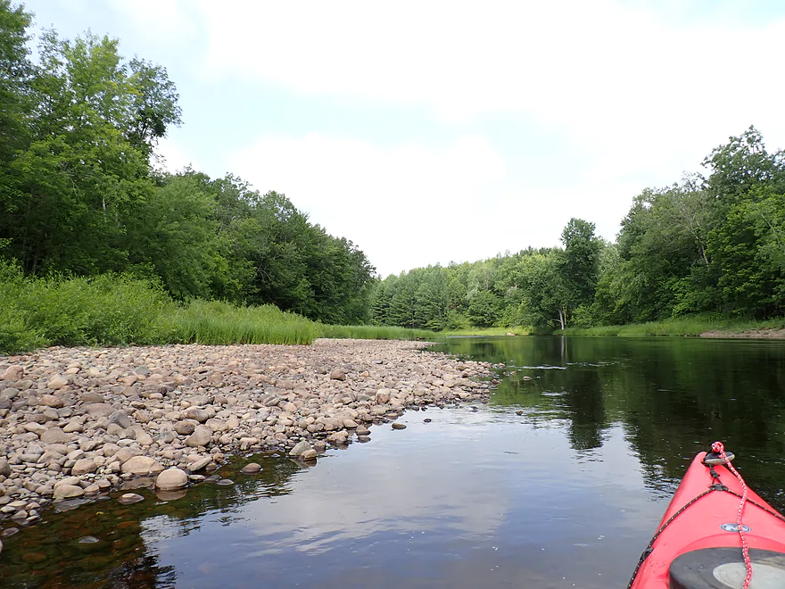
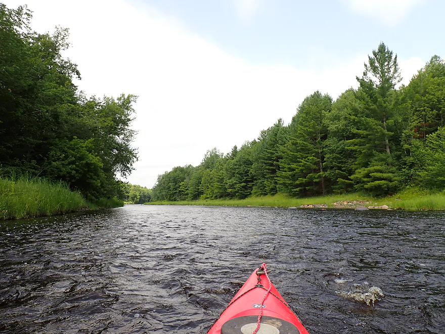
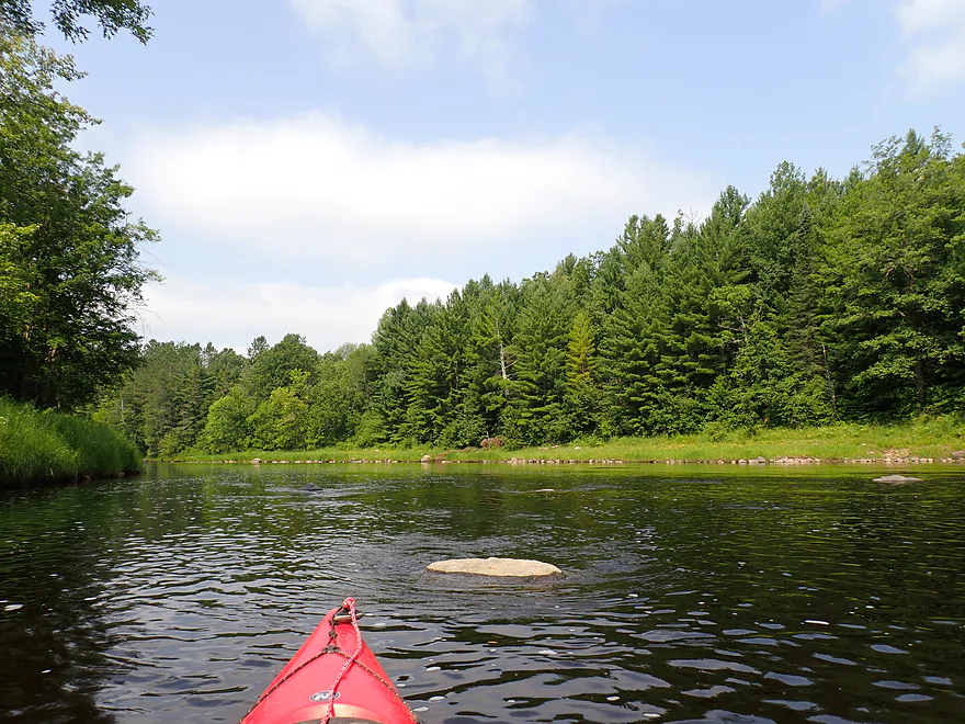
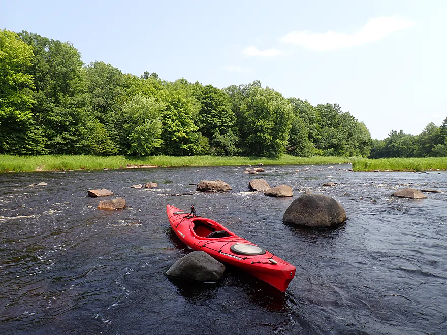
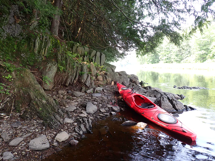
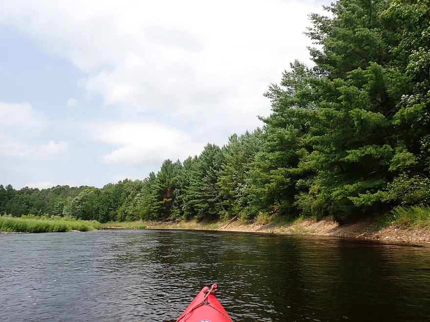
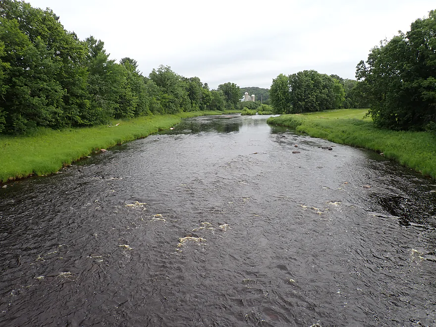
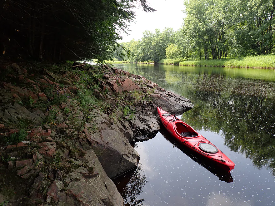
Finally on the water!
Lot of great pine trees on the river
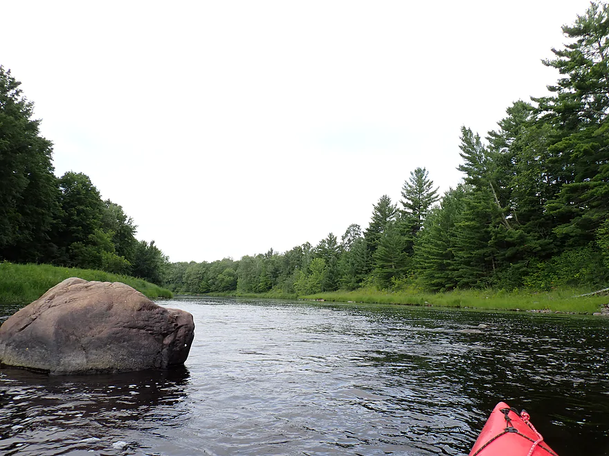

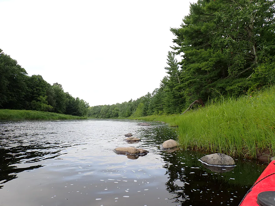
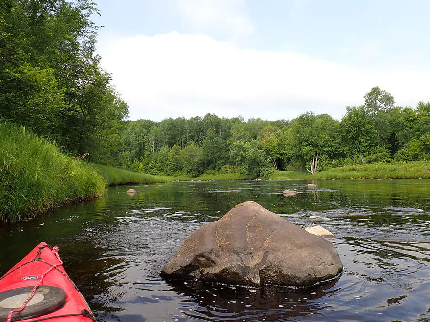
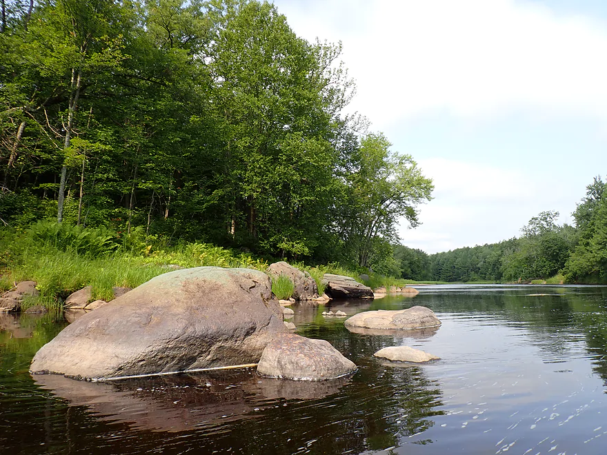
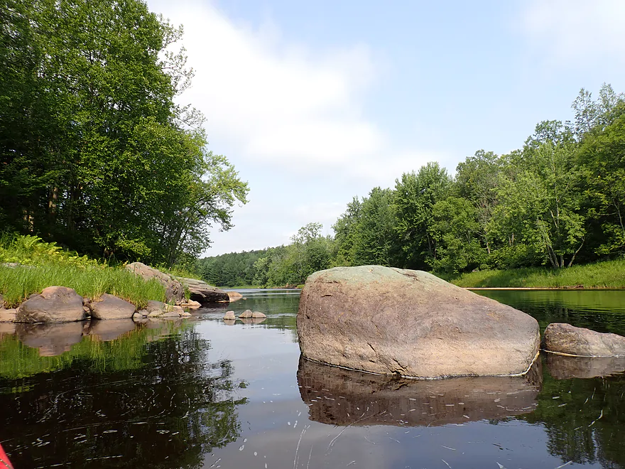
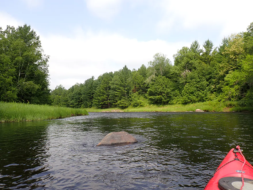
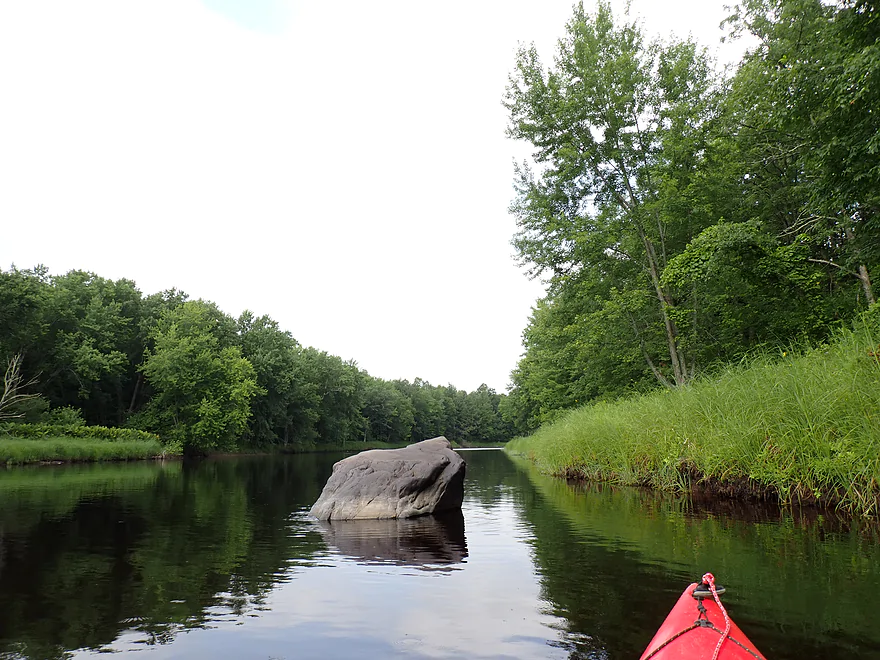
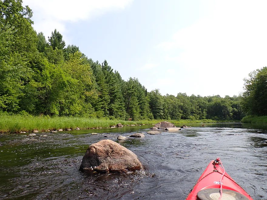
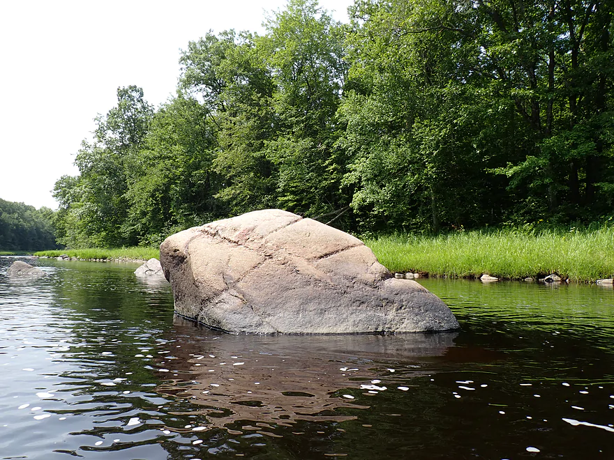
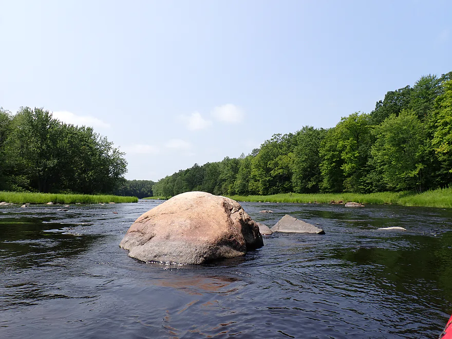
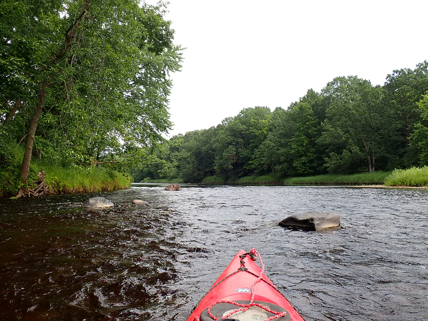
One of countless boulders
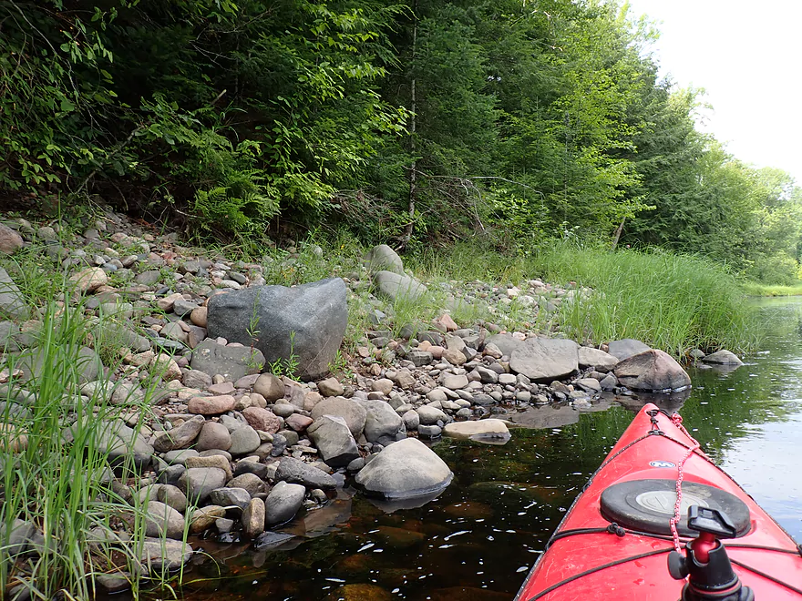
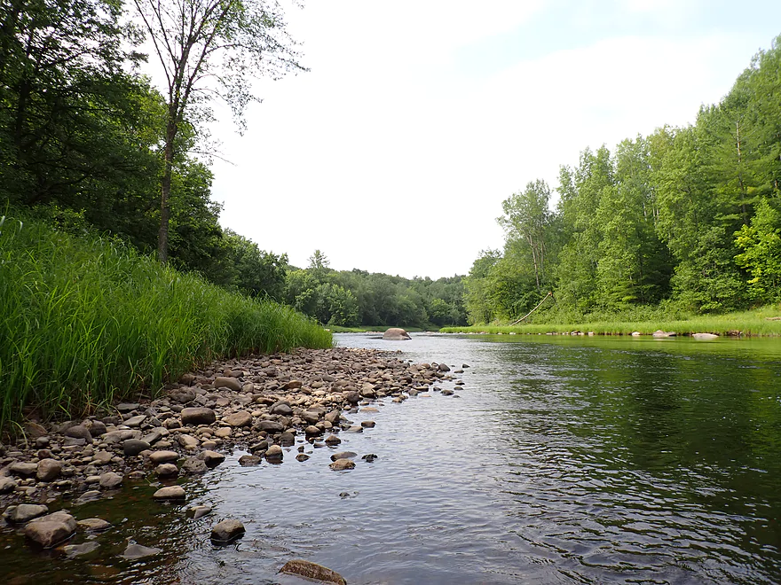
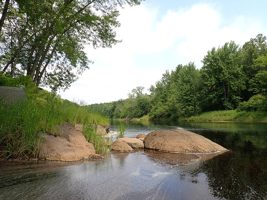
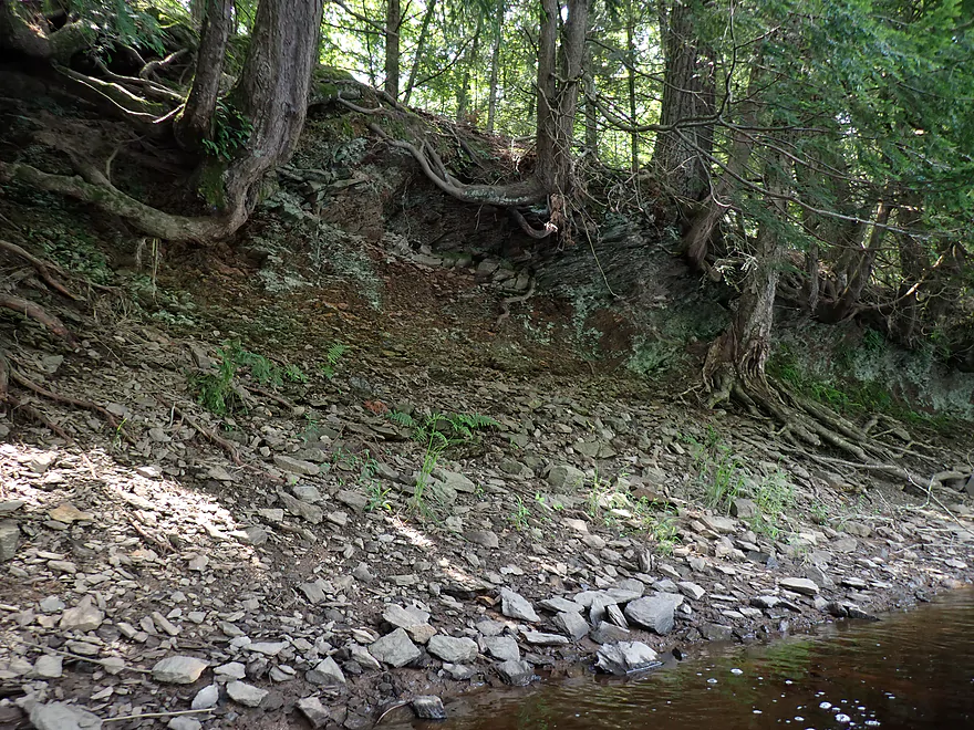
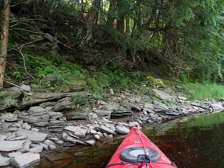
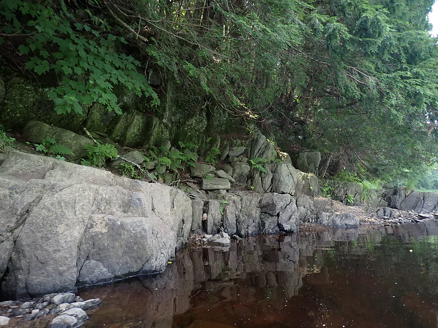
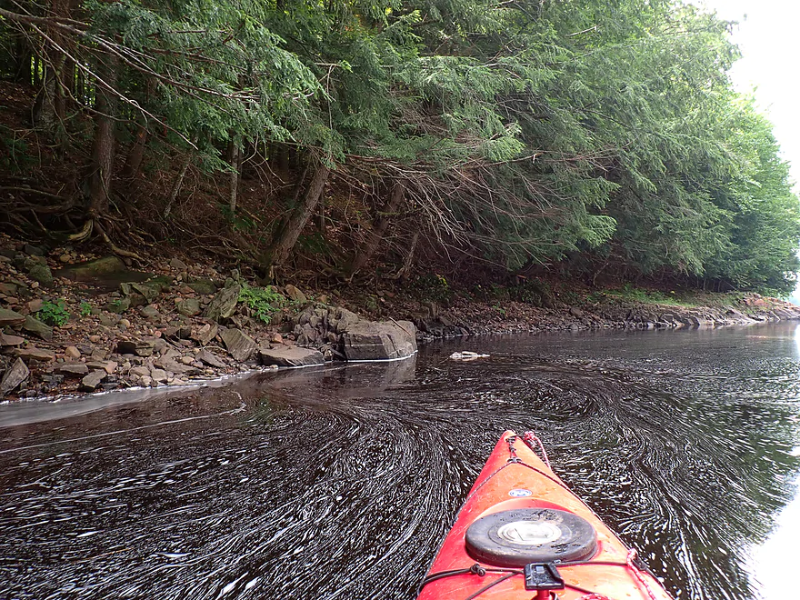
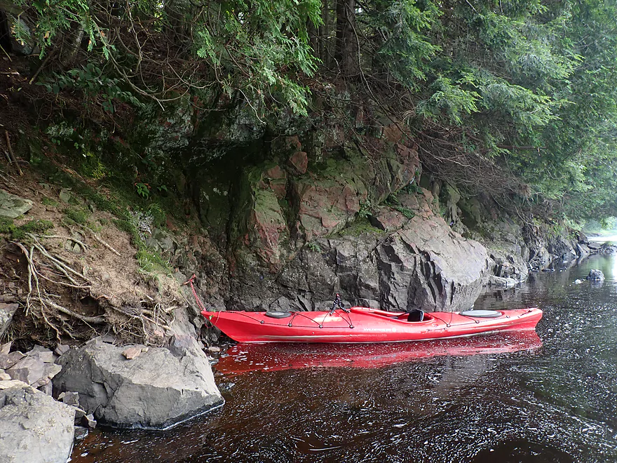
Rocky shoreline
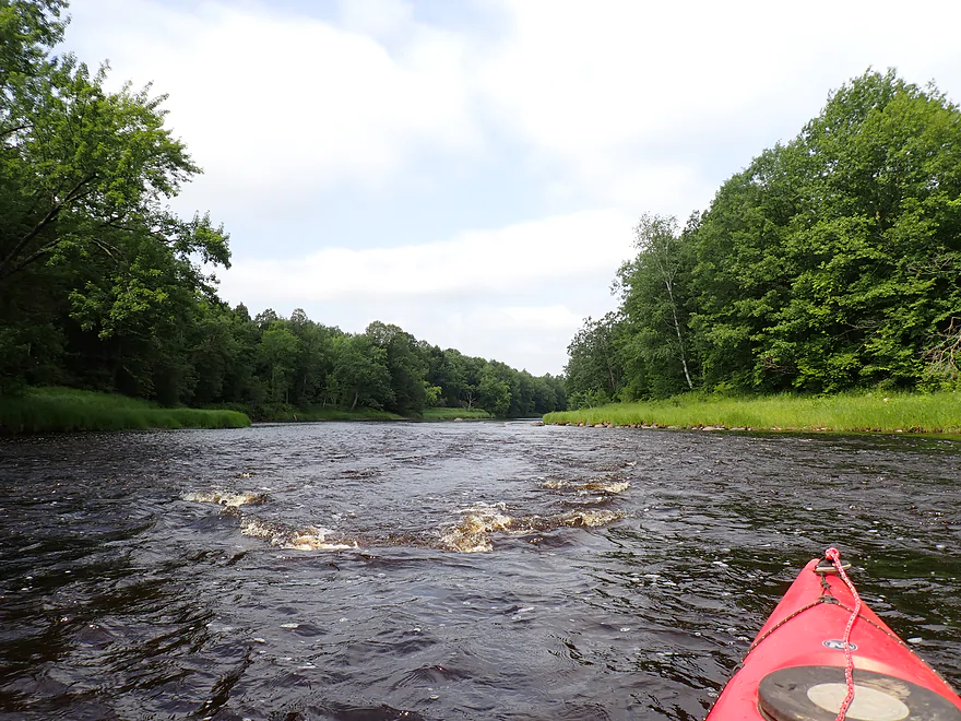
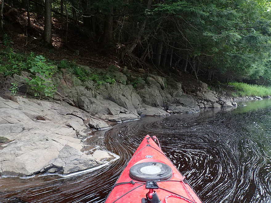
String of bubbles wrapping around the corner
One of several gravel bars
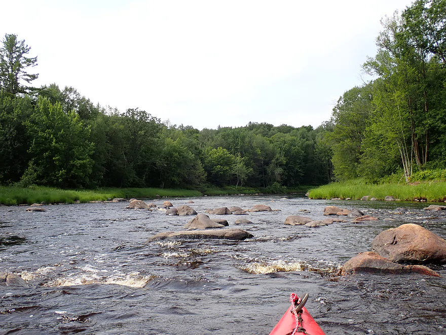
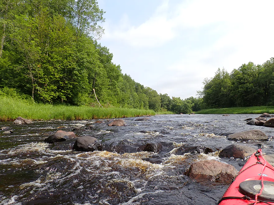
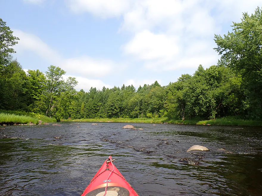
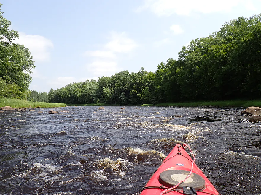
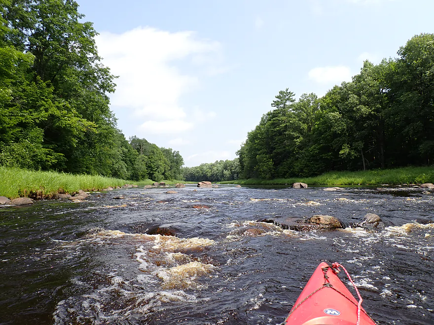
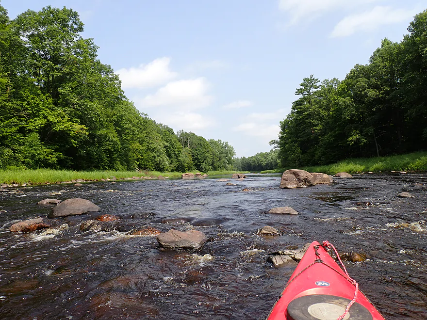
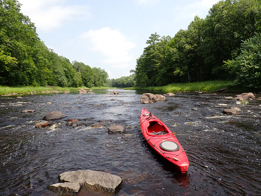
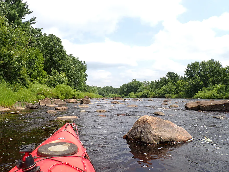
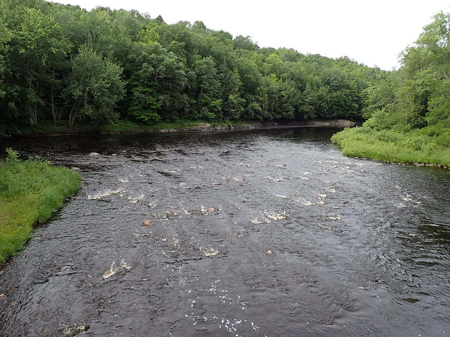
Finally some rapids
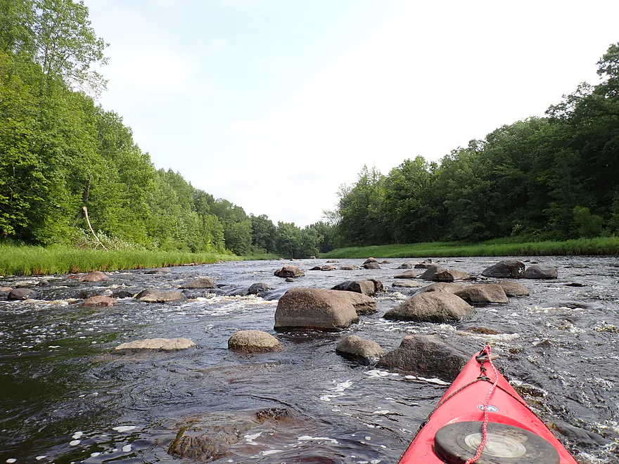
Reverse view of the shallow end
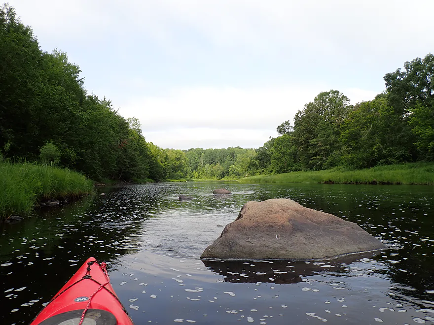
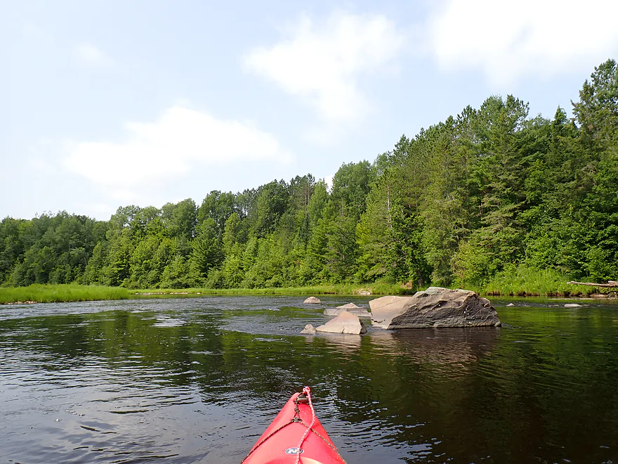
Nice boulder garden
Attractive scene
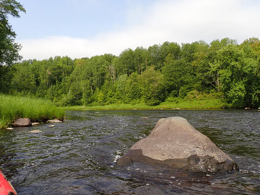
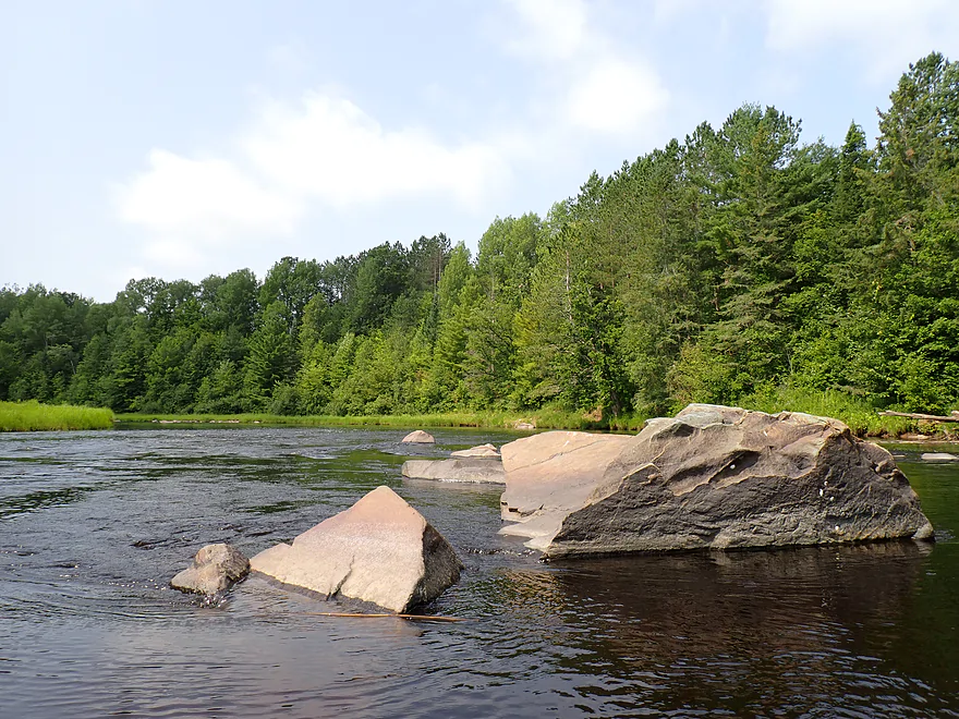
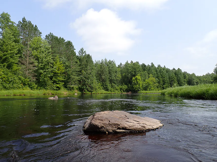
Multi-shaded rock
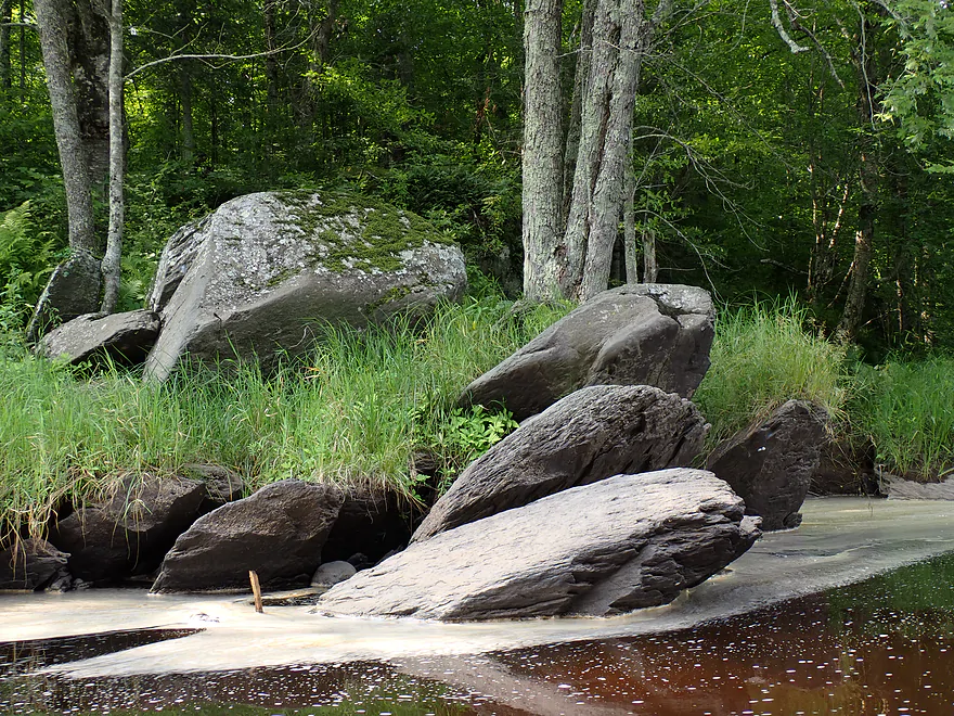
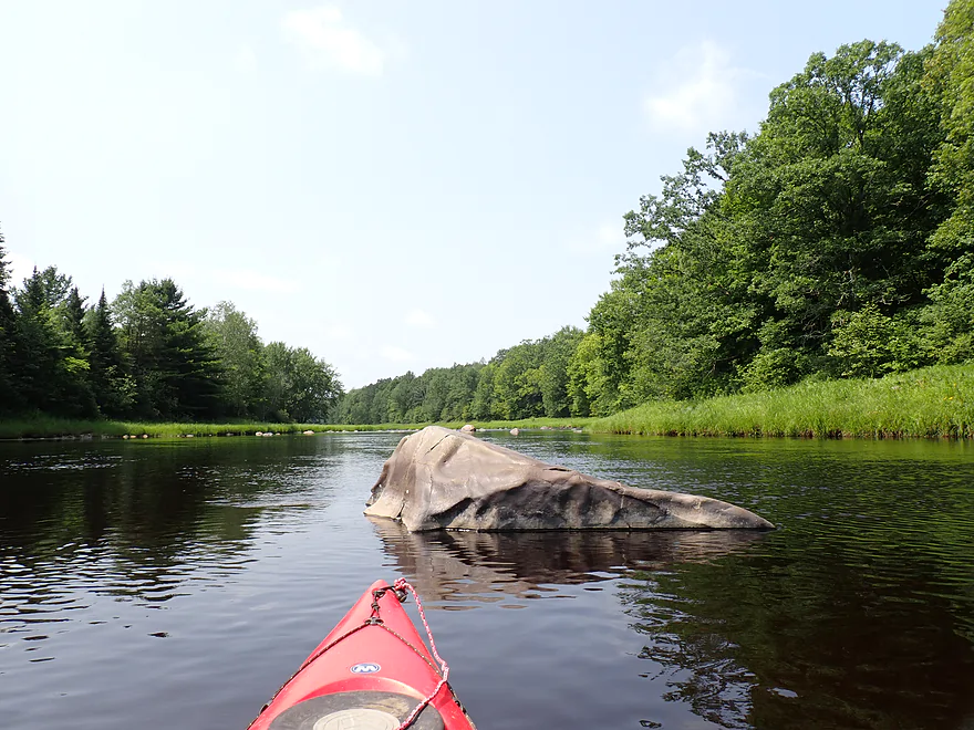
Giant stone “turtle heads” poking above the shoreline
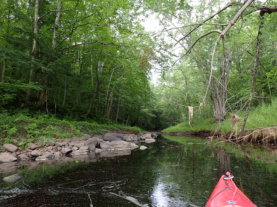
Shallow side creek
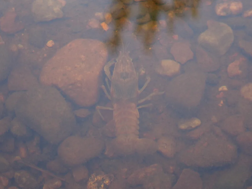
Crayfish…they were countless in number
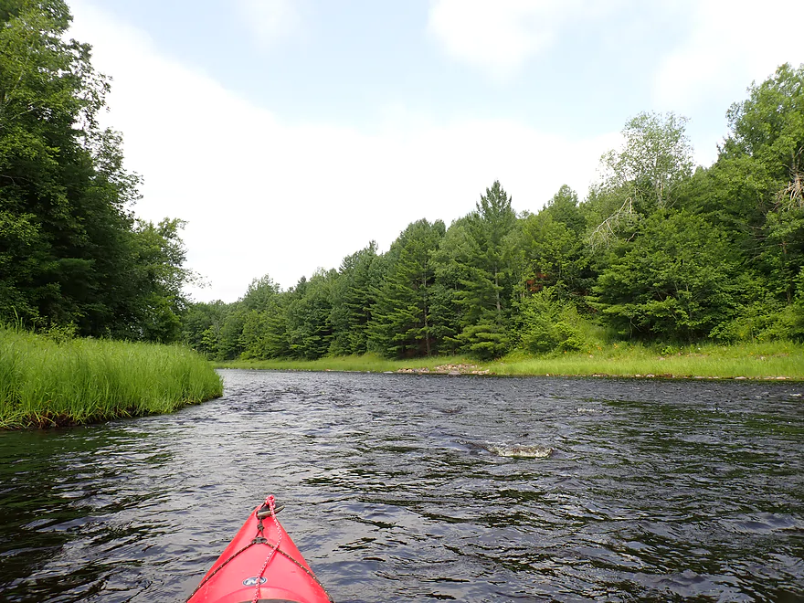
More great pines
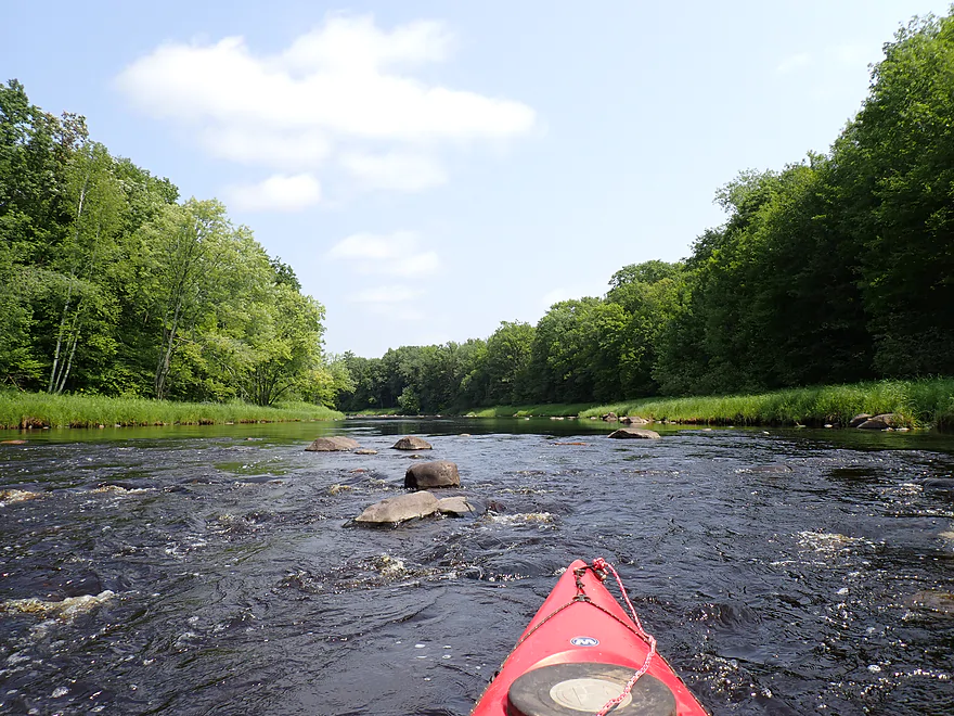
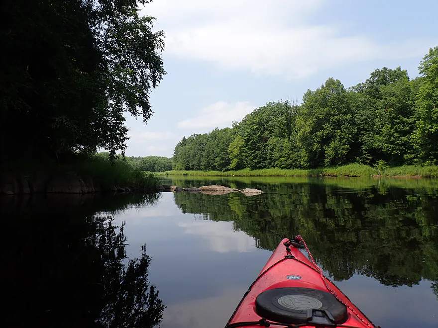
River alternated between riffles…
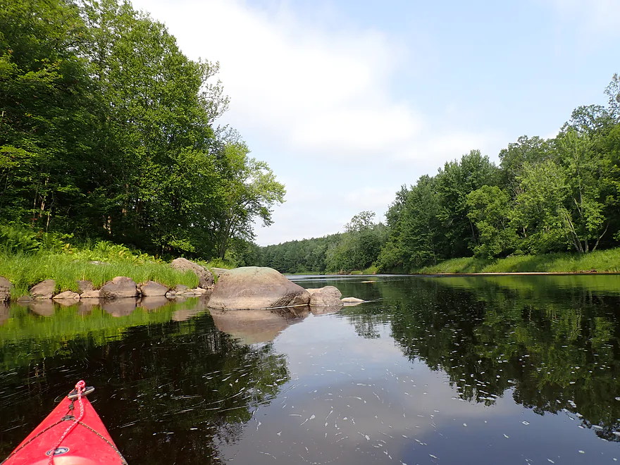
…and pools
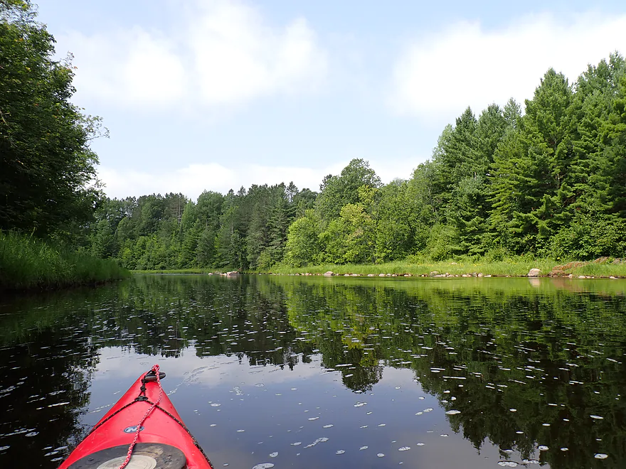
Nice reflection
Another nice boulder garden
Reverse view
Fun rapids…just Class 1 and easy
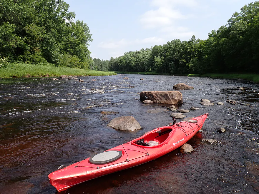
Getting out for pictures
Boulder with what looks like glacial scrape marks
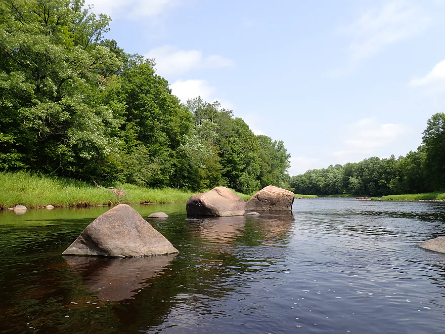
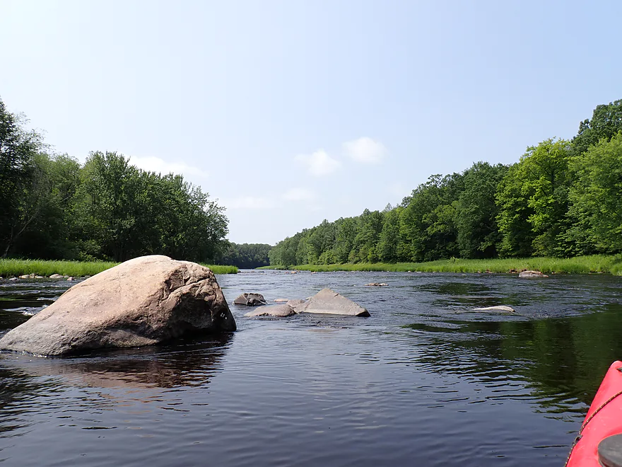
Some of the bigger boulders
Great scenery
Getting out for pictures
A later pitch of light rapids
Very smooth rock
Last major boulder field
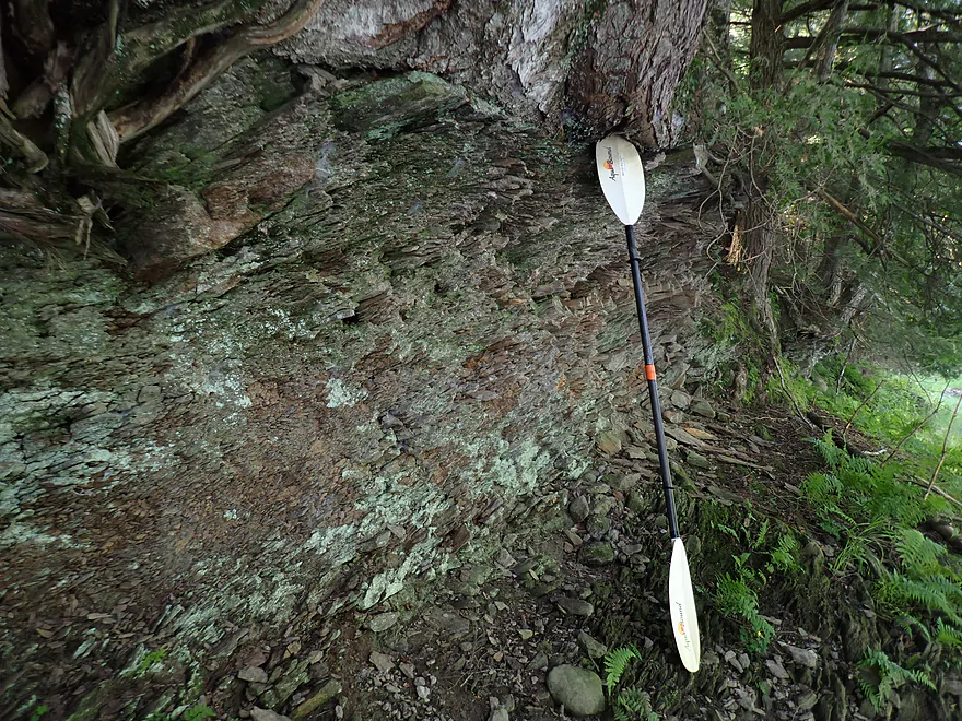
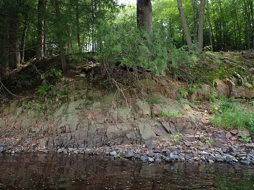
Some interesting shore-side geology
Rock face is being undercut
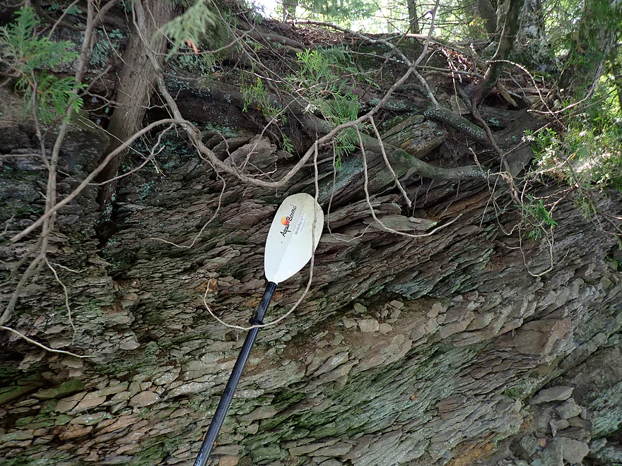
Eroding into shards
Looks like wood…but is rock
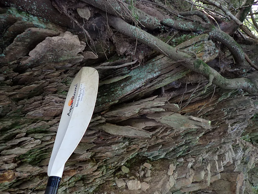
More “plate” erosion
Exposed bedrock
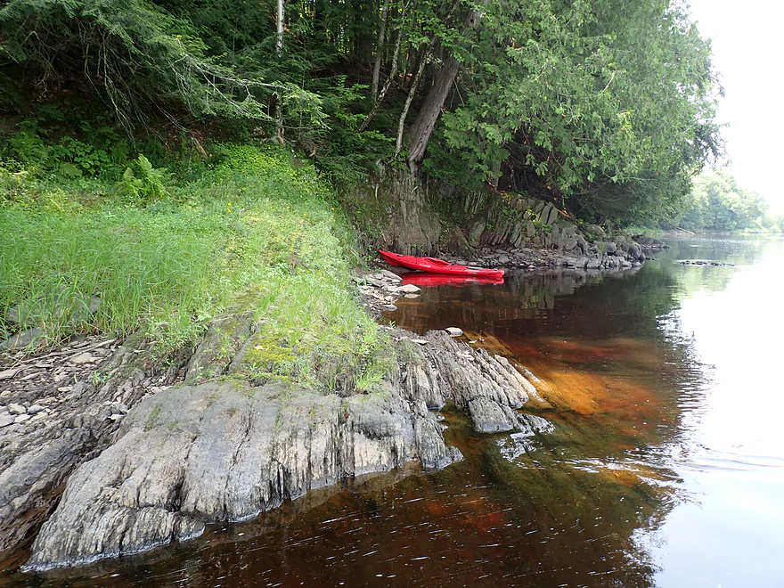
Cool little bay
Hemlocks and white cedar grew over the rocks
Last outcrop in the series
Starting to lose my good lighting
Dense boulder field…easy to navigate around (far right)
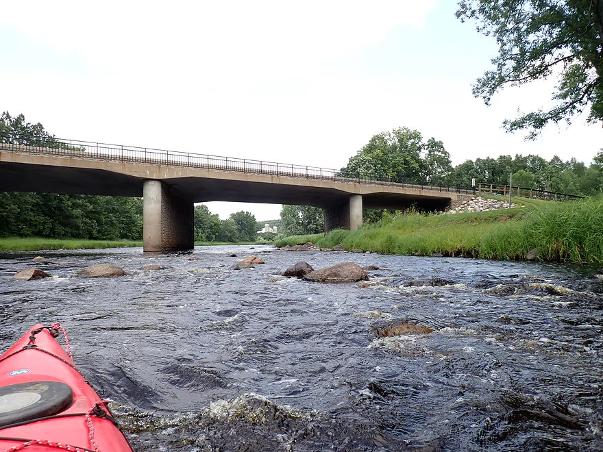
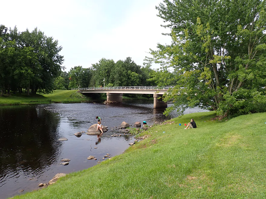
Hwy 73
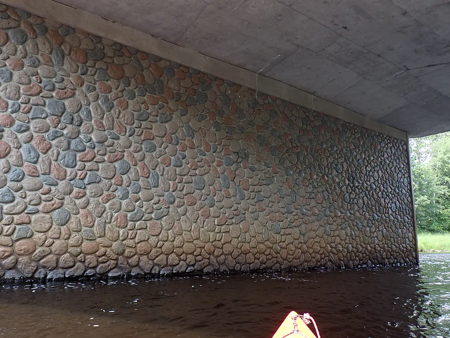
The stonework is fake, but still attractive
Wayside Park, just south of the bridge, is a great public access
View upstream
View downstream
Continuing downriver…cool swirl patterns
Another great stretch of outcrops
Swirls wrapping around the rocks
Very rugged boulder
These yellow birch roots are helping to break down the rock face
Slant block fractures
Ending the trip by Bridge Drive
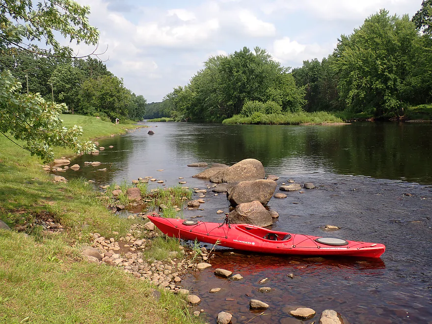
Village Park Landing is a good public access
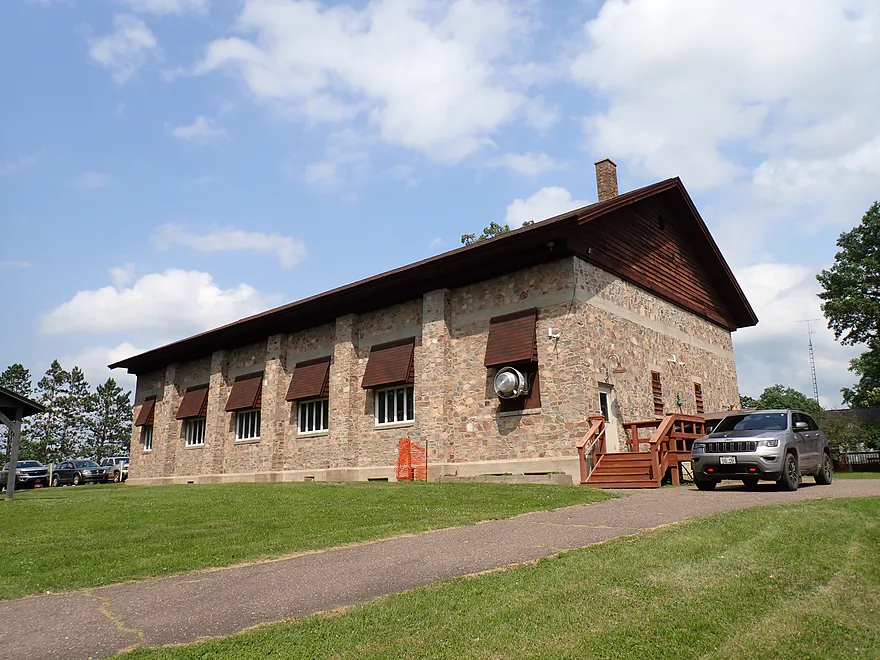
Rustic meeting center in the park
Jump River

When the Flambeau River is your neighbor to the north, it’s easy to be overlooked by paddlers. Despite this, the Jump is a relatively nice river and it’s long been on my todo list. For this first-time trip I decided to start with a “random” stretch (coincidentally one with an easy bike shuttle).
The trip started at a wayside launch by Hwy M which was ridiculously well hidden. If you didn’t read about it in a guidebook, you likely wouldn’t know it exists. The area was rough, but plenty doable as an access. Upstream a series of rapids wrapped themselves around the river bend in an inviting scene. Despite these early rapids, I didn’t see as many as I expected and there was a lot of flatwater paddling. Typically the river would alternate between pools and riffles…with maybe rapids every quarter mile. Practically all the rapids were easy (Class 1). Beginner paddlers though should still be careful as there are a lot of “submarine boulders”. You won’t see them, but they are hiding just under the surface and can stop your boat in a hurry.
A highlight of the trip was the relatively undeveloped and wooded banks. White pines were common and attractive. I also didn’t see evidence of logging, which was nice. If logging would occur in the area, it would be great if at least river corridors could be spared and protected. Here is a cool website that tracks where logging has occurred in Wisconsin and beyond.
The channel itself was attractive with clean, red-hued water and frequent boulder gardens that speckled the river. In many ways the Jump reminded me of the Black River (upper, not lower Black). Same size, same red water, same types of trees, same boulder gardens, same pool and riffle rapids…I could likely swap Jump and Upper Black photos and few would notice. The one exception was rock outcrops, which the Upper Black has, but I hadn’t yet seen on the Jump. But this changed two-thirds into the trip. I finally encountered a great series of outcrops along the south shore. The rock looked like fossilized wood and broke off in layers and shards. Really cool.
The river opened up a bit as I approached “Jump River” (a confusingly named city). Here there were a nice series of rapids leading up to the Hwy 73 bridge. In fact, these might have been the “strongest” of the trip, yet still were only Class 1+. In lower water, these “fun rapids” turn into “unnavigable boulder gardens”. Google Streetview actually has a nice reference picture of what the rapids look when low. There is a great public access option by the bridge (Wayside Park), but I decided to keep paddling.
The final half mile of the trip was surprisingly nice. Most of the south shoreline had a long stretch of small but rugged granite outcrops. This was easily one of the trip highlights. I ended the day at Village Park Landing, which was a busy park, but a nice access.
In summary, this was a good trip that I enjoyed. It’s not a bad option for beginners. I actually saw a large group of Amish launching at my take-out without life jackets…not that I endorse canoes + rapids + no life jackets. Water levels aren’t as volatile as the Upper Black, but paddlers should still be careful. It is still a Goldilocks river that often is too high or too low. In hindsight I wonder if there are better legs on the river than what I did? Further upstream there is the famous “Big Falls” which features a spectacular stretch of rapids and rock formations. But these upstream legs are rougher, more dangerous, and more difficult to shuttle. The lower stretches of the Jump have potential and have easy bike shuttles. I look forward to doing them in the future.
I didn’t see much…just some frogs and insects (including dragonflies). Some mosquitos were at the put-in, but none were on the water, which was great. The highlight were the crayfish…they were countless in number and everywhere. In several spots I got out for photography, but I always had to be careful where I waded so I didn’t step on one (no matter where in the river I was). While I took pictures, the crayfish would “tickle” my feet…as if probing to see if I was a food source.
Big Falls County Park: Just upstream from my trip is a scenic gorge with a series of Class 4 rapids and dells referred to as “Big Falls”. You can see the falls and take pictures via a trail on the east side. Google Photos has some nice pictures.
CR M Wayside: Finding this access is tricky. This landing, despite having both an entrance and exit road, is well hidden by trees and weeds. Paddlers may want to simply park on the M shoulder and then pull their boats down the access road, as the latter is in poor shape. It’s narrow with low-hanging branches, weedy, muddy, rutty and steep in spots. Definitely not recommended for low-clearance vehicles. After the drive, you must then lead your boat down a steep bank to reach the water. There is a faint but defined trail you can use. All in all this is not an ideal access, but it is definitely doable.
Alternate Put-ins:
- Big Falls County Park (6.7 miles upstream from M Wayside): This bonus leg would be incredibly scenic with a mile-long stretch of boulder gardens, numerous rock outcrops, and even a small waterfall from a feeder creek. But…there are a lot of Class 2 rapids to deal with and the shuttle route would be long and indirect.
Village Park Landing: This is located at the west end of the city of Jump River. There is a large and popular park here. You can take out almost anywhere along the long grassy bank, but about 90′ of uphill boat dragging is required to reach the access drive. Outhouses are available.
Alternate Take-outs:
- Wayside Park/Hwy 73 (0.6 miles upstream from Village Park): An excellent and scenic public access. Outhouses are available. The parking lot is on the east end, but it appears locals can and do park on the west end (much shorter walk to the river). Note: taking out here instead of Village Park is certainly an option…but this would omit a half mile of scenic outcrops on the south shore.
- Hwy H (7.0 miles downstream from Village Park): There is no landing at H, but it should be a doable bridge access. This bonus leg should be good with more Class 1 rapids, boulders, and outcrops. I believe it is one of the more popular stretches on the river with local paddlers.
Bike Shuttle – Village Park Landing to CR M Wayside: 5.5 miles with 98′ of ascent. This was a pretty easy bike shuttle…it’s relatively flat and all paved.
Wind: This is a relatively open river, so you should be mindful of forecasted wind direction and speed.
Logjams: None.
Strainers: There was one strainer (a downed tree) in the rapids just upstream from the Village Park take-out, but if you’re paying attention, it will be easy to avoid.
Rapids/Current: The river has medium current that is mostly pretty tame. But this is often interrupted by sections of light rapids. Most of the rapids were minor with none being above Class 1 in difficulty. The strongest rapids were likely by Wayside Park and even those were likely just Class 1+. I would consider this a beginner-friendly stretch for rapids…but paddling newbies should still have some degree of good boat control. They should be mindful that there are rocks often hiding just below the surface which can turn your boat suddenly sideways in fast current.
Gauge: Jump River @ Sheldon
Trip Depth: 245 CFS or 3.74′
Navigability Estimates: The gauge is located just downstream from this section so should be accurate. The following are rough estimates based on cross correlating this gauge’s history with other nearby ones I’m more familiar with. My estimates may not be accurate. Always use your own judgement.
- < 185 CFS: This might be too low. Most of the river will be fine, but many rapids would have to be waded.
- 186-220 CFS: Low depth. Pretty scrapey in spots, but perhaps doable for shallow-drafting boats.
- 221-280 CFS: Average depth…good target range. I rarely got hung up on the rocks at 245 CFS.
- 291-350 CFS: High depth. Should be doable.
- 351-500 CFS: Very high depth. Likely doable, but the river may be pushy in spots. Water clarity likely won’t be as good.
- 501-1000 CFS: Extremely high depth…will only occur briefly after heavy rains. This stretch might actually still be doable at these levels…but good boat control will be required. At these high’ish depths, the current will be fast and unforgiving if you mess up.
- 1000+ CFS: Maybe too high for practical kayaking?
Click here to see an overview map of the Jump River.
South Fork:
- Upstream from Luke Heights Lane: Much of the river looks navigable, but there could be strainers and deadfall to deal with. I just don’t know.
- Luke Heights Lane to Copper Dam Campground: 2.0 miles. A good stretch that includes high banks, a rocky bottom, minor rapids, and some white pines.
- Copper Dam Campground to Cty N: 6.8 miles. A scenic leg with more white pines, boulders, and rapids. Best feature is Little Falls (200 yards of Class 2 rapids which can be portaged).
- Cty N to Big Falls County Park South Access: 1.3 miles. A short leg with some light rapids and boulder gardens.
- Big Falls Park South Access to North Access: An incredibly scenic stretch of dells, rock formations and rapids. Paddlers should be warned this contains Class 4 rapids and has killed people. Unless you are a professional whitewater paddler, you should portage this. There is a 900′ portage path to the right. Even if you don’t paddle the rapids, definitely consider checking them out (it’s a local tourist attraction). A trail system east of the river provides good views.
- Big Falls Park North Access to North/South Fork Confluence: 1.7 miles. Includes a mile-long stretch of boulder gardens and Class 2 rapids. Also includes numerous rock outcrops and a small waterfall from a feeder creek.
Main Branch:
- North/South Fork Confluence to Cty M Wayside: 5.0 miles. This section includes high sand and gravel banks and multiple Class 1 rapids.
- Cty M Wayside to Village Park Landing: 5.9 miles.
- Cty M Wayside to Wayside Park by Hwy 73: 5.1 miles. A pleasant stretch. There is no special scenery, but it is consistently good with pine trees, boulder gardens, and light rapids. Rapids are generally safe with none greater than Class 1. There is a short stretch of small but scenic outcrops.
- Wayside Park to Village Park Landing: 0.6 miles. A short stretch by the village of Jump River. There is a terrific series of outcrops along the south bank.
- Village Park to Sheldon: 10.2 miles.
- Village Park Landing to Cty H: 7.0 miles. I think this is one of the more popular legs on the Jump with paddlers. Highlights include Class 1 rapids, boulders, some outcrops, and attractive wooded banks. View from Cty H bridge is scenic.
- Cty H to Haley Park/Sheldon: 3.2 miles. Seems to be more boulder gardens and light rapids. There is a scenic railroad bridge by Sheldon.
- Haley Park to Cty G: 4.0 miles. A pleasant Northwoods stretch with frequent shallow rapids and boulder gardens.
- Cty G to Whispering Pines Drive Ramp: 5.1 miles. First half is nice with large gravel bars and more boulder gardens. Second half is impounded by the Holcombe Dam and is likely slow and less interesting.
- Whispering Pines Drive Ramp to Wayside Boat Landing: 1.7 miles. Likely uninteresting lake paddling.
- Wayside Boat Landing to Sportsman Club Park/Mouth on Chippewa River: 3.7 miles. Likely uninteresting lake paddling.
North Fork:
- Upstream from Hwy 8: There could be navigable sections, but I don’t know. Snags and strong rapids could be issues.
- Hwy 8 to Hwy 1: 10.9 miles. The guide book “Wisconsin’s North Central Canoe Trails” describes this as a mix of minor rapids and quiet water by “meadow-like” sections. Note: this guide is outdated and was likely done at low water. The snags and rapids difficulty may now be worse.
- Hwy I to Riley Road: 4.4 miles. First half has some longer stretches of rapids including what I think are Class 2+ (piecing together clues from Rick Kark).
- Riley Road to W. Forest Lane: 1.7 miles. A few more rapids, but not as many nor as intense (I think).
- W. Forest Lane to Cty N: 2.0 miles. Good leg with what I believe are some longer stretches of Class 1 rapids.
- Cty N to South/North Fork Confluence: 4.3 miles. Rick Kark paddled this when high. He described it as being wooded and fast, but lacking in noteworthy rapids.
Mondeaux River (a tributary to the South Fork): The section north of the dam to the mouth on the Jump is likely too congested to run, but the lake itself (the Mondeaux Flowage) is a nice paddle. You can read a review on the Mondeaux here.
Trip Map
Overview Map
Video
Photos Size: