
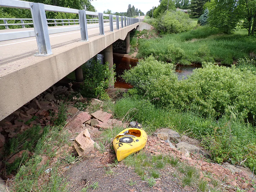
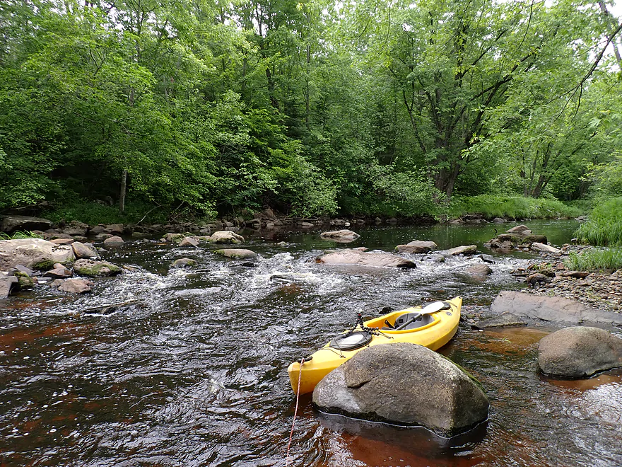
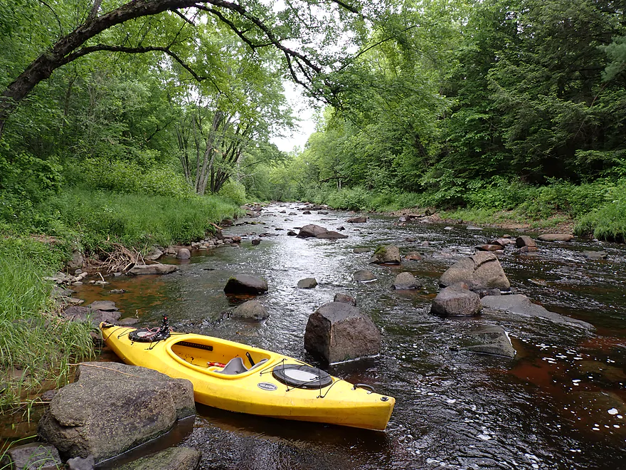
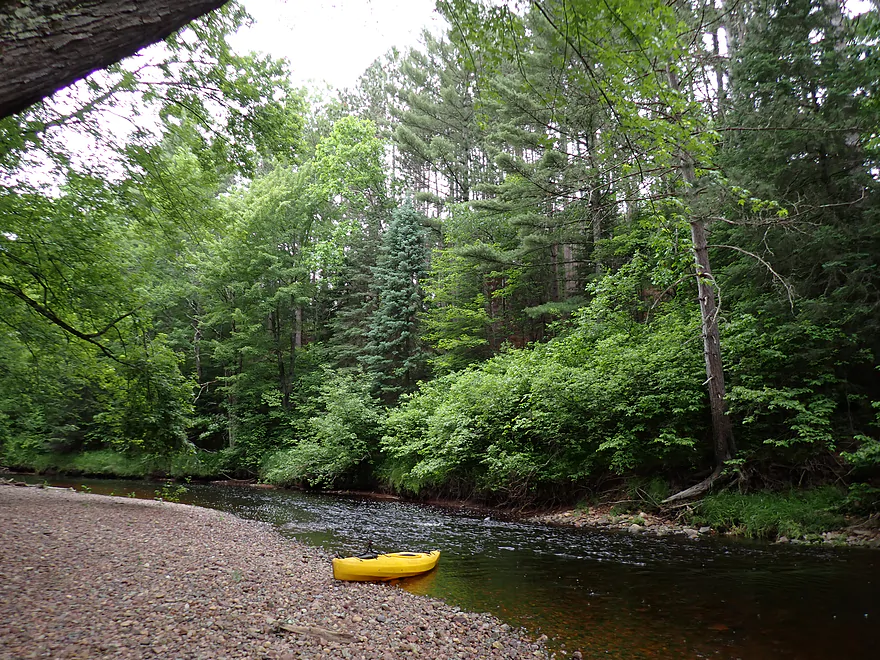
Starting at Cty Road WW…steep but doable
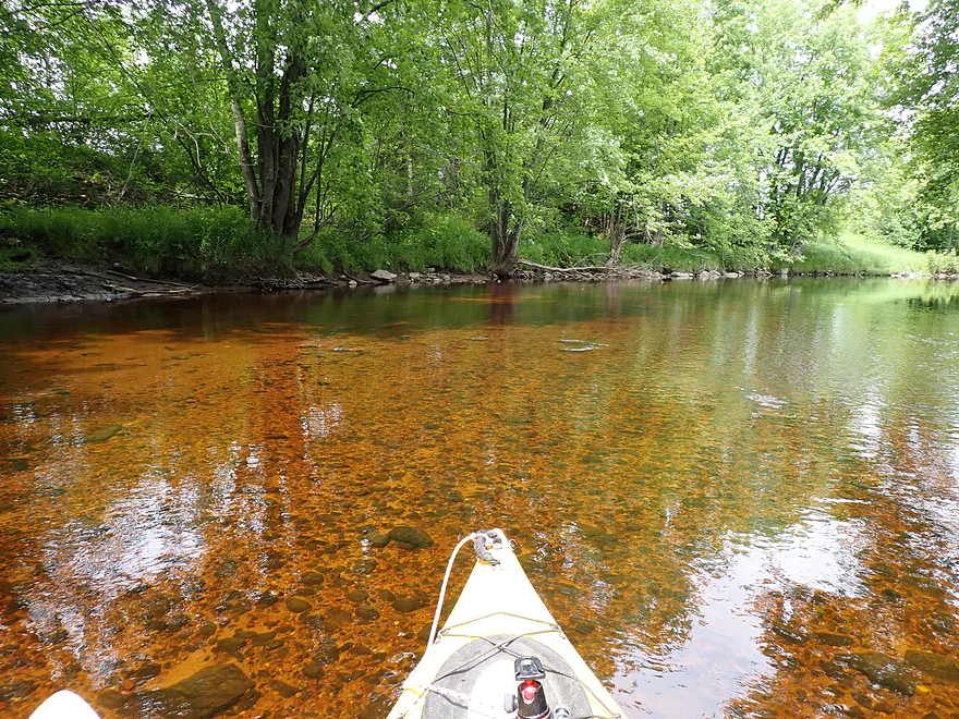
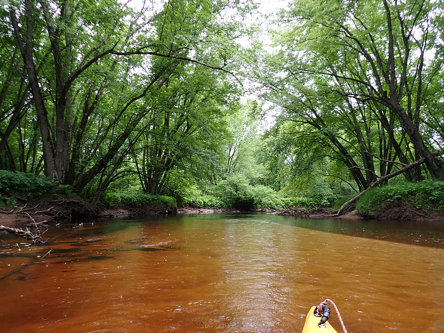
Nice clarity with a red hue
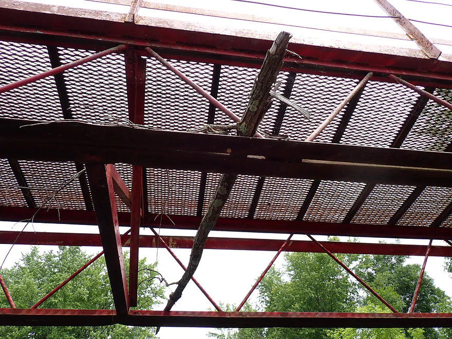
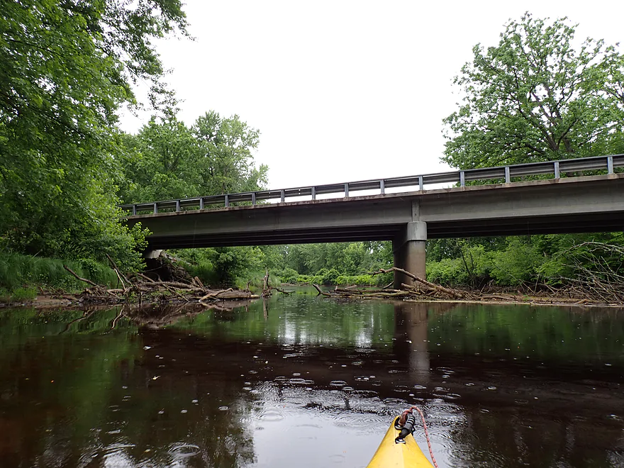
Debris in this golf course bridge shows how much the Trappe can flood
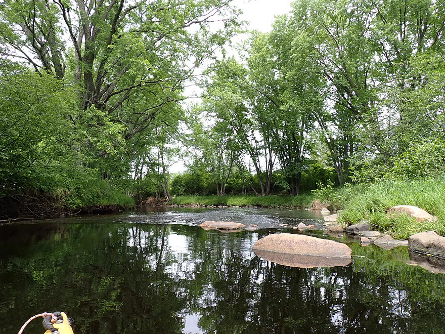
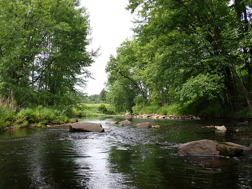
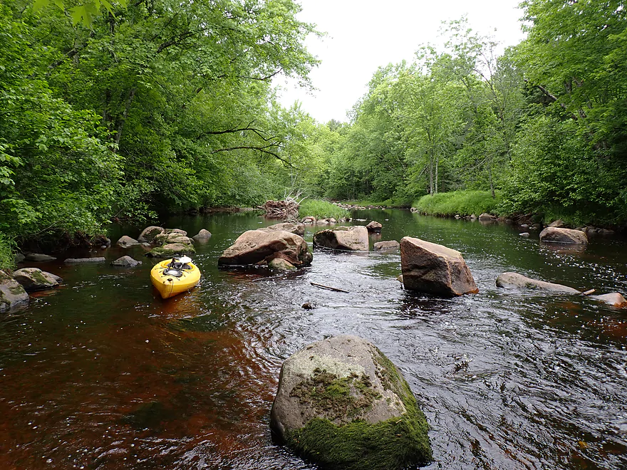
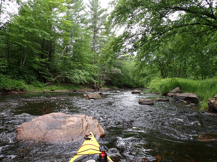
One of many nice little boulder gardens
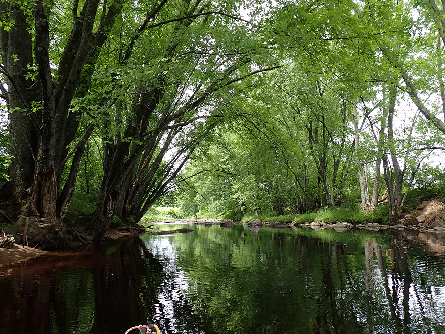
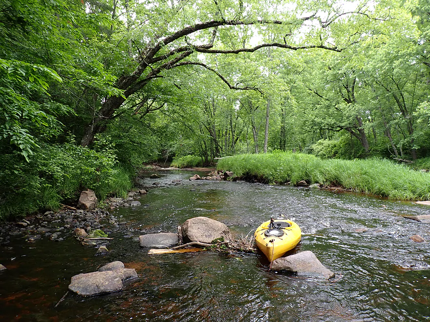
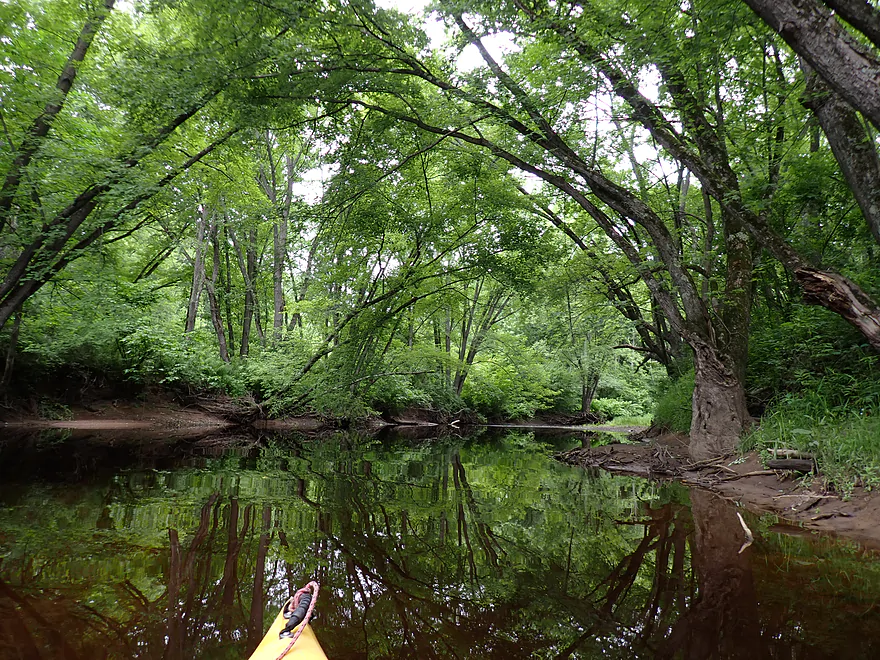
Shady overhanging trees reminded me of the Yellow River
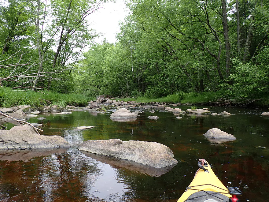
Lot of riffles were shallow
Getting out to wade
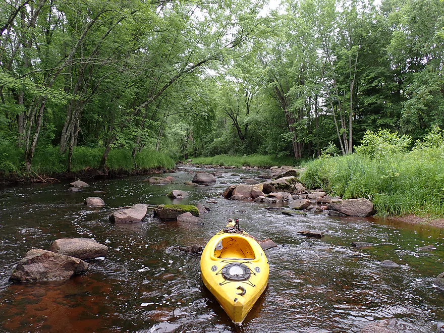
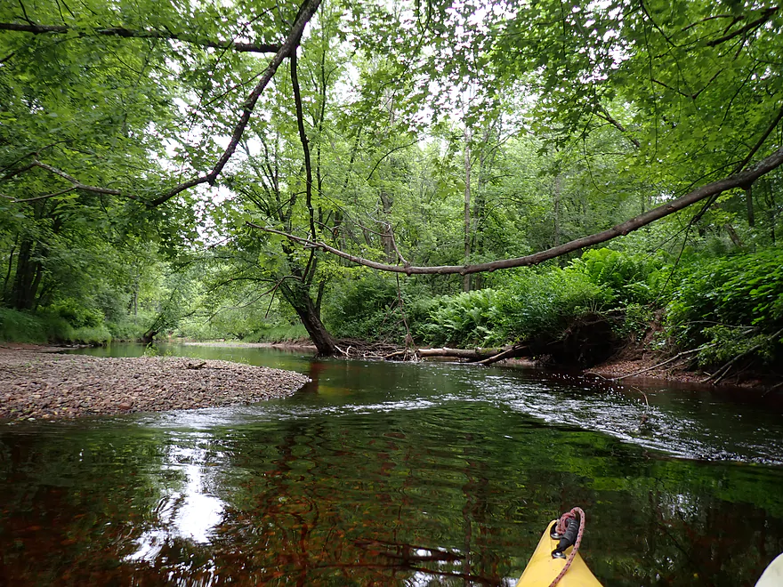
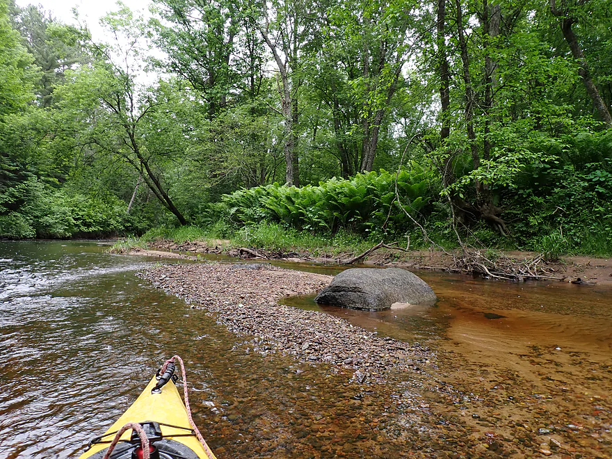
Long gravel bar
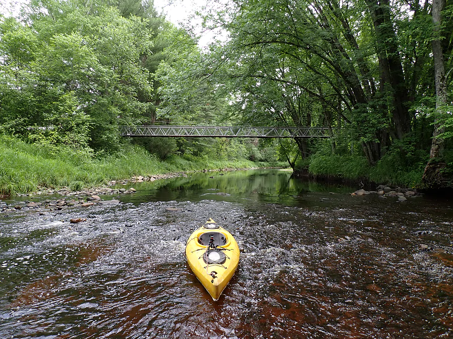
Shallow area by a nice suspension bridge
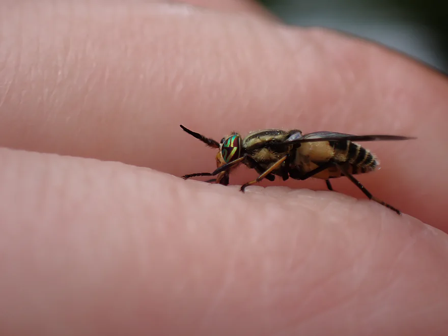
Interesting eyes
The pine trees were great on this trip
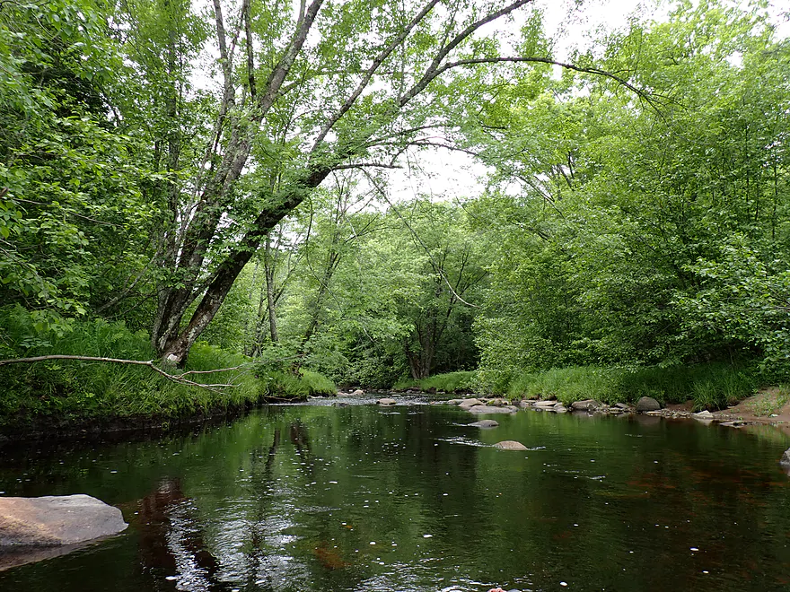
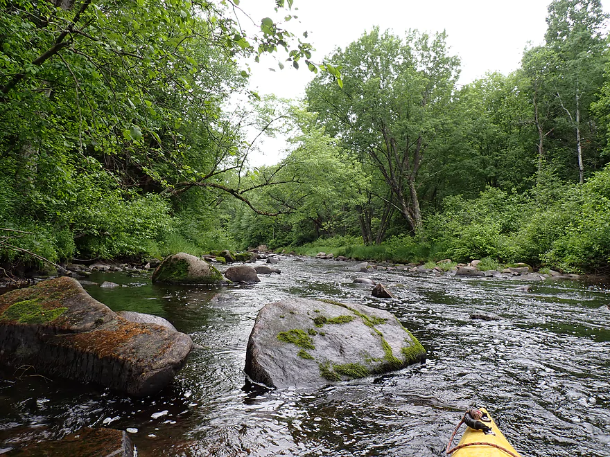
More clear water
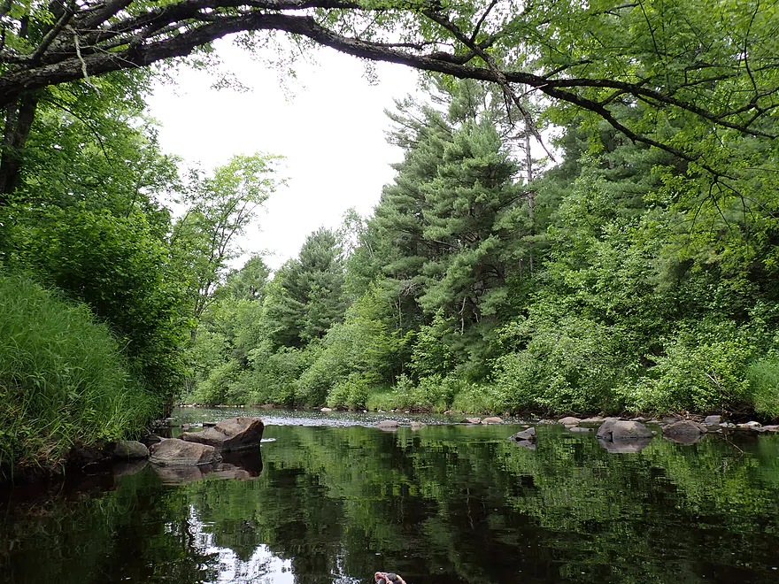
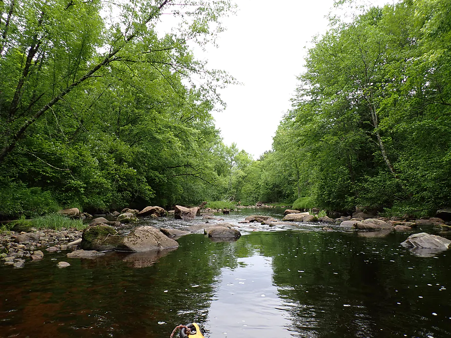
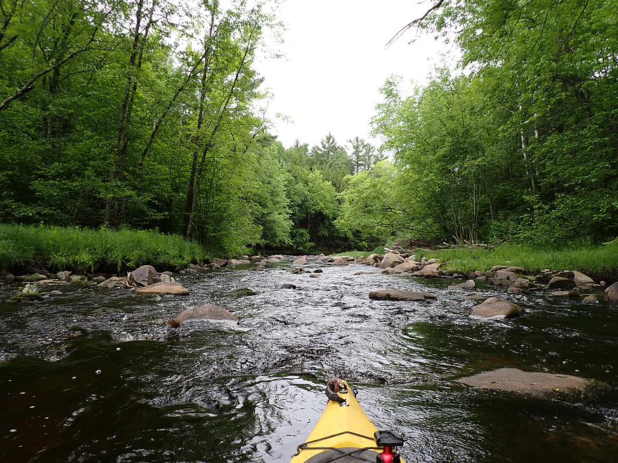
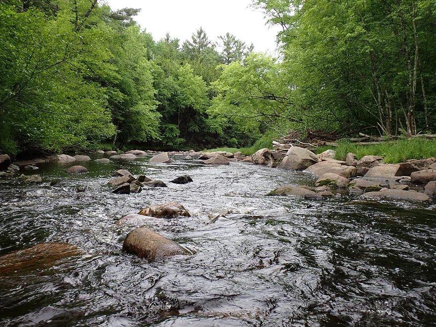
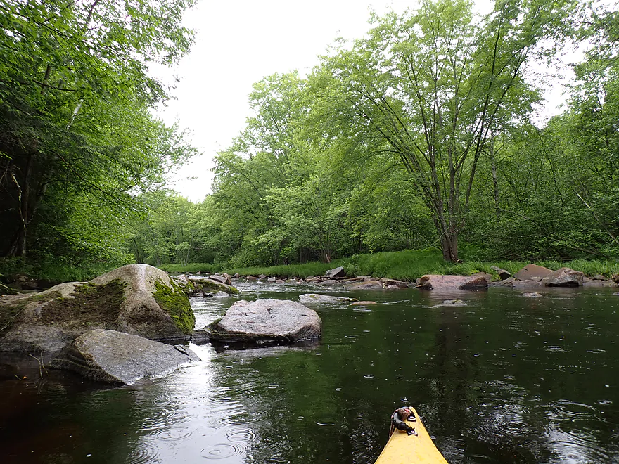
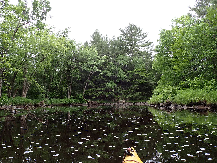
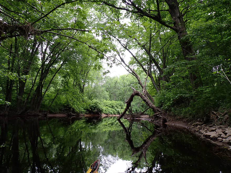
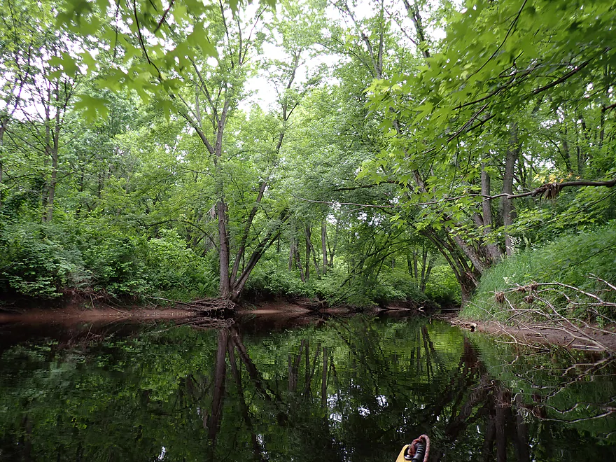
Very scenic river
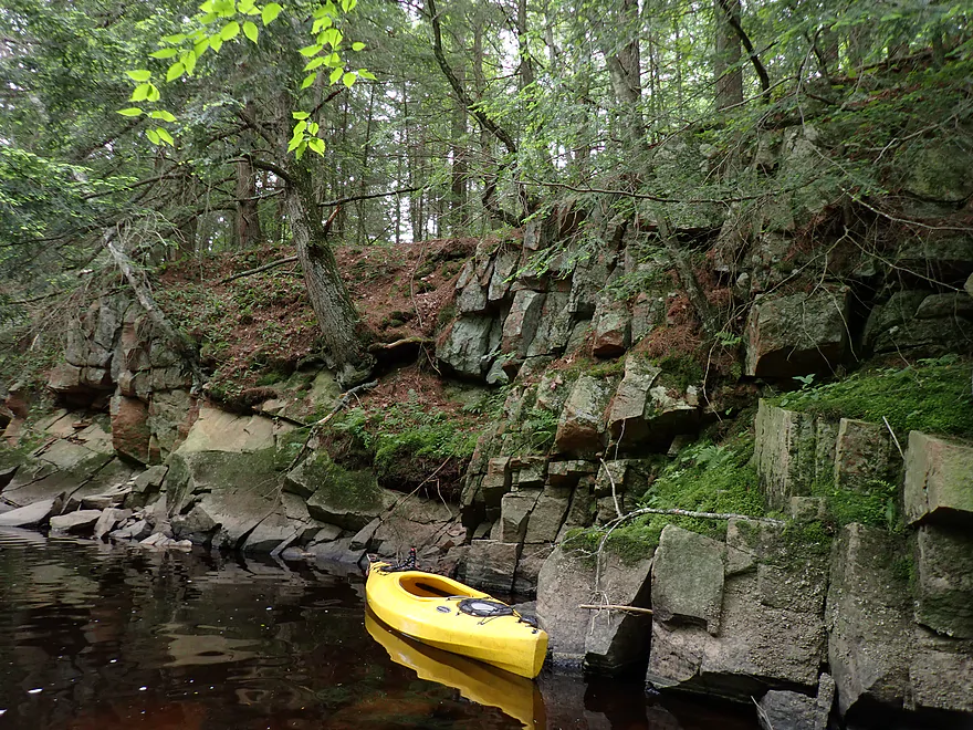
Rocky shoreline
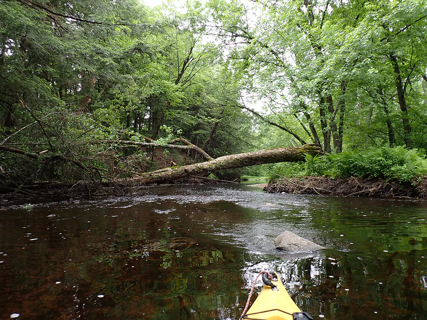
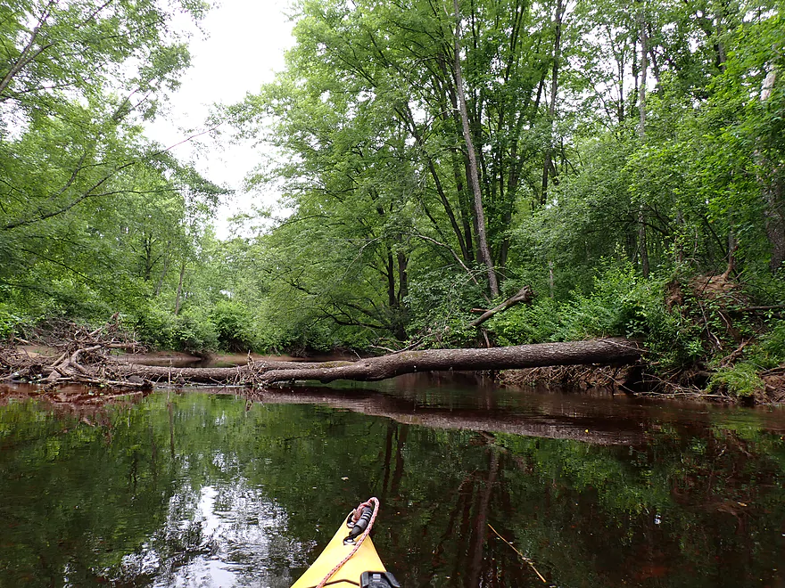
Recent downed tree…easy to get under
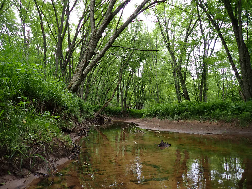
Taking a photo break under some hemlock trees
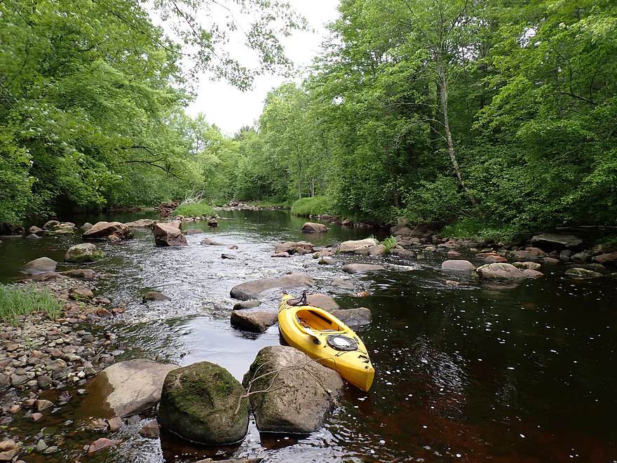
River starts to get more rocky
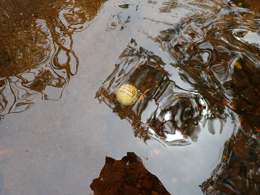
Funny…a few miles downstream from the golf course and STILL seeing golf balls
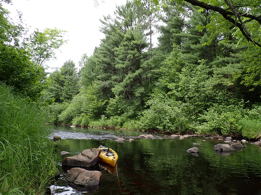
One of several islands…some channels were deeper or more scenic
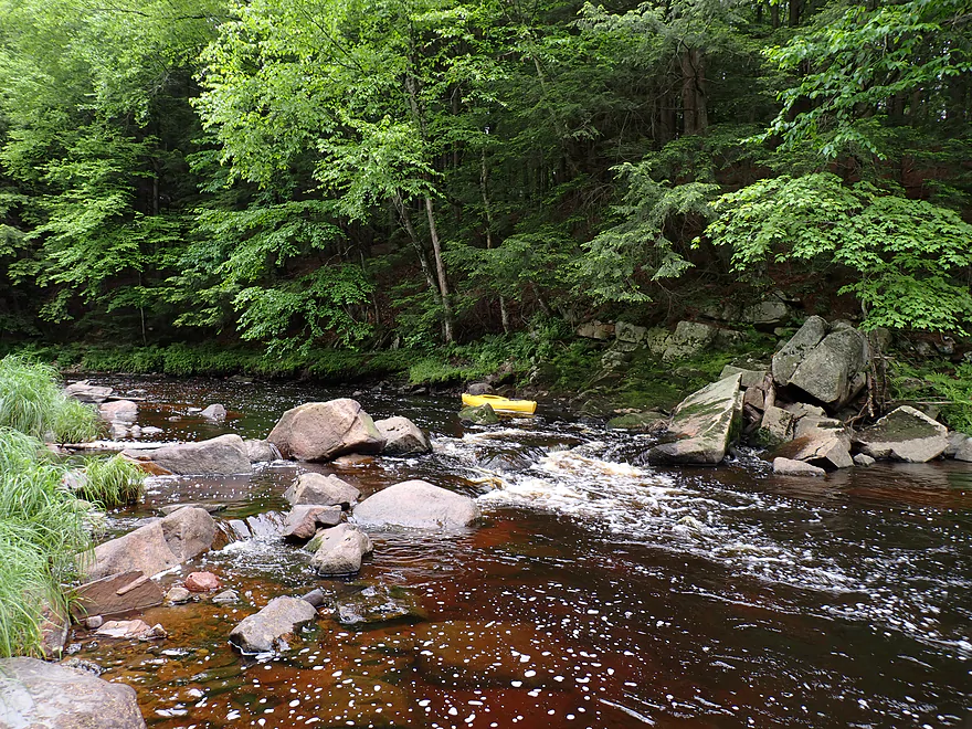
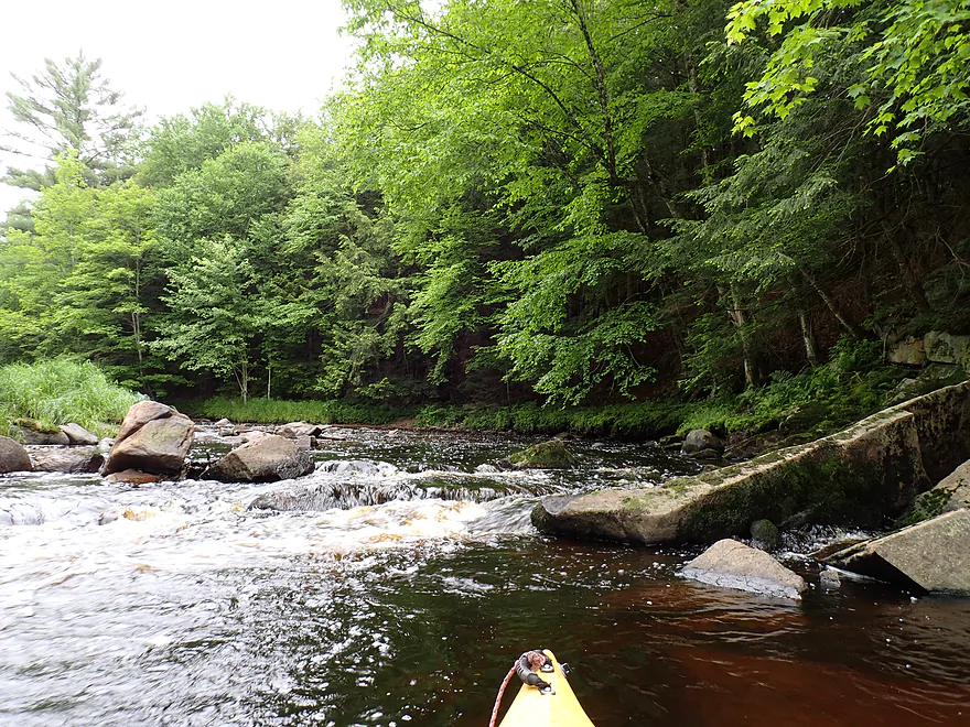
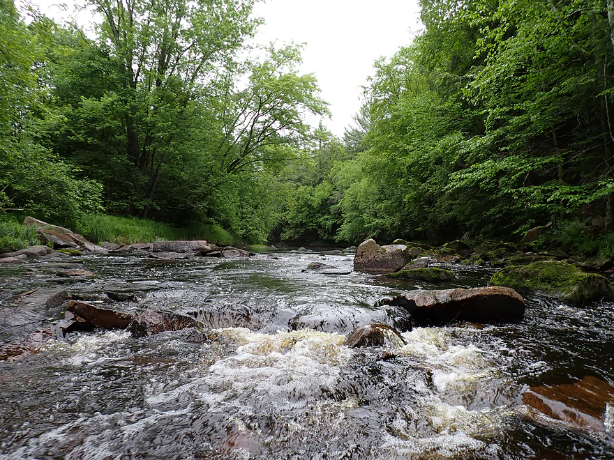
Nice rapids
Reverse view
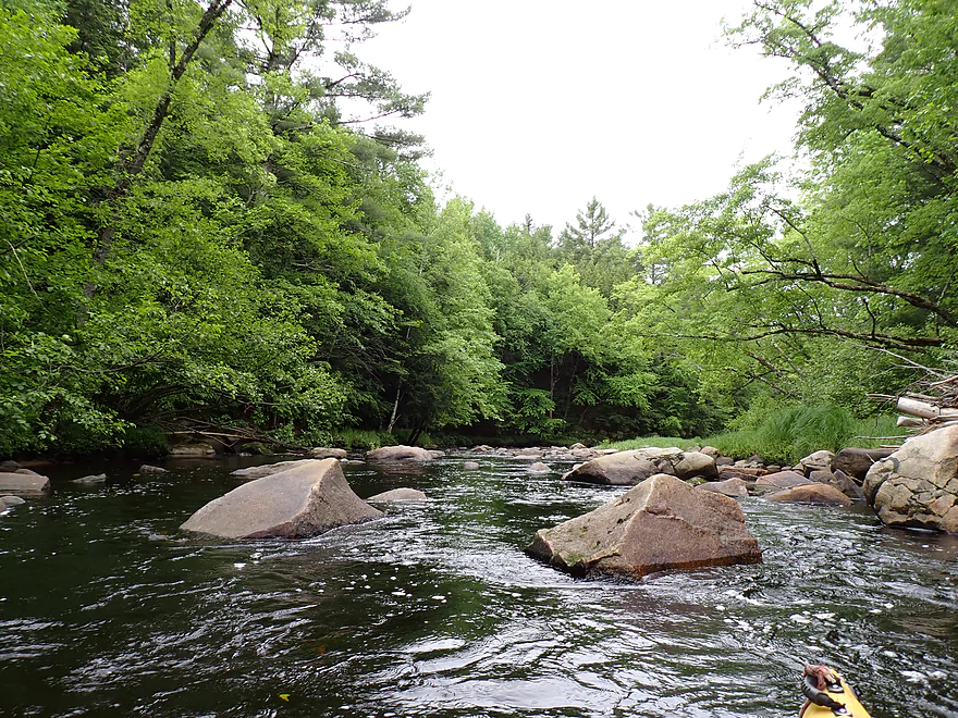
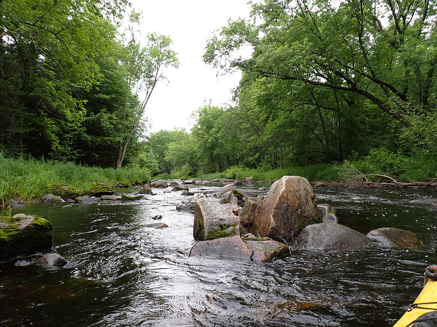
Some of the largest boulders on the trip
Start of a long boulder field
A fast but bumpy stretch
This could be tricky in high water
Most scenic pitch of the trip
Crossing the river for pictures
Tight…but I was able to paddle through that
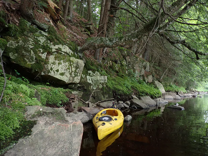
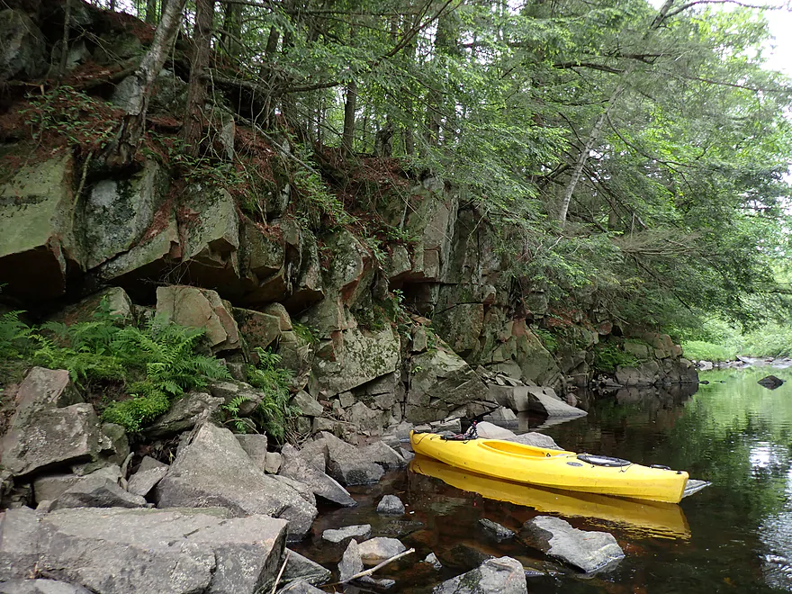
Rock outcrops started to get nicer
Start of another very long boulder field
This was fast and shallow
Stressful trying to find a navigable path through
Granite rocks started to lose their light red hue because of the rain
End of the longest stretch of rapids on the trip…note how shallow it is
Cool pattern of foam bubbles
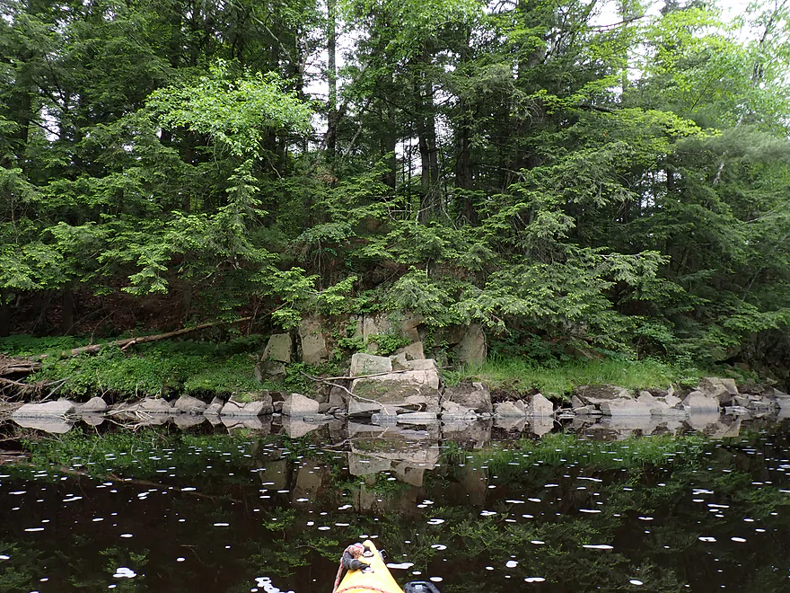
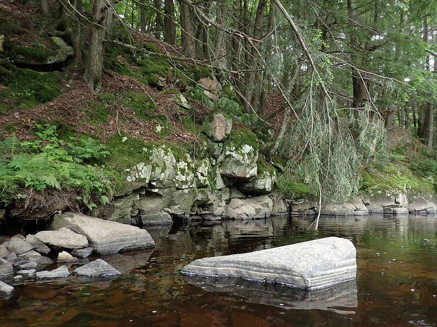
Some more nice outcrops
One of my favorites
Still more boulders and light rapids
You can see this spot from Shady Lane Road (good depth reference)
Shady Lane Road
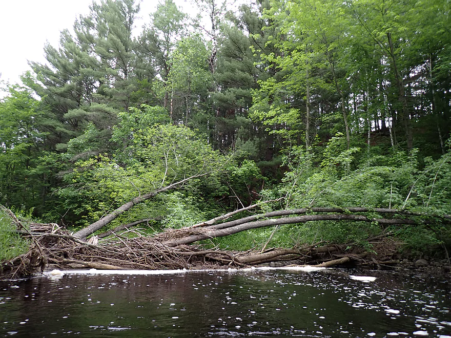
Fresh logjam (likely from the May tornado)
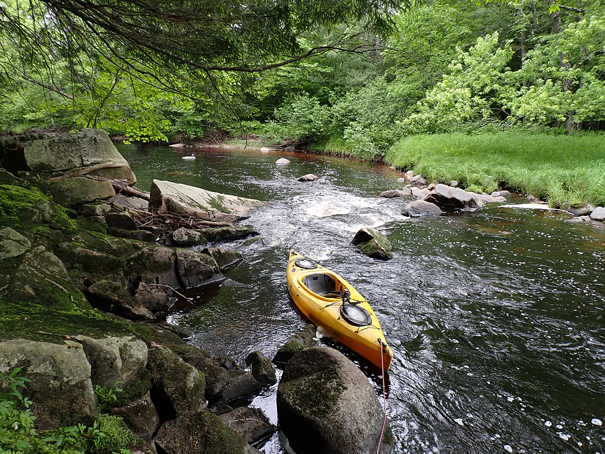
Easy portage
No outcrops past Shady Lane Road…but nice banks
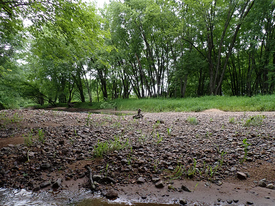
Cool gravel bar and cairn
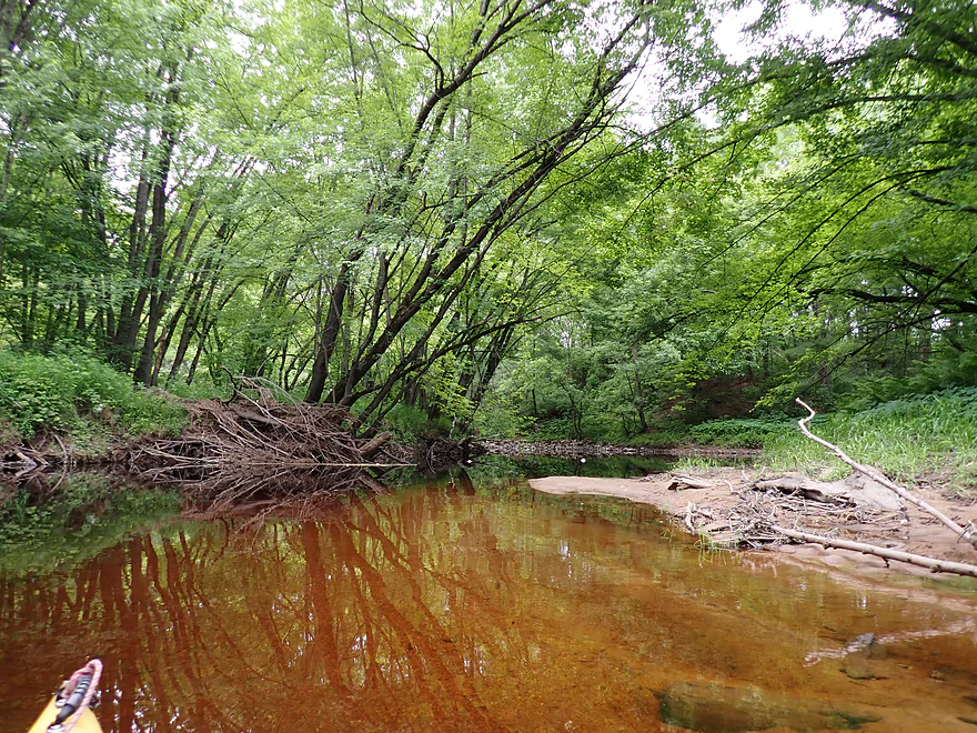
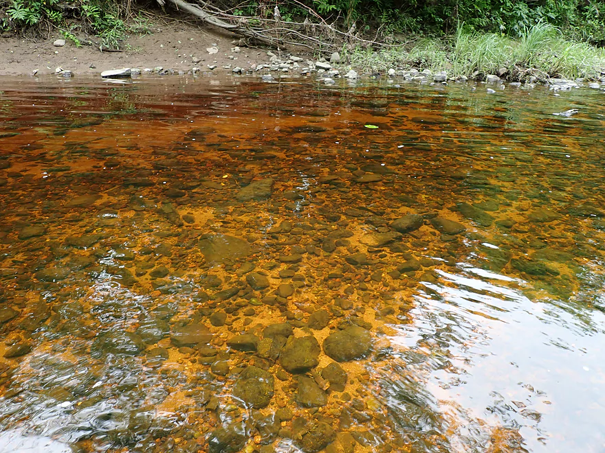
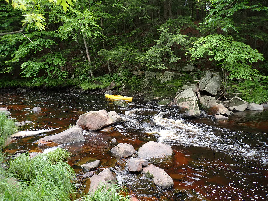
Loved the red water
Attractive reflections
Artificial riprap on the right bank
Diamond reflection from a bent tree
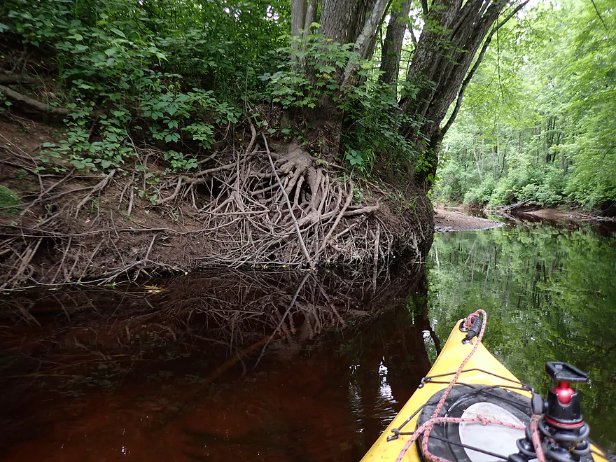
Mirrored tree roots
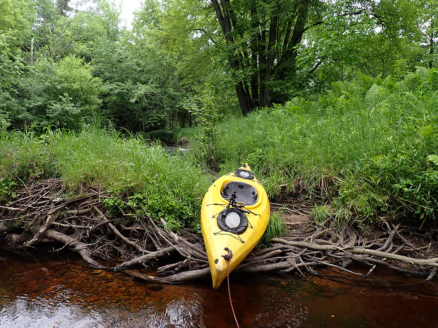
Second logjam…easy portage on sandbar to left (not pictured)
Overhanging branches created a nice tunnel effect
Lot of ferns on this trip
Little Trappe River joins up….tiny but attractive
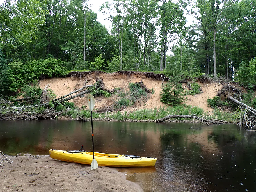
Exposed sand bank

Quite a variety of trees (spruce, pine, and hemlock)
Rain is really starting to come down
Ferns were one of the trip highlights
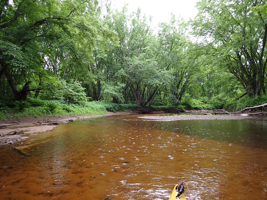
Great red color
This portion of the river had a very sandy bottom
Hwy W
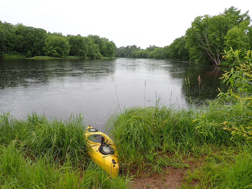
Shortly after W, the Trappe joins the Wisconsin River
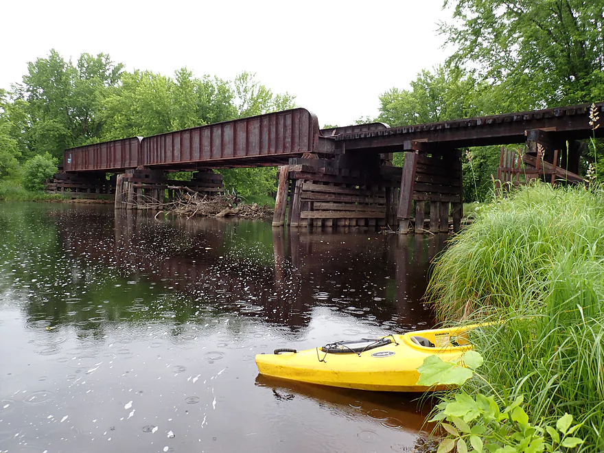
Looking upstream at the Trappe railroad bridge
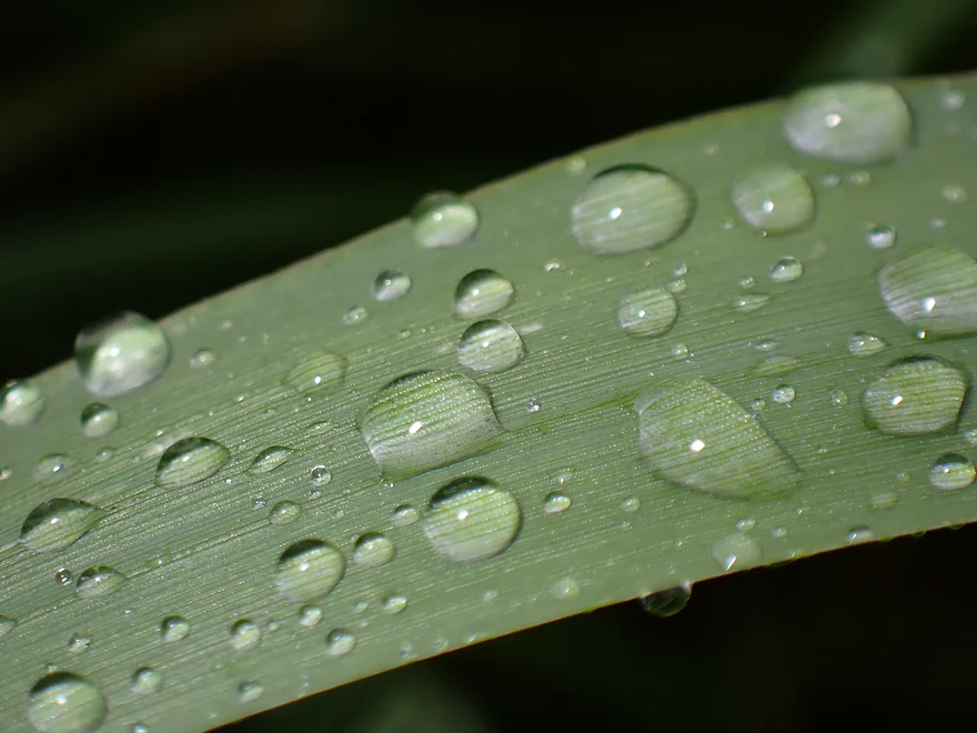
Fresh rain droplets
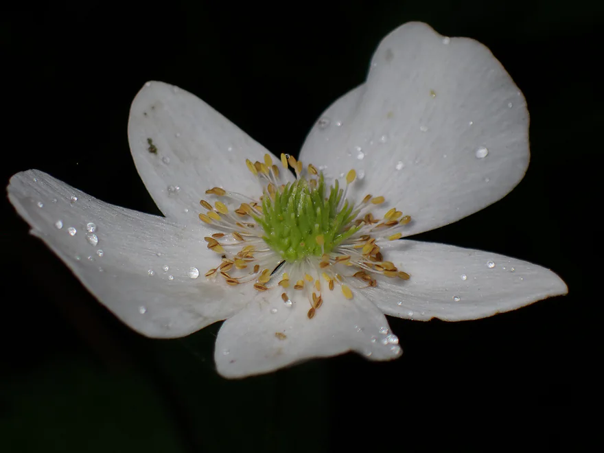
A disembodied Canada anemone flower
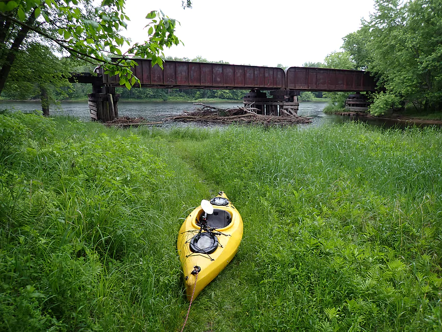
A faint trail above the bridge leads to the take-out (Jesse Park)
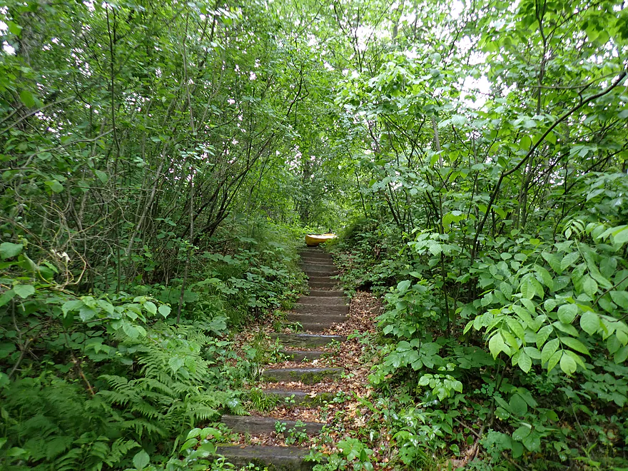
I had to pull my boat up wooden stairs (and over some broken glass)
Public cul-de-sac…road is in bad shape, but I liked how secluded it was
Trappe River

Located just north of Wausau, the Trappe is a small tributary to the Wisconsin River. Whitewater paddlers will sometimes do the stretch above 97th Street which has some Class 3 rapids. I wasn’t in the mood for that so decided to do the last leg instead, which is tamer.
I started at WW which was a manageable bridge access. Upstream from the bridge, I could see shallow riffles which had me nervous. The Trappe is usually too low to run and it doesn’t have a gauge, so sometimes it is a dice roll to know if your trip will turn out or not.
The first half mile flowed by the “Trapp River Golf Course” (not sure what happened to the e). The course was bustling with activity as many locals were trying to get in a game before the rain. Several mini-bridges crossed the river and I could see carts pass overhead as I paddled underneath. Golf balls were in the water everywhere…in fact I ended up seeing them 3 miles later, which was funny.
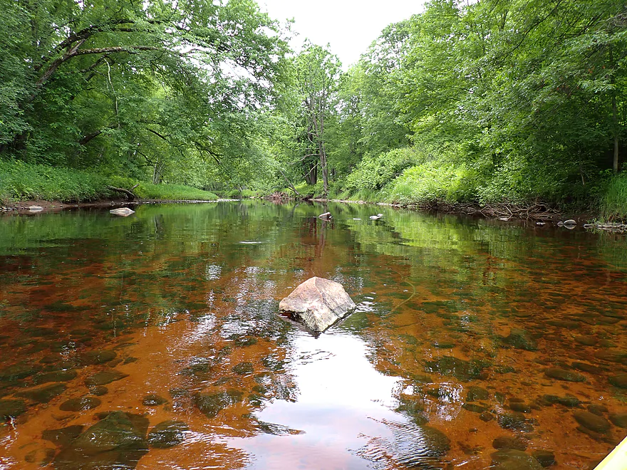
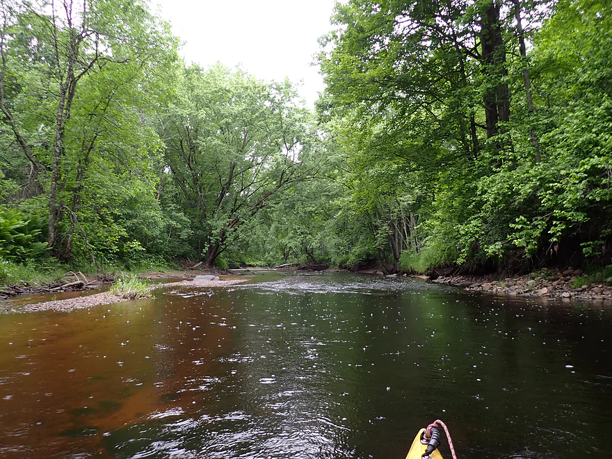
The trip to start was mellow but really nice with red-hued water, great clarity, and an attractive gravel bottom. Crayfish were zipping around left and right. It VERY much reminded me of the Upper Yellow River by Hwy 80.
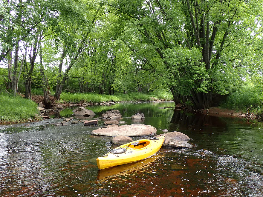
There were several small but nice boulder gardens. What wasn’t so nice was that most of the riffles by the boulders were too shallow to run. I got out a lot on this trip (sometimes for pictures but mostly for shallows). I lost count…but long story short, I needed more water (more on this later).
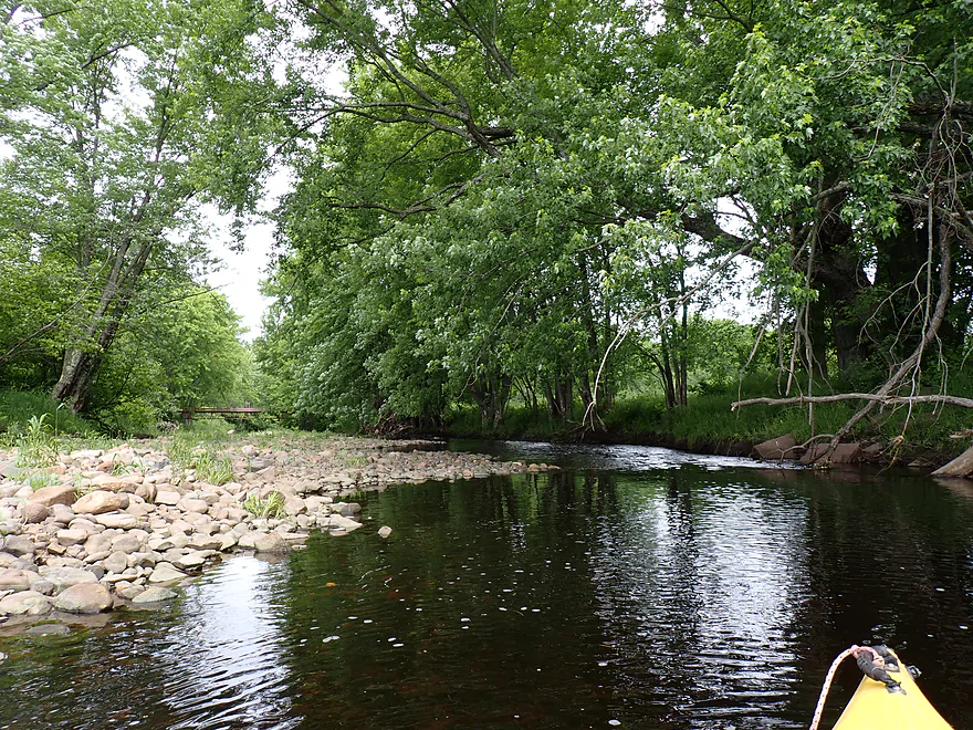
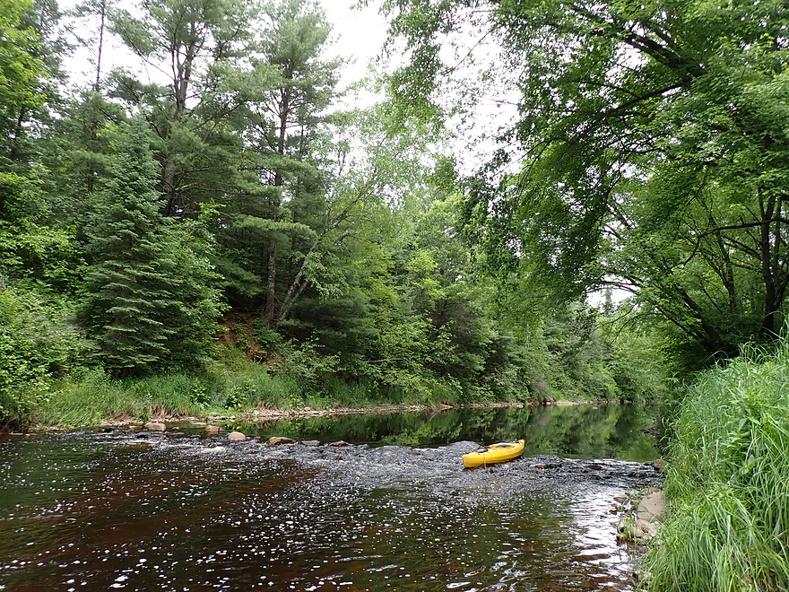
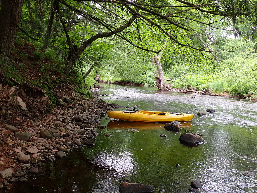
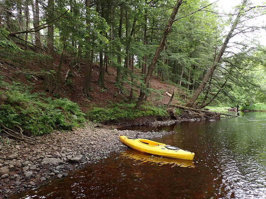
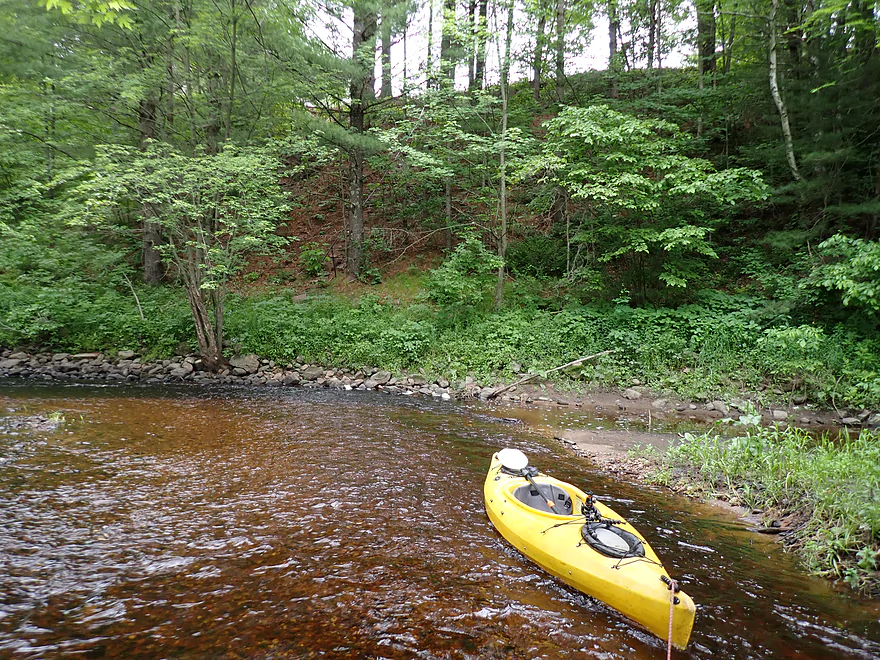
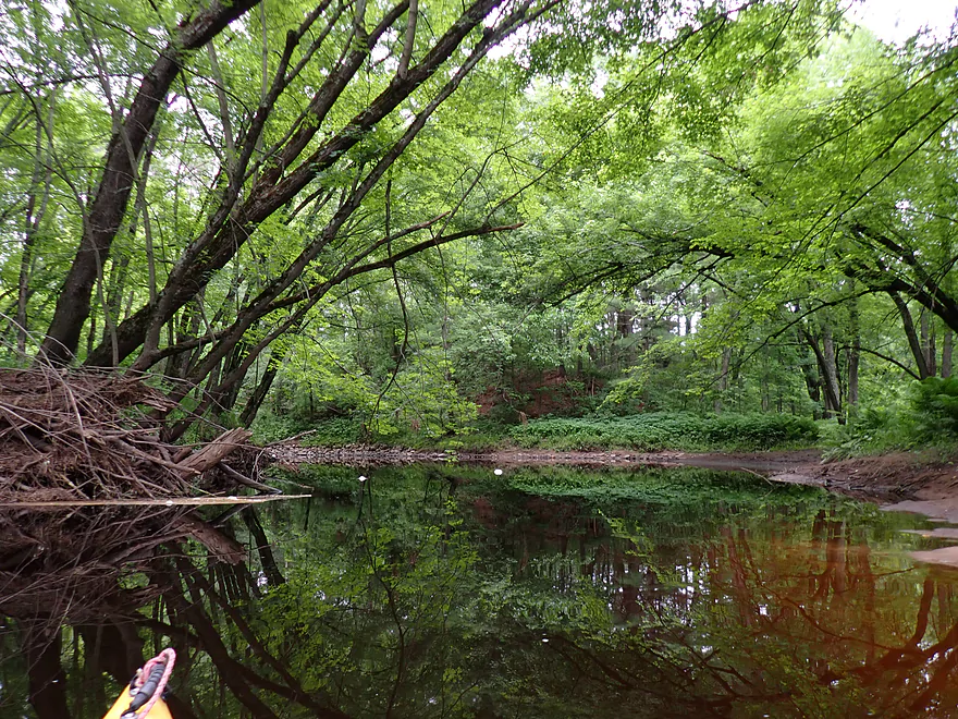
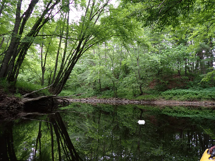
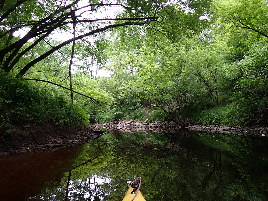
The scenery for much of the trip was very good…mostly heavy woods with occasional pines and hemlocks with occasional ferns growing on the banks. Other than the golf course and a few homes, the trip was largely devoid of farmland or development. Another highlight were the occasional small sandbars and gravel bars. In several cases the gravel bars extended to the shore and formed attractive rocky banks.
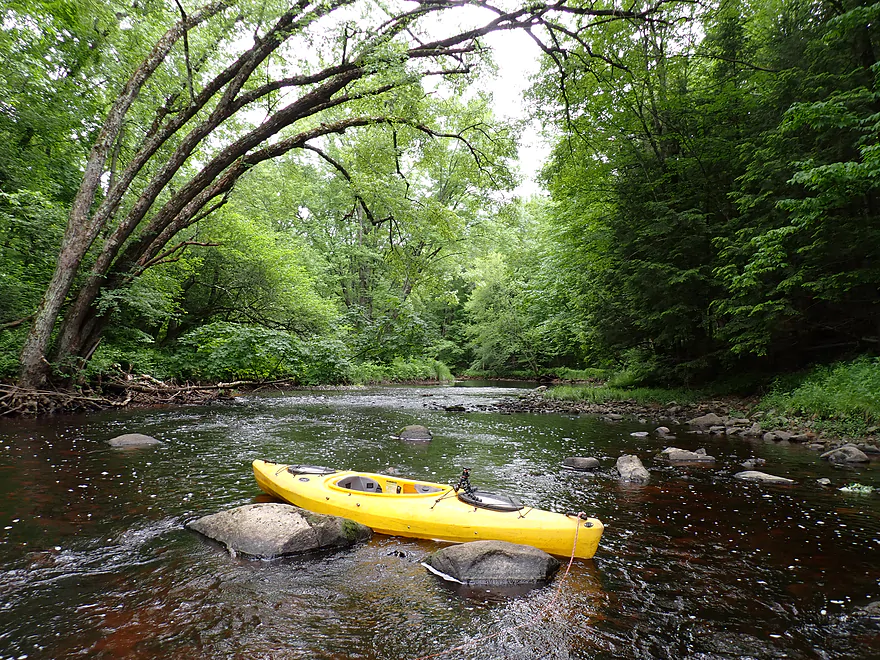
About a mile upstream from Shady Lane Road was the start of a long series (almost a mile long) of rapids and boulder gardens. Unfortunately this was the shallowest part of the trip…well, shallow isn’t the right word. There was enough water…just not enough to get over/between the inconveniently placed rocks. It was frustrating to have to walk what should have been fun rapids. But perhaps in hindsight it was a good thing the rapids were so low… The rocks were so irregular that in high water, the resulting pitches might become a rough and dangerous pinball course. There were some really nice and exotic granite outcrops on this stretch. They were very striking when combined with the mosses, ferns, and overhanging hemlocks.
At the end of the boulder field was Shady Lane Road. It looked like you could possibly use the southeast corner as an access, but I didn’t stop there as my plan was to continue to the Wisconsin River.
The last ~2 miles of the trip were very different….much less rocky and much deeper (way easier). The rain which had been forecasted to come in at 5:00, came in two hours early and I got wet. Kayaking in the rain isn’t all bad though…it’s fun to hear the pitter-patter of droplets fall around you. Rain also provides terrific ambiance and contrast for river photography.
What wasn’t so fun were the swarms of mosquitoes. Once the wind died down, they came out of their hiding spots in the weeds and attacked (they certainly didn’t mind the rain). I was ok as long as I kept up a good pace, but if I slowed down, they started biting.
So despite the last two miles having almost no boulders, few riffles, and no outcrops it was surprisingly scenic. Silver maples draped over the channel and provided fantastic reflections on the clear red water. Ferns were a common sight along the banks and there were several sandbars and even a sandbank. The only downside were the two logjams, but those were easy to get past. They looked fresh, and I suspect were caused by the May tornado that hit the Wausau area.
My take-out was located on the mouth of the Wisconsin River. It’s actually upstream from the railroad bridge, but I accidentally overshot it and had to double back. The take-out requires a bit of hiking and is on a sketchy drive, but is public, scenic, and secluded.
In summary this was a nice trip. It started on a good note (~4 stars), but got better as it went on. The second half was terrific (5 stars) and included incredible boulder gardens, outcrops, clear water and ferns. I’m not sure I can recommend this trip for casual paddlers though. The river is usually too high or too low (for rec paddlers anyway) with not much of a Goldilocks zone. Something paddlers could do is to scout the channel upstream from WW where there are micro-riffles. If those look too shallow, then much of the trip will likely be too shallow. More concerning is high water when the river can live up to its namesake and be dangerous. There just isn’t a lot of room between the boulders…so during high flow events the river could turn into a washing machine. Maybe this trip is only suitable for extremes… Advanced whitewater paddlers with proper gear may want to wait for high water, while rec paddlers may want to do it when low (although not too low) and simply wade the shallow spots (bring rope and wading boots).
Sights included a garter snake, swallows, clams, many crayfish, deer, and an osprey with an aerodynamically-tucked fish in its talons. The lowlight were the mosquitos…lots and lots of mosquitoes.
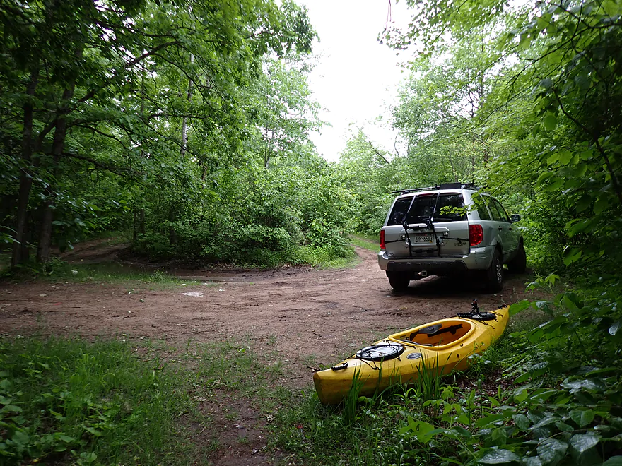
County Road WW: The bank was a bit steep, but this is a plenty doable bridge access.
Alternate Put-ins:
- Buffalo Ridge Road (2.9 miles upstream from WW): I think whitewater paddlers take out at Buffalo Ridge Road, so it should be a doable bridge put-in. I don’t know much about the stretch above WW. It may have “surprises”.
- Shady Lane Road (3.3 miles downstream from WW): I believe you can park/launch from the southeast corner, but a sign does say no overnight parking. Launching here would exclude a very scenic part of the trip…but also a very shallow stretch. Shady to the Mouth is somewhat deeper, more navigable, and lacking in major rapids…so I could see beginner kayakers maybe starting here.
Jesse Park: The public access is located just before the confluence of the Trappe and Wisconsin Rivers. Finding it (both from car and from boat) can be a bit tricky. From boat, it is just southeast of the railroad bridge. If you end up on the Wisconsin River, you’ve gone too far. Weedy banks obscure the faint trail, but it does exist. This will necessitate about 100′ of boat dragging to reach the dead-end drive, which includes going up steep wooden stairs (rope helps…mind the broken glass). At the top of the stairs is a dirt/sand cul-de-sac. Note, this road is in poor shape with deep ruts. If it gets muddy or your car doesn’t have good clearance, you may want to park on Wisconsin River Road instead but that would mean ~400′ more boat dragging. Despite the stairs and beat-up drive, I liked this take-out. It was scenic and very secluded.
Alternate Take-outs:
- Shady Lane Road (2.2 miles upstream from Jesse Park): I believe you can park/launch from the southeast corner, but a sign does say no overnight parking. Ending a trip here is perhaps viable and might be an option for those only interested in the boulder gardens, rapids and cliffs.
- Brokaw Mill Landing (4.2 miles downstream from Jesse Park): This is a great landing. I could see paddlers wanting to pad a bonus 4 miles on the Wisconsin River if they launched from Shady Lane Road. This is a nice stretch of the Wisconsin.
Bike Shuttle – Jesse Park to Cty Road WW: 4.0 miles with 79′ of ascent. I thought this was an easy and pleasant bike shuttle. Note, Buck Trail Road is in theory more direct, but it has steep hills. 0.4 fewer miles for 120′ more feet of hill climbing is a bad trade-off. You want to turn off of Shady Lane Road and then stay north of the river…not south.
Logjams: There are none upstream of Shady Lane Road. Downstream from Shady Lane Road there are two logjams (they look fresh). These are super easy portages though.
Rapids/Current: Downstream from Shady Lane Road there are just a few minor riffles. But the mile preceding Shady Lane Road contains a number of dense boulder fields with frequent rapids. When water levels are low (like during my trip), these will be mostly Class 1’s with a few Class 2’s. The big problem is they are usually too shallow to run without constantly bumping onto (not into) a rock. However, during high water levels, these rapids likely get to be strong…perhaps many Class 2’s with a few Class 3’s. Only whitewater paddlers in proper gear should attempt the Trappe when high. Portaging some of the rapids would be easy…while others might be tricky (but ultimately doable).
Gauge: Big Eau Pleine River @ Stratford
Trip Depth: 52 CFS or 2.8′
Navigability Estimates: The Trappe doesn’t have a gauge which is a problem as this is a very depth sensitive river. The Prairie River gauge and Eau Claire River gauges are nearby, but I don’t trust either as both are significantly bigger than the Trappe (for reference the Prairie was at 150 CFS and the Eau Claire at 165 CFS). IMO the Big Eau Pleine is the “best” gauge…the river is the same size, rocky and has a similar gradient…but it too is imperfect. You can somewhat scout the river by the bridges. If the section upstream from WW looks too shallow, you’ll be in for a long day. If the rapids upstream from Shady Lane Road look too rough, you could be in for a wet day. Note the strongest rapids are actually out of sight from Shady Lane Road so even that isn’t a good guide.
Be very skeptical of the following estimates…these are just rough guesses.
- < 41 CFS: Ultra low…not kayakable in any form.
- 41-80 CFS: Very low…at 52 CFS the open stretches were plenty deep enough, but most riffles were too shallow to go down. The river downstream from Shady Lane Road though is more navigable.
- 81-120 CFS: Low…bring wading shoes and rope as you will have to pull your boat over a number of riffles. Determined paddlers may still enjoy a trip at these depths.
- 121-300 CFS: Maybe a sweet spot in which the river isn’t too shallow or too rough. I really don’t know though.
- 301-500 CFS: High depth…maybe only suitable for skilled whitewater paddlers.
- 501+ CFS: Very high depth…definitely only for expert whitewater paddlers.
Click here to see an overview map of the Trappe River.
- Upstream from Porcupine Road: The river splits and is too small for kayaking.
- Porcupine Road to Sunrise Road: 2.8 miles. Small and narrow with some boulder gardens and possible geology. Likely mostly flat woodlands though. I don’t know much more.
- Sunrise Road to Hwy G: 1.8 miles. I don’t know much about this stretch. It could have tricky rapids and logjams…or be pretty tame.
- Hwy G to Hwy J: 2.2 miles. This stretch should have numerous light riffles, hemlocks and spruce. More info from Rick Kark. Per AmericanWhitewater.org, this is mostly just swift-flowing water with few actual rapids.
- Hwy J to Trappe River Road: 0.6 miles. A few sets of rapids…maybe Class 1+.
- Trappe River Road to Buffalo Ridge Road: 3.0 miles. Section includes the famous Trappe River Dells (Class 3+). This can be very dangerous (especially in high water) and should be scouted and portaged if need be. More info from American Whitewater.
- Buffalo Ridge Road to Hwy WW: 2.9 miles. There is little documentation on this section. It’s probably shallow, rocky and filled with some rapids. I suspect it’s mostly manageable but there could be “surprises”.
- Hwy WW to Jesse Park/Mouth: 5.5 miles
- Hwy WW to Shady Lane Road: 3.3 miles. A very scenic but very shallow stretch. The last mile is almost continuous boulder gardens with many rapids. In low water it can be difficult to fit between the rocks…but in high water these could be dangerous Class 3 rapids. I doubt there is much of a Goldilocks zone.
- Shady Lane Road to Jesse Park: 2.2 miles. This leg is somewhat deeper and less rocky than the previous legs. The scenery is very different but very good with overhanging trees, small sandbars, clear red water, and a medium-sized sand bank.
- Jesse Park to Brokaw Mill Landing: 4.3 miles. This would be a bonus leg on the Wisconsin River. It’s an easy and attractive paddle.
Trip Map
Overview Map
Video
Photos Size: