
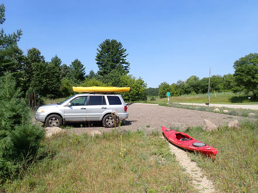
Starting the trip at Dixie Ave…nice access
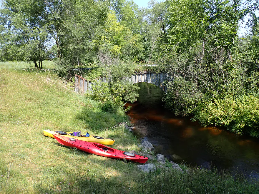
Rocky access by the river
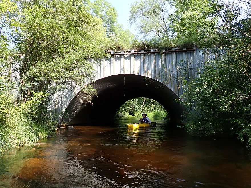
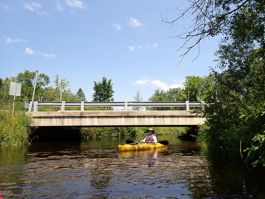
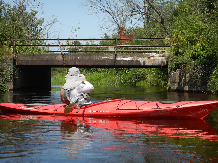
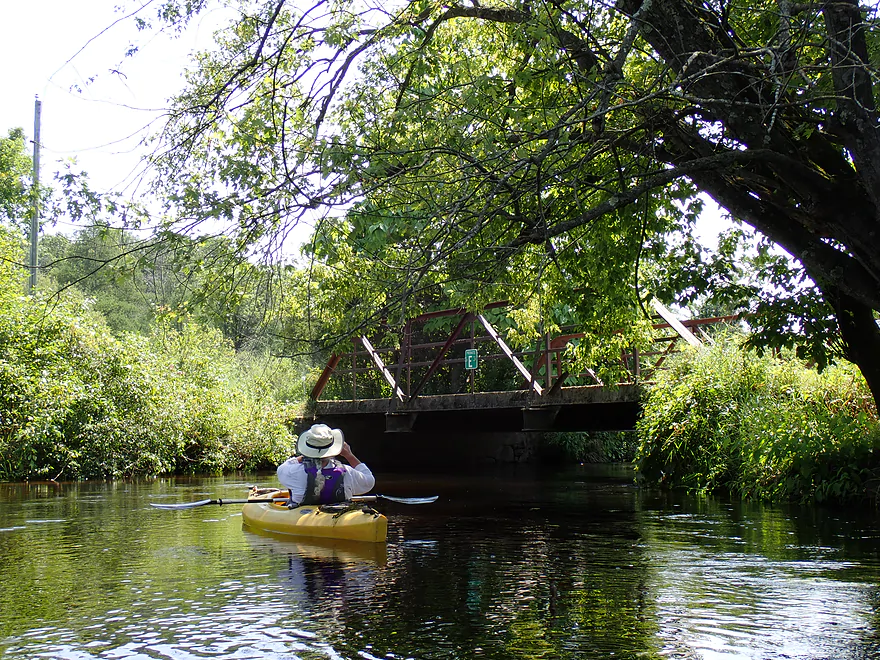
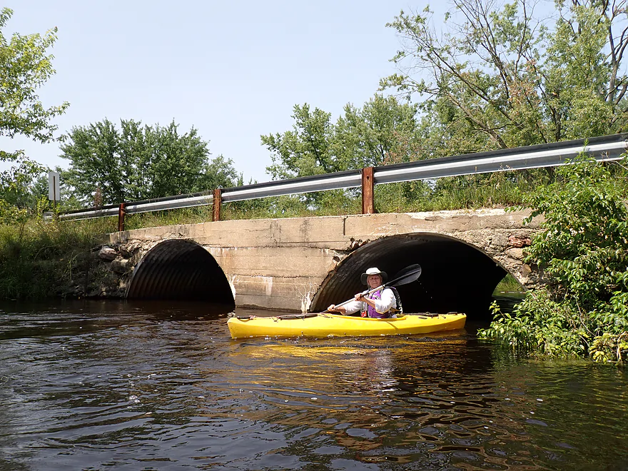
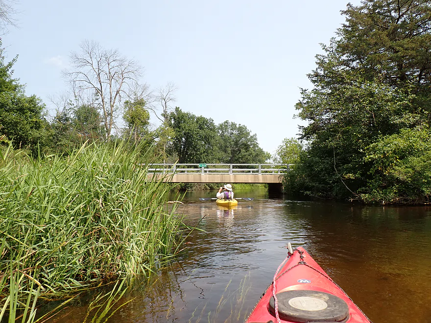
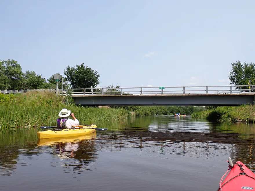
Cool bridge and culvert
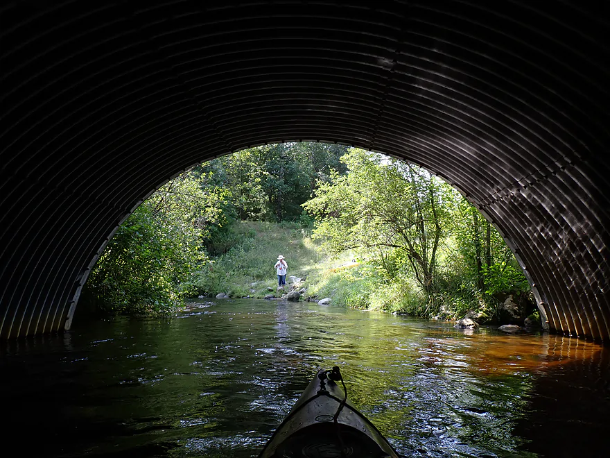
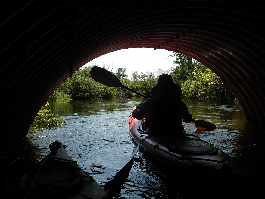
View from inside
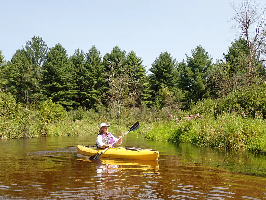
Water was on the high side–a consistent 4-5 ft. the whole trip
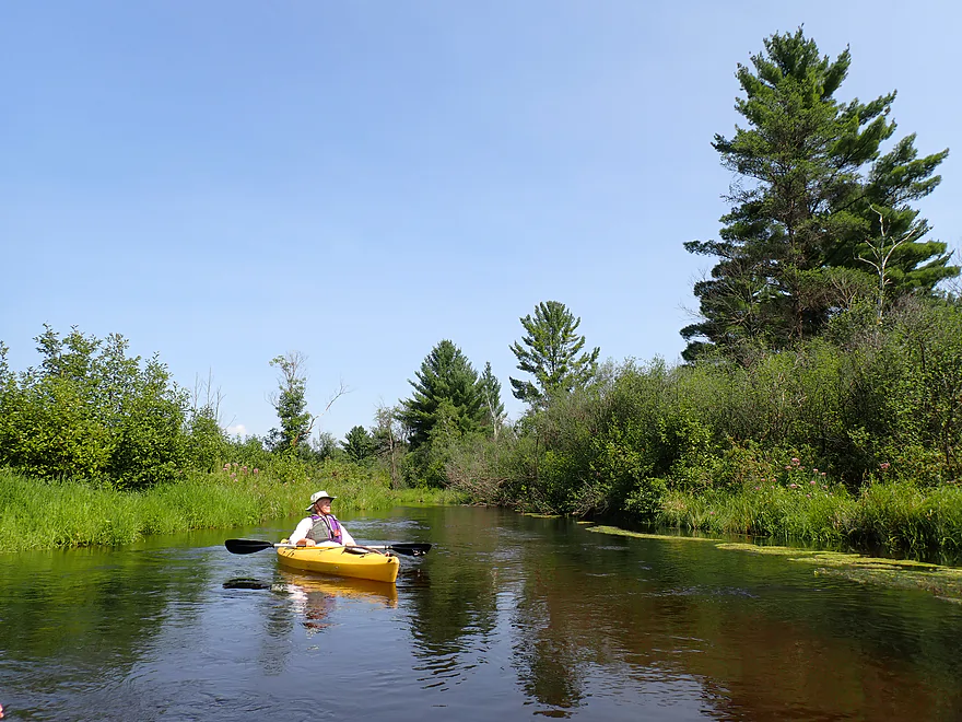
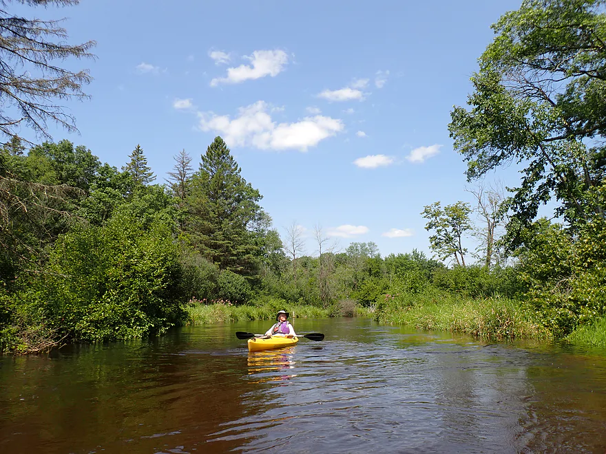
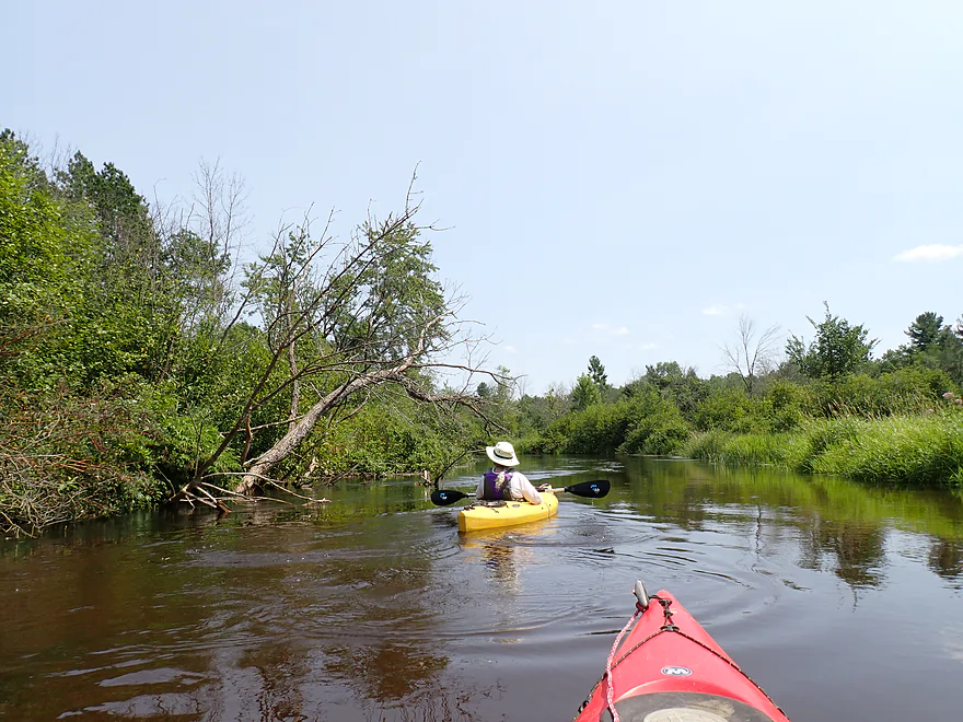
Alders, joe-pye weed, and white pines lined much of the river
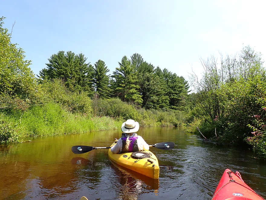
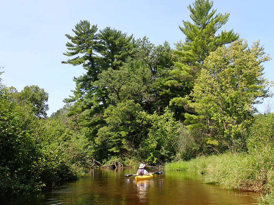
A larger stand of white pines
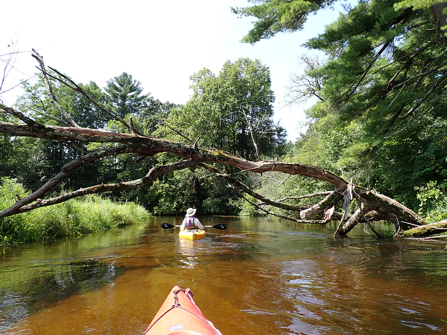
Locals do a good job of clearing out deadfall
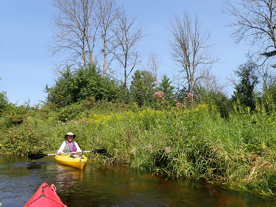
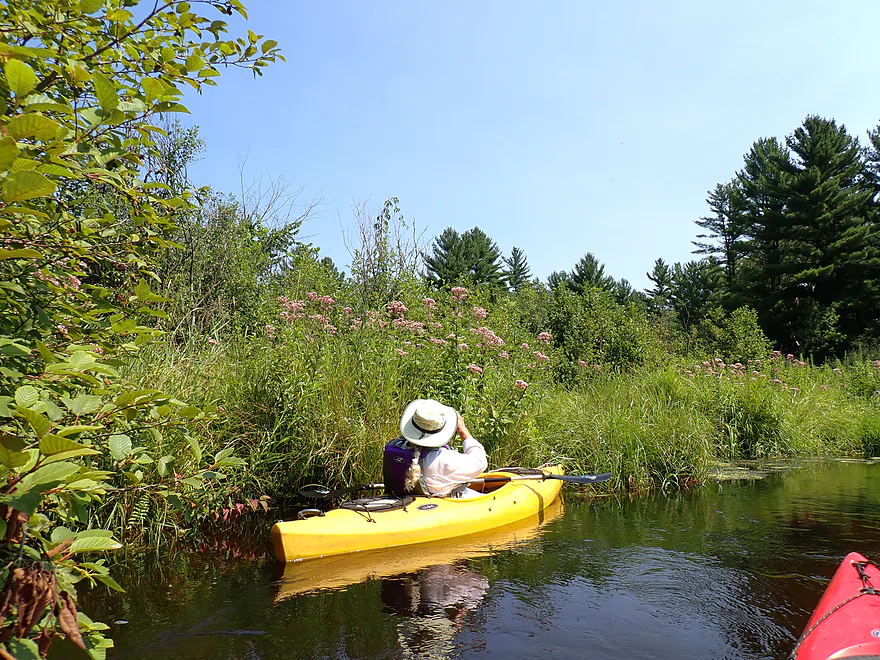
A few joe-pye flowers with goldenrods in back
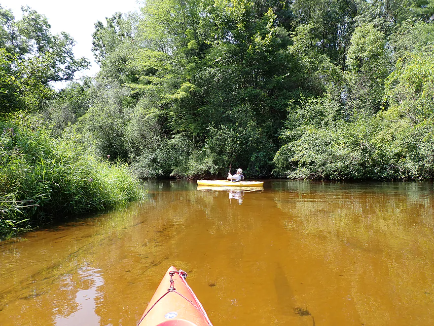
Clear, spring-fed water and a sandy bottom characterize the upper Mecan
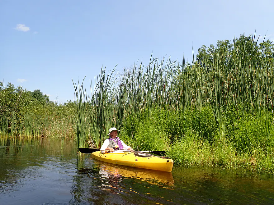
Not many cattails on the trip, but some
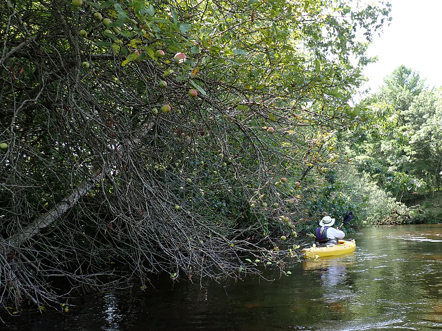
An apple tree (perhaps the progeny of a previous kayaker’s lunch)
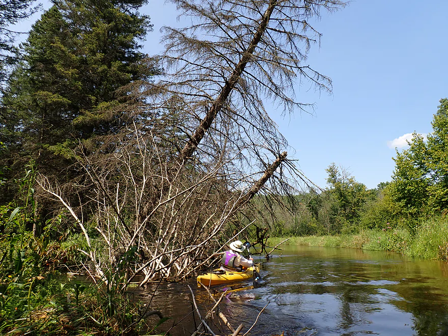
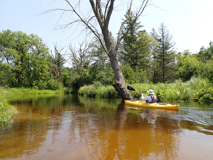
Leaning away from a leaning black spruce
The yellow-green grass on the left bank is cutgrass (nature’s serrated knife)–beware!
Dover Ave…a good access
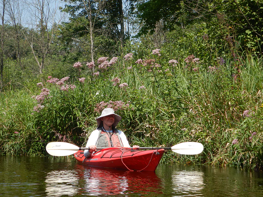
Joe-pye flowers gave a pale purple color to much of the streambank
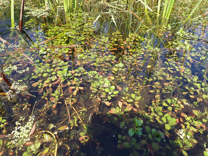
An interesting submerged plant (not sure what this is)
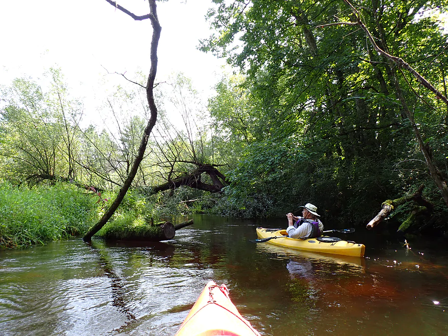
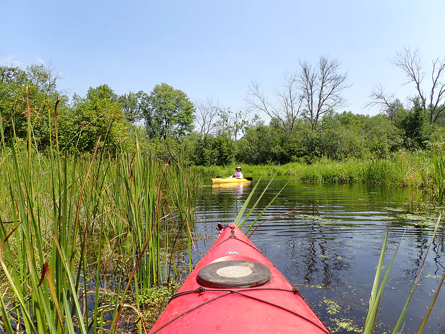
Exploring a side creek
One of several private bridges
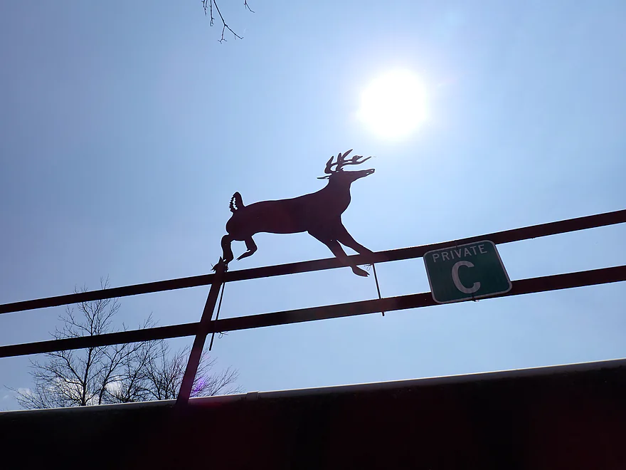
Nice little deer silhouette
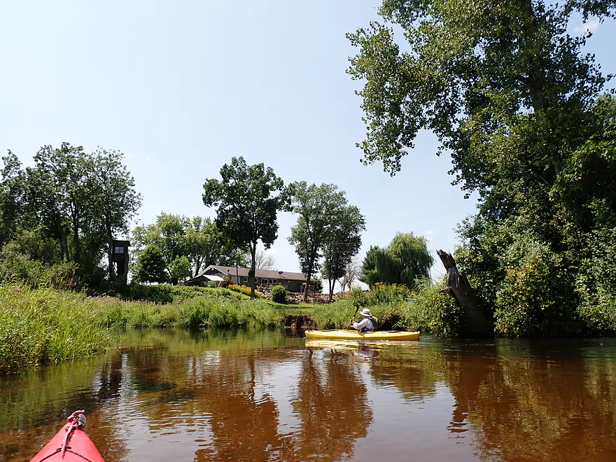
One of the few houses we saw on the trip
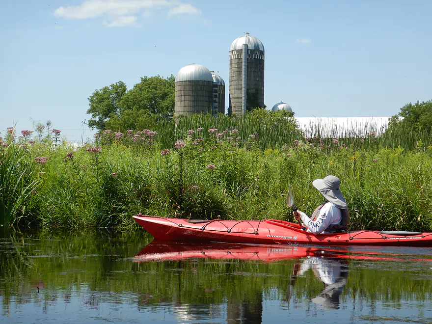
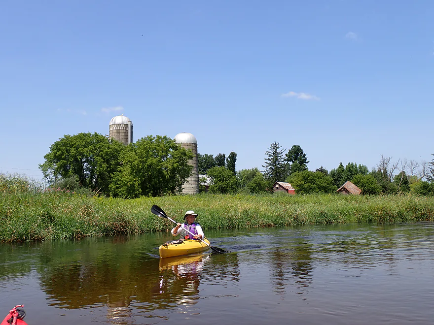
The only farm we saw
Another private bridge
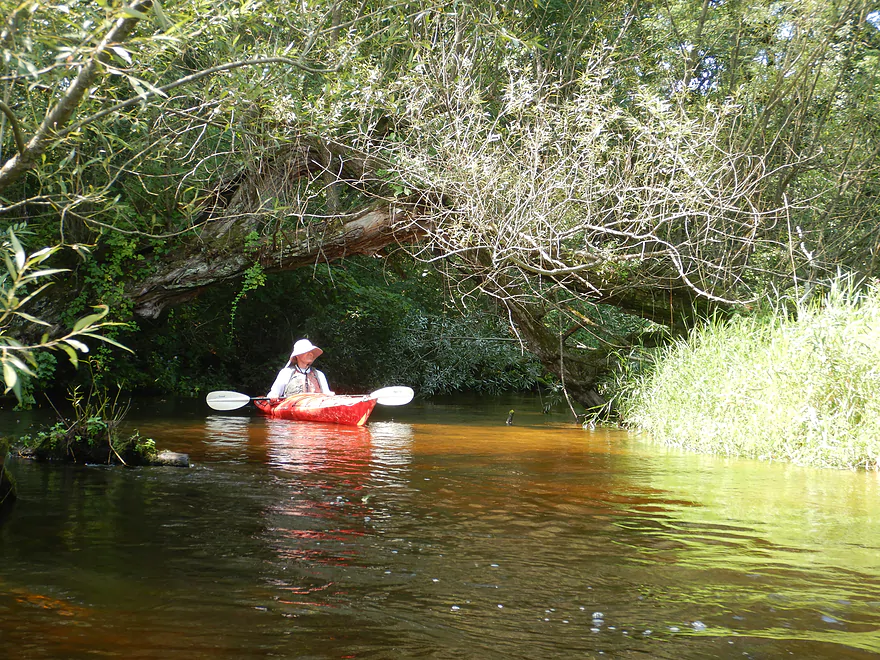
Water has a red hue
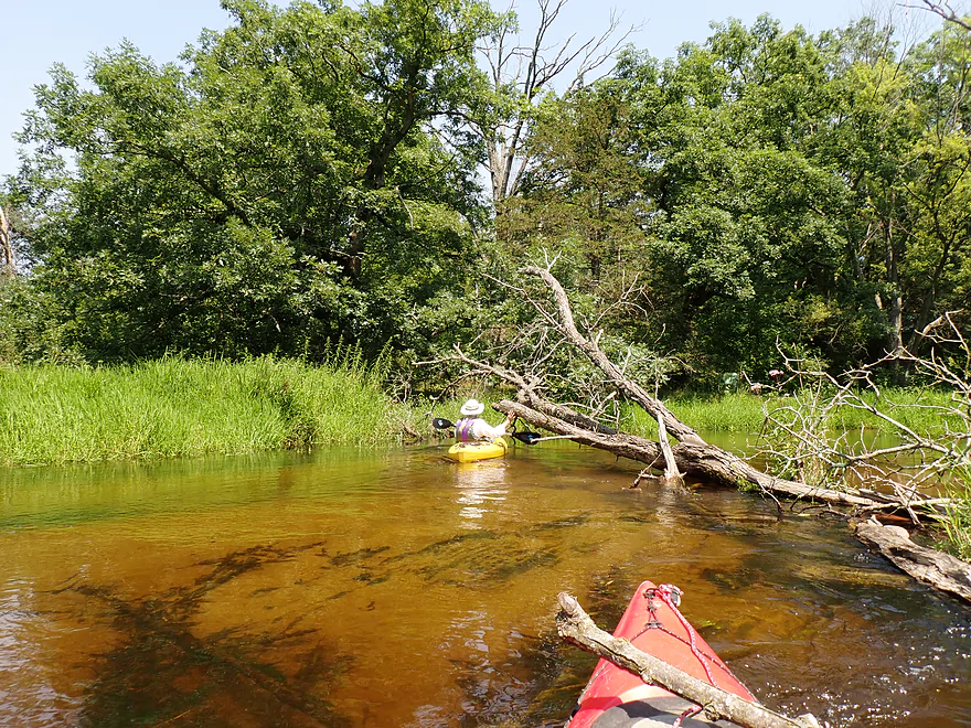
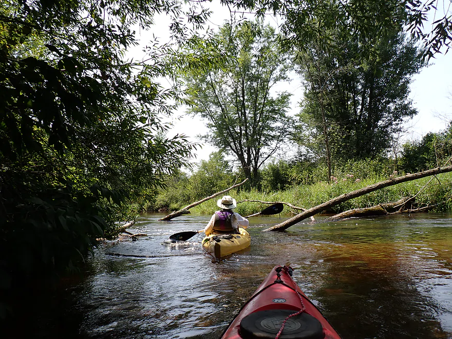
Downed tree…easy to hop over
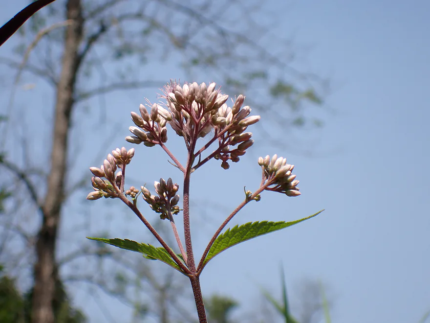
A closeup of a joe-pye flower
Hwy E–two culverts to pick from
15th Drive
Which is soon followed by Hwy 22
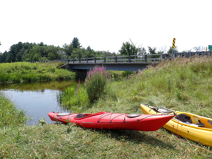
Good take-out
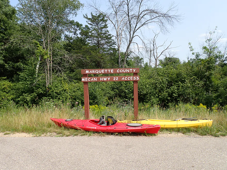
Official take-out
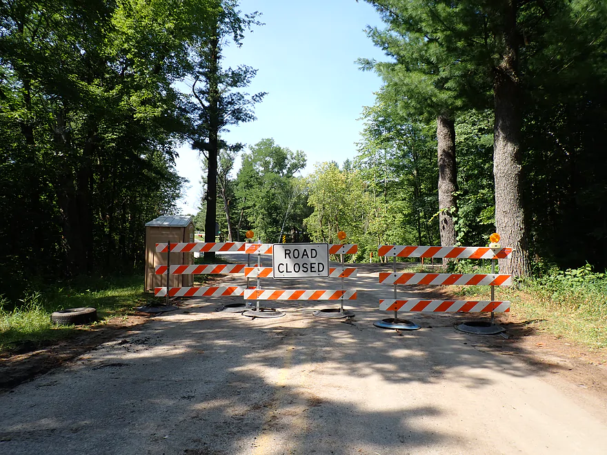
Scouting the Dakota/Hwy Y construction scene
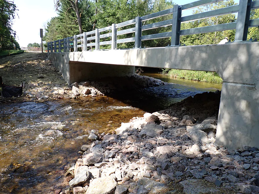
The culvert here has been replaced with a concrete bridge…it will be reopened in mid-August
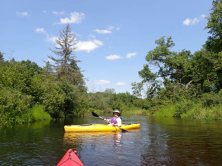
Mecan River – Dixie Ave


The Mecan is a great paddling river located north of Portage. The best and most scenic parts are upstream from Dixie Ave. But for this trip, I wanted to change things up and explore a less popular stretch to see how it compared.
The trip started at Dixie Ave, which has a great public put-in. There is a small parking lot just for paddlers, and a trail leads down a hill where you can launch by a scenic tunnel (well, culvert) and rocky banks (well, riprap).
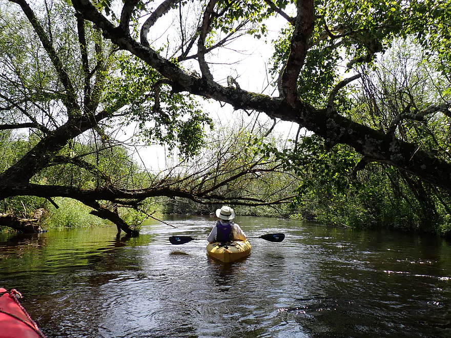
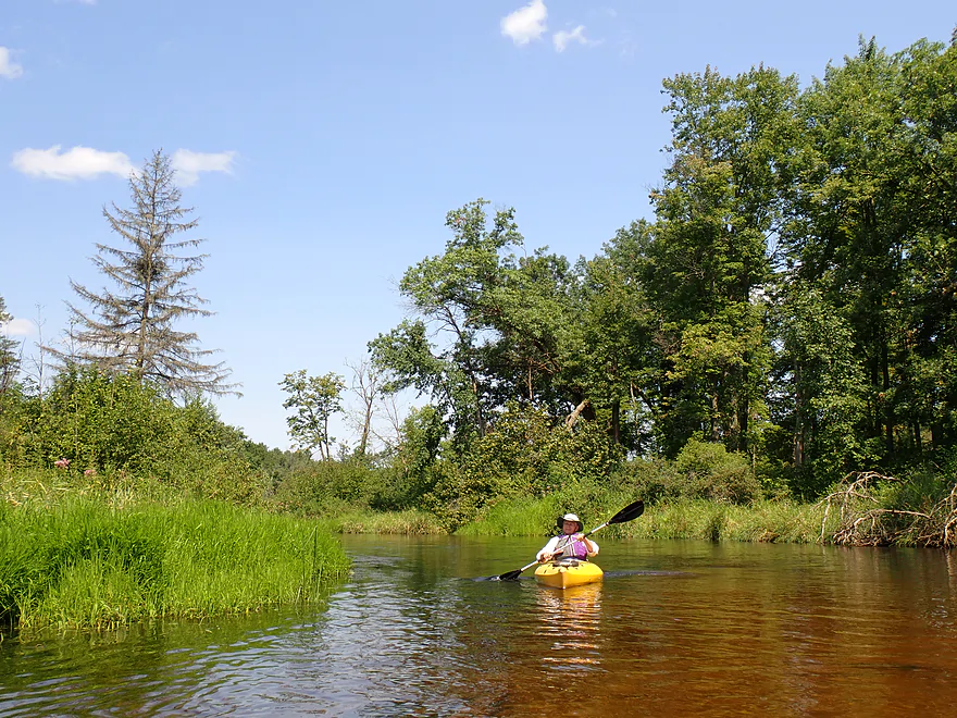
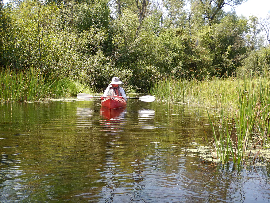
Much of the Mecan flows through open marshy bottoms, has shrubby banks, and features crystal clear, spring-fed water. Homes are rare and farms almost nonexistent, giving the river a very private and remote feeling. The first two miles of this trip (Dixie Ave to Dover Ave) carries on this tradition and is largely an enjoyable, undeveloped stretch of river. There are tons of twisty turns in fast current, and the water is cold and slightly red-hued from tannins in the water.
Unfortunately water levels were up relative to my last Mecan trip, but even at normal depths, this stretch is definitely deeper than previous legs and averaged a continuous 4-5 ft. This would be a great paddle for taking swim breaks on a hot day, especially with the smooth, pristine sand bottom and clean water. The current was very fast, making this a great “rubber ducky” river (just sit back and let the current do the work), but it also made it very hard to stay in place for photos or backtrack upstream.
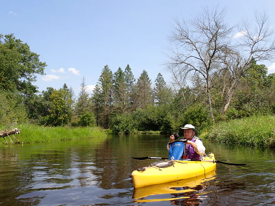
After Chaffee Creek joins up, the Mecan starts to feel like a small river and no longer like a big creek. The river bottom seems to broaden somewhat and higher ground (with oaks and pines) occasionally appear close by.
After Dover Ave, the river really becomes less interesting. There are more alders (a boring shrub), weedy grasses (including cut-grass), and scruffy banks. But there were still nice spots…including some with August flowers and cattails. One of the highlights of the Mecan River are its white pine trees, but they really started to peter out after Dover. Interestingly, tamaracks, which are common on the upper legs, didn’t appear until the end of the trip.
This area of the state was hit by strong storms earlier in the year, but despite this deadfall was never an issue. Locals do a great job of keeping the river navigable. There was only one downed tree upstream from Hwy E, and that was easy to “hop” over.
There were lots of bridges on this leg (9), so you should study a map ahead of time so you don’t get confused. Generally speaking the bridges are labeled on the upstream side, and the private bridges will be lettered, so you know these are not for public access.
We ended the trip at the Hwy 22 landing, which was a nice access. We saw other kayakers use this access, along with a small flotilla of tubers heading downstream on a variety of inflatables, including one that looked like a llama.
In summary, this was a pleasant trip…but not nearly as nice or scenic as the upstream legs. If you’re new to the Mecan, definitely start with 11th Road to Dakota or Dakota to Dixie…those are way better. Dixie to Dover isn’t a bad leg, and can be a decent add-on for those looking to do longer Dakota trips. Dover Ave onward is ok…but is markedly less interesting. It’s still a good experience though and the fast, clear current is a lot of fun.
Sights included some small fish, two deer, a painted turtle, and evidence of beavers. The Mecan is known for its trout populations and areas of the river are open for public fishing.
In 2024, Waushara County is replacing the culvert at the Dakota access with a concrete slab bridge. It’s unfortunate that they did this as the old culvert/tunnel and rapids were really cool. The new million dollar bridge and its ugly riprap are almost done and are scheduled for completion on Aug 23rd, 2024. As of August 3rd, the road to the Dakota access is still closed, but in theory you could park at the “Road Closed” sign and just drag your boat to the water.
Ice Age Trail – Mecan River Segment: A section of the Ice Age Trail is located nearby, and while I haven’t hiked it, it sounds like it is worth checking out.
Dixie Ave: This is a great put-in. From the public parking lot, you can drag your boat down a hill and launch among the rocks. The access area is scenic and back-dropped by a large culvert. Alternatively there is a faint path east of the river which locals also use as an access (less steep and less rocky).
Alternate Put-ins:
- Hwy H/JJ/Dakota (5.3 miles upstream from Dixie): This is a scenic and popular put-in. Note, the access has been closed for much of 2024 to replace the bridge, but this is almost done and should be reopened by mid-August 2024. The leg below Dakota is one of the best stretches on the river.
- 14th Ave (2.5 miles upstream from Dixie): This is a decent shoulder access. The leg below 14th Ave is good…better than the leg below Dixie, but not as good as the leg below Dakota.
Hwy 22: There is a good public access northeast of the bridge. If you park here, make sure you don’t block other vehicles from entering or exiting.
Alternate Take-outs:
- Dover Ave (2.5 miles upstream from Hwy 22): A good shoulder access. The leg upstream from Dover is much more interesting than the leg below Dover.
- Hwy E (0.7 miles upstream from Hwy 22): I don’t think many paddlers take out here because of the fire hydrant, but you should be fine as long as you don’t block the hydrant with your car.
Bike Shuttle: 3.0 miles with 20′ of ascent. This would be a super easy bike shuttle.
Mecan River Outfitters: This is a possible rental and shuttle option. Typically though they prefer to service the far lower Mecan closer to the mouth. You should contact them before committing to a trip to make sure they would be willing to go farther north.
Rapids: None.
Current: The current is consistently fast while not really being that dangerous. This was one of the highlights of the trip.
Logjams: None. There was a downed tree upstream from E, but it wasn’t difficult to “hop over. Perhaps in lower water it may require a portage (which wouldn’t be difficult). Here is an exact location.
Low Bridges: There are many bridges on this trip, but none were low enough to be trouble. This could change in high water though, and at that point some might have to be portaged.
Trip Depth: 13.4 CFS or 3.68′ per the gauge at Chaffee Creek @ Coloma (which isn’t a great analog for the Mecan).
The following are only very rough estimates.
- < 3.59′: The river rarely gets this low.
- 3.59-3.60′: A relatively low depth but should be navigable.
- 3.61-3.63′: An average late-fall depth and a good target range.
- 3.64-3.68′: Above average depth.
- 3.69-3.72′: High depth…but should be navigable. Clarity might not be as good.
- 3.73’+: A relatively high depth. Likely navigable but perhaps not ideal for kayaking as you might lose a lot of good clarity.
Detailed Overview
Generally speaking, the further upstream you go on the Mecan, the better. Upper Mecan segments tend to have less mud, better current, better clarity, and more attractive shorelines.
- Mecan Springs to 9th Ave: 1.4 miles.
- Mecan Springs Boat Launch to Hwy GG: 0.6 miles. The river starts as a spring-fed lake sandwiched between two moraines. This is a neat lake paddle with clear water and visible springs located mostly along the western end. Trip length can be expanded by 1-2 miles if you explore the various bays throughout the lake.
- Hwy GG to 9th Ave: 1.4 miles. The first mile of the river has a few snags to dodge, but is super scenic with nearly perfect water clarity.
- 9th Ave to Hwy 21: 2.3 miles. Satellite maps indicate there could be many logjams and portages.
- Hwy 21 to Cumberland Road: 2.3 miles. Satellite maps indicate there could be many logjams and portages.
- Cumberland Road to 11th Ave: 3.9 miles. A great section with fast current, clear water and scenic white pines. A few logjams to portage but not bad.
- 11th Ave to Hwy Y/JJ: 3.7 miles. A fantastic section and my favorite on the entire river.
- Hwy Y/Dakota to Dixie Ave: 5.4 miles.
- Hwy Y to 14th Ave: 2.8 miles. An excellent section with white pines, tamaracks, narrow twisty turns and crystal clear water.
- 14th Ave to Dixie Ave: 2.5 miles. While not as good as the previous leg and more open, this is still a good stretch. This includes the "Mecan River Pine-Oak Forest State Natural Area".
- Dixie Ave to Hwy 22: 4.5 miles.
- Dixie Ave to Dover Ave: 2.0 miles. An ok section, but not as good as upstream sections. Even more open and slower, with far fewer pines.
- Dover Ave to Hwy E: 1.8 miles. River starts to become less interesting but is still ok.
- Hwy E to Hwy 22: 0.7 miles. Nothing special about this section. Open and somewhat simple.
- Hwy 22 to Germania Marsh Dam: 5.8 miles.
- Hwy 22 to Duck Creek Road/Electric Fence: 4.2 miles. More open and not as interesting, but the brisk current and good clarity are enjoyable.
- Duck Creek Road/Electric Fence to Dam: 1.6 miles. River slows and empties into a mile long shallow marsh. The Germania Marsh features nice scenery and good wildlife. Take-out is on a small access road off Hwy N.
- Dam to Elk Road: 6.3 miles. The most popular section on the Lower Mecan.
- Dam to Hwy N: 5.2 miles. River turns into a flowage pond and marsh. Take-out is on a small access road off Hwy N.
- Hwy N to Elk Road: 1.1 miles. The river completely moves east, creating a really cool corridor.
- Elk Road to Hwy 23: 2.4 miles. Traditionally a section with many logjams, but it does get cleared out periodically by the local livery. Hwy 23 is a poor access option.
- Hwy 23 to Hwy C: 2.7 miles. Again, this usually has logjams but they are often cleared out by the locals. Hwy 23 is a poor access option.
- Hwy C to Mouth: 1.1 miles. Simple open stretch leading to the Fox River.
- Mouth to the Princeton Locks: 3.1 miles. An uninteresting stretch on the Fox River.
For further information on the Fox River, see my Fox River review.
Trip Map
Overview Map
Video
Photos Size:
Did the section from Dakota to Dover last year. Inauspicious start, with a pine sapling stub breaking a toe. Undeterred, I finished the paddle because, well…I was there. Pleasant outing, with the exception of trying and failing to get out for a pee break at Dixie. Too steep and rocky. Dover takeout was much less challenging, with the exception of a smelly deer carcass next to the parking area. All in all, a good trip, with a yummy lunch afterwards at the bar in Dakota.
Thanks for the comment.
We did from Dakota to Hwy 22 on July 5th in our canoe. The river was still quite high and we had to lay completely flat to get under the bridges. Some of them we only had a few inches of clearance. Was still a good trip though. I love the Mecan. We’ve never started any further up stream than Dakota. This was the first of three trips where we could make it over the one log jam you referenced because of the high water, all the others we had to walk around it.
Thanks for the comment. I’m surprised those bridges were so low…the Chaffee gauge I use may not be very accurate. Glad you had a nice trip.