
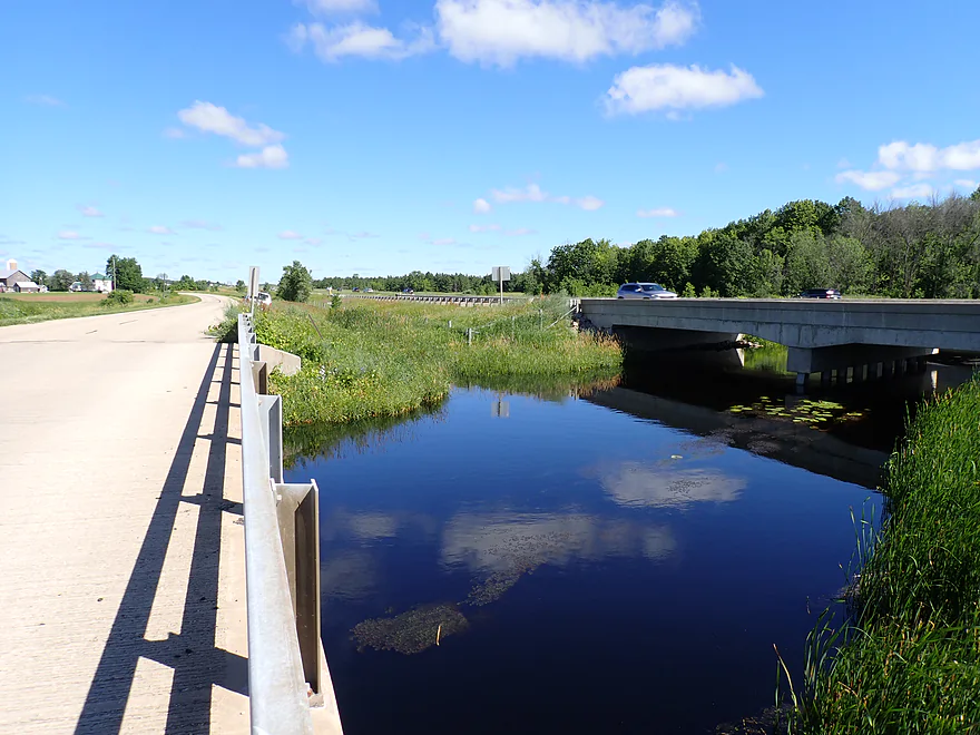
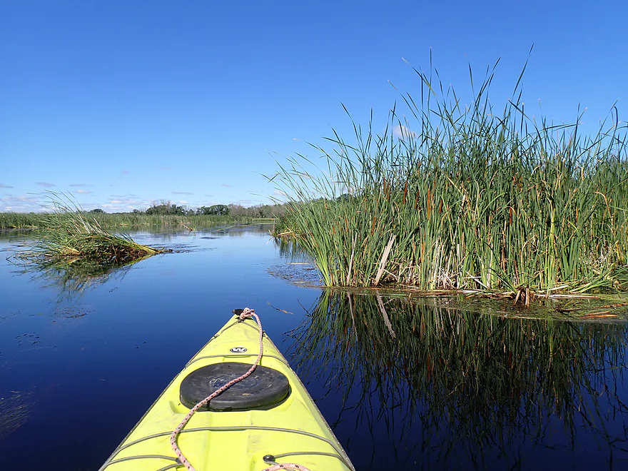
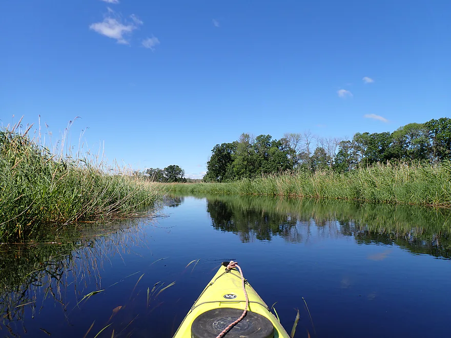
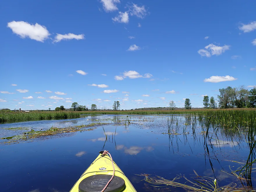
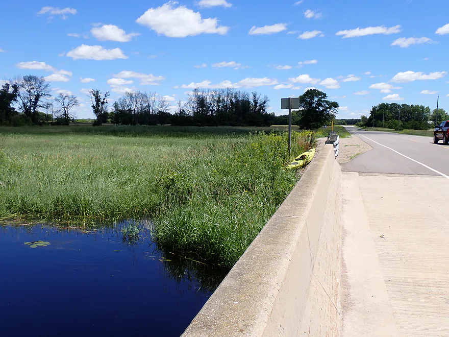
Starting the trip between Bison Road and Hwy 10
Good bridge access
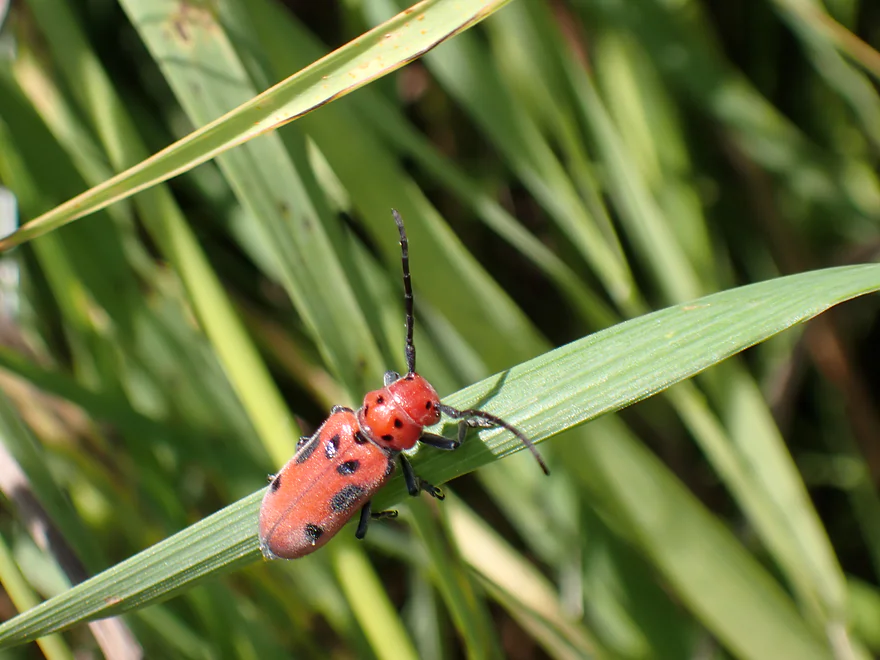
A lot of cool insects hiding in the weeds…this is a red milkweed beetle
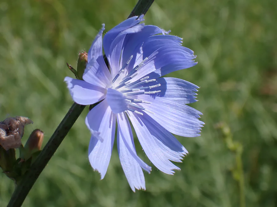
A chicory flower
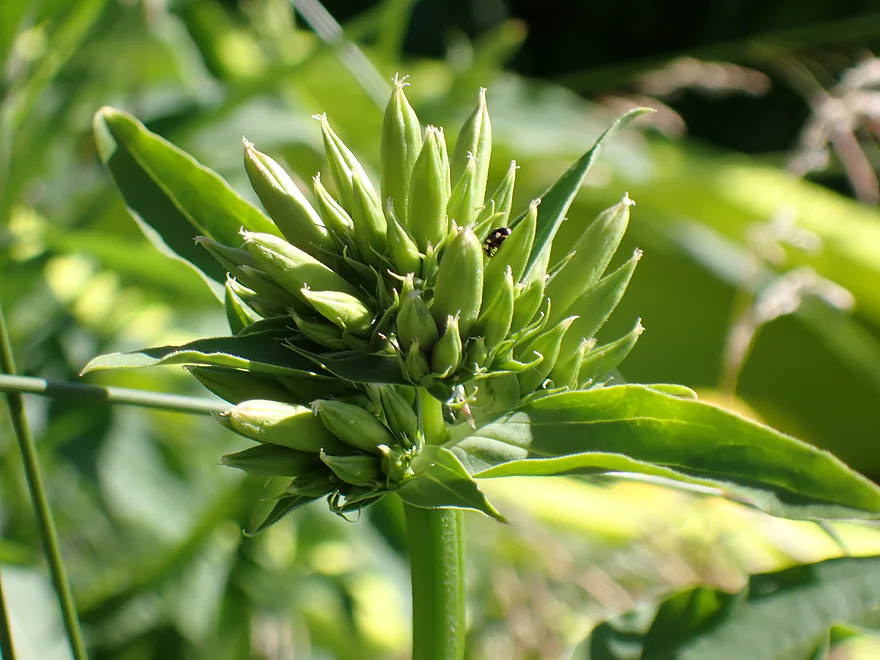
Some interesting flower buds
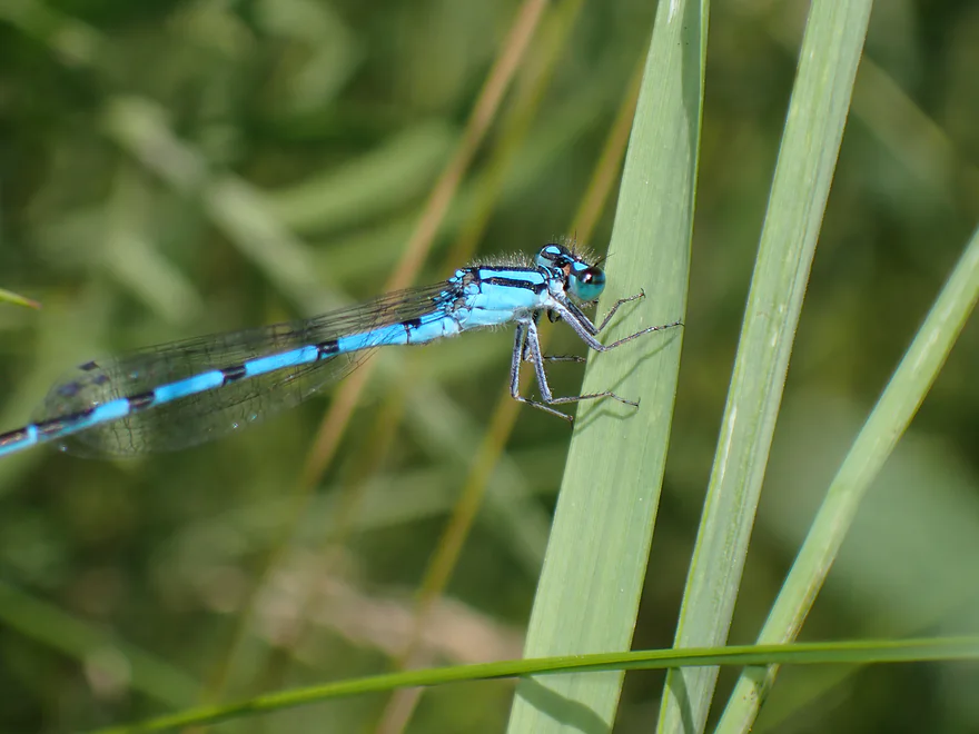
Common blue damselfly
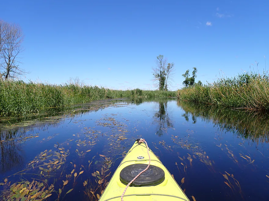
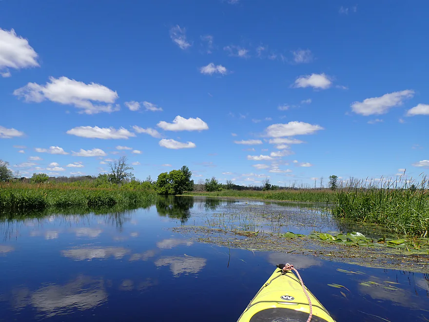
River starts wide, slow and straight
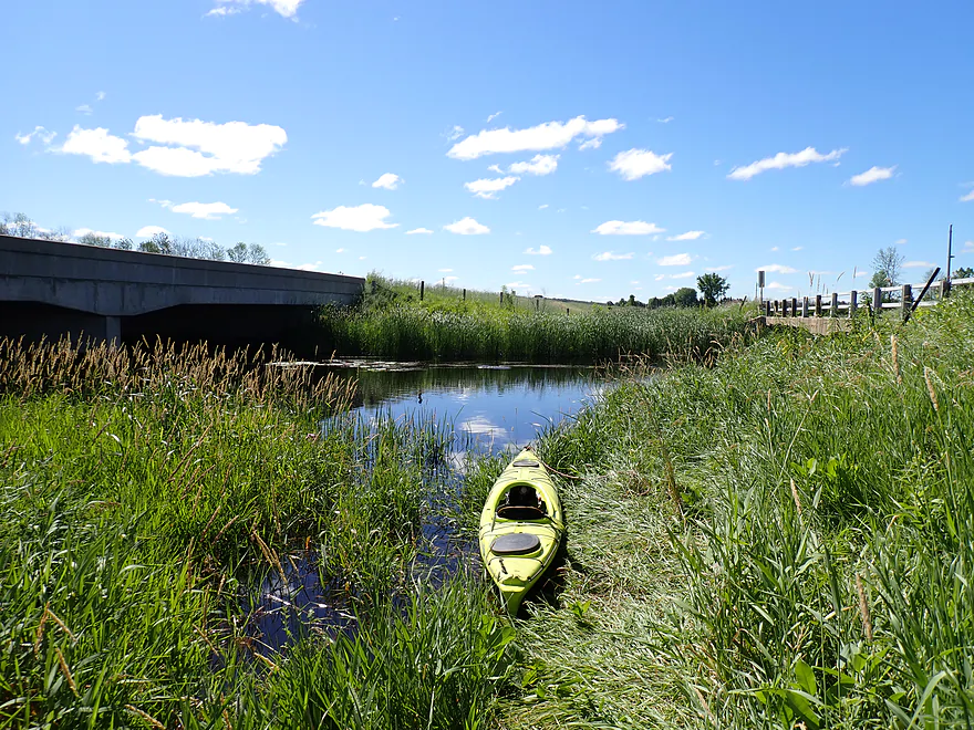
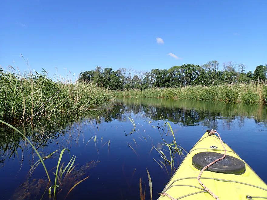
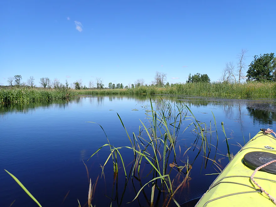
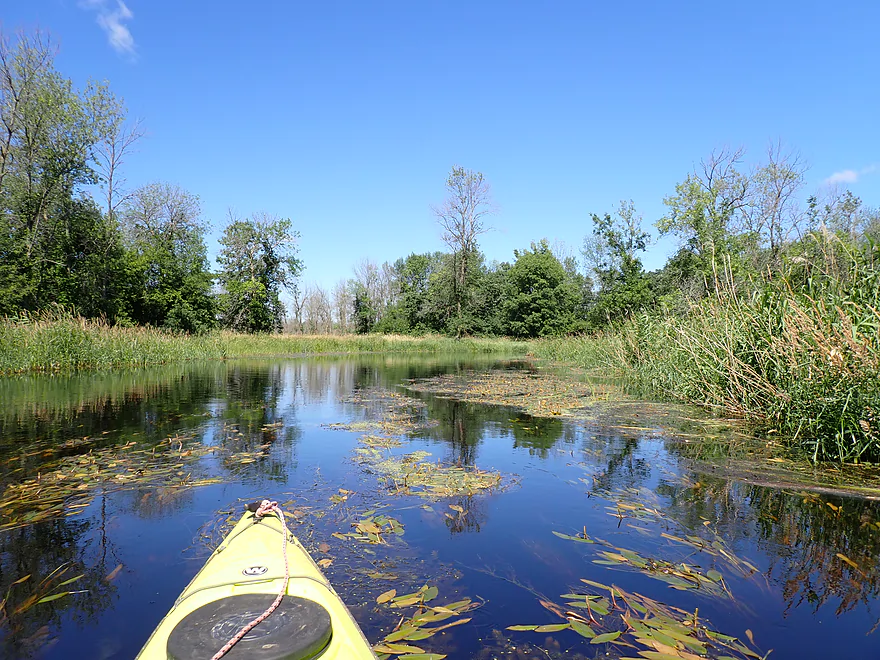
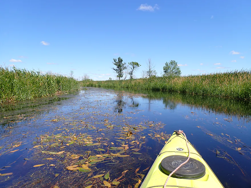
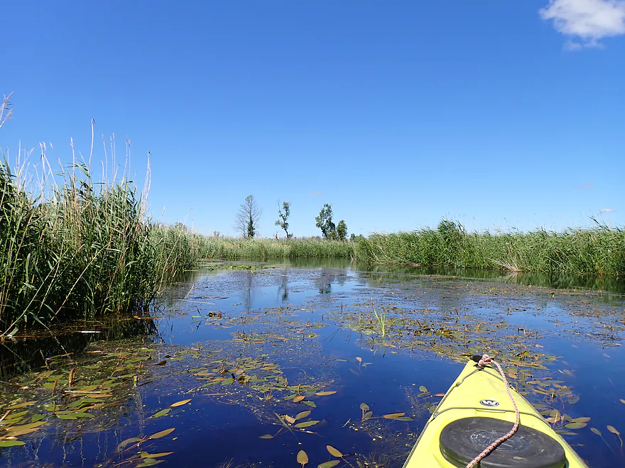
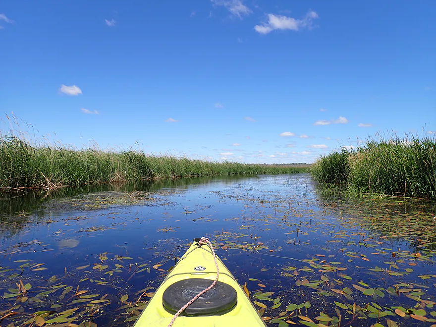
A very marshy trip
Lots of cattails
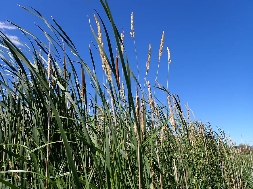
I think this i wildrice…supposedly it can be a problem in the fall
There were a lot of aquatic plants (this is potamogeton)
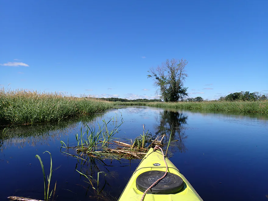
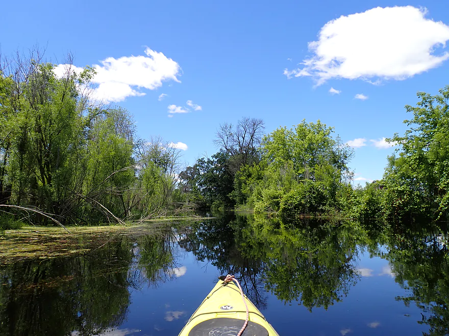
Approaching a rare stretch of woods
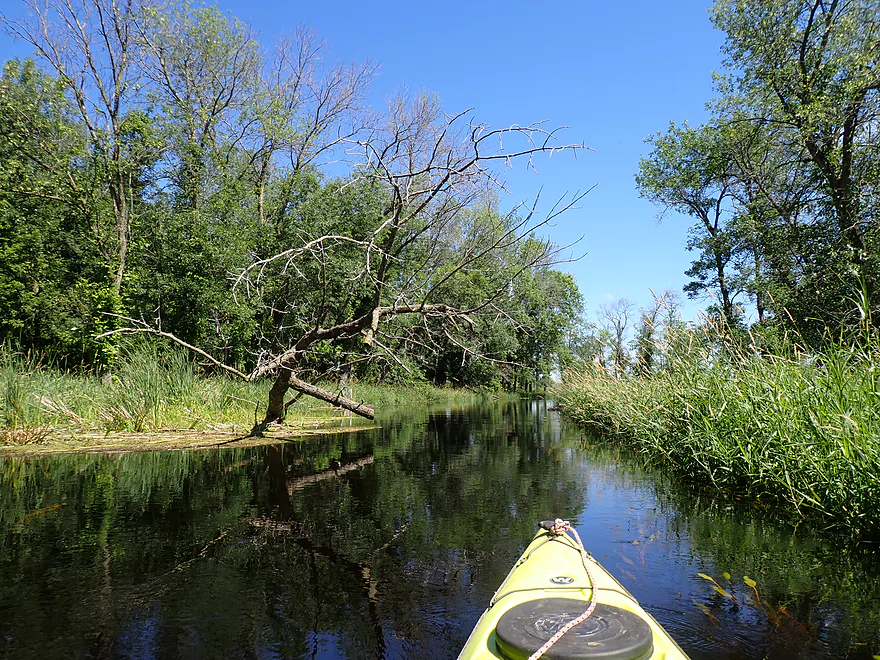
Somebody had chainsawed a gap through the tree
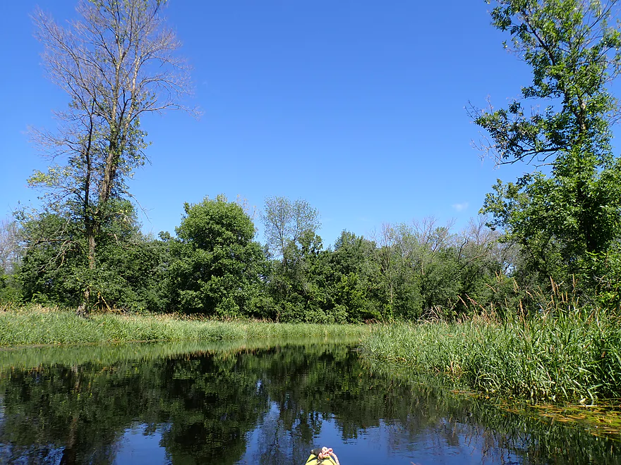
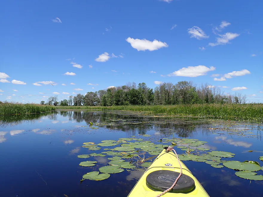
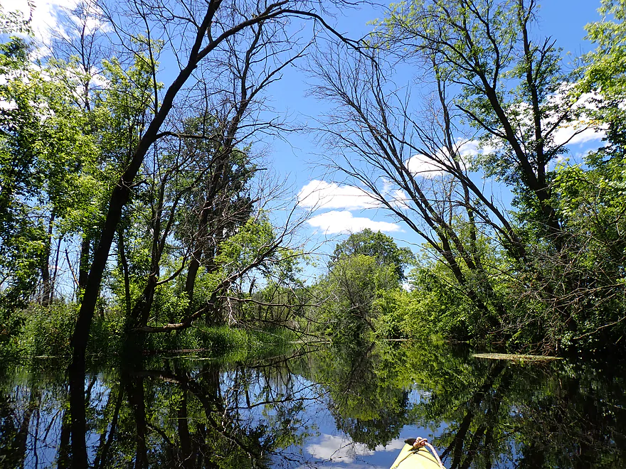
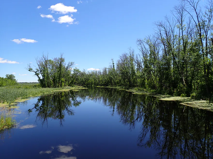
Nice reflections
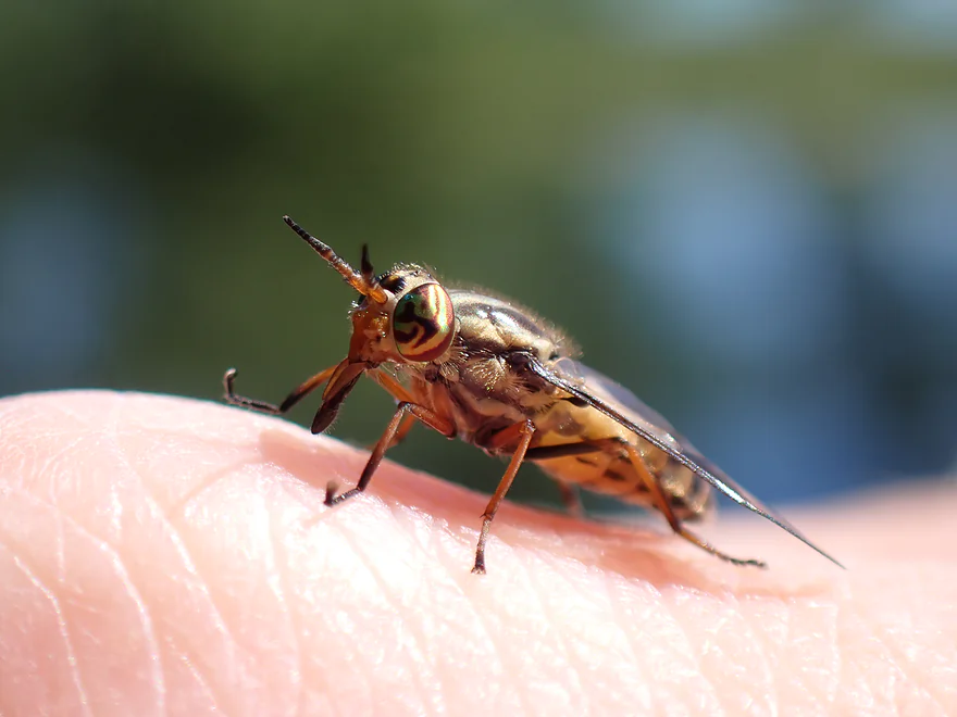
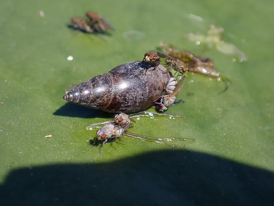
Always cool to photograph fly eyes
Current starts to slow and get more congested
River was maybe 2′ above normal…this could be a “thick” paddle at normal levels
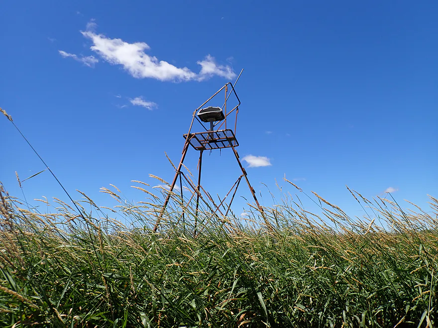
Hunting stand in the middle of nowhere
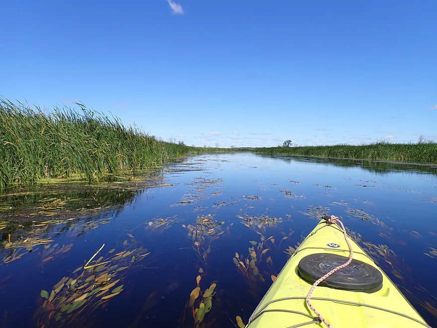
Aquatic plants seem to be getting thicker
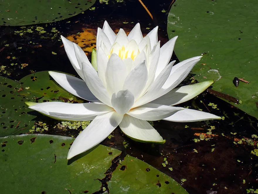
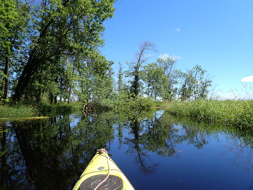
Beauty…
…and the beast
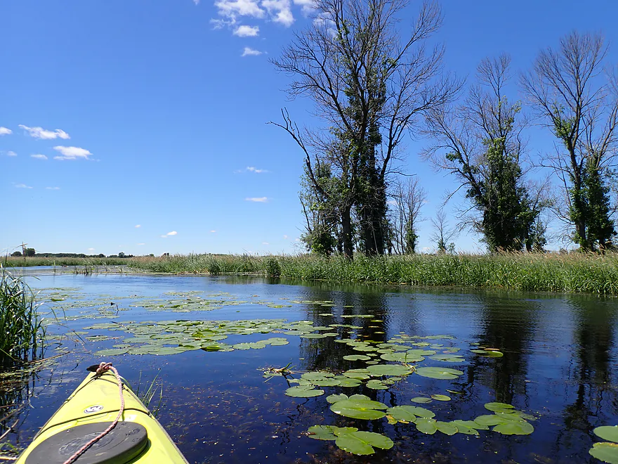
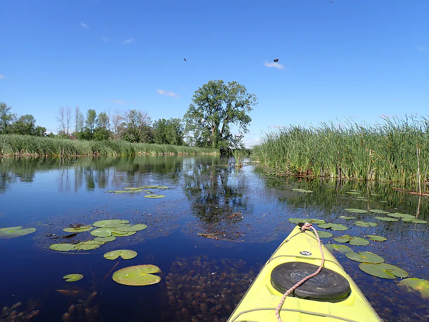
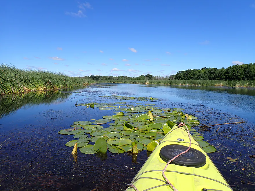
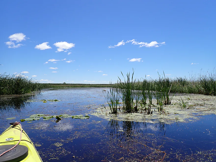
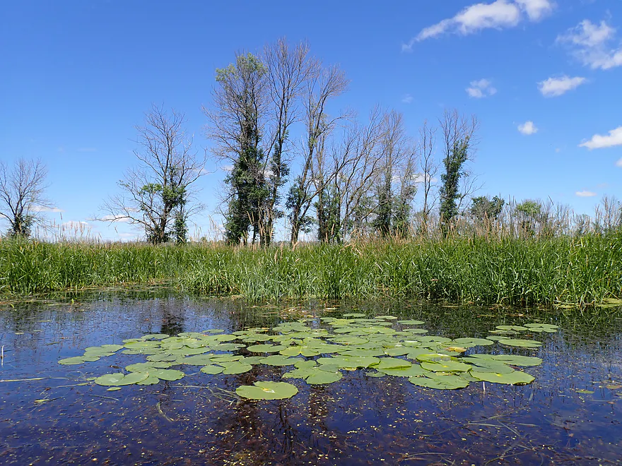
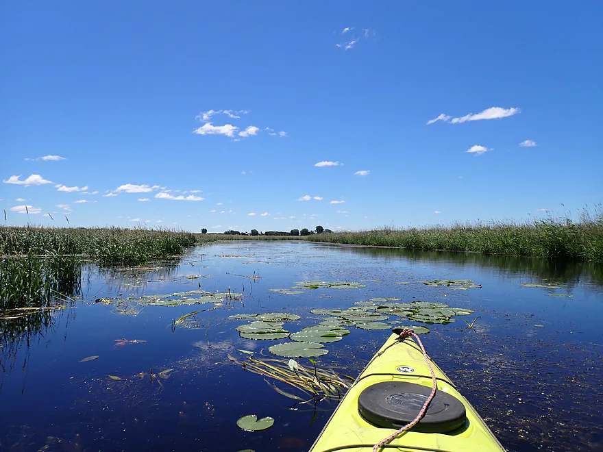
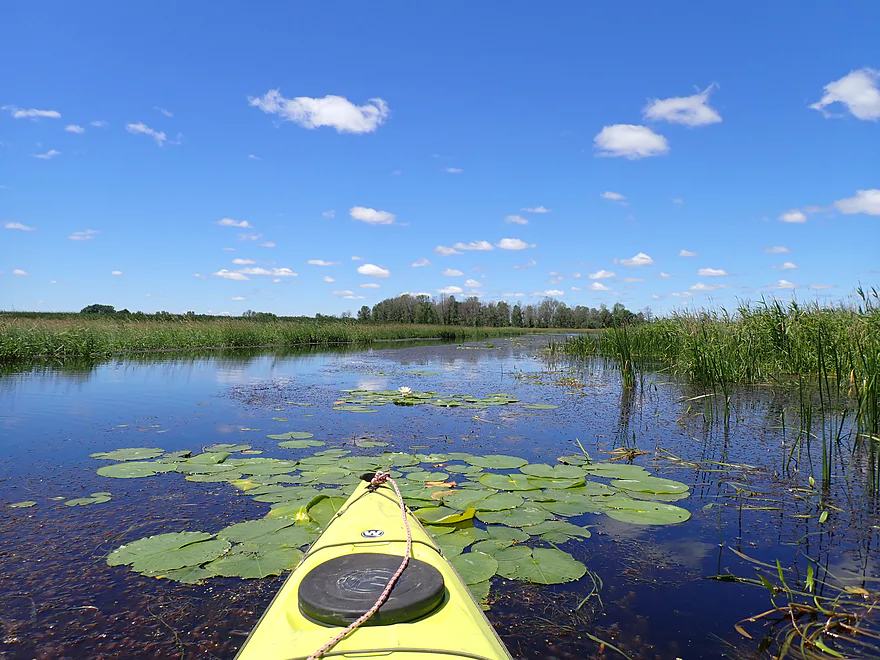
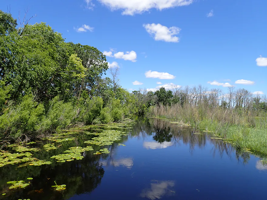
A lot of great lily pads on the river
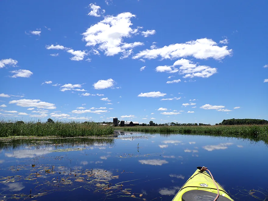
River starts to widen out
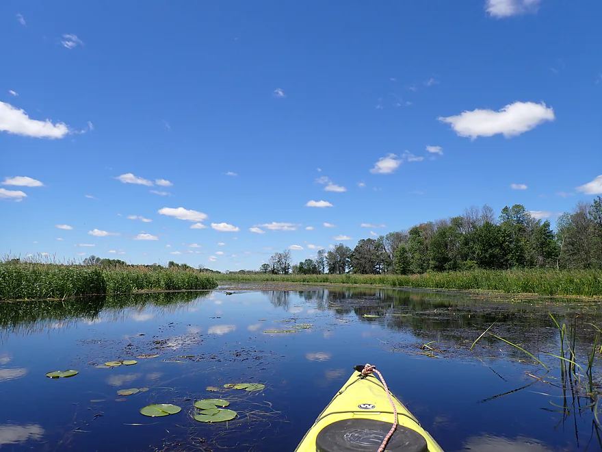
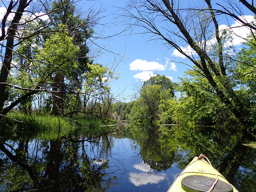
Great cloud day
Paralleling Hwy II
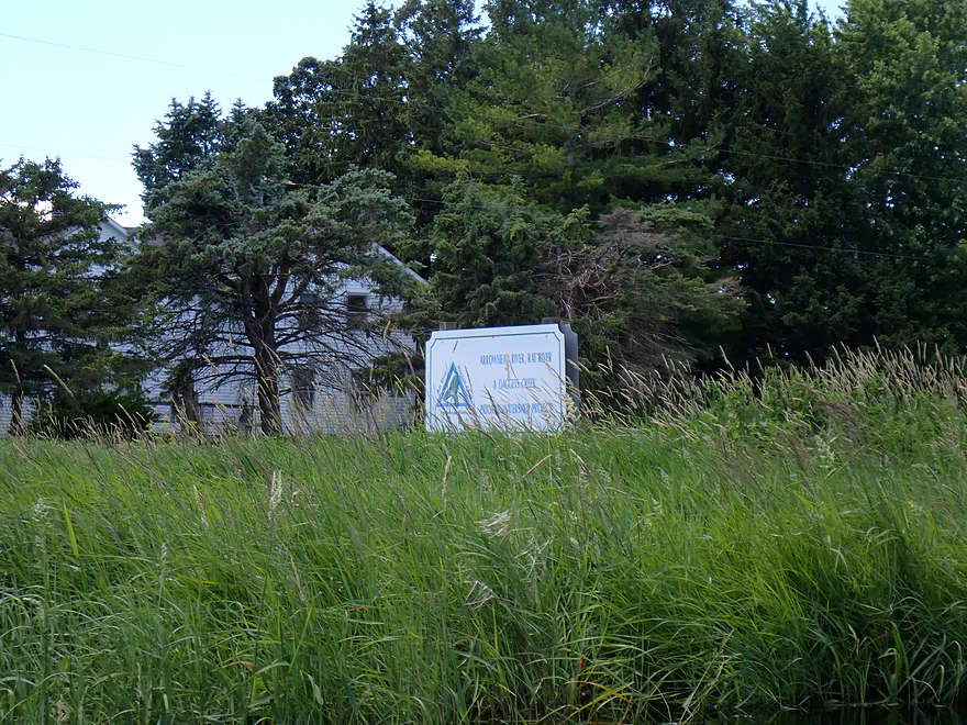
“Arrowhead River, Rat River, & Dagger Creek – Priority Watershed Project”
Final stretch had a nice collection of trees
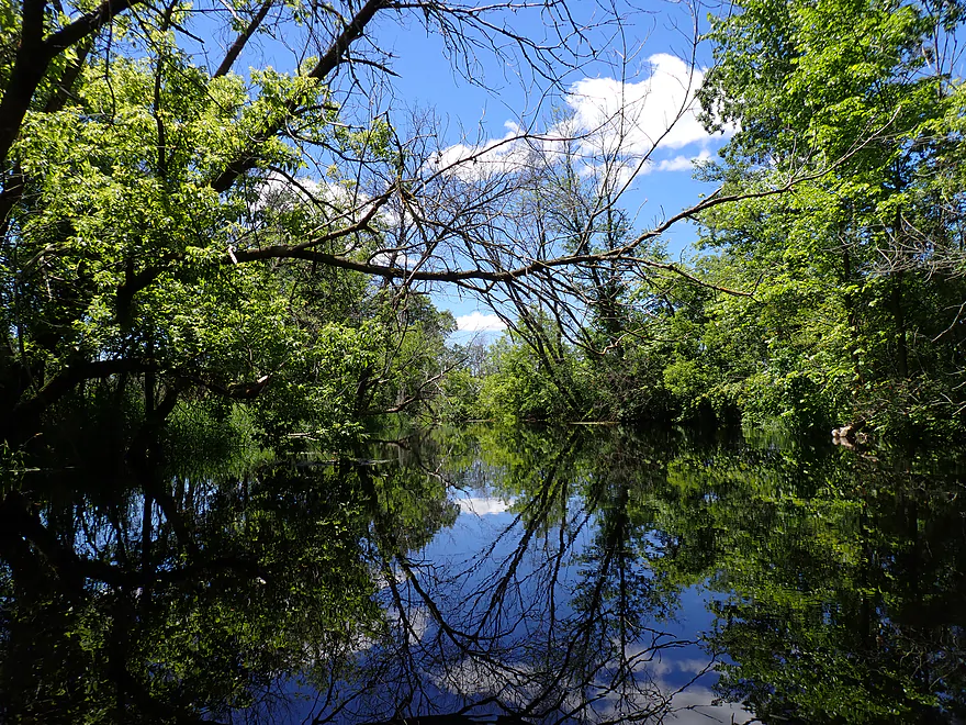
Terrific color and reflections
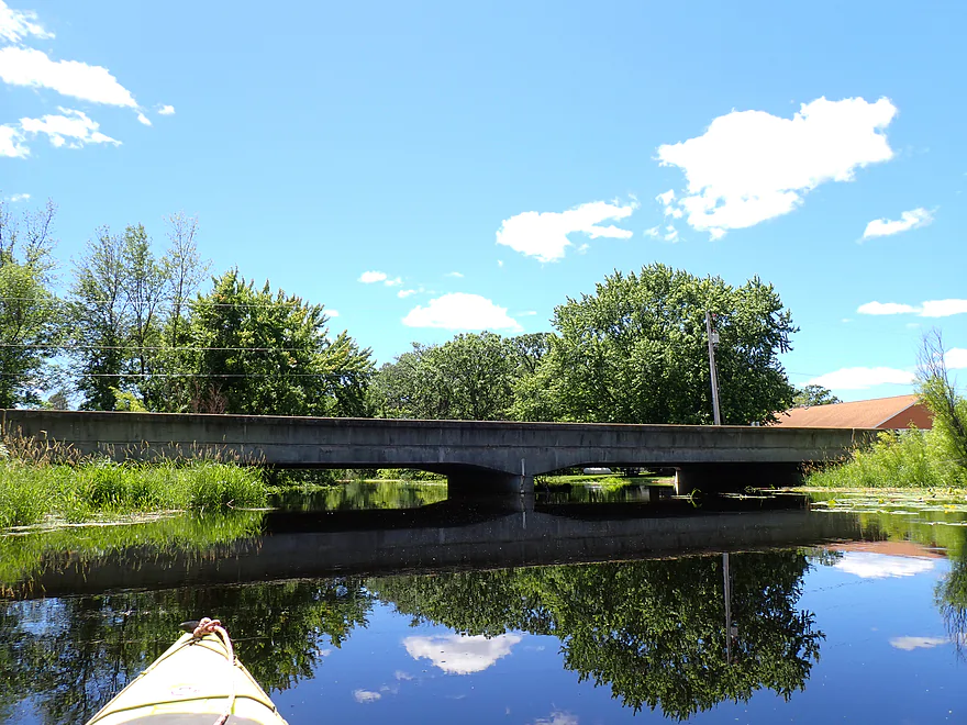
Hwy II
Ok take-out NE corner
View from bridge…if you get permission the downstream bar is actually a better access
Looking upstream from bridge
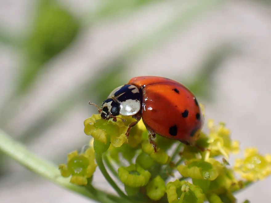
Colorful ladybug at the take-out
Scouting S. Road…looks like a viable bridge access
Downstream view from bridge
Scouting Kiesow’s Landing…good access, but you must pay to use it
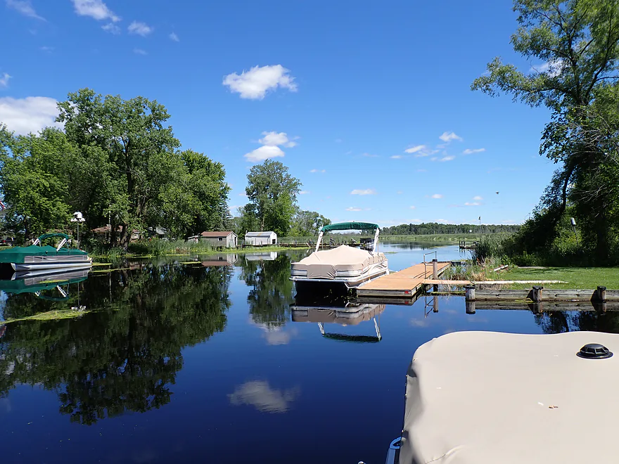
Lot of motorboats in this area
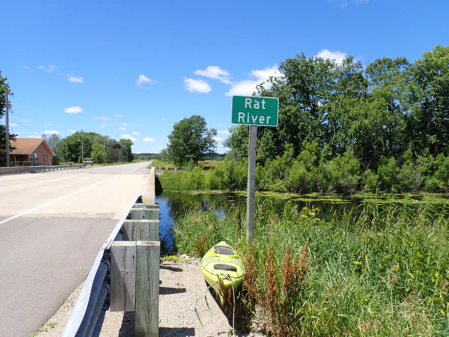
Rat River

The Rat is a slow, marshy river located west of Appleton. It eventually joins the Wolf River just prior to entering Lake Poygan. It does get occasional kayaking traffic, with the most popular stretch being from Bison Road to Highway II, which is what I did for this trip .
I started my paddle off the Bison Road shoulder, which was a good bridge access. A trampled weed path to the water suggested other kayakers had launched here recently.
The first part of the trip was very open, flanked by cattails, and had an appealing zen-like simplicity. Although at times a bit too zen-like, as some parts were boring. Highway 45/10 was located by the put-in and was crazy loud. I presumed, since I would be paddling downstream, the road noise would go away. Instead I could hear it for the ENTIRE 7+ mile trip. It’s remarkable how noisy freeways are.
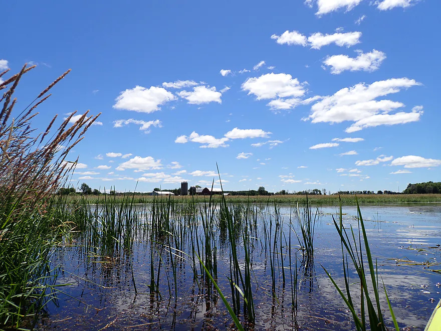
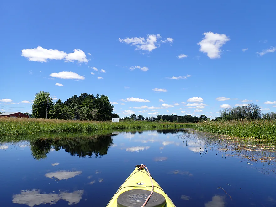
About a third into the trip, the river turned sharply north to form a long “camel hump”. It was here that the cattails were replaced by wetgrass. I preferred this as the grasses were lower and provided more expansive views of the surroundings. I also saw a few trees here, but by and large this trip was 99% treeless.
It was great to see a lot of marsh plants and lilies…but what wasn’t so great were the large colonies of aquatic plants like coontail and wild rice that at times almost choked the channel. These tended to be worst at the top of the “camel’s hump” (see trip map) where the current was the slowest. Mind you, navigability was never an issue for me. I easily cut through the plants with my “sharp and pointy” boat. But water levels were high (consistently 4-5′ deep…about 2’ above normal .
I suspect in drought years (like 2023) or in late summer, aquatic plants can be more than a nuisance and could actually block paddlers. The Rat River actually made the news a few years back when a massive “iceberg” of dead cattails and marsh plants broke off and blocked the Rat’s mouth on the Wolf River.
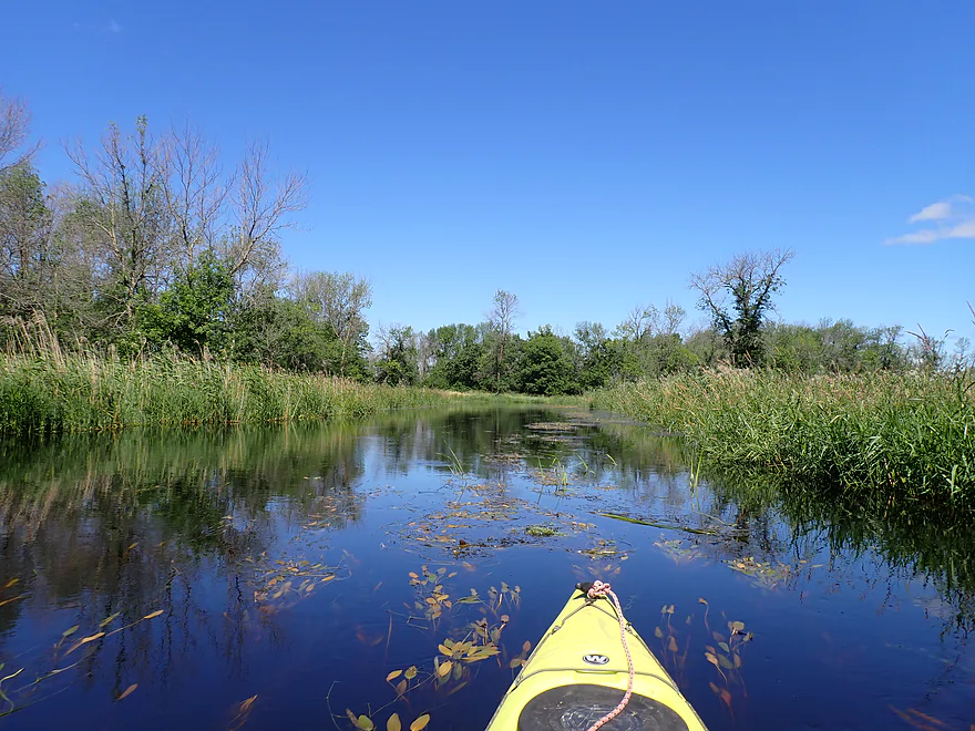
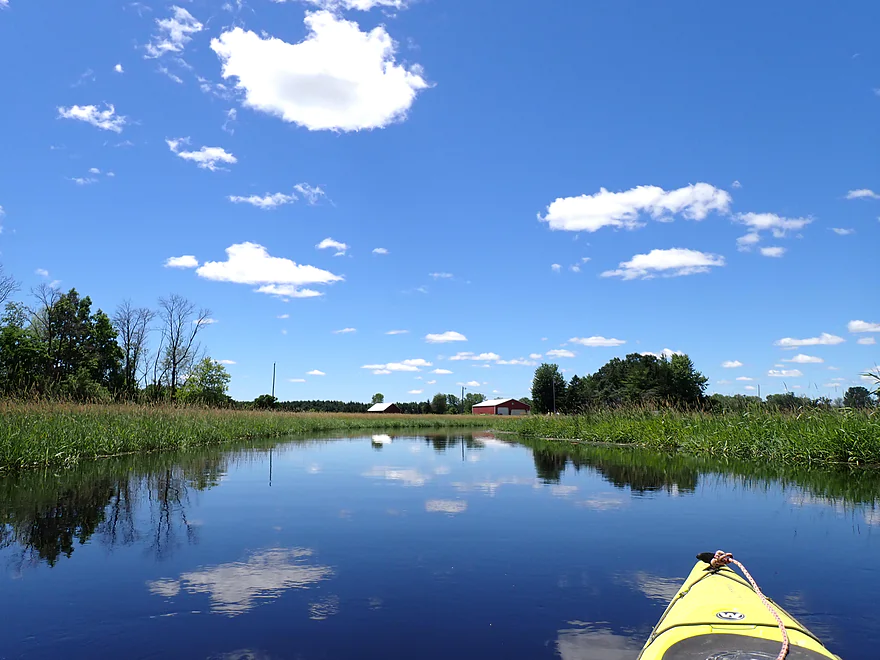
After the peak of the “camel’s hump” the river turned south. This was a nicer stretch with a narrower and more meandering channel, and a few more trees. It was nice to see dark blue skies. Typically Wisconsin summers have at best, washed out pale blue and hazy skies because of Canadian forest fires…but not this year. Guess they are getting the same rain we are.
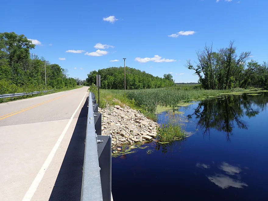
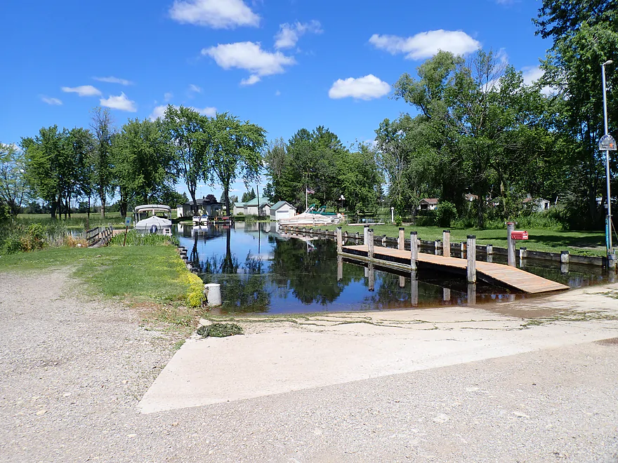
I took out at Hwy II, which was a manageable bridge access. Nearby was the “Whiskey River Pub and Grill” (locals call the Rat River “Whiskey River”). It was tempting to take out on their riverside lawn, but that would require asking permission after I already got out, which would be awkward, so I got out by the bridge instead.
In summary, this was a mediocre trip. It’s slow, marshy, flat, and open. It’s not a destination paddle for outsiders, but locals in the area may enjoy it. Good weather will be an important catalyst…if it’s cold, windy, or overcast you likely won’t enjoy your paddle. Something to keep an eye on is the weed situation. Complete blockages might periodically happen, especially in late summer and during droughts. To avoid a “Drat River” experience, follow current conditions, and perhaps call locals like (like Kiesow’s Landing) to ask about the latest on conditions (they would know). Overall though, I enjoyed my trip, and I look forward to paddling other similar rivers in the area like the Arrowhead and Embarrass Rivers.
I saw of lot of red-winged blackbirds and insects. There were a handful of flopping fish…most were likely carp. The highlight were the large number of muskrats, the most I’ve ever seen on one trip (perhaps the origin of the river’s name). One territorial rodent came at me as if trying to ram the boat, but dived at the last second (see 1:23 in the video). Supposedly muskrats have been known to attack people, but that’s extremely rare and I wouldn’t fear them. While I was driving home, a large snapping turtle was waiting to cross the busy Hwy 10 freeway. I wonder if he made it…
Bison Road: This was a good bridge access with a nice, flat area for launching upstream/north of the bridge.
Alternate Put-ins:
- Hwy M (5.5 miles upstream from Bison Road): This is likely a nice marshy leg, and actually more scenic than the river below Bison Road. But…aquatic weeds and wild rice likely create serious congestion issues and, in fact, may completely block the channel (especially in late summer). Paddle at your own risk.
Hwy II: I took out at the northeast corner which was an ok bridge access, but a bit weedy and rocky. The southwest corner has a really nice lawn, which would be a preferable take-out, but it is private (part of Whiskey River Pub and Grill) and you’ll need their permission to take out there .
Alternate Take-outs:
- S. Road (1.5 miles downstream from II): This bonus leg will feature more marsh (less wetgrass/more cattails though). S. Road is a good bridge access (east/downstream corner is best).
- Kiesow’s Landing and Storage (3.0 miles downstream from II): This additional segment would go through a thick cattail marsh. Don’t be surprised to see motorboats. Kiesow’s Landing is a private boat ramp. It will cost $2-$10 depending on the number of boats you have. Credit cards are not accepted, so bring cash. Hours may be limited to summer weekends. Outhouses are available on site for customers. An attendant will be on site to accept your money and direct you where to park.
Bike Shuttle – Hwy II to Bison Road: 5.5 miles with 16′ of ascent. This was a really easy bike shuttle…flat, little wind, and all paved. Only downside was nearby Hwy 10, which was very noisy.
Bathroom Breaks: Most of the Rat is an open marsh without a proper shoreline for getting out and taking a break. There are also no outhouses at the put-in or take-out (nor privacy). Although, at the take-out there is a pub by the river, and maybe you could use their restrooms if you ask.
Rapids/Current: The current is very slow…in fact, round trips might be viable from any of the bridge access points. The fastest current is actually at both the put-in and take-out, and even here it still barely moves. There is almost no noticeable current in the middle stretch of the river.
Logjams: None. I only saw one downed tree, and somebody (presumably kayakers) had chainsawed a navigable gap through it.
Weedjams: Because of the slow current, a combination of cattails, aquatic weeds, and wild rice can constrict the channel. I suspect during low water and/or late summer the channel can even be completely choked off. I didn’t have problems for my trip. There were a few weedy sections, but they were easy to go through as water levels were high and I had a very pointy boat. Paddlers should exercise caution doing this trip late in the season. If you’re not sure about river conditions, you could contact Kiesow’s Landing….they should know the latest conditions.
Wind: This is a very open trip, thus is susceptible to wind. I wouldn’t do it if headwinds are say 10 mph or stronger.
Gauge: Duck Creek @ Howard
Trip Depth: 87 CFS or 12.42′
Navigability Estimates: Duck Creek isn’t a great analog gauge as it is much faster than the Rat River. Take the following estimates with a grain of salt.
- < 4 CFS: Shallow level…river might be too weedy to run.
- 5-15 CFS: Low levels…might be some weed issues.
- 16-30 CFS: Average levels…likely an ok depth, except in late summer when the wild rice is tallest .
- 31-60 CFS: High levels…good depth.
- 61-90 CFS: Very high depth…plenty navigable.
- 91-200 CFS: Extremely high depth…plenty navigable.
- 201+ CFS: River might overflow some banks…should still be navigable.
Click here to see an overview map of the Rat River.
- Upstream from M: The river is too congested to paddle. Large cattail fields have overrun the river and you can’t even see the channel in spots from satellite view.
- Hwy M to Bison Road: 5.5 miles. Likely a scenic stretch, but aquatic weeds and wild rice may be an issue. In fact they may completely block the channel (especially in late fall). Paddle at your own risk.
- Bison Road to Hwy II: 7.0 miles. The most popular stretch on the river for paddling. It’s mostly open and marshy…kind of a mediocre paddle.
- Hwy II to S. Road/MM: 1.5 miles. More open marsh…perhaps a bit more cattails and less wetgrass.
- S. Road/MM to Kiesow’s Landing: 1.5 miles. Some paddlers extend their Bison Road trips to Kiesow. This is an ok add-on leg with some nice cattail marshes. Note, paddlers may start to see motorboats coming upstream here.
- Kiesow’s Landing to Mouth on Wolf River: 1.5 miles. Last leg on the Rat River. This is an open cattail stretch with some motorboat traffic.
- Mouth to Boom Bay Boat Landing: 4.2 miles. Likely uninteresting open water paddling on Lake Poygan and the Wolf River.
Trip Map
Overview Map
Video
Photos Size:
I love your reports but am puzzled by your outings on mediocre streams. I do appreciate you doing my homework for me so I can avoid such paddles, especially if it’s a long drive to the put-in. Why do these in the first place? Thanks for your continued excellence.
People have diverse taste. Some paddlers hate lake paddles…some love them. Some hate rapids, some love them. Some love marshes, some hate them. The Rat is just such a niche river. I did it because most of my other A prospects were too high with all the rain we got. That being said I did enjoy my trip on the rat, and I know other paddlers that liked this river as well. It is however a bit of an acquired taste.
I hear what you’re saying, especially with the high river levels. I’m one of those that doesn’t paddle lakes. I like a peppy stream (but not too peppy) and love the adventure of what’s around the next bend.
Update for paddlers…wild rice has spread aggressively since the two years I did this trip. I can’t be certain this leg is navigable any longer.