Fever River (aka the Galena River)


The name of the river is confusing, because while originally named the Fever River, the state of Illinois (shamed to have a river named after smallpox) renamed it to the Galena River. This left mapmakers in Wisconsin confused…to this day. On the flip side, some old Galena residents in Illinois still refer to it as the Fever.
The inspiration for this trip came from a video review from Morrall Films. In the video, they showed a fun, riffly stream running through “cow country” and along scenic rocky banks with hillside tunnels to explore. All water trails have a weakness…and shallow depth would be the Fever’s. The key in planning this trip will be to keep an eagle eye on the Buncombe Road gauge. In Mark Morrall’s review, he ran the river at 4.18′ (looked a tad pushy and muddy IMO…but not by much). He says the river was good to run at 3.4′ when he did it earlier and thought that 2.8′ would be tolerable, but with some walking and rock bumping. We ran this at 2.67′! I was ok with this…but am a battle-hardened paddling veteran who has faced much worse than shallow waters. Most paddlers will not want to run this at 2.67′ though. For reference, I had to get out maybe five times, there was perhaps a 500′ walk on one section, and most riffles were bumpy, with a lot of “gorilla pushing” to get through. Okay in my book, but in few others. Ultimately, I would recommend running this between 3.0′ and 4.0′. Most days in spring should have enough water to run this, while most in the summer won’t (unless preceded by a heavy rain). I’m not sure I would recommend a spring paddle, as the vegetation was a highlight of the trip and the water quality was terrific. On the flip side, during spring, the vegetation wouldn’t cover up as many of the nice rock outcroppings on the banks. My vote would be a late May or early June paddle, depth permitting.
The main put-in by the Hwy W bridge is very good. The best launch area will be to your far left by (or in) Diggins Creek. Great parking at this little park, and would be a five- star put-in if it had facilities (which it did not). For this trip, I did not bike shuttle, but car shuttled instead. Note, while there is a livery on the river, it is located deep in Illinois and I do not believe they service the Wisconsin segment. A warning if you bike shuttle…there are some serious roller coasters to contend with (but at least the roads are paved).
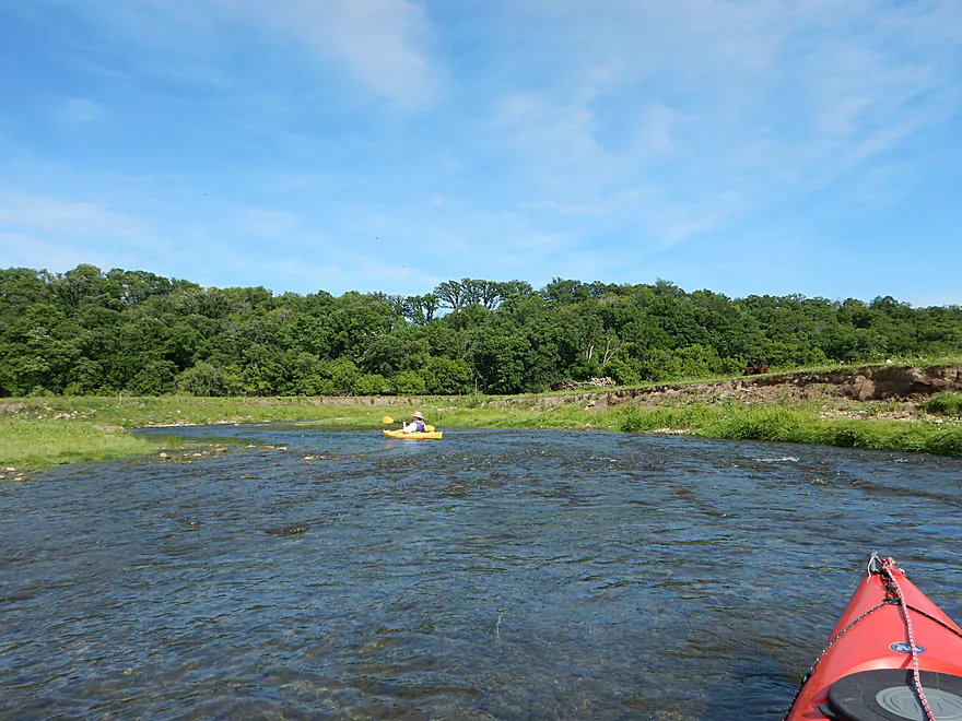
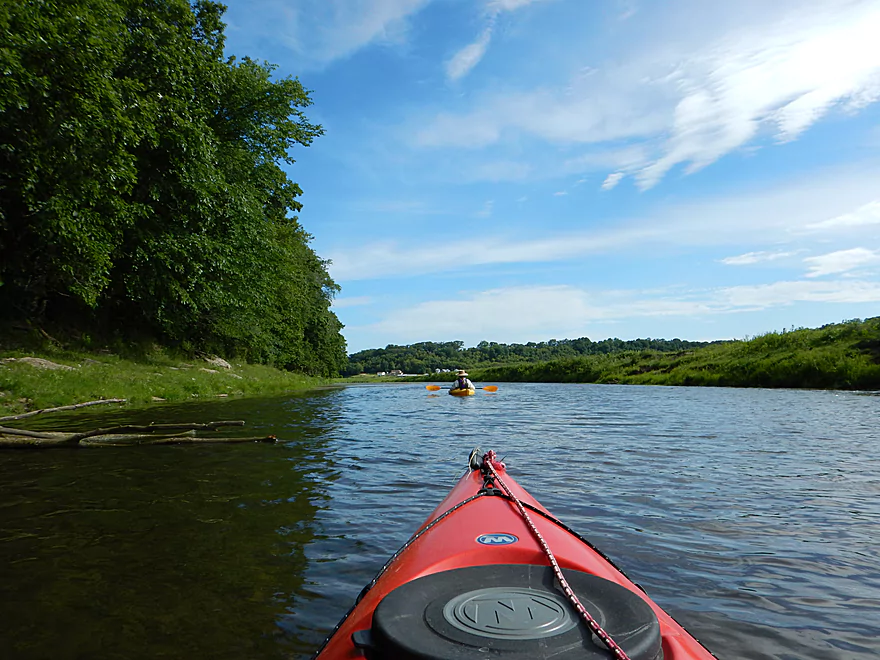
The river starts out with a great impression. Wonderfully clean water, riffly, and with attractive plants on the banks. Some bumping, but not so bad…yet. (Ironically, the river was deepest the first mile or so.) The substrate wasn’t sandy, nor muddy…just rocky. Occasional micro rock outcroppings added a nice touch to the banks.
After paddling maybe 3/4 of a mile, you come across the main reason people love to do this trip: an abandoned, single-track railroad tunnel running through an adjacent hillside referred to as Strawbridge. It will be easy to miss if you’re not looking for it (especially when the leaves are out). The key landmark will be an ancient river monolith on your left (well, perhaps an old bridge abutment). There will be a riffly run in the center and packed down grass on your right where people get out to explore the tunnel. The tunnel itself is very cool (literally) and long at 650′. It was created as an alternative to tracks running parallel to the Fever as they tended to get washed out. The line, originally set up to service the zinc mines in the area, was abandoned amid market downturns and issues with feeder lines getting washed out.
Consider bringing a flashlight, as there are two hidden side tunnels (used for mining) that you can explore as well. As you exit the other end of the tunnel, you’ll be greeted by a nice fern glen. The old rock work and lush green vegetation give this tunnel (and other parts of the river) kind of a “lost civilization” feel, which is unique. At this point, you can actually see a longer trail that leads to a road….so you can access this tunnel by car if you want (see map).
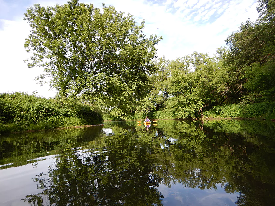
After the tunnel, the river gets pretty bumpy for 2.67′ (again, don’t run it at this depth!). For this trip, the wildlife viewing was pretty good. I saw a turtle, blue heron, eagle (being harassed by smaller birds), raccoon, decent-sized water snake, and a deer. A special treat was hearing the endangered cricket frog the entire length of the river. Their constant and unique call sounded like two ball bearings being tapped together–which I initially thought was my camera going berserk (heard in video). But probably the highlights were the fish and the plants. The terrific water quality (see pictures) really lets you get a birds-eye view of the fish, which included a large Longnose Gar I photoed (I think…don’t know my gars). The plants were great as well. Granted, this was cow country (so a bit of an artificial ecosystem), but the flowers were nice, as were the ferns, mosses, and even a surprise waterlily bed. One of my favorite river plants was Purple-stemmed Angelica, which looks like a firecracker (quite common on this segment of the river).
After the first tunnel, you’ll be entering the heart of cow country. The banks are well-grazed and, to use a Star Trek term, losing their “structural integrity” to the river amid heavy hoofing. Saw quite the herd staring at us on our left. Here the air picked up an unfortunate smell and there is no doubt a significant portion of cow excrement ends up in this wonderful little river. Coincidentally, about 500′ downstream from this pasture there was a massive pondweed field we had to push through.
You’ll soon encounter an old iron bridge with a nice rock bank on the right which appears to service a private driveway. What will really catch your attention here, though, is the cattle fence strung across the stream and above a very fast moving part of the river. This is a surprise for multiple reasons. In, I believe, 2008, a woman was injured trying to get under a barbed wire fence on the Fever River (and specifically on this stretch). The DNR, in reaction, issued a warning about illegal fencing across the Fever River and even went so far as to single out electric fences! It’s wonderful to know that Wisconsin has a $500 fine for obstructing navigable waterways…but it doesn’t seem to have deterred most farmers (especially on the Platte River and Coon Creek). This particular fence appears to be new (didn’t see it, same bridge, with Morrall films) and could be an issue to run in higher water. Because the water was so low, it was easy for us to duck and bump under it. Always be vigilant on these types of rivers/creeks, as farmers can set up these fences on short notice and sometimes intentionally so to spite paddlers.
Following the nice iron bridge (and evil cow fence) is probably the most shallow part of the trip, and here I did a lot of walking. Very peaceful section of the river though and pleasant, with nice plant life and rocks on the banks. Soon on your right though you’ll see an entire line of trees either pushed over or half tipping into the water. The river is wide enough you can easily get around these without portaging (in fast water you may be careful though). It appears the farmer literally bulldozed the brush and trees into the river to get a few extra feet of corn.
Next landmark of note is the Beebe Road bridge. Nothing special here, but it could be an alt access point (not a good one though). Soon after will be the finest rock wall on the river and a cool larger boulder splitting the channel.
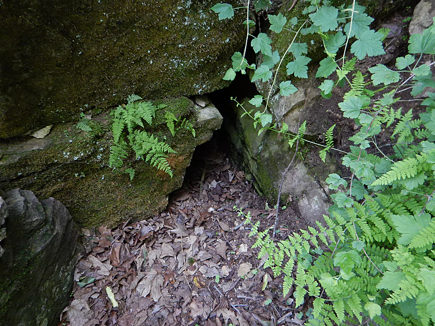
After these nice rock outcroppings, you’ll want to be vigilant for the second tunnel (Buncombe Tunnel), as this is very easy to miss. I’ve marked it on the map, but perhaps the best landmark will be a small stream on your right. The tunnel itself is on your left and well hidden. Part of the reason I detected it was because I felt a large blast of cold air mysteriously descend down the left hillside and over the water. While there are no “no trespassing” signs, I’m not 100% sure this is public. Somebody had been chainsawing firewood by the tunnel and even stacked it by the tunnel so it could dry in the tunnel breeze. There are a couple of chainsaw-carved chairs by the tunnel overlooking the river and a barbed wire fence blocks the entrance. None of this human activity was in the Morrall film’s segment, so it all appears to be new.
The tunnel itself is splendid. Shorter than tunnel #1 (at 350′), but taller, with what appears to be ribs from the blasting. Surrounding the tunnel entrance was a patch of wild mint plants that gave the air a wonderful fragrance (why you don’t do a river like this in the spring, IMO!) Be careful if you go into the tunnel as there are barbed wire remnants on the ground that can poke through shoes. The other end of the tunnel leads out to another nice little fern glen, and there are surprise tire tracks leading into the tunnel (perhaps to load up the firewood on the other side?).
After tunnel #2, you will paddle under another private drive bridge which, in hindsight, should have been our take-out. The DNR has recently purchased fishing easements on the Fever River and I’m fairly sure this spot (see map) is one of those spots and would be perfect for a kayak take-out. In fact, when driving past this spot, I saw a number of cars parked here, including one with a kayak trailer. There is a fence to contend with between the parking area and the river…but a stile allows you to climb over it.
Maybe 1500 feet further was our take-out. Noted canoe author Mike Svob advocates using a dirt road here to access the river, but it was closed and locked for us. In fact, it was locked for another paddle group we heard from as well, so I’m afraid Mike’s advice is out of date. There are two creeks that feed in here (Bull & Scrabble), and Scrabble actually leads to a bridge on Ensch Road (which some use). This was too shallow for us, so we had to drag our kayaks through stinging nettles and weeds to get to our parked car on Ensch. Again, not the best access point–use the new public fishing area instead!
In summary, this is a river I do recommend doing…especially for southern Wisconsinites, but time it for 3-4′ and hopefully when there are leaves out and the spring mud has been washed away and replaced with the terrific clear water we got to enjoy. Oh…and bring your Deet-free insect repellent .While there weren’t mosquitoes, there were some swarming little black insects that were biting at me (probably thought I was a cow).
From our take-out, you’re actually close to the Illinois border, and there are definitely more options if you want to continue on downstream. Alternate options upstream of Hwy W are unknown but intriguing, with the potential for fun riffles and rocky banks (but with possibly more river fences).
Here are some more links & info about the river and area:
- River Trails of Southern Wisconsin by Morrall Films
- Paddling Southern Wisconsin: 85 Great Trips by Canoe And Kayak by Mike Svob
- What SW Wisconsin used to look like
- History of Strawbridge Tunnel
- More tunnel history
- History of the River Name
Detailed Overview
- Upstream from Knee Deep Road: The creek is likely too small to run. Peter noted that Hwy H doesn't have a good access option.
- Knee Deep Road to Bean Street: 6.4 miles.
- Knee Deep Road to Twin Bridge Road: 1.3 miles. Creek is small and a bit congested. There will be 1-2 logjams, but also some outcrops.
- Twin Bridge Road to Bean Street: 5.1 miles. River widens noticeably after Twin Bridge Road. This is a shallow trip with good geology and many Class 1 rapids. There may be cow fences to deal with.
- Bean Street to Hwy W: 8.0 miles. Great section with limestone outcrops and many light rapids.
- Bean Street to Horse Shoe Bend: 2.2 miles. A five star section with open oak savannas, fun rapids including a one-foot ledge and a wonderful limestone wall north of Hwy 11. One fence to duck under which is low but manageable.
- Horse Shoe Bend to Bennett Road: 4.1 miles. You should be able to launch at Horse Shoe Bend no problem (public fishing area). This segment is not as interesting and a bit weedy and overgrown, but still fast and with a few really nice outcrops. One tricky fence to get under.
- Bennett Road to Hwy W: 1.8 miles. Bennett Road should be doable as a put-in (another fishing access). River really opens up after this bridge and is quite nice with more rapids and a few limestone outcrops.
- Hwy W to Buncombe Road Fishing Pull-off: 5.8 miles. A great section on the Fever with some cool tunnels.
- Buncombe Road to W. Council Hill Road: 5.5 miles.
- Buncombe Road to N. Birkbeck Road: 3.0 miles.
- N. Birkbeck Road to W. Council Hill Road: 2.5 miles. Put-in and take-out are likely very brushy and somewhat difficult (but think they are doable). Parking at W. Council Hill Road is a challenge.
- W. Council Hill Road to W. Buckhill Road: 4.4 miles. Both put-in and take-out are brushy with W. Buckhill being more feasible.
- W. Buckhill Road to Galena/Depot Park: 5.0 miles. This stretch starts interesting with good driftless scenery and riffles. Then it becomes slower and less interesting. The last part through historic Galena is very pleasant.
- Galena/Depot Park to Mouth/Gear's Ferry Landing on Mississippi River: 5.6 miles. On the Mississippi veer right and paddle upstream to reach the boat ramp. Motorboat traffic might be an issue.


Don’t these cows understand we’re trying to paddle here? And yes, at the sight of the whole herd, I totally dropped my camera, fortunately just onto my board. Adventures on the Wisconsin side of the Galena river, earlier this week.
https://www.wisconsinrivertrips.com/wp-content/uploads/2020/07/Fever-River.mov
Thanks Lillian for the video! Yeah…cows are kind of common on the Fever.