
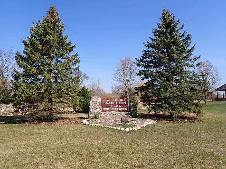
Welcome to Campbellsport – Kettle Moraine Country
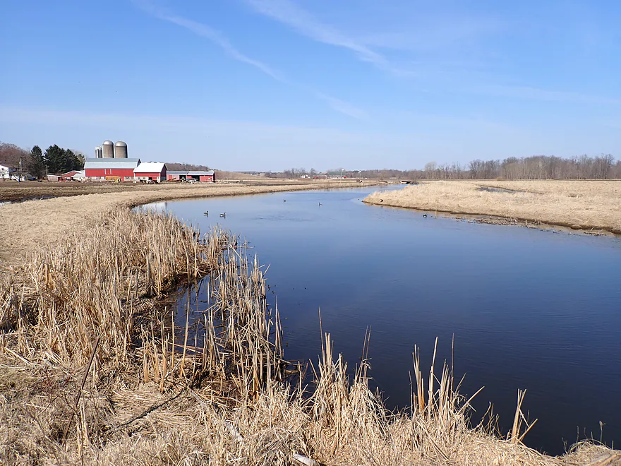
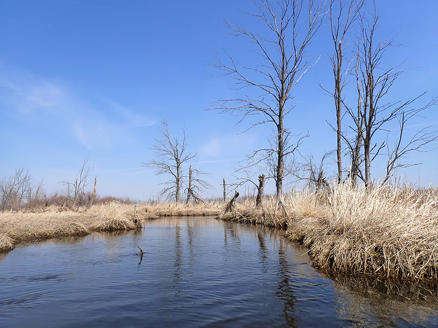
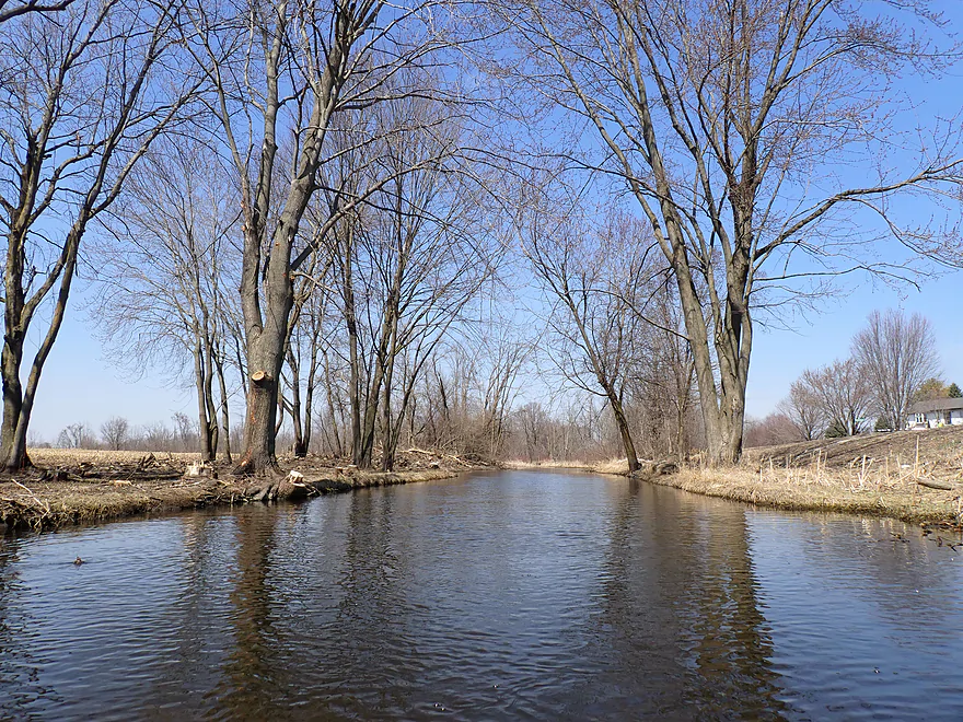
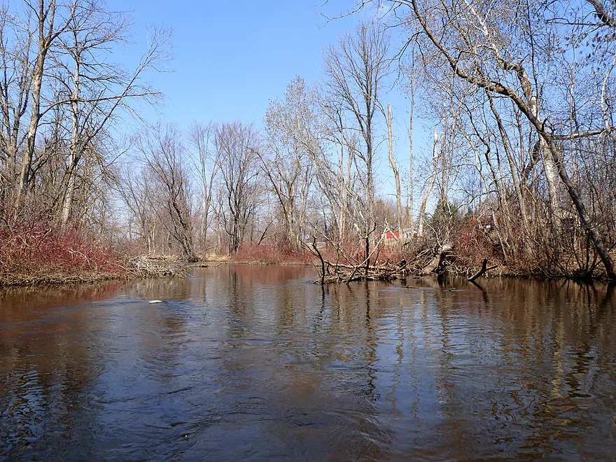
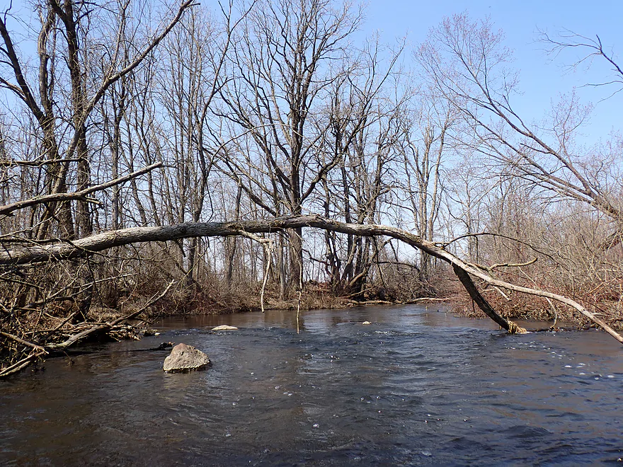
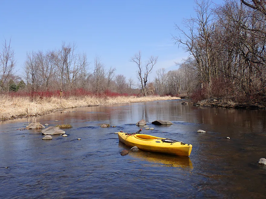
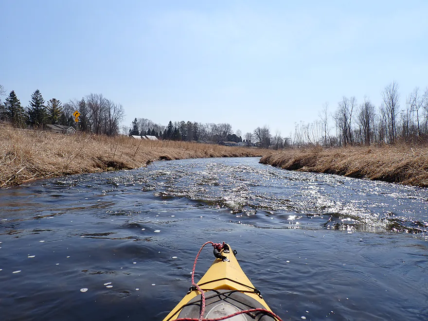
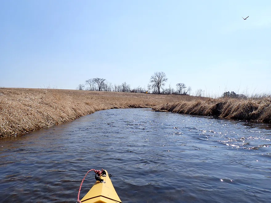
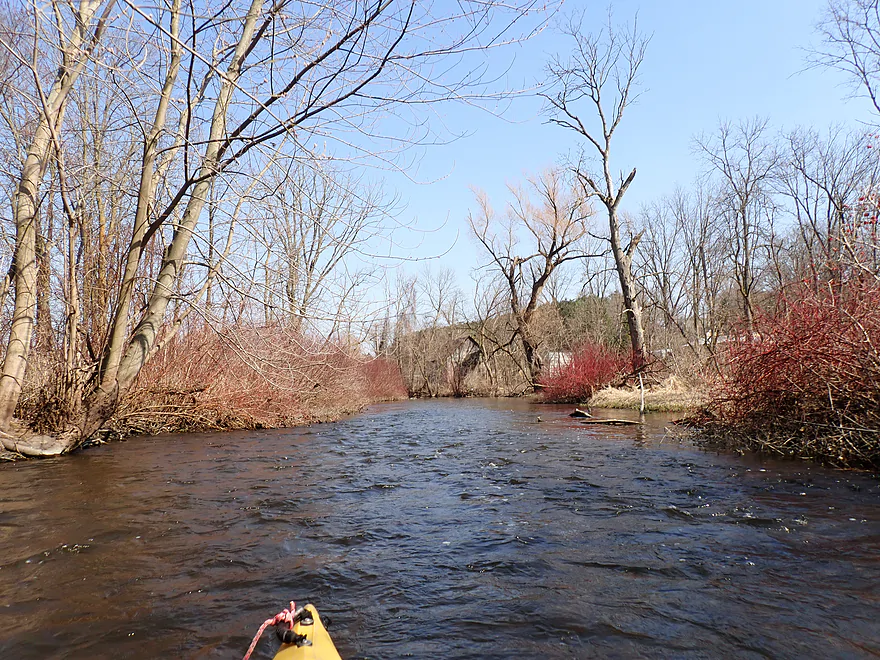
First view of the river by Cty W

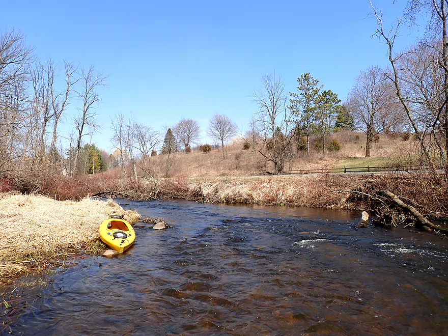
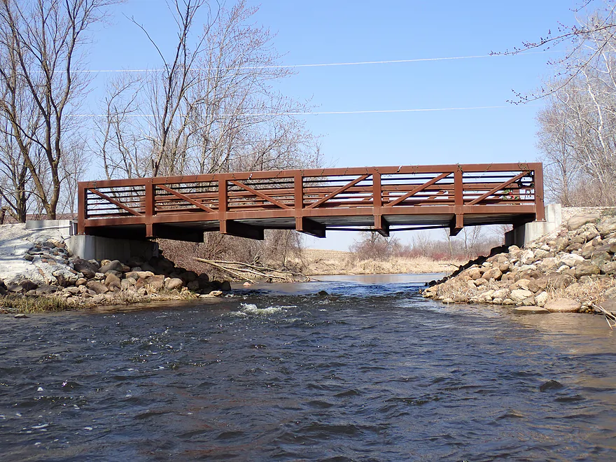
Decent bridge put-in
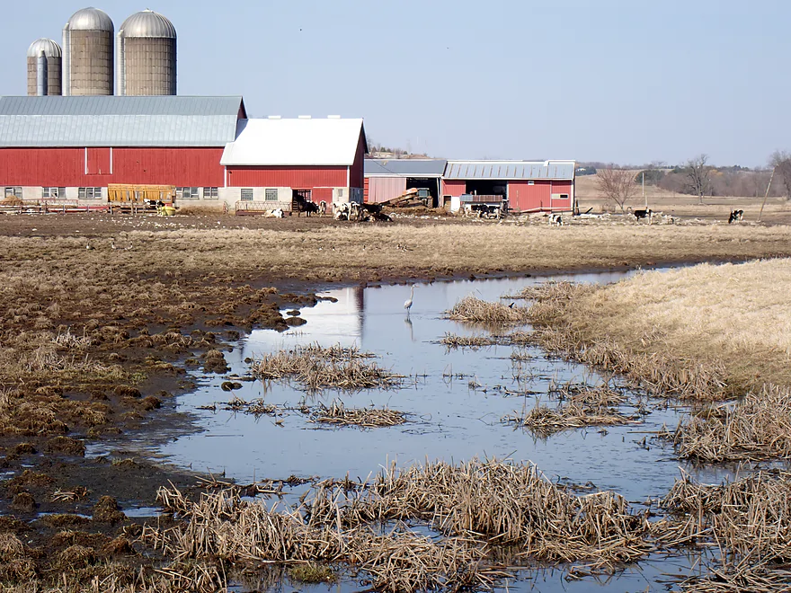
Heron hanging out in a cesspool
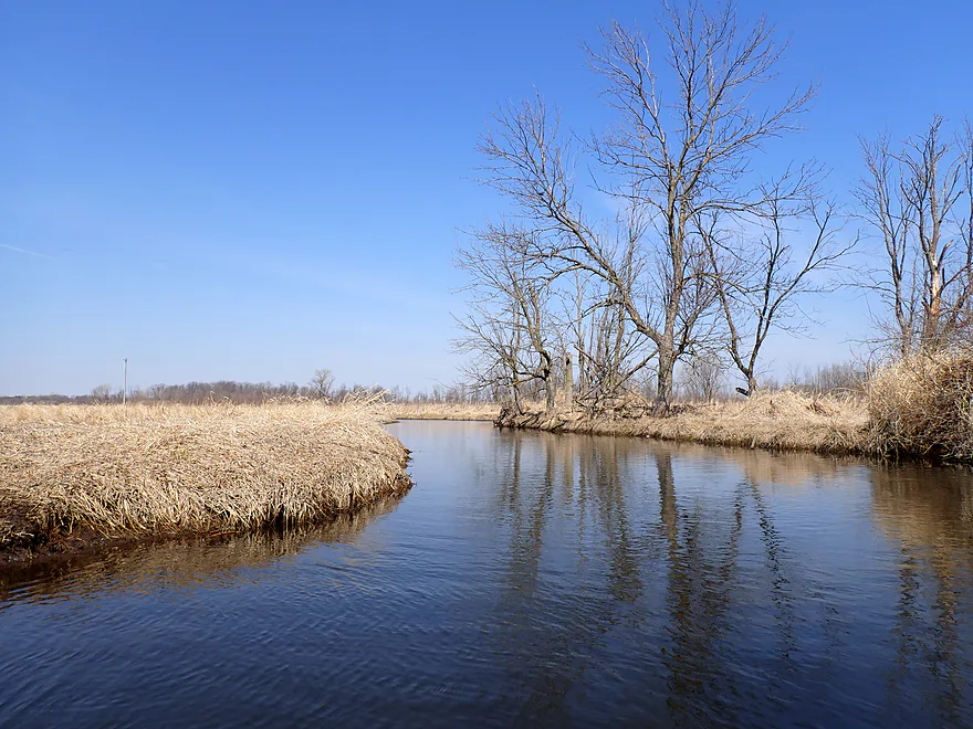
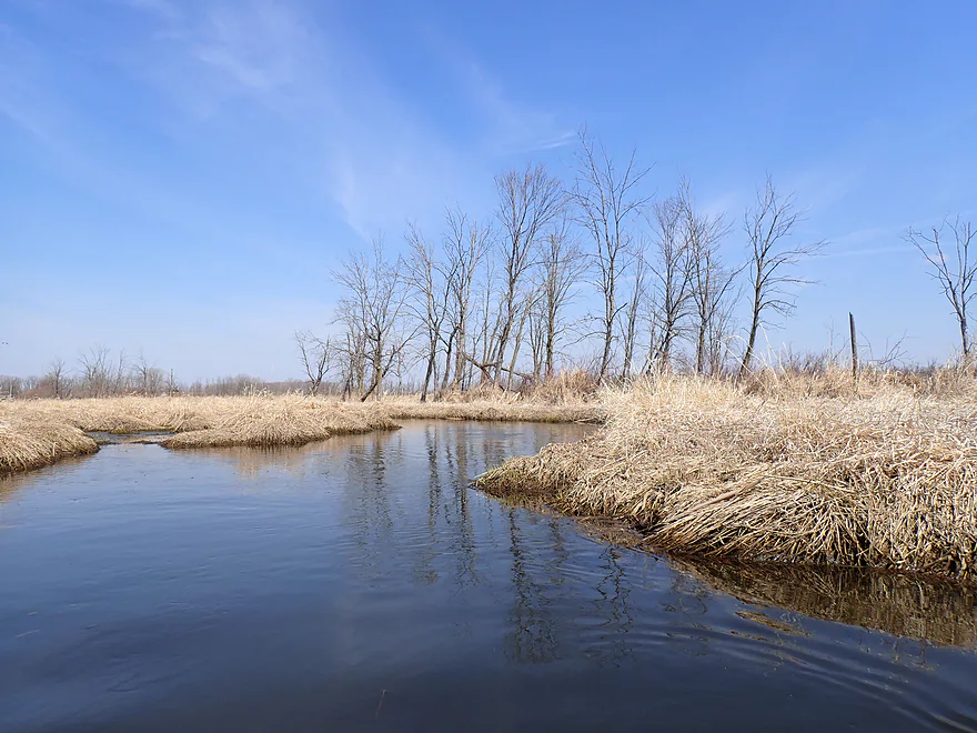
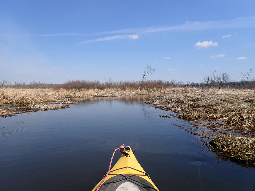
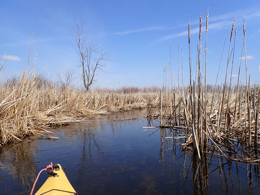
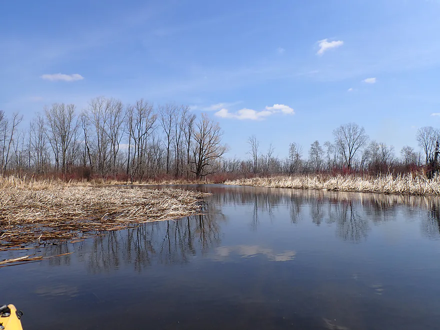
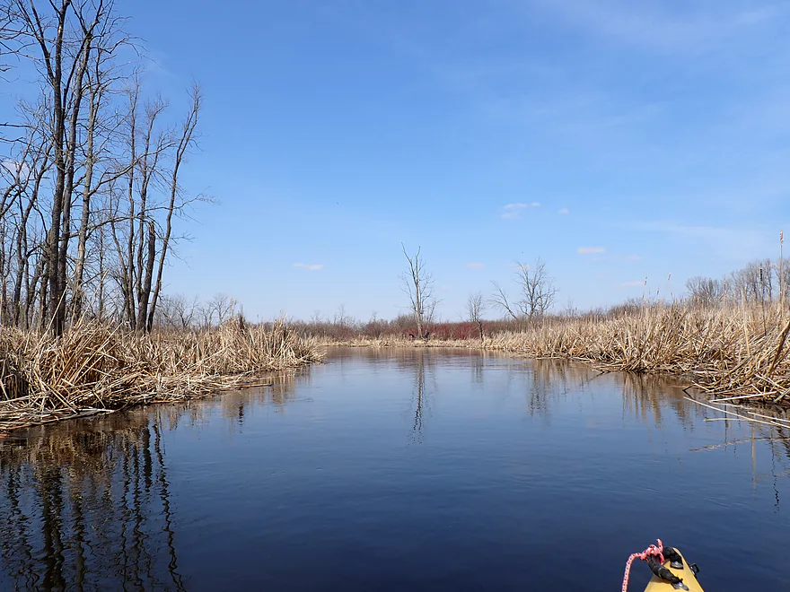
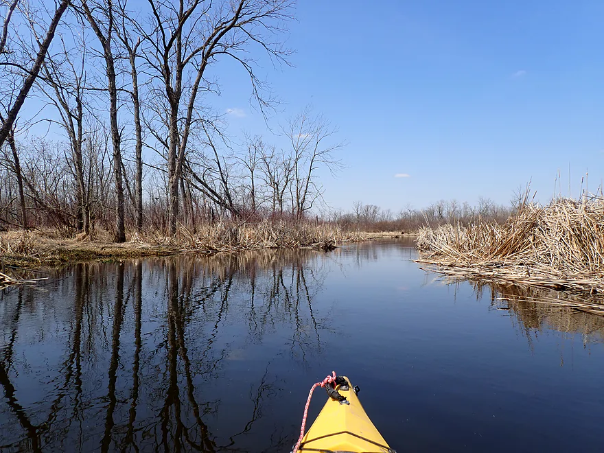
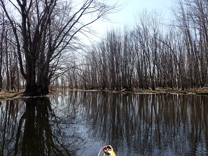
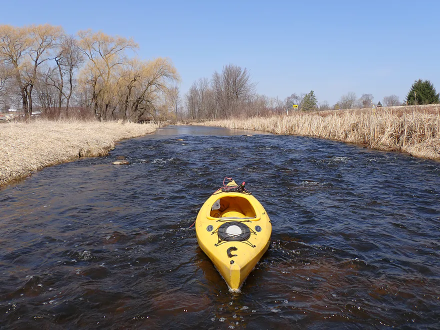
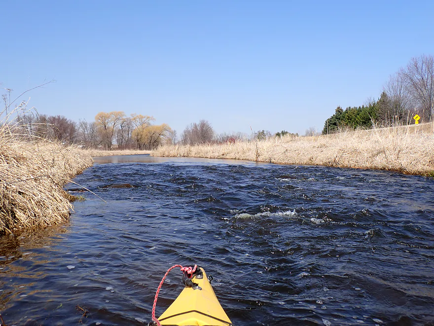
Attractive wetgrass portion
Some sections were artificially straightened
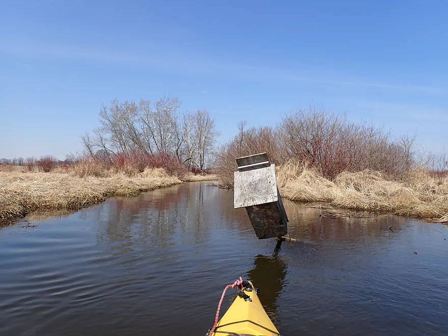
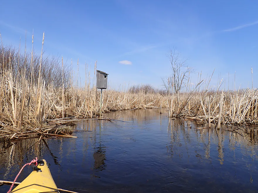
Birdhouse in trouble
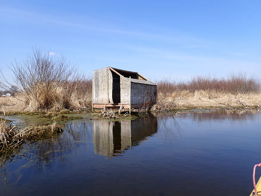
Quite a few blinds
A significant unnamed creek roughly doubles the Milwaukee River
I couldn’t get too far upstream on it though
Scenic creek…but I didn’t explore too much
Goose stole a muskrat lodge for her nest
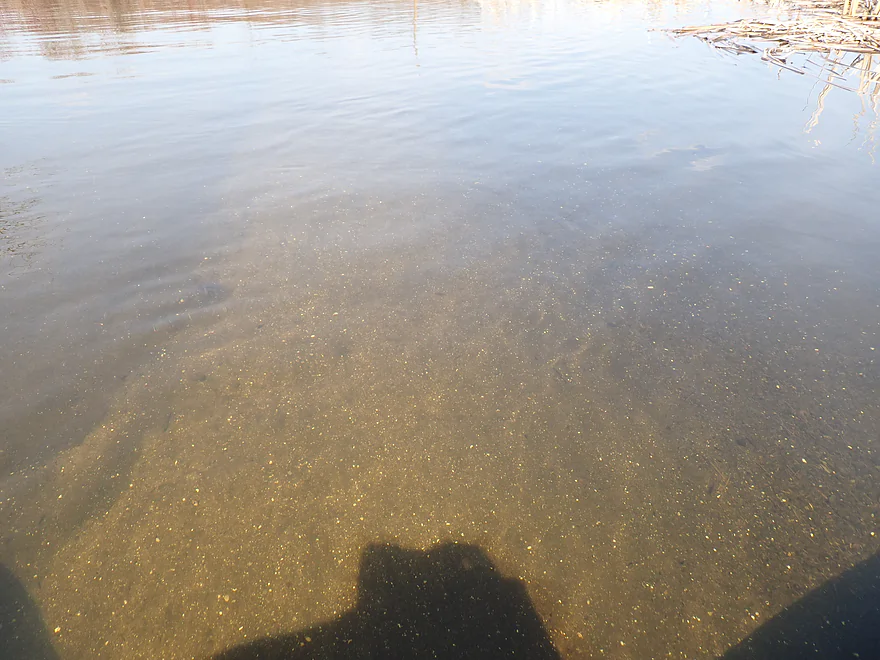
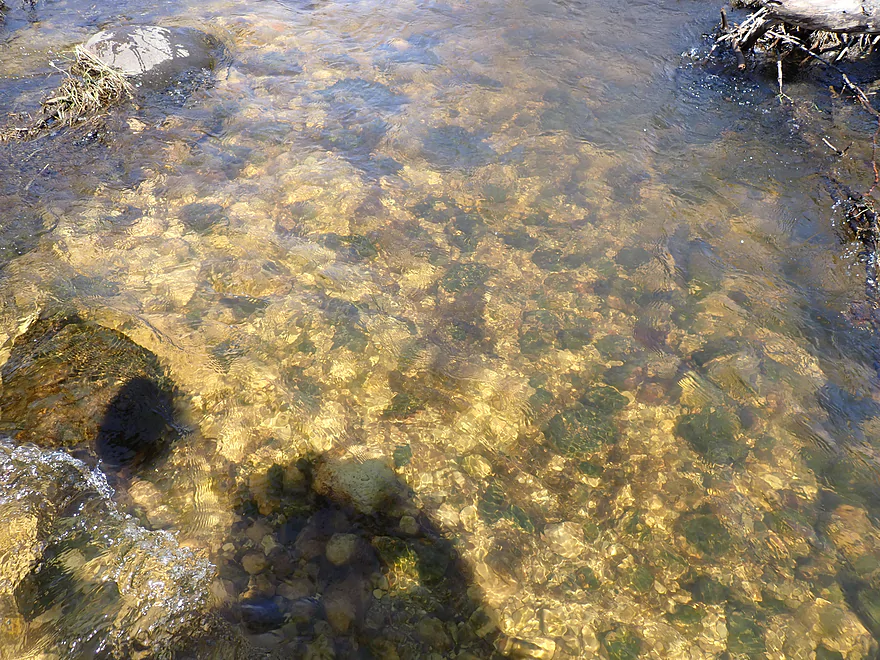
Decent clarity…tons of tiny little shells
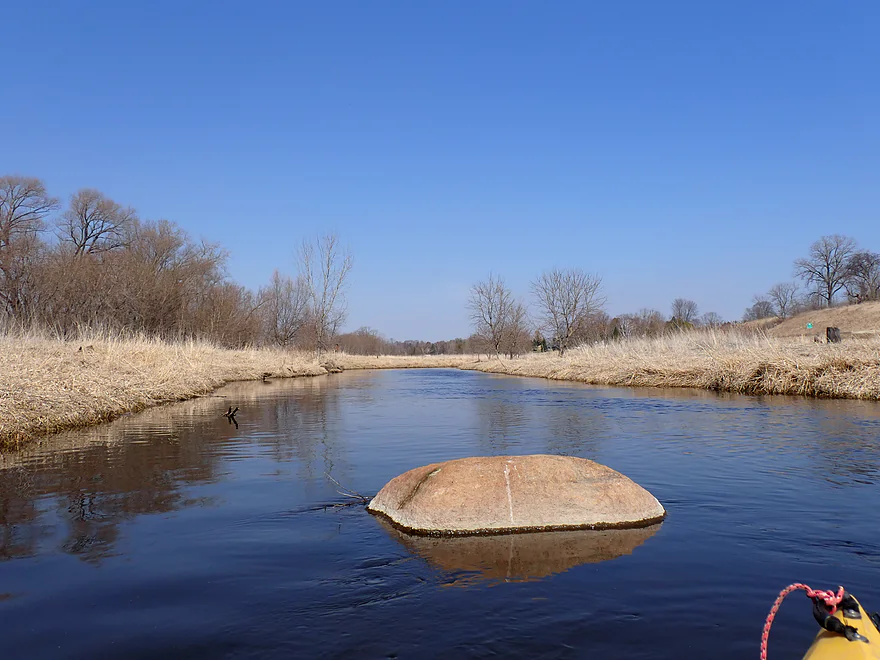
River widens and slows
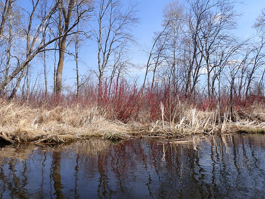
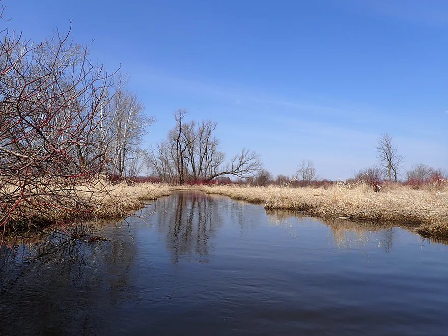
A lot of red osier dogwood growing on the banks

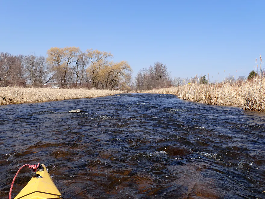
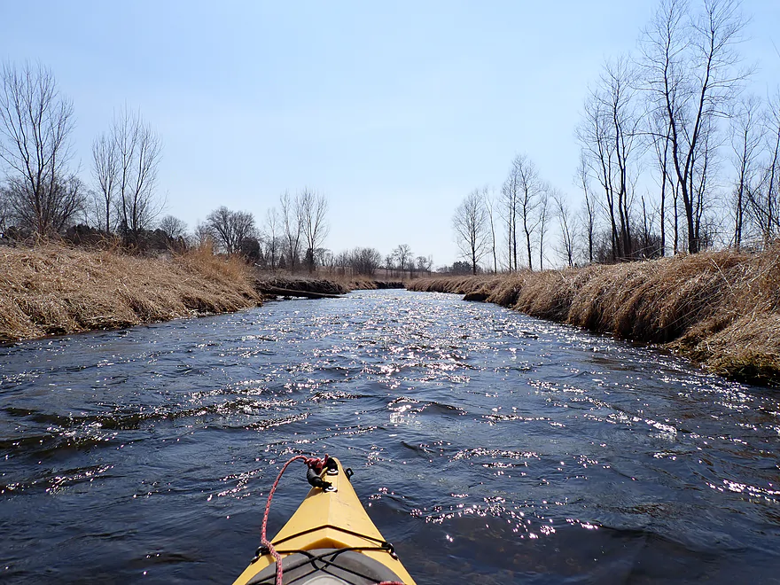
Water levels were on the high side
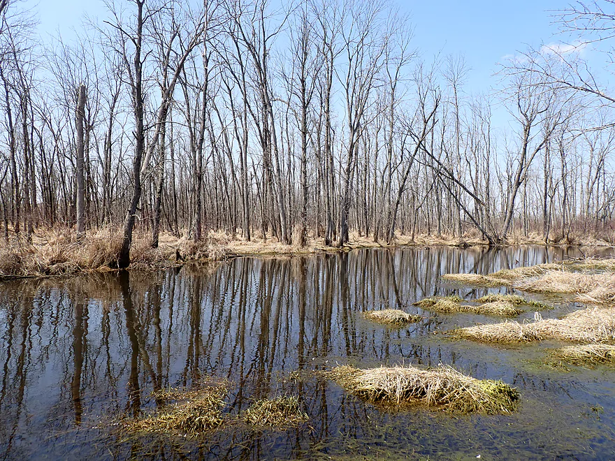
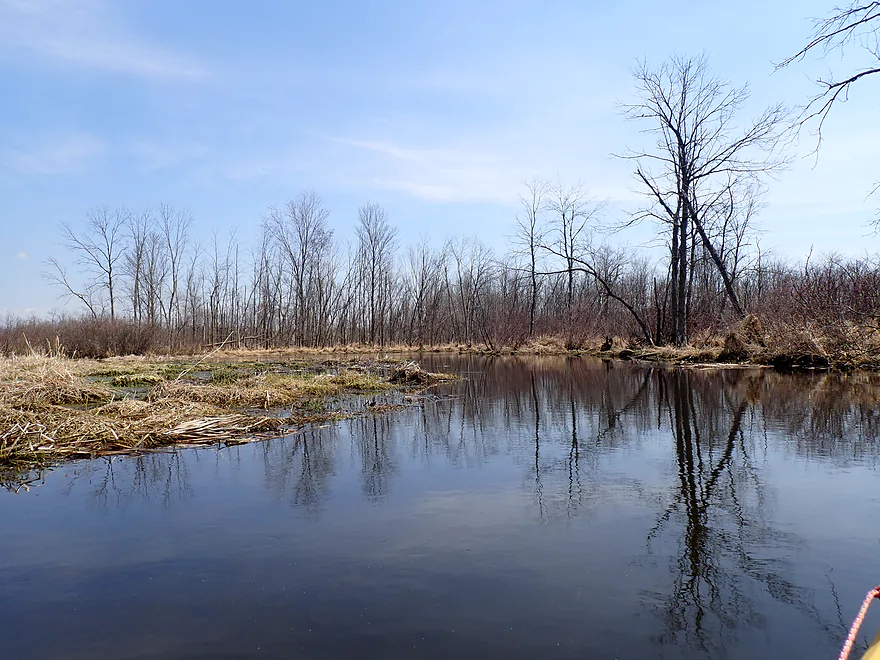
Starting to see more woods
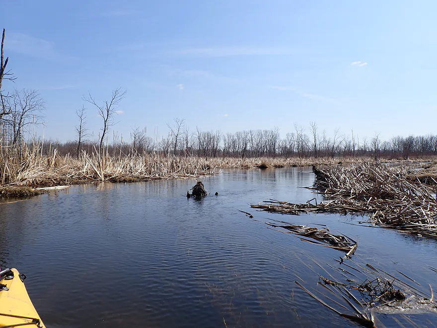
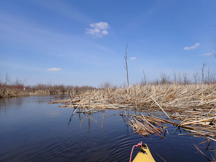
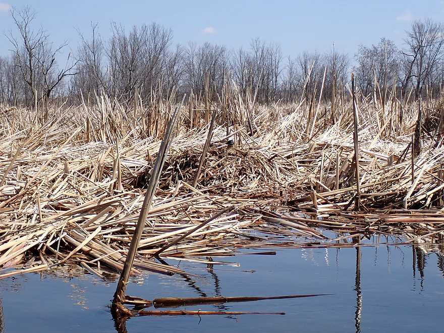
A cattail jam…not too difficult to get through
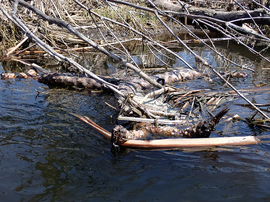
A huge rhizome from some kind of aquatic plant
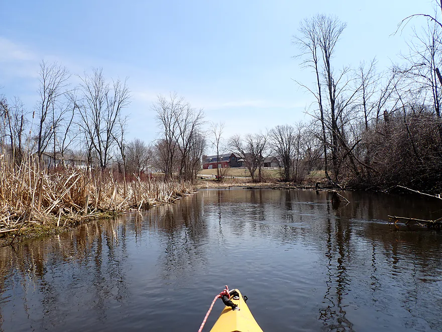
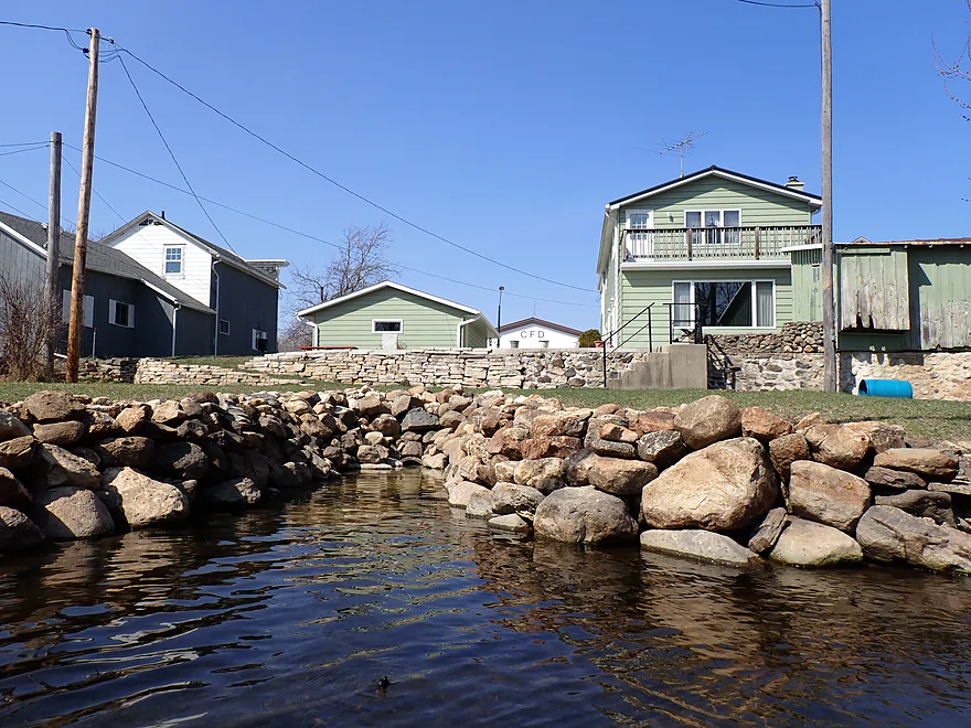
Approaching a residential area
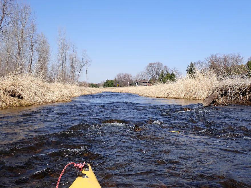
Farmer cleaned up the banks here
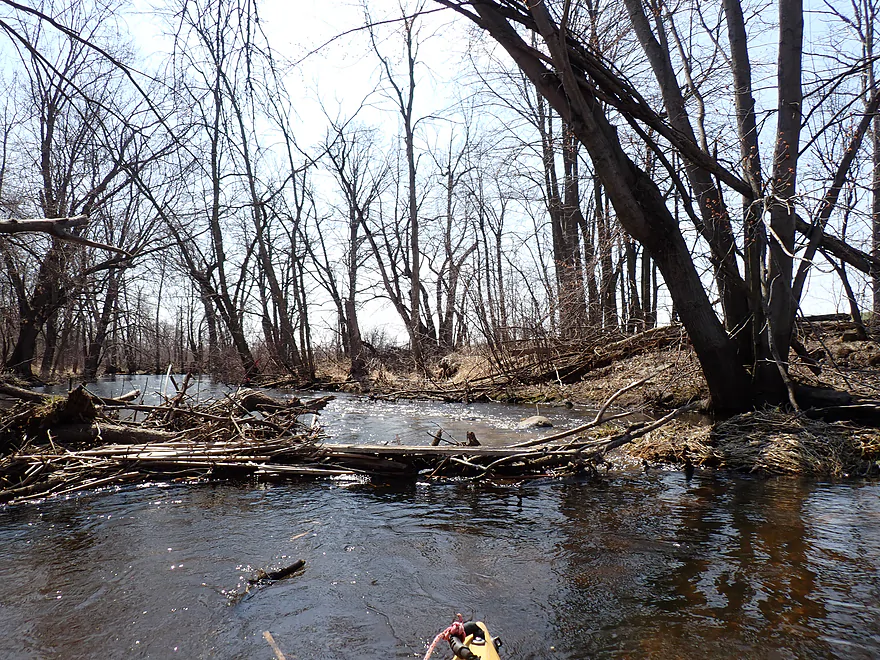
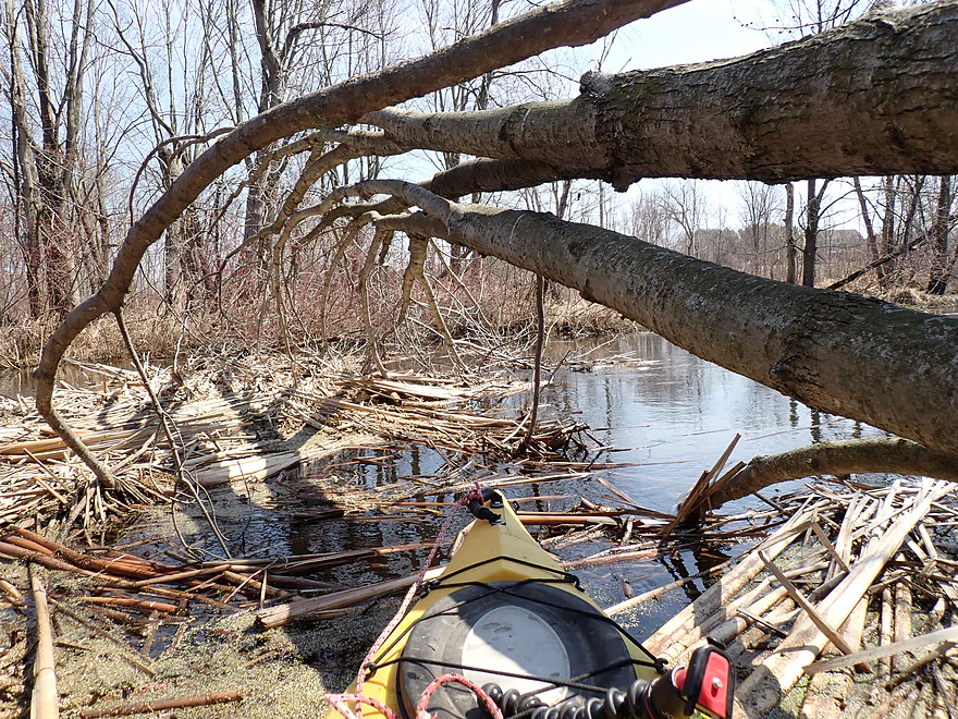
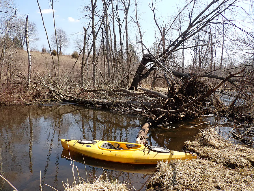
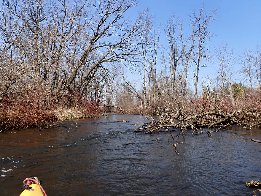
Logjam before
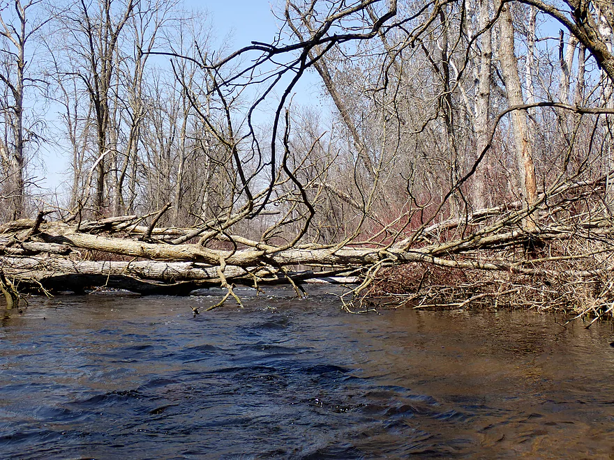
Logjam after…I mostly cleared it out
Glacial substrate
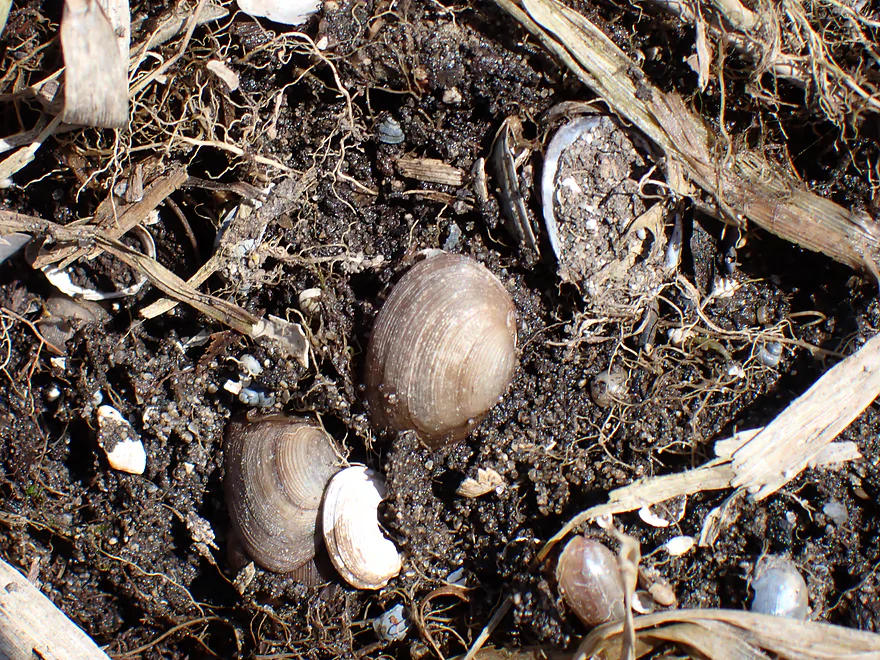
Fingernail clams
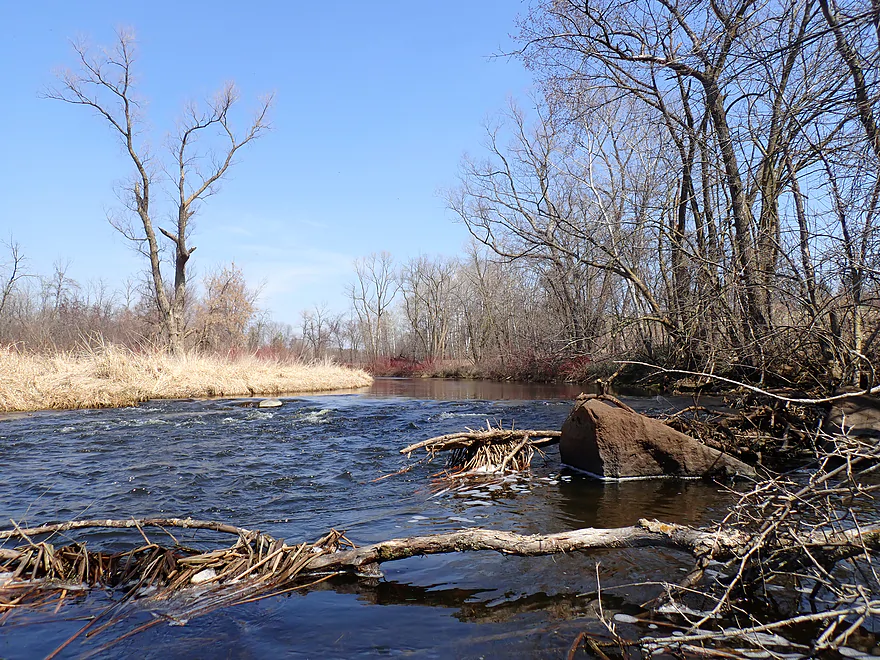
Major logjam…this was a bit tricky to portage
Reverse view
Scenic stretch…river is sandwiched between two drumlins
Current starting to pick up
Starting to see more rocks
Fun rapids under a bridge
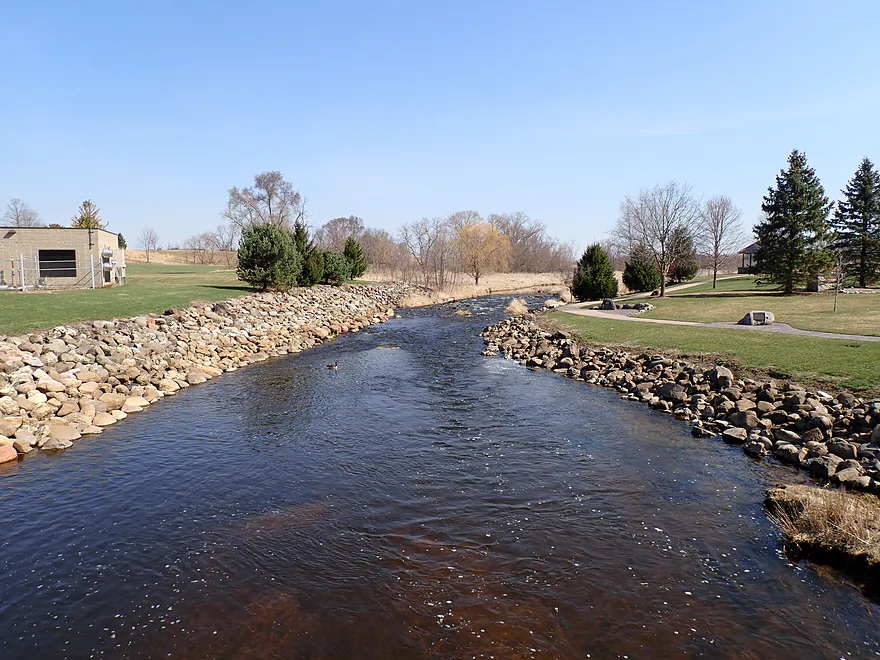
Entering the former Campbellsport Millpond
Kind of cool seeing rapids next to cattails (unusual)
More fun rapids
Reverse view
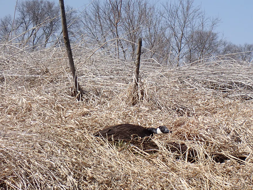
Goose laying low
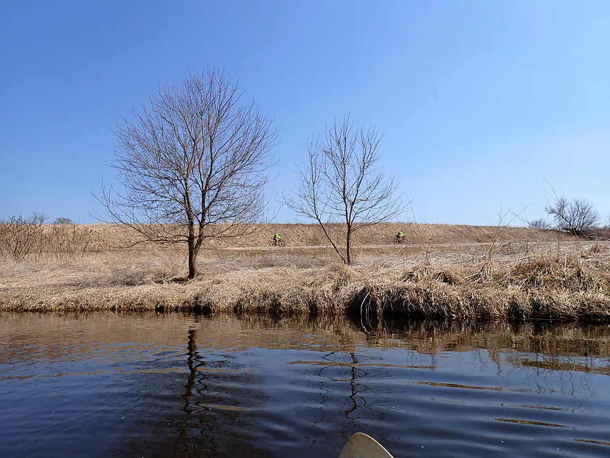
Bikers backdropped by a drumlin
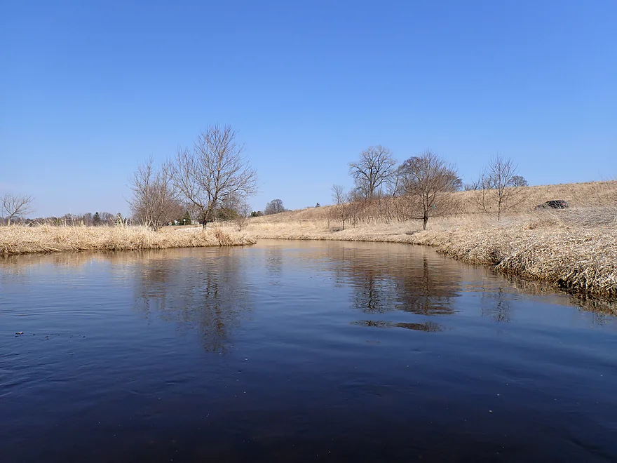
Nice stretch
This used to be a silted in and stagnant millpond
Approaching the old dam location (not 100% removed!)
Rocky but fun rapids
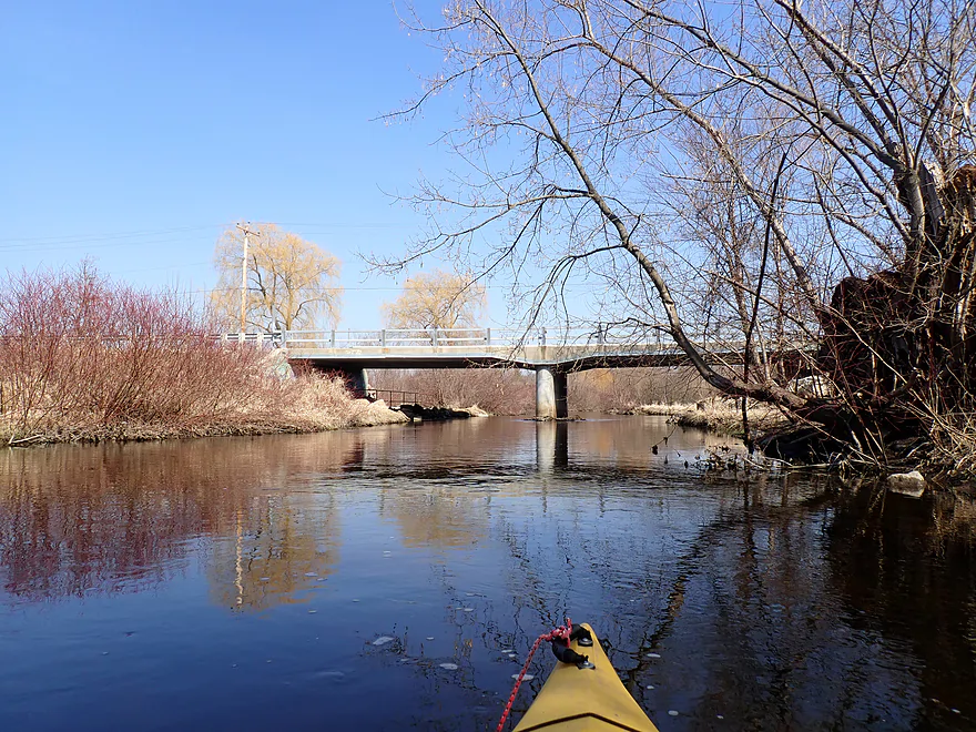
View from Hwy 67 bridge (Campbellsport Wayside to the right is an access option)
The old millrace…now mostly sealed in
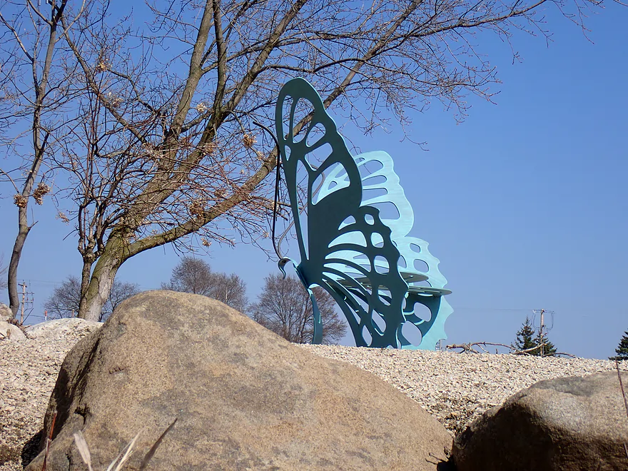
Terrific butterfly sculpture bench
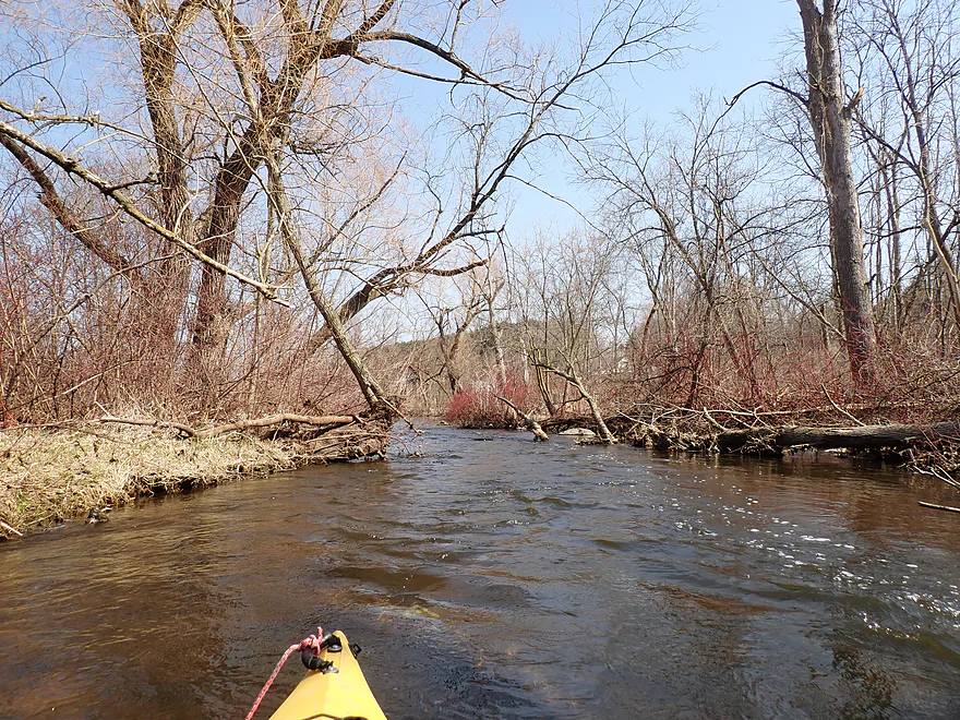
Final wooded stretch through east side of town was really scenic
New Cassel Street
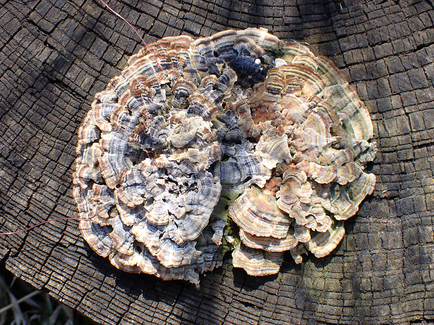
A photogenic fungus (turkey tail mushrooms)
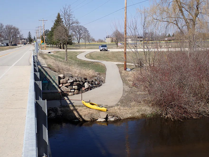
Columbus PARC was a good take-out
Milwaukee River – Campbellsport

Most kayakers are familiar with the Milwaukee River, which is a popular paddling experience…but only from West Bend to Lake Michigan. The northwest portions closer to Fond du Lac, in contrast, are largely unexplored territory. This includes a leg by Campbellsport that has been transformed in the past decade by the removal of a local dam and millpond. Geologically speaking, this is an intriguing “Ice Age paddle” as it flows through the heart of Kettle Moraine country. This is a famous line of geologic features created when the Green Bay and Michigan glacial lobes “butted heads”. This left a series of kames, drumlins, and moraines which can be neat features to paddle past.
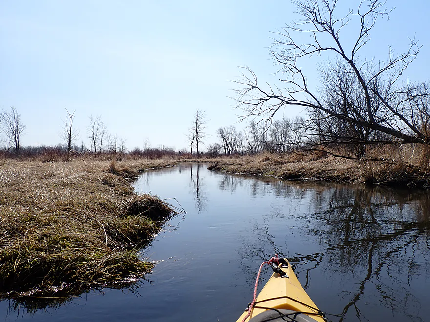
Putting in off the Cty W bridge was pretty straight forward. In theory you could launch even further upstream (and maybe I should have), but the upper portions suffer from straightened channels and several large farms. Past W, the river quickly narrows into a winding waterway and flows through an inviting wetgrass marsh. For much of the trip, the only signs of human activity were numerous hunting blinds. The marsh then shifted from wetgrass to cattails. I had been concerned about possible cattail jams from my readings of Google maps, but these proved not to be an issue.
At about a mile into the trip a notable unnamed creek entered from the north, which effectively doubled the size of the Milwaukee. The river’s character really changed as the intimate twists and turns gave way to a wider, slower and straighter channel. This was less scenic than before, but it was still pleasant. The clear water provided occasional glimpses into the riverbed where a multitude of small white snail shells were scattered alongside broken clam shells and occasional crayfish. This part of the marsh was terrific for waterfowl and I constantly heard cranes, geese, and songbirds. Red osier grew along parts of the shoreline and provided a striking visual contrast to the died back grassy banks.
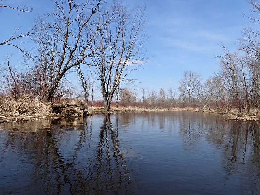
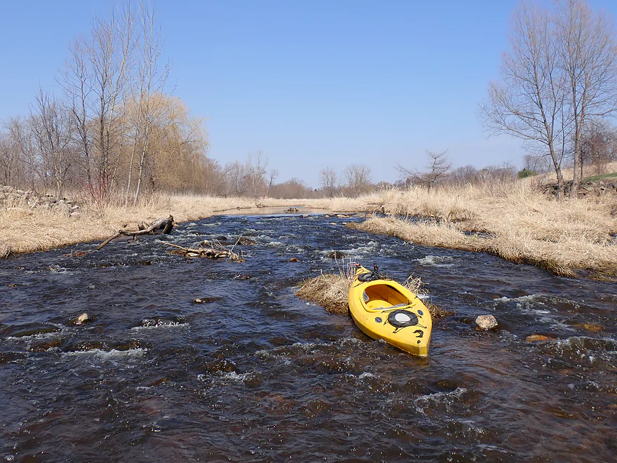
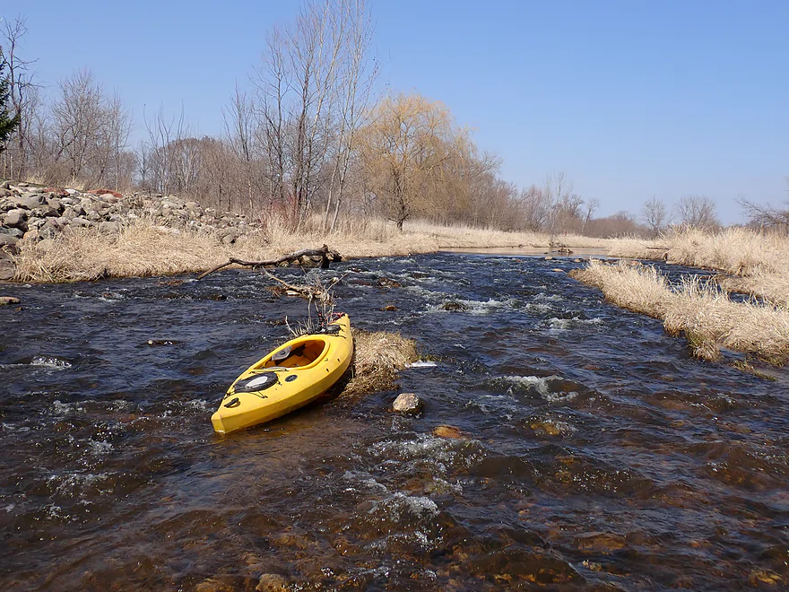
As Hwy SSS began to parallel the river, the landscape shifted, as the river was redirected between two drumlins. The open marsh gave way to wooded banks and an increasing presence of houses. Underneath my kayak the substrate became rockier–undoubtedly a testament to the glacial till deposited thousands of years ago. While scenic, this wooded mini-stretch was where I encountered my worst obstacles of the trip. The first was a “cattail jam” which I squeaked by with little difficulty. This was soon followed by a minor logjam (which I dislodged for future paddlers). But the third logjam was major and required a portage (doable but annoying). All in all, I only had to portage once for the trip, which I consider acceptable.
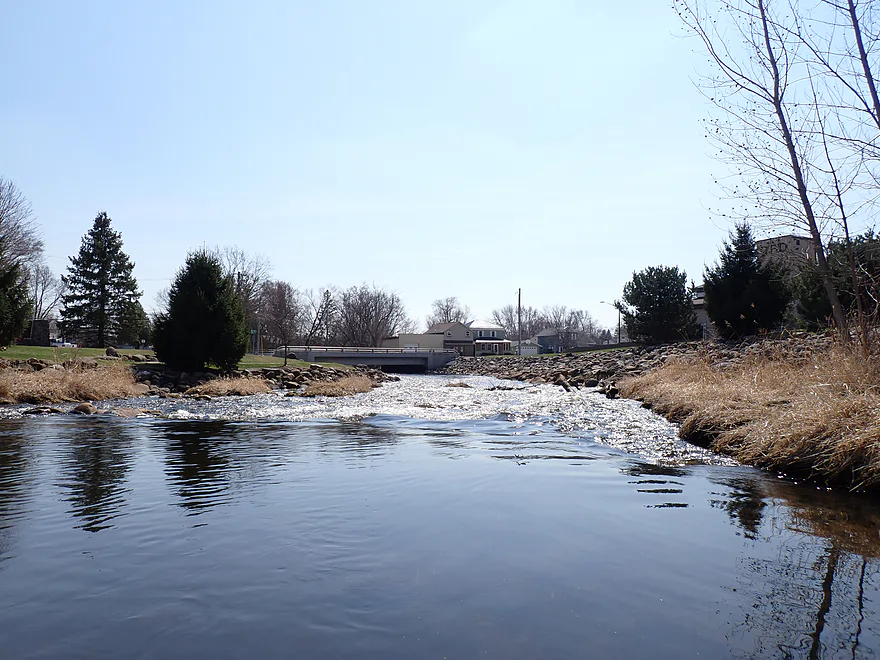
Closer to Campbellsport, the river quickened dramatically, treating me to a lively series of Class 1 rapids. Approximately a mile was once submerged beneath the Campbellsport Millpond. As is inevitable with millponds, it became silted in, which led to the dam’s removal in 2011. The restoration has been a success and restored life (figuratively with faster current and clear water), but also literally as the shallow and stagnant millpond fostered excessive bacteria and aquatic weed growth, which hurt the greater ecosystem. What remains of the millpond is mostly just a small cattail marsh which grows alongside the rapids. It is highly unusual to have cattails grow next to rocky rapids…this was a unique and cool experience.
Technically speaking, they didn’t remove 100% of the dam…maybe 97%. What remains is a Class 2 pitch of rapids about 250′ long and descending about 2′. You have to pick your path very carefully to avoid the rocks (see video at 4:58) but I thought it was pretty fun. There is a nice wayside here and you could certainly end a trip here or use it to scout/portage.
After passing East Main Street, the river wound through the small but attractive residential area of Campbellsport. A local filled me in on the history of an adjacent millrace which was partly (but not completely) sealed in. The final half mile was scenic and paralleled a local park and trail system. I ended the trip at Columbus PARC (not a typo) which was a great access.
In summary, this was a fun and diverse trip…very reminiscent of the Upper Bark River. The varied landscapes (wetgrass marsh > cattail marsh > woods > rapids > town) kept the trip engaging…with the rapids and the initial wetgrass sections being my favorite. The only thing holding back a full recommendation is again the logjam, which was a bit tricky to portage. Locals could easily clear this out as it is right next to Hwy SSS (hint hint for anyone reading this). Other considerations include needing slightly higher water levels to do this leg, as otherwise you’ll have to wade most of the rapids. Lastly, Google maps suggest the upper portions might get weedy in later summer…all that said though this is a great water trail that I would recommend.
Sights included blackbirds, cranes, ducks, crayfish, and many songbirds. Geese were common…often one parent would split off from its partner and lead me on a “goose chase” downstream away from the nest. There weren’t many fish, but there were some schools by the take-out. There was also a number of clam shells, including fingernail clams, but nothing living. Live clams are somewhat of a rarity nowadays and they may be impacted by pesticides and other pollutants. At the start of the trip I saw a heron wading around in a farmer’s drainage-ditch/cesspool…not sure that was a good idea.
Eisenbahn State Trail: This is a rails-to-trails project that runs through the west-end of Campbellsport. For those launching further upstream (like by Happy Road) you could (mostly) use this as a bike shuttle.
Cty W: This was a good bridge access. Launch on the east side where it is more open.
Alternate Put-ins:
- Meadow Road (1.5 miles upstream from W): This should be a doable bridge option. The bonus stretch will include mediocre farm scenery, but it shouldn’t be too bad and you won’t have to worry about logjams.
New Cassell Street/Columbus PARC: This is a great access option. There are actually multiple access options along the park…what I chose was just east of the road bridge. A public trail connects the park parking lot to the river.
Alternate Take-outs:
- Campbellsport Wayside (0.4 miles upstream from Columbus PARC): The wayside by the former dam is a great access option. But…if you end the trip here, you would miss out on a nice bonus stretch of river.
- Cty Y (2.8 miles downstream from Columbus PARC): This is a scenic bonus stretch, but likely has 2-3 logjams. Not sure if it is worth it.
Bike Shuttle – Cty PB to Fritz Road: 3.0 miles with 105′ of ascent. There is some minor hill climbing, but this is otherwise a pretty easy bike shuttle. For those wanting to launch further upstream (like by Happy Road), aking the Eisenbahn State Trail would be a viable bike shuttle option.
Logjams: The river was actually fairly open, but I did encounter three obstructions close to East River Road. The first was a cattail jam and it wasn’t difficult to plow through. The second was a minor logjam, but I mostly cleared this out and kayakers should be able to squeak by without portaging. The third though was a major logjam (marked on map) that I had to portage. This was a medium difficult portage because of the mud. Doable, but pretty annoying. Hopefully this will be cleared out in the future.
Wind: This is a relatively open paddle, so be mindful of forecasted wind speed and direction.
Current/Rapids: The current starts at a brisk pace but slows in the middle marsh portion. The last quarter was fast with a number of light rapids. The only major rapids though are at the former dam site by Main Street. Basically it’s a rocky 2′ drop about 250′ long. Pretty fun, but could get bumpy during shallow water. It is easy to scout/portage via the adjacent wayside. You can see the rapids at 4:58 in the video.
Fences: None.
Aquatic Weeds: These weren’t an issue during my April trip, but satellite images from Google suggest in late summer the upper parts of the marshes might get a bit “weedy”.
River Gauge: Rock River @ Horicon
River Trip Depth: 599 CFS or 6.5′
River Navigability Estimates: There is no gauge on the Upper Milwaukee, and I don’t trust the lower Milwaukee gauges. Instead I went with the Rock River gauge by Horicon as it represents a neighboring watershed of similar size. But note, these are really rough guesses so may not be accurate.
- < 200 CFS: Probably too shallow.
- 201-300 CFS: Very low depth..the marsh portion should be fine but most of the rapids by Campbellsport will have to be waded.
- 301-500 CFS: Maybe an average depth. The Campbellsport rapids though will be really bumpy.
- 501-700 CFS: Good target range. You’ll hit some rocks on the rapids, but should mostly be ok.
- 701-1000 CFS: A high depth, but likely good for paddling this trip. Rapids should have good padding.
- 1001-1400 CFS: Very high depth…should still be navigable though.
- 1400+ CFS: Probably major flood stage and not suitable for kayaking.
Detailed Overview
Additional access options are visible on the overview map. Special thanks to Milwaukeeriverkeeper.org which has some detailed information on the river, including this great map.
- Upstream from Happy Road: Not viable for kayaking.
- Happy Road to Meadow Road: (0.7 miles) Small but mostly open stretch partly straightened by farmers. Likely ok.
- Meadow Road to Cty W: (1.5 miles) Very open stretch that flows past wetgrass marshes and farms. Likely an ok prospect with no logjams.
- CTY W to CampbellSport: (4.5 miles)
- Hwy W to Campbellsport Wayside: (4.1 miles) Starts as a narrow wet grass marsh and widens into a slower cattail marsh. Marsh recedes when sandwiched between two drumlins and becomes rockier and faster with some rapids. Overall a varied and scenic paddle. As of 2025 one logjam will have to be portaged.
- Campbellsport Wayside to Columbus PARC: (0.4 miles) A pleasant and scenic leg flowing past the outskirts of Campbellsport and a local town park.
- Campbellsport/Columbus PARC to Cty Y: (2.8 miles) Maybe 2-3 logjams. Otherwise this is a scenic stretch.
- Cty Y to Hwy 45: (1.7 miles) Maybe 3-5 logjams.
- Hwy 45 to Auburn Ashford Drive: (1.3 miles) Maybe 1-3 logjams...some riffles.
- Auburn Ashford Drive to Old Bridge Road: (0.7 miles) Maybe 1-3 logjams.
- Old Bridge Road to West/Main Branch Confluence: (2.0 miles) Maybe two logjams. For those launching above Kewaskum, I think they will start on the West Branch instead.
- Alternate - Hwy 45 to West/Main Branch Confluence: (0.7 miles) Probably one logjam...but more viable than starting from Old Bridge Road.
- West Branch/Main Branch Confluence: (2.8 miles) A mediocre prospect. Maybe one logjam..I don't know much more.
- Kewaskum Dam/Park to Cty H: (2.9 miles) Solid prospect.
- Cty H to First West Bend Dam: (6.3 miles) A solid prospect with some flowage paddling at the end. The take-out entails dragging your boat across a private parking lot.
- First West Bend Dam (Barton Ave) to the Second West Bend Dam: (1.3 miles) Mostly an urban flowage paddle. The first dam is a difficult portage or put-in.
- 2nd West Bend Dam to Quaas Creek Park: (3.8 miles)
- 2nd West Bend Dam (Washington Street) to South River Road: (2.1 miles) Terrific section with a restored prairie, fast current, light rapids, and good urban scenery.
- South River Road to Quaas Creek Park: (1.7 miles) A paddle through urban woods...pleasant but not top-notch.South River Road to Cty M: (6.3 miles) A pleasant stretch with little development and clear water.
- Cty M to Main Street Bridge (Newburg): (3.4 miles) Good prospect with small boulder gardens in shallow water.
- Main Street Bridge (Newburg) to Cty A Bridge: (6.3 miles) A popular paddle with great water clarity.
- CTY A to Waubedonia Park (Waubeka): (5.7 miles) A decent leg with good current, some rocky stretches, and nice color in the fall. North Branch joins up and significantly enlarges the river.
- Waubedonia Park to Ehlers Park/Mink Ranch Road: (5.3 miles) A good stretch with a number of light rapids.
- Ehlers Park to Peninsula Park: (2.5 miles) A suburban stretch with maybe one set of rapids.
- Peninsula Park to Grafton Canoe Launch (south Saukville on Cty O): (1.9 miles) Kind of a suburban paddle.
- Grafton Canoe Launch to Veterans Memorial Park (Grafton): (4.1 miles) Some suburban and flowage paddling, although I think there are minor rapids in the upper stretch.
- Grafton Dam (SW of Bridge Street) to Lime Kiln Park: (1.3 miles) A terrific section with class 2-3 whitewater and scenic dells.
- Lime Kiln Park to Hwy T: (1.6 miles) A good section with the scenic 'Grafton Dells' and some Class 1 whitewater. I'm not sure Cty T is a good take-out.
- Cty T to Pioneer Road: (1.9 miles) A solid prospect.
- Pioneer Road to Thiensville Park: (6.9 miles) A solid d prospect but with some flowage paddling at the end.
- Thiensville Park to Badger Meter River Park: (4.8 miles) This is a less popular stretch of the Milwaukee. While not bad, it had somewhat repetitive scenery and lacked unique features.
- Badger Meter River Park to Kletzsch Park: (5.3 miles) This is a solid prospect.
- Kletzsch Park to Estabrook Park: (4.1 miles) Some flowage paddling and a nasty low-head dam to portage. A second dam has been, I believe, recently removed so this section might be very different now.
- Estabrook Park to Riverside Park: (3.1 miles) A number of decent rapids in this wooded but urban paddle.
- Riverside Park to McKinley Marina: (6.3 miles) A great trip on the last section of the Milwaukee.
- Riverside Park to Bruce Street Boat Ramp: (3.9 miles) A scenic paddle through downtown Milwaukee featuring some skyscrapers and great architecture.
- Bruce Street Boat Ramp to McKinley Marina: (2.5 miles) A bonus add-on section along Lake Michigan that features scenic vistas of the downtown.
Trip Map
Overview Map
Video
Photos Size:
I’ve actually paddled the entire length of the navigable Milwaukee River. The river is actually navigable starting from County Road F to the north. However, that section from County F to Happy Road is brushy and hardly worth doing. Tis a shame you didn’t launch from Meadow or Happy road to extend the trip. I grew up near where you launched and that additional mileage is also worthy of paddling. There is a small rock waterfall during lower water levels in between Happy & Meadow roads that is fun to go over as well.
Thanks for the tips…I’ll probably do the stretch by Happy as a future trip.