
Welcome to Lytle Creek
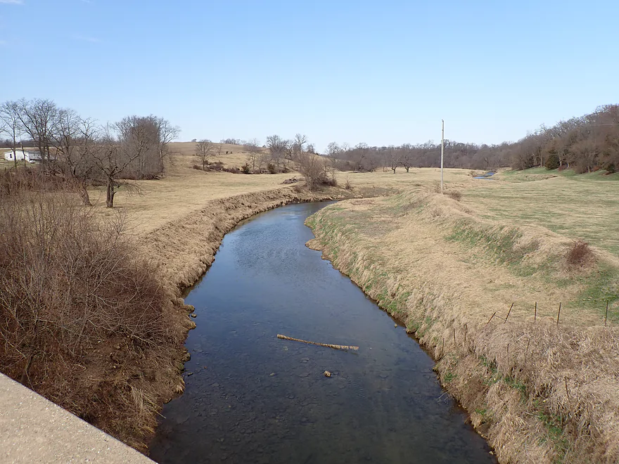
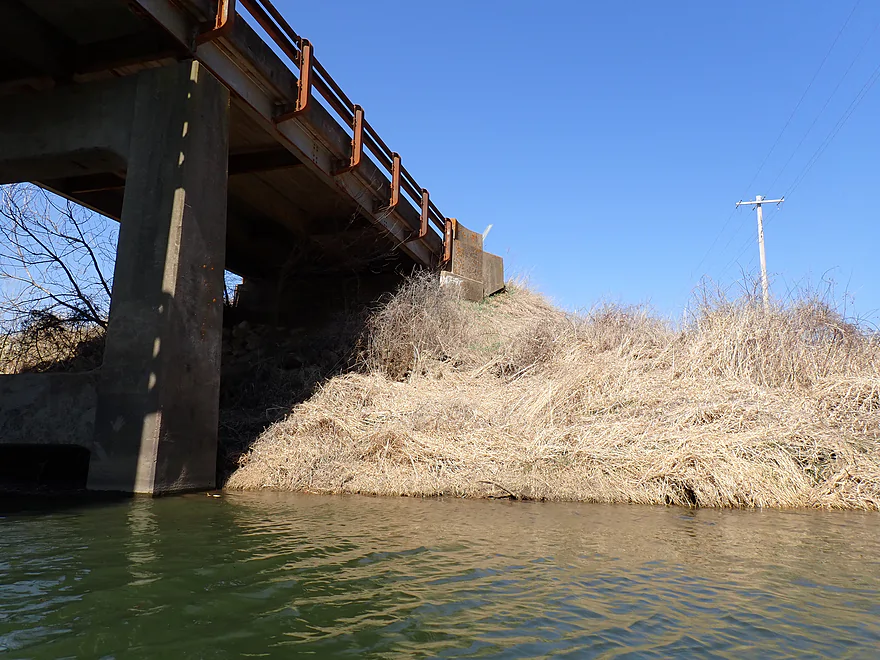
Starting the trip at Higginsport Road
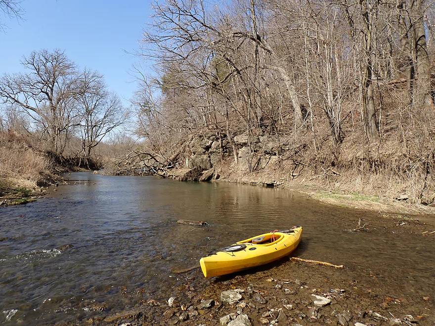
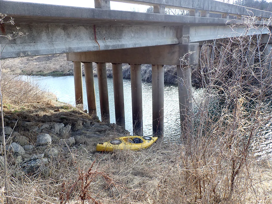
A muddy but doable put-in
Wire just upstream of bridge (not electric)
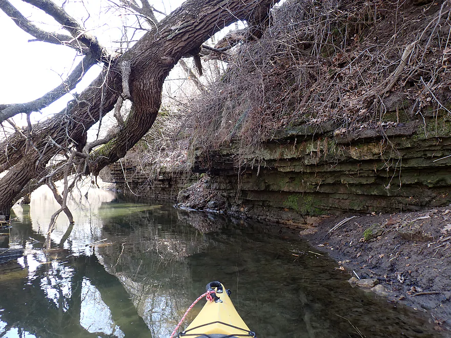
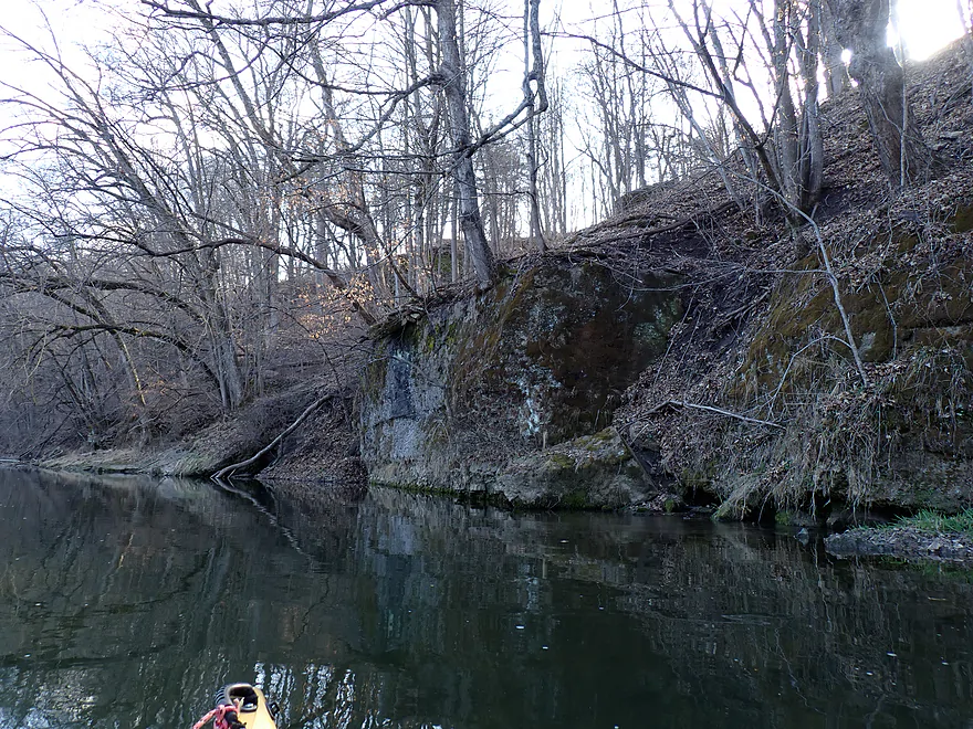
First outcrop
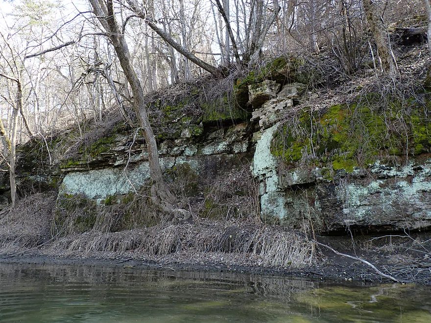
Terrific layers (likely limestone or dolomite)
One of several artesian springs along the creek
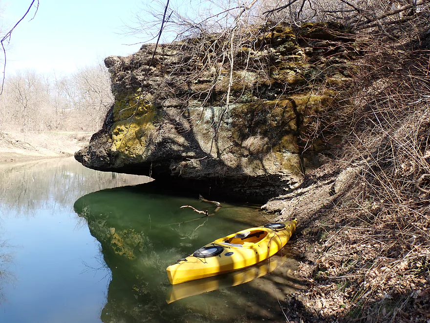
A duck-shaped outcrop
In the summer this outcrop would be hidden by vegetation
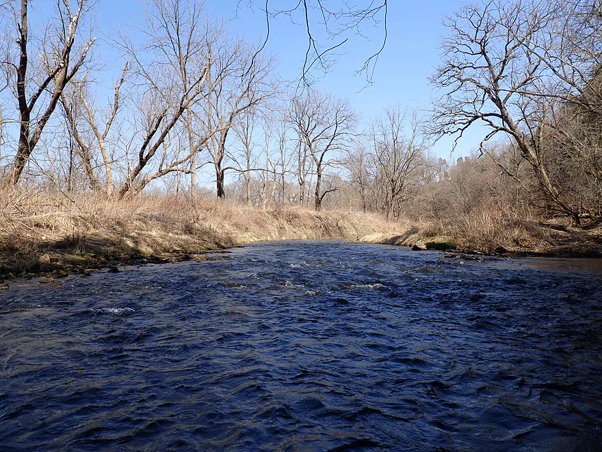
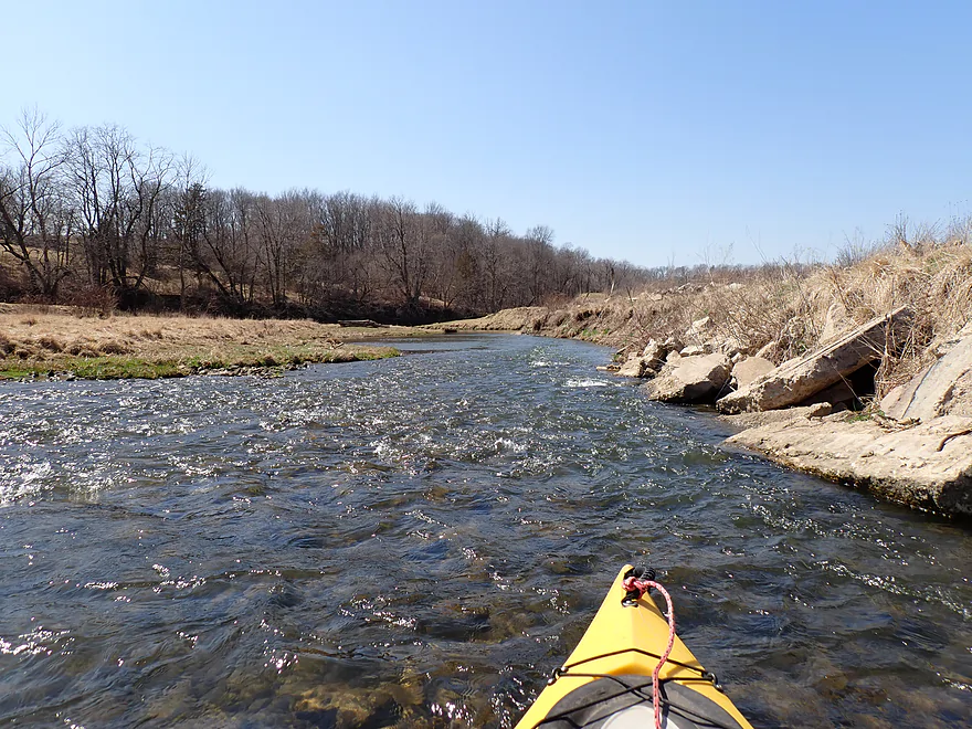
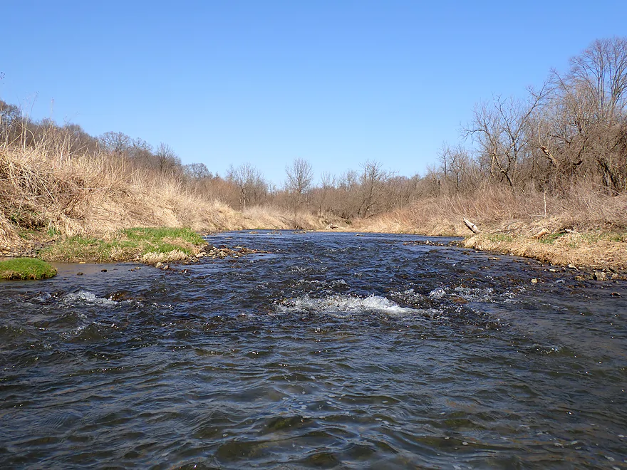
The first of several light rapids
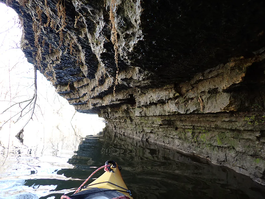
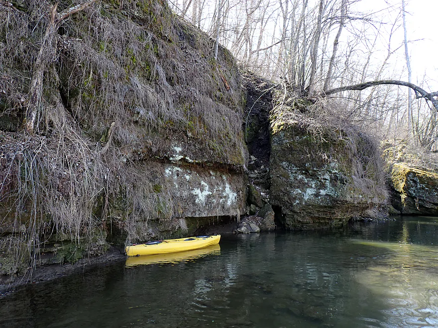
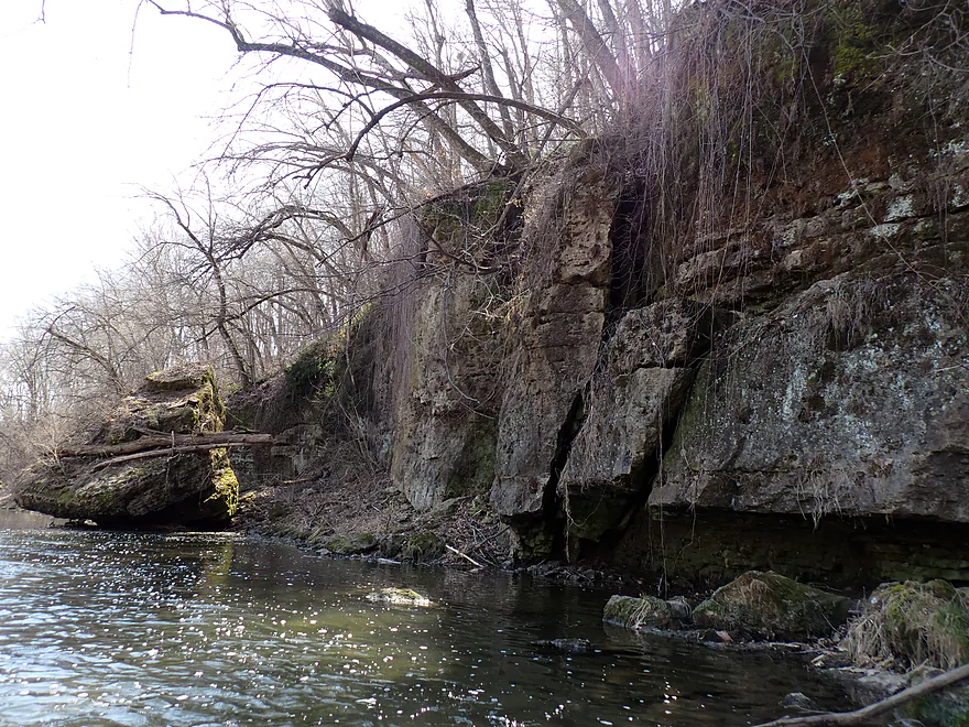
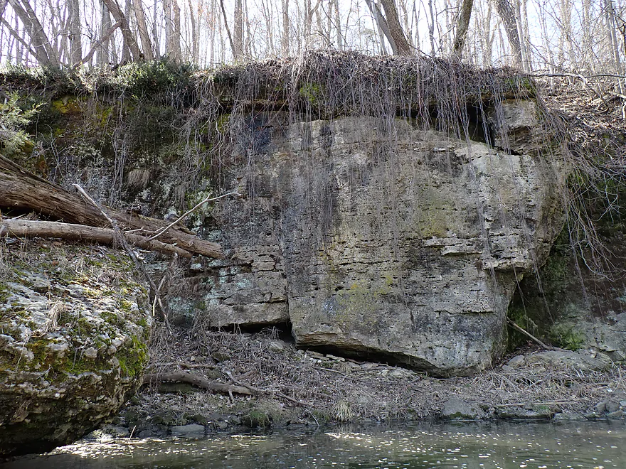
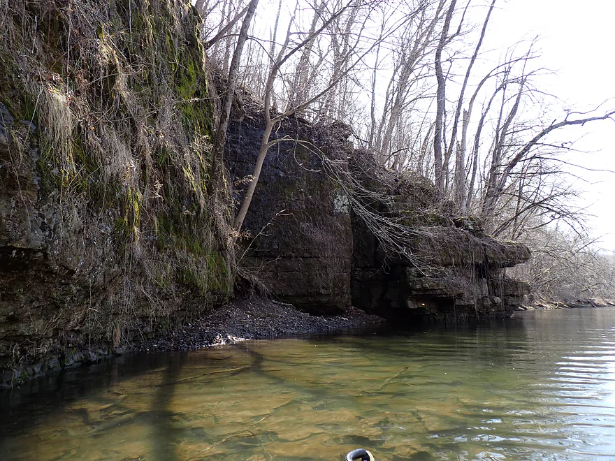
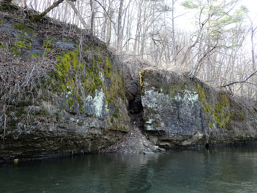
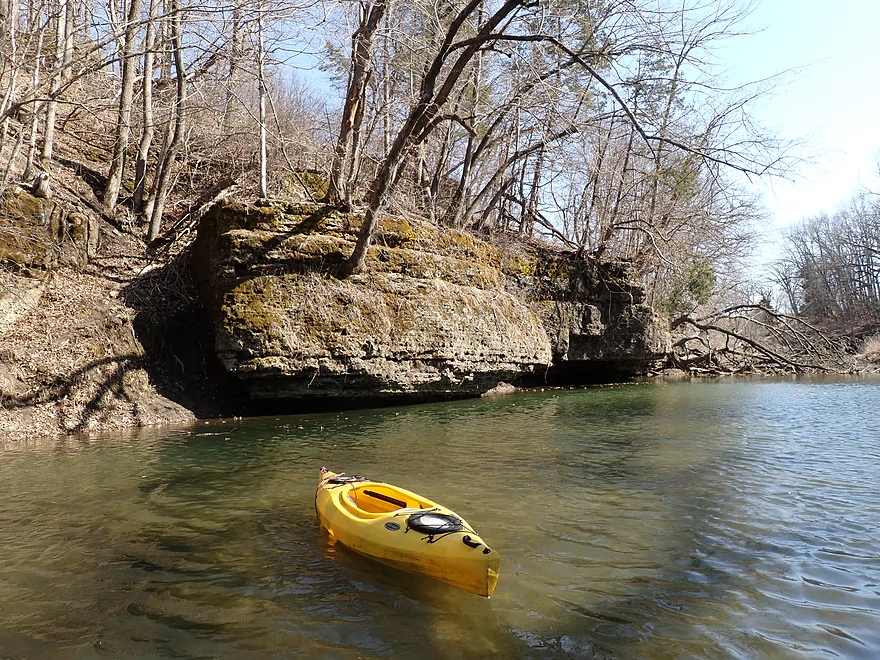
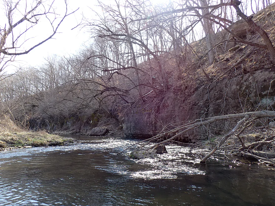
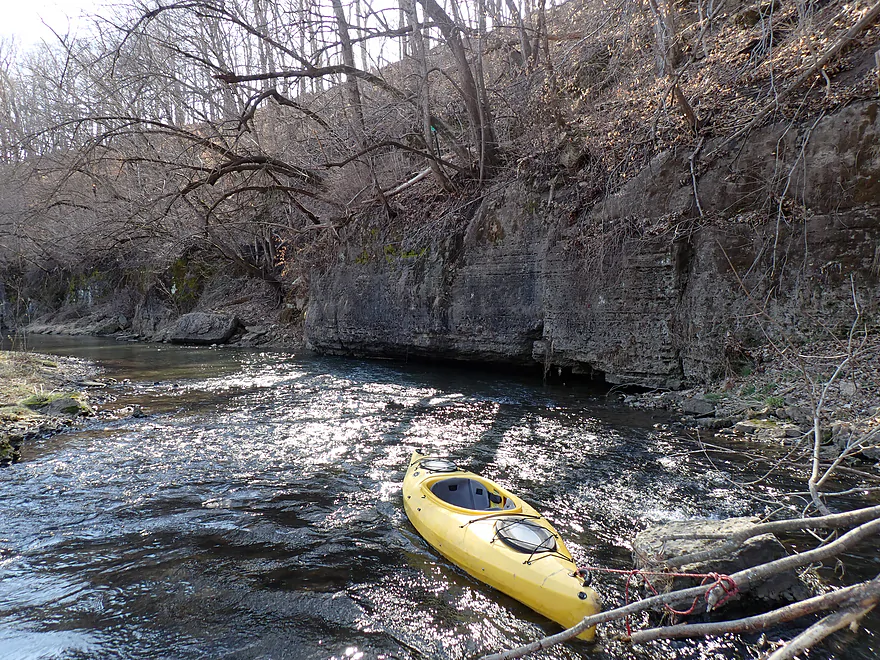
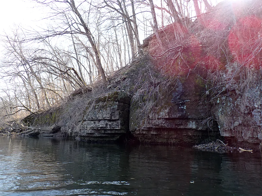
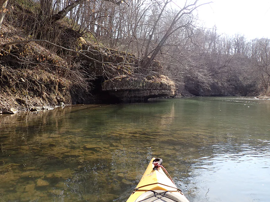
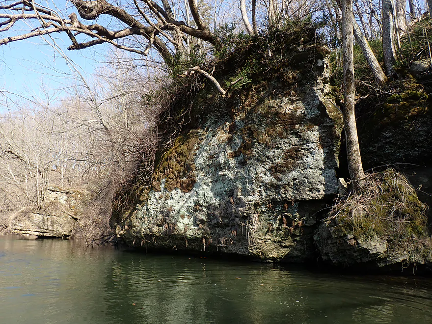
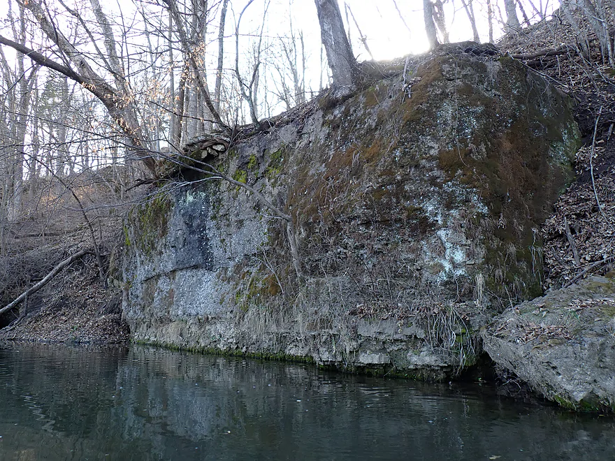
Coming up on one of the nicer cliffs
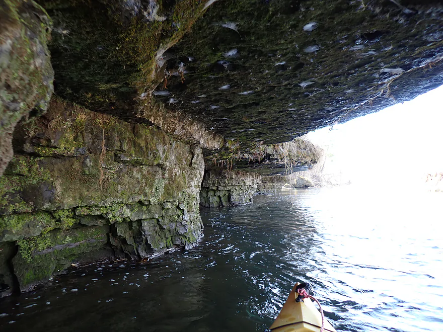
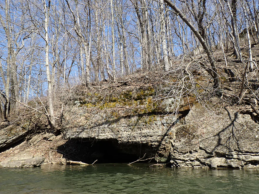
The rock overhangs were fantastic
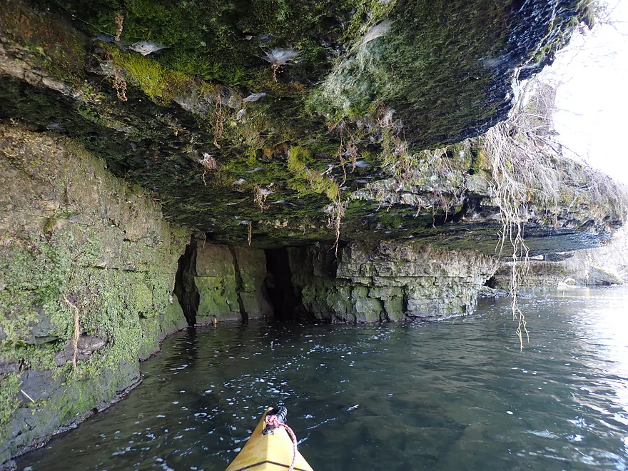
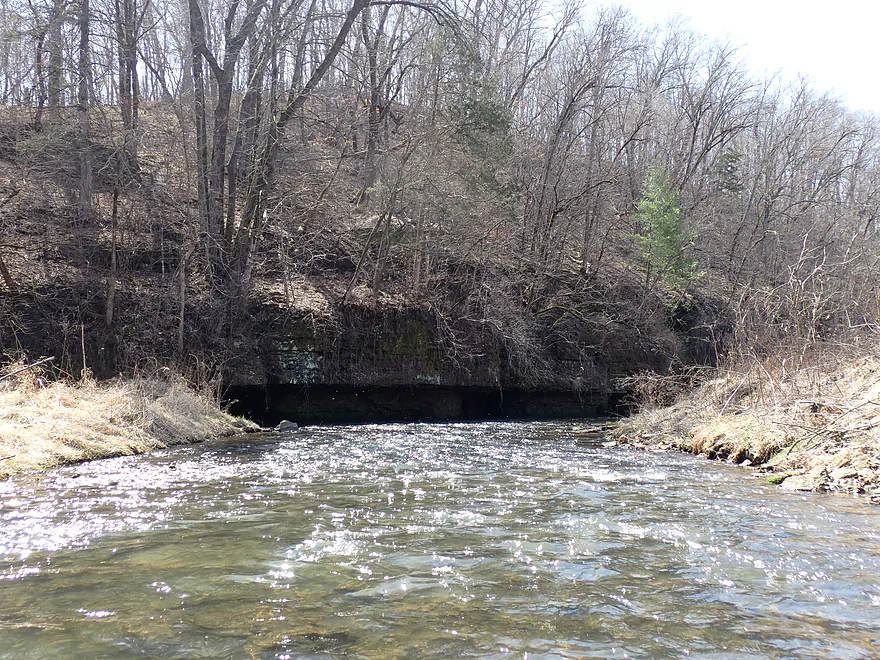
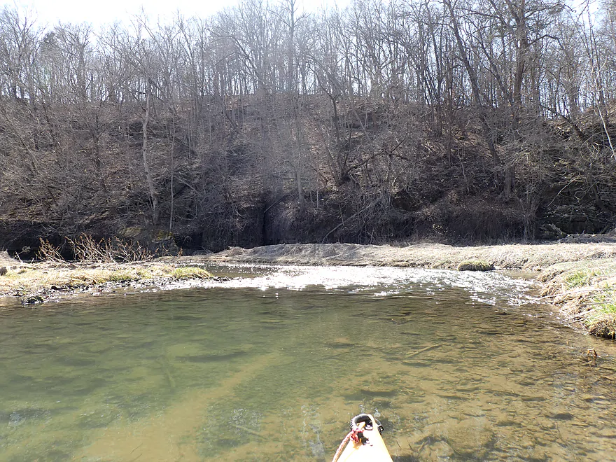
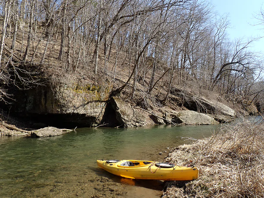
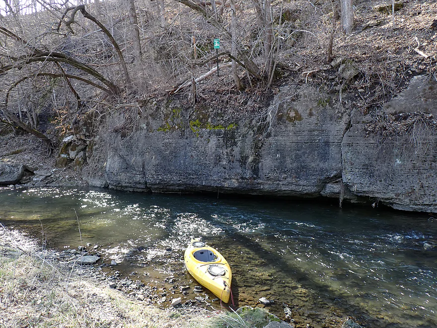
Note quite a cave, but almost
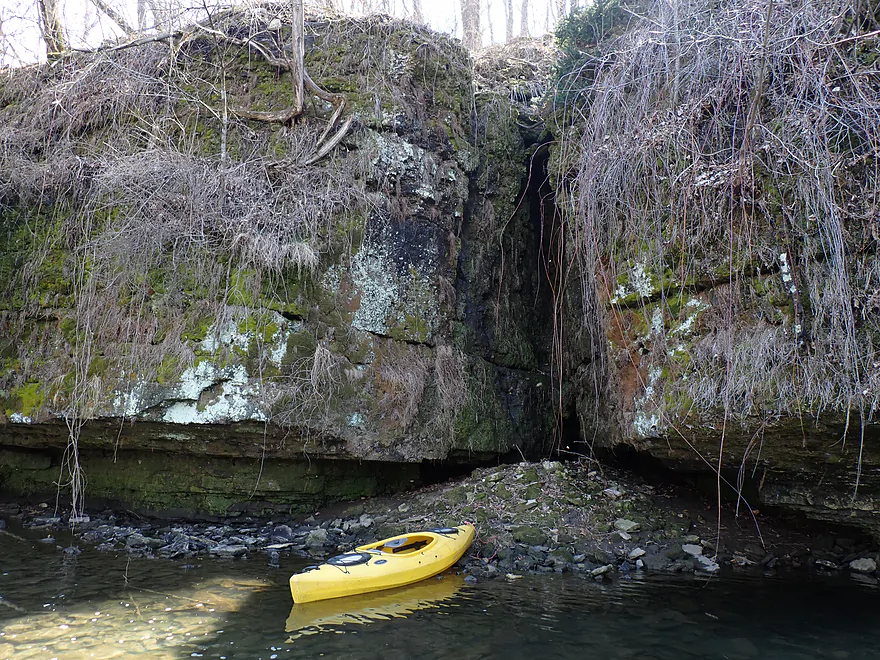
Rock being split in two
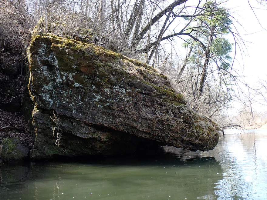
Almost ready to slide in
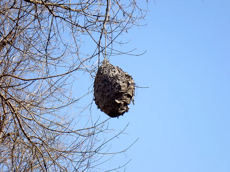
Nice bald-faced hornet nest
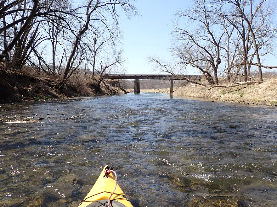
Lyons Road
Paddlers sometimes launch here
More fun rapids

Some tree dodging but never a major logjam
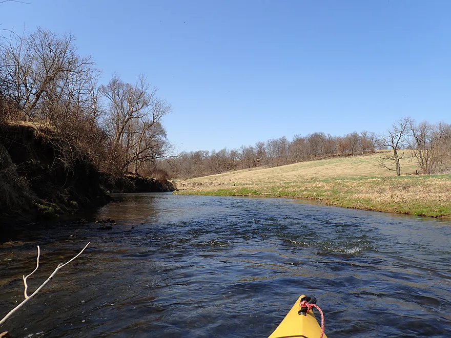
Open pasture
Fence…not electric and easy to duck under
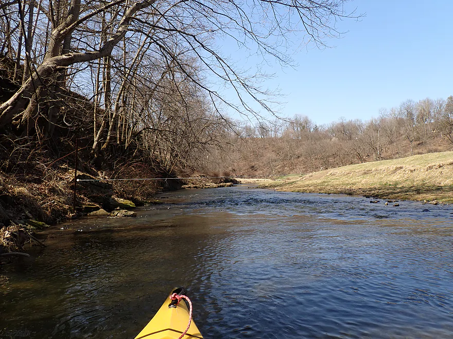
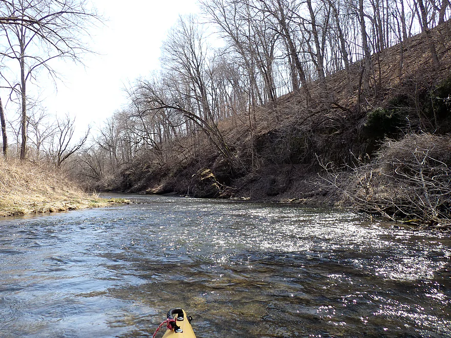
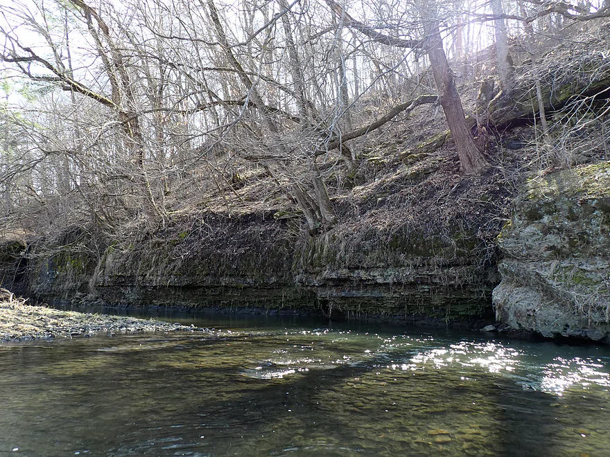
Approaching a nice bluff

Last fence of the trip…very low but not electric so easy to get past

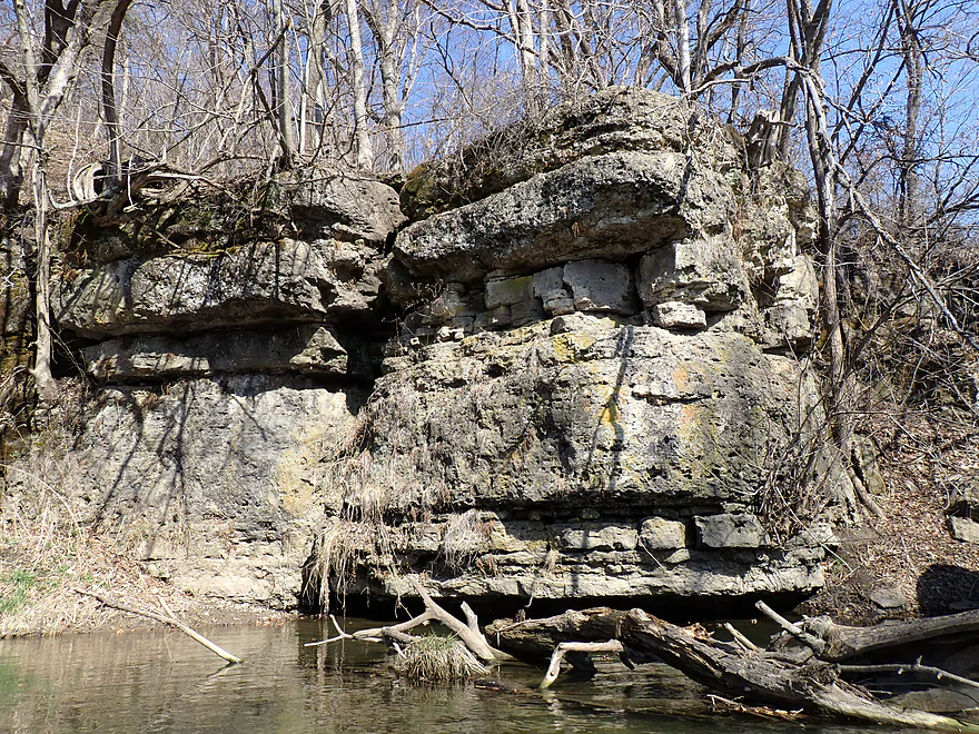
One of the larger cliffs on the trip

Trip featured some big boulders
Interesting vines draped from the rocks
Cool how the rapids flowed into the bluffs
Not many pine trees but some
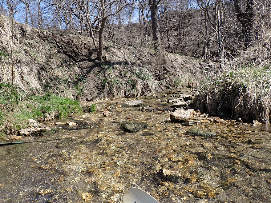
Some shallow spots
Clarity was pretty good
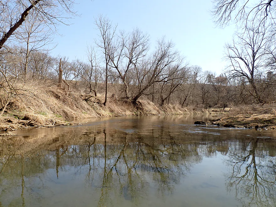
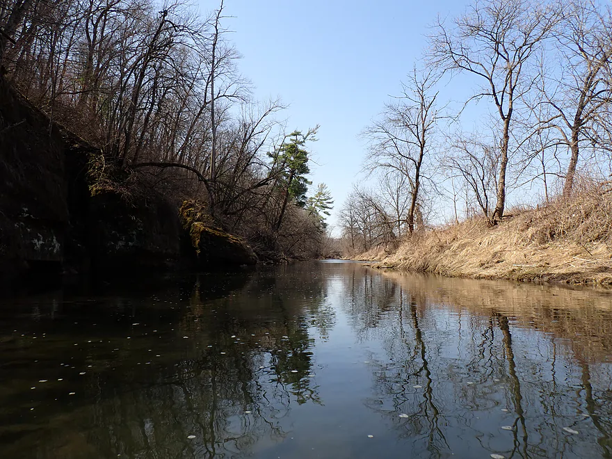
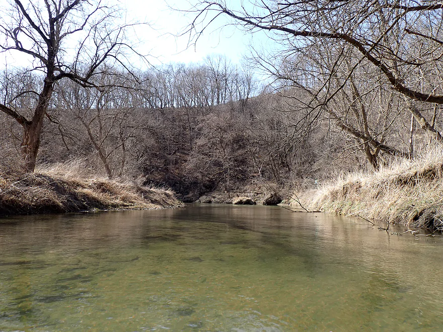
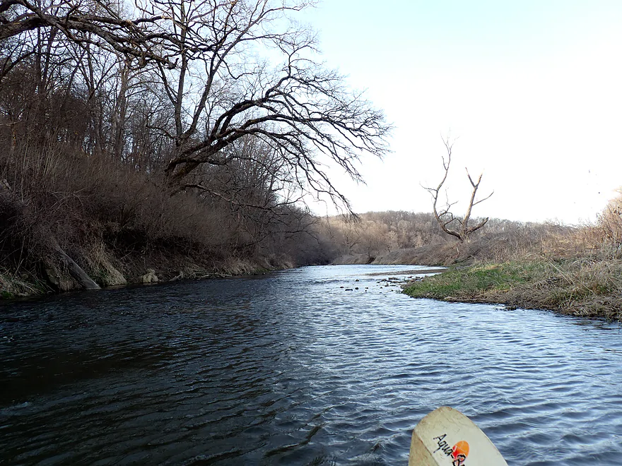
Another cool river bend
Cliff barfing rocks into the river
Terrific part of the creek

Another scenic cliff face
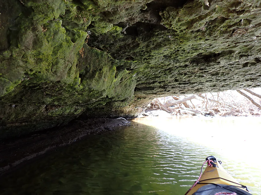
You could get pretty far under some of these overhangs
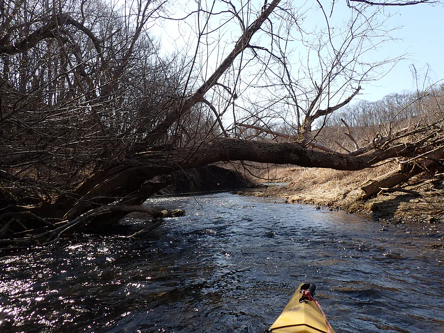
Again, no logjams on the trip
Approaching another large bluff
Reminded me of the Rush River
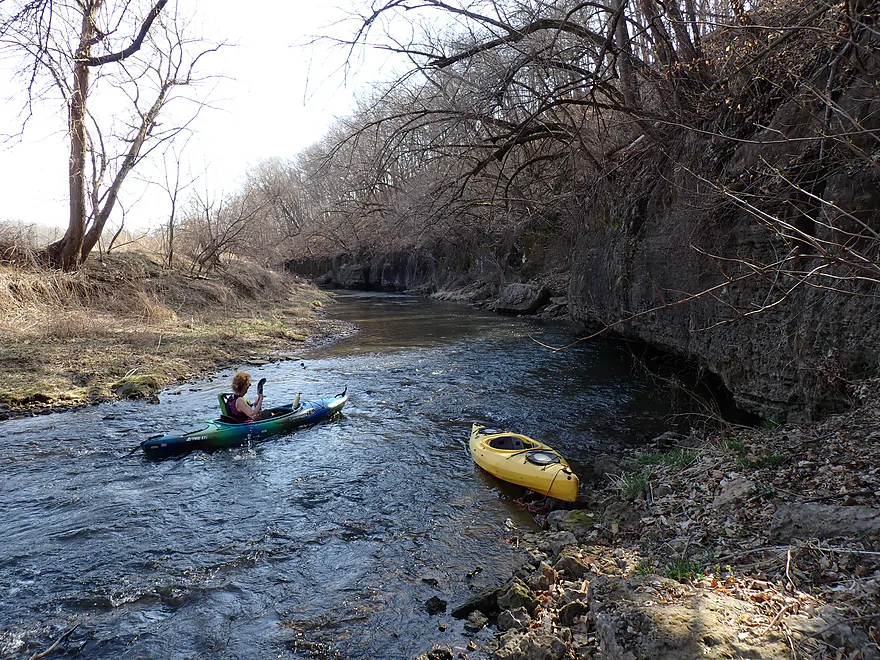
Shocked to see another paddler in March
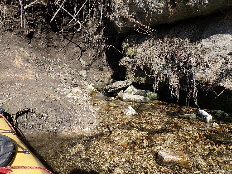
A noisy spring–I could hear it before I saw it
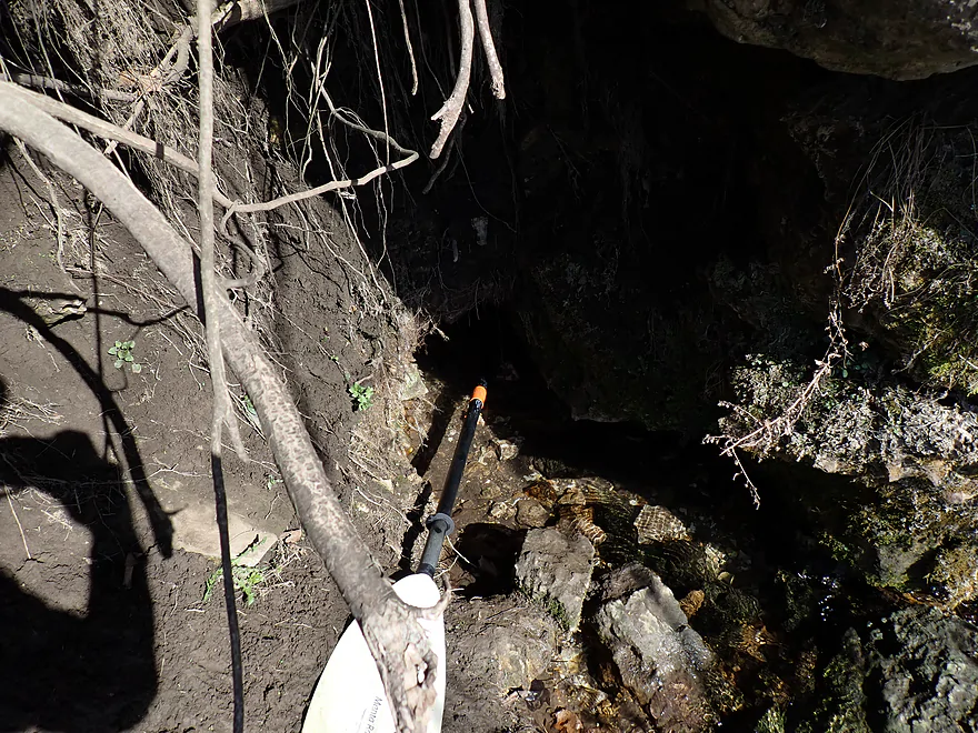
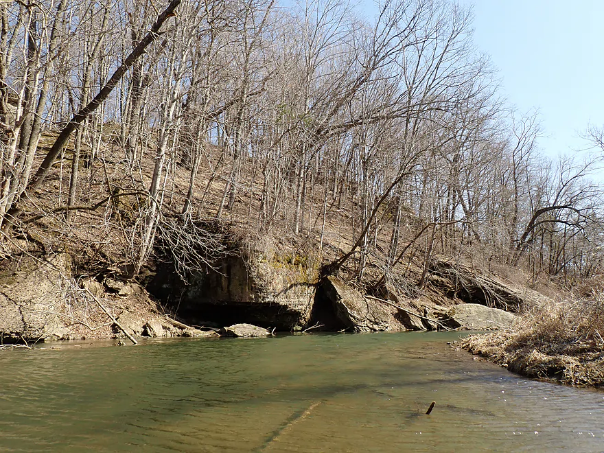
Where there are springs, there are caves…my paddle goes pretty far into the rock face
That is yew growing on top of the rock.
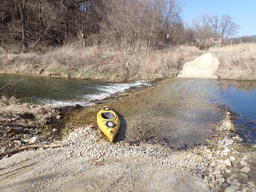
This river ford connects a parking area to the Bowstring Wildlife Area
Most paddlers get out here
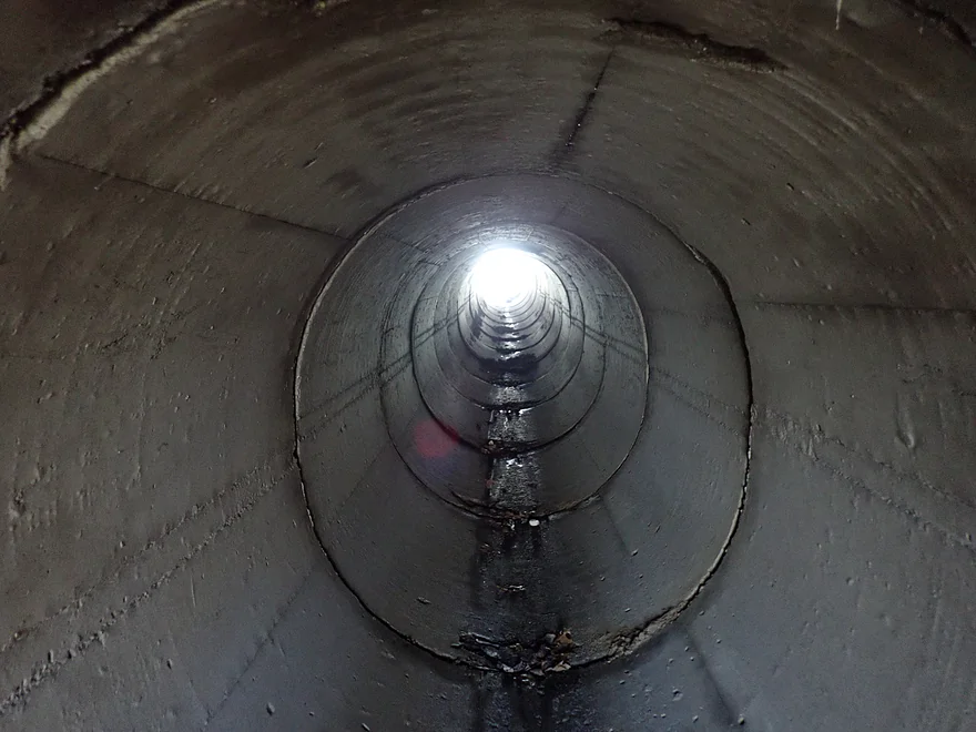
A random tunnel you can walk though
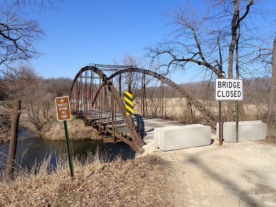
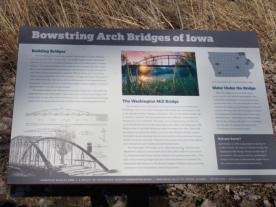
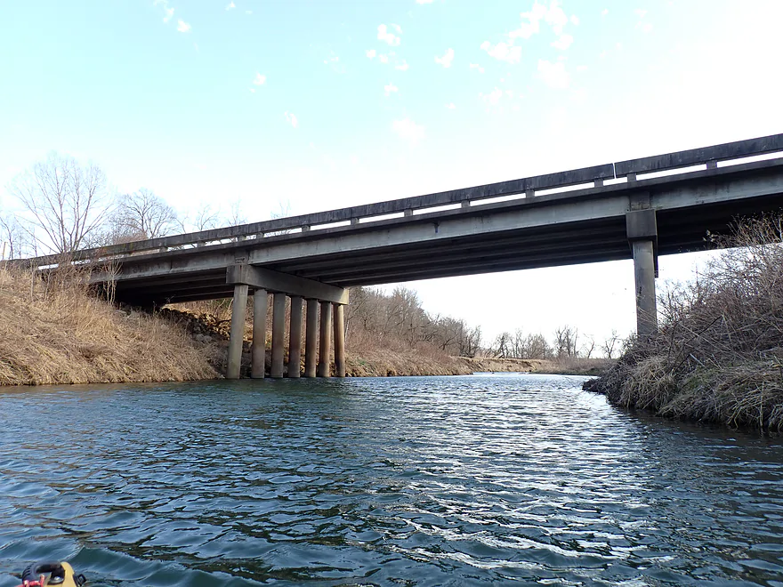
The main feature of the park is the Washington Mill Bridge, a rare example of a bowstring bridge
Getting back in to resume my trip…there is a large ledge after the ford…easy portage
More great outcrops
Huge boulder
Final leg
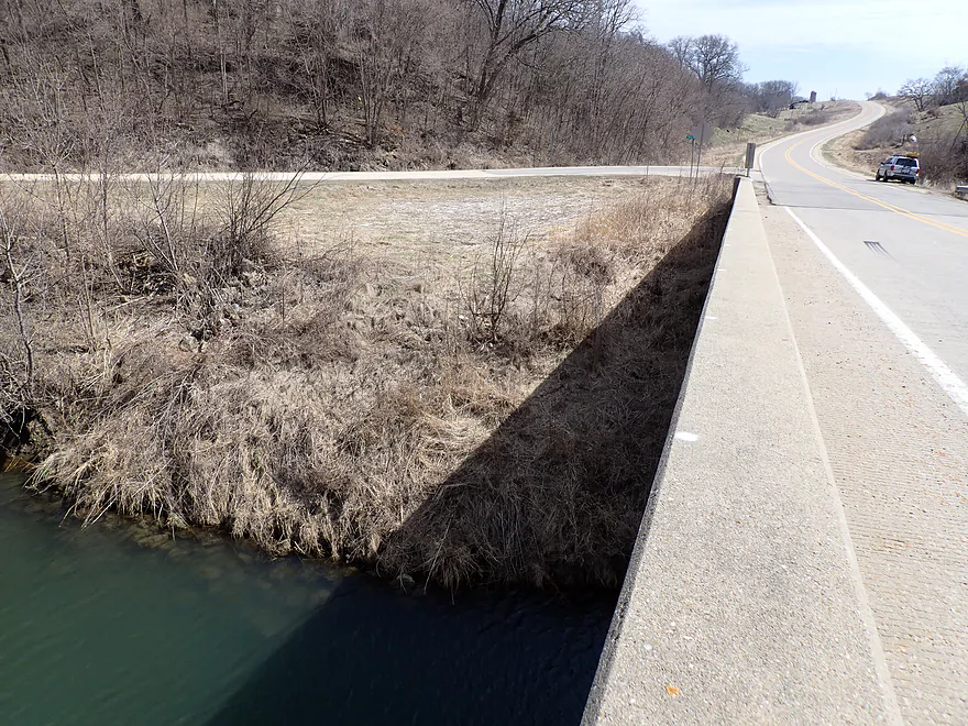
Washington Mills Road
A tall bank here made getting out a bit tricky
View of the bridge access area…not ideal…the Mill Ford is much better
You can continue to 287th Street, but there are tricky electric fences (photo by Suzanne)
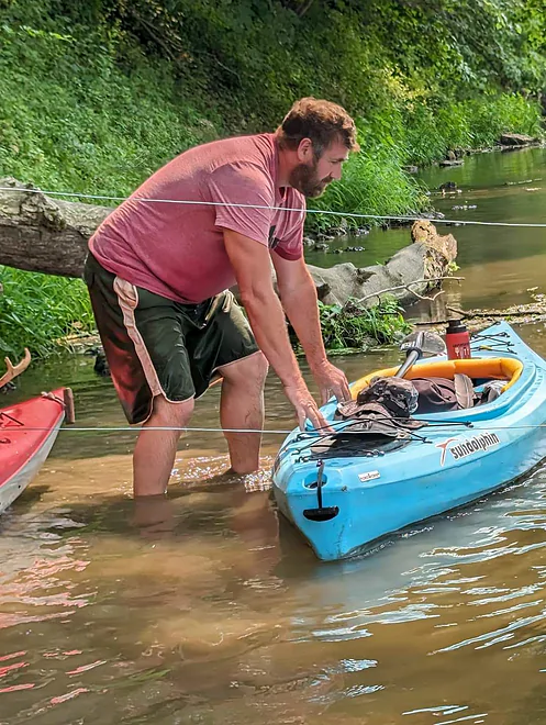
This party received a shock getting past this fence
Lytle Creek

Lytle Creek is a tributary to the North Fork of the Maquoketa River situated just southwest of the Dubuque, Iowa Airport. To outsiders it is pretty obscure and you won’t read about it in most paddling guides. But Dubuque area locals know about it and have been promoting it as a scenic water trail.
Most paddlers will start from either Higginsport Road or Lyons Road. This is a relatively short trip, so I opted for the more upstream Higgensport which added a half mile. The bridge itself rests on a large bank that towers over the creek, but I did find shoulder parking and a faint path southwest of the bridge where it appears other paddlers have launched.
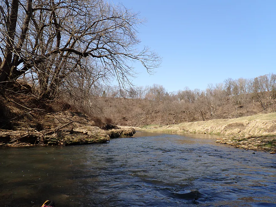
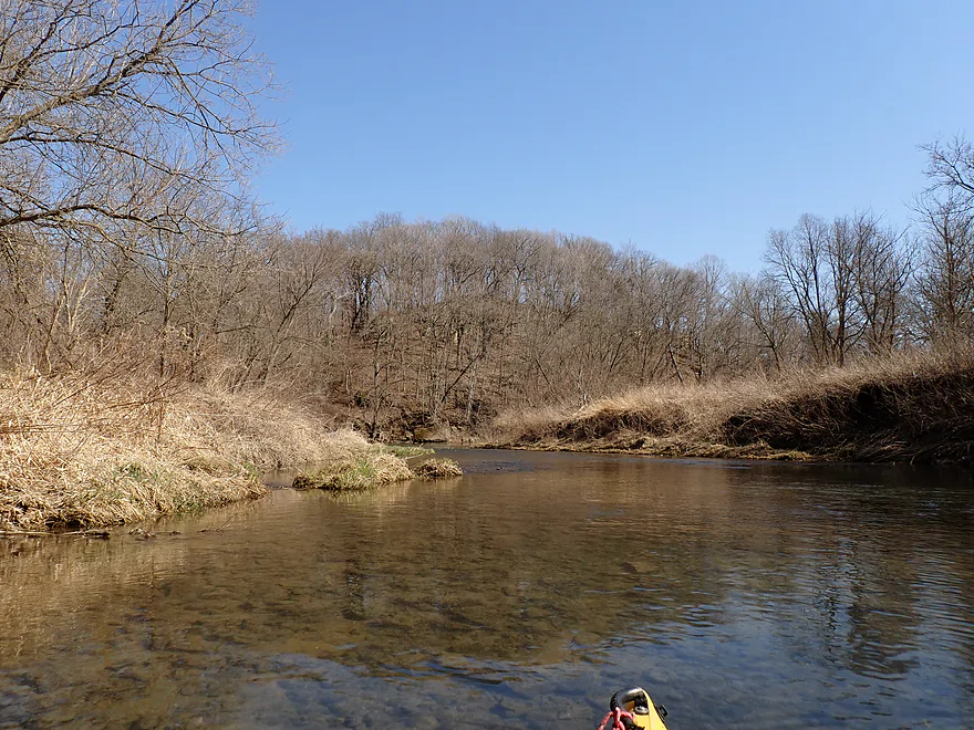
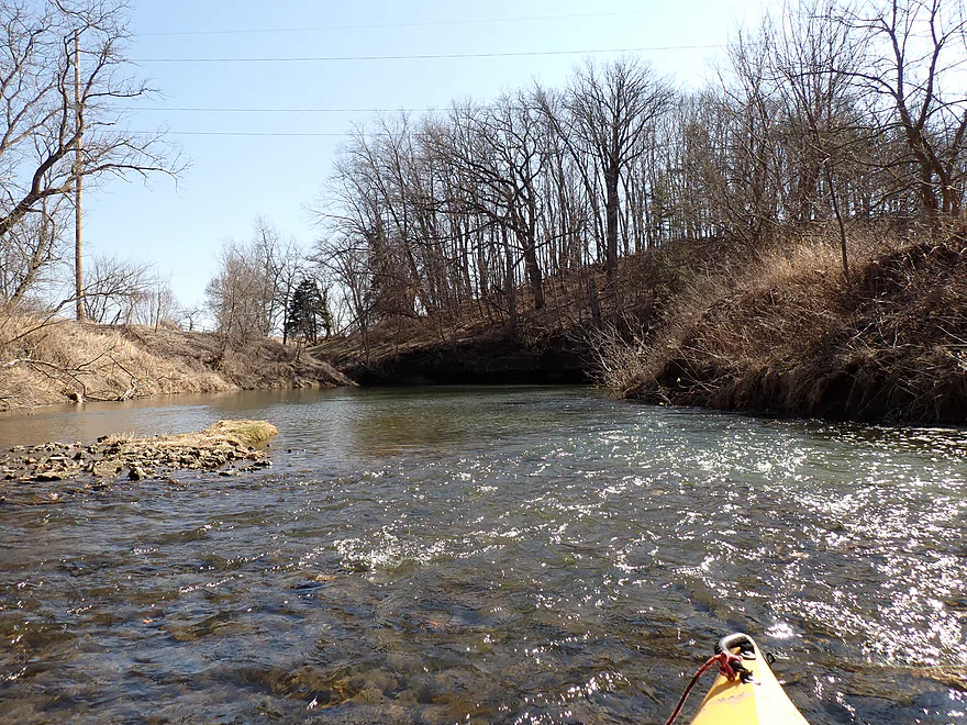
My first impression of the creek was very positive. After a large cliff swallow colony, I enjoyed relatively clear water with a nice blue-green hue. There was some particulate matter but overall water quality wasn’t bad. I soon encountered my first outcrop. They proved to be so frequent, I cancelled my plan to count them. In most cases you were never more than a long frisbee throw from at least one riverside cliff.
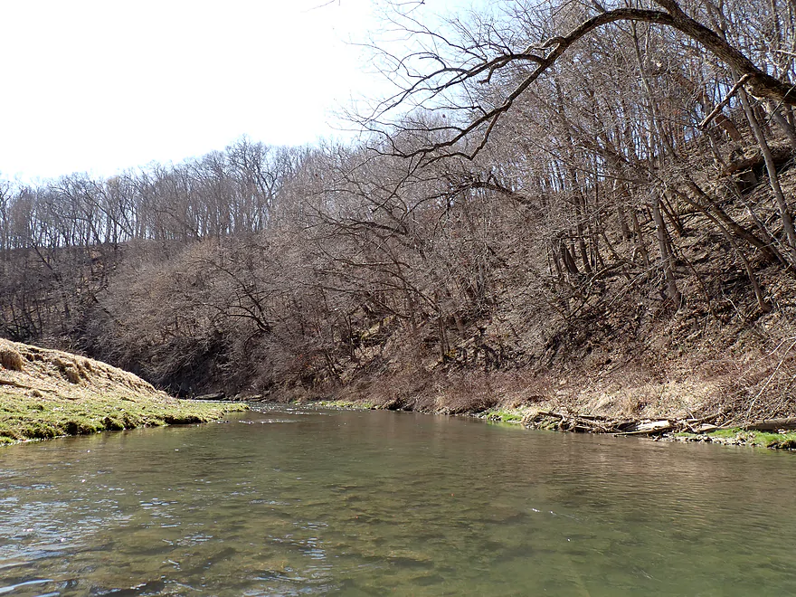
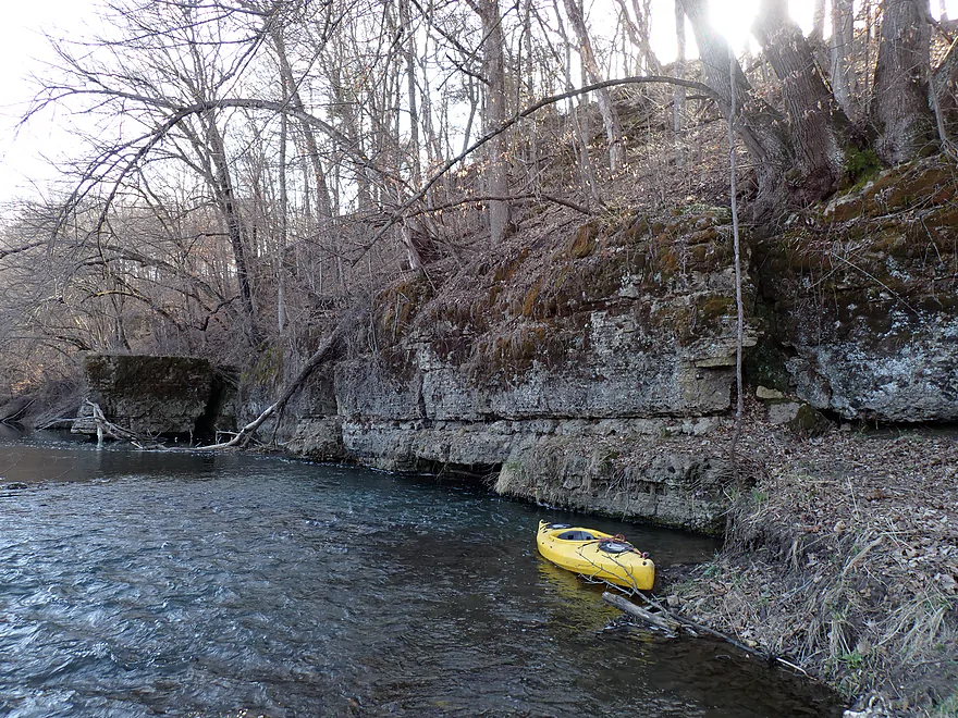
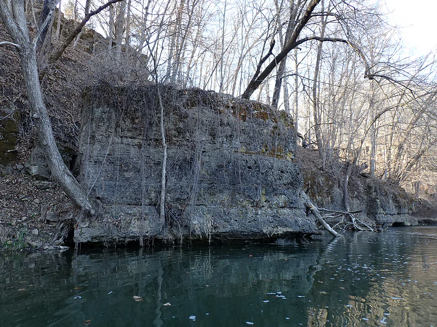
The short subleg between Higginsport and Lyons had terrific scenery and I was glad I opted for the longer trip. While I can’t really call them true caves…there were terrific extended limestone overhangs I could paddle completely under. It was very cool kayaking under these flat ceilings of limestone (see video and photos). The overhangs, monster boulders, and exotic limestone brick patterns provided impressive scenery. If possible you want to do a trip like this before May or after October, as I believe most (say 70%) of the rocks will be hidden by summer vegetation.
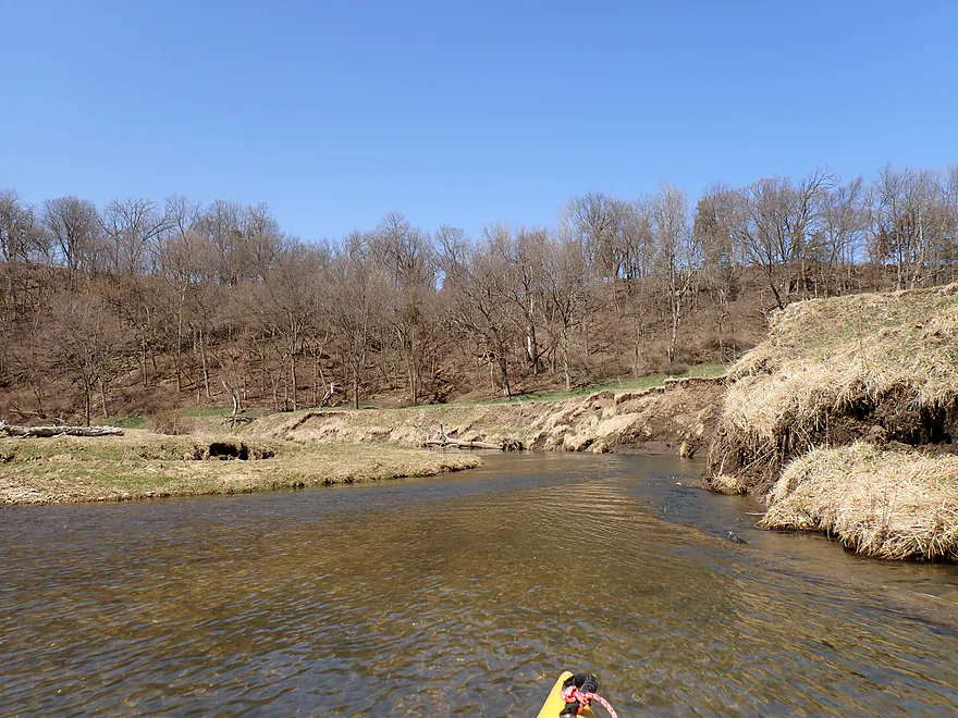
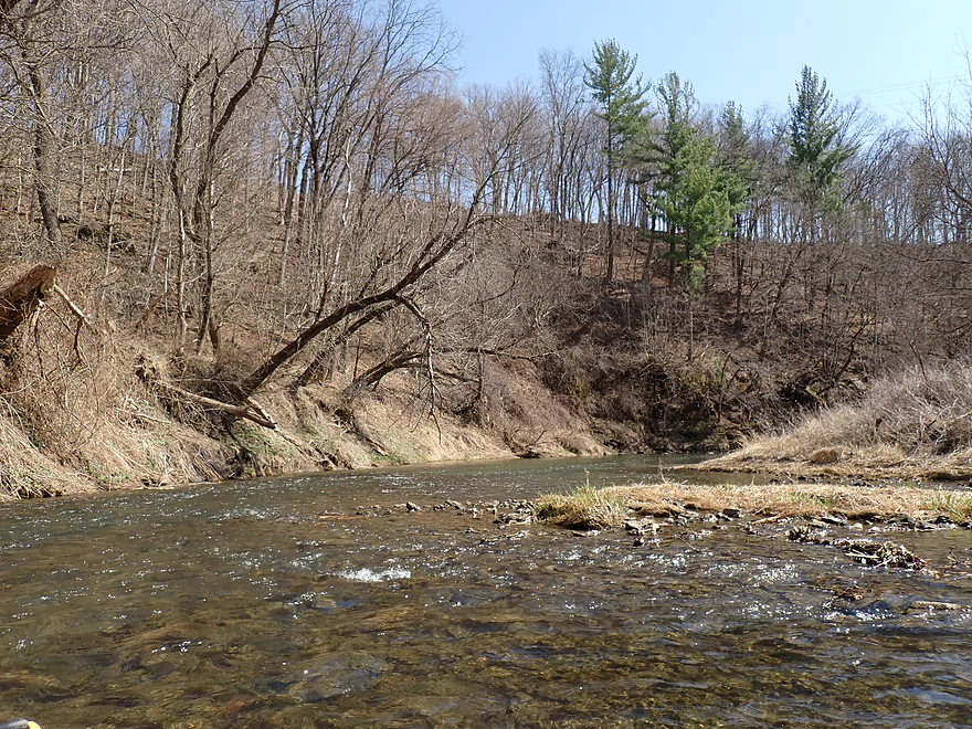
Following Lyons Road (a meh but doable bridge access option), I encountered a fun series of light rapids. The creek in general has a pool and riffle structure similar to the Platte River. While the riffles are common, they typically aren’t that strong. In fact, none were greater than Class 1 (with one exception I’ll cover later). The bigger problem was that the riffles usually meant I would be hitting some rocks. It wasn’t a deal breaker, but I did have to bump down a number of light rapids…and having a bit more water/padding would have been nice.
After Lyons Road, the scenery stayed great with more cliffs, impressive bluffs, and tight creek turns. Strong 30 mph winds howled overhead (in fact the Dubuque Airport clocked one gust at 46 mph). But I was relatively protected by the hills and limestone walls. These small, hilly rivers are great prospects to do when it is windy. For contrast, when I crossed the Mississippi coming home, it was frothing with visible whitecaps.
I did encounter two fences…but both were easy to get past. They looked electric, but I tested them (carefully) and none were live (that day anyway). Electric fences are more of a concern for downstream legs…more on that later. Despite being in pasture country, the banks were in relatively good shape. WAY better than the adjacent North Fork…in fact, while I gave both my North Fork reviews five stars…Lytle Creek was far superior.
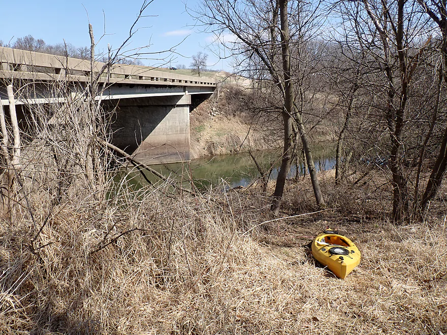
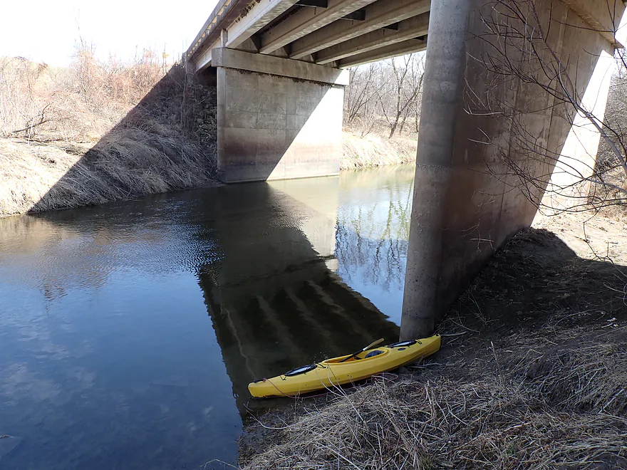
Near the end of the trip I paddled into the Bowstring Wildlife Area. Basically it’s a park with a series of trails, an obscure tunnel, and protected river banks. The park’s main feature is the Washington Mill Bridge…a unique 1878 historic “bowstring” bridge that you’ll paddle under.
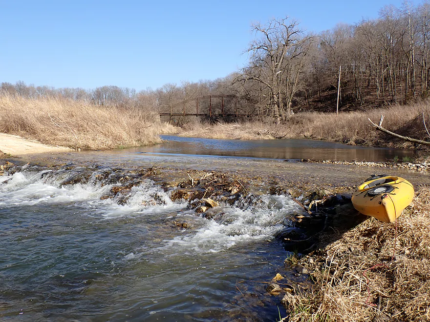
Shortly after the bridge, I encountered a huge gravel dump used to make a ford road. Because the Mill Bridge is now closed , the ford must have been a workaround solution. I found it interesting that a local would drive over a creek this large to reach his property…they must have a very high clearance vehicle. Even then, I’m not sure it would be 100% safe.
The ford road accidentally turned out to be a perfect boat ramp. Most kayakers end their trip here and there is good public parking nearby. I actually encountered two other kayakers on the river and one was nice enough to offer a shuttle to the park if I wanted, but I politely declined as I wanted to extend the trip further.
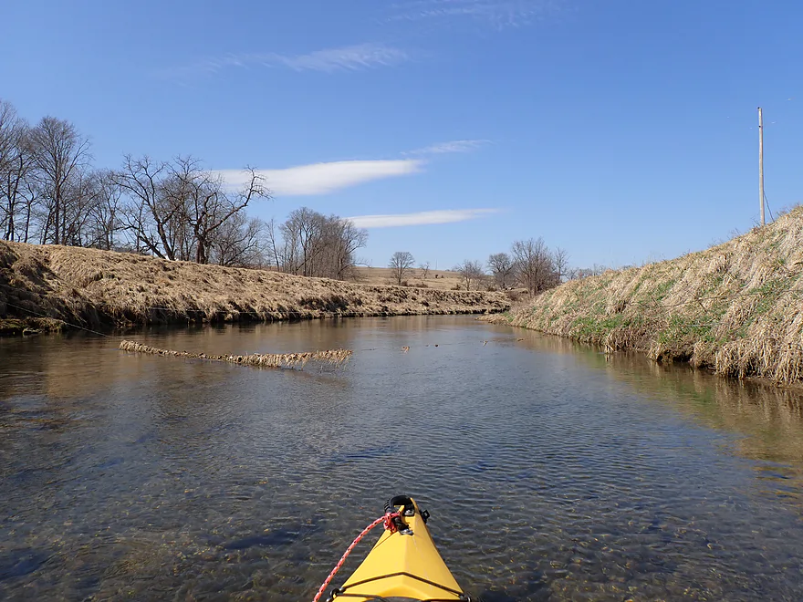
So after easily portaging a two-foot ledge below the ford, I paddled the last half mile of the trip. Again, I’m glad I opted for a longer option. This subleg featured more cliffs beneath a long bluff. There were also several artesian wells that were loudly bubbling out of the rocks (I counted four total on the trip). Unfortunately the last half mile was the shallowest of the trip and the bridge access was cumbersome…but neither was a deal breaker.
In summary this was a terrific trip. In fact, it is among the best paddles I’ve ever done in Iowa, yet is only a 20-minute drive from the Wisconsin border. The turquoise water, huge boulders, steep bluffs, and tight turns with fun riffles were great…but the main highlight were the limestone outcrops…both in their frequency and exotic shapes and textures.
I am curious about the section above Higginsport (if you know more, provide a comment below). Supposedly the section below Washington Mills Road (after my take-out) is also scenic with many outcrops and flows through the Lytle Unit National Wildlife Refuge. But…rumor has it there are two very difficult electric fences which might be a show stopper. If you know more about this leg or any of the further south legs closer to the North Fork, also definitely let me know.
Sights included an impressive bald-faced hornet nest, one clam shell, two groundhogs, vultures, a small band of turkeys, frogs, and many cliff swallow nests under the bridges. The highlight was a mink.
Bowstring Wildlife Area: This is a relatively new 87-acre park and woodland area which is open to the public. It features a trail system (map) that parallels the river and cuts through several hills. The trails are nice…but really, your best views will be from a kayak. There is this random tunnel east of the parking lot which you can walk though. The main highlight is the Washington Mill Bridge, an historic bowstring bridge you can’t drive on (but can walk over). Cars now use a ford road downstream from the bridge, which accidentally became a perfect kayak ramp. Most paddlers take out here.
Higginsport Road: The bank here is steep, but there is nice shoulder parking and a faint trail southwest of the bridge that leads to the water. Kayakers are known to use this bridge access, but it is close to a private house, so be courteous to the local landowner.
Alternate Put-ins:
- Lyons Road (0.7 miles downstream from Higginsport): This is not an ideal bridge access, but it is a bit more convenient than Higginsport. I think most paddlers start here…but then you miss out on a scenic sub-stretch with nice rock formations.
- Upstream from Higginsport: The creek splits into three (Buncombe Creek, Lytle Creek and Prairie Creek) and thus is a lot smaller. But I believe these upper branches are still somewhat navigable and have very scenic outcrops. I could see some great cliffs over Buncombe Creek when driving over. But note, these upper branches could have unforeseen difficulties (eg shallow water, fences, and logjams). If you know more, let me know in the comments below.
Washington Mills Road: This wasn’t an ideal bridge access. Getting out was tricky and the bank was steep. Having rope to pull my boat up the steep bank helped. But I don’t want to exaggerate how bad it was, as I’ve faced FAR worse and shoulder parking was very good. But…I presume most paddlers will prefer to take out at the upstream Washington Mill Bridge instead, which is a popular and easy access. Note…if you take out here, don’t get out at the bridge proper as I did…but disembark a bit upstream (northeast of the bridge) where the bank is shallower and it connects to Creek Branch Lane…much easier.
Alternate Take-outs:
- Washington Mill Bridge (0.5 miles upstream from Washington Mills Road): This is part of the larger Bowstring Wildlife Area. You can’t drive on the bridge nor take out immediately by it. But just downstream is a ford road, which is a terrific take-out ramp for paddlers. Because of this and the nearby public parking lot, most kayakers end their trips here. Be warned, the ford road creates a two-foot ledge in the river…it’s not difficult to avoid in low water, but in high water could be annoying. The only downside to getting out at the ford road is you miss out on scenic cliffs and a few small springs located just downstream.
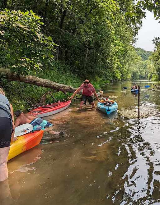
- 287th Street (2.7 miles downstream from Washington Mills Road): This is an enticing add-on option…paddlers have done this before and there are many scenic outcrops. It also flows through the Lytle Unit National Wildlife Refuge. But…there are two electric fences that are a significant challenge to get past. So much so (see photo gallery), I’m not sure this leg is viable at the moment unless you are very dexterous and don’t mind getting wet. Hopefully the situation is remedied in the future and paddlers can once again kayak this leg.
Bike Shuttle – Washington Mills Road to Higginsport Road: 3.6′ miles with 203′ of accent. Bike shuttlers will have two options (both are relatively manageable given the Driftless Area’s extreme standards).
- You can shuttle west of the river. This is what I did…it’s paved, but longer at 3.6 miles and includes a steep 200′ hill climb (not fun). The winds on this shuttle were quite strong, but thankfully were mostly behind me which gave me a big boost. At times I had to intentionally slow my bike to keep from getting blown off my bike.
- You can shuttle east of the river. It is shorter (2.9 vs 3.6 miles), but…it has 269′ of hill climbing and is gravel. 63′ of extra hill climbing and gravel is not worth 0.7 miles of shuttling…go west.
Group Paddles: If you don’t care for shuttling you can paddle the river during a group paddle event hosted by “Dubuque County Conservation“. You can contact them on Facebook to find out when the next group paddle will be.
Logjams: None. Just below Lyons Road there is a pair of downed trees in fast current, but I found these easy to paddle around and actually kind of fun. If anything serious were to fall into the creek, it would be easy to portage.
Wind: Not much of a factor on the water despite hearing 30-40 mph winds howl overhead. Water trails like this are great to do on windy days because the bluffs provide protection.
Current/Rapids: The creek falls at a decent rate…but is mostly pool and riffle (slow, slow, slow, FAST, slow, slow, slow, FAST, etc…). I thought the riffles were really easy. I suppose they might get rowdy during high water though. The only noteworthy rapid was the ledge below Washington Mill Bridge. It’s about 2’…I almost ran it, but it looked a bit bumpy, so instead I did a very easy portage by the ford road. In high water, this might be easier to float (or not!).
Fences:
- Fence #1 is just upstream of Higginsport Road. As it was above the put-in, I didn’t have to deal with it. But I did check it out regardless for future upstream references…it looked electric but wasn’t and there was a spot where you could duck under.
- Fence #2 is maybe a quarter mile downstream from Lyons Road. It also looks electric but isn’t and was easy to duck under.
- Fence #3 is perhaps a half mile downstream from Lyons Road. This was only one that had me concerned…it sagged and dragged in the river and there didn’t seem to be a way to get past it without touching the wire. But I (carefully) tested it (with a quick bounce with the back of my hand) and it wasn’t electric…so I was easily able to lift it over my head and pass under.
River Gauge: North Fork Maquoketa River @ Fulton
River Trip Depth: 270 CFS or 2.97
River Navigability Estimates: The Fulton gauge is located much further downstream on the North Fork of the Maquoketa River. It may not be very representative. The following are just rough guesses.
- < 250 CFS: This might be too shallow for paddling.
- 251-300 CFS: Likely too shallow for v-bottom boats, but viable for adventurous paddlers in flat bottom boats who don’t mind bumping down some riffles. At 270 CFS I had a good time and would do it again, but having more padding would have been nice.
- 301-350 CFS: An average depth, this is probably a tough paddle for v-bottoms, but should be fine for flat bottoms.
- 351-450 CFS: Likely a good target depth. V-bottoms might still hit some rocks.
- 451-600 CFS: A high depth…water clarity will likely be bad and the rapids might be a bit more rowdy. This should be manageable for most paddlers though.
- 601-800 CFS: Very high depth. Perhaps only suitable for experienced paddlers. Water quality will be awful.
- 801+ CFS: Maybe flood conditions? The rapids might be fun, but a few might be challenging at these levels.
Click here to see an overview map of Lytle Creek.
- Higginsport Road to Washington Mills Road: 4.1 miles.
- Higginsport Road to Lyons Road: 0.7 miles. Really scenic section past a large creek bend. Terrific rock outcrops.
- Lyons Road to Washington Mill Bridge: 2.8 miles. The most popular and likely best section of the creek. Highlights include massive boulders, springs, light riffles, scenic bluffs and fantastic cliffs.
- Washington Mill Bridge to Washington Mills Road: 0.5 miles. Nice shady stretch past a large bluff. Good outcrops at the base with several noisy springs.
- Washington Mills Road to 287th Street: 2.7 miles. Paddlers used to kayak this stretch, but a new farm owner put up two challenging electric fences that are very difficult to get past. In one case a group of paddlers had to get into the water to limbo under a fence and still received an electric shock from a paddle touching a wire. See photo gallery for context. For most this subleg can’t be recommended…but if these fences were ever remediated this would be a fantastic add-on leg as it flows through the Lytle Unit National Wildlife Refuge and contains many scenic rock cliffs.
- 287th Street to Hwy D61: 9.4 miles. This is a long leg, but scenic with many bluffs and cliffs. It will partly include the LaSoya Wildlife Management Unit. Otter Creek (an intriguing prospect on its own right) adds significant volume near the end of the leg. A note from Suzanne:
- You can put in at Maloney and then get out on D61. That’s a nice run too…Also there’s a barbed wire you have to portage, easy enough to do. And a very very fun drop of 3 feet. Go toward the right side.
- Hwy D61 to 226th Street: 2.4 miles. Likely flatter, more open and less interesting. There might still be a few more cliffs though.
- 226th Street to 188th Street: 2.6 miles. This leg is straighter and flatter with more farmland and fewer bluffs. I suspect there are still a few outcrops.
- 188th Street to Mouth on North Fork: 1.5 miles. A messier stretch with perhaps a few strainers to dodge. Could be one last outcrop, but it will be mostly farm fields and mud banks.
- Mouth to 150th Street/E17: 3.8 miles. Technically this is the North Fork of the Maquoketa River. I suspect this is one of the more boring legs of the North Fork…but it still might not be bad.
Upstream from Higginsport: The creek splinters into three sources (Buncombe Creek, Prairie Creek, and Lytle Creek). The split diminishes a lot of volume so these branches will have a different vibe…but relief maps suggest intriguing outcrops on all three…especially Buncombe Creek
- Main Branch: Probably the weakest of the three sub-branches. Fences and snags could be an issue, but should be scenic. Not as many outcrops as the other two branches though.
- Larkin Road to Higgensport Road: 4.0 miles.
- Buncombe Creek: Shallow and with possible fences, this is likely the most scenic of the three branches. I could actually see some of the outcrops while driving over.
- Bennettville Road to Fagan Road: 3.1 miles.
- Fagan Road to Higgensport Road: 1.2 miles.
- Prairie Creek: Likely more scenic than the main branch…but fences are likely an issue. I can see several ones from Google Maps.
- Benard Drive to Stoffel Road: 0.9 miles.
- Stoffel Road to Fischer Road: 1.2 miles.
- Fischer Road to Higginsport Road: 3.5 miles.
Trip Map
Overview Map
Video
Photos Size: