
The flowage was really low, exposing some nice sandbanks
Just west of the dam is a popular launch
The flowage was really low exposing some nice sandbanks
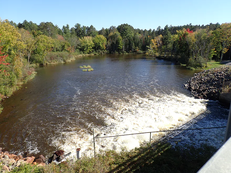
Downstream view of the river from the dam
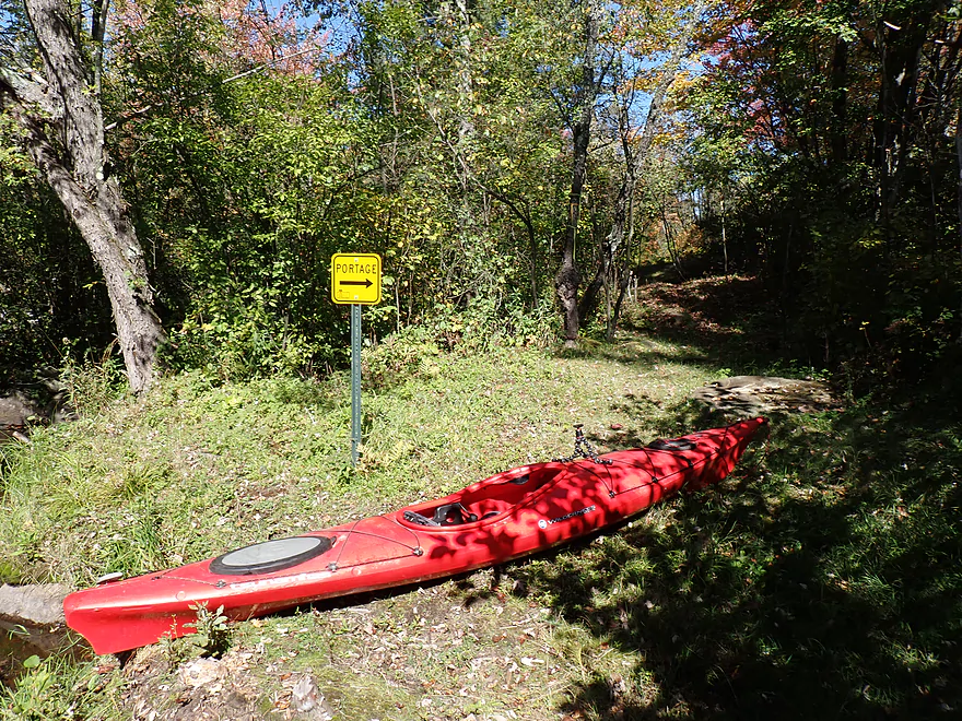
Launching south of the dam by the portage path
Pretty easy hike
Easy launch
This is a relatively tall dam compared to river volume
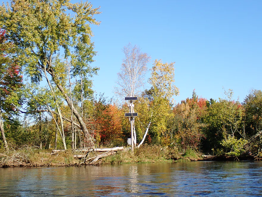
A solar powered dam release siren
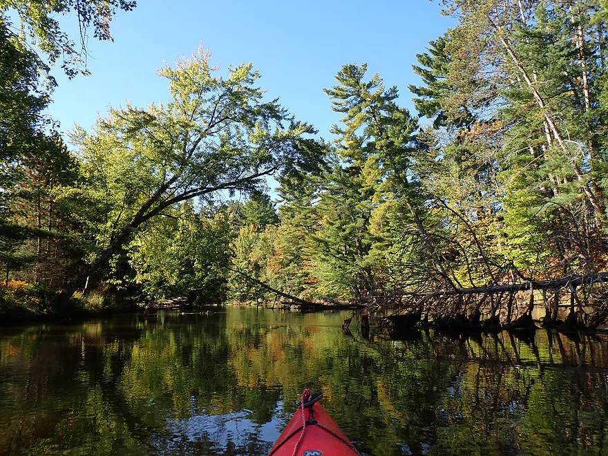
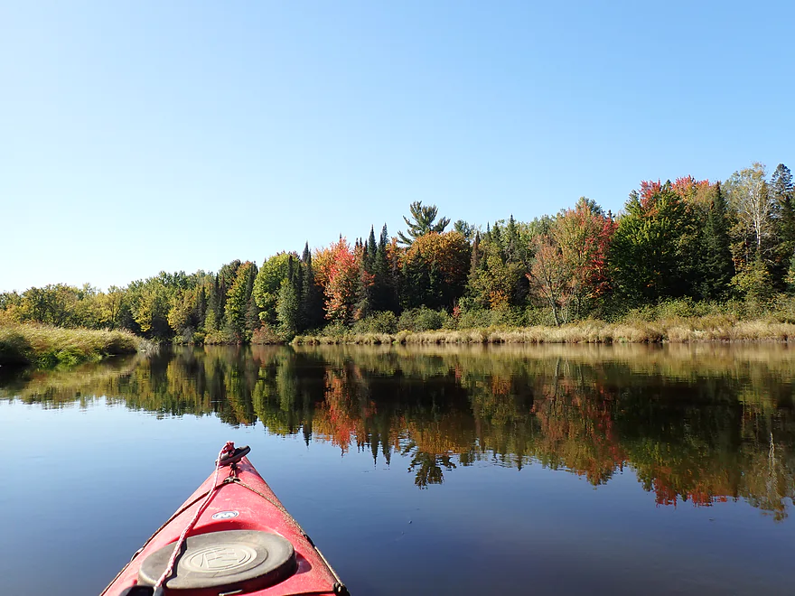
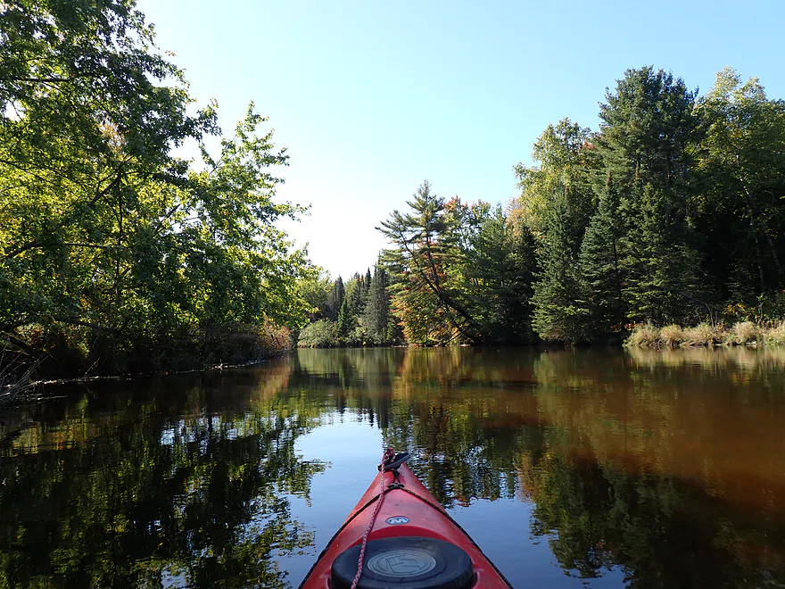
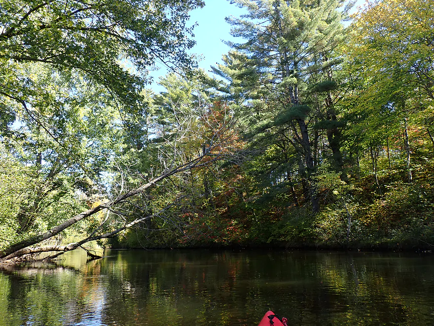
Terrific white pines right off the bat
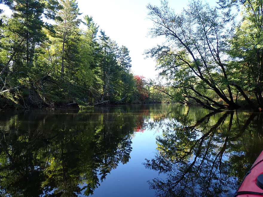
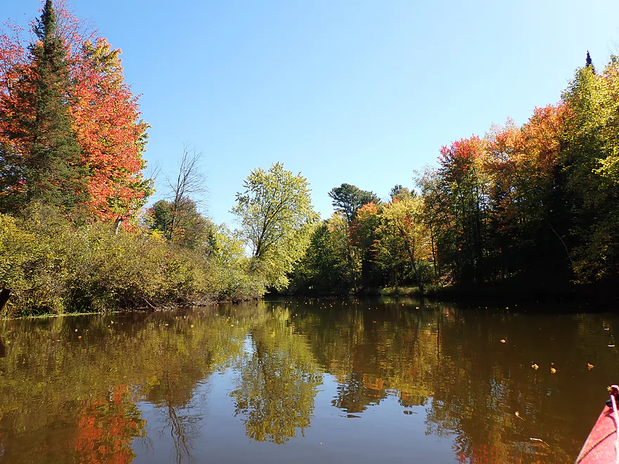
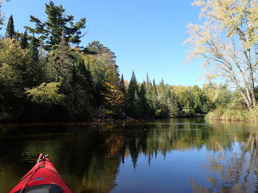
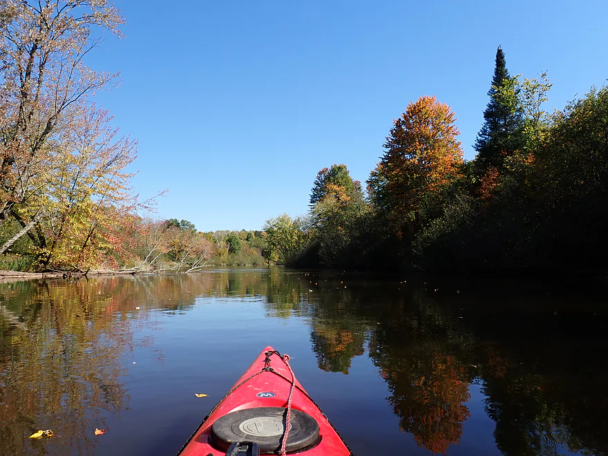
Nice relections
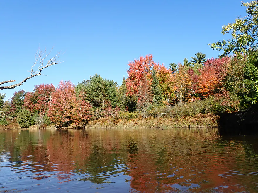
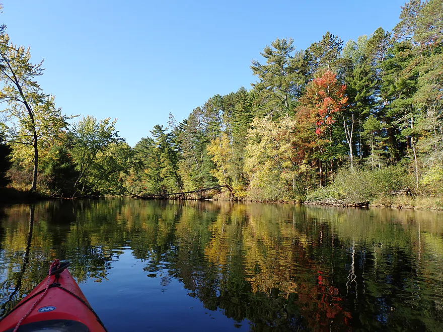
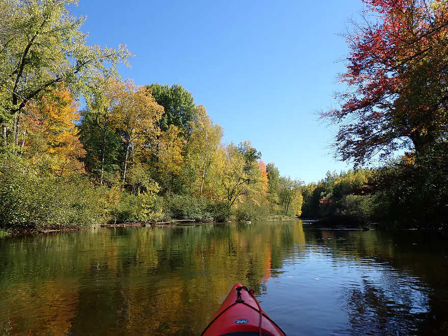
Good fall color for September
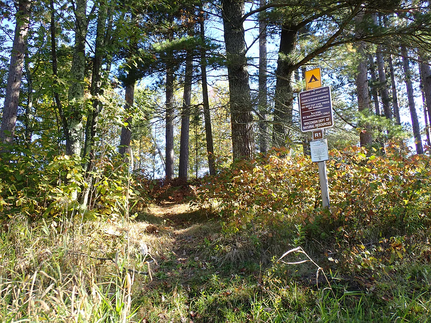
The Tomahawk River has a few shoreside campsites for paddlers
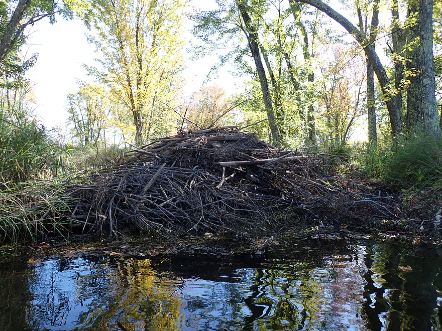
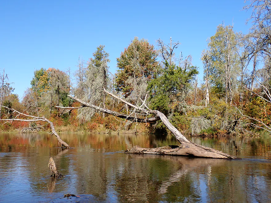
Large beaver lodge
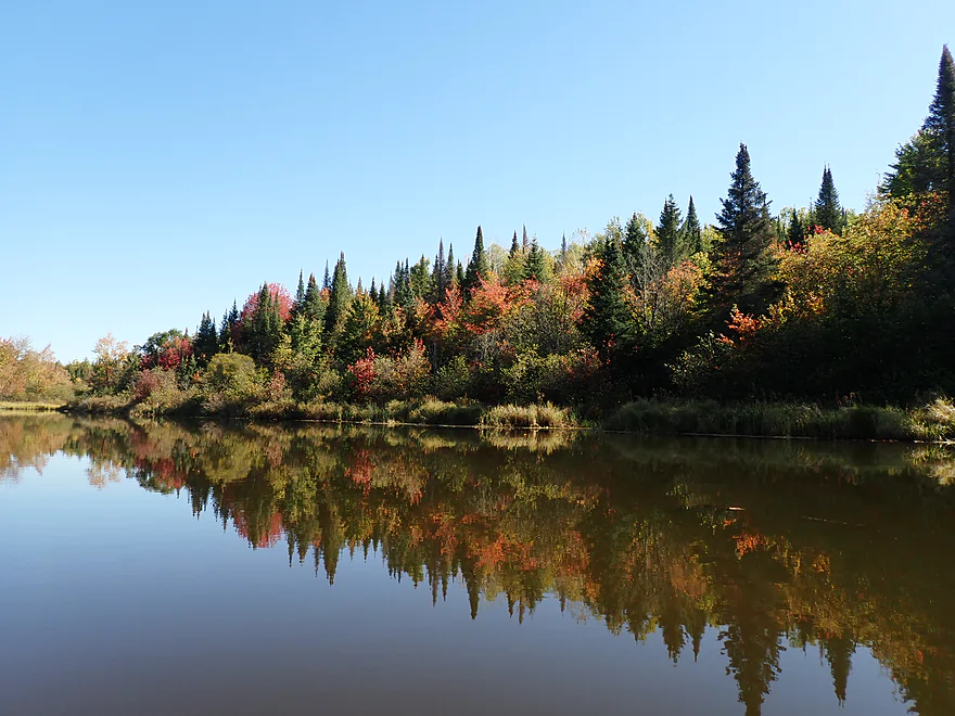
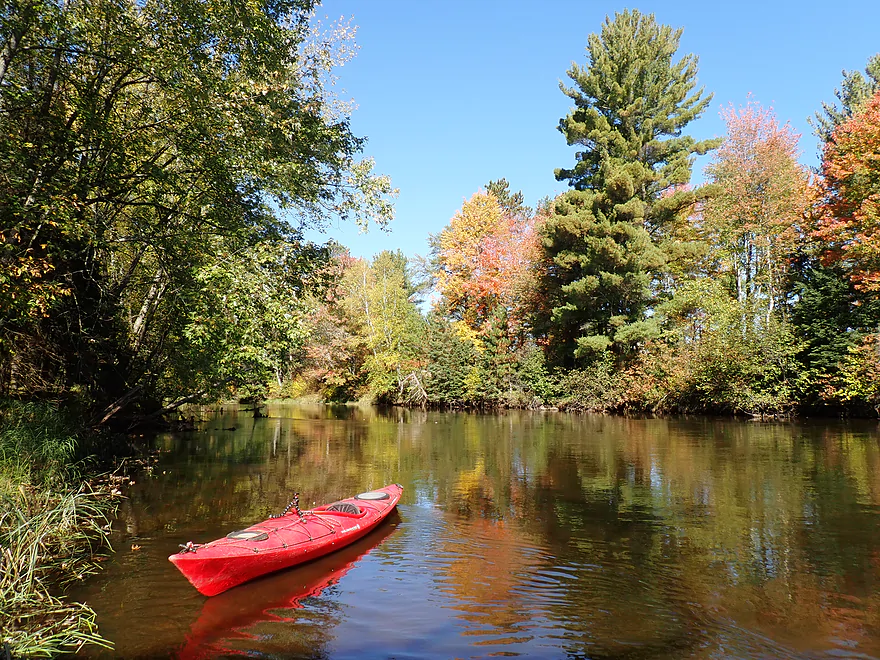
Mirrored fir trees
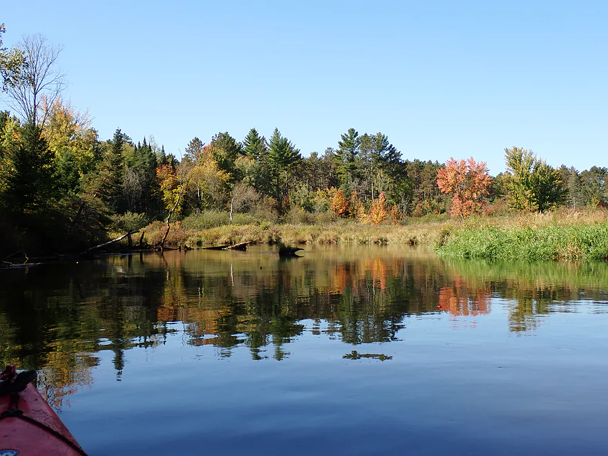
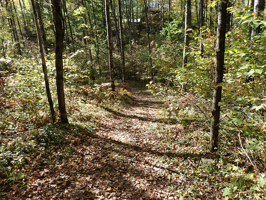
And more around the next river bend
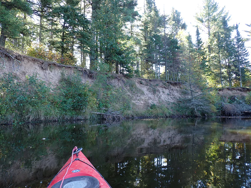
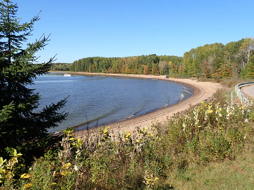
Exposed sandbanks
Paddling past another conifer wall
The brown tips are pine cones
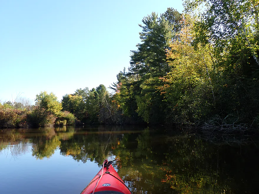
Another nice stretch of pines
Hwy Y…Little Rice Resort is an access option but you need their permission
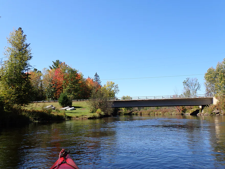
Downstream view from bridge
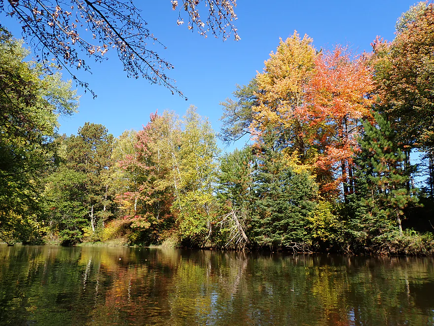
Great fall color
Getting out for pictures
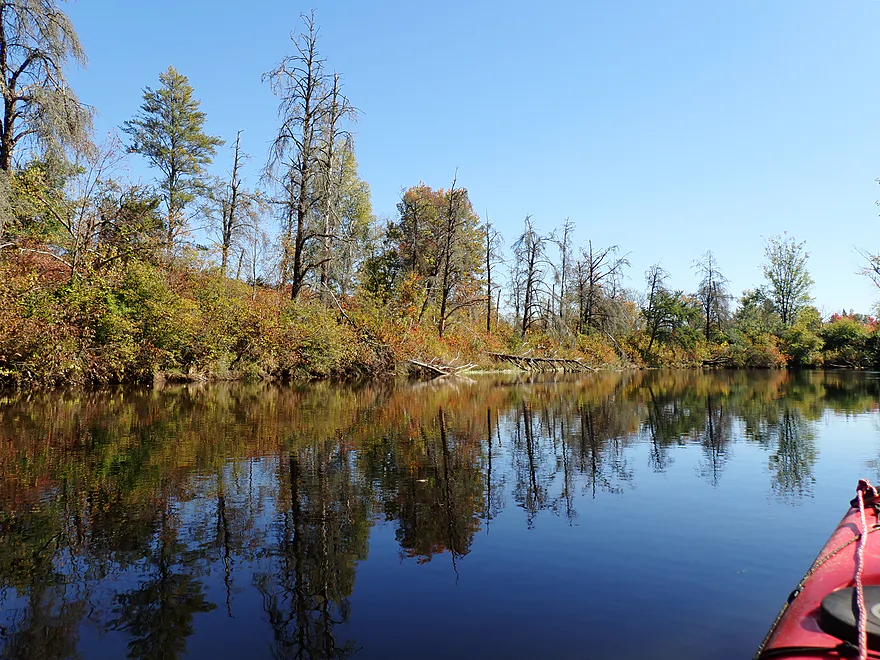
Strange line of dead trees
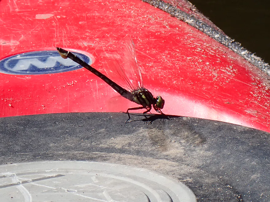
An ovulating stylurus spiniceps
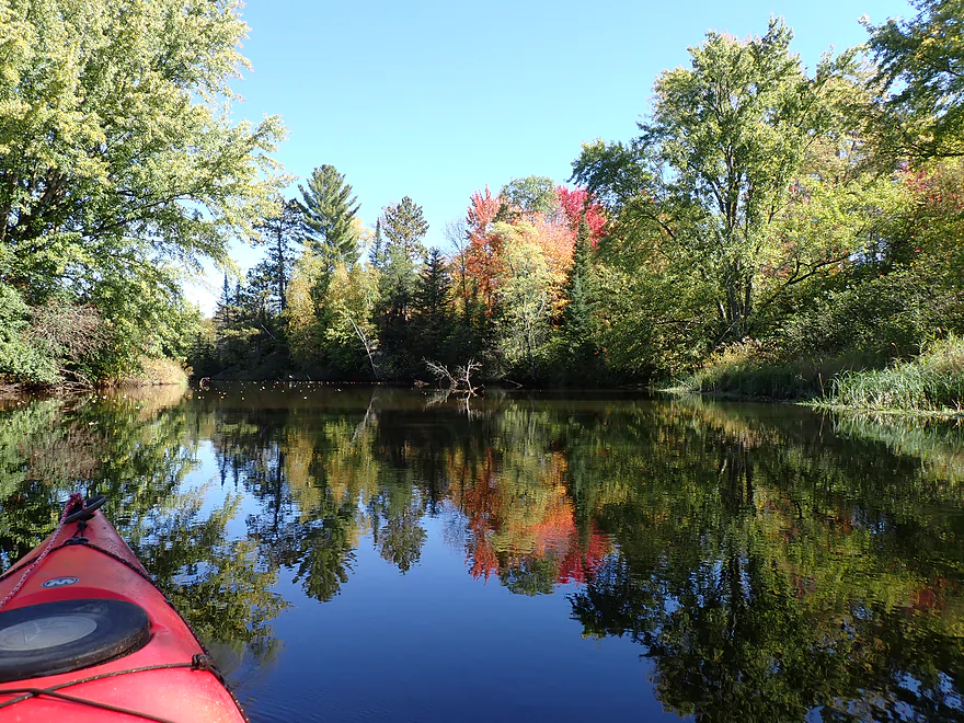
More nice reflections
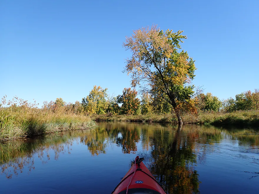
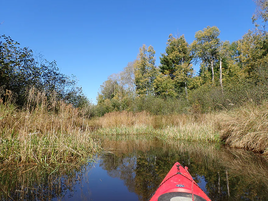
Paddling past a very open stretch
Single line of pines marks the border of heavy logging (on DNR land…sigh)
Portage path for Halfbreed Rapids
First pitch is very scenic
A solid Class 2 with a splashy stretch at the bottom
This is the second pitch
This is an easy Class 1
Approaching the last, longest, and strongest pitch
I would rate these Class 2+…I got pretty bounced around
Reverse view of the last pitch
The rapids split around an island…the left/north channel has tricky rocks at the bottom
This is the east end of the portage path
River starts to get hillier with more homes
Pines are also starting to get taller
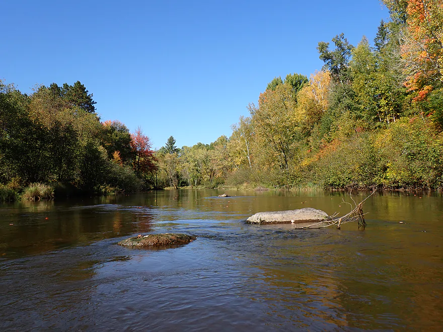
Not many rocks outside of Halfbreed Rapids, but some…
Cool birch gate
Paddling upstream on Swan Creek
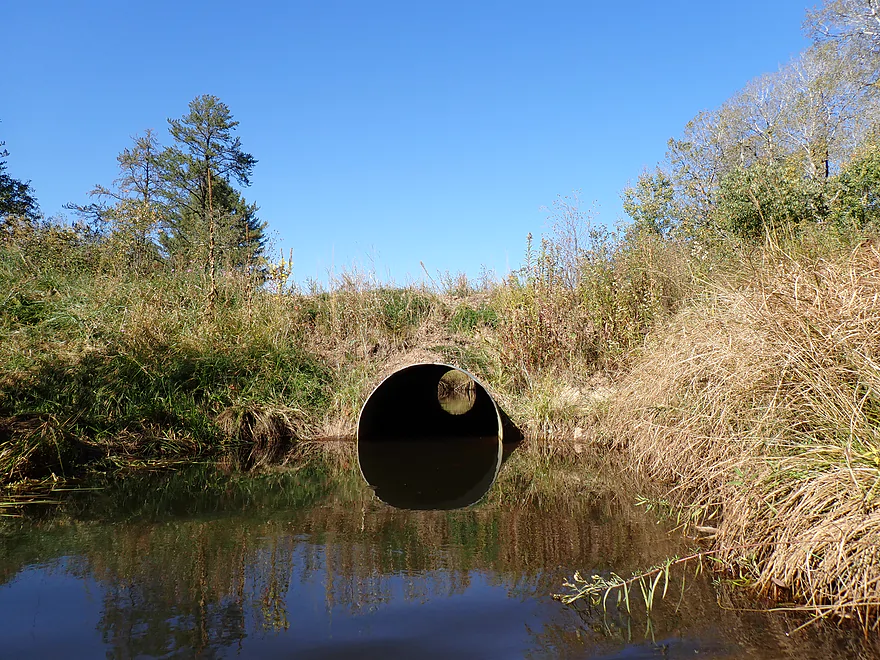
Getting out at Rocky Run Road (don’t do this…locals don’t want this to be access)
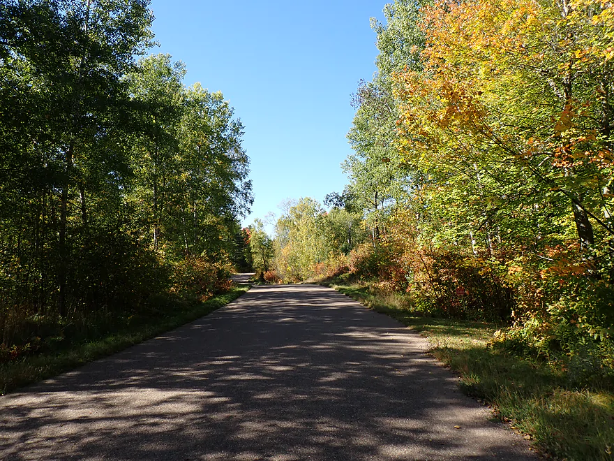
Scenic shuttle
I found the Cassian Launch downstream after the trip…it has an insane 600′ long hike and is steep
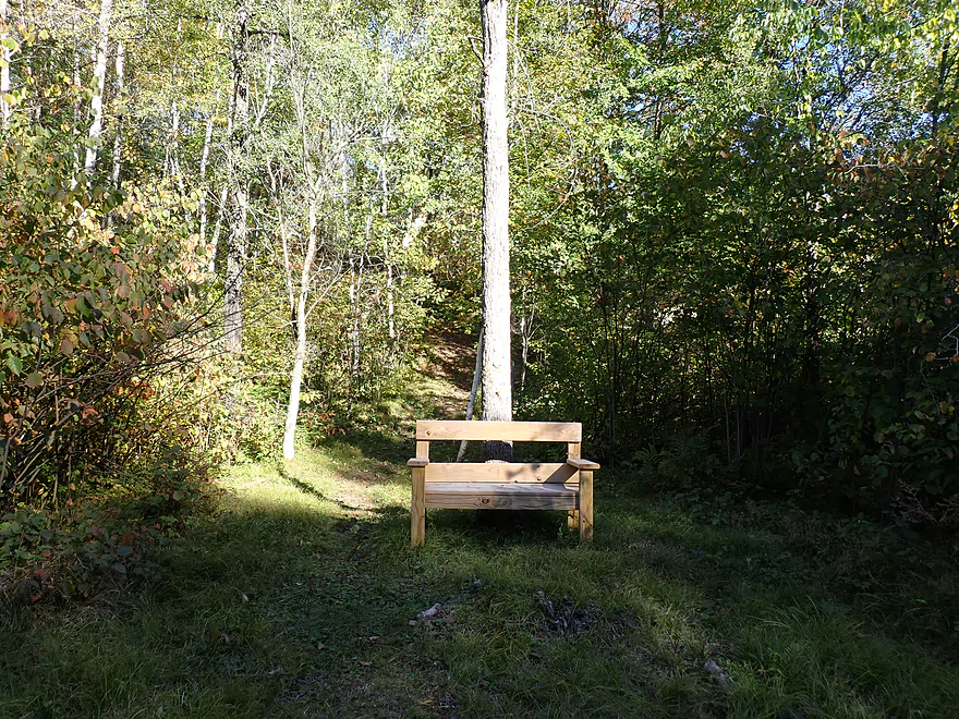
This bench is a landmark for paddlers taking out at the Cassian Launch
Tomahawk River

The Tomahawk is a significant tributary to the Wisconsin River located in North Central Wisconsin. In fact just looking at a map, you could easily mistake it for the Wisconsin River given its size and north-south direction. Sadly, much of the river has been ruined by flowages (Willow, Rice, Jersey City and Minocqua). But there are still some legs that flow free and are great paddles.
Before I started my trip, I needed to drop off my bike at the take-out (for a self-shuttle). This would prove to be a misadventure (but an educational one for other paddlers). I first spotted a sign for a public landing on Rocky Run Road pointing toward Running Bear Lane. I turned onto it and asked a local where the launch was. He said just down the road and I couldn’t miss it. Murphy’s Law…if somebody giving directions says you can’t miss it, you will. I drove a half mile down the drive and didn’t see a landing. I saw numerous west-facing dirt pull-offs, but none were marked as a landing and the river wasn’t anywhere close by. I pulled into one of the drives but it was clearly a private home and I backed out.
Discouraged, I backtracked my route and decided to continue on to my original take-out plan on Rocky Acres Drive (located nearby). It was a public landing referred to by WisconsinTrailGuide.com (great site) and other reviewers. But I couldn’t find that either and I suspect it has since been closed and developed. On to plan C….the Swan Creek bridge was practically next door to the Tomahawk River, and I saw from the matted grass others paddlers took out here, so I decided to make this my take-out and left my bike here. This would prove to be a mistake, but more on that later.
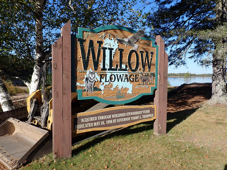
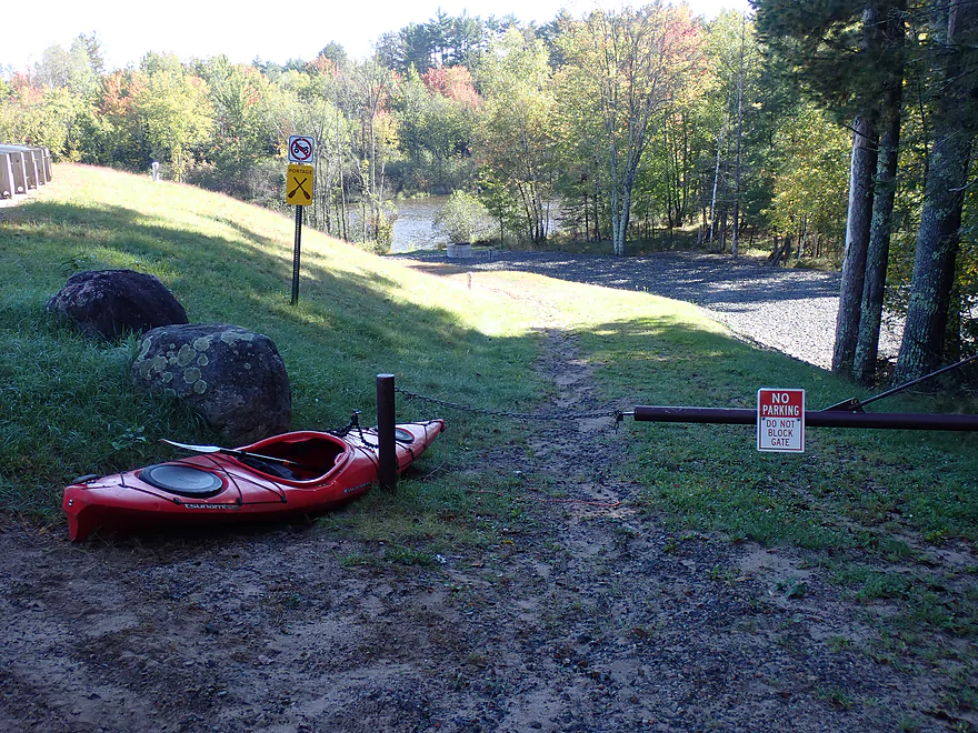
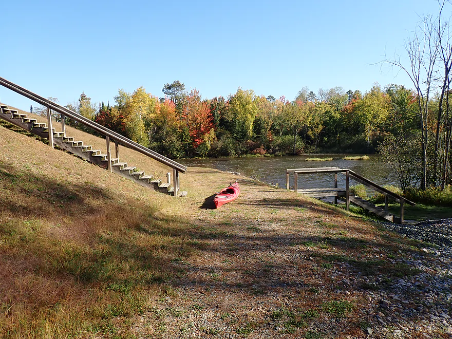
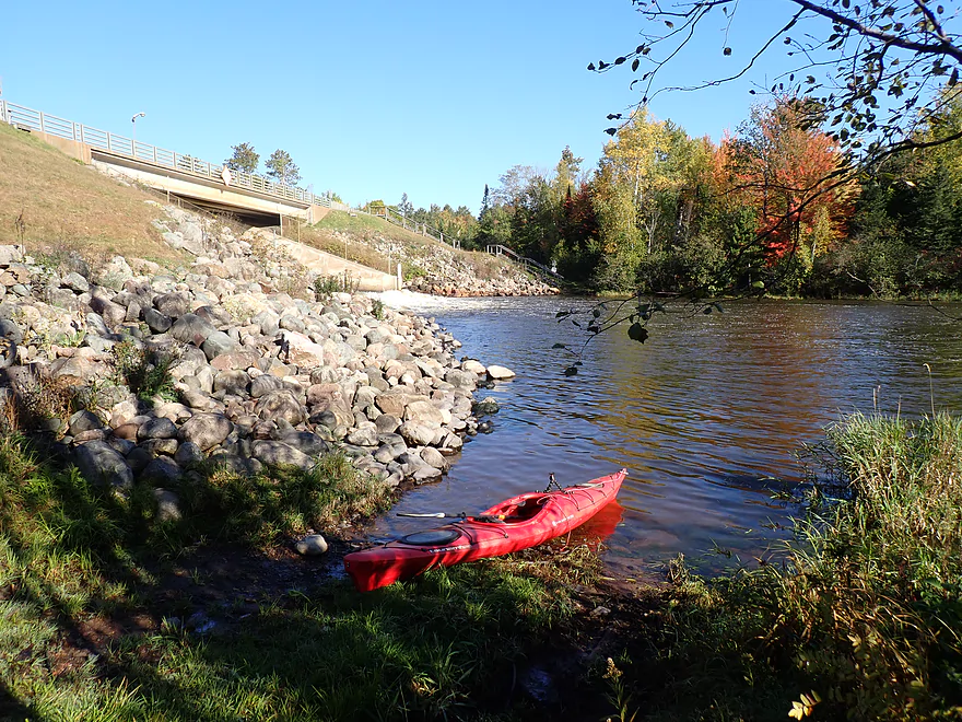
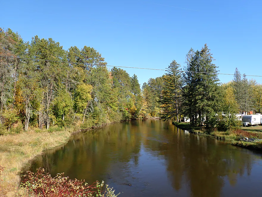
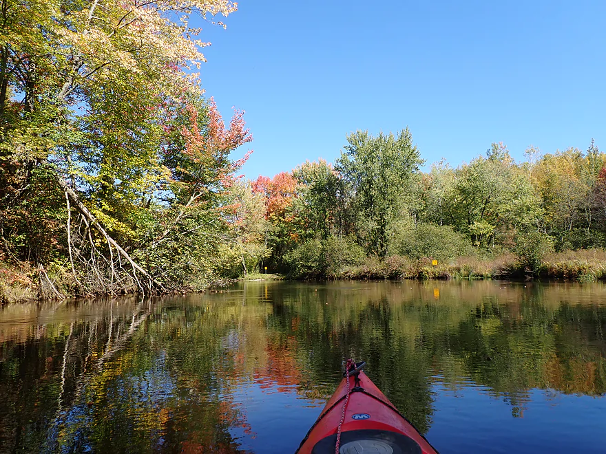
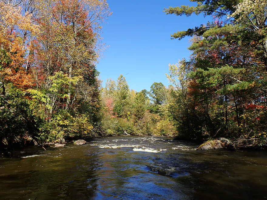
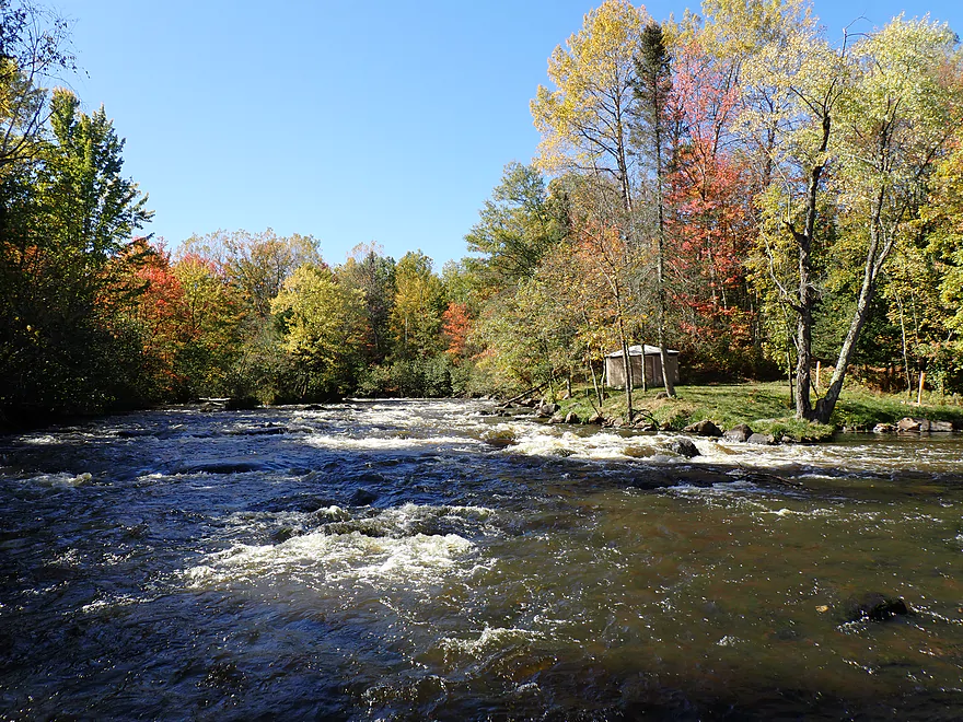
I started the trip at the Willow Flowage dam, which was a bustling scene. To the west was a large bay with active motorboats and campfire smoke could be seen in the distance. Yet this bay was just a small part of the massive Willow Flowage, which is a popular tourist destination. To the east was the roar of the dam and a line of wading fishermen backdropped by a scenic stand of pine trees. North of the dam was a major landing, which was so busy the parking lot had filled up and trailers were parked on the shoulder. Access from the north didn’t seem viable, but that was ok as there was a well-marked portage path south of the dam. I was able to park on the shoulder, pull my boat down the dike trail, and do an easy launch.
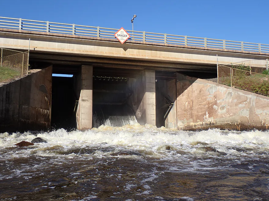
After launching, I paddled up to the base of the dam, which was an impressive sight and tall relative to the width of the river. There is no paper mill or power plant attached here. Instead the dam’s sole purpose is to bank water for downstream paper mills to provide consistent flows during the winter. It’s one of five drawdown flowages on the Wisconsin River watershed…about 15 miles downstream is the Rice Flowage (another of the five). Because of this, Tomahawk River levels are very artificially controlled…often making them remarkably stable and not correlated with other rivers or flowage levels.
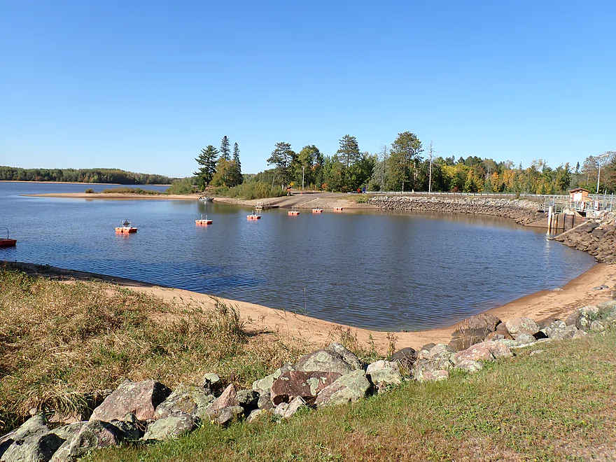
Typically WVIC (the dam cartel that controls the flowages) will try to bank as much water as they can in spring and summer (they see any water going over a dam as a “waste”), and then release it in fall and winter to supplement other flowages. During the fall drawdowns, Willow Flowage can shrink dramatically and expose some nice sandbars along the shore. There is an obscure gauge below the dam which read 354 CFS. I suspect this would be an average summer depth, but relatively high for September.
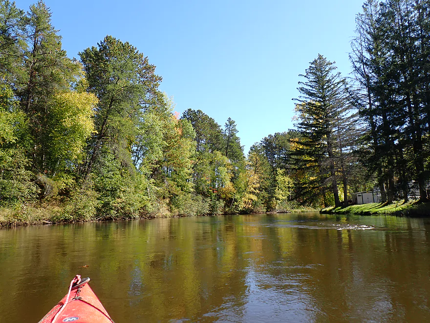
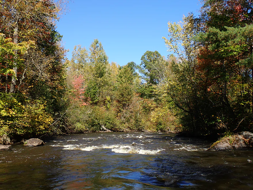
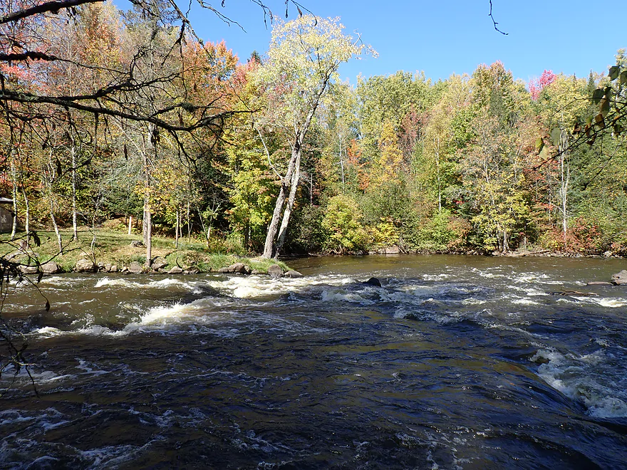
The first quarter mile of my trip flowed past a few small homes and tall “conifer walls” which were attractive. The river channel was surprisingly deep (about 4′) and turbid. This, coupled with the river pointing directly into the morning sun, probably made me not appreciate the first half of the trip as much as I should have. Following a lodge and private campground, I soon left civilization behind for the next few miles.
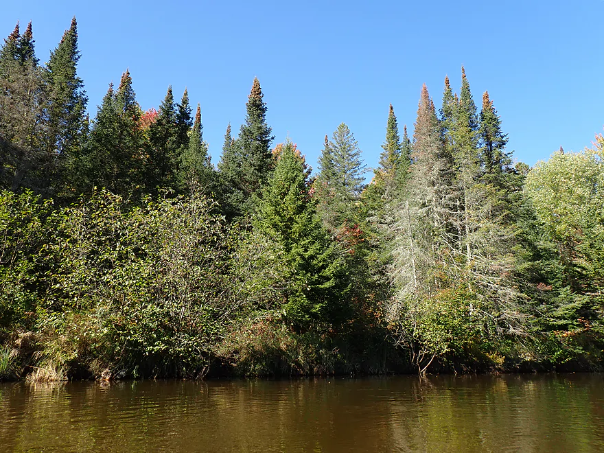
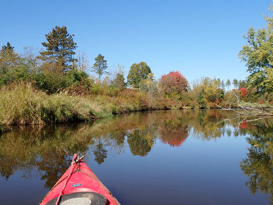
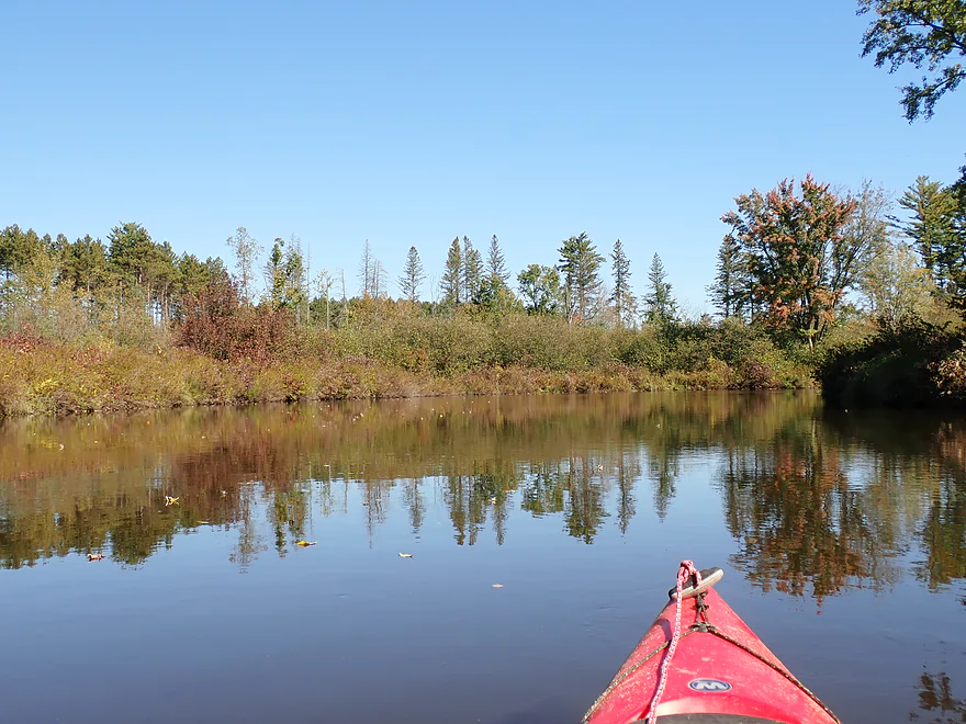
From here to Hwy Y, the scenery was inconsistent. At times there were terrific pine and fir stands. But these were often interrupted by “scrubby-shrubby” stretches. Here the banks were open, with a few weed trees and evidence of having been cut over. GlobalForestWatch.com claims significant logging happened on the north bank in 2021 (cool map). I really wish loggers would make allowances for river corridors because of their ecological and scenic significance.
What’s interesting is much of the logging along the Tomahawk River has taken place on DNR-managed land, which means it could have been protected or exempted. Most don’t know this but the DNR is awful at conservation. It often sells public land or logging rights to its land at sweetheart deals to private interests. Many of these lands were donated to the DNR under the false belief they would be protected. Sadly, if you overlay a DNR management map with a logging map, you can see clearly private owners have done a significantly better job of protecting the Tomahawk River forests.
I was surprised as to how soon I reached Hwy Y, which was the ~4 mile mark and halfway point in the trip. As I neared the bridge and a small resort, I paddled past a terrific stand of white pine. Hwy Y is an access option, but a bit tricky. The north side is too weedy to launch from and a guardrail on the south side redirects you toward the Little Rice Resort bank (a private campground). The owner is ok with kayaks launching from the resort, but she does want you to check into the main office first.
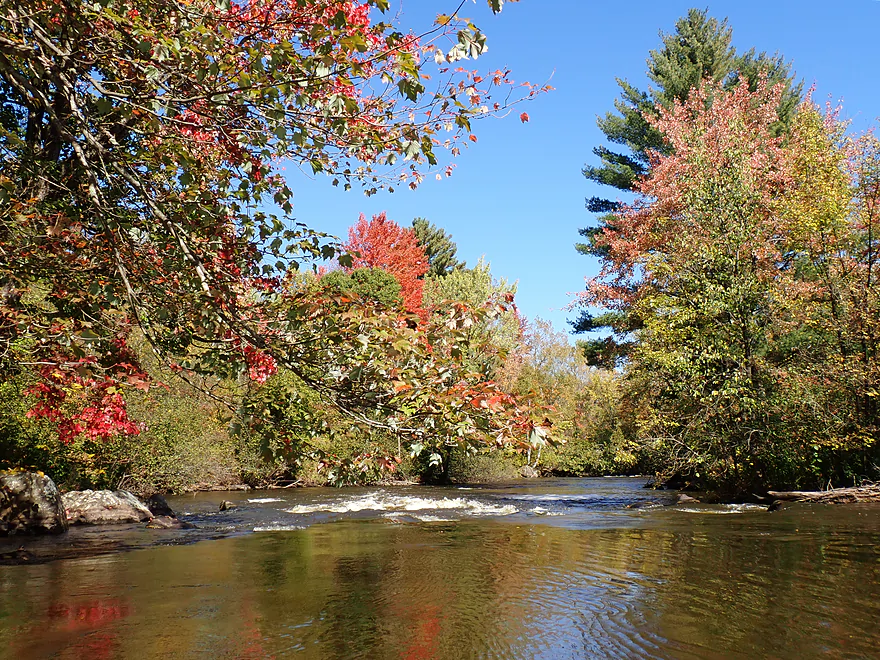
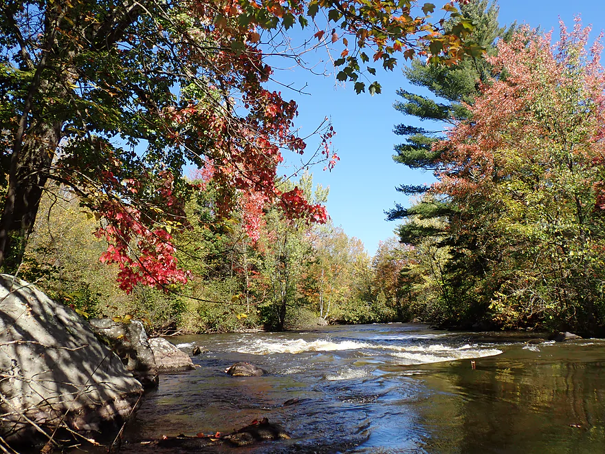
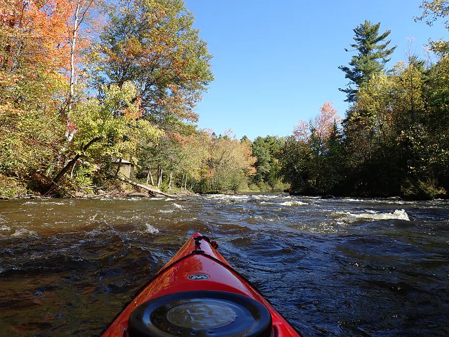
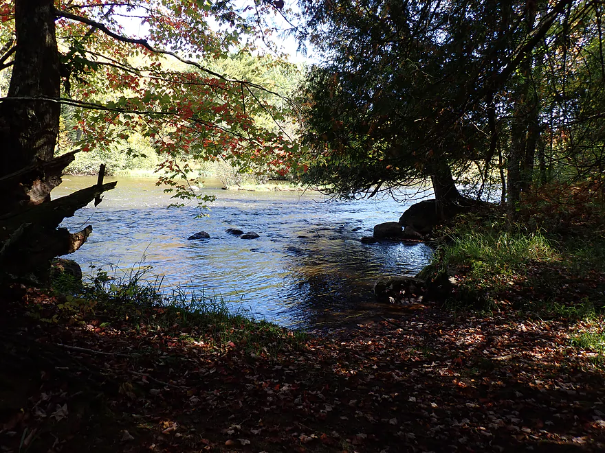
The second half of the trip proved to be more enjoyable. The scenery was inconsistent and still alternated between terrific woods and then ugly logged-over shrubland. In fact the second half probably had more cutover woods, but was still nicer because I was no longer paddling into the sun. I soon heard the roar of Halfbreed Rapids which I had been looking forward to. Unlike many other up north rivers, the Tomahawk doesn’t have much in the way of geology, such as boulder gardens, cliffs, or rock bars (on this stretch anyway). So actually seeing rapids for once instead of zigzagging through slow, open river corridors was a treat.
A sign up ahead warned of challenging rapids and advised a portage along the south bank. The first pitch could be seen from above and was incredibly scenic. I paddled over to the north bank to try to get a view of the second pitch, when I heard a voice behind me say, “this is private property”. I looked up to see two locals and explained I needed to portage/scout the challenging rapids. They didn’t care and said I could portage on the south bank. The problem was the south bank was more wooded with obstructed views of the rapids which I needed to scout. I asked if it was ok to use the north bank with their permission (I was still in the water at that point), but he kept repeating it was private property like a robot. I don’t think he understood what I was saying, or that the DNR allows for portaging of river obstacles. But…I wasn’t going to argue (his friend had a rifle in hand).
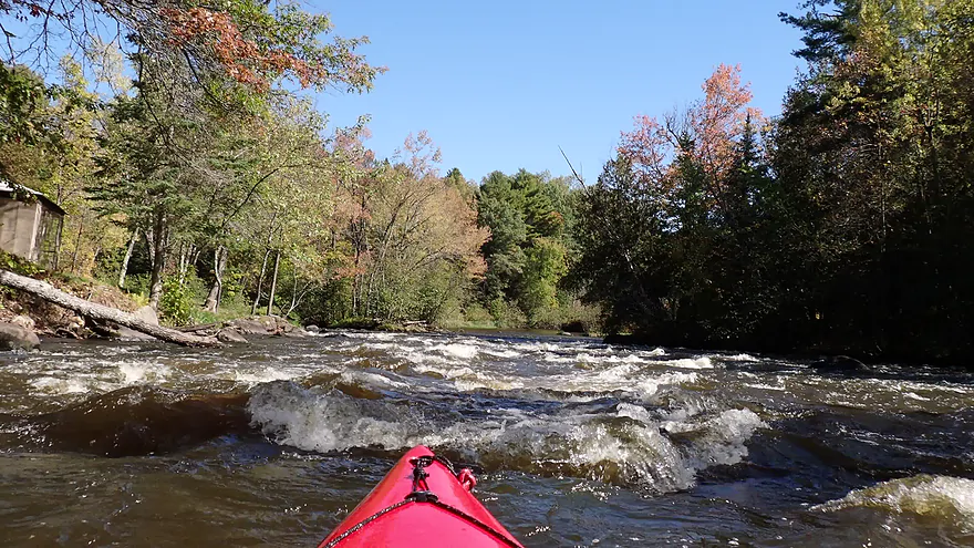
I then paddled over to the south bank, tied up my boat and hiked down the south portage path to get a feel for the rapids (while feeling like I was still being watched). From what I could surmise there were about three pitches…the first and last were the most difficult. These were likely Class 2+ and were runnable at these levels, but I’m guessing they are frequently not runnable. The WVIC guy I talked to prior to the trip said most paddlers preferred a minimum of 400 CFS to avoid hitting rocks, but the rapids seemed well padded at 354 CFS. Too high though and these would be dangerous, so my timing was likely pretty good.
I ran the first pitch and got a bit wet from the standing waves (video at 3:38). There was a bit of a break after the first pitch which allowed me to size up the next pitch…this proved much easier but I did need to be careful to avoid a strainer on the right side of the channel (pretty easy). The third pitch was the longest and most difficult. I got bounced around pretty good, but was determined to stay on the right side of the rapids as the channel is split by an island with an irregular drop on the left. In the end it all worked out and was pretty fun…in fact I consider Halfbreed Rapids the highlight of the trip. Those averse to whitewater could easily portage these, although on the south bank (not north bank…sigh).
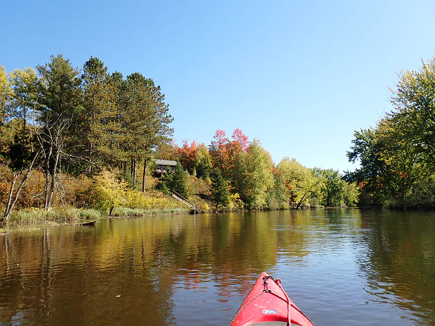
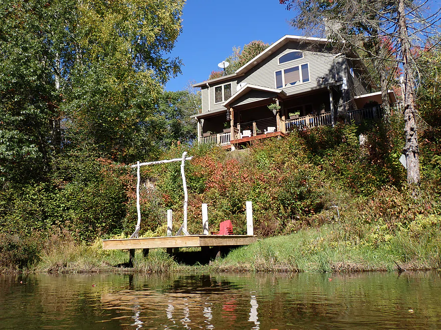
Following the rapids, I started seeing small cabins, piers and motorboats. I presume the boats can’t get past the rapids, but could go further downstream to explore. It was a scenic section with some nice conifer walls. It’s funny…the closer you get to civilization the less logging there is and the taller/larger the trees are. It’s as if loggers try to hide their mayhem away from roads and homes to avoid political backlash.
To end the trip I paddled 200′ up Swan Creek to take out at Rocky Run Road, which crossed the creek. In many ways it was an easy take-out, but…. As I was packing up my gear, a local in his truck slowed down and chewed me out for taking out on “private property”. According to him I was the second kayaker to have done this in the past few days which had him really upset. Mind you…Swan Creek is public, Rocky Run Road is public, and the DOT establishes a public right-of-way/easement flanking the road that the public can use (like for pulling over). I thought I was within this right-of-way, but the guy was grumpy, and I wasn’t in the mood to debate access law.
In situations like this it’s important to stay polite and disagree without disagreeing (which can be seen as a challenge). I diplomatically explained my early morning misadventure trying to find the take-out, but he wasn’t impressed and thought the official Cassian landing was clearly marked with a sign and super easy to find. It’s not…there is a sign on Rocky Run Road, but not not on Running Bear Lane. Locals always overestimate how easy it is to find things in their neighborhood. Eventually he drove off.
I did revisit Running Bear Lane after the trip. One of the dirt pull-offs had a “no camping” sign, which I reasoned (correctly) was the intended landing. I parked there and hiked the trail 600′ and up two exhausting hills to reach the water. I was flabbergasted…this “landing” required an insane hike and for some non-athletic paddlers with heavy boats wouldn’t be viable. It would have made my hall of fame of worst take-outs ever (and among my 450 trips I faced some horrendous ones). That said, paddlers should use this or continue to Swamp Lake Road to avoid getting into arguments with the locals. I suspect what happened was that there WAS an old landing off of Rocky Acres but that was closed and to alleviate their guilt for closing down a key landing, the township decided to dedicate a local hiking trail as the new landing…despite its impractical length.
In summary this was a nice trip, but a smidge disappointing. The channel was generic, there were a lot of shrubs, and the logging was bad. The lighting was also challenging. But some of the conifer stands and fall color I did encounter were really fantastic. Also, Halfbreed Rapids were super fun and super scenic…that alone justified the entire trip. It was a downer that I got chastised by locals for “trespassing” both at the rapids protage and at the take-out, but you can learn from my lessons and enjoy a more positive experience. I look forward to doing more Tomahawk Creek trips in the future.
Sites included eagles, lots of woodpeckers, one huge beaver lodge, and an assortment of songbirds . One dragonfly landed on my boat and started oozing out eggs. I did occasionally hear gunshots, which I suspect might have been bear hunters. The highlights were the flocks of turkeys (mostly seen on my shuttle). I counted five separate flocks, which was impressive.
Willow Flowage: This is a massive lake created by an impoundment on the Tomahawk River. Typically lakes this size in Wisconsin are jam-packed full of resort homes and piers. But with Willow Flowage most of the 73 miles of shoreline and 106 islands are undeveloped and publicly owned. While you can (and some do) kayak the flowage, it’s a bit large for a conventional paddle. Most instead get about on motorboats.
The main appeal of the flowage are its wilderness campsites, most of which are only accessible from the water. See the overview map for campsite locations. Fall is an especially great time to camp on the flowage since it will typically be partially drawn down exposing some nice sandbars along the banks. Do note, the flowage has many rules and considerations to follow:
- No drinking water is provided
- Each campsite has a fire ring, picnic table, and box latrine
- Campsites are sometimes arbitrarily closed by the DNR
- You are limited to 10 days per campsite and campsites at night must be attended
- Camping is not allowed in undesignated areas
- Power equipment and fireworks are not allowed
- There is no garbage service (remember to carry-in and carry-out)
- Bears do visit the campsites…store food away from the tents and picnic tables
- The DNR contradicts itself on driftwood…it says you can use wood for fire if dead and in upland areas, then it also says it is illegal to burn driftwood
- Campfires must be confined to metal rings
- Firewood can’t be brought in from more than 10 miles away
- Standing trees may not be cut down (even if dead)
- Dogs must be on leash from April 1 to July 1, and are not allowed to damage the shorelines or banks regardless of the time of year.
- For the most updated rules see the DNR website.
Tomahawk River: Between the Willow Flowage and the Rice Flowage, there are four river campsites that can be accessed from a kayak or canoe. Unlike the flowage campsites, these DO require reservations which can be done here. River campers are limited to one night. See overview map for locations.
Willow Flowage Dam: North of the dam is a large boat landing that services the flowage. In theory you could park here and then drag your boat 400′ down a hill to reach the river but I don’t advise it. It would be a long hike and the parking lot often fills up (during my trip trailers were forced to park on the shoulder). Instead, park south of the dam on Willow Dam Road where there is adequate shoulder parking. Note, do not block the gate or the turnaround area. From the shoulder it’s about a 250′ drag down a hill (and portage path) where it is easy to launch on the south shore by the dam.
Alternate Put-ins:
- Willow Dam Road Landing (~2 miles downstream from the dam): There is a public DNR access on the south shore. It’s a usable option but would require driving down a long beat-up dirt road to get to it.
River Road(3.7 miles downstream from the dam): There is a dead-end road here that seems like an access, but the banks appear too steep to launch from. I only mention this in case somebody is considering this as an alternative to Hwy Y.- Hwy Y (4.1 miles downstream from the dam): The north side of the bridge is too weedy to launch from. You might be able to shoulder park and launch from the southwest corner. The southeast corner is the best location, but to use it you would have to walk around the guardrail and onto the Little Rice Resort (a private campground). I talked to the owner and she seems ok with kayakers launching from the southeast corner, but she does want you to stop into the office before the trip (and ideally buy a drink). Note, their hours may be limited outside of summer weekends, and you may want to call ahead to ensure availability (715-453-3190).
Swan Creek/Rocky Run Road: To end the trip, I paddled a couple hundred feet upstream on Swan Creek and took out by the Rocky Run bridge. There is evidence other paddlers take out here, however I got chewed out for being on private property (despite the creek, road and shoulder right-of-way being all public). Regardless, don’t upset the locals and don’t take out here. Instead take out at the Cassian Township Landing (or a later access).
Rocky Areas Drive Access(240′ downstream from Swan Creek): Multiple paddle guides reference a landing here, but I didn’t find any evidence of one. I suspect one used to exist, but was closed to allow for a new house to be built. I could be wrong and maybe there is a sneaky trail and access I totally missed? That is possible as everything in this area is confusing and poorly marked…but I suspect it’s no longer an option.- Cassian Township Canoe Landing/Running Bear Landing (0.4 miles downstream from Swan Creek): This the official landing and the one you’re supposed to use in the Swan Creek/Rocky Run Creek area. The shore access is very nice and marked by steps and an attractive bench…but it is a long and difficult hike to your car (600′ and two very steep hills). Note, from land this can be tricky to find. While there is a sign referencing a landing on Rocky Run Road, there is none on Running Bear Lane. All the private drives face west and look the same with hidden dirt drives and thick woods. Don’t worry…I marked the exact location on the trip map and overview map. If in doubt…it will be the only pull-off with a “no camping” sign…if you see that or the 4499 fire code, you’ve found the landing
- Swamp Lake Road Landing (5.3 miles downstream from Swan Creek): This is a terrific public access. Be advised the landing is not located at the bridge…but just west and upstream from it.
- Wayside Park (6.9 miles downstream from Swan Creek): Technically this is on Bearskin Creek, but paddling the 600′ upstream on the creek should be manageable for most paddlers and this would be a decent access option.
Bike Shuttle – Swan Creek to Willow Flowage Dam: 6.6 miles with 59′ of ascent. Note, the shuttle included 1.5 miles of gravel…the bad type with thick, loose chunks of gravel. Outside of that though this was a nice shuttle and relatively flat. The scenic tree walls often provide great protection from the wind. You’ll share the road with ATVs which are a common sight.
Wind: Much of this trip is open, so you should be mindful of strong forecasted headwinds. But typically the prevailing winds here don’t come from the east so you should be ok.
Logjams: None.
Current: The current tends to be slow but consistent.
Rapids: This trip was almost rapids free, but it did include Halfbreed Rapids which is a significant set of Class 2+ rapids about 900′ long. The main portage path is on the south bank…use that even though some paddling guides say to use the north bank (locals don’t like north side portages, as I learned the hard way). There are three pitches which you should scout the best you can from the south bank. Note, in shallow water the rapids can be pretty bumpy…while in high water the pitches can be unforgiving and the south side portage path may become submerged. I think most paddlers will aim for 400-500 CFS, but I think 300-400 CFS is a fine range (I ran the rapids at 354 CFS).
- Pitch 1 (3:38 in video): This is a steep but mostly straight forward drop. Be mindful of the tricky rocks at the bottom.
- Pitch 2 (4:06 in video): This is the easiest of the three pitches and is fairly straightforward.
- Pitch 3 (4:34 in video): This is the longest and most difficult pitch. There isn’t any time for a break so you should really scout this ahead of time. The trickiest spot is at the bottom where the channel splits around an island. The main current will push you left but into a tricky drop with rocks at the bottom. While I think most paddlers go left, IMO your best bet is to go right, but that will require fighting the current a bit. It will make sense in the video.
- Bonus Footage:
- First Person Footage: Note how high the water is and how it washes out all three pitches.
- Third Person Footage: This was also taken in high water but the video only shows the last pitch.
River Gauge: Tomahawk River Below Willow Flowage Dam
River Trip Depth: 354 CFS
River Navigability Estimates: Note, WVIC doesn’t post historical data so my guestimates are just that and may not be accurate.
- < 100 CFS: I doubt WVIC lets the river get this low.
- 101-200 CFS: A relatively low depth but plenty navigable with good clarity. Halfbreed Rapids would have to be portaged.
- 201-300 CFS: A low depth, but fine for paddling. Halfbreed might be runnable in the right type of boat, otherwise it is an easy portage.
- 301-400 CFS: This is a common depth, and I think WVIC tries to keep the flow consistently in this range. It’s fine for paddling and the rapids should be runnable.
- 401-500 CFS: The rapids should be well padded at this point.
- 501-700 CFS: Rapids might be getting a bit rough at this threshold. You should still be able to use the southern portage path.
- 701-1000 CFS: Very high flow rate. Rapids will be dangerous and unforgiving at this point.
- 1001+ CFS: Much of the river will still be navigable, but it will be dirty with poor water quality. Note, the southern portage path floods at high water levels, but I’m not sure at what point that occurs.
Click here to see an overview map of the Tomahawk River.
- Upstream from the Minocqua Dam: This is the famous Minocqua Chain of Lakes. It’s very developed and “resorty” but there are some nice spots where you can do some paddling. See overview map link above for options.
- Minocqua Dam to Hwy 70: 1.0 miles. A slow section with a few small ponds. Shoreline is developed…this can be considered the last of the Minocqua Chain of Lakes.
- Hwy 70 East Shoulder to the Hwy 70 West Access: 8.2 miles. This leg appears less boggy than downstream legs and I suspect it’s really nice.
- Hwy 70 Access to Blue Lake Road: 7. 7 miles. River flows past large and open bogs. This should still be a nice trip with good water clarity. Here is a picture above the put-in.
- Blue Lake Road to Camp 9 Road: 3.8 miles. River here is smaller with bog-like scenery. There might be a few logjams, but this should still be attractive. The Squirrel River doubles the Tomahawk in size. Here is a picture of the put-in.
- Camp 9 Road Bridge to Mouth of Kaubashine Creek: 2.4 miles. This is a scenic and great leg for paddling. Here is a gorgeous shot of the put-in.
- Cedar Falls Drive to Mouth of Kaubashine Creek: 3.2 miles. Kaubashine is a significant tributary to the Tomahawk and is a nice paddle. You can start on the creek and continue on the river. Here is a video.
- Mouth of Kaubashine Creek to Cedar Falls Campground: 4.3 miles. This is a scenic and great leg for paddling. Here is a video.
- Cedar Falls Campground Bridge to Cedar Falls Boat Landing: 0.3 miles. This is a scenic stretch but does have several difficult pitches of Class 3-4 rapids. Here is a video.
- Cedar Falls Access to Willow Flowage Dam: 7.0 miles. This is the famous Willow Flowage which is a mixed blessing for paddlers. The camping opportunities, undeveloped wooded shorelines, the exposed sandbars, and fun little coves and islands to explore are great. But for most there is just too much open water paddling to be considered enjoyable.
- Willow Flowage Dam to Rocky Run Road/Swan Creek: 7.5 miles.
- Willow Flowage Dam to Willow Dam Road Landing: 2.3 miles. A nice leg with attractive pine stands and some steep banks.
- Willow Dam Landing to Hwy Y/Little Rice Resort: 1.4 miles. This stretch has suffered from logging, but it is still pleasant. Little Rice Resort will require permission for access (+1-715-453-3190).
- Hwy Y/Little Rice Resort to Swan Creek/Rocky Run Road: 3.8 miles. A great stretch with the highlight being Halfbreed Rapids. Little Rice Resort will require permission for access (1-715-453-3190). Swan Creek should not be used as an access because of territorial locals.
- Swan Creek/Rocky Run Road to Cassian Township Canoe Launch: 0.4 miles. Attractive subleg with terrific woods and a few shoreside homes. The Cassian Launch is not ideal because a long hilly hike is required to connect from the road to the water, but it is your best bet in the area as the other two nearby launch options in the area don’t appear to be public or usable.
- Cassian Township Canoe Launch to Swamp Lake Road Landing: 4.9 miles. This is a good prospect and likely one of the better legs on the river.
- Swamp Lake Road Landing to Wayside Park: 1.6 miles. Likely an attractive leg. The take-out will require 500′ of upstream paddling on Bearskin Creek but this should be doable.
- Wayside Park to Lower Tomahawk River Pines Landing: 4.1 miles. Likely more open and shrubby, but there should still be some good pine stands.
- Lower Tomahawk River Pines Landing to Peaceful Lane Access: 3.6 miles. One of the more wooded stretches, this is a great prospect. Note, this leg includes Prairie Rapids which are Class 2+ and should be scouted before running.
- Peaceful Lane Access to Prairie Rapids Road: 0.3 miles. Last stretch of free flowing river before the massive Rice Flowage takes over.
- Prairie Rapids Road to Rice Reservoir Dam: 4.0 miles. This is the Rice Flowage (aka Lake Nokomis). Some of the inlets might be worth exploring but in general I don’t see this as a paddling destination because of the open water, developed shorelines, and motorboat traffic. There are a handful of other access options on the lake.
- Rice Reservoir Dam to Bay Mill Road/Mouth on Wisconsin River: 5.3 miles. This is mostly the Jersey City Flowage. It’s relatively narrow for a flowage, but it still likely has too much development and open water to be of interest for most kayakers. I think you can portage the Jersey City Dam on the west bank.
Trip Map
Overview Map
Video
Photos Size: