
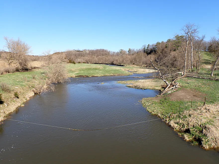
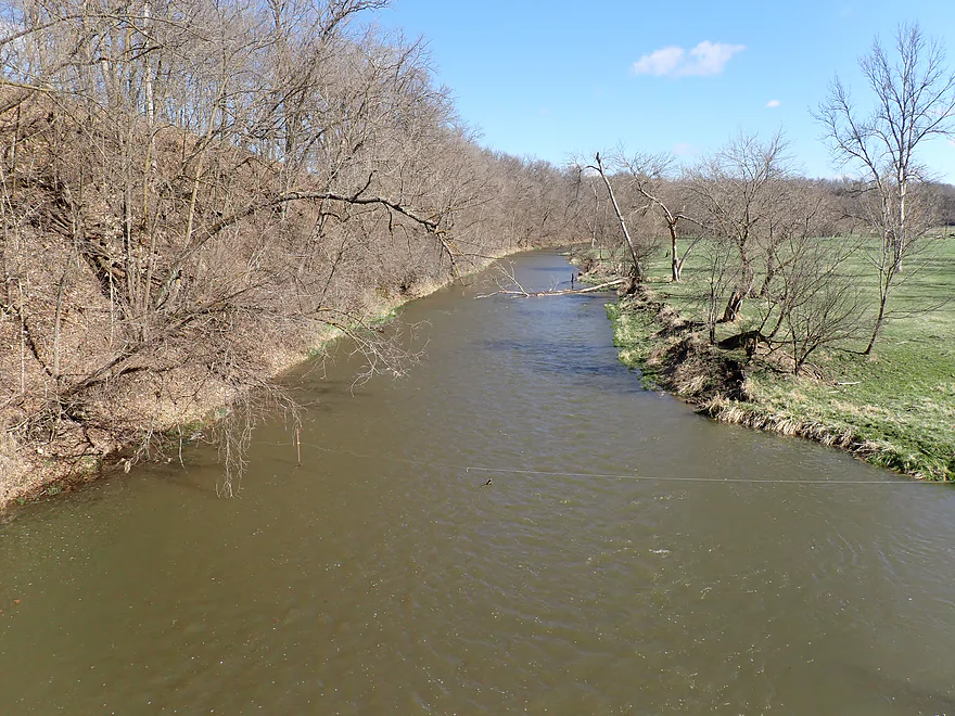
View from the Hwy 38 bridge
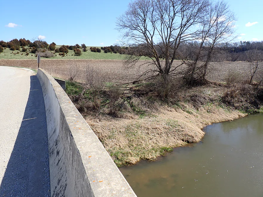
Good bridge access
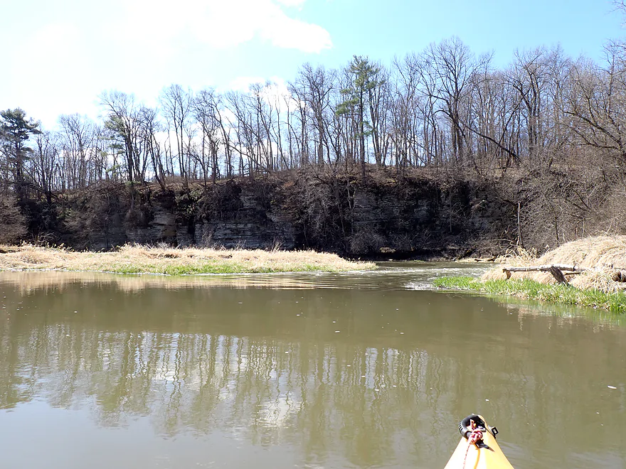
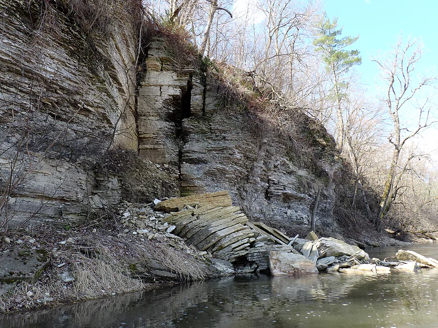
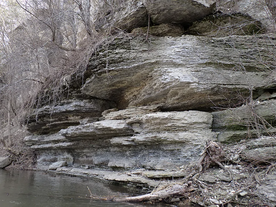
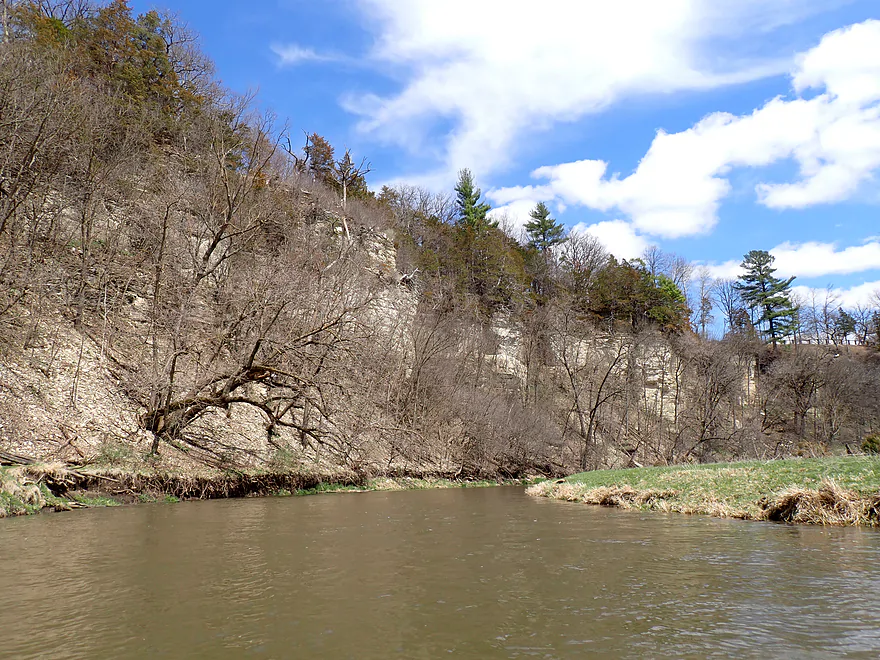
First bluff of the trip
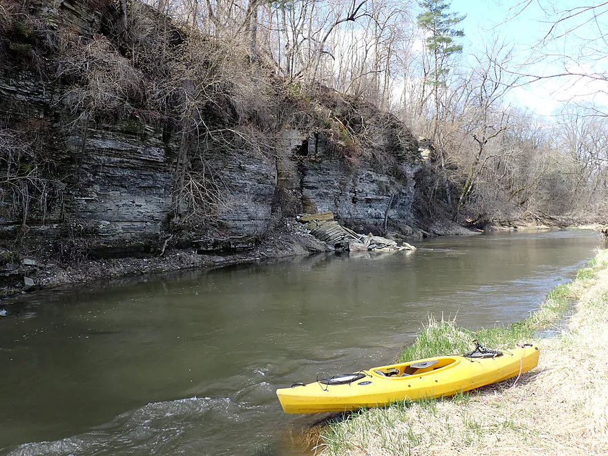
Nice outcrop
Broken plates tumbling out of the pantry
There were a number of smaller outcrops as well
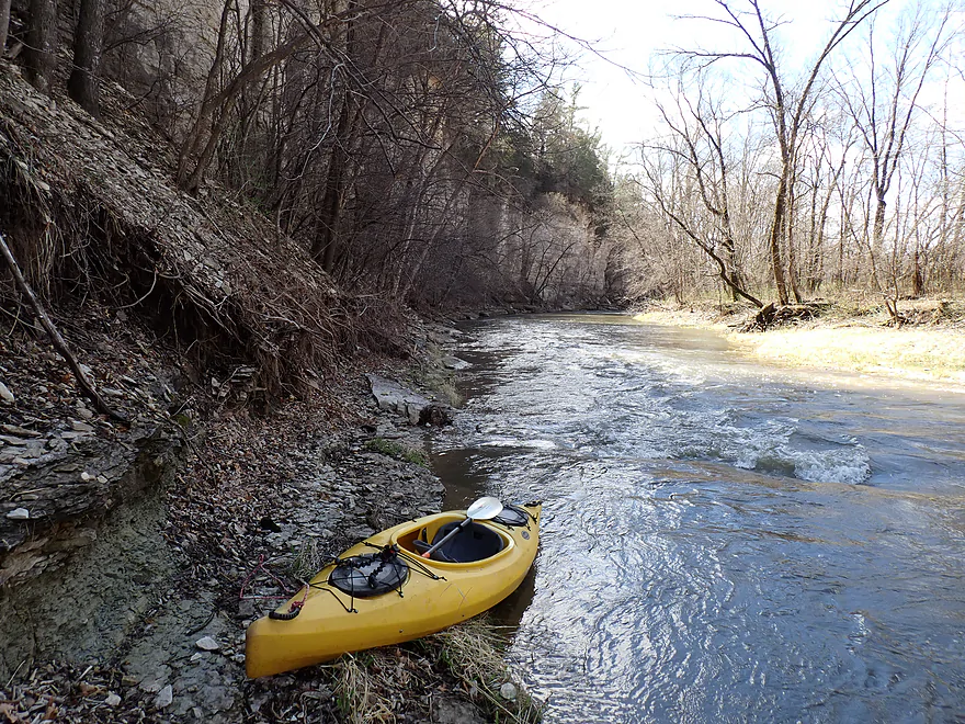
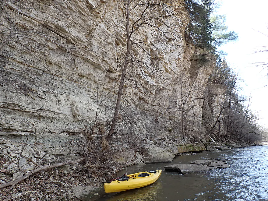
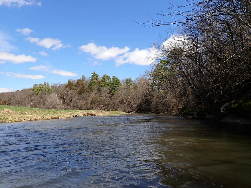
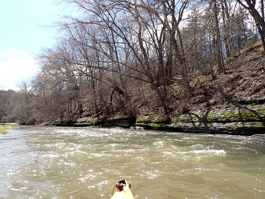
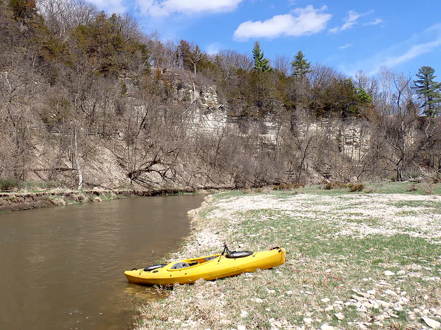
The first (and best) palisade
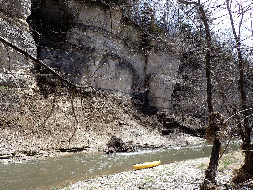
Interesting how the base is eroding
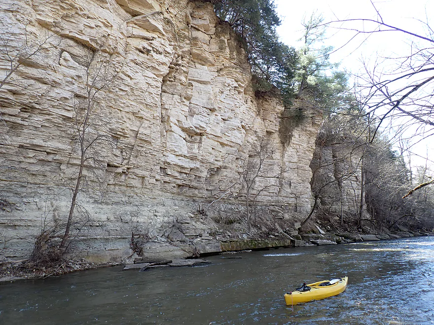
I took so many pictures…
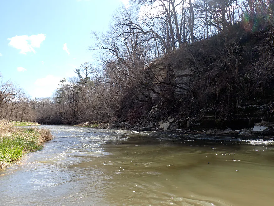
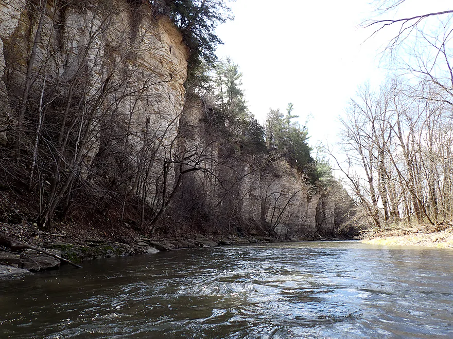
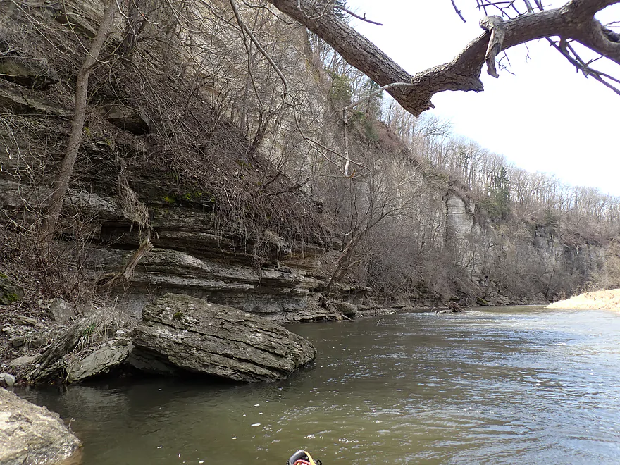
Just the start…the cliff face is quite long
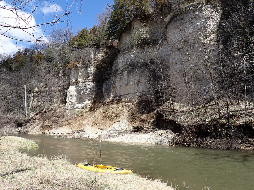
Best lighting was behind me
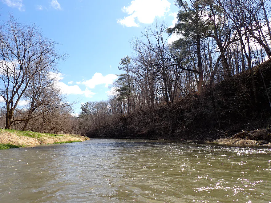
This would be a hidden jungle in the summer
Very reminiscent of the Upper Iowa River
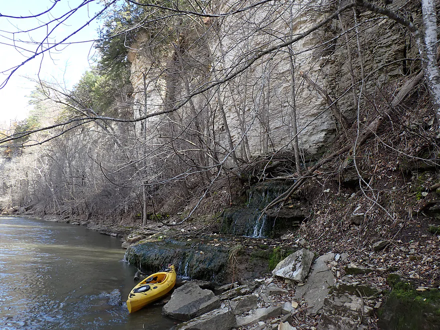
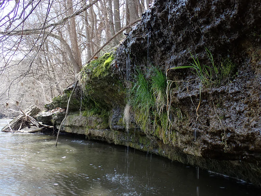
Fantastic artesian well
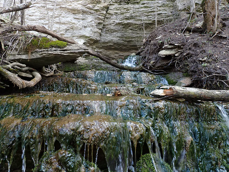
Water coming out of a hole 10′ up on the rock face
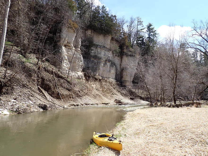
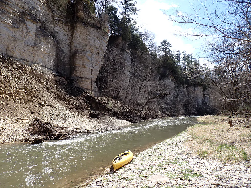
Last stretch of cliffs
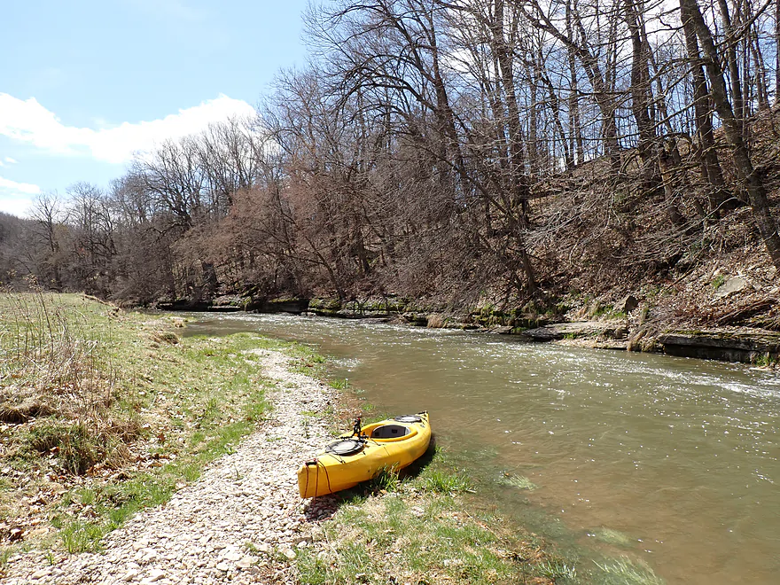
Wading into the water to try to get the right angle
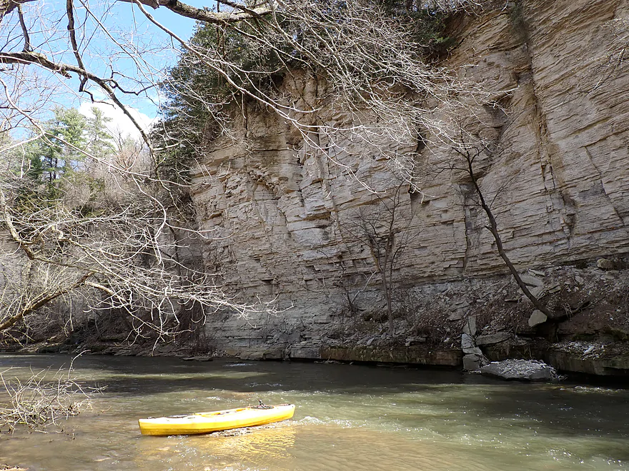
Last picture of the palisade
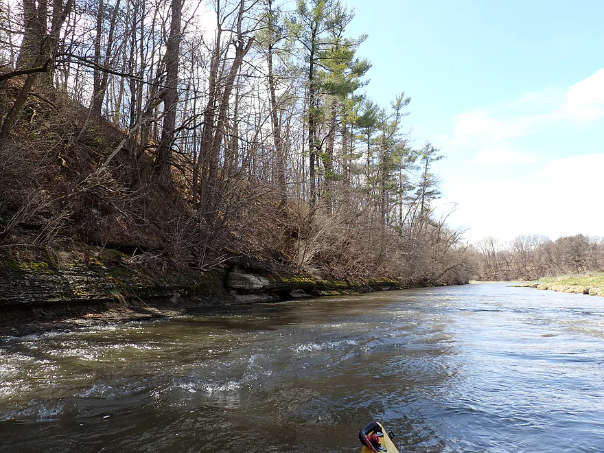
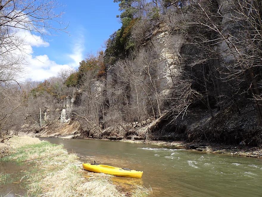
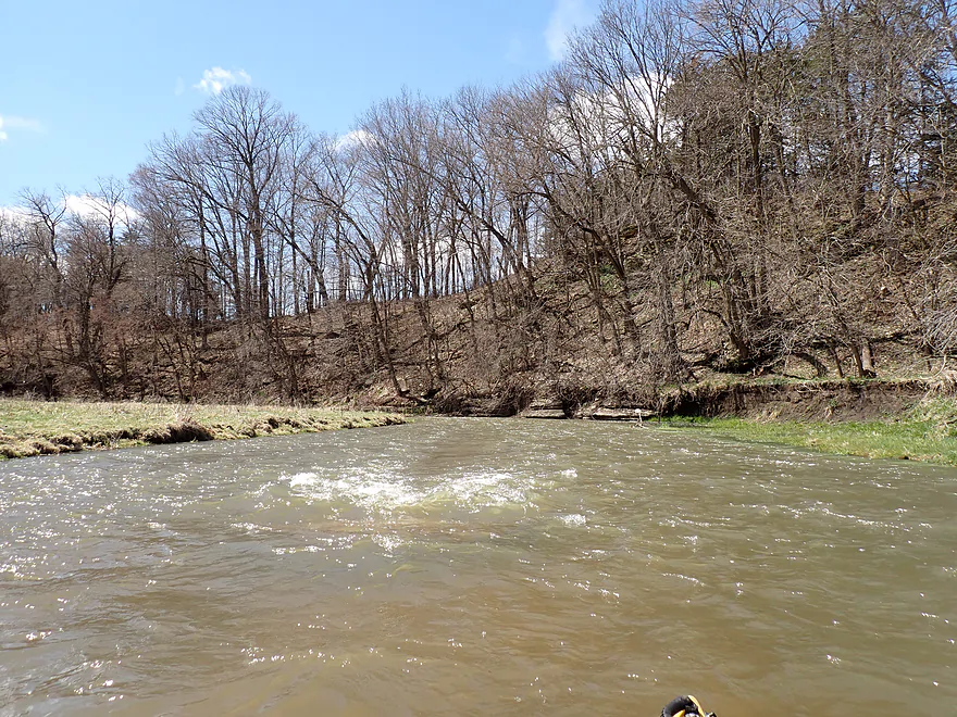
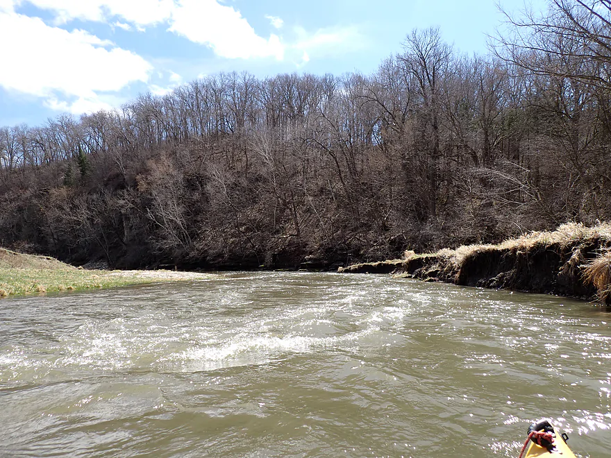
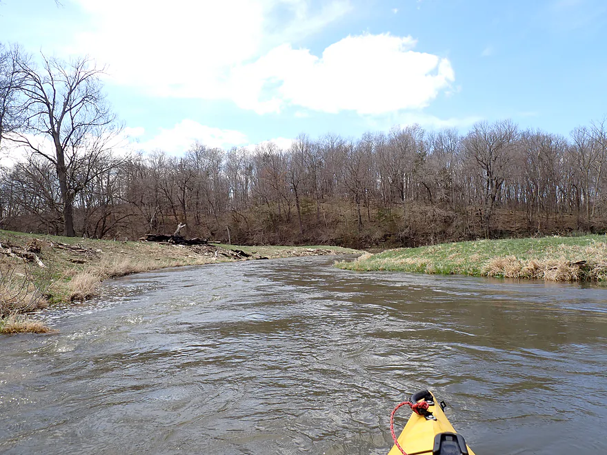
More brisk current
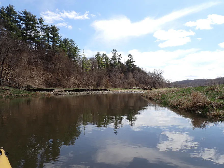
Pine trees weren’t uncommon
Open pasture with some cattle in the distance
Approaching another bluff
Getting out for pictures
Another cool seep
Approaching another large bluff

Third best palisade of the trip
Getting out for photos

Reverse view
Exotic layering
Last photo of Palisade #2
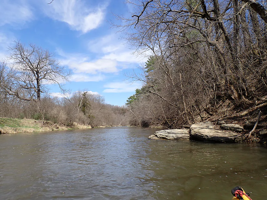
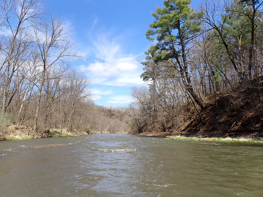
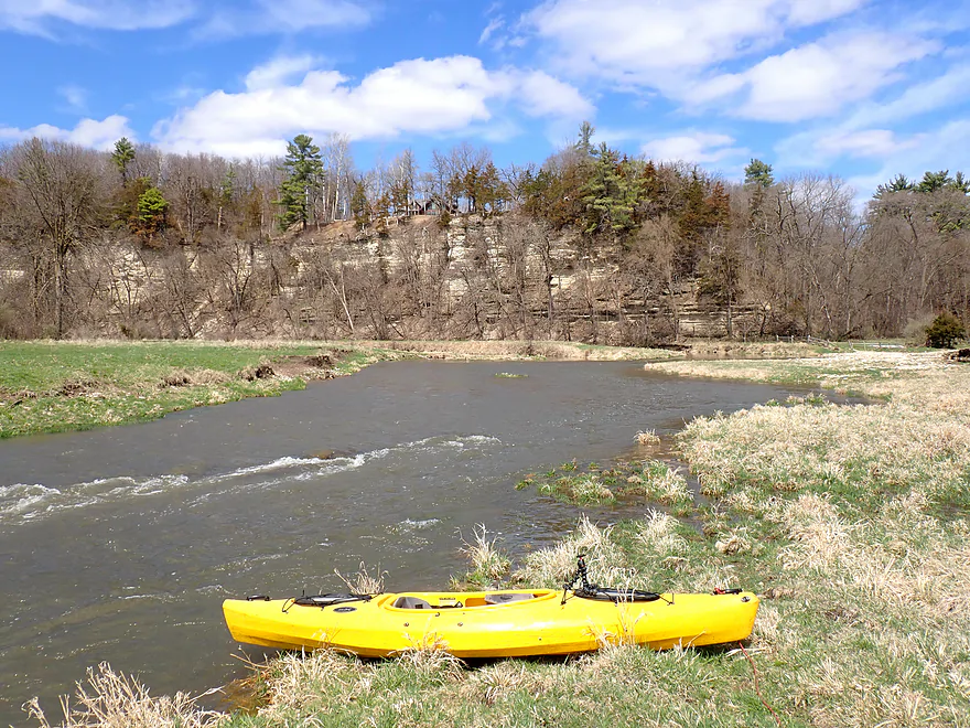
Nice blue skies–perfect for paddling
Third palisade (and second best) coming up
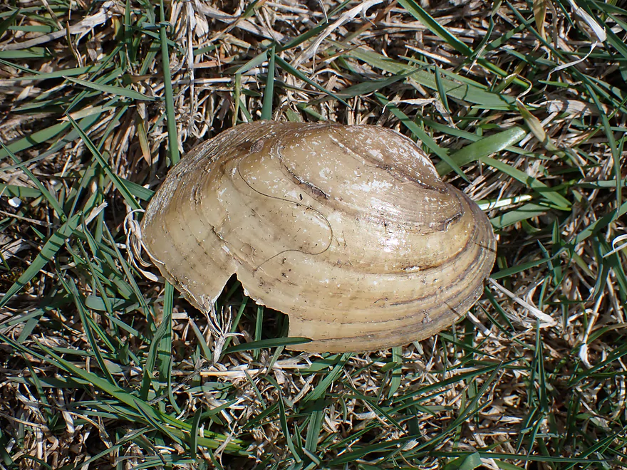
Some clam shells on the shore
Mouth of a dry creek bed
Really scenic
Last photo of Palisade #3

Approaching a large island…stay right…left channel has a fence
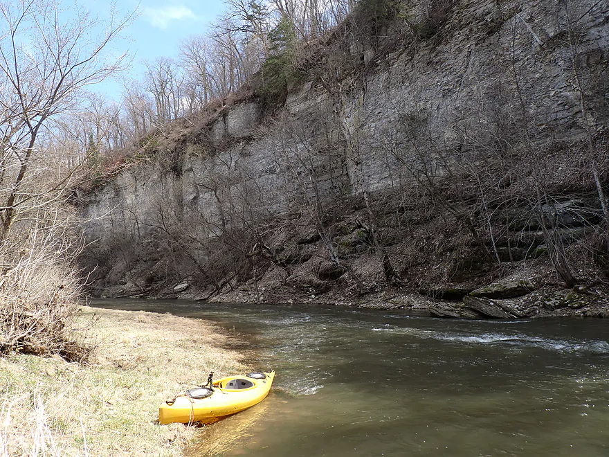
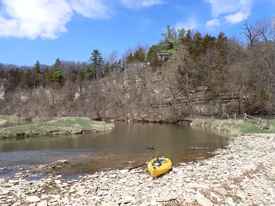
Last bluff of the trip
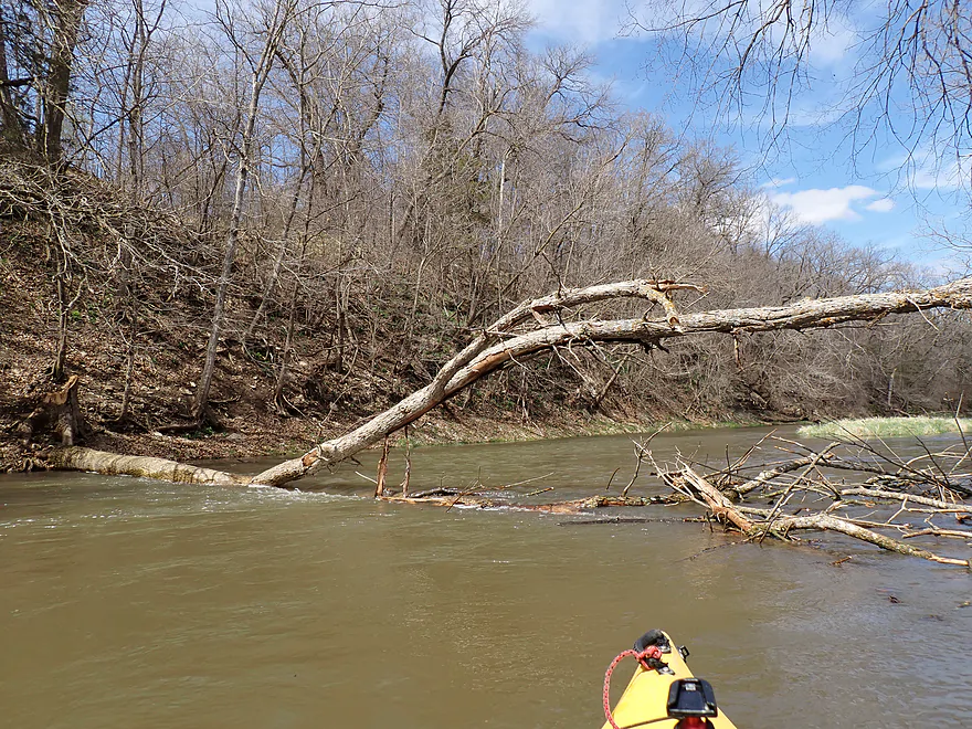
Only logjam of the trip…not difficult to get past

Last outcrop
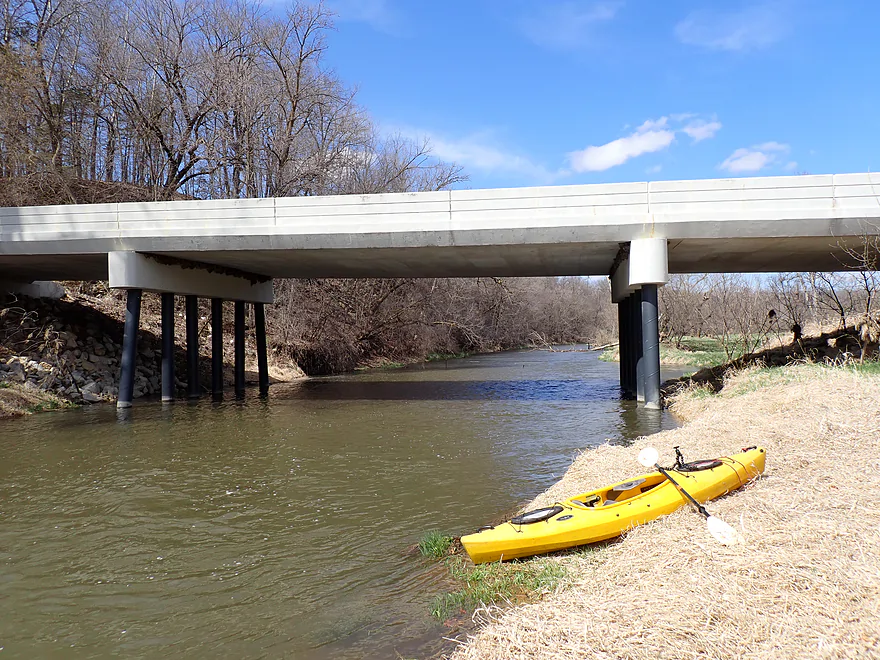
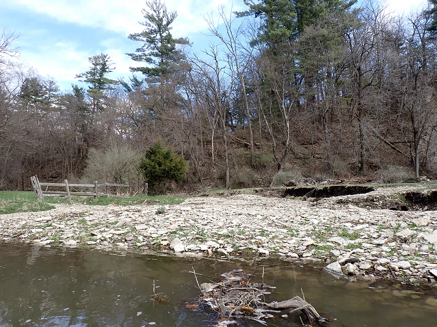
Nature Road (1st bridge) was a good access
View from bridge…note the fence…it was a great place to take out
Bear Creek MN – Hwy 38 to Nature Road

Tucked away within the rolling hills of Southeast Minnesota’s picturesque Driftless Area lie a handful of paddling gems. Among the best of the best are the tributaries to the Middle Branch of the Root River…Deer Creek and Bear Creek. These super creeks contain fantastic cliffs that resemble those seen in the more famous Upper Iowa River located just south of the state’s border. I did Deer Creek last year, which was one of my all-time favorite trips. Now it was Bear’s turn.
Bear Creek has several sublegs to choose from, or you can combine them for a longer journey. To find the best leg, I consulted Don Schaub’s Bear Creek videos (great reference!) which indicated Hwy 38 to Nature Road might be choice. Hwy 38 proved to be a good bridge access, and where I was joined by a group of fishermen. I was surprised to see so many anglers that day (~5-6 sprinkled along the creek). I believe parts of the shoreline have been purchased as public easements by the Minnesota DNR.
I must admit my first impression of Bear Creek was a bit disappointing. Heavy rain from the previous night had left the channel high and turbid – a stark contrast to last year’s Deer Creek trip, which had terrific clarity. Bear Creek was also significantly wider and more powerful than its southern sibling, moved at a surprisingly fast speed and featured countless light rapids. The shoreline was also more degraded and less attractive than last year’s Deer Creek trip.
But just around the bend was the reminder of why I made the two hour drive, endured the dusty gravel roads, braved the cold air temperature and high water, and even endured a literal dog nip during the previous bike shuttle. It was the first of Bear Creek’s many spectacular limestone cliffs. I’m not sure my pictures/video did them justice because of poor lighting conditions, but they were truly impressive and featured striking white limestone stacked in layers. This is precisely why April is such a good time to do trips like this…Don Schaub did his Bear Creek trips in May and he already started to lose some of the cliffs behind the encroaching summer foliage.
After some light rapids, the creek swung toward a towering pine-topped bluff which bounced the river 180 degrees south again. At the base of this half-mile long bluff was an impressive 110′ high cliff. Fallen boulders and scenic rapids dotted the base of the horseshoe bluff, creating an impressive landscape which was the trip highlight. Getting good pictures was half the adventure and at times required wading in the fast water that was much colder than what I remember on Deer Creek.
At the center of the horseshoe cliff was an artesian well, which gushed directly from the rock face and tumbled over colorful algae to form a 10′ high small waterfall. I encountered other seeps later in the trip, but this was the best.
Leaving the dramatic palisades behind, the creek opened up into a broader landscape. This included some open pasture and grazing cows…thankfully none were in the river and there were no major fence problems. There were still some more cliffs after that, but they were mostly smaller (still nice though).
For major cliffs (palisades) I counted three total for the trip. The final one was located about three-quarters into the trip and was part of another sweeping horseshoe bluff…figure 1000′ long and 100′ high. With the sun hitting the cliffs at the right angle, I finally received good lighting for pictures. A house was perched atop the cliff, which had me a bit self-conscious about loitering too long for photos…the observer was likely being observed! At the east end of the cliff was a large rocky, dry creek bed leading out of a hidden draw…it likely gets very interesting during floods.
The channel was soon divided around a long (~900′) island. Paddlers should take the larger channel located to the right (west). The eastern channel runs through a fence, a bit close to a house, and past several major logjams. In contrast, the west channel is much more navigable and parallels a scenic bluff. But it too had a logjam (pretty easy to get past though). Shortly after the island I reached Nature Road, my take-out for the trip, which was a nice bridge access.
My three-mile trip will be too short for most paddlers. But you can certainly take out at a downstream bridge or even on the Middle Branch of the Root River itself. Or better yet, start your trip further upstream where the best scenery is located.
In summary, Bear Creek was a great trip. The palisades were fantastic and the rapids were lots of fun. It might truly be one of the best water trails in Southeast Minnesota. That being said, I do slightly prefer its sister creek to the south. This, despite Deer Creek being smaller, shallower and having more fences to deal with…but IMO its cliffs were just more frequent and more exotic. Ultimately though, both creeks are definitely worth paddling.
Sights (and sounds) included redtails, some clam shells, geese, singing frogs, and cows.
Masonic Park: This is a small and obscure park located along the banks of Deer Creek (about 2 miles south of Bear Creek). Its highlight is the impressive, whitish limestone palisades that border the creek. In fact these might be the best and most impressive cliffs on Deer Creek and the park can be a great take-out for paddle trips. Many years ago, I believe the Weisbeck’s Sawmill and Furniture Factory was located here. The cliffs were referred to as the “Hogsback” and a plan was to create a 30′ dam here and then tunnel a millrace through the cliffs. Today there is no evidence of the former sawmill, and it appears the millrace and dam were never built (thankfully). A landowner donated the land to the area Masonic Lodge, who developed the park and built a pavilion. The Masons, in 1999, gave the land to Filmore County.
Hwy 38: This is a good bridge access which fishermen sometimes use. The best launch area will be north/downstream of the bridge where it is less steep.
Alternate Put-ins:
- Hwy 1 (5.5 miles upstream from Hwy 38): A scenic stretch with one nice set of palisades…there is a fence upstream from 141st Ave, but shouldn’t be too bad to get around.
- 141st Ave (4.0 miles upstream from Hwy 38): Maybe the best leg on the river with more great cliffs.
Nature Road (1st Bridge): This is also a very good bridge access. Get out downstream/east of the bridge where there is a nice grassy bank that leads to the shoulder.
Alternate Take-outs:
- Nature Road (2nd Bridge) (3.3 miles downstream from Hwy 1): A mediocre leg with some snags and a few logjams. Not an awful leg, but not at the same standard of excellence as the previous sections.
- Hwy 5 (5.7 miles downstream from Hwy 1): As Bear Creek nears and eventually joins the Middle Branch it loses a lot of its magic (and cliffs). Still not an awful stretch…there are just much better options located upstream.
Bike Shuttle – Nature Road-1st Bridge to Hwy 38: 3.1 miles with 243′ of ascent. This is a hilly shuttle that is all gravel. That being said, it wasn’t too bad if you’re ok with walking a few hills. The gravel had packed-in areas which (mostly) helped. What didn’t help were the aggressive dogs. One dog (who I’ll dox as 16222 Nature Rd, Spring Valley, MN 55975) chased me and lightly nipped my heal. This might be a bike shuttle to pack pepper spray on…
Fences: These really weren’t a problem. There is a fence upstream from the take-out, but it was easy to duck under and wasn’t electric.
Strainers: There were a couple of strainers in fast current. But if you have decent boat control, these should be easy to get around.
Logjams: There was one logjam (marked on map). I was able to hop over…but if paddlers prefer they can portage, which would be easy because of the shallow banks.
Current/Rapids: The current was pretty fast with many light rapids. The strongest rapids were by the first west-facing bluff…but even these were still only Class 1 and pretty easy.
Island: The river splits around a large island near the end of the trip (almost visible from the take-out). It is important to take the west (larger) channel. The east channel has a fence and several tricky logjams.
Closest Gauge: Middle Branch of the Root River @ Fillmore
My Trip Depth: 997.65′ or 287 CFS. (For comparison my Deer Creek trip was completed at 997.23′ or 173.00 CFS.)
Gauge Guide: The following are very rough estimates that could be inaccurate. Always use your own judgement.
- < 100 CFS: This might be too shallow.
- 101-150 CFS: Very shallow but might be ok for determined paddlers in flat bottom boats who don’t mind a bit of wading.
- 151-200 CFS: Shallow depth and bumpy in spots, but likely viable for flat bottom boats. Should be good clarity.
- 201-250 CFS: Average spring depth. Good target range…some bumps…but IMO not bad.
- 251-350 CFS: Higher depth with poor water quality…but the rapids will be well padded. A good target range.
- 351-550 CFS: Very high depth. Some of the strainers might be a bit annoying, but should be doable for paddlers with good boat control. I believe Don Schaub did his Bear Creek videos when the creek was about this high.
- 551-1000 CFS: The banks might burst at this point. Personally I would stay off the river as it will be fast, dirty, muddy and pushy…but I think skilled paddlers could handle this depth ok.
- 1001+ CFS: Likely too high for any paddling skill level.
Click here to see an overview map of Deer Creek, Bear Creek, and the Middle Branch of the Root River.
Bear Creek:
- Upstream from Hwy 476: The creek is likely navigable, but I doubt the scenery is as good.
- Hwy 476 to Hwy 1: 8.7 miles. The first half is flatter and less interesting. There may be a few logjams to deal with. The second half should feature terrific wooded bluffs and outcrops. Here is a great video.
- Hwy 1 to 141st Ave: 1.5 miles. Super scenic bluffs and cliffs. Fast current with possible fences and strainers can make this a challenging if not dangerous section in high water. Bear Creek is bigger than Deer Creek but can still run shallow. Here is a nice video of that stretch.
- 141st Ave to Hwy 38: 4.0 miles. Creek twists through a narrow valley with incredible outcrops. This is likely one of the most scenic legs on the river. Warning: it can be trying in low water or high water. Stay alert for electric fences. Here is a nice video of that stretch.
- Hwy 38 to Nature Road 1: 3.1 miles. This might be the second most scenic leg of the creek with three sets of fantastic palisades. More tight turns past incredible bluffs and cliffs. Warning: this too can be trying in low water or high water.
- Nature Road 1 to Nature Road 2: 3.3 miles. Creek is more open and a bit slower…but still some shallow rapids and a few cliffs. Not for beginner paddlers, with some snag dodging…and not to be done during high water. Video of that stretch starting from 6:55.
- Nature Road 2 to Mouth (Deer Creek and Bear Creek confluence and start of the Middle Branch): 0.9 miles. Last leg of the creek. Channel flows past a large west-facing bluff. Video of this stretch starting from 9:03.
Deer Creek:
- Upstream from Hwy 63: I don’t know much about these parts. I suspect they are small and shallow. There might be some outcrops, but relief maps suggest they wouldn’t be very big.
- Hwy 63 to Mower Fillmore Road: 2.0 miles. A small leg with maybe a few logjams. There appear to be outcrops but they are likely small.
- Mower Fillmore Road to Hwy 8: 4.1 miles. Good prospect with multiple medium-sized outcrops. There may be a large logjam cluster under the railroad bridge.
- Hwy 8 to Hwy 1: 3.2 miles. First of the great Deer Creek legs. Includes many impressive limestone outcrops. Portages may be required for two fences and two strainers in rapids. This can get pushy in high water and bumpy in low water.
- Hwy 1 to 141st Ave: 2.2 miles. A terrific leg with fantastic limestone cliffs. In high water the rapids and snags can be tricky. A video of this stretch (1:51 to 3:25) can be seen on Youtube.
- 141st Ave to Masonic Park: 4.0 miles. This has some tricky rapids and possible snags, but it’s also likely the most scenic leg on Deer Creek (if not all of southern Minnesota). Highlights include gorgeous limestone outcrops with the best and tallest residing at Masonic Park. A video of this stretch (3:25) can be seen on Youtube.
- Masonic Park to Hwy 8: 5.1 miles. Great prospect with steep terrain and many cliffs.
- Hwy 8 (1st bridge) to Hwy 8 (2nd bridge): 0.7 miles. Deer Creek starts to flatten out with far fewer scenic outcrops. There should still be a nice bluff along the south bank.
- Hwy 8 (2nd bridge) to Nature Road: 0.9 miles. An open stretch with some pasture and sandbars.
- Nature Road to Mouth (Deer Creek and Bear Creek confluence and start of the Middle Branch): 0.3 miles. Last leg on Deer Creek.
Middle Branch:
- Start of the Middle Branch (end of Deer/Bear Creeks) to Hwy 5: 1.5 miles. A mediocre leg, but there might be a nice bluff by Filmore. Video of this stretch starting from 9:25.
- Hwy 5 to Morgan Road: 7.1 miles. While not having the elite scenery of Deer or Bear Creek, this is still a good leg with a few outcrops and light rapids.
- Morgan Road to Hwy 7: 2.6 miles. An ok prospect with perhaps a few outcrops.
- Hwy 7 to Confluence with Main Branch: 1.4 miles. Last leg on the middle branch. Nice stretch through a wooded valley. Might be some outcrops.
- Confluence to Juniper Road: 0.3 miles. A short leg on the main branch to reach an access.
- Juniper Road to Parsley Bridge Access: 3.4 miles. Another take-out option on the main branch. This is a nice leg with good scenery and outcrops.
Trip Map
Overview Map
Video
Photos Size:
Don just posted a video of the far upper stretch of Bear Creek (Hwy 476/Raven Rd to Hwy 1) which I hadn’t properly considered before: https://www.youtube.com/watch?v=XgN6d5HhGoo It’s very scenic with a number of cool cliffs…check it out!