
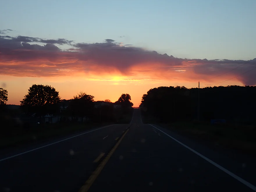
Getting an early start to the day
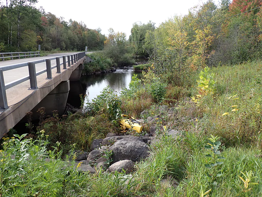
Starting at Bridge Road…rocky but doable
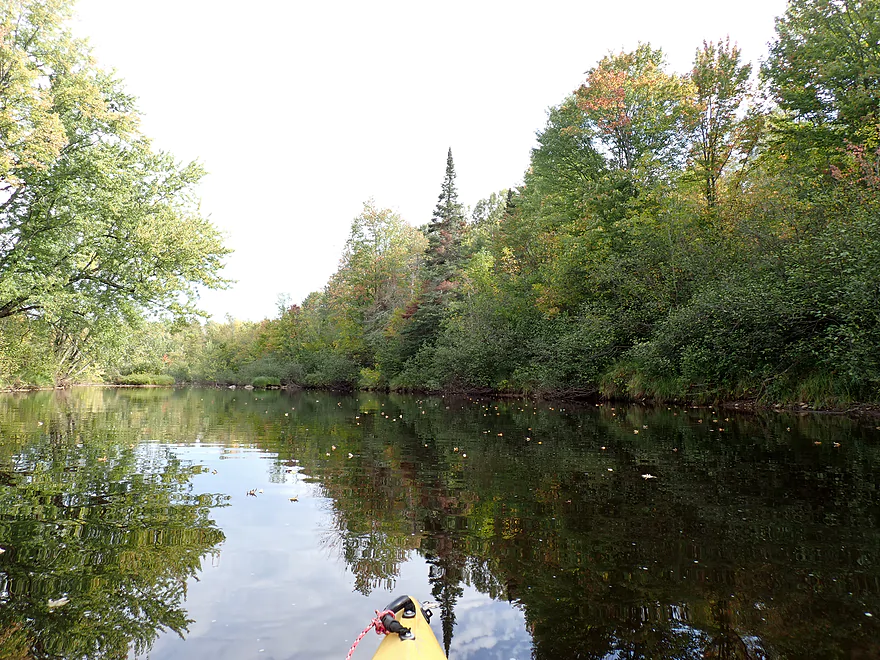
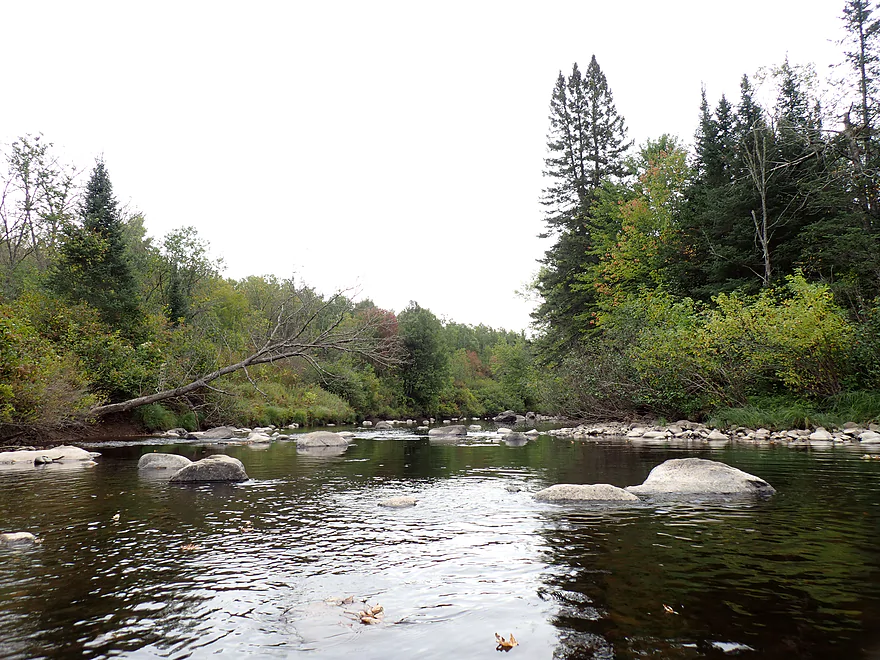
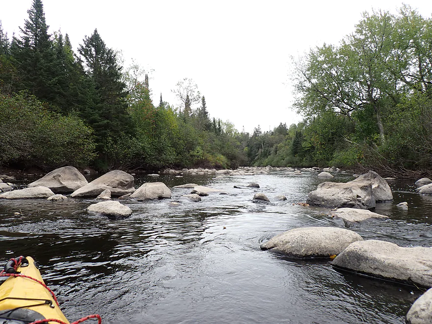
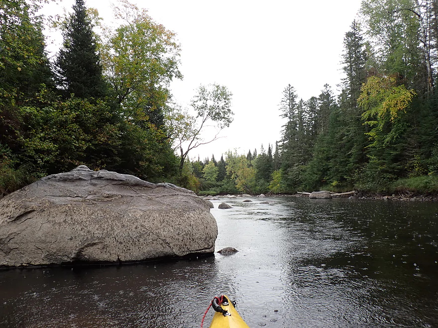
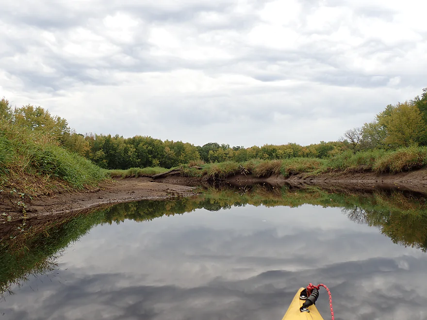
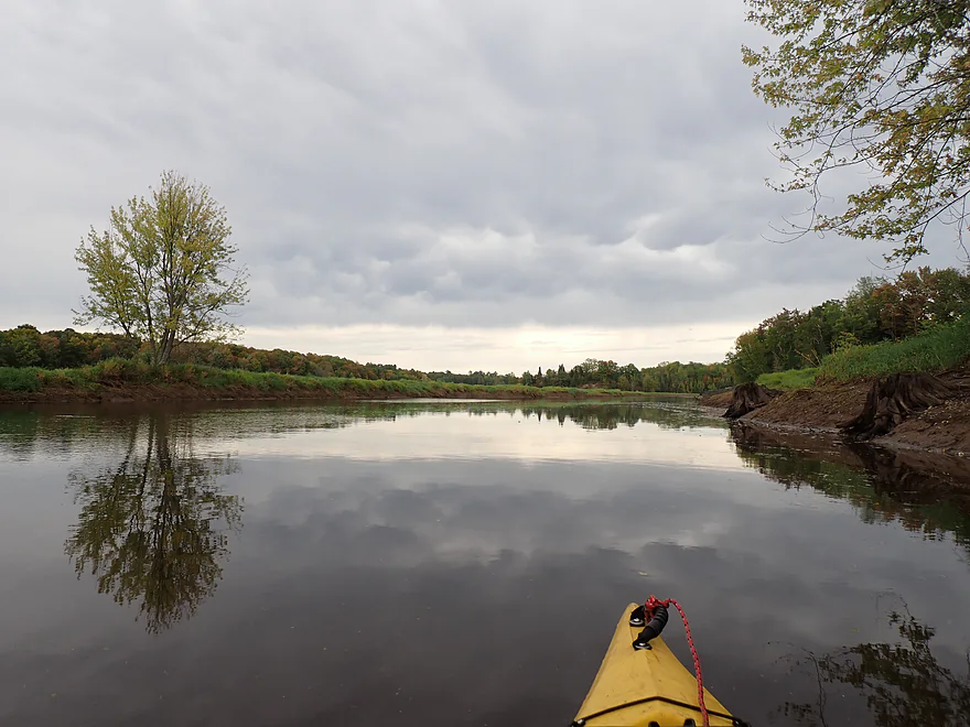
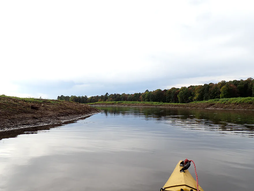
River starts slow…
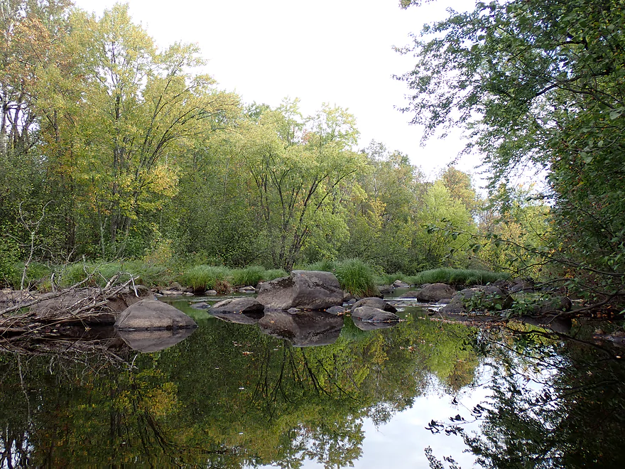
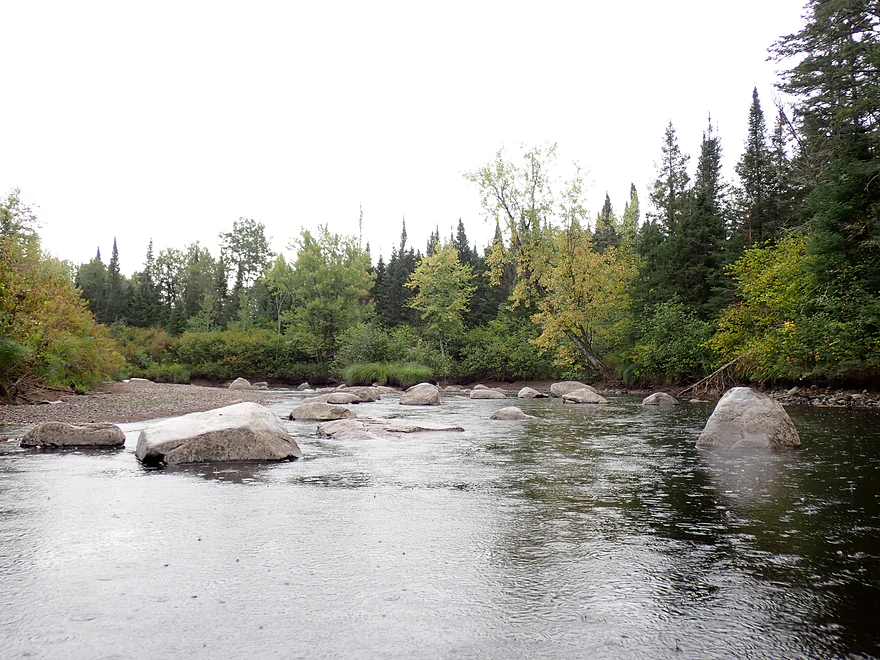
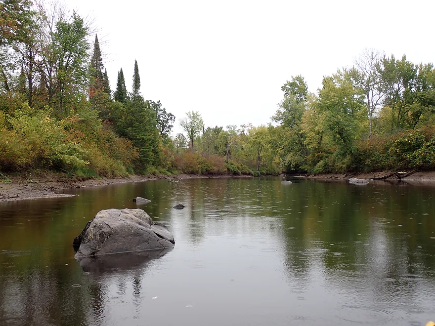
The start of a long boulder field
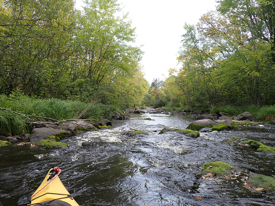
Very scenic
But difficult to fit down
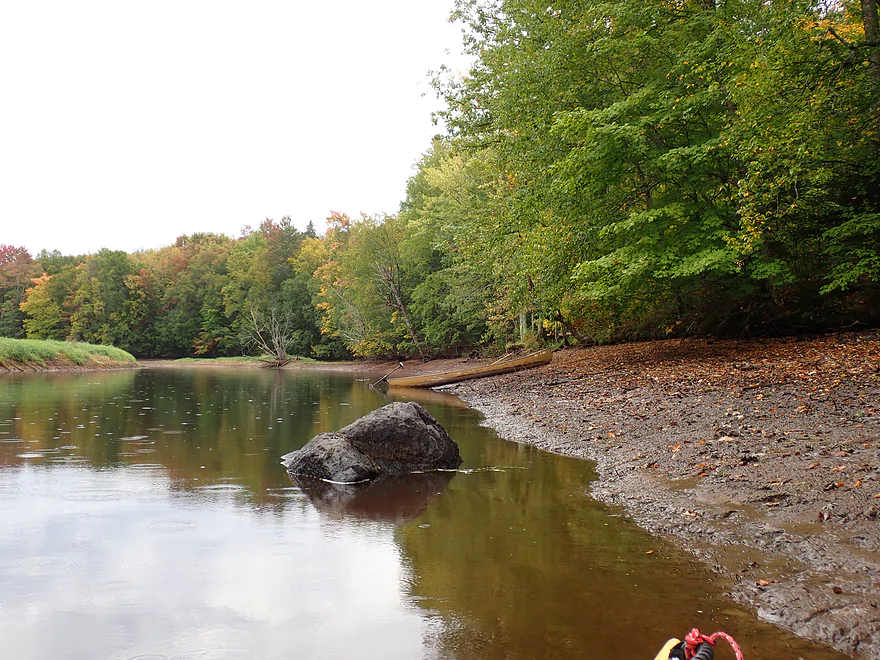
I barely bumped my way down
In high water this would be insane
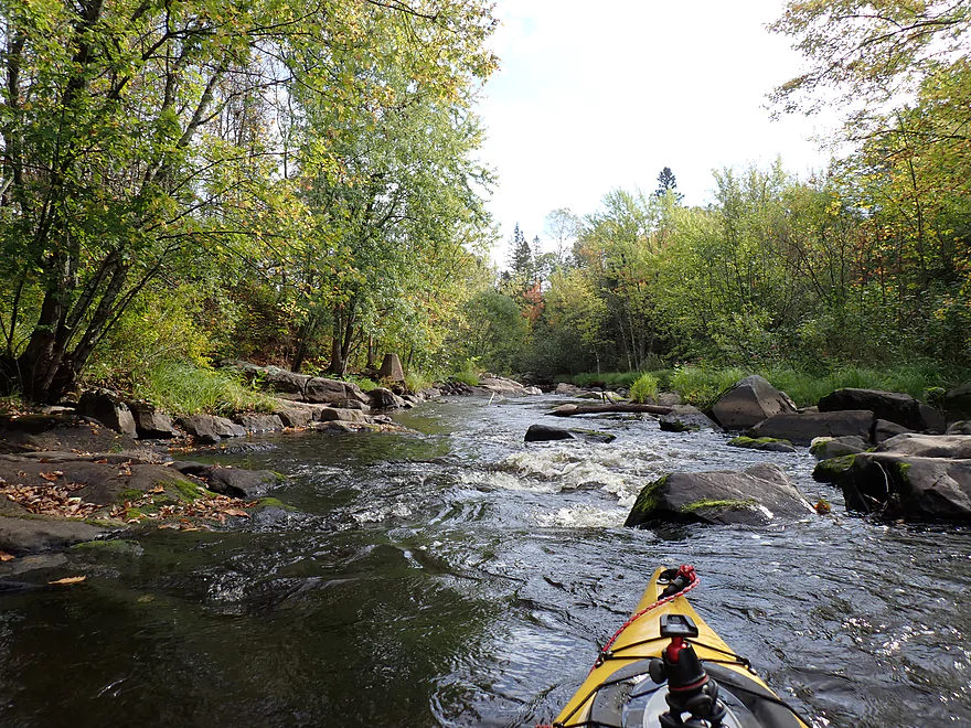
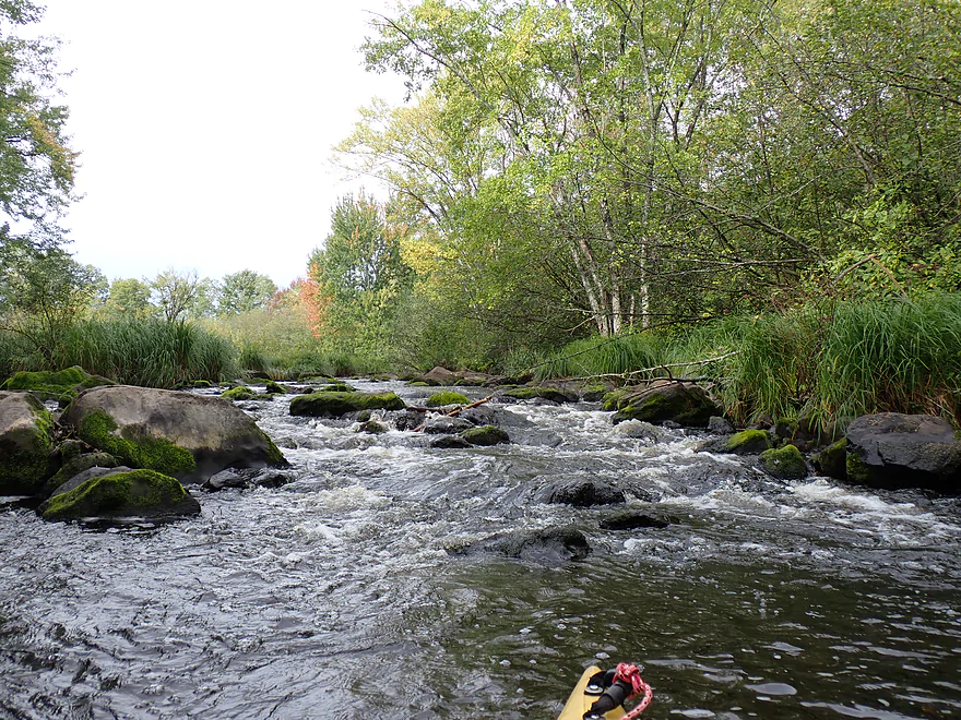
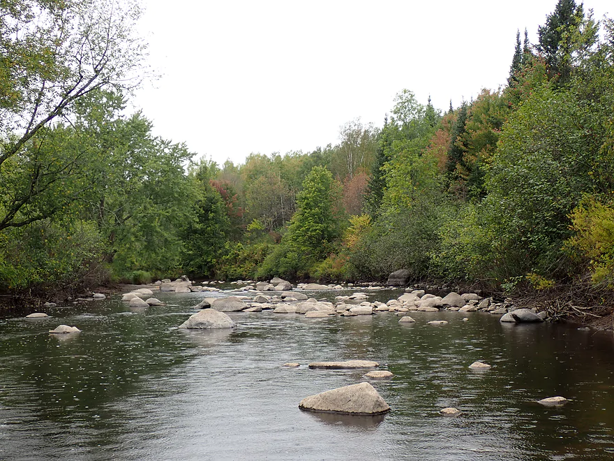
Boulders starting to get bigger
Starting to see an horizon line
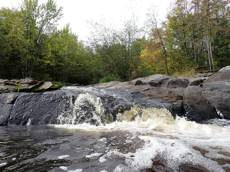
Portaging Spirit Falls
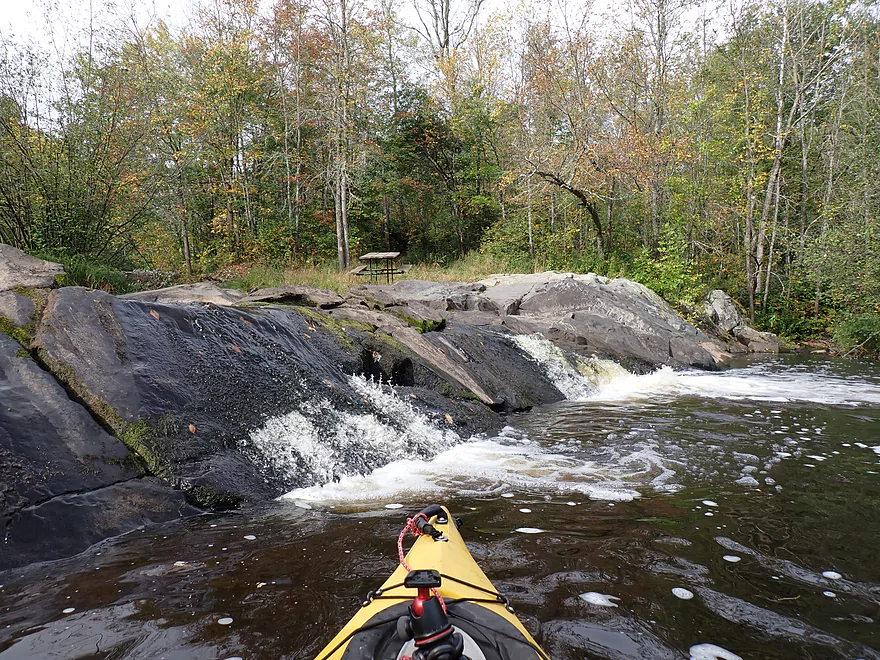
The falls are considered Class 3 and are almost runnable
In high water there are dangerous backrollers below Spirit Falls
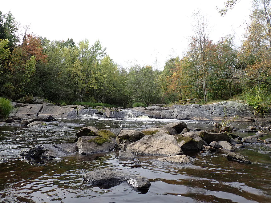
Panned-out view of Spirit Falls (an access trail comes in from the right)
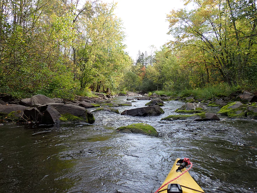
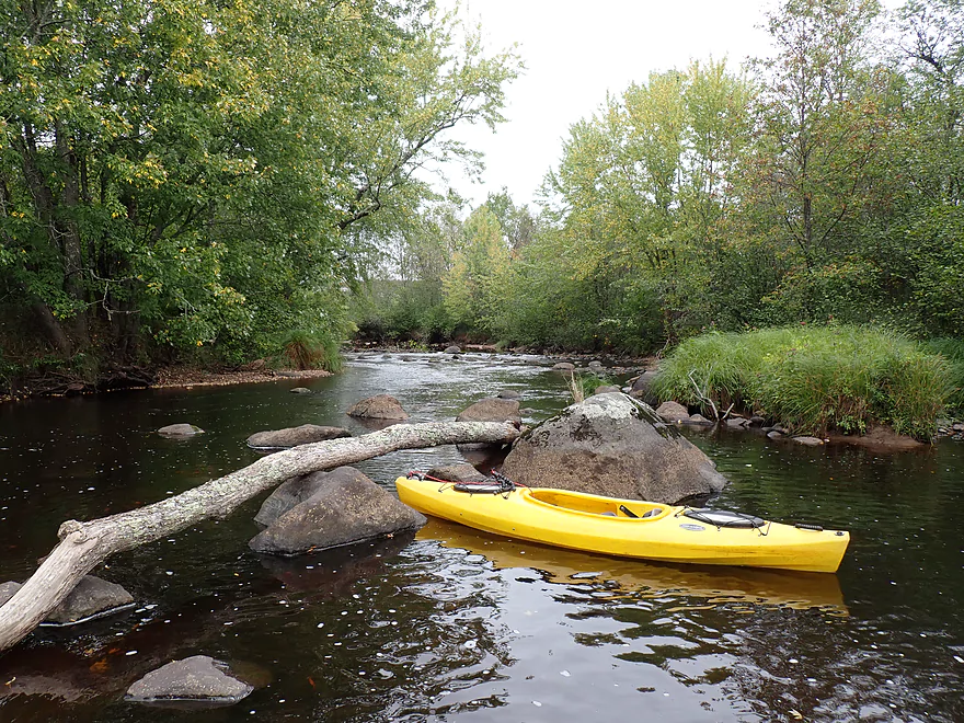
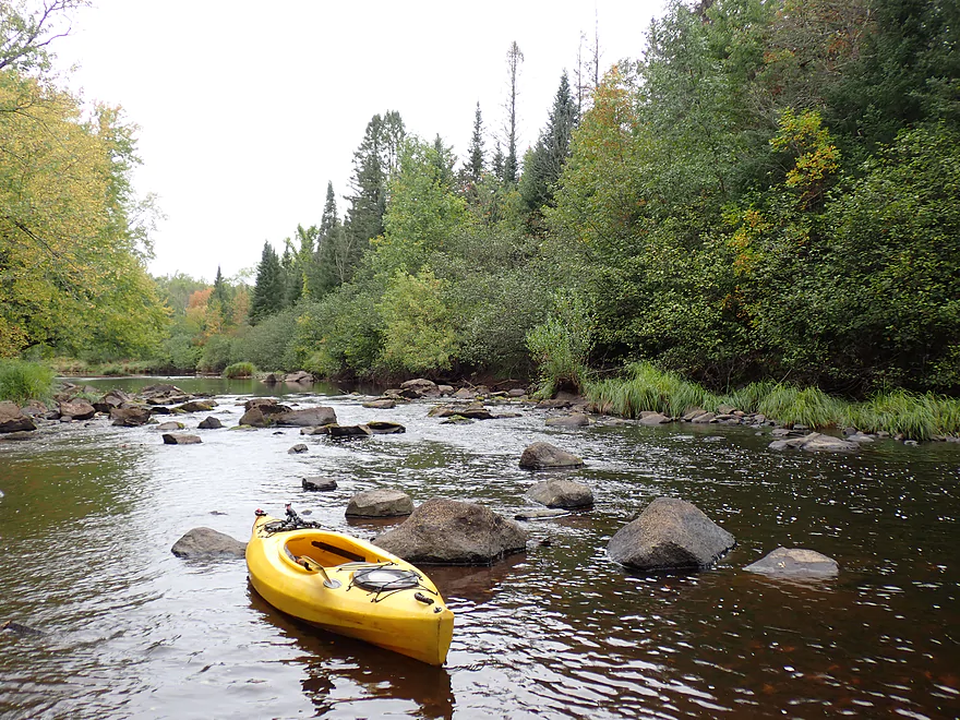
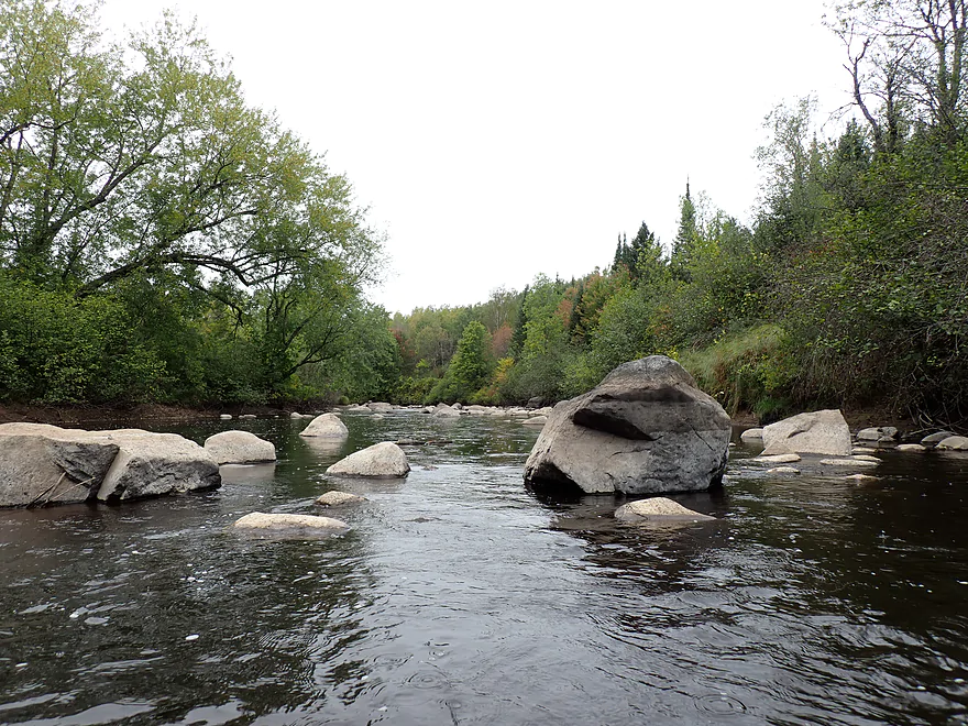
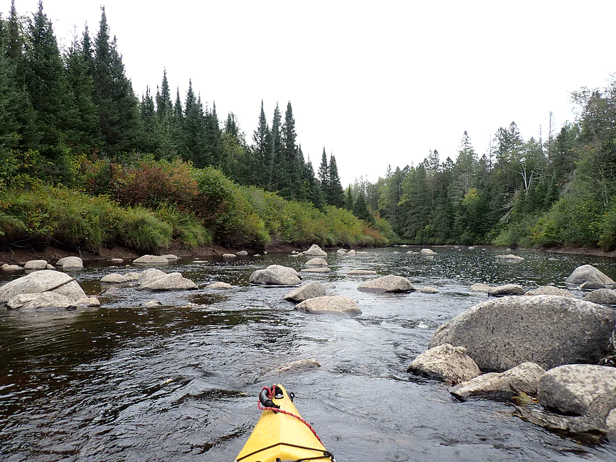
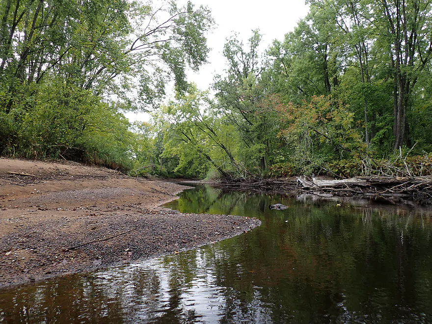
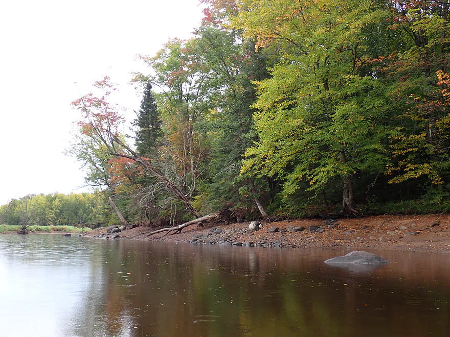
Looking downstream at more boulders
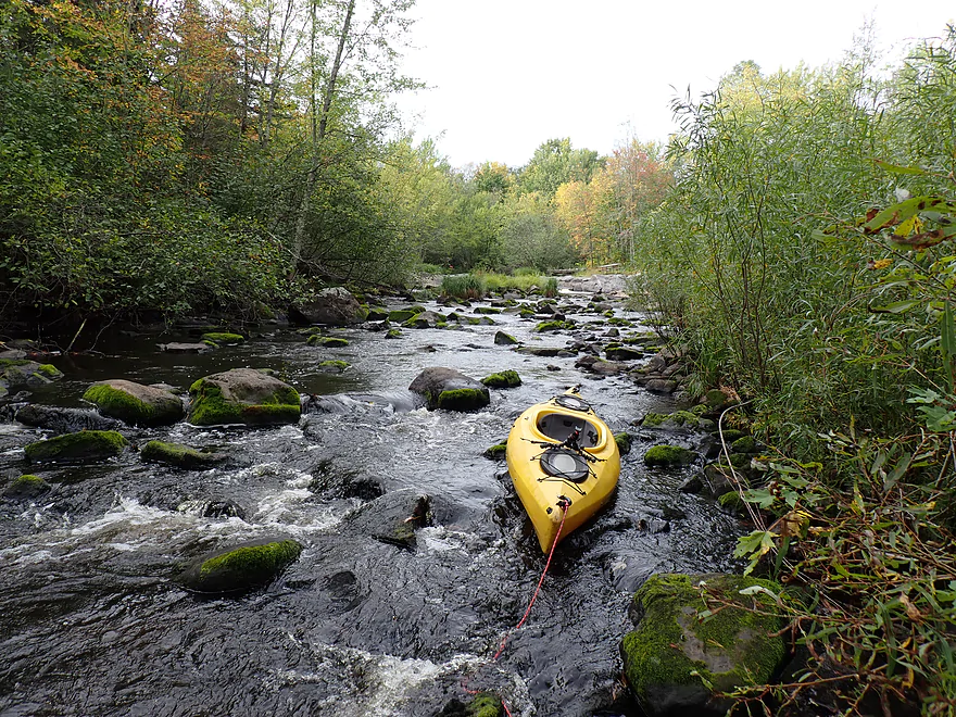
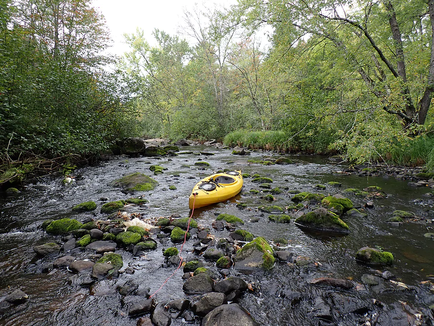
This wasn’t floatable so I had to wade it…not fun

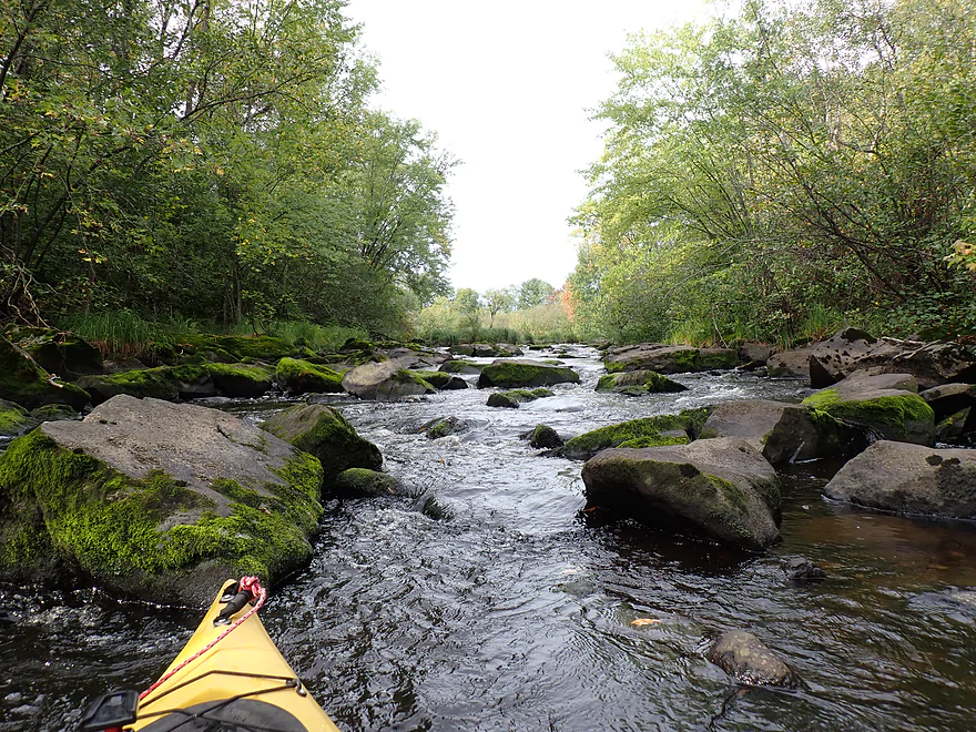
Possible reprieve?
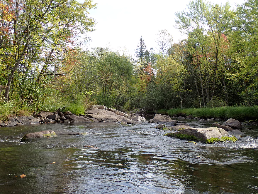
Nope…more boulders
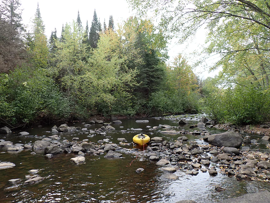
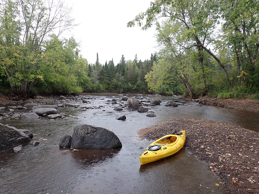
Roughly the end fo the boulder field
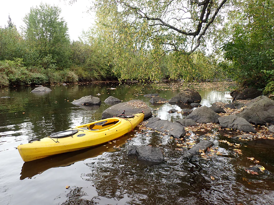
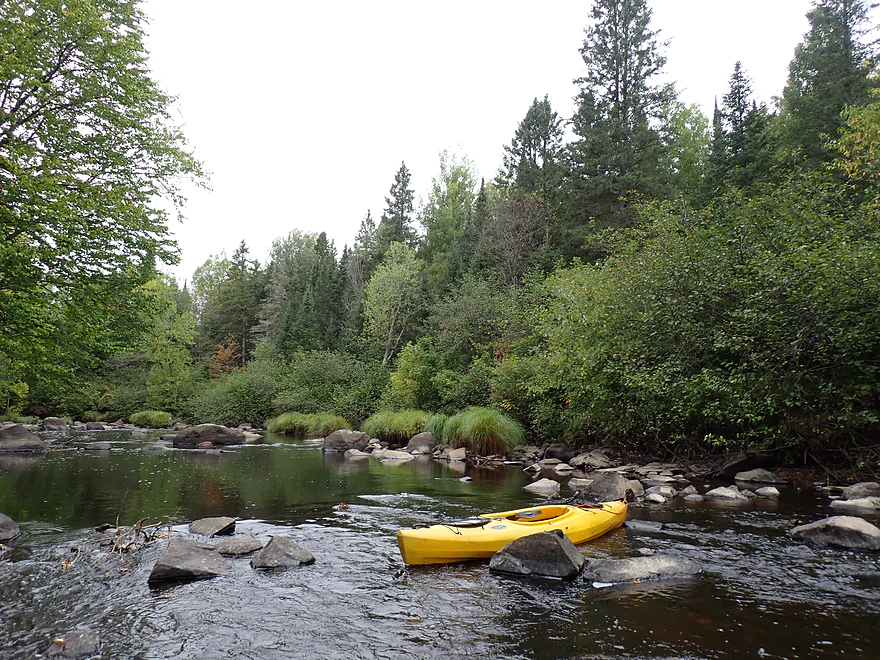
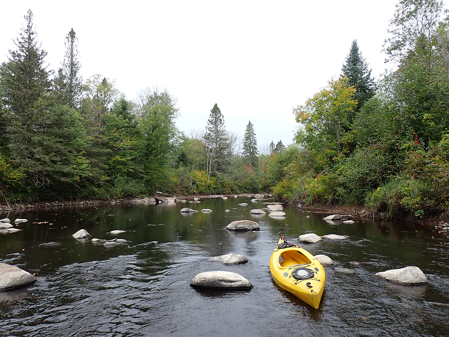
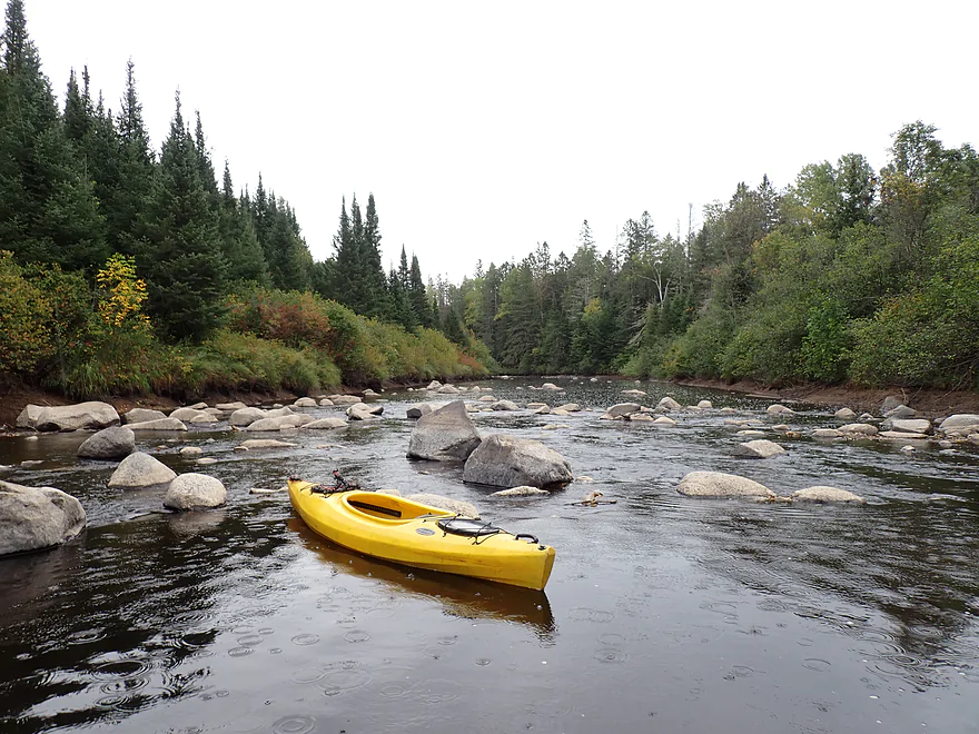
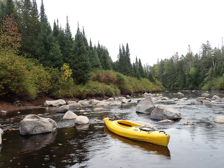
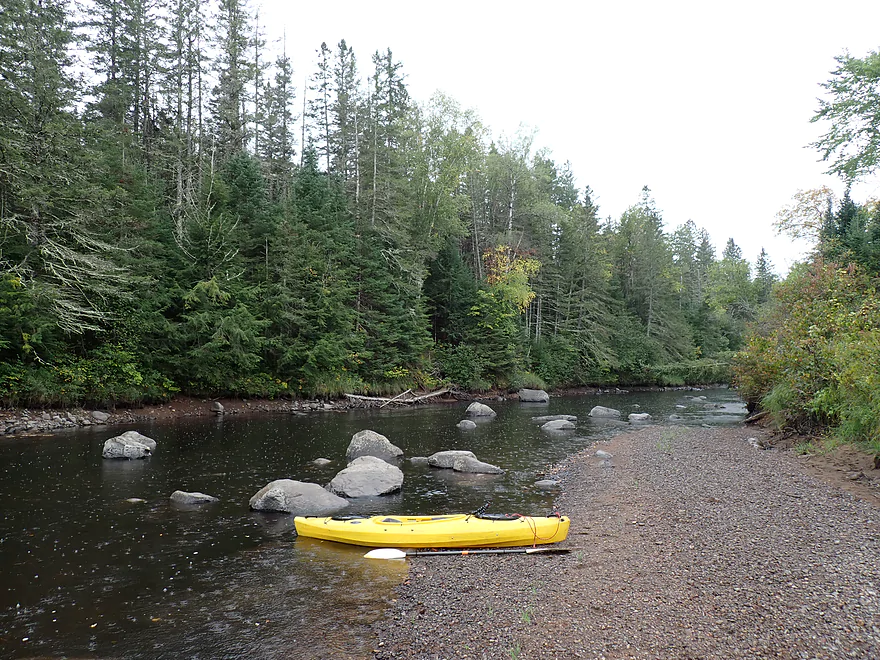
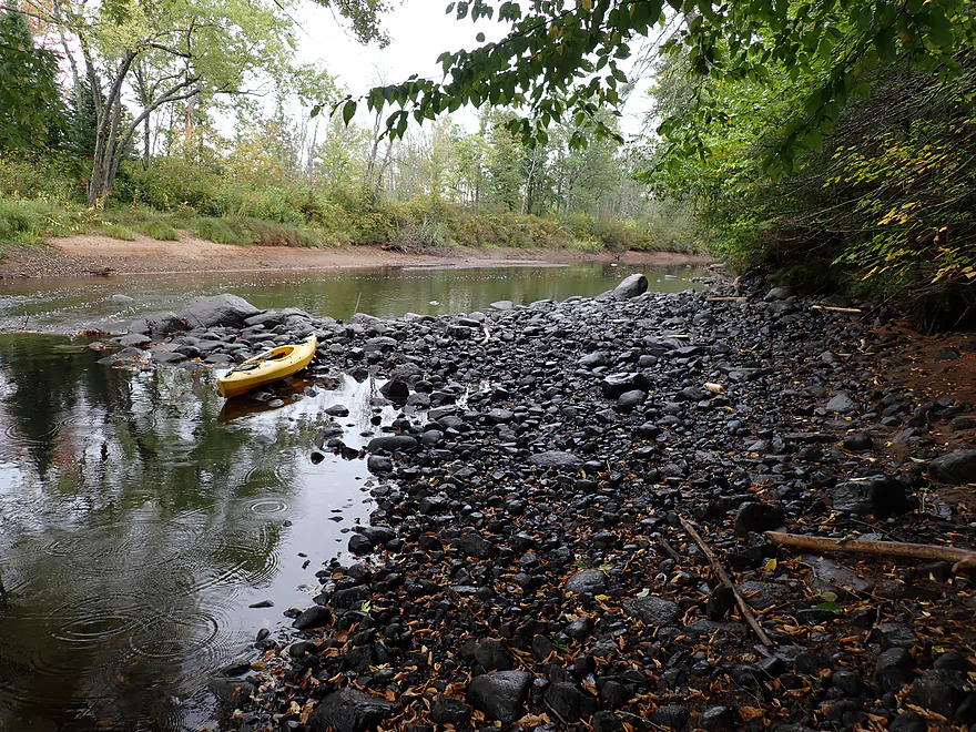
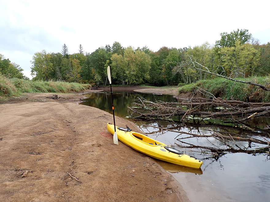
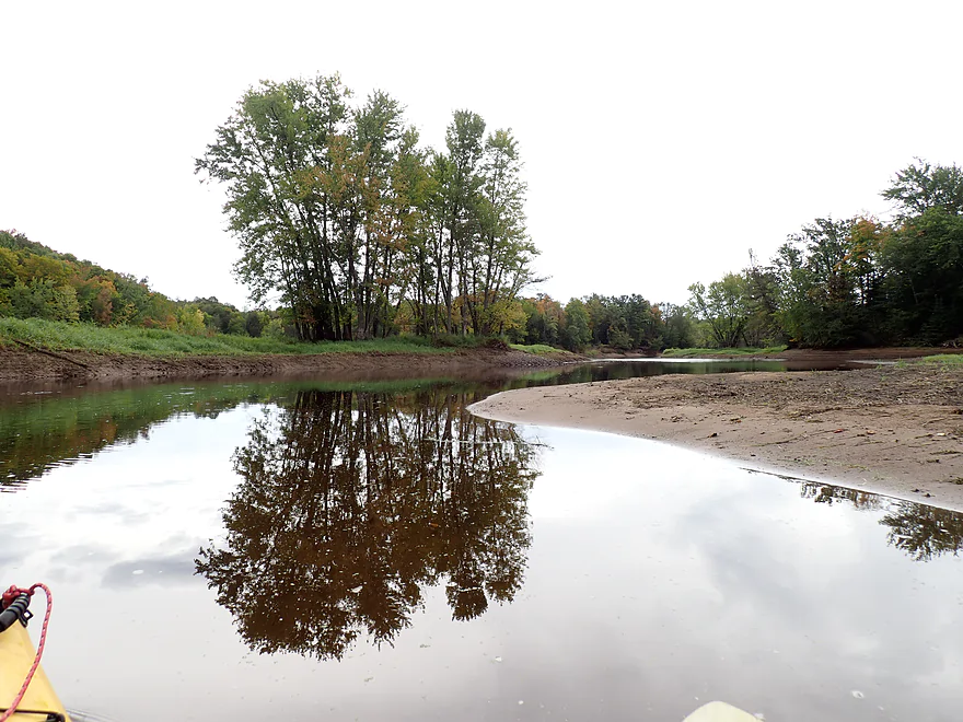
Highly recommend paddlers start here (Squaw Creek) to avoid the shallow boulder fields
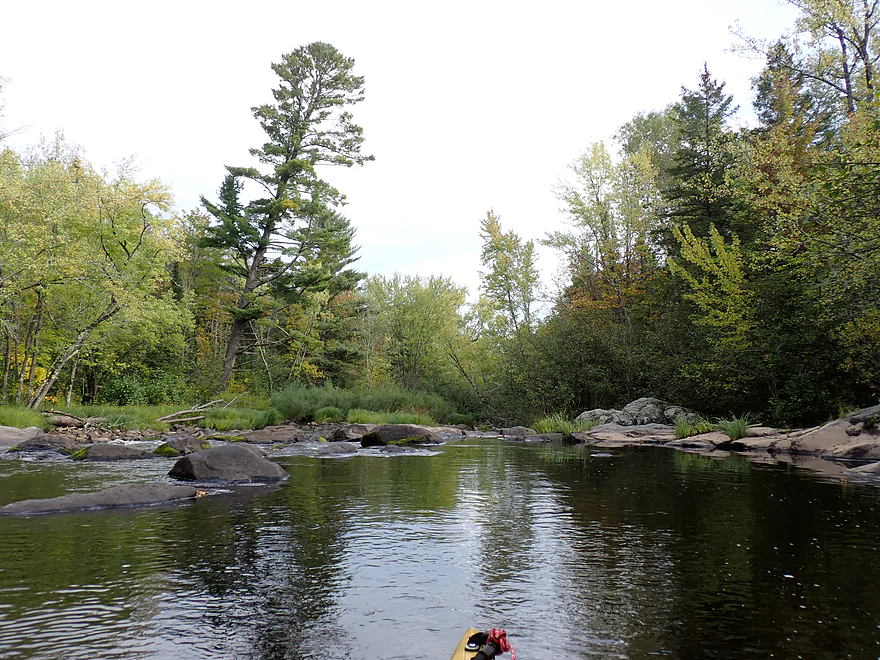
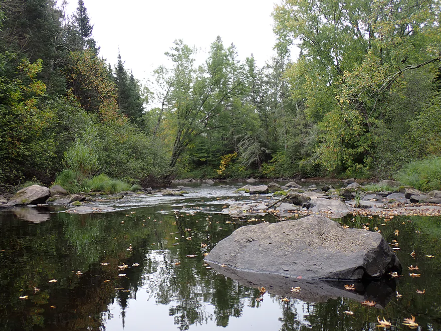
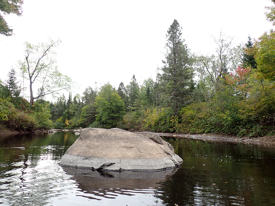
Still nice boulders but at least the river is floatable now
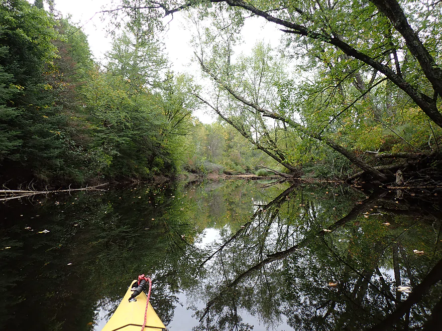
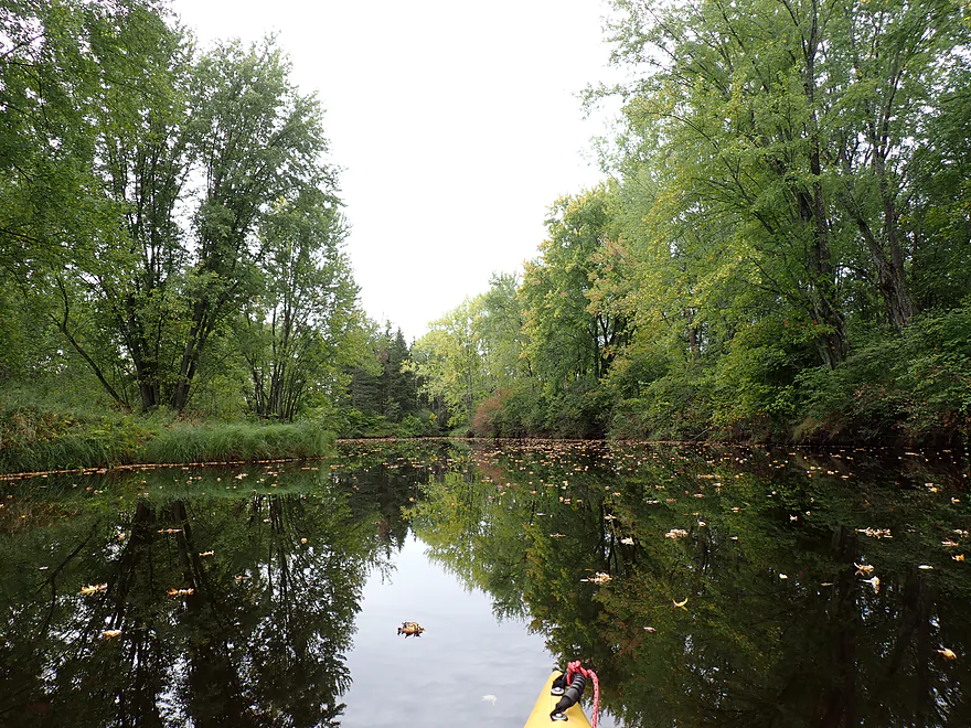
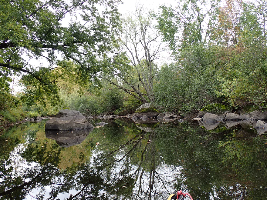
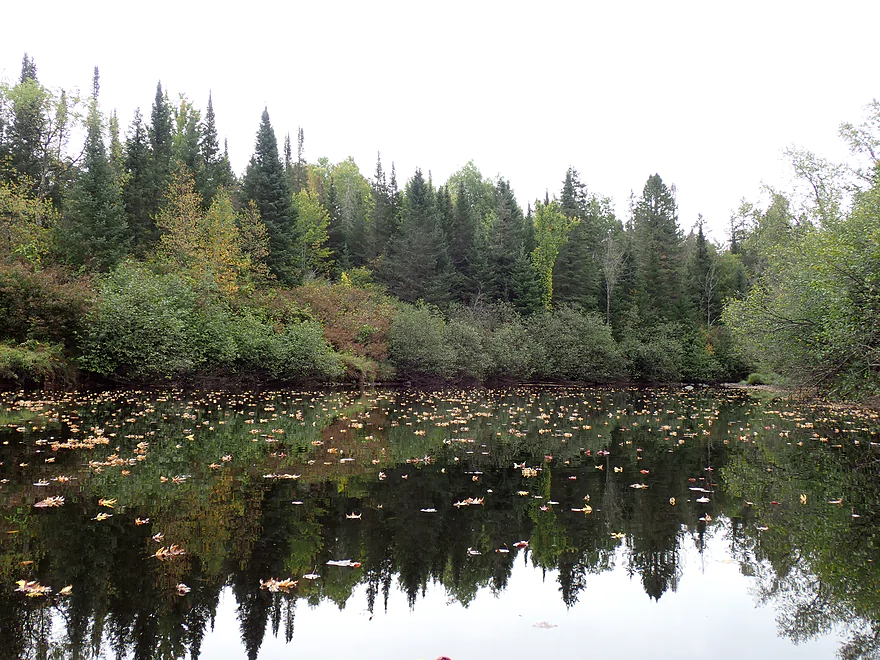
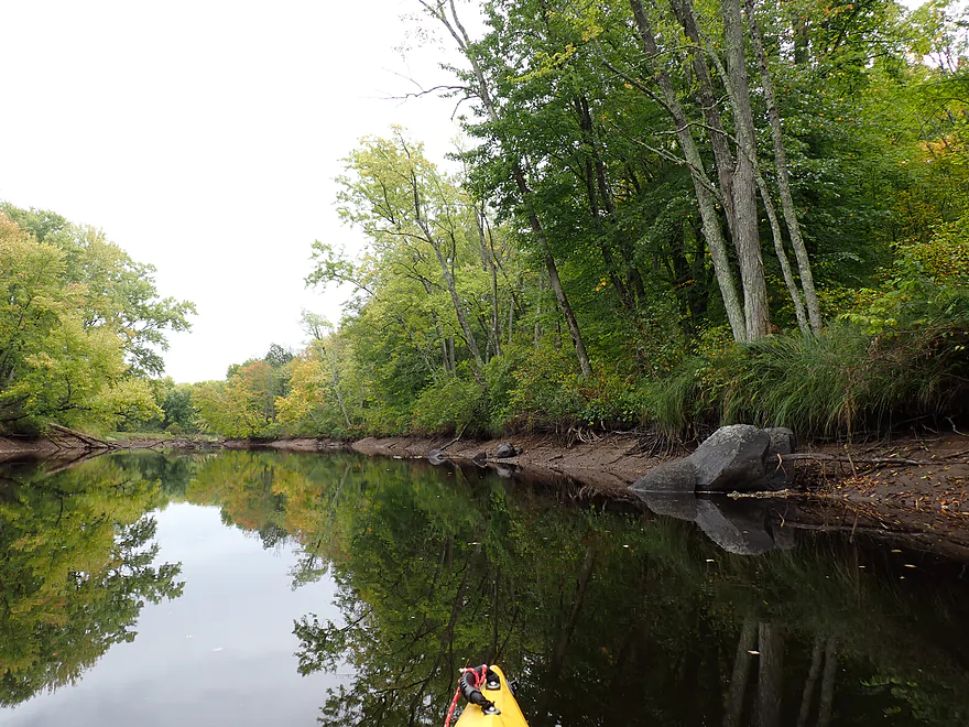
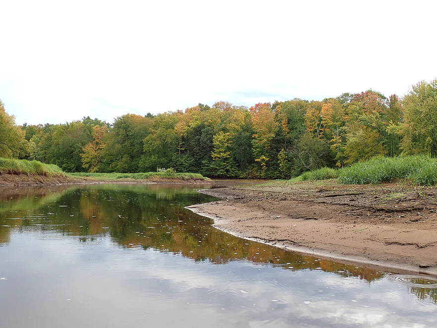
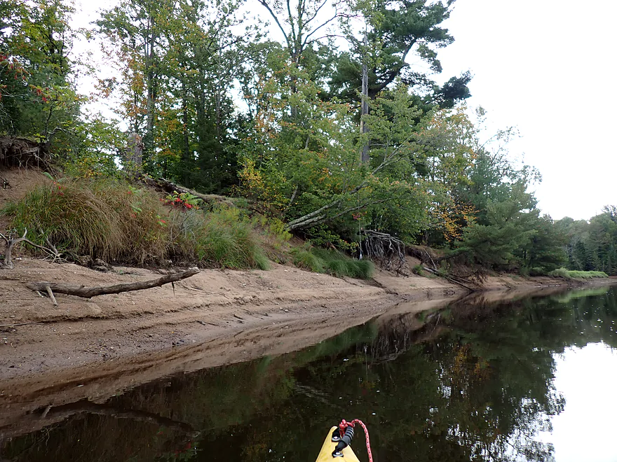
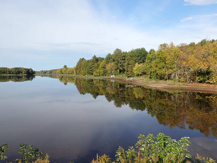
Great reflections
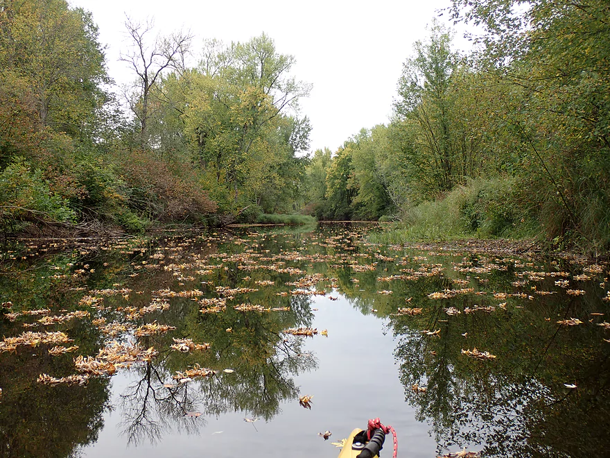
Lot of fall leaves
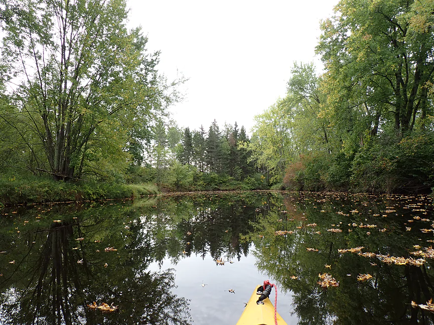
Calm stretch
This was mid-September….color is much better in October
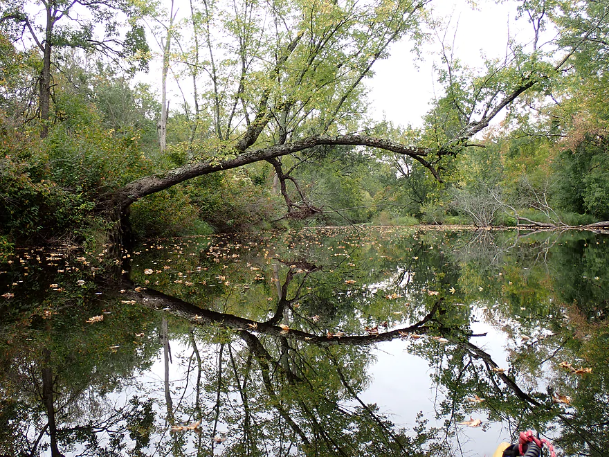
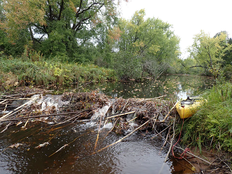
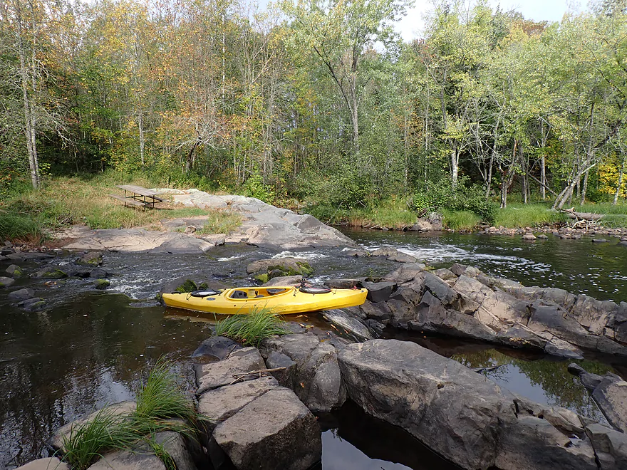
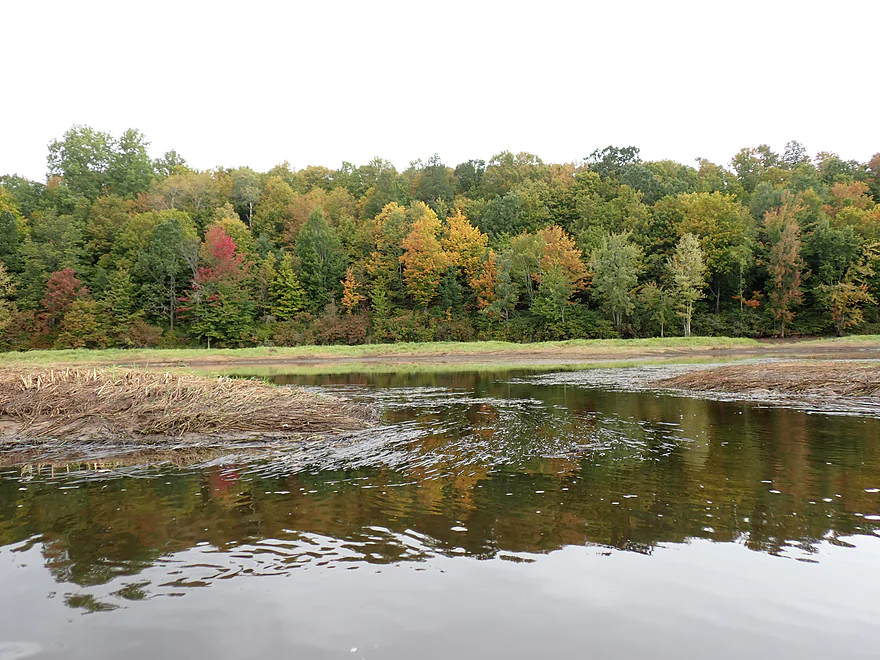
Beaver dam (easy portage)
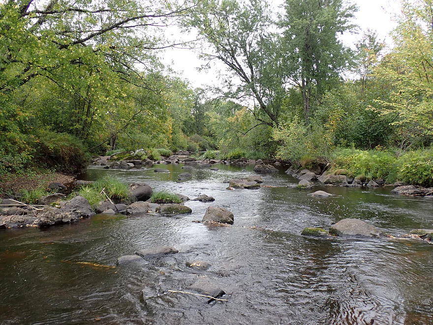
After the beaver dam I started to see a ton of boulders again
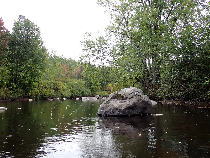
Including some big ones
I frequently got out for pictures
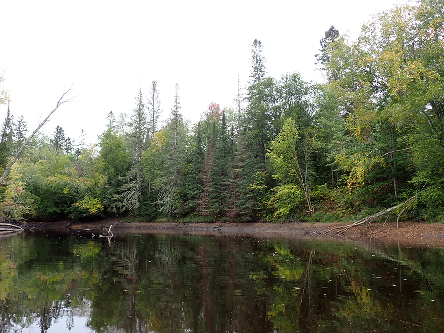
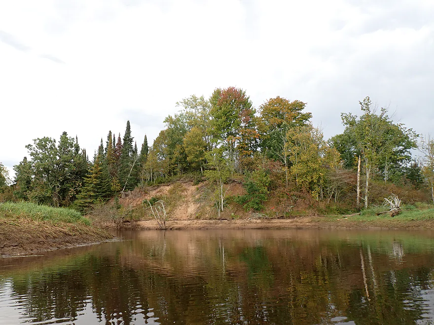
Some fir trees in the distance, but this spot appears cut over
An especially thick stand of firs
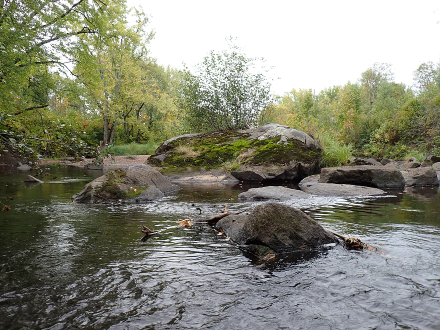
Boulders and balsam firs are a scenic combo
Still some light rapids, but very easy
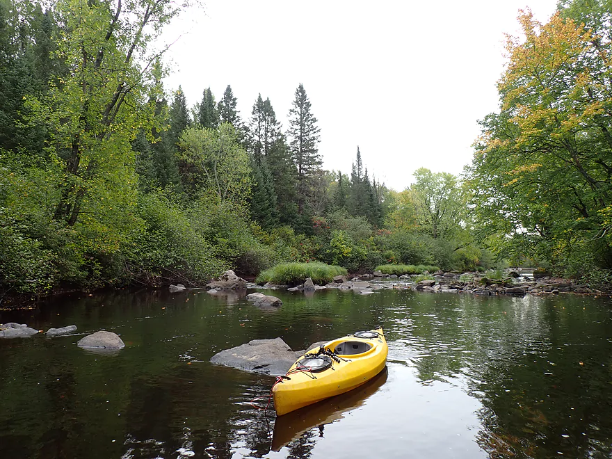
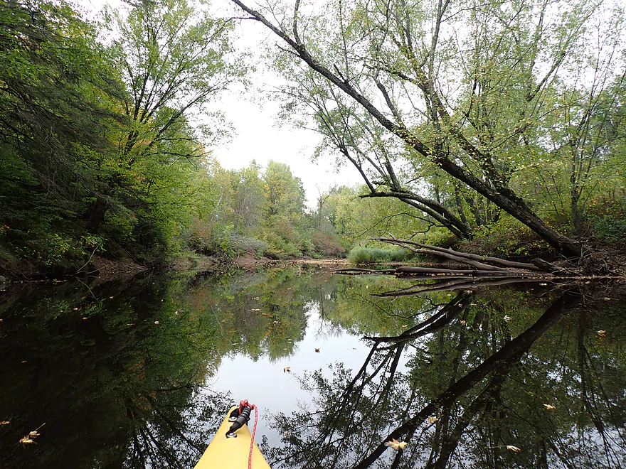
Reverse view
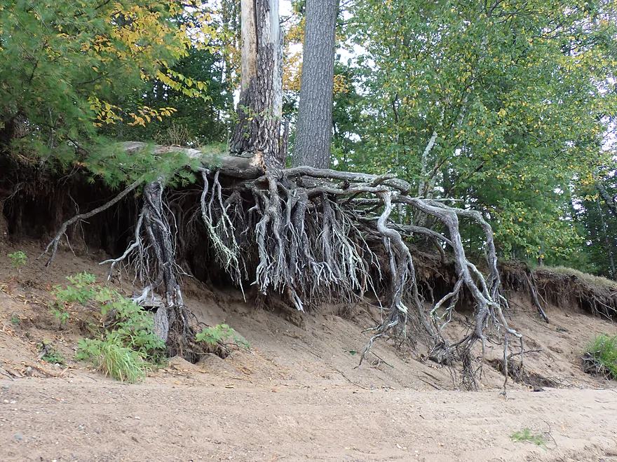
Interesting high water line
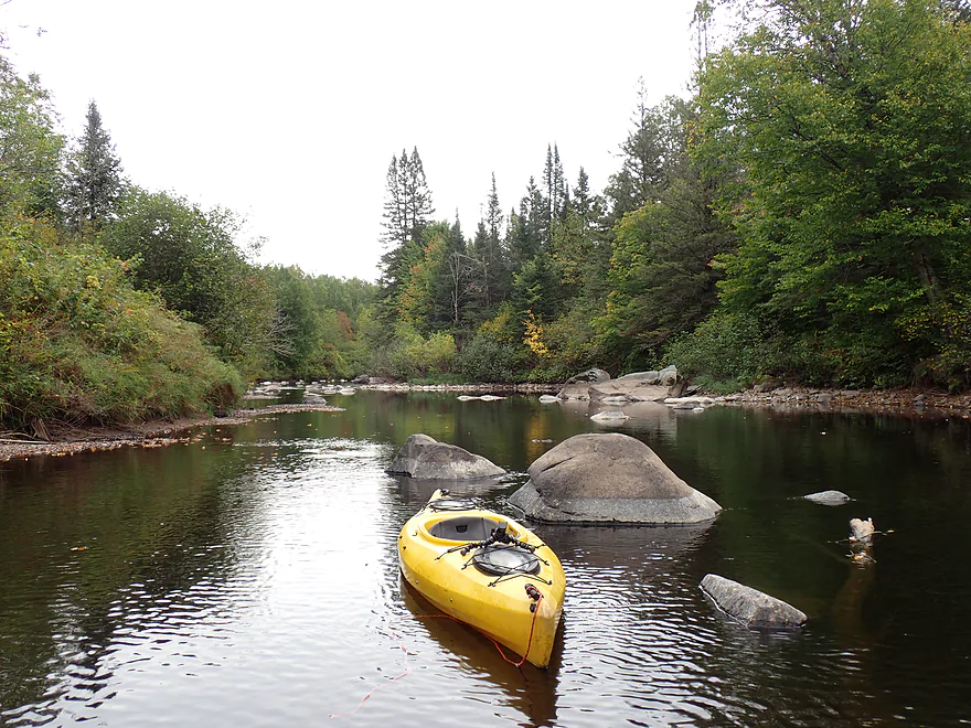
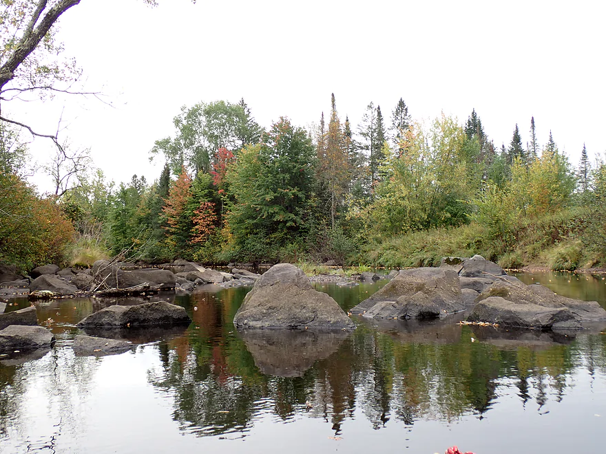
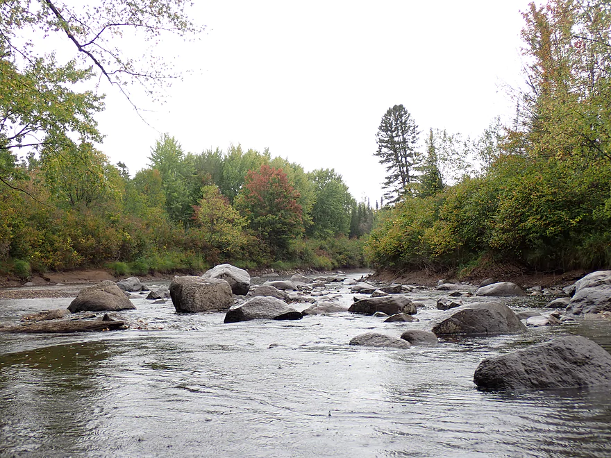
Another great boulder field
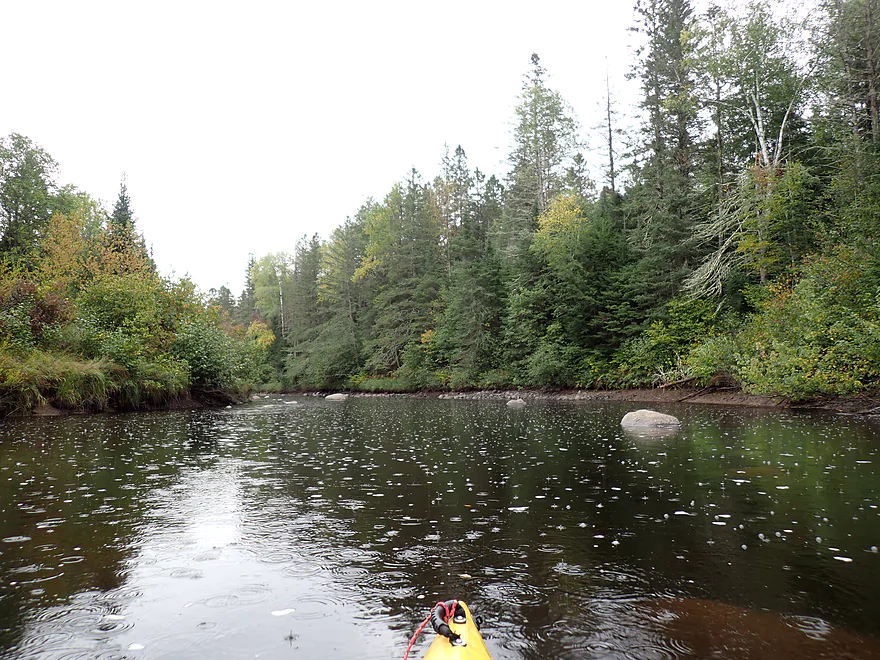
Then it started to rain…
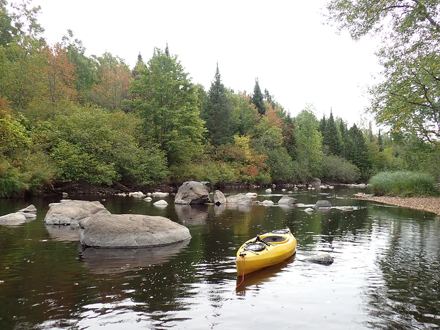
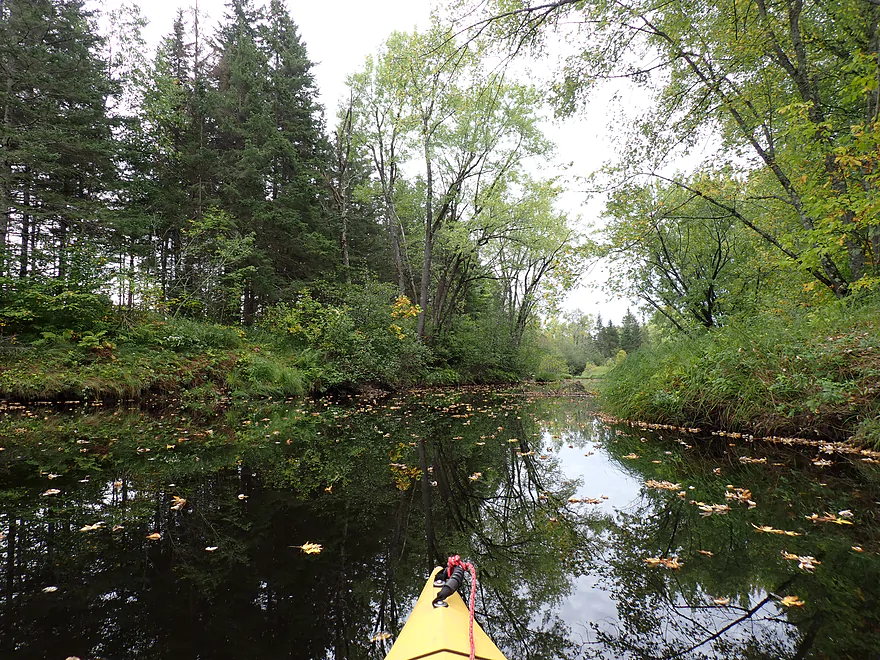
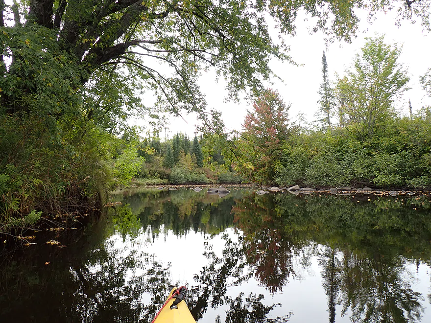
Incredibly scenic river
Entering a long stretch of boulders
My favorite stretch
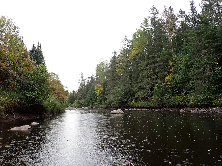
Raindrops backdroped by pines
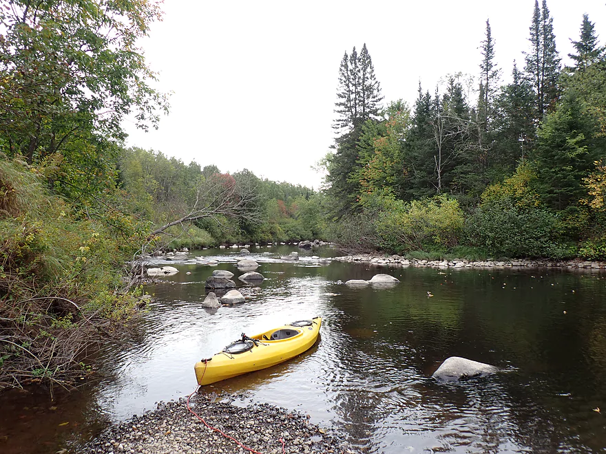
Yet another boulder field
Reverse view
Same view but taken during higher water (thanks WickedDarkPhotography.com)
Start of the last boulder field
Super cool…normally you can’t see many of these boulders because of high water

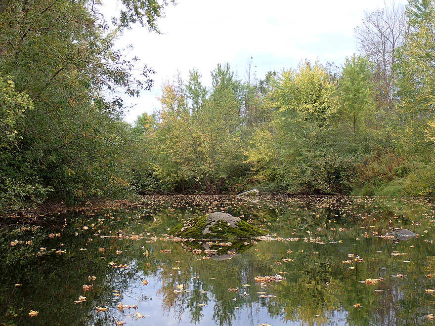
Attractive gravel bar
Same view but in Oct and at higher levels (thanks WickedDarkPhotography.com)
Many boulders on this final section were buried by sediment
Another great pine wall
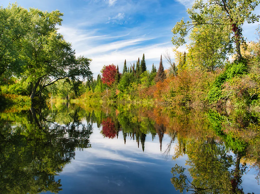
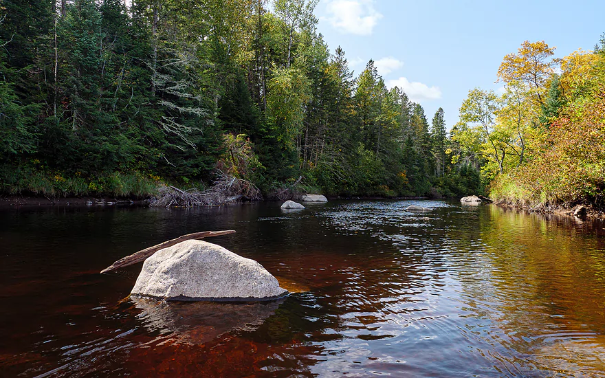
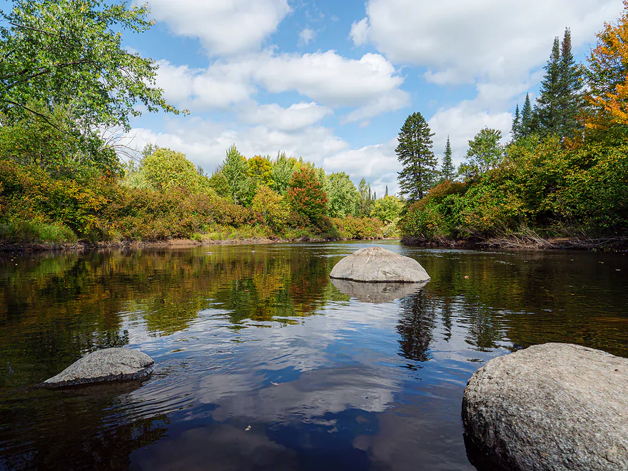
What the river can look like with blue skies (thanks WickedDarkPhotography.com)
Portaging a minor beaver dam (to the left) along an impressive rock bar
River really starts to slow and widen (note the high water marks)
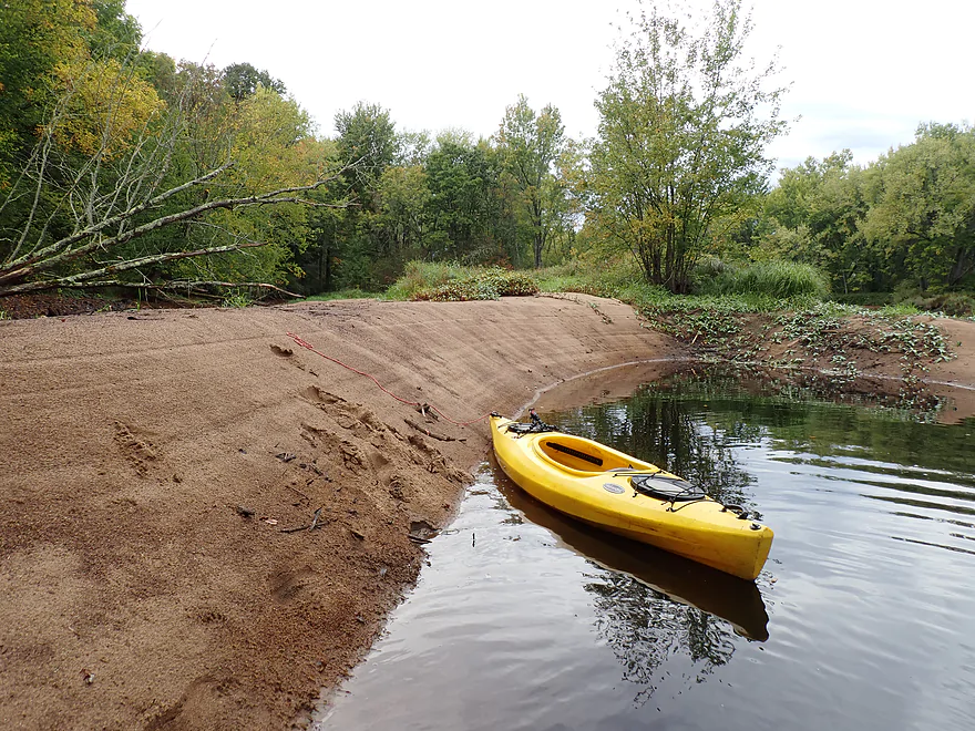
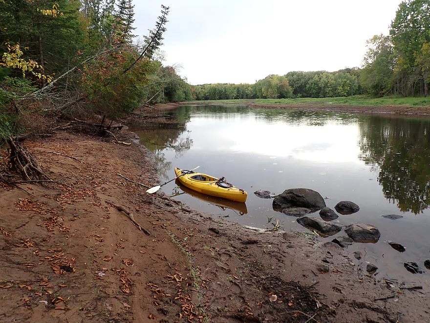
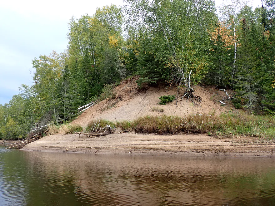
One of several nice sandbars
Getting out for pictures
Spirit Flowage was partly drawn down which explains the bare banks
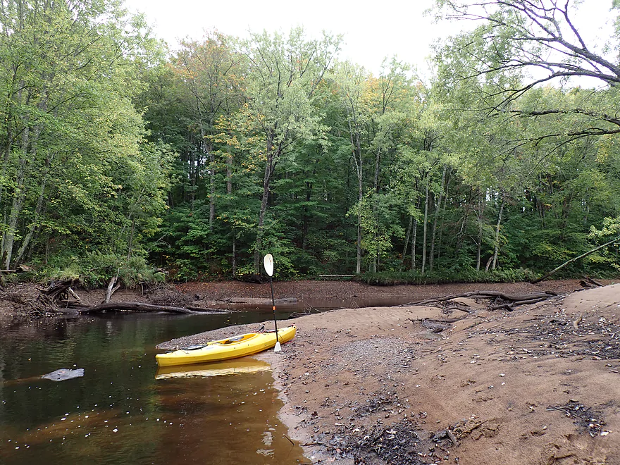
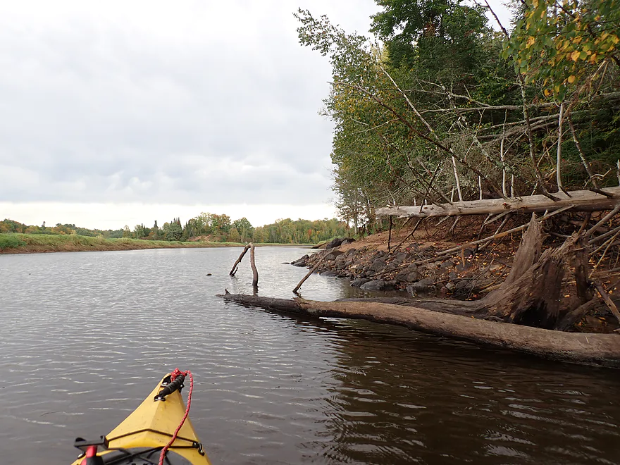
Minor logjam…super easy portage
Cool clouds
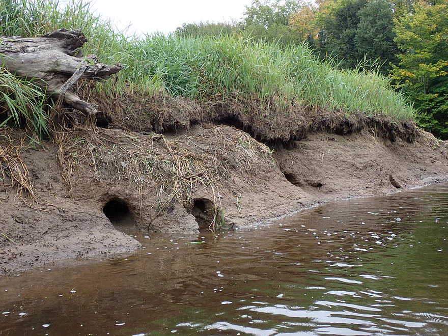
Saw many holes in the banks (maybe beaver)
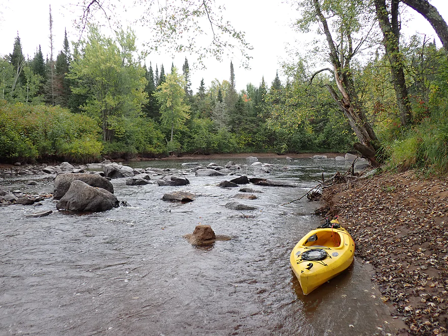
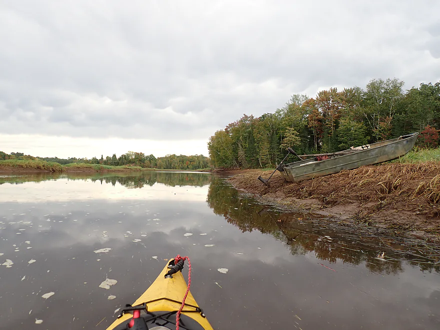
Brave of the owner to leave their boat out with the forecasted rain
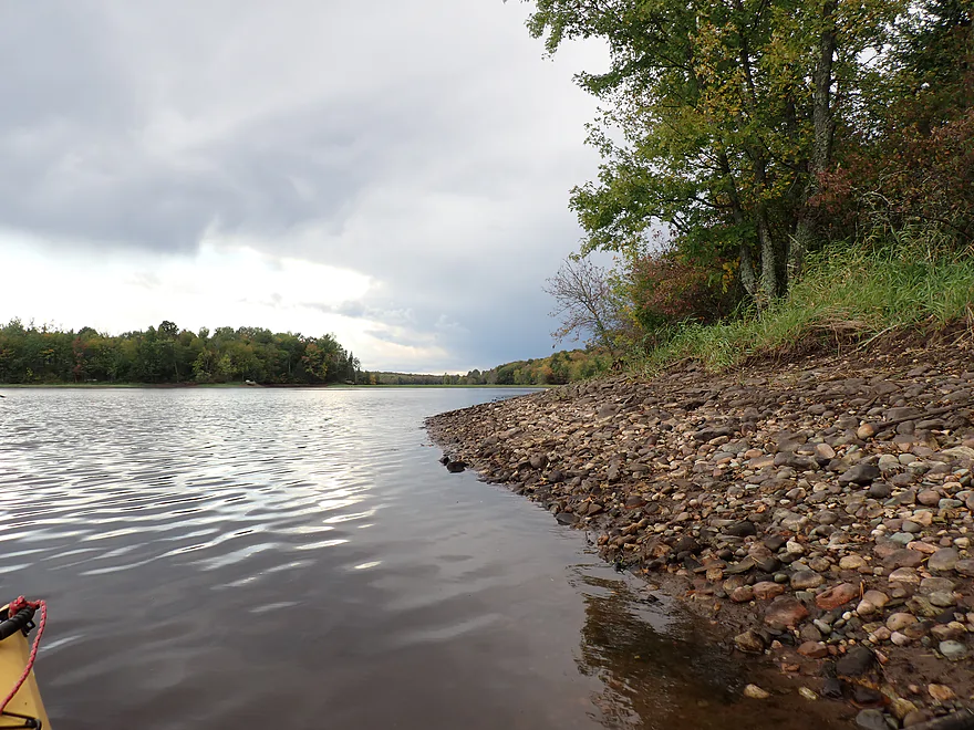
Low water reveals some great shoreline character
One of several side sloughs that “dried out” from the drawdown
Nice sandbank
Future logjam
The sandbanks were covered with animal tracks
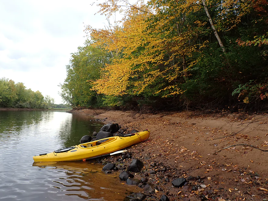
Nowhere near peak…but still nice color at times
Clouds looking ominous
New Wood Road (to the right) is actually a public access, but few know about it
Tall sandbank
There is no current left in the river
This sandbank had what looked like bear prints and bear scat on it
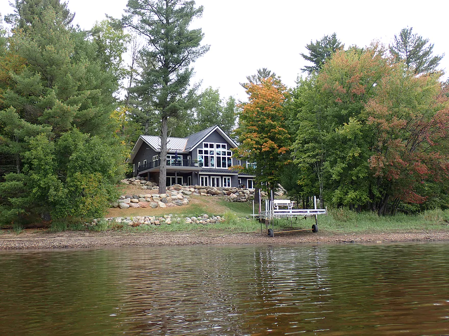
Now on Spirit Flowage proper…starting to see more homes
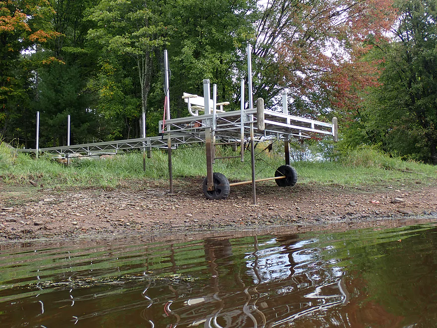
Lot of piers high and dry
Spirit Flowage isn’t as interesting as the river, but it’s ok
View of the flowage from earlier in the morning
Approaching my take-out
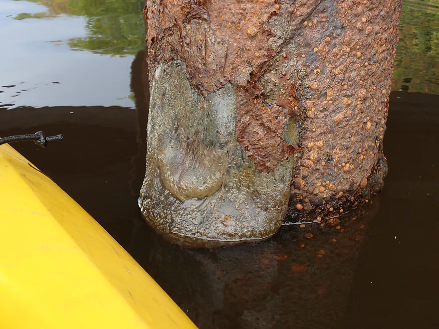
Interesting slime growing on the bridge pillars
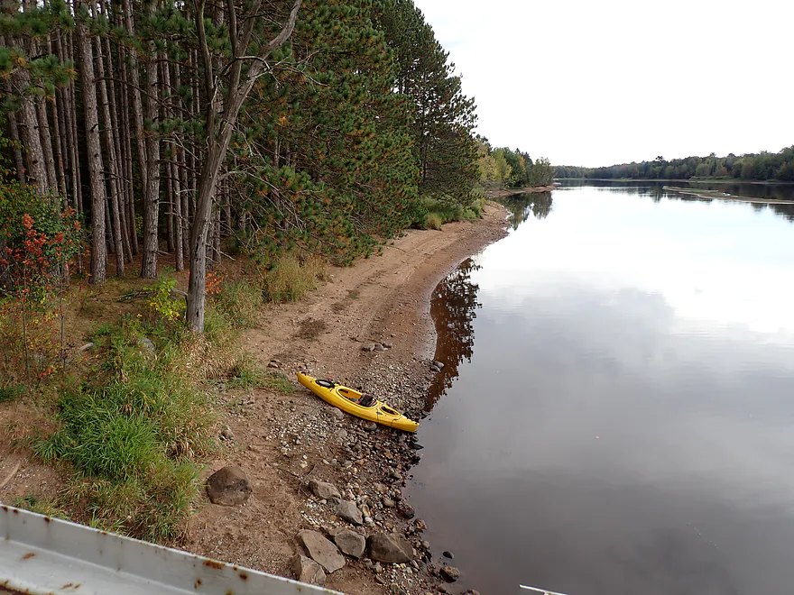
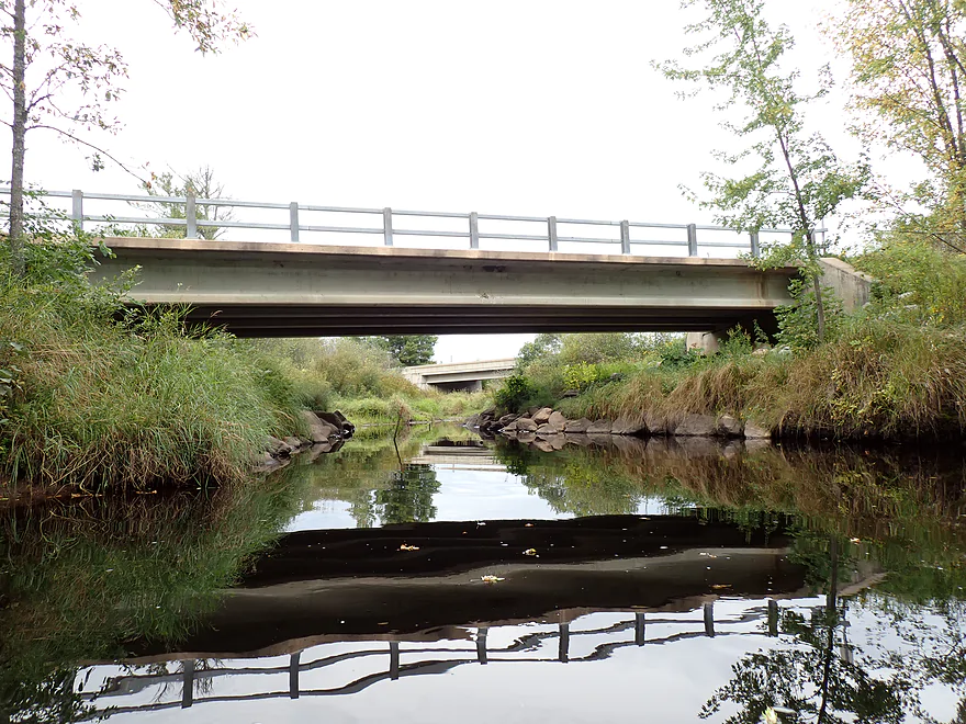
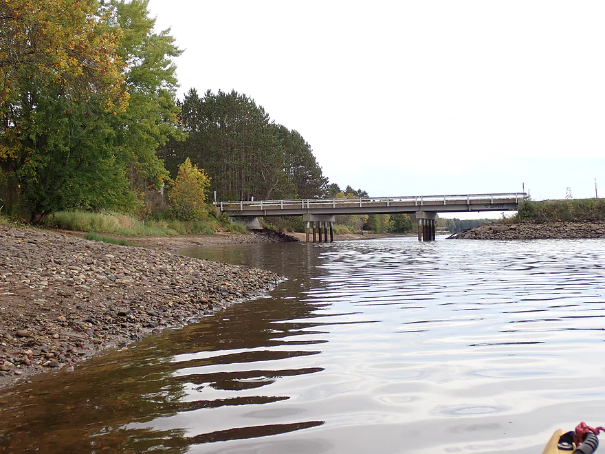
Taking out at the Hwy O bridge
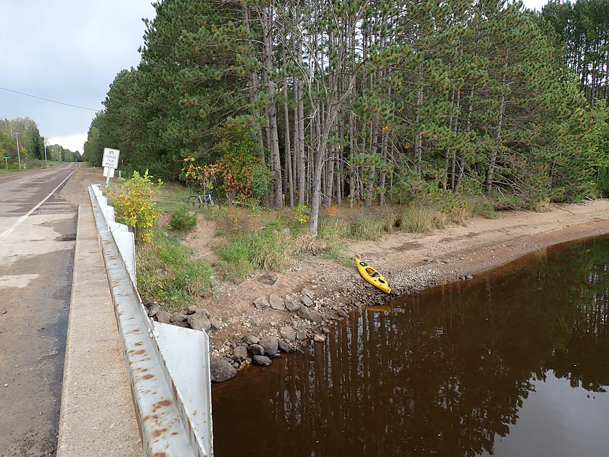
Nice access…sandy trail leads to a pull-off for parking
Spirit River

The Spirit River is located in north central Wisconsin near Tomahawk. It feeds the famous Spirit River Flowage, which in turn empties into the Wisconsin River. The headwaters of the river flow down the east side of Timm’s Hill, making it one of the highest altitude rivers in the state. Although in terms of “high altitude paddles”, I think the Wisconsin River, where it begins at the Lac Vieux Desert is higher.
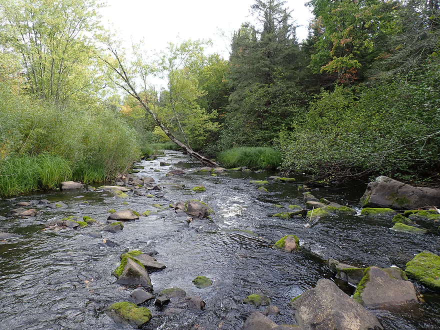
The plan was to emulate a trip I read about in Small River Canoe Adventures of Wisconsin, which meant starting at Bridge Road. Here the river was no more than a small creek and I soon encountered a dense boulder field with rapids. The boulders were very scenic, but navigation down the shallow rapids was a pain. I bumped, hopped, and in a few cases waded myself down. It was a difficult process, but I’m sure in high water it would have been worse and actually dangerous.
Around a corner I came into view of “Spirit Falls”. Here the river is “dammed” by exposed granite bedrock and then flows over a ~3′ ledge to form a mini-waterfall. It almost looked runnable at low levels, but I decided to portage. When high, Spirit Falls basically turns into a low-head dam with dangerous recirculating current, so even expert whitewater paddlers should treat it carefully. Portaging along the north bank looked difficult because of the wall of granite…but the south bank proved a manageable portage. Along the north bank is a picnic table and public trail leading to a parking lot. The falls are a mini-tourist attraction and are also popular with locals.
Spirit Falls was followed by a 1000′ rocky stretch with micro-rapids that was completely unfloatable. My boat sometimes wouldn’t even fit between the rocks, so I had to get out, wade, and pull the boat over the shore. This was the worst part of the entire trip, as it wasn’t easy lugging my kayak over the rocks (it also brought back flashbacks of the Little Somo River from last week).
Thankfully, Squaw Creek soon joined up with the Spirit and everything changed for the better. The river widened, slowed (but still had a few rapids/rocks), and navigation proved no longer to be an issue. I highly recommend paddlers launch by Squaw Creek to avoid Spirit Falls and its adjacent boulder gauntlets.
For the next two miles the river turned sharply south and I enjoyed a pleasant paddle. Fall leaves carpeted the water while silver maple canopies provided a roof. Fall color was nowhere near peak, but there were still some nice color moments on the river. At times the hardwoods were replaced with terrific walls of conifers.
At roughly the 3-mile mark, I encountered a significant beaver dam that I portaged. The dam is a noteworthy demarcation, and for the next 1-2 miles the river changed as I started to see fantastic boulder gardens…in fact, some of the best I’ve ever paddled through. These were back-dropped by incredible up-north scenery and fantastic balsam firs. It started to rain (note, Windy.com’s rain forecasts aren’t very accurate), and while I got wet, it didn’t phase me (too much) as the light showers provided great ambiance for the river and the pictures I was taking. I had no idea the Spirit River was this scenic (much more so than my other recent up-north trips, which included the Somo, Copper and Trappe Rivers).
Throughout the trip I heard a lot of gunshots and baying dogs. It turns out it was a big bear hunting day and this exact area is considered a black bear hotspot. Even paddle reviewer Frank Piraino mentioned the black bears, which is why I brought bear spray. I didn’t see any bears, but think I saw bear scat and bear tracks. After the trip, I bumped into a local who told me the area was packed with black bears. His friend lived near Spirit Falls, and I believe had sighted 16 black bears in the past year. He told me typically in a kayak I wouldn’t have anything to worry about. The black bear will smell you long before you see them and simply scurry off. The hunting parties I saw that day were large and well organized. Groups with radios were stationed along certain points near Hwy 86 with dogs and atvs, and it appeared they were using an odd looking radio tracking truck. I would not be surprised if this hunt had been preceded by baiting. If you’re a paddler who wants to do a “black bear paddle” in hopes of seeing one, this might be the river for you (if any are left after the big hunt).
Back to the river trip… I started to see more gravel bars, rock bars, and even sandbars, which was a nice change of pace. What was remarkable were the ribbons of exposed shoreline with no weeds growing on them. This ribbon started about a foot high but soon grew in height and eventually would get to be about 3′ by the end of the trip. It turns out this was the border of the Spirit Flowage…but the height of the flowage varies dramatically. In the summer it will climb very far upstream into the Spirit River and submerge some of the attractive boulder gardens, but in fall and winter the water recedes very far downstream.
The Wisconsin River watershed has many dams (about 20 on the main channel), but only five are considered suitable drawdown flowages. The Spirit River, unfortunately, was selected to be one of these (the four others are the Rice, Willow, Rainbow and Eau Pleine flowages). In the winter the Wisconsin River experiences a “drought”, so to ensure a constant stream of water for the paper mills, the five drawdown flowages bank water in the summer and release it in late fall and in winter. Consider this: in winter 40% of the water that flows through Wisconsin Rapids is likely coming from drawdown flowages. Locals aren’t happy about the extreme drawdowns, but the paper gods are politically powerful and there really isn’t anything they can do about it.
Typically in the summer Spirit Flowage is near max and there is a lot of motorboat activity on the lake. But usually, starting in September, Spirit Flowage gets drawn down and a lot of piers are left high and dry. During my trip it was a 5.4′ drawdown, which locals considered a big deal, but the Spirit Dam is actually allowed to draw down much further (up to 12′). In years past the limit actually used to be 17′, but the local homeowners association lobbied against this and got the max changed to 12′.
For kayakers the depth of Spirit Flowage is a big deal. Generally speaking, lower is better…it will mean more river paddling and less lake paddling. You’ll also see more sandbars, more gravel bars, more boulder gardens, and fewer motorboats. Roughly speaking, April 1 to mid-September will mean a high water paddle; otherwise it will be a low water paddle (with exceptions). If you’re interested in learning more on the drawdown process, the WVIC (Wisconsin Valley Improvement Company) website provides information, as does the book Stewards of the Wisconsin II.
As I proceeded downstream, the channel widened, the high water marks got higher and the current died. Because of the partial drawdown there were many out of place sandbars and mudflats scattered about with little growing on them. Unfortunately I believe a lot of neat geology and boulders are buried by all this flowage sediment. Animal tracks were common…mostly mammals that I couldn’t ID . Several side sloughs were visible but most were completely inaccessible because of the “low” water. While I heard a motorboat in the distance, I never saw one on the trip and I don’t think they can get very far upstream during partial drawdowns.
The final few miles on the flowage (that wasn’t quite a flowage) proved pleasant with some attractive shorelines and sandbanks, but it did seem to kind of go on forever. I didn’t mind this or the light rain, but the distant thunder and exotic clouds made sure I kept up a brisk paddling pace. Close to Hwy O I started to see homes and VERY exposed piers. I ended the trip at Hwy O, where there was a nice shoulder access on the north side. It was a good thing I ended the trip and subsequent bike shuttle when I did, as heavy downpours started soon after. On my way home on Hwy 51 cars were traveling well under the speed limit with some having their hazard lights on. When I got home, I discovered my boat had half-filled with water and it proved tricky just getting it off the the car roof.
In summary this was a really nice trip. But learn from my experience. Don’t launch from Bridge Road…instead launch a mile downstream at the Squaw Creek mouth. This will let you bypass the boulder field by Spirit Falls which was a “drag”. Don’t worry…you can still see Spirit Falls if you want, as there is a public trail and access along the north side. But no need to kayak the area unless levels are high and you are a whitewater paddler. The next few miles were the best of the trip with incredible boulder gardens and balsam firs. The last half of the trip was mediocre, but not bad and kind of a unique experience. Paddlers will have a choice…do this during summer when the Spirit Flowage backfills the river, or in fall/spring when it is low. I advise the latter so you can see more of the boulders, gravel bars, and sandbars.
Sights included dragonflies, a few clams, two eagles, many crows, frogs, one flopping fish trying unsuccessfully to get up Spirit Falls, many bank beaver dens, two beaver dams (a small one and a huge one), and one barred owl. The sandbars were filled with the tracks of various mammals and mud paths leading into the water were common.
I believe I saw bear scat. This area is a hotspot for black bears. I brought bear spray on my trip, but I was told by a local that black bears typically scamper away as soon as they pick up your scent.
I asked the same local about wolves. He said there used to be a population here but they had been “cleaned out”. Part of the issue is the lack of deer and he seemed to think they would return if the deer did. For now what remained of the pack has mostly moved on from Lincoln County to Price County. He mentioned one of the ways he knows the wolves left is he now hears coyotes yipping again (coyotes and wolves don’t share territory).
Tim’s Hill: This is the highest point in Wisconsin. There is a nice park, trail, and overlook tower atop the hill where there are terrific views (especially in the fall). The east side of Timm’s Hill feeds the Spirit River, which would make it one of the highest altitude rivers in the state. Bass Lake is within the park and is the state’s highest lake. It’s a nice paddle that was guest reviewed by Peter Johnson.
Spirit Falls: Note: this was actually on the trip itself, but because it is preceded and followed by a difficult rock field, I don’t think most paddlers will want to navigate through it. An alternative way to see the falls is from land. Just park northwest of the falls off of Spirit Falls Ave. A short trail will lead to the falls. Here you’ll see 2-3 drops over a large block of granite. It’s much more impressive in high water.
Bridge Road: There are some rocks to climb over, but this is otherwise an ok bridge access. Park on the north side, so you don’t block the south side drive used by hunters.
Alternate Put-ins:
- Spirit Falls Ave (0.7 miles downstream from Bridge Road): Located at the mouth of Squaw Creek, this is a bit rocky but suitable as a bridge access. I recommend most paddlers launch here to avoid the dense and difficult boulder field by Spirit Falls.
Hwy O (aka New Wood Road): There is a very good shoulder access northeast of the bridge. A short sandy trail leads down to the shoreline where it is easy to get out.
Alternate Take-outs:
- New Wood Road Access (1.7 miles upstream from Hwy O): Per WVIC there is an obscure public carry-in access here. To take out here though would require a 300′ hike up a grassy hill though. It’s still an intriguing take-out as the remaining ~2 miles are much more open, wider, and less interesting.
Bike Shuttle – Hwy O to Bridge Road: 5.8 miles with 82’ of ascent. Traffic is surprisingly heavy on Hwy 86, but this is still a very manageable bike shuttle with adequate shoulders and no gravel.
Wind: The second half of the trip is more open and exposed. Head winds can be an issue if forecasted.
Beaver Dams: There is a 2-3′ beaver dam a couple miles into the trip. It’s an easy portage. There is a second beaver dam in the second half of the trip but it is small and easy to hop over.
Rapids and Current:
- Bridge Road to Squaw Creek: This is mostly a dense boulder field with multiple Class 2 rapids. Spirit Falls itself is a Class 3 but can be portaged on the south bank when low. I advise paddlers not to run this stretch. Typically it is too low and bumpy and would require lots of wading. On the flip side, when it is high it is very rough and dangerous. Here is a high water video that shows Spirit Falls with some dangerous recirculating current.
- Squaw Creek to Spirit Flowage High Water Line: Current is slow but appreciable. There are a handful of Class 1 rapids that aren’t difficult.
- Spirit Flowage: Slow with no noticeable current.
Logjams: Almost none. Maybe 60% into the trip there is a downed tree by a sandbar which likely requires a portage but it is very easy because of the sand.
Getting Lost: While not as bad as the Somo River, the second half of the trip has numerous side bays and there is no telltale current. Generally you should be fine as long as you continue east and follow the main channel, but be mindful cell reception is not good in this area and studying maps ahead of time is recommended.
River Gauge: Spirit River @ Spirit Falls
River Trip Depth: 16.5 CFS or 1.46′
River Navigability Estimates: The gauge is located by Spirit Falls so should be accurate for the first half of the trip. But the second half is more impacted by Spirit Flowage and its depth. You should also know the current lake height which I’ll cover later.
- Spirit River Above Squaw Creek:
- < 20 CFS: Very shallow with tons of rock bumping and wading. Not recommended. Spirit Falls might be runnable.
- 21-50 CFS: Some shallow spots but maybe somewhat navigable for whitewater paddlers. Some sections could be tight and tricky.
- 51-100 CFS: High depth only suitable for expert whitewater paddlers who scouted the stretch ahead of time.
- 101+ CFS: Maybe too high for anybody? Spirit Falls develops a dangerous backroller at higher flows.
- Spirit River Below Squaw Creek (for about 3-4 miles below Spirit Flowage kicks in):
- < 20 CFS: A few minor shallow spots, but generally speaking pretty navigable and a good depth.
- 21-40 CFS: Higher depth…should be plenty fine for navigation.
- 41-80 CFS: Very high depth…should still be navigable. Some of the boulder gardens might lose their character though.
- 81+ CFS: This might be bordering on flood stage. It might be navigable, but I suspect the river would be dirty and unappealing at these levels.
Spirit Flowage Gauge: Spirit River @ Spirit Dam
Flowage Depth: 1432.40′ above sea level (5.4′ below max)
Flowage Estimates: Spirit Flowage experiences significant drawdowns and buildups. For kayakers both extremes are navigable…but will impact the type of experience you have. Basically, do you prefer lake paddling or river paddling? At lower levels you can see more of the boulders and fewer motorboats, so this is generally recommended.
- 1420.88‘-1425.88′ (12-17′ below max): 17′ was the old drawdown minimum, but was later changed to 12′ after lobbying from the local homeowners association. You should not see drawdowns exceeding 12′.
- 1425.88‘ to 1427.88′ (10-12’ below max): Major drought levels. I believe this should still be navigable for kayaks though.
- 1427.88′-1431.88‘ (6-10’ below max): Drought levels…great for paddling though.
- 1431.88‘- 1434.88‘ (3-6’ below max): Flowage is significantly drawn down. A great depth for paddling.
- 1434.88‘-1436.38‘ (1.5-3.0’ below max): Flowage is partly drawn down.
- 1436.38‘-1437.88′ (0-1.5’ below max): This is likely a typical summer (full) depth (figure April 1 to early September). When high, Spirit Flowage will backfill and submerge much of the river. Some of the scenic boulder gardens will no longer be visible at this depth.
- 1437.88′: This is roughly the maximum height of the flowage.
Click here to see an overview map of the Spirit River.
- Upstream from Hwy 86: The river up here is only a small creek and navigation is likely difficult.
- Hwy 86 to Fox Farm Road: 1.8 miles. I’m not sure how navigable this leg is. It appears to be narrow, heavily wooded, rocky, and fast. Technically this is the North Fork.
- Fox Farm Road to Bridge Road: 4.3 miles. Upstream from Bridge Road the river splinters into small creeks. This section is rocky and scenic, but could be challenging to navigate with possible logjams. I don’t know much more.
- Bridge Road to Hwy O: 8.5 miles.
- Bridge Road to Spirit Falls Ave/Squaw Creek: 0.7 miles. A scenic but rocky and narrow stretch with tricky Class 2 rapids. Spirit Falls is a Class 3 that should be scouted and portaged. In low water this section is too “boney”. In high water, it is too dangerous. Paddlers are advised to skip this leg and start at the Squaw Creek bridge instead.
- Spirit Falls Ave to New Wood Road Access: 5.9 miles. First half of the leg is scenic with fantastic boulder gardens and many balsam fir trees. Second half is less interesting as it’s impacted by the Spirit Flowage, but still pleasant with some nice sandbars and sandbanks. The flowage is significantly drawn down in fall, winter and early spring.
- New Wood Road Access to Hwy O: 1.7 miles. This is the start of the lake portion of Spirit Flowage. But during low water, the lake will recede revealing a slow, open channel. Highlights include several nice sandbanks . Prefer lake paddling? Do this section in the summer. Prefer river paddling? Do this section in spring or fall. Note: New Wood Road access, while public, is a bit rough.
- Hwy O to Spirit Dam: 8.5 miles. This is Spirit Flowage. The shoreline is developed and there is motorboat traffic. The open water portions likely aren’t that interesting for kayaking but the lake should be nicer on the west ends and along the inlets.
- Hwy O to Evergreen Road Landing: 0.8 miles. A relatively narrow part of the lake at only 450′ wide.
- Evergreen Road Landing to Hwy 86 Ramp: 2.0 miles. Likely a nice part of the lake where the channel is about 200′ wide.
- Hwy 86 Ramp to East Bilby Bay Landing: 1.4 miles. Lake starts to really widen out. This is likely an uninteresting section.
- East Bilby Bay Landing to Spirit Haven Landing: 1.5 miles. Very open water with the channel already reaching a half mile in width. This likely isn’t that appealing, but Coffee Creek outlet is very cool and is worth exploring.
- Spirit Haven Landing to Spirit Dam: 2.6 miles. Likely a very boring part of the flowage.
- Spirit Dam to Park Lane Access: 2.0 miles. Final leg of the Spirit River. Take-out is just downstream from its mouth on the Wisconsin River.
Trip Map
Overview Map
Video
Photos Size: