Eau Claire River – Chippewa Tributary
Not to be confused with Wisconsin’s other Eau Claire Rivers this is located at the western end of the state near the city of Eau Claire. Highlights include clear red water, mostly undeveloped shorelines, and fun rapids.
Trip Reports
Koehlers Ford Forest Road to Hwy H

Date Paddled: July 2nd, 2017
Distance: 5.3 miles
Time: 2 hours 27 minutes
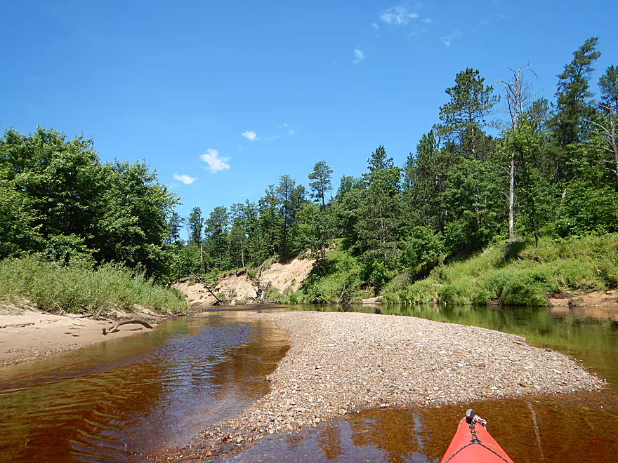
This is a pleasant wilderness paddle with nothing too special, but does contain the most sand and gravel bars I've ever witnessed for a trip.
Read More...Harstad Park to Hwy D Bridge

Date Paddled: September 21st, 2013
Distance: 8.5 Miles
Time: 3.5 Hours
There are actually three Eau Claire Rivers in Wisconsin, so this can be very confusing. I previously reviewed the Eau Claire River that flows into the Wisconsin River at Wausau here. There is another Eau Claire that flows into the St. Croix, but in this case the review will focus on the river that flows […]
Read More...Hwy D to Big Falls County Park

Date Paddled: June 6th, 2020
Distance: 6.8 miles
Time: 4 hours 23 minutes (2 hours 30 minutes would be more typical)
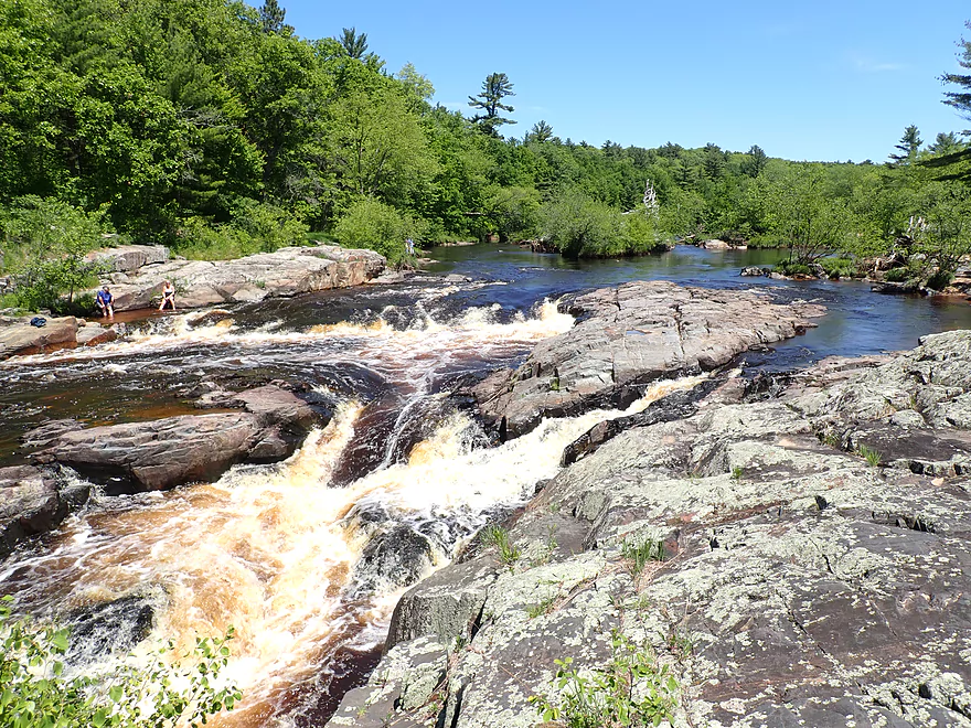
This was a pleasant trip that included many nice sandbars, several granite outcrops, and one set of fun Class 2 rapids. The highlight was Big Falls which has an impressive 15' descent and was quite photogenic.
Read More...Overview Map
Detailed Overview
North Fork:
- Upstream of Township Memorial Park: While probably navigable I just don’t know enough to speculate.
- Township Memorial Park to Hamilton Falls Road: 2.9 miles.
- Hamilton Falls to North/South Fork Confluence: 7.8 miles. Main stretch of North Fork. Scenic and riffly but narrow and might need high water. Roads are poor. You can launch above or below Hamilton Falls.
South Fork:
- Upstream of Koehler Ford Lane:
- Dickerson Ave to Kohler Ford Lane (Main Branch): 7.3 miles. Very sandy stretch and likley a handful of logjams. Probably nothing special about it.
- Rock Dam County Park to Kohler Ford Lane: 4.5 miles. Half this trip is on Hay Creek which has some neat dells. Launch below the dam. Maybe some logjams but should be easy to portage on adjacent sandbars.
- Koehler Ford Lane to Hwy H: 5.1 miles. Pleasant stretch.
- Hwy H to North/South Confluence: 3.1 miles. A sandy segment I don’t know much about. Likely nice.
Main Channel:
- North/South Fork Confluence to Eisberner Memorial Park: 0.8 miles.
- Eisberner Memorial Park to Hwy G: 5.1 miles. Good section with boulder gardens and Class 1-2 rapids. Water levels can be fickle though.
- Hwy G to Lake Eau Claire Dam/Lake Eau Claire Park: 6.1 miles. Probably uninteresting flowage paddling. Alt access on the north shore by the county park. Note the portage past the dam to Hwy 27 would be very difficult.
- Lake Eau Claire Park to Hwy 27: 0.3 miles. A scenic section with rapids and rock formations.
- Hwy 27 Landing to Harstad County Park: 1.7 miles. Launch on a newish landing under Hwy 27. Neat granite outcrops in the area.
- Harstad Park to Hwy D: 8.5 miles. Great section with epic sandbanks.
- Hwy D to Big Falls Park: 6.7 miles
- Hwy D to Hwy K Landing: 5.5 miles. Good section with a number of sandbars and one set of fun Class 2 rapids.
- Hwy K to Big Falls Park: 1.2 miles. A short stretch with one nice beach by Hwy K. Big Falls Park is very scenic but has some serious whitewater and falls.
- Big Falls Park to Hwy QQ: 5.6 miles. You can launch from either the north or south shore, but either way it is a long hike to the water. This should be a pleasant stretch with some nice sandbars.
- Hwy QQ to Altoona Lake Dam: 4.5 miles. Half of this flows through a broad sandy channel and half through a flowage lake. There is an alternate take-out at Lake Altoona Park.
- Altoona Lake Dam to Mouth: 3.3 miles. A neat section through downtown Eau Claire with some Class 2 rapids.
- Eau Claire Mouth to Hobbs Landing: 1.9 miles. A short paddle on the Chippewa through the University of Eau Claire campus to reach your take-out.
Coon Fork Creek:
This is a a wild card prospect referred to me by canoe author Mike Svob and EC Adventures. The main route starts at Coon Fork County Park (by the dam). I checked it out and it actually looked really cool. The area is very rocky and it appears the creek flows partly through rocky dells and canyons before emptying into the Eau Claire (at which point you could take out at G). While shallow looking (when I scouted it), I thought it might be runnable as is (can’t be certain though). Reminds me of perhaps Robinson Creek or Spring Brook in the Dells. RiverDarter.com has a nice video of the creek here.
Bridge Creek:
This is a really cool tributary to the Eau Claire with rocky dells and striking sandbanks. Reviewed here.
