
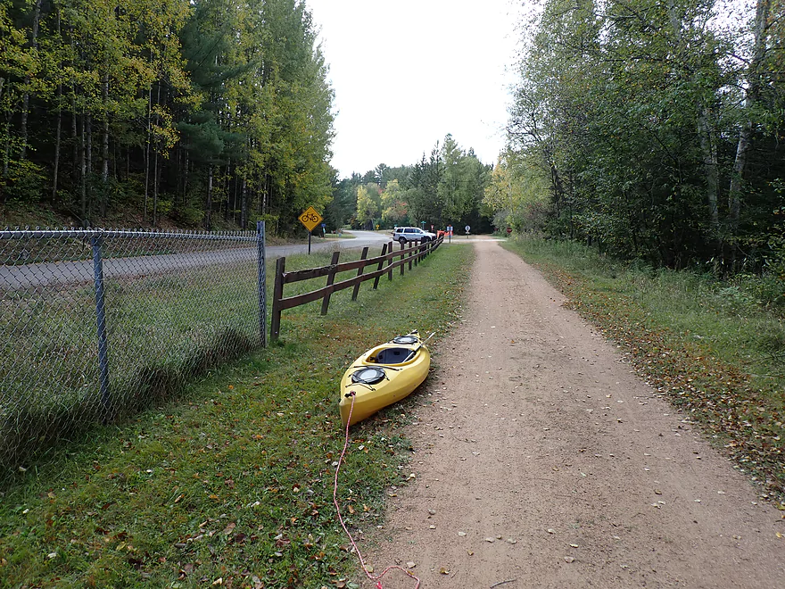
Starting the trip at a bike access spot in Harshaw
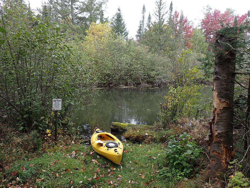
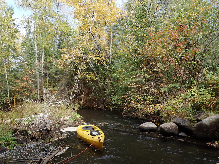
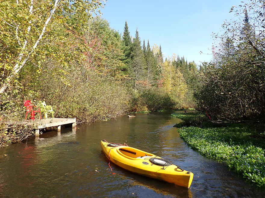
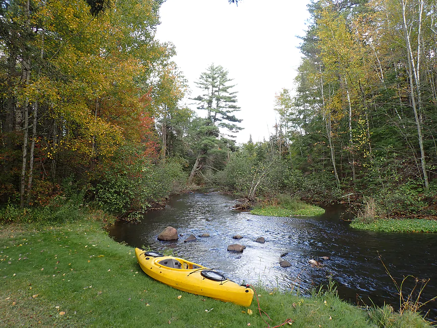
Nice launch spot north of the parking area
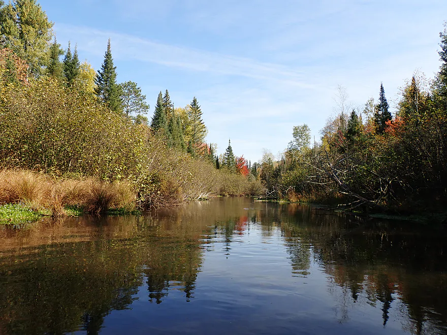
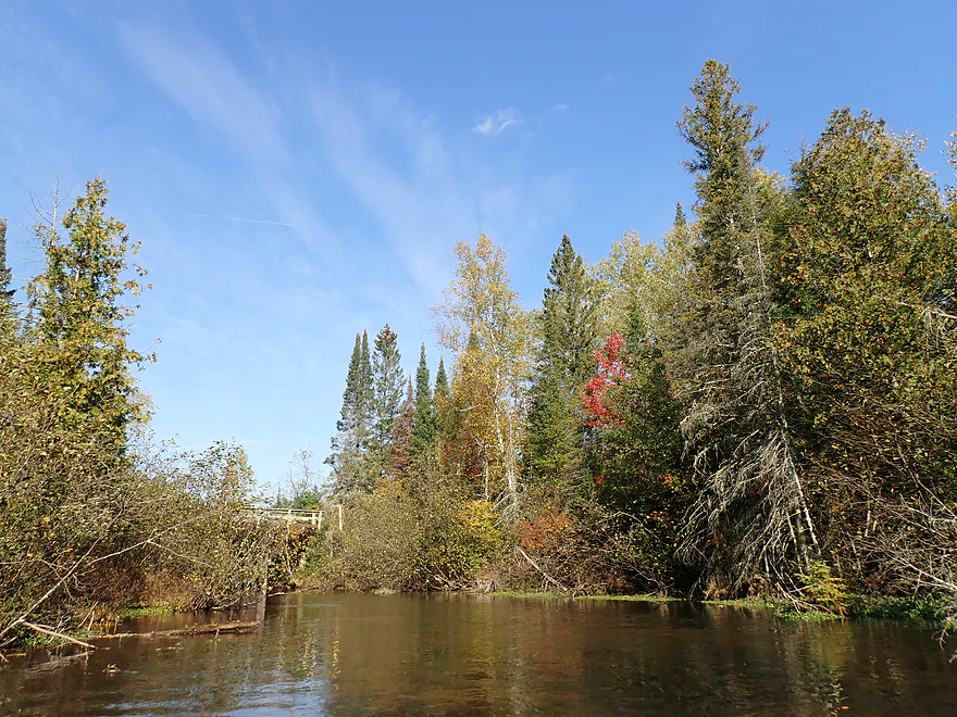
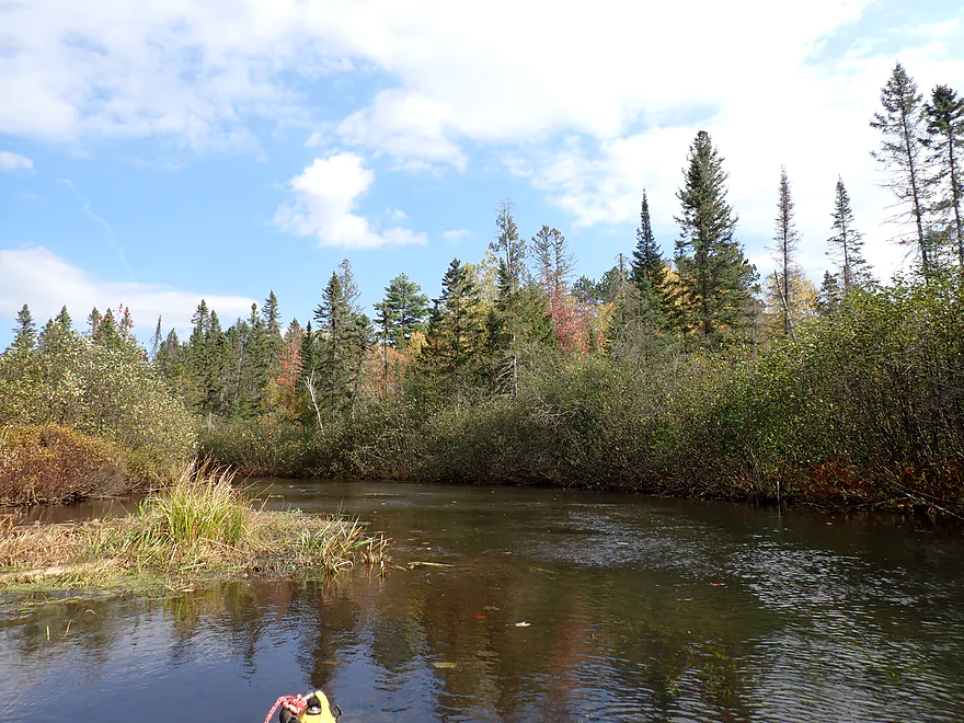
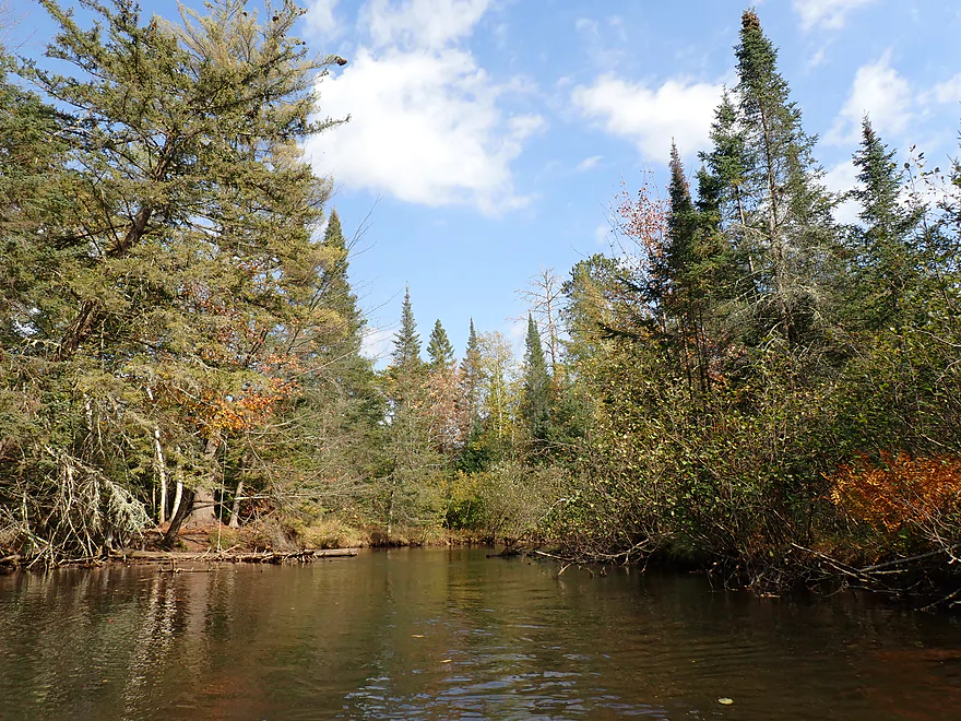
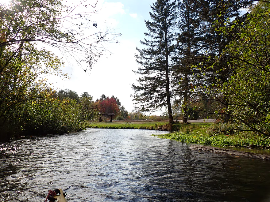
Paddlers should head a bit upstream after launch to check out the scenery
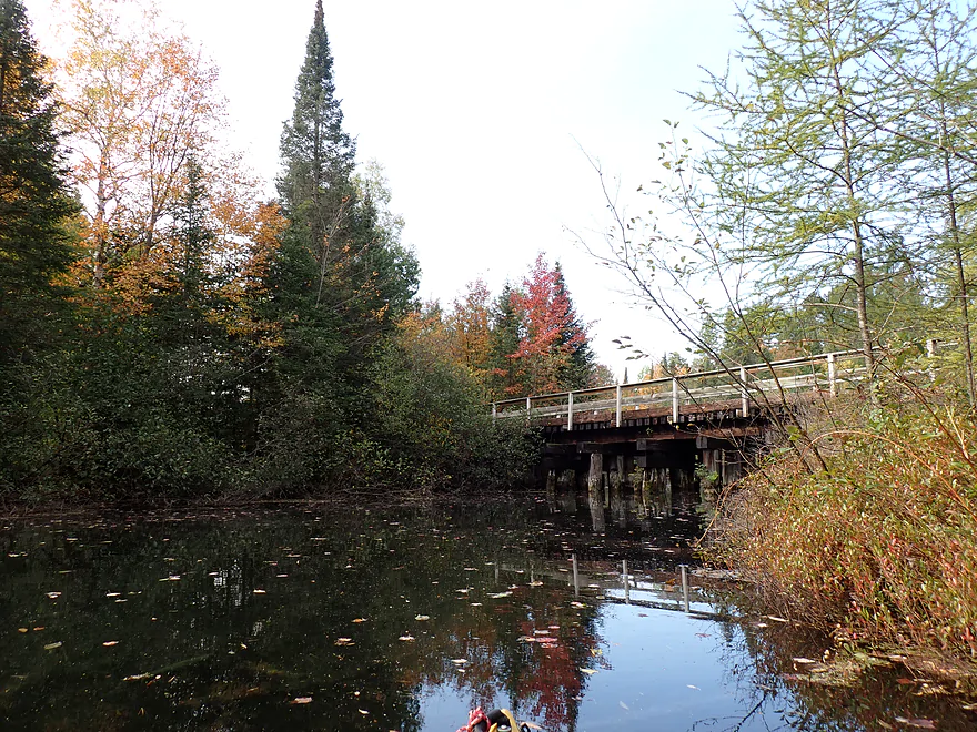
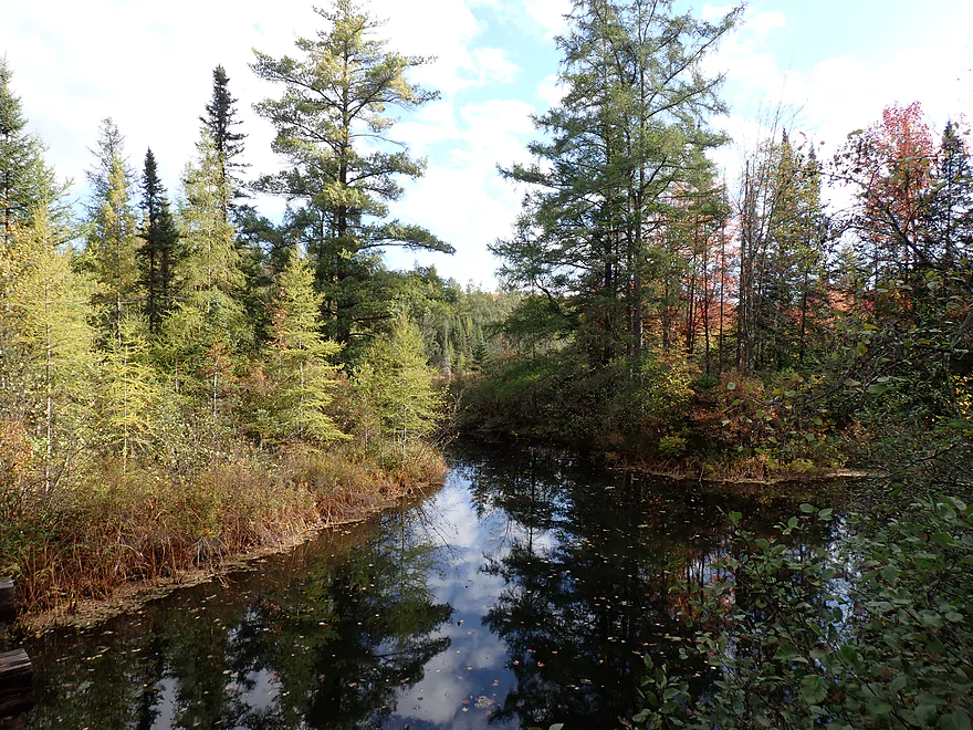
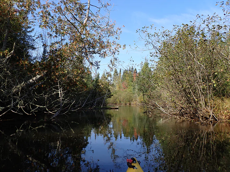
Checking out an unnamed creek tributary
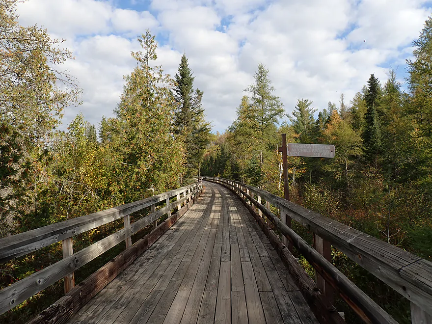
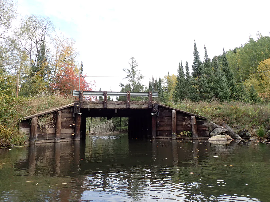
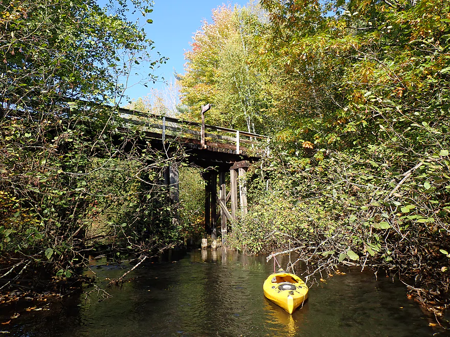
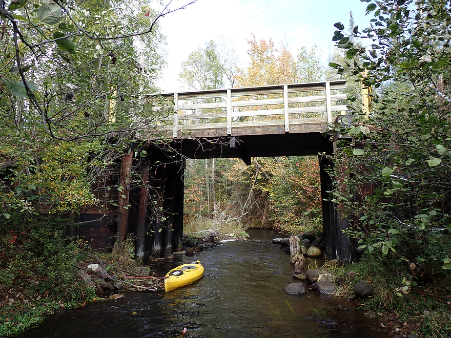
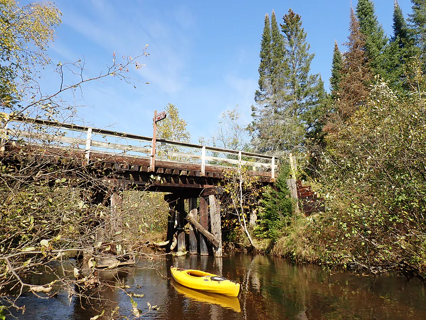
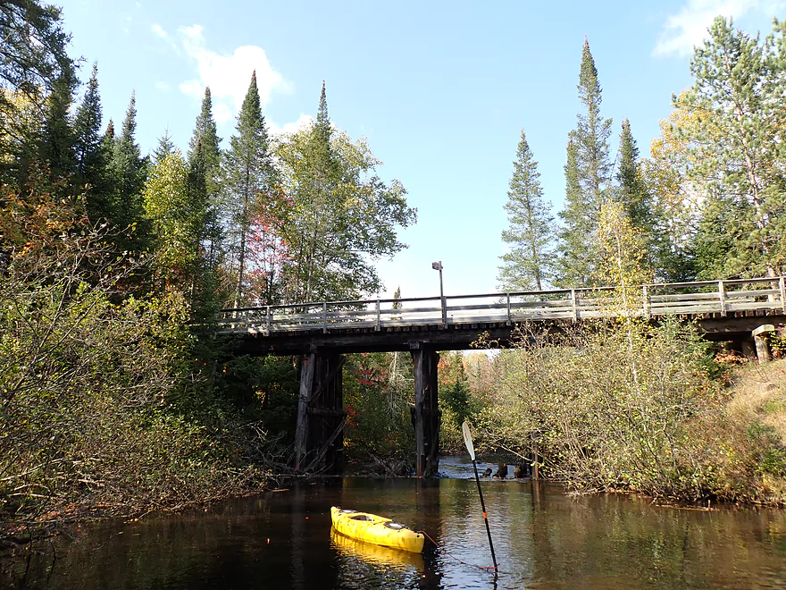
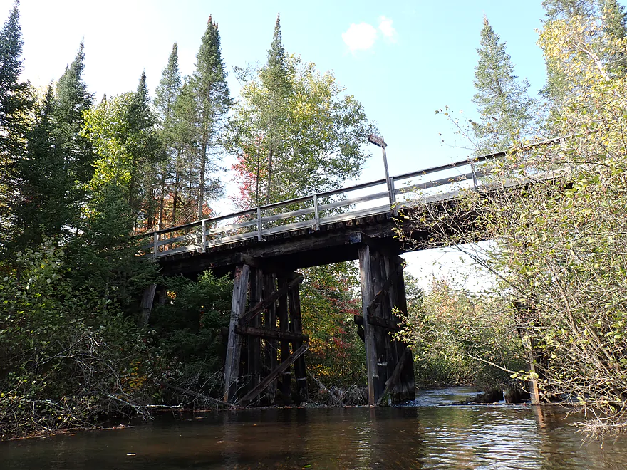
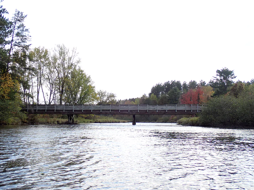
The tributary is spanned by the attractive Harshaw Trestle
Gateway to the creek
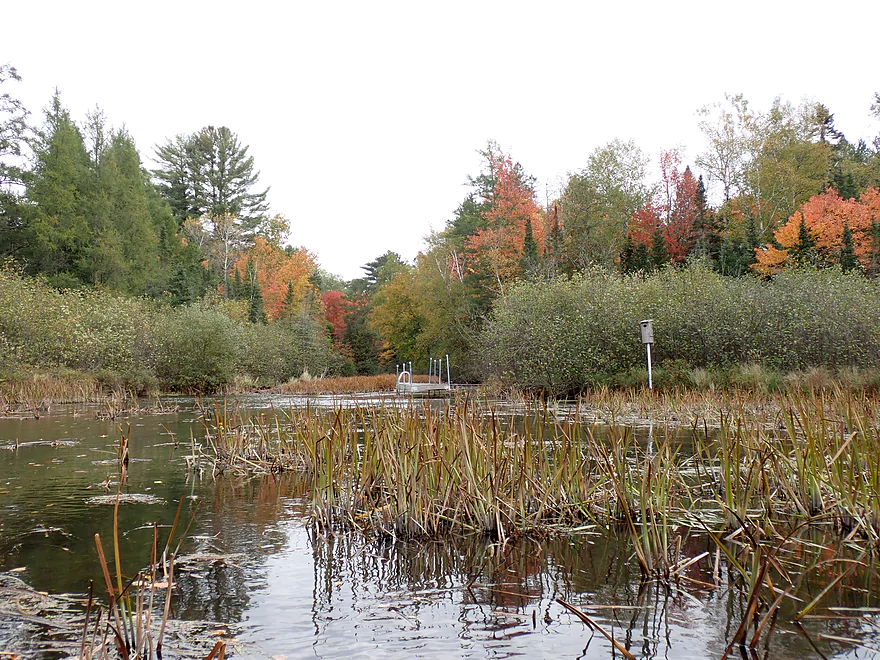
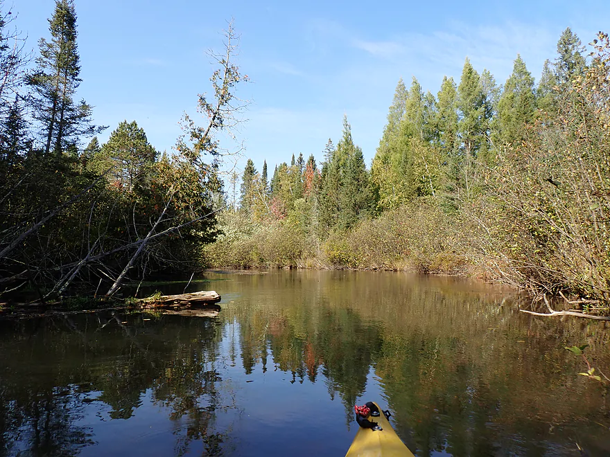
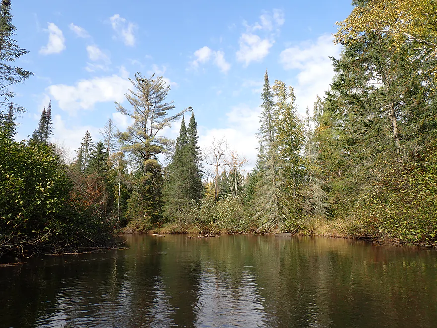
Creek opens up into a small lake
I then headed back to Bearskin Creek
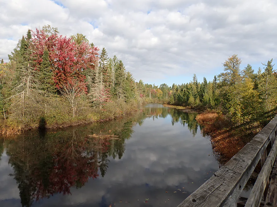
Church Road
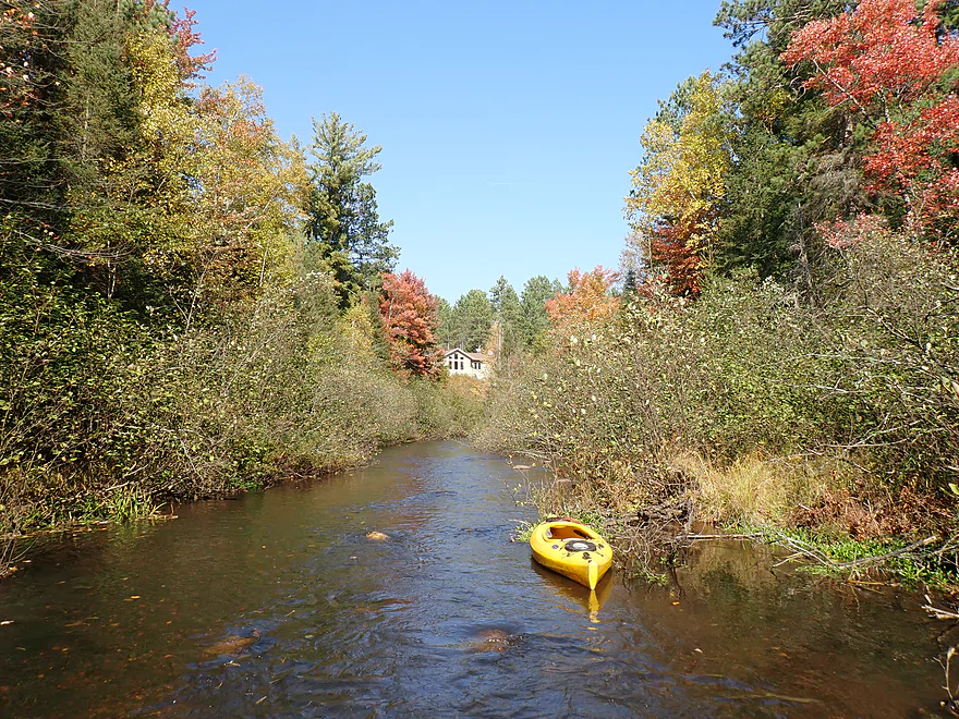
View from bridge
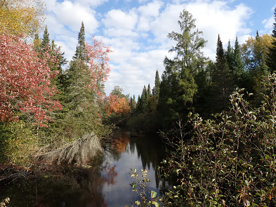
Some nice fall color
Getting out for pictures (which I did lot of)
Creek was mostly undeveloped but there were a few piers and homes
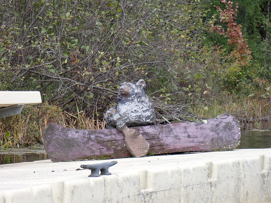
A bear paddling Bearskin Creek
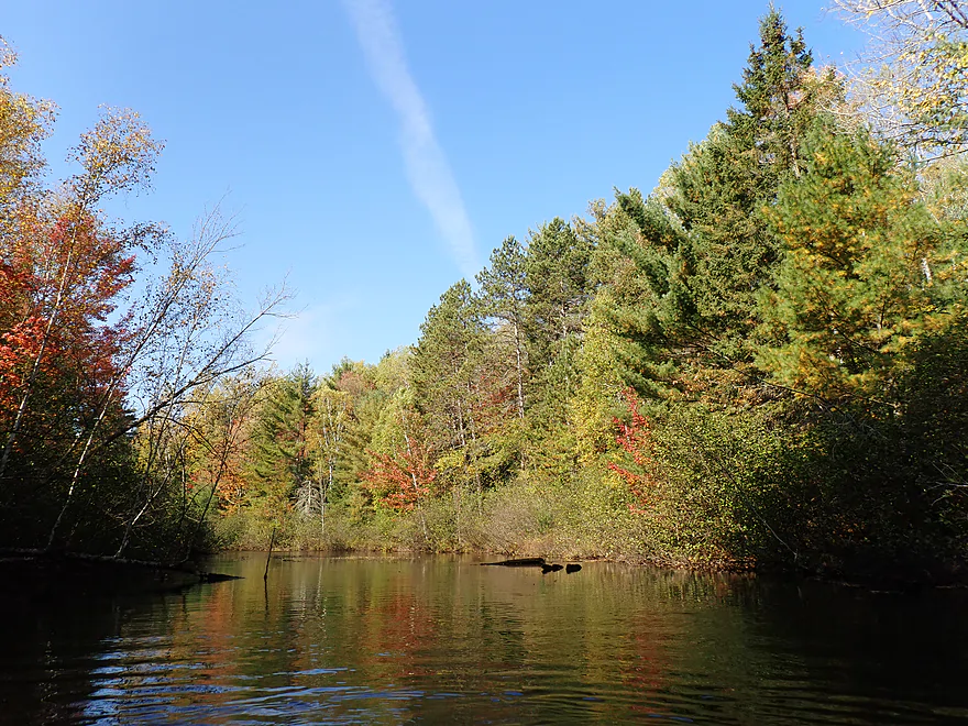
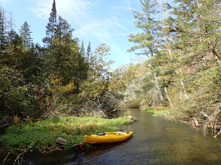
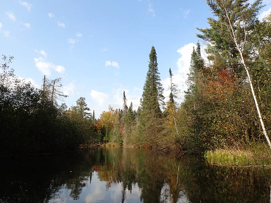
One of several nice “pine walls”
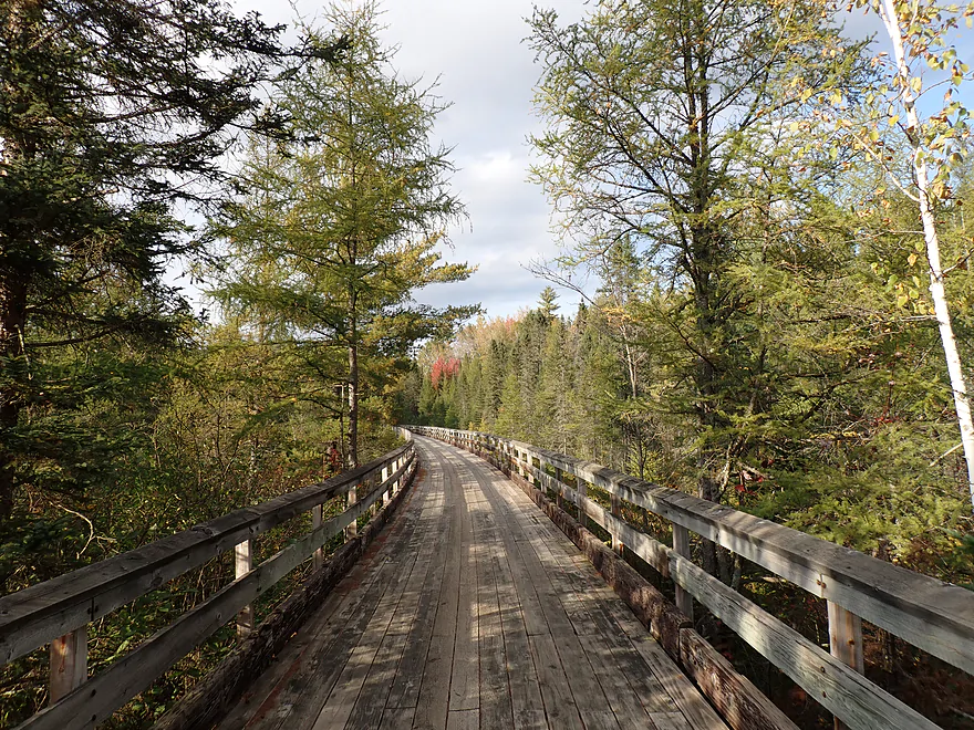
Brandy Trestle (another section of the Bearskin Trail)
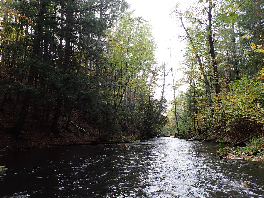
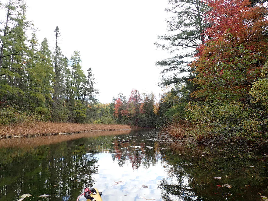
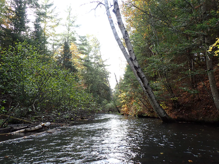
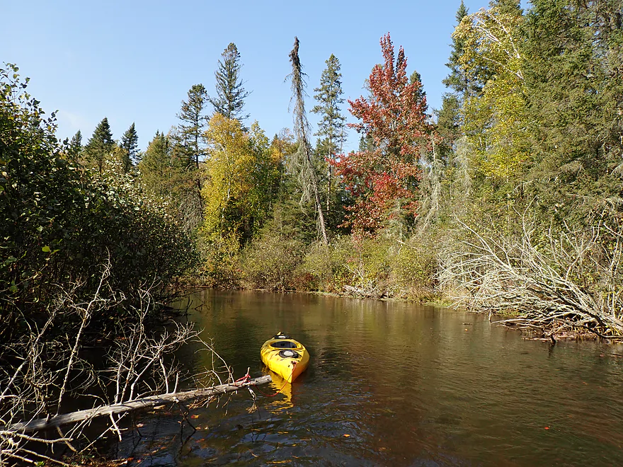
Entering a scenic ravine
Super cool
Locals do a good job of keeping the creek open
Reverse view
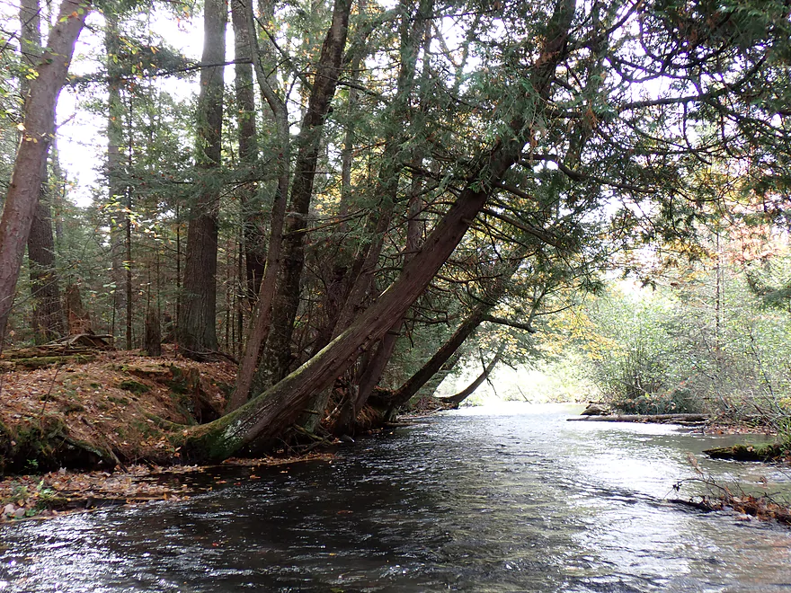
Leaning hemlocks
Creek had some light riffles (bordered here by alders)
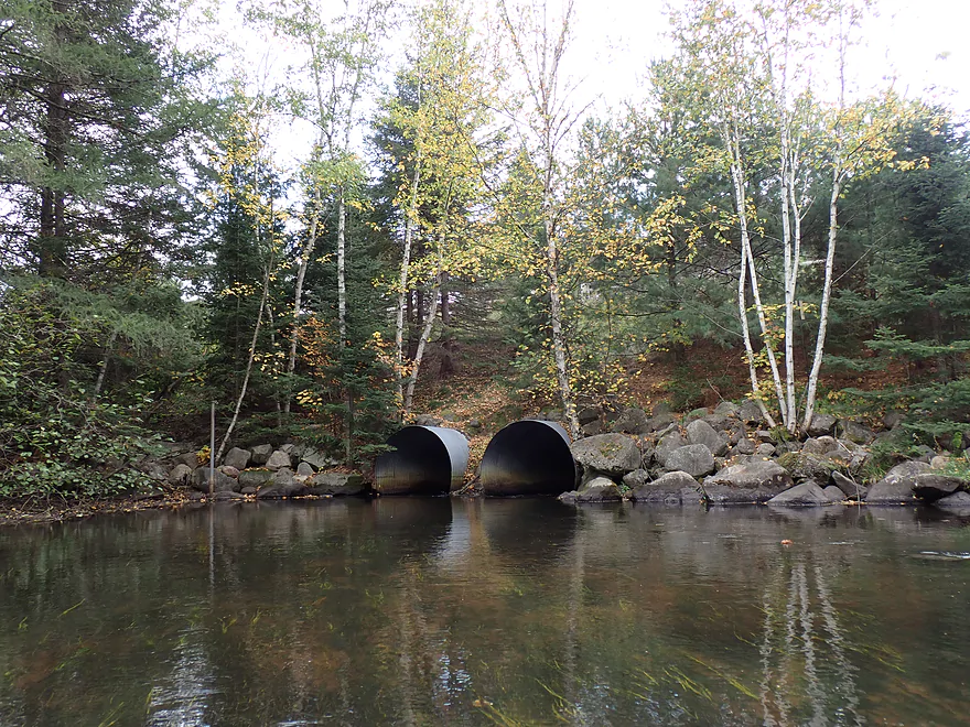
Triple Tubes Trestle
Just downstream was a submerged log I had to hop over
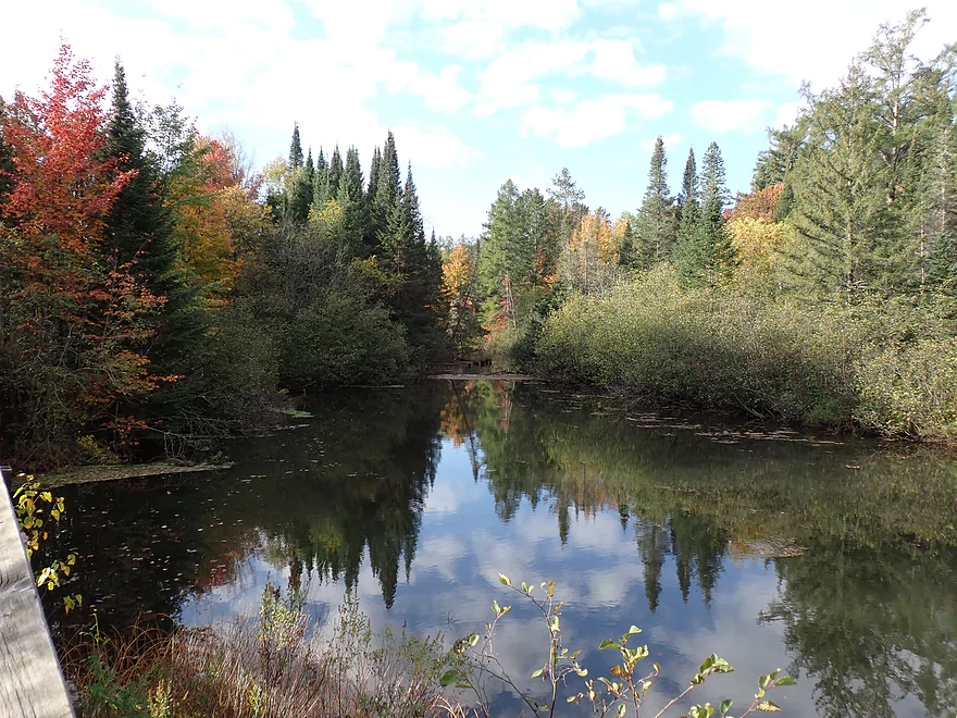
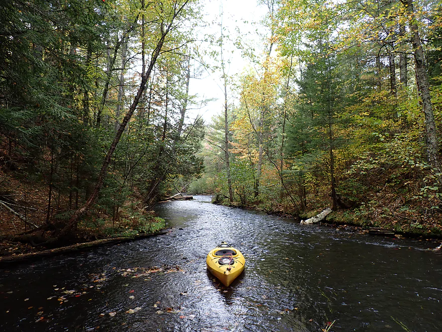
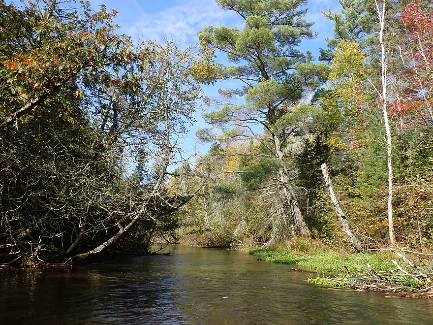
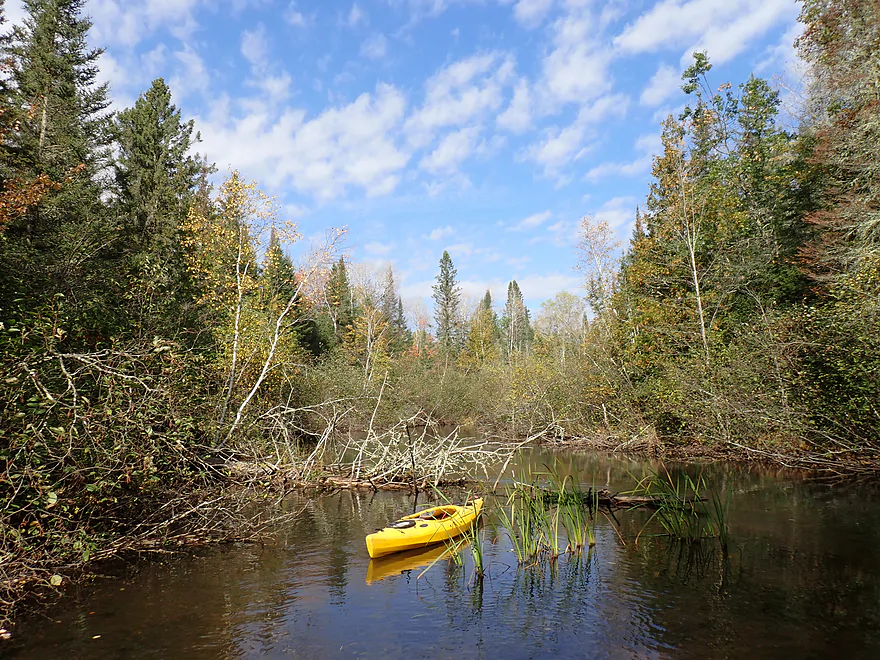
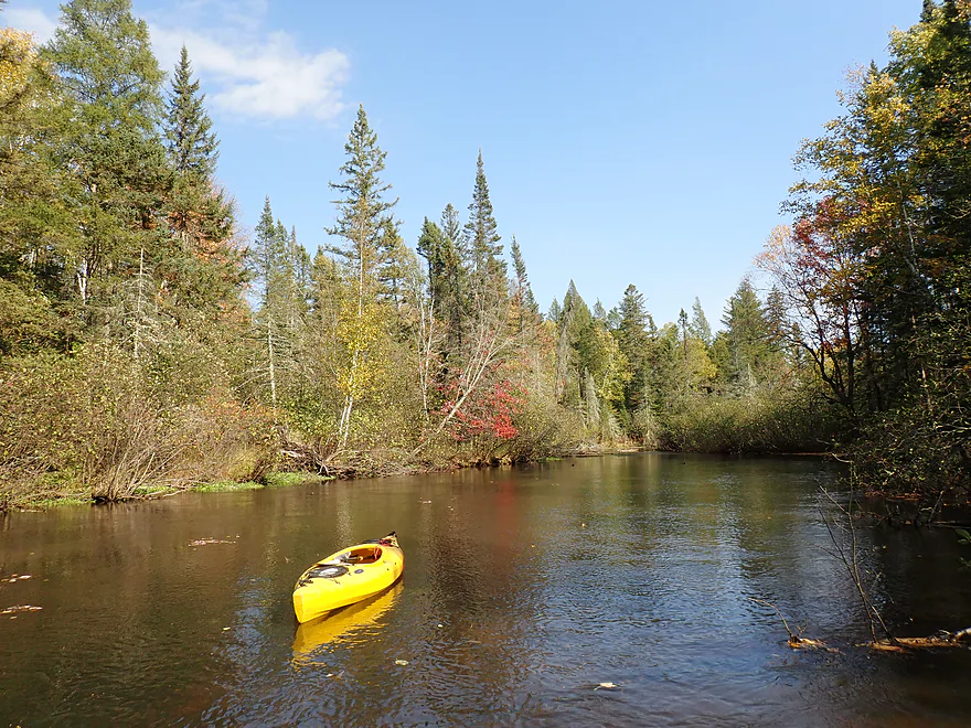
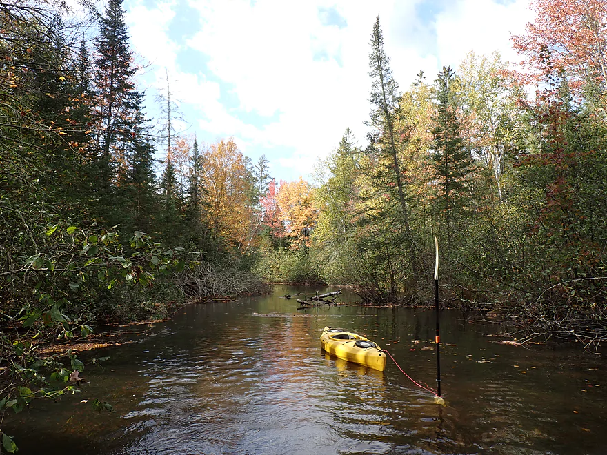
A scenic stretch of the creek
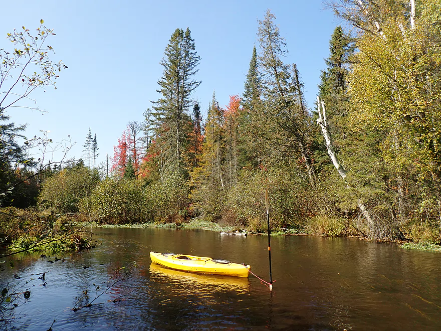
Anchoring my boat for photos
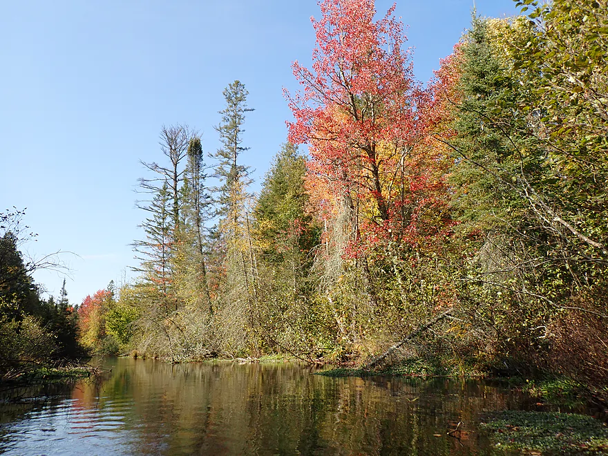
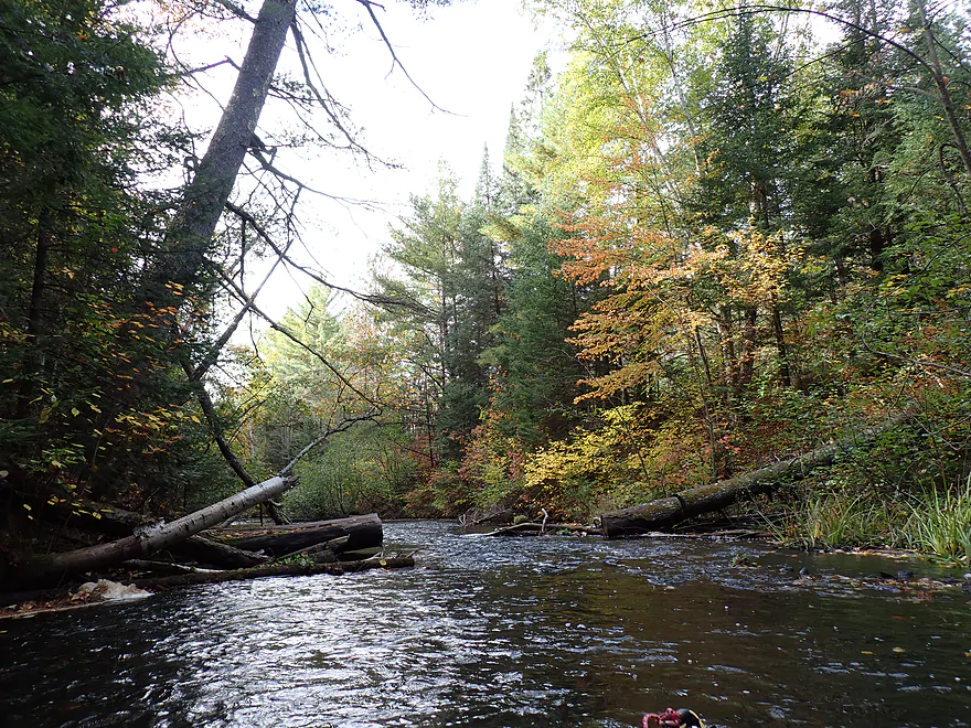
Great fall color
Always scenic (and pointy) balsam firs
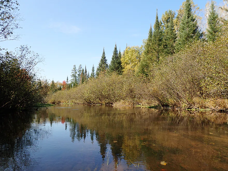
Some alders…not too many though
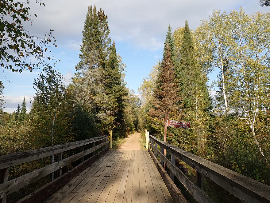
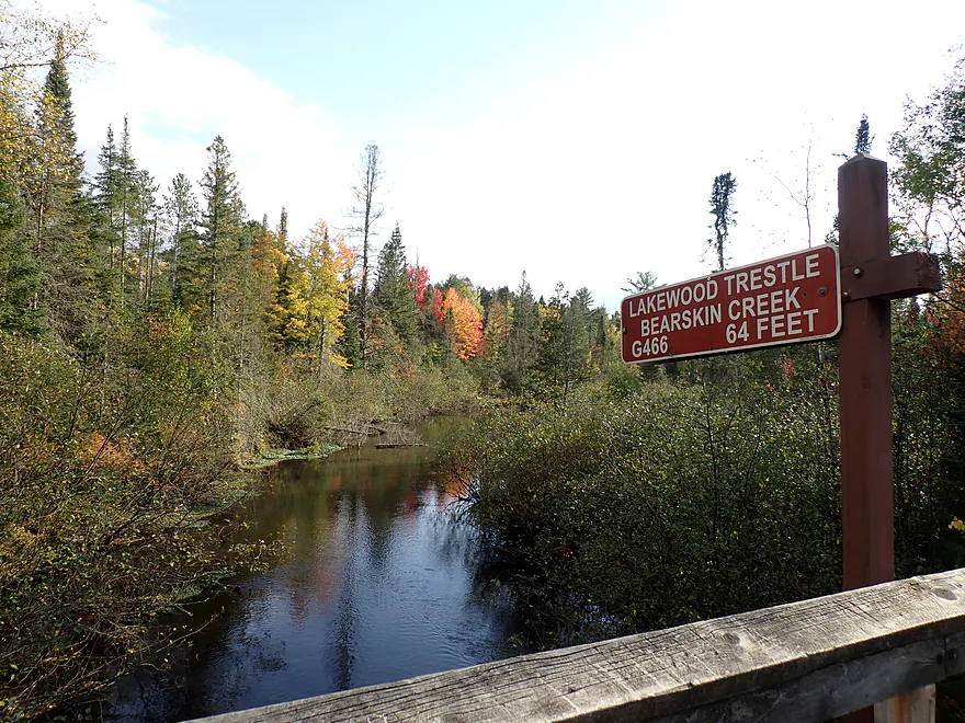
Lakewood Trestle (brown signs were great progress markers)
Lakewood Road is a good access if you prefer to get out here
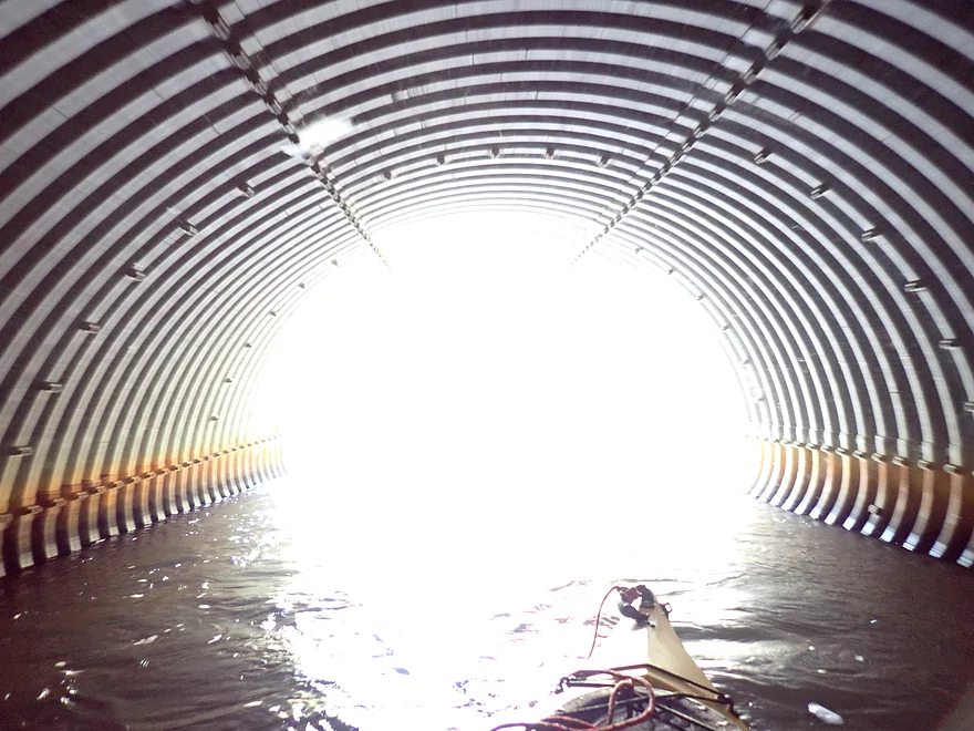
Continuing on into the light
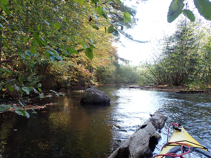
I started to see more boulders from here on
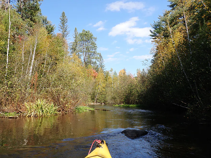
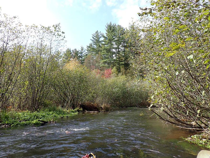
Great scenery
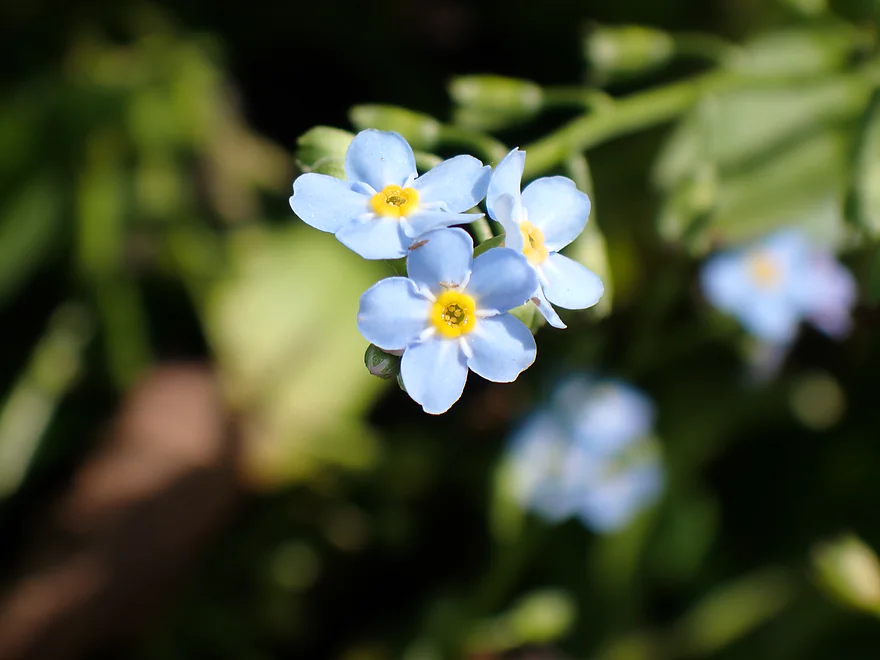
A closeup of forget-me-not flowers
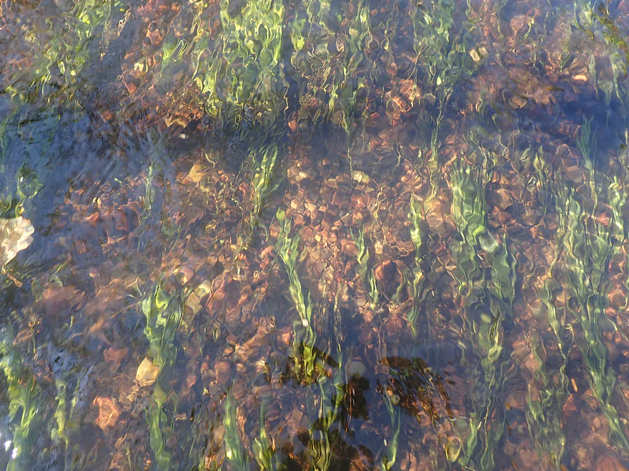
Good water clarity
Attractive corridor (with spectator seats)
Hwy K wouldn’t be a great access (but doable if you REALLY wanted to)
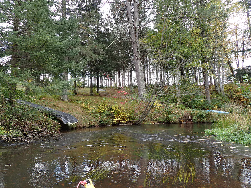
A water slide ending in the creek
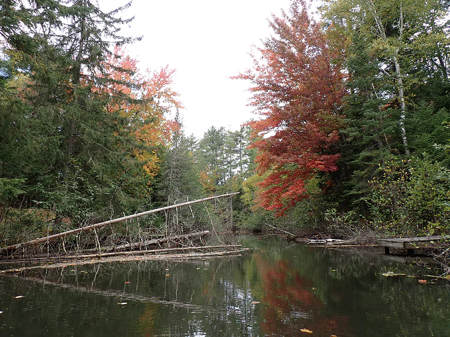
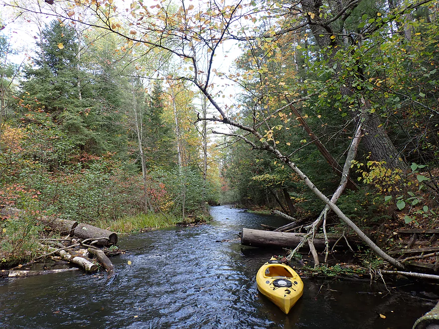
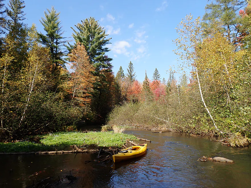
Last few miles were less open and not as scenic, but still nice
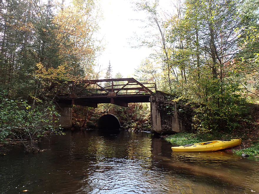
Hwy K Trestle
Of the historic trestles this was my favorite
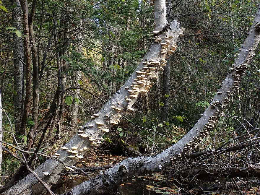
Photogenic fungi
Starting to lose my light
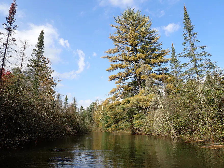
Not too many white pines, but some
Horizon line of a massive two-foot high beaver dam
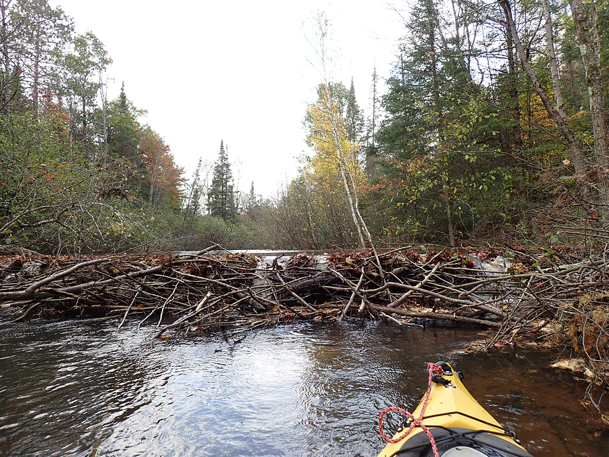
Was steeper than it looks…trick to get over
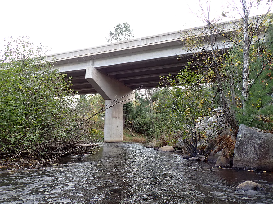
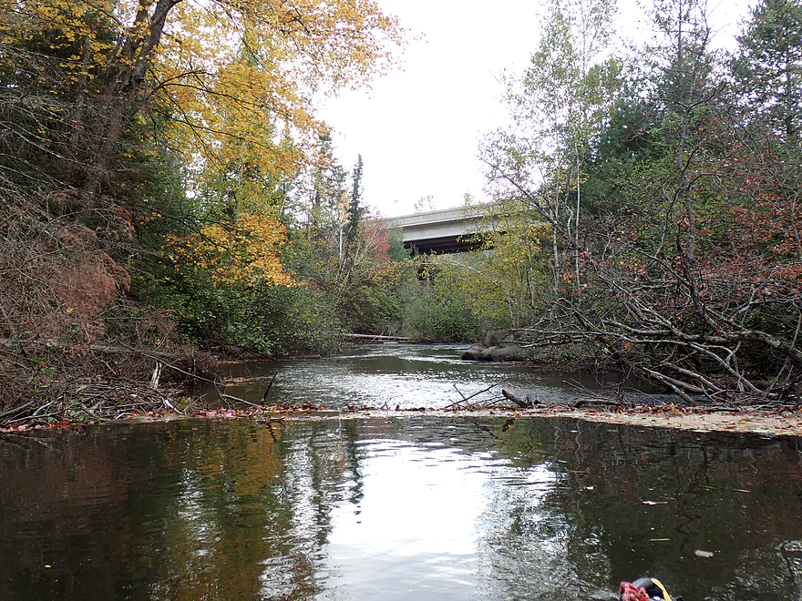
Busy Hwy 51
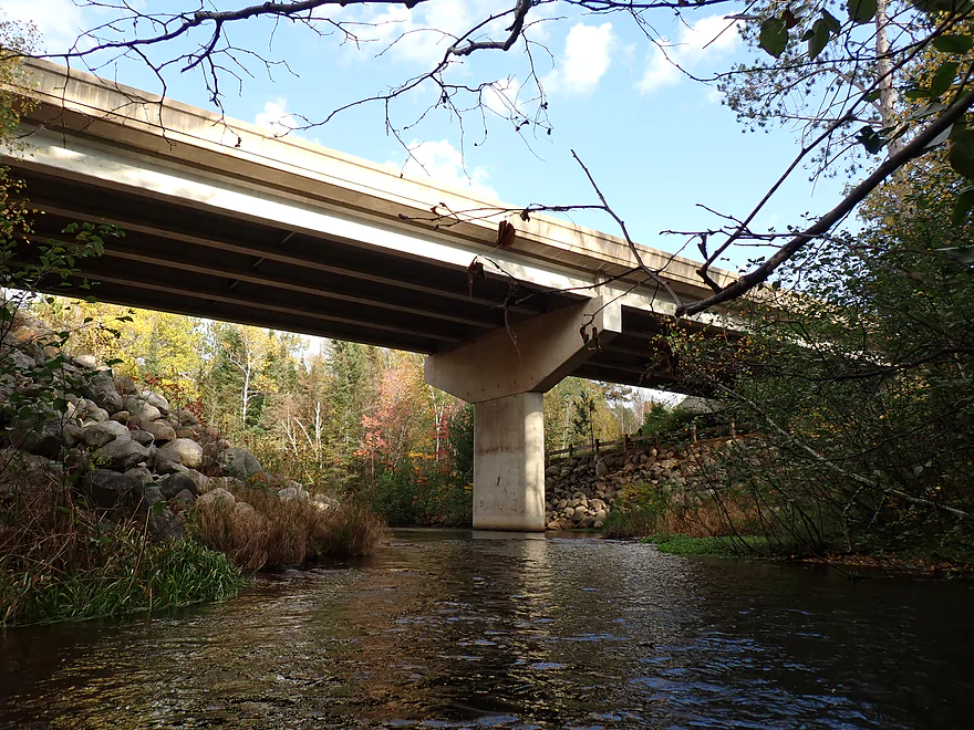
The wood railing is the Bearskin State Trail
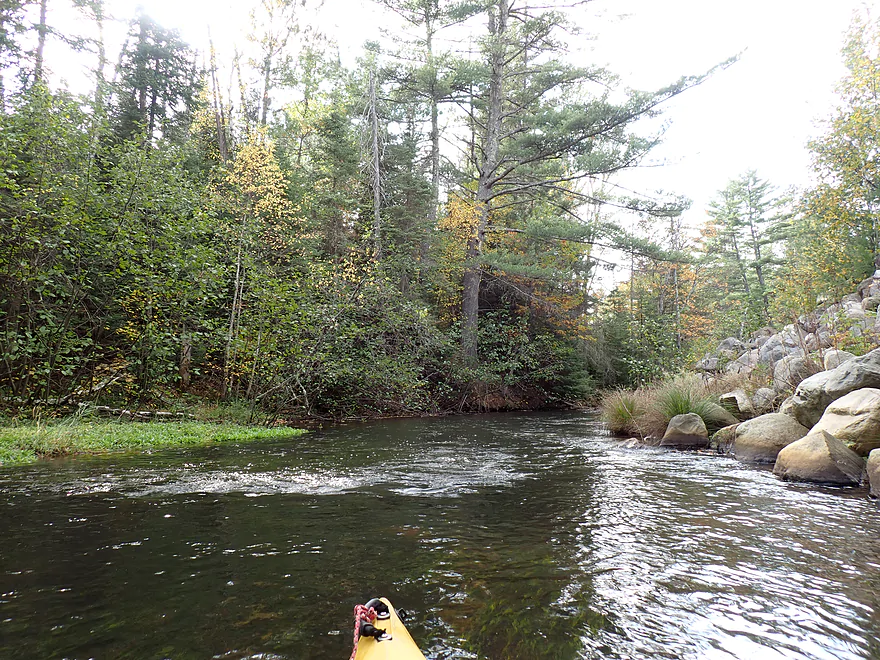
Creek starts to speed up for the last half mile
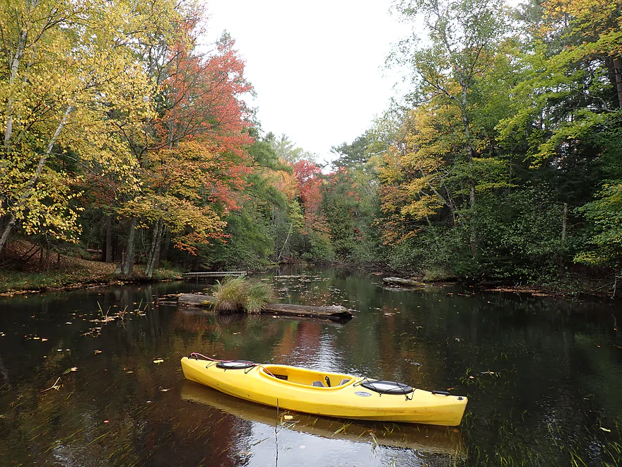
Approaching Wayside Park (my take-out)
Paddling out of the mouth and onto the Tomahawk River
I then paddled back up Bearskin Creek to take out at Wayside Park
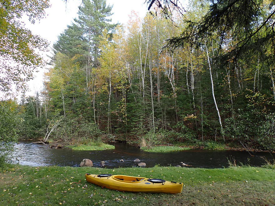
Scenic take-out area
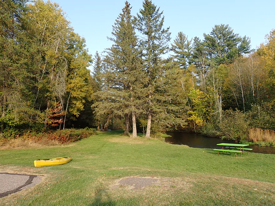
Larger view of the park
Terrific bike shuttle back to my car in Harshaw
Some nice vistas of the creek
Ending the shuttle by the Harshaw Trestle
Bearskin Creek

Bearskin Creek is an obscure tributary to the Tomahawk River. If the name sounds familiar it is because it parallels a famous rails-to-trails bike trail of the same name. Back in the day, that used to be a train connection that ferried Chicago tourists into Minoqua (remarkable that trains once connected these two cities). The creek itself isn’t super long and the upper parts by Bearskin Lake aren’t super navigable. So your choices are pretty much just two…a long trip to the mouth starting from Goodnow or a shorter trip starting from Harshaw. I went with the latter to play it safe.
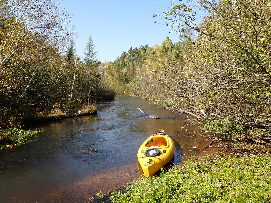
At Harshaw is a popular bike trail access and parking area. If you follow the trail a short ways north, you’ll find a hidden fishing access (perfect for launching a kayak). It’s worth it to paddle a bit upstream to check out the scenery. Here the state bike trail crosses a creek tributary to Bearskin Creek. If you Google “Bearskin Creek” chances are you will see this exact spot as it is very photogenic. It’s a combination wood trestle and boardwalk closely flanked by pine trees and is incredibly gorgeous.
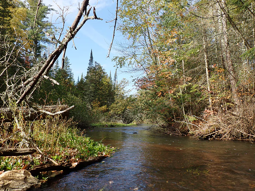
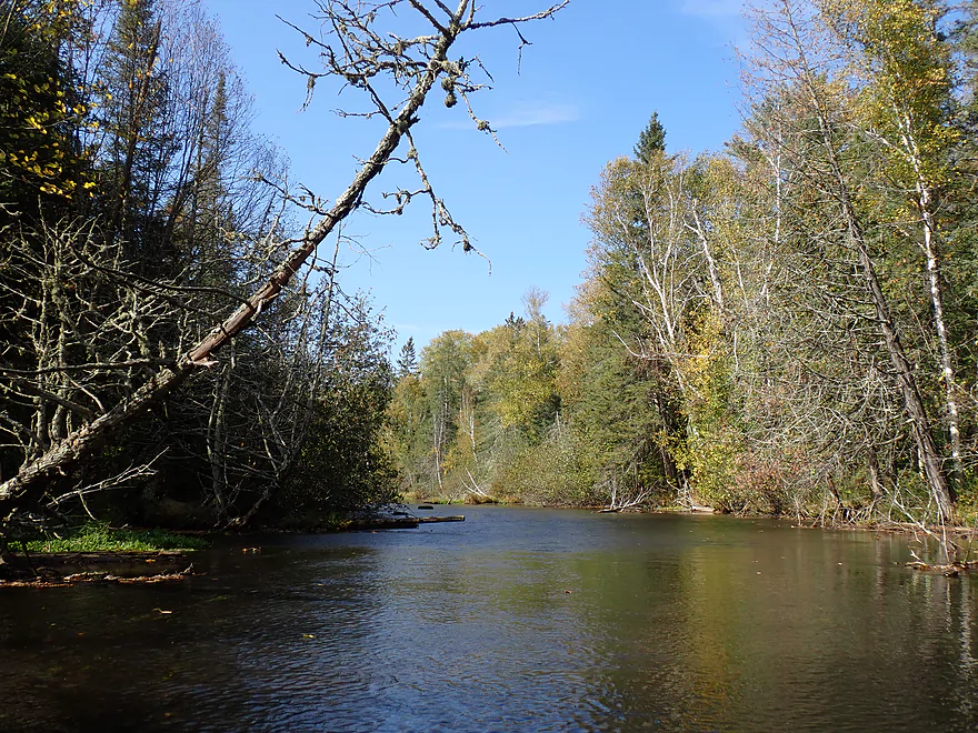
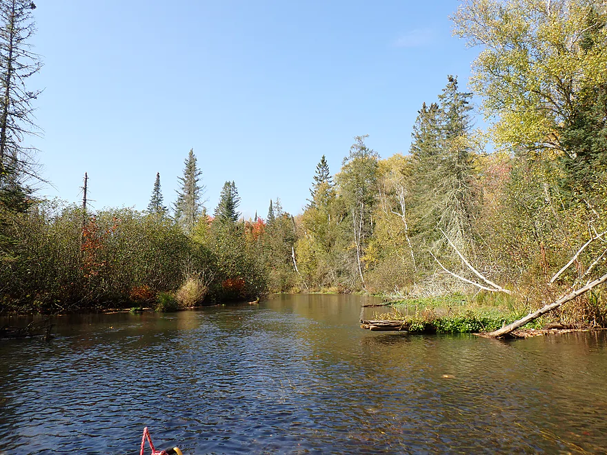
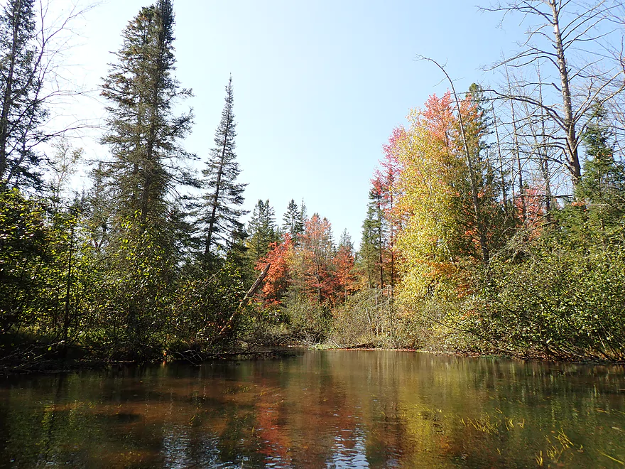
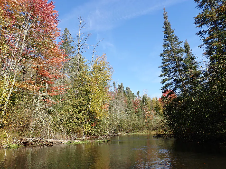
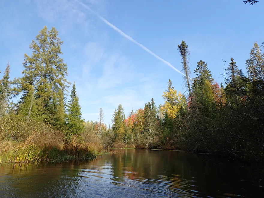
I explored the unnamed side creek a bit, which opened up into a spring lake, and then turned around to start the main trip. Bearskin Creek didn’t waste any time in showing off its amazing scenery. In the distance, the tips of white pines and firs would poke above the horizon line signifying another scenic pine stand around the corner. The conifers closely crowded the banks to create narrow winding corridors which were a treat to paddle though. The most attractive trees were the conifers, but there were some hardwoods which provided good fall color. Unfortunately the clouds kept changing between blue skies and ugly, overcast white skies. This isn’t a big deal for kayaking, but for photography (which I do a lot of) it can drive you bonkers.
I soon paddled under the second of five Bearksin State Trail trestles I would encounter on the trip. They all mostly had cute names you could see from attached wooden sign posts. These are fantastic trip markers to let you know how deep you are into the trip. The “Brandy Trestle,” like most of the others, was a gorgeous historic wooden trestle with attractive plank railings. If this bridge were created today it would be an ugly cement monstrosity. Not everything we think of today as progress is progress.
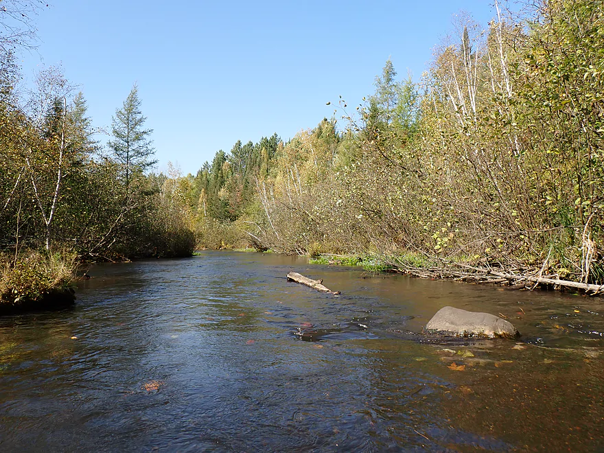
Most of the trip was pretty flat (courtesy of the last glacier), but there was a really nice ravine between the “Brandy Trestle” and the “Triple Tubes Trestle”. Here the creek narrowed dramatically past steep banks and riffles with trees growing right up to the waterline. The trees were many times taller than the creek was wide which created a fantastic tunnel effect. After having been a bit disappointed from last week’s Tomahawk trip and seeing all its logging, Bearskin Creek is much more protected (and way more scenic), which was a nice contrast. With all these trees, I was concerned about logjams, but they were never an issue. Sure, some trees had fallen into the creek, but locals had always chainsawed a path through.
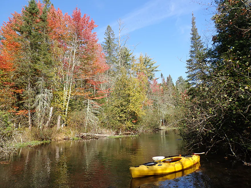
The trip opened up after the “Triple Tubes Trestle,” with some of the best color of the trip (and the clouds finally behaved for pictures). It very much reminded me of the Mecan River but on steroids (way nicer). Often I got out for pictures despite the very cold spring water.
Past Hwy K, I encountered the last trestle (“Hwy K Trestle”) which was the most impressive one of them all. This was roughly the four mile mark in a 5.4 mile trip. After this the creek really changed in character as banks became steeper and the creek narrowed. It was still attractive, with nice tree canopies, but I did prefer the previous legs. A long stretch of the creek was impounded by not one, but two beaver dams. The first was easy to slide over, but the second was an impressive two-footer. I was able to get past it but only by very gingerly nudging my boat over at a steep angle.
The last beaver dam was soon followed by busy Hwy 51 and then Wayside Park by Hwy L. The park (my take-out) was located close to the mouth on the Tomahawk, so I decided to paddle out to the mouth proper (although in hindsight maybe I shouldn’t have as current coming back was stronger than expected). It’s interesting comparing the rivers…the Tomahawk was scenic and I could see an inviting trail bridge just downstream, but IMO Bearskin Creek was so much nicer and way more photogenic. I then returned to my car using (mostly) the Bearskin Creek State Trail. The trail has some great vistas and wooded corridors, but IMO the views from a kayak were way better.
In summary this was a terrific trip and a hidden gem for paddlers in North Central Wisconsin. If you find yourself in the Minocqua area with a kayak, definitely consider checking this out…it will be much more scenic than anything you’ll see on the Chain of Lakes. The highlights were many: rustic wooden trestles, fall color, impressive pine walls, a lack of logging, clear water, no logjams, and a fun bike shuttle. A hidden perk to this trip are both the creek and bike trail are fairly protected from the wind because of the trees. It was gusting quite strongly that day, but I wasn’t bothered. Had I been doing a bigger river like the Tomahawk, I would have been clobbered.
Sights included a few small fish and a dragonfly. There were also a number of interesting animals I couldn’t quite ID : a white water snake or eel(?), possibly a pheasant, and then also possibly a grouse. There was also an eagle, bear, and shark…carved dock decorations. I suspect real black bears avoid areas like this with lots of human smells (mostly from the bike trail).
Harshaw Road Bike Access: Just north of Church Road there is a long parking area that parallels the state trail (and creek). I parked at the south end thinking I would launch by the bridge, but I discovered there was a better fishing access north by the Harshaw Trestle so I dragged my boat (already off the roof) 400′ north to reach this. Don’t make the same mistake I did…park instead on the north end of the parking lot. Here you can slide your boat under the wood fence and will have a much shorter hike to the fishing access. The launch area is very good. Note, there are no outhouses at the put-in (or take-out), and the parking lot on Google Maps for the Bearskin Trail is wrong (it’s too far north).
Alternate Put-ins:
- Lakewood Road/Goodnow (3.0 miles upstream from Harshaw): In hindsight I should have launched here as I believe this is a scenic and navigable section. Be mindful of where you park by Lakewood Road as there are No Parking signs on the bridge. You should be ok to park on the shoulder south by the bike trail.
Wayside Park: Located close to the mouth on the Tomahawk River and by Hwy L, this is a great public park and access option. Note, the local sign refers to this as “Roadside Park” but Google calls it “Wayside Park”…not sure why the discrepancy. While the park is great and photogenic, visitors do not do a good job of cleaning up after their dogs. Watch your step.
Alternate Take-outs:
- Hwy K (1.6 miles upstream from Wayside Park): This isn’t an ideal take-out as the bank is steep and there is a guardrail to deal with…but in theory you could take out on the rocks downstream from the bridge. You are this close to the mouth though, so my advice is to just keep paddling.
- Lakewood Road (2.4 miles upstream from Wayside Park): This is actually a nicer access option than Hwy K. Basically there is a fishing access northeast of the bridge which is perfect for launching. But again, paddlers who have come this far should just keep going to the mouth.
Bike Shuttle – Wayside Park to Harshaw: 3.6 miles with 43′ of ascent. This starts with a short leg on busy Hwy 51 and then Old Hwy K…but then most of the shuttle is on the fantastic Bearskin State Trail. The bike path not only conveniently parallels much of the creek, it is in great condition and has tree cover for protection from the wind. Unlike many Southern Wisconsin trails that use crushed limestone, this uses crushed granite which is far superior. Note: a state trail pass is required.
Bike shuttlers coming from Wayside Park may be tempted to take a shortcut by heading south on Hwy 51 and then rejoining the bike trail by the bridge. Unfortunately the highway department put up a fence to discourage this (otherwise it would be a great idea). There is a slight gap in the fence, so if you were determined you could likely still make this idea work.
Beaver Dams: There are two beaver dams on this trip–both located just upstream from the Hwy 51 bridge. The first is very small and easy to get over. The second is large (about 2′ high) and requires careful positioning to slide down. A portage would be possible, but tricky.
Logjams: Practically none…the locals do a good job of keeping the creek open. Note, this is a very wooded trip though, so surprise logjams could easily appear suddenly after a windstorm. The only snag worth noting is almost directly under “Triple Tubes Trestle”. Here there are light rapids over what looks like a partially submerged bridge support. I didn’t find this difficult to hop over, but paddlers should be careful around it.
Rapids and Current: The current varies from very slow in the wide parts to brisk in the narrow stretches. There are a few fast stretches that could be considered light rapids, but they are very minor and super easy. Generally speaking this is a pretty mild creek.
River Gauge: Spirit River @ Spirit Falls
River Trip Depth: 13 CFS or 1.37′
River Navigability Estimates: The Spirit River isn’t a good analog gauge but there isn’t much else to choose from. Note, the following are only rough guesses.
- <11 CFS: Maybe too shallow.
- 11-15 CFS: Shallow depth but mostly navigable. Don’t be too discouraged by the take-out…that is the shallowest part of the trip and is not overly representative. You’ll still ground out a few times at this depth, but IMO is plenty fine for paddling.
- 16 -20 CFS: Average depth. Fine for paddling.
- 21-30 CFS: Higher depth…should be ok for paddling but clarity won’t be that good.
- 31-50 CFS: Pretty high depth. I think it should still be ok for paddling.
- 51-100 CFS: Very high depth. Maybe still navigable…I’m not sure.
- 101+ CFS: Maybe too high for suitable kayaking.
Click here to see an overview map of Bearskin Creek.
- Upstream from Little Bearskin Lake: Little Bearskin is the last of a chain of lakes (Muskie Lake, Little Muskie Lake, Seed Lake, Birch Lake, Bearskin Lake and Little Bearskin Lake). These are likely pleasant but developed lakes with many shoreside cabins. Typically the creek between lakes is too small to be navigable.
- Little Bearskin Lake Boat landing to Goodnow: 4.2 miles. Little Bearskin Lake is navigable and a typical up-north lake. Below the lake, the creek appears extremely congested and not navigable.
- Lakewood Road/Goodnow to Harshaw: 3.0 miles. Likely a very scenic stretch with impressive conifer stands.
- Harshaw Road Bike Access to Mouth on Tomahawk River: 5.5 miles.
- Harshaw Road Bike Access to Lakewood Road: 2.9 miles. One of the best stretches on the creek with scenic wooded corridors created by walls of conifers. The other highlight are three historic wood trestle bridges.
- Lakewood Road to Hwy K: 0.8 miles. An attractive leg with scenic conifers and clear water.
- Hwy K to Wayside Park: 1.6 miles. This leg is more closed-in with steeper banks, but is still nice. As of 2024 a large beaver dam significantly backs up the creek.
- Wayside Park to Mouth: 0.2 miles. A fast leg with light rapids.
Trip Map
Overview Map
Video
Photos Size:
My dad and I paddled Bearskin Creek today April 6th 2025. We put in at Goodnow and it was exactly 8 miles to the wayside takeout and took us just under 3 hours. Mostly sunny with air temps in the low 40s. 1 down tree to portage near the downstream end of the sweet narrow section. For a novice its probably a tricky spot to have to pull over with fast moving water right into the strainer, but its shallow enough it’ll probably work out. Still 2 beaver dams in the last little bit. First one is easy to portage river right, 2nd was easy to go over/through. Culverts were fun and holy crap there are a lot of golf balls waiting for someone to score big on when they clean them out of the creek. Scenery and water quality 10/10.
Thanks the feedback!
This trip is everything you mentioned it being! Beautiful panoramic scenes the entire trip. And the locals do a wonderful job keeping this Creek navigable! We started at Goodnow as well. Golf balls galore near the Country Club section of the creek! The last Beaver Damn was an easy portage left bank, but it is deteriorating. Water was a bit low the day we paddled. Paddled 9/28/25
Appreciate the feedback! I was a bit concerned the beaver dam would be an issue for other paddlers, but it sounds like it’s no longer difficult to get past.