Crawfish River
Generally speaking the Crawfish isn’t a great river for paddling. It’s slow, wide, and has mostly uninteresting banks. But there are a few legs worth checking out.
Trip Reports
Udey Dam to Danville Dam

Date Paddled: September 14th, 2019
Distance: 9.5 miles
Time: 4 hours 35 minutes
The Crawfish isn't the greatest of paddling rivers, but there is a nice exception located between Columbus and the Danville Dam that is worth checking out.
Read More...Aztalan State Park to Riverfront Park in Jefferson

Date Paddled: August 12th, 2023
Distance: 7.4 miles
Time: Expect 3-4 hours
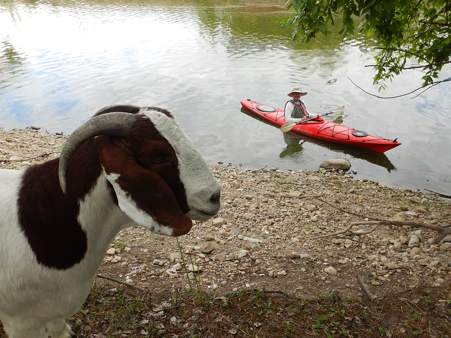
This stretch of the Crawfish was a pleasant surprise with abundant waterfowl and a number of small boulder gardens. The highlight of the trip is Goat Island which is home to a small herd of goats.
Read More...Overview Map
Detailed Overview
- Upstream of Columbus-Fall River Road: The Crawfish splits into two branches upstream of the bridge. Both branches are very scenic and have some rocky sections that I've scouted extensively before. Unfortunately, logjams are a major problem this far upstream and I'm not sure there are many if any viable legs in this stretch.
- Columbus-Fall River Road to Old Hwy 73: 3.8 miles. A mostly wooded section with perhaps 4 logjams.
- Old Hwy 73 to Udey Dam/Columbus: 3.2 miles. Mostly slow flowage paddling. Somewhat of an urban paddle that goes through the northern outskirts of Columbus. Area parks are alternate access options.
- Udey Dam to Danville Dam/Hwy T: 9.5 miles.
- Udey Dam to Columbus Wastewater Plant: 0.8 miles. An attractive fast section. Rapids and rocks will be visible at low flow rates. As of Sep 2019, there were two logjams, but they can be hopped over.
- Wastewater Plant to River Road (Creek Bridge): 2.9 miles. A mediocre section with one logjam to sneak around. Current slows and the banks consist of a mix of woods and open sections.
- River Road to Ninabuck Road: 3.2 miles. Terrific section with good current, healthy woods, light riffles and small boulders. This would be a very scenic section at low water levels.
- Ninabuck Road to Astico Park (West Landing): 1.0 miles. Mostly uninteresting flowage paddling.
- Astico Park (West Landing) to Astico Park (East Landing): 1.1 miles. A nice hilly section by Astico Park. Current is almost nonexistent though.
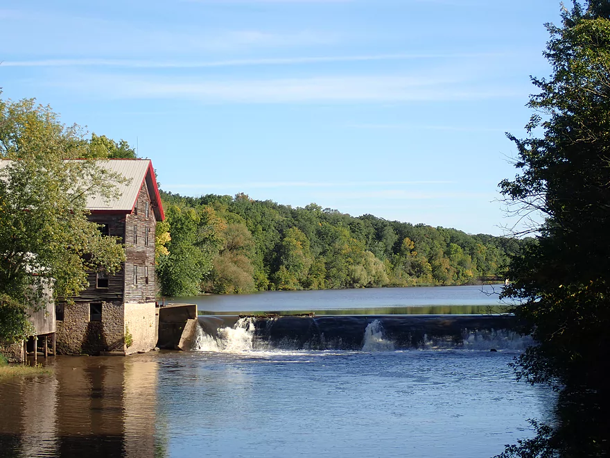
- Astico Park (East Landing) to Danville Dam (Elba Street): 0.5 miles. A half mile of paddling a very silted-in flowage. The dam can be easily portaged along the eastern bank. Take out southwest of the dam. The mill here is very scenic.
- Note: While local fishermen regularly use the shoreline south of the dam, it is private property. The owner is very nice about letting people use the shoreline to access the water. But be considerate if you take out here. If you want a more public access option, you could take out at Hwy T just downstream.
- Hwy T to County Road TT: 5.1 miles. Artificially straightened by farmers, I suspect this might be an uninteresting segment.
- County Road TT to Austin Road: 3.1 miles. Likely wide, slow and muddy.
- Austin Road to Hwy I: 3.0 miles. Likely a mediocre section.
- Hwy I to Hwy BB: 4.8 miles. A mediocre section that features the mouth of the Maunesha River.
- Hwy BB to Hwy G: 2.3 miles.
- Hwy G to Hubbleton: 4.3 miles. The Beaver Dam River adds considerable volume to the Crawfish.
- Hubbleton to Olson Road: 1.3 miles. Wide, slow, muddy and likely boring.
- Olson Road to Hwy A: 7.7 miles. Likely an uninteresting section.
- Note: I'm not sure if Hwy A is a viable access.
- Hwy A to Aztalan State Park: 3.1 miles. Likely a boring paddle. The highlight is Aztalan State Park.
- Aztalan State Park to Riverview Drive Boat Launch: 7.4 miles. A mediocre trip with a few nice boulder gardens. The highlights are the start (Aztalan State Park) and the end (Jefferson/Goat Island).
- Aztalan State Park to Hwy 18: 5.6 miles. A nice rocky stretch with good waterfowl and a number of boulders.
- Hwy 18 to Riverfront Park: 1.3 miles. A weak uninteresting section with slow current. The highlight at the end is Goat Island which in the summer will have goats on it.
Nearby Guages
Videos
Comments
FYI, the goats are back on Goat Island: https://www.facebook.com/friendsofgoatislandwi
From https://www.facebook.com/photo?fbid=636694428674347&set=a.478807194463072
--
Five (5) of our six (6) four-legged Friends of Goat Island passed on to the Great Farm in the Sky this month (Oct 2023).
• Each contracted caseous lymphadenitis (CL), a chronic bacterial infection that primarily affects sheep and goats.
• CL presents itself with abscesses around the neck & abdomen, eventually impeding the animal’s ability to eat, breath and cognitively function.
• No known treatment or cure, but a vaccine does exist, though currently in limited supply.
As a result, the FOGI Board of Directors is taking the following preventive measures:
• Goat Island will be cleaned of debris, refuse & other areas of potential contamination.
• All goats on Goat Island will be “FOGI goats” moving forward.
• All goats will be taken care of by the same farm/organization during the “offseason”. If other goats are present, FOGI goats will be kept separated/segregated.
• All goats will be inoculated for CL (and other concerning illnesses) prior to visiting the Island.
Thanks to the actions taken, thus far, Sweetie-Janester has been given a clean bill of health and will be returning to Goat Island next year as an official FOGI…along with three more.
Appreciate the update!
Crawfish River from Columbus to Dam at Astico Park/Campground. Saturday 8-14-21. Water as at 82 CFS on USGS gage at Beaver Dam River, the closest one to this section of river. Beautiful trip first hour. Second hour thru 2 miles of riffles there was some dragging. Would have been a lot of fun with about t6 more inches of water. Last section wide and calm. Lots of Blue Herons, Kingfishers, Green Herons, and Egrets. Current is minor as gradient is 0.5 fpm, except in riffles. Camping at Astico Co Park is great home base as the River runs around 3 sides of it. Three areas of riverside camping, esp. for smaller tent or pop-up campers.
Thanks for the feedback Karen! Here's the video for readers that you referenced: https://www.youtube.com/watch?v=z3sUqTrYAEU
I love paddling on the Crawfish. There are frequently downed trees in the early section after the Hy 16 bridge. But we usually manage to find a way through. There is a nice hike at the park. I have some videos on YouTube from a hike and from a paddling trip. Not as complete as your photos. If you would like to view them they are at WENDTWORKS Stories ‘N Flight!
Karen
Thanks for the tips. Your advise is timely...as I have recently encountered hole #3 and hole #4 in my red boat :(.
Suggestion for future hole in kayak. Years back on a trip down the St Croix river we hit a rock with an aluminum canoe, spun sideways and tipped up river, the canoe filled with water and folded in half. after prying it of the rock we got it to shore. My buddy, a big guy, tried stomping it straight. It straightened out but resulted in two tears just below the waterline. We still had two more days to go. We ended up cutting strips from a garbage bag, tucking them through the hole with a pointed knife and pulling them even. Packed in as many as we could, ended up with a ball of plastic on the inside and outside, still had a little seepage but nothing we couldn't mop up. I believe this would work on a poly-ethylene kayak as long as the repair doesn't hit too many rocks.
Appreciate the tip!
Yesterday (06/12/2020) my niece and I put in at Rotary Park in Columbus, planning on kayaking down the Crawfish River. We took out at the Udey dam and put back in after the dam, but there's a huge tree down right around the first bend (you cannot see it) and we got caught in the strong current & tree. Made it out ok, but suggest putting in AFTER the tree or staying in Rotary Park.
How did your trip turn out? Questions or comments? Feel free to leave your feedback.
SUBMIT COMMENT!
