
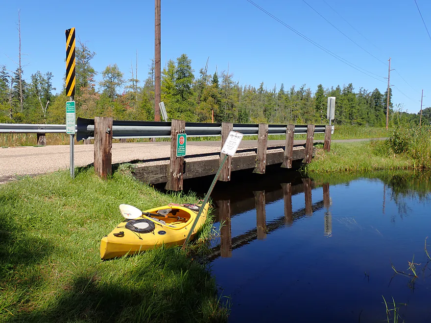
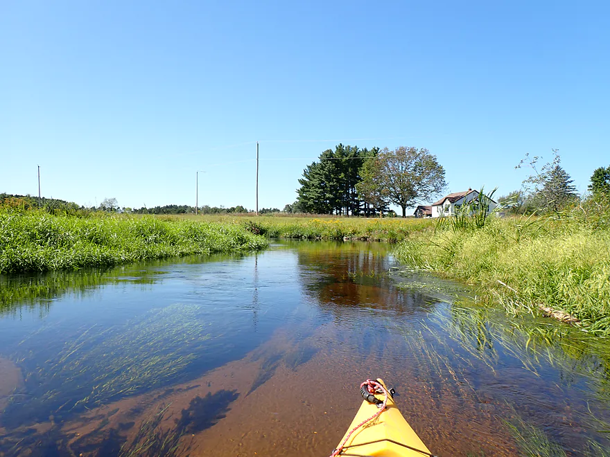
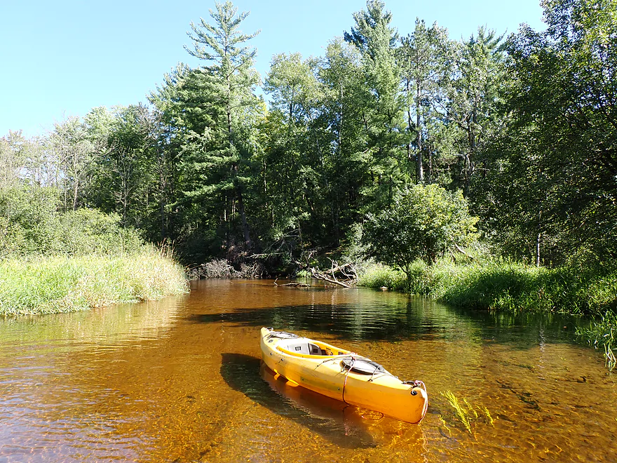
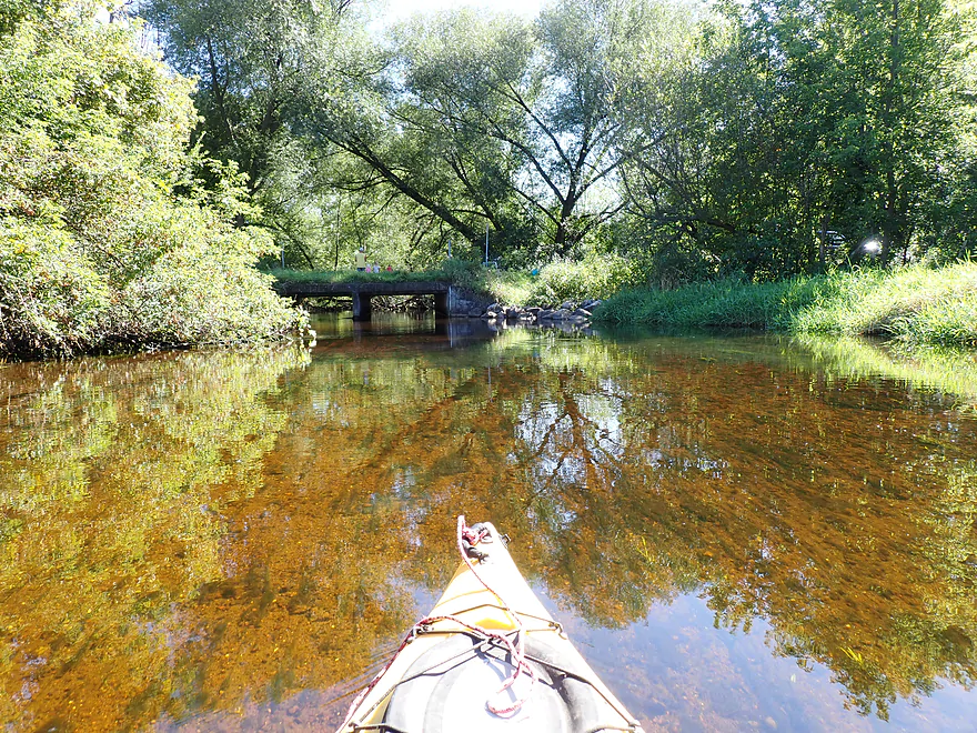
Launching at Tresness Road
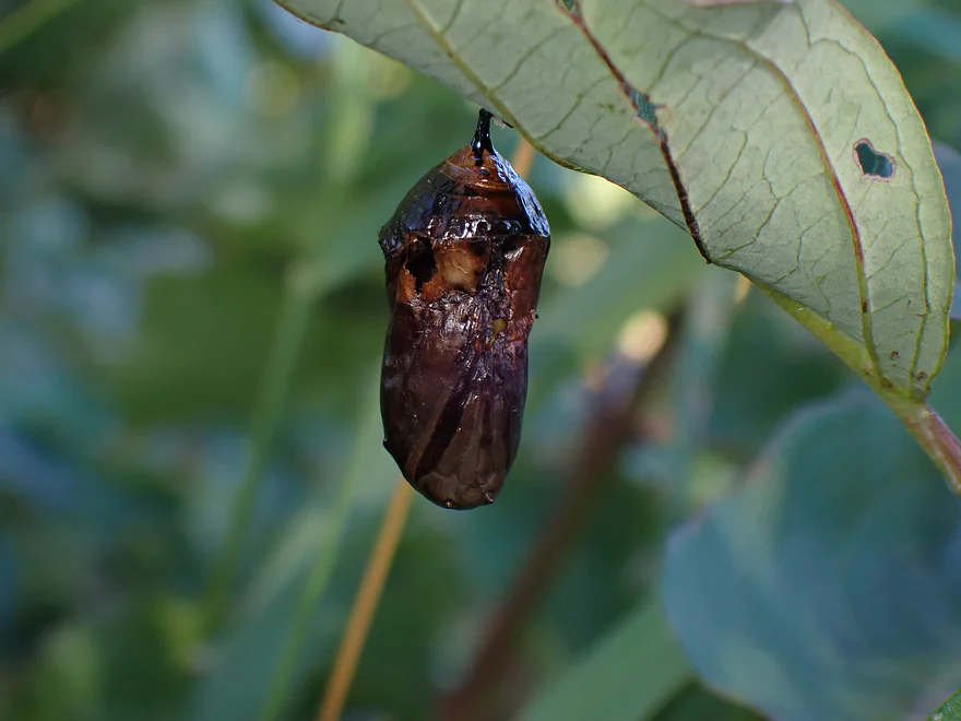
A butterfly chrysalis
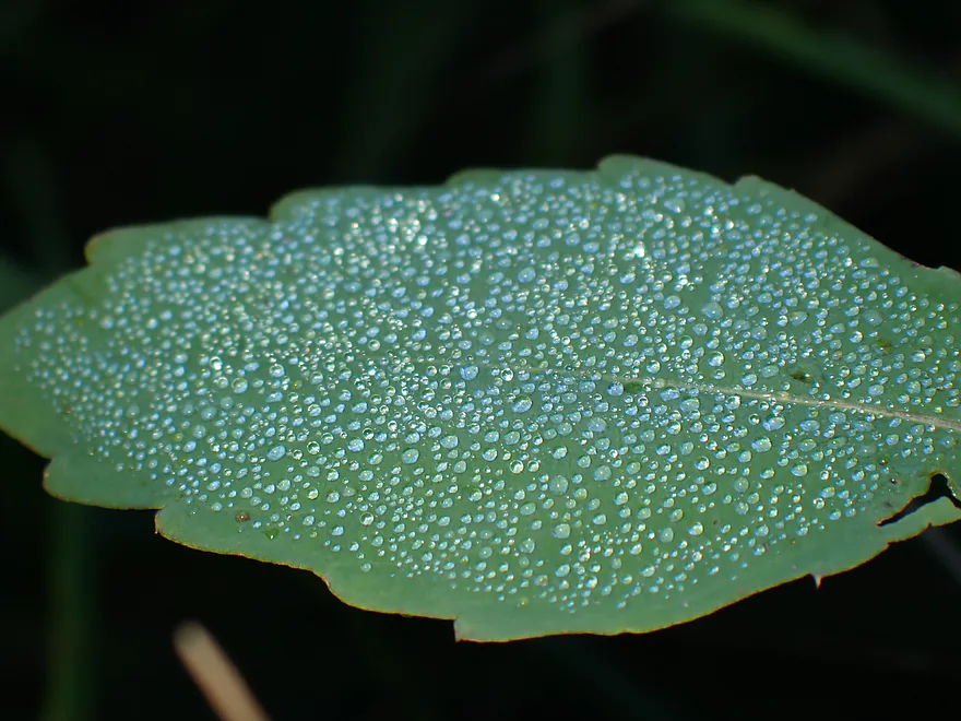
Morning dew on a leaf
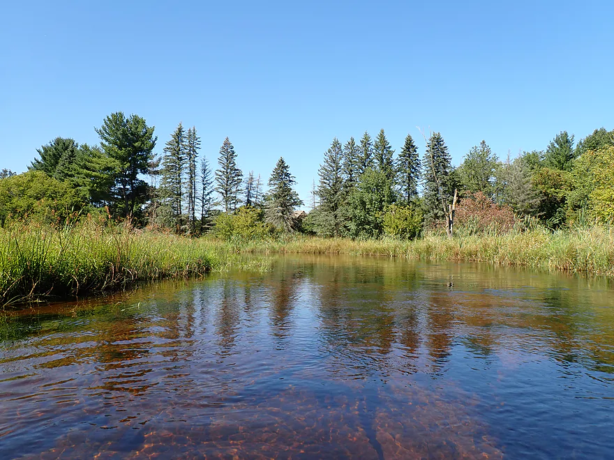
Nice tamarack trees in the distance
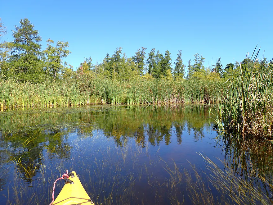
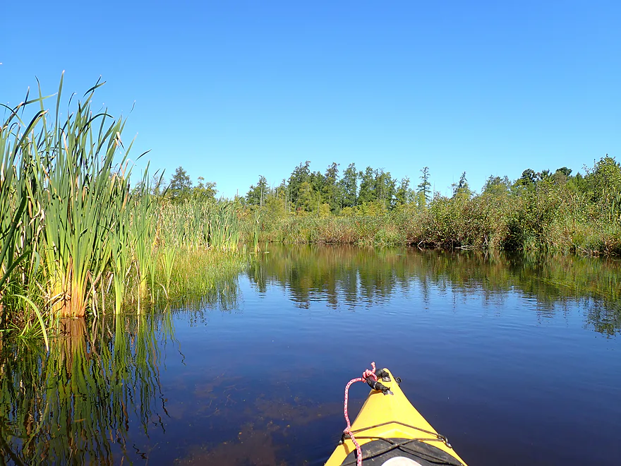
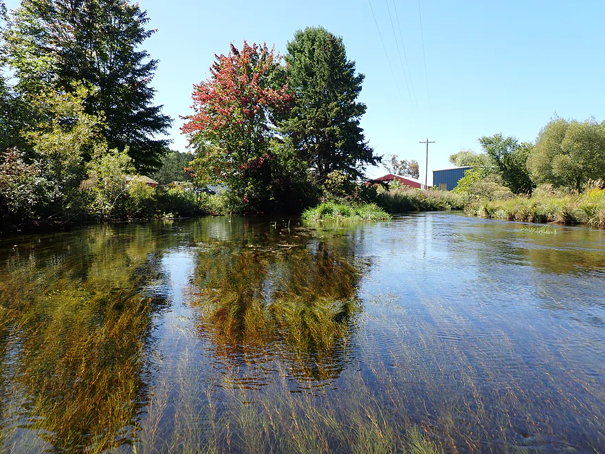
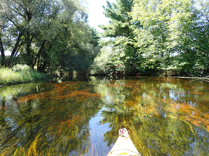
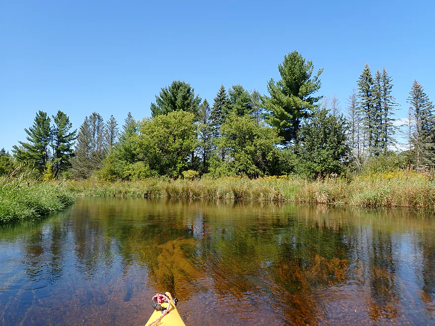
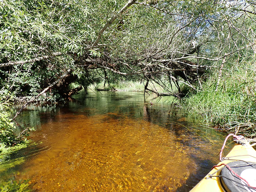
Cool cattail corridor to start
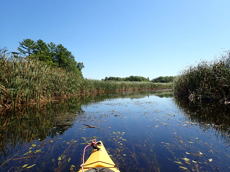
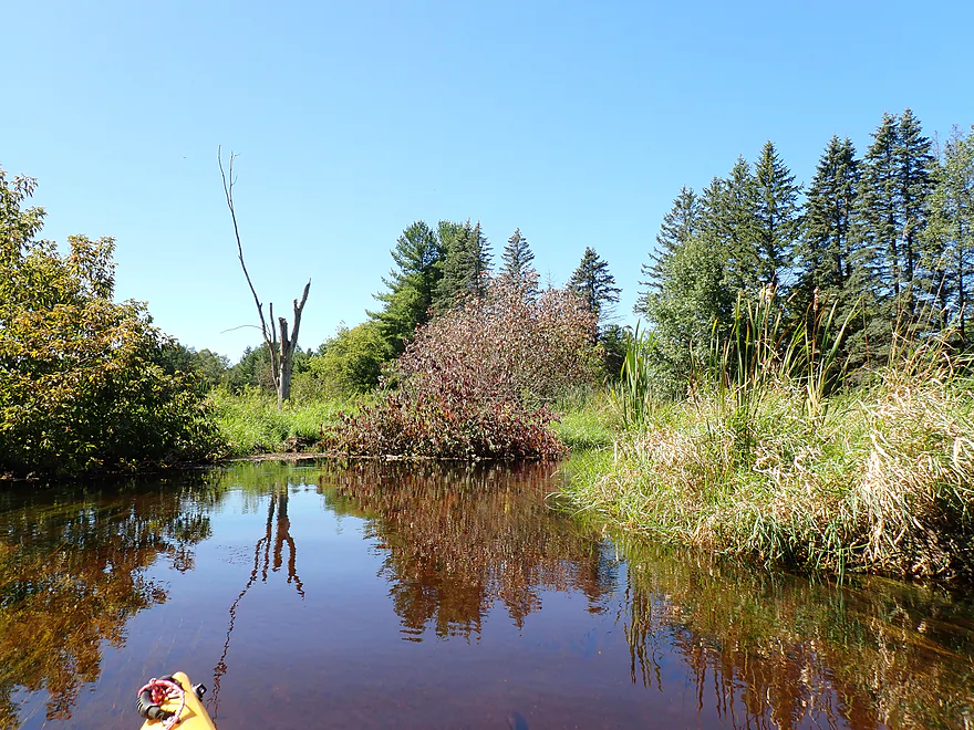
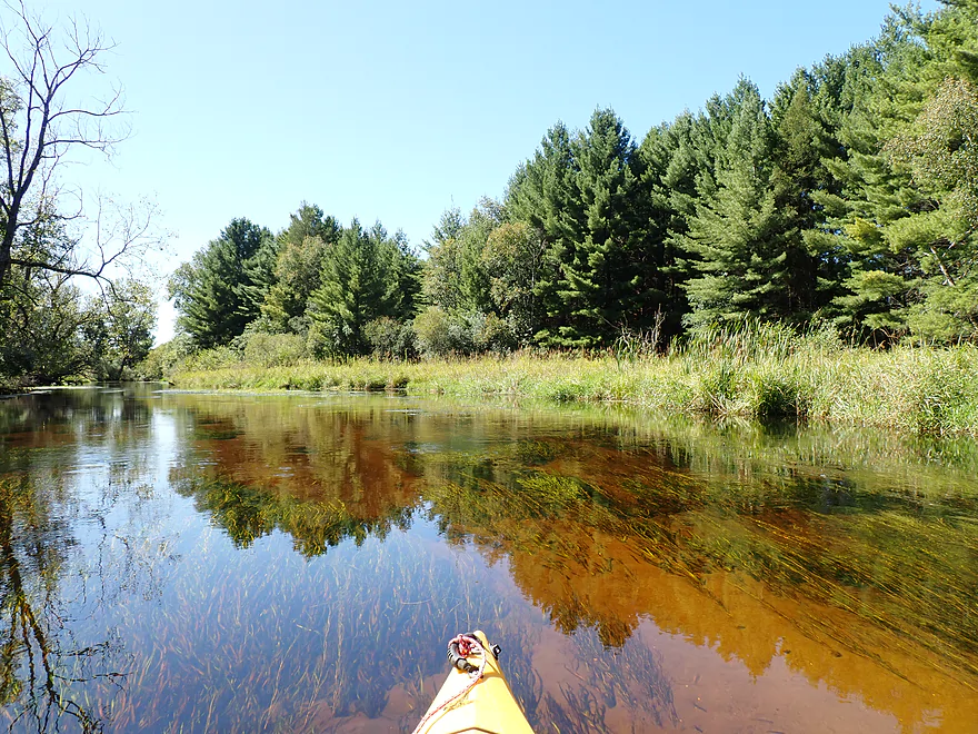
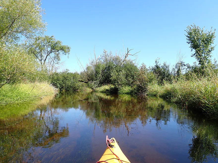
Reverse view

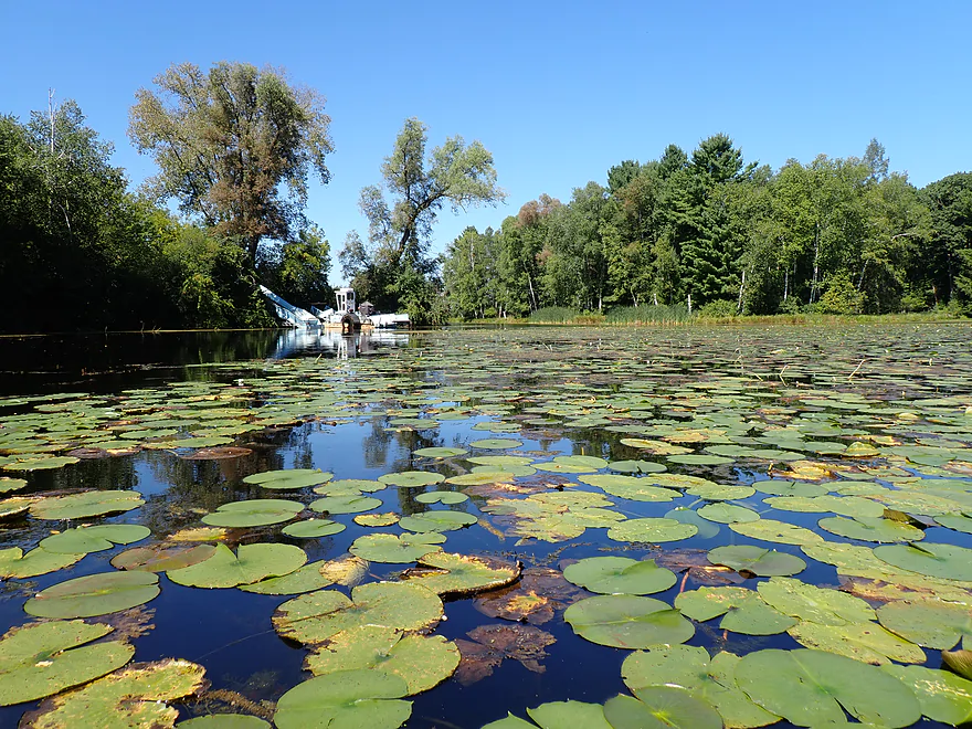
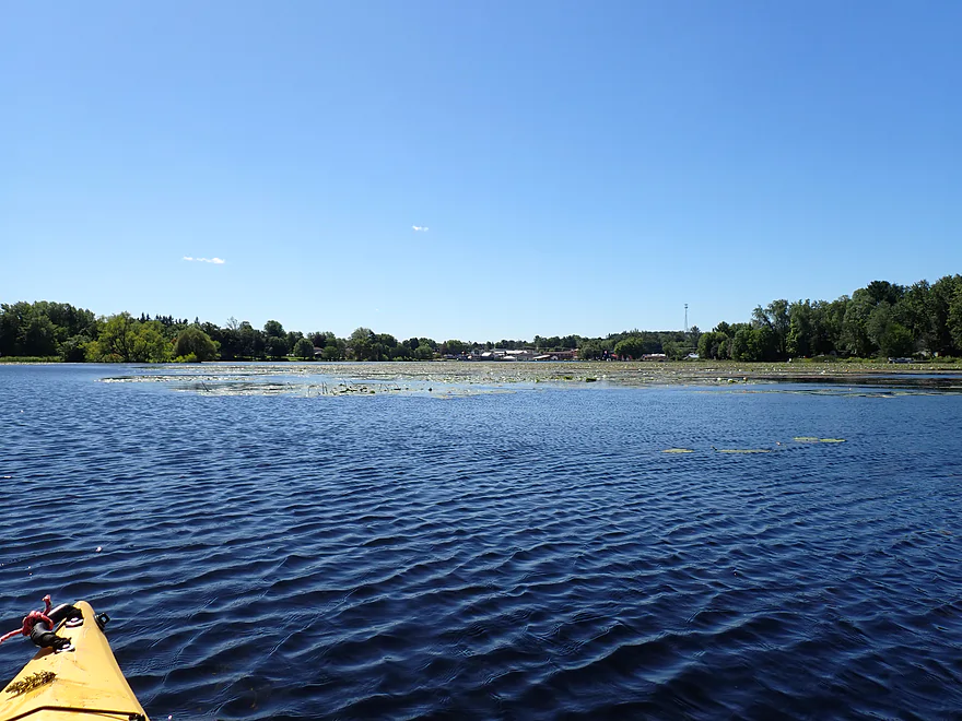
Out on Iola Lake which is congested with weeds
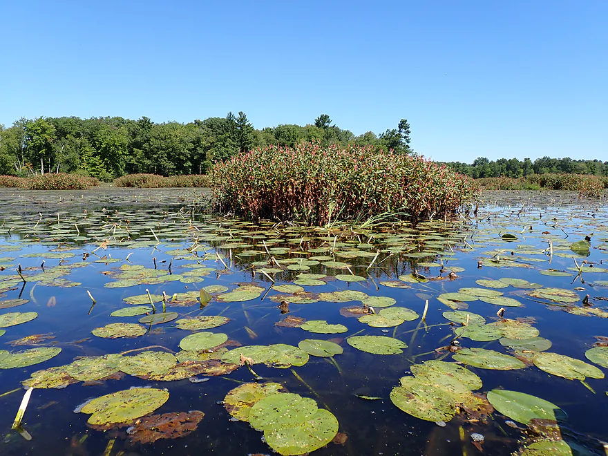
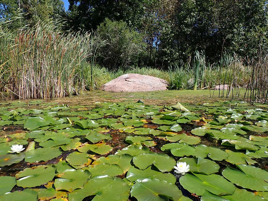
Some nice marsh plants
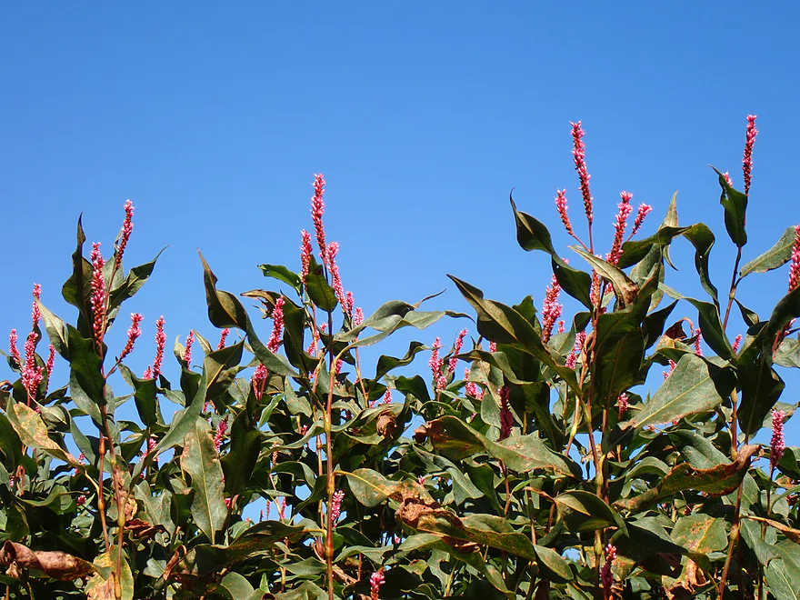
This is swamp smartweed
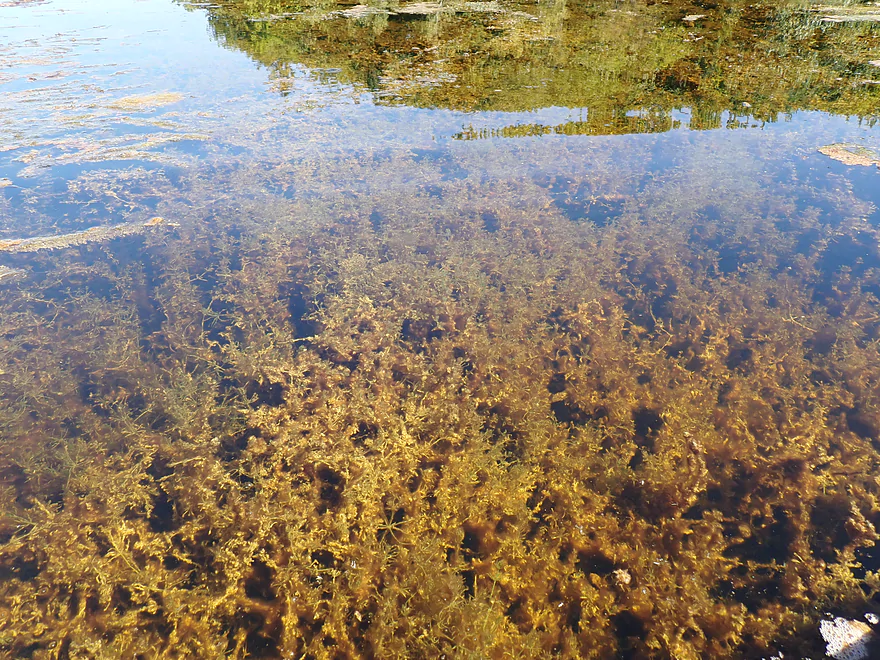
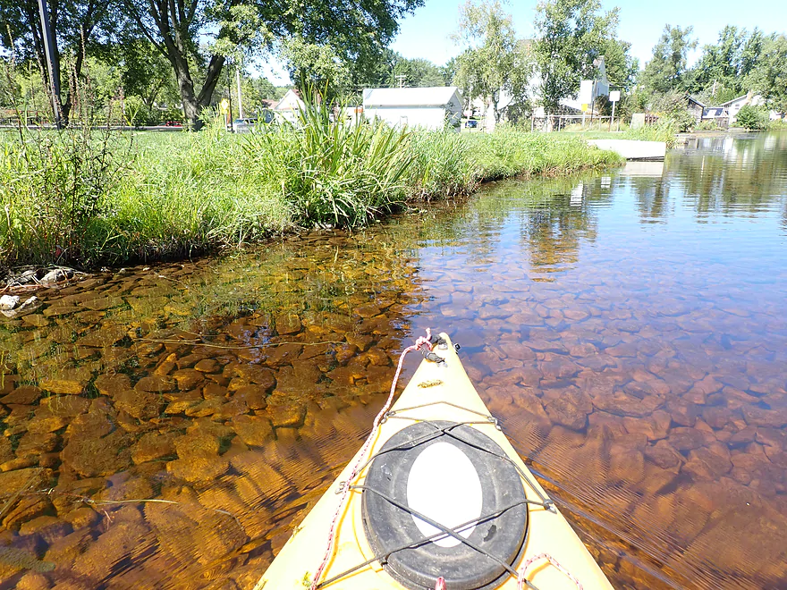
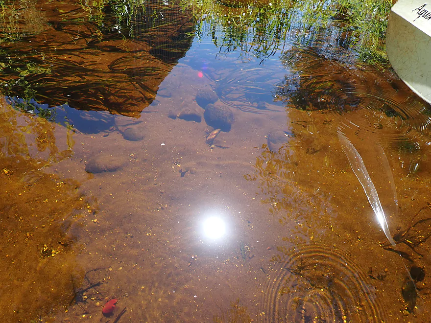
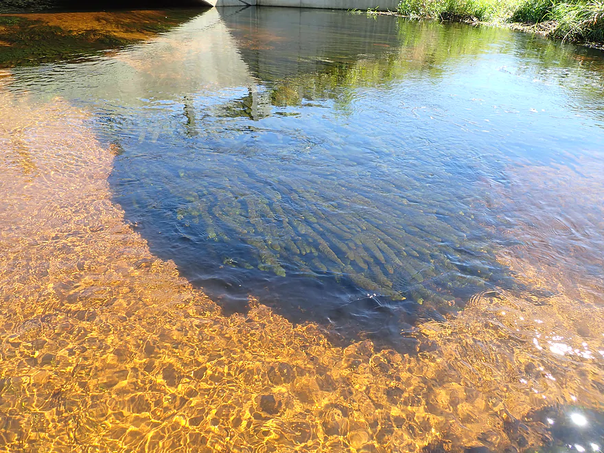
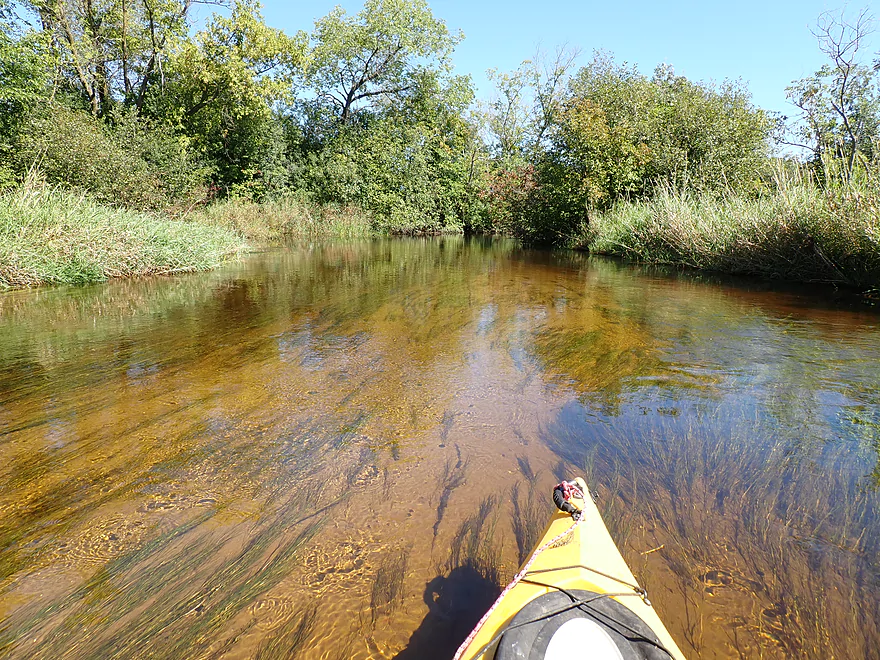
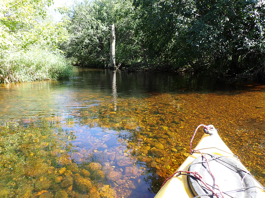
Crystal clear water (the plant might be chara, a large species of algae)
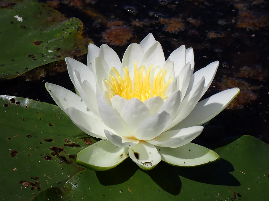
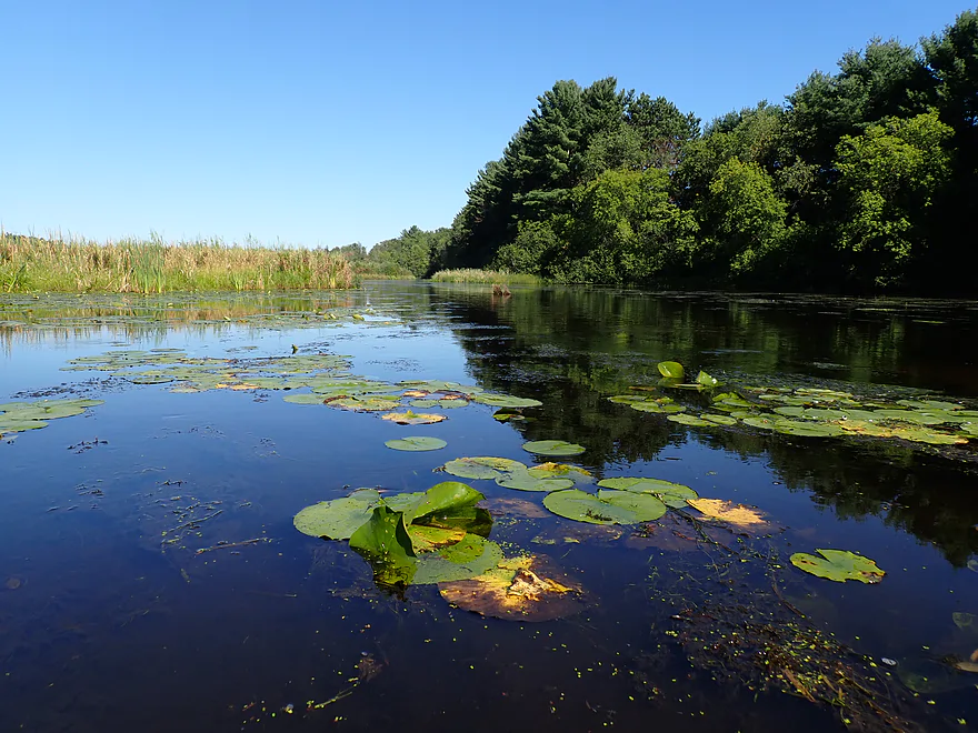
White water lily
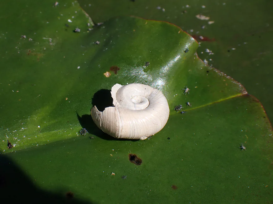
Saw a number of snail shells on the trip
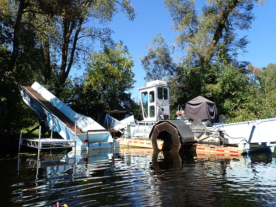
A weed eater
Reverse view
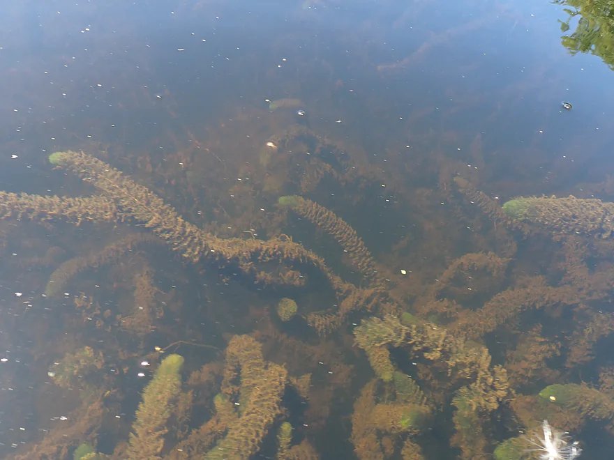
Coontail
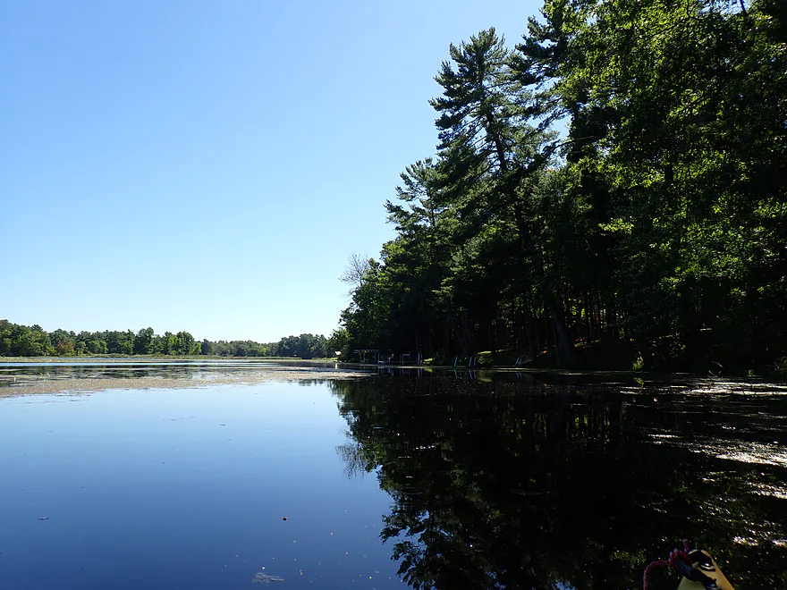
White pines on the western edge of the lake
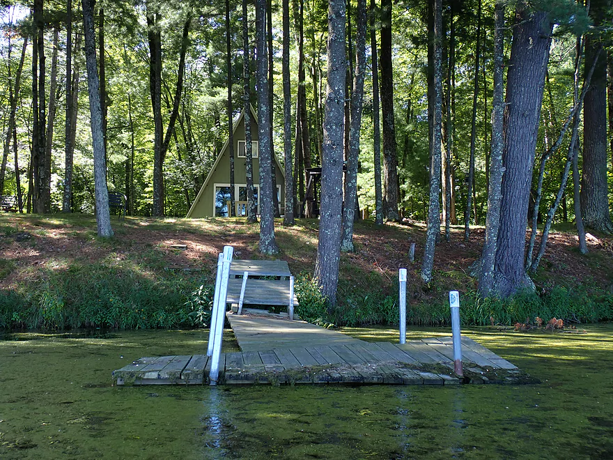
Cool summer cabins
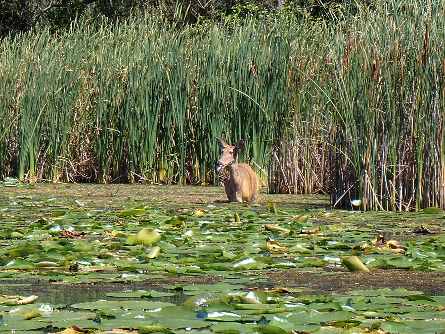
Deer snacking on lilies
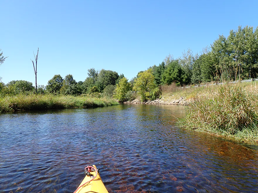
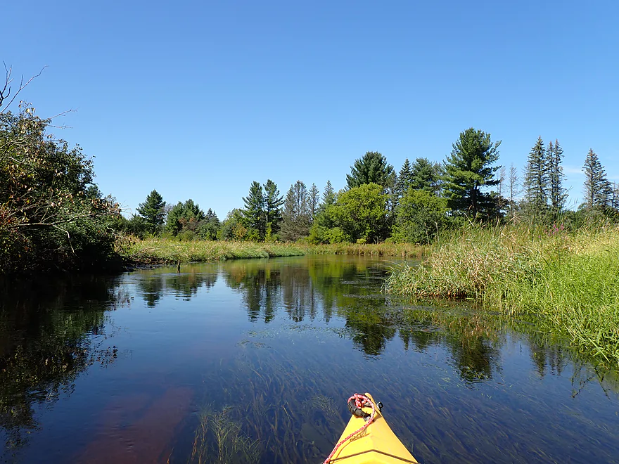
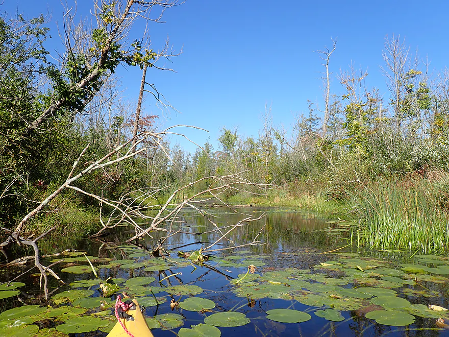
Cool little pocket
Most of the lake is kind of boring
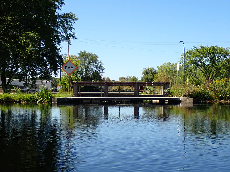
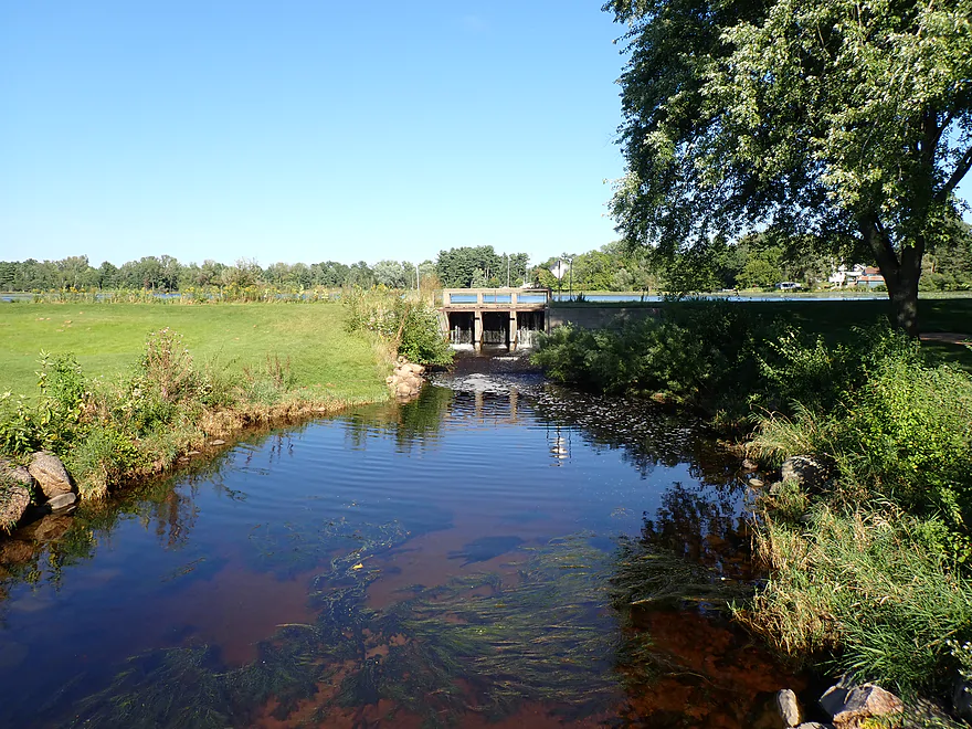
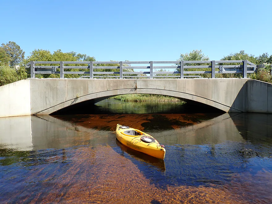
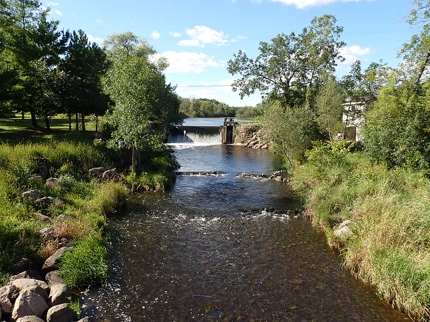
Dam is next to Veterans Memorial Park
Cool rocks
Easy portage
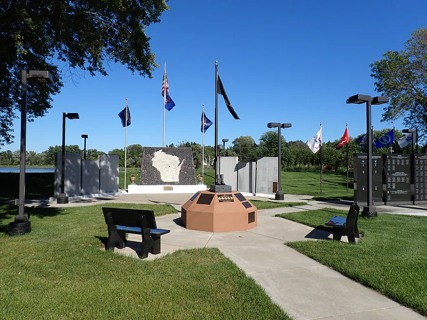
Dam is next to Veterans Memorial park
You can reenter on the right side or cross the dam and launch from the bank
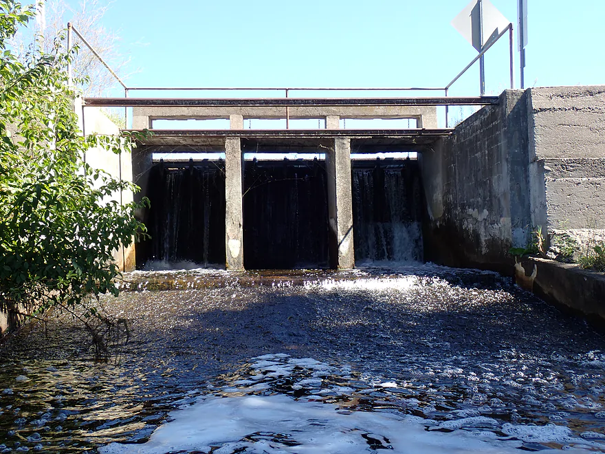
Right gate is leaking
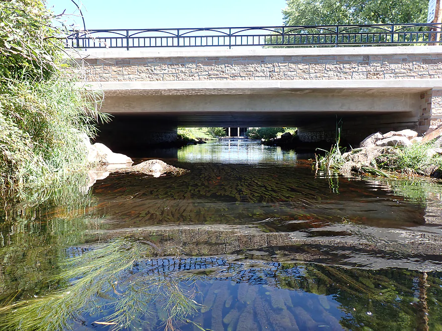
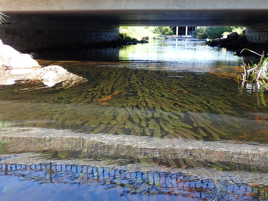
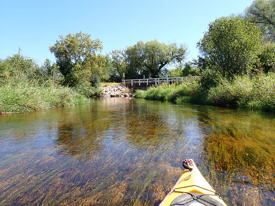
Paddling under Main Street
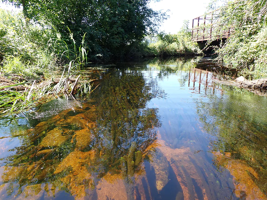
Really clear water
More coontail
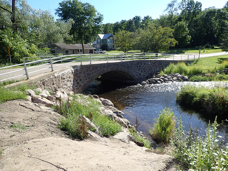
This bridge is part of the River Walk Trail, which runs adjacent to the river for a half mile
The historic Iola Mill and mill race
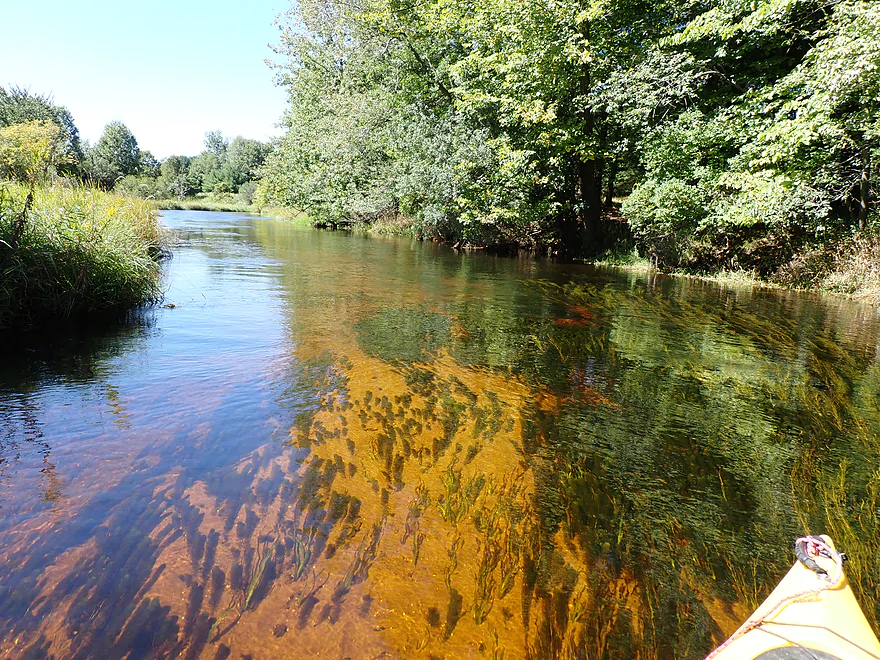
So many aquatic weeds
Attractive sand/gravel substrate
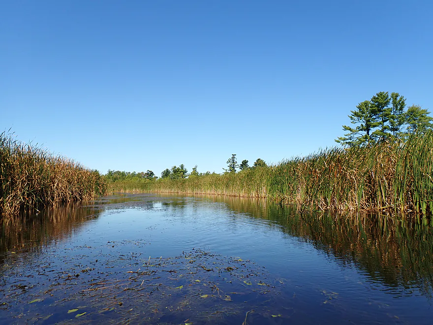
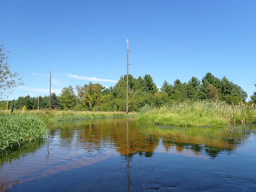
Town LIne Road
Incredible clarity
Reverse view of bridge
Really reminded me of the Mecan River
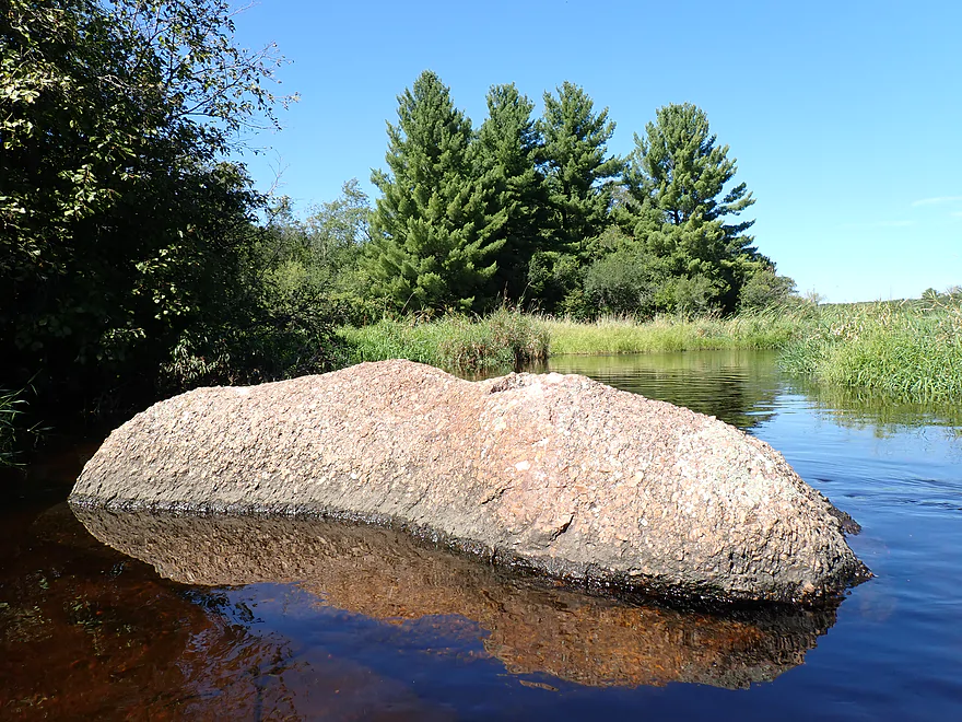
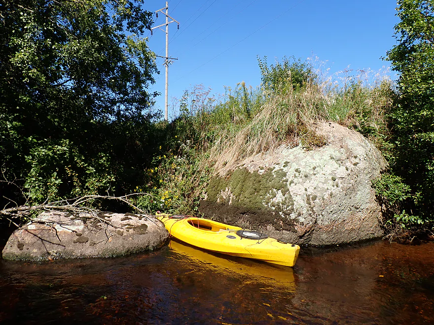
Granite boulder…likely a glacial erratic
Hwy G
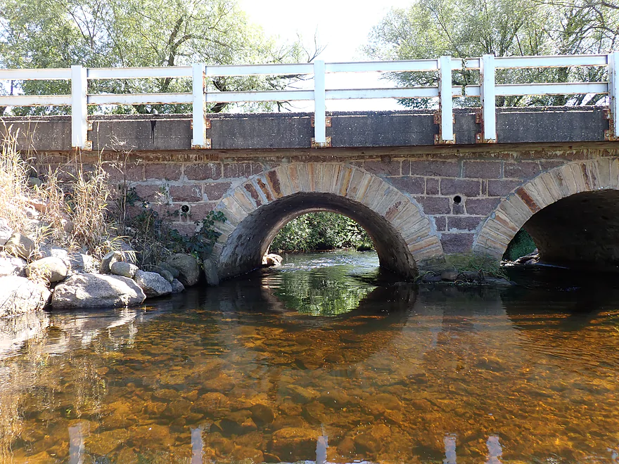
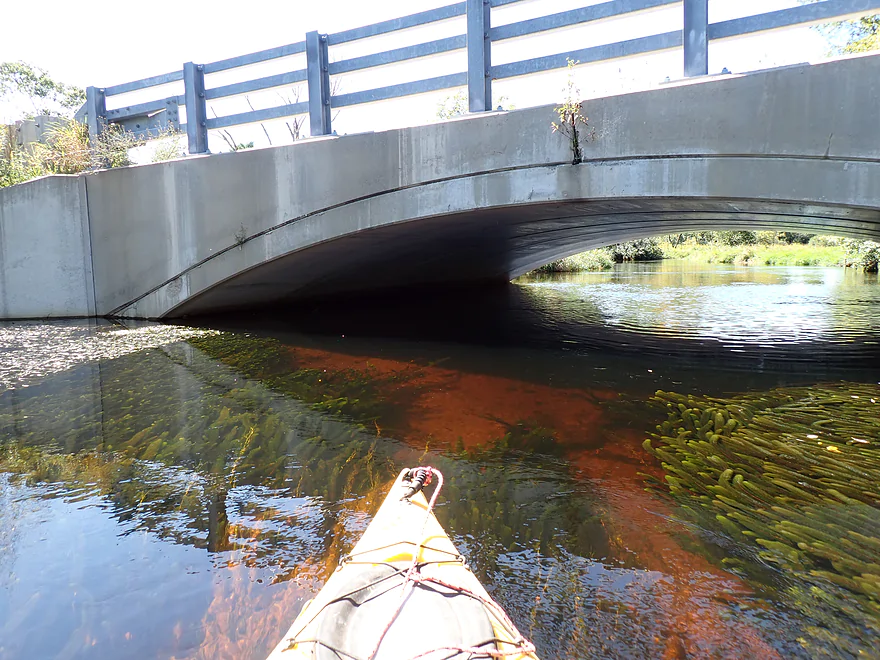
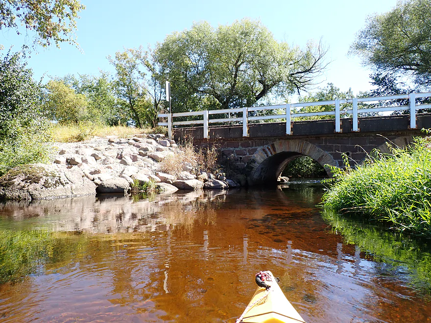
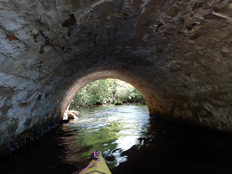
Fantastic stone arch bridge
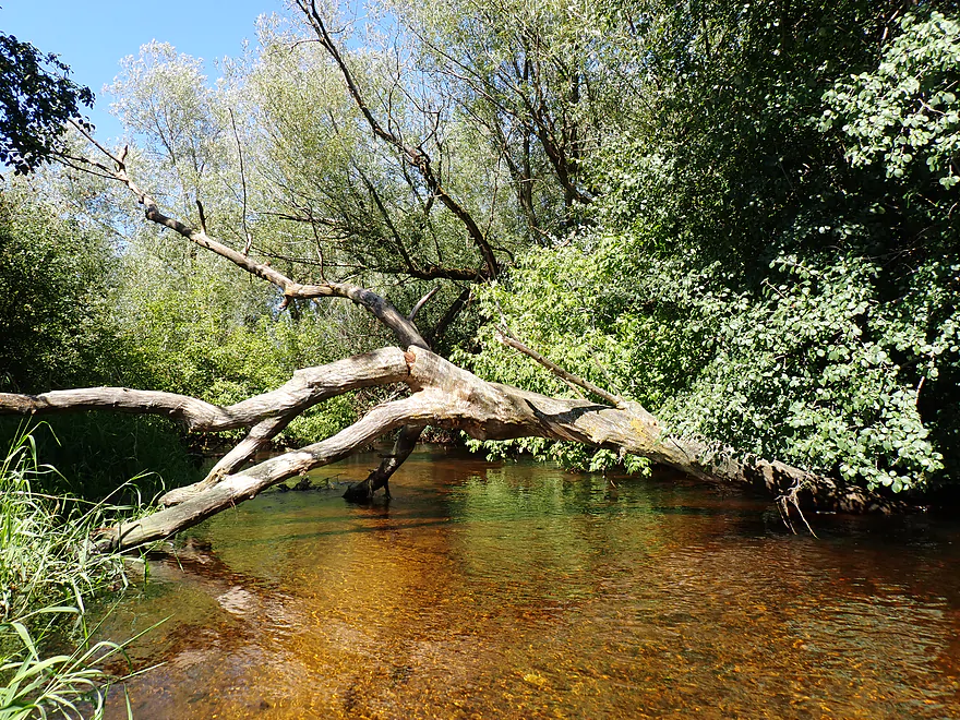
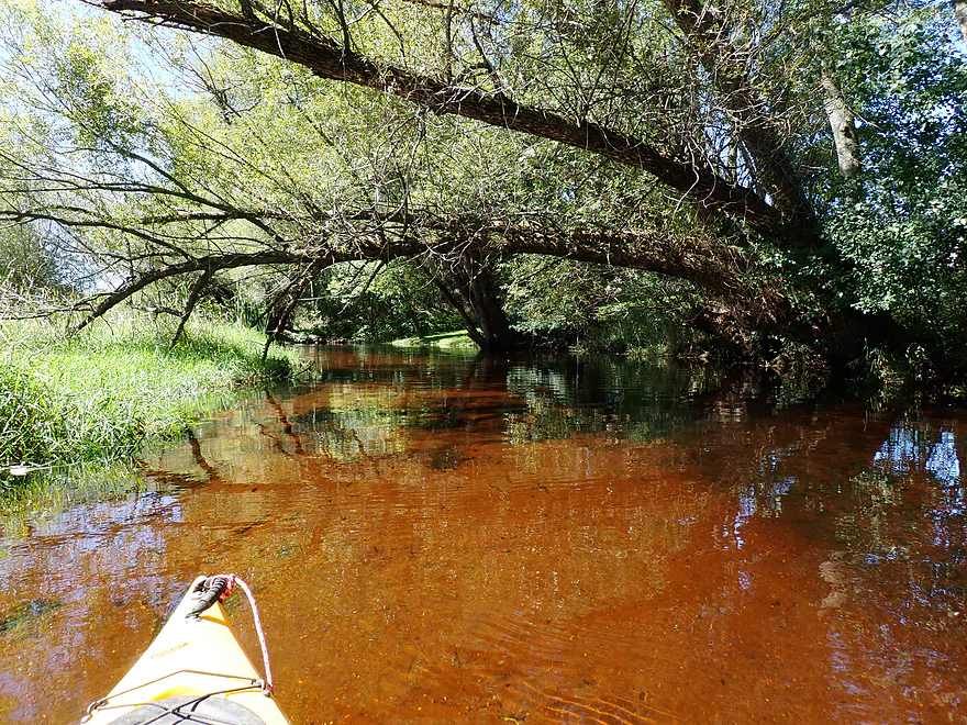
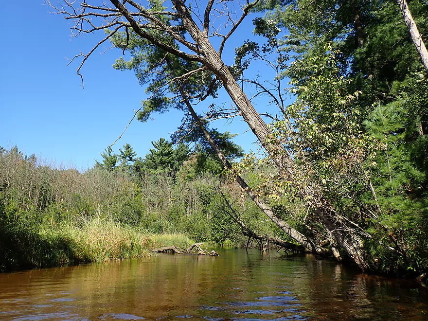
Some low trees after the Hwy G bridge…but always a way through
Some big boulders
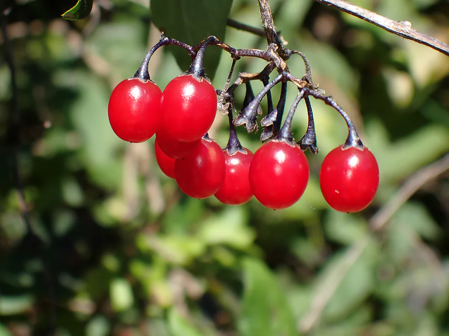
Some ripe nightshade berries
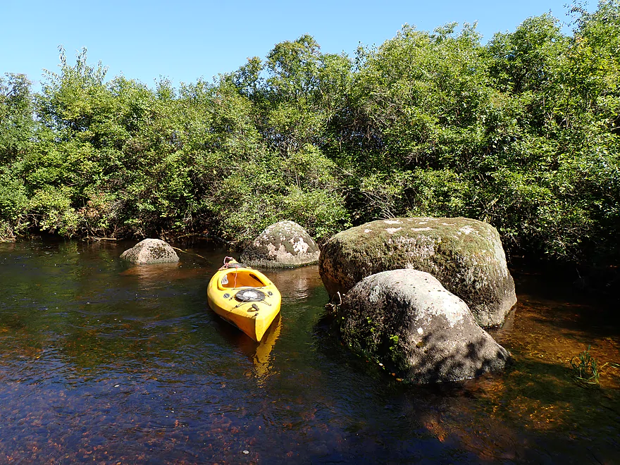
Another collection of boulders
This little stretch reminded of the main branch of the Little Wolf
Substrate getting rockier
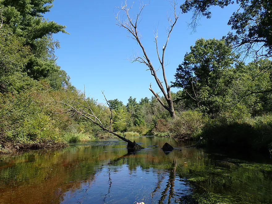
Floating on air
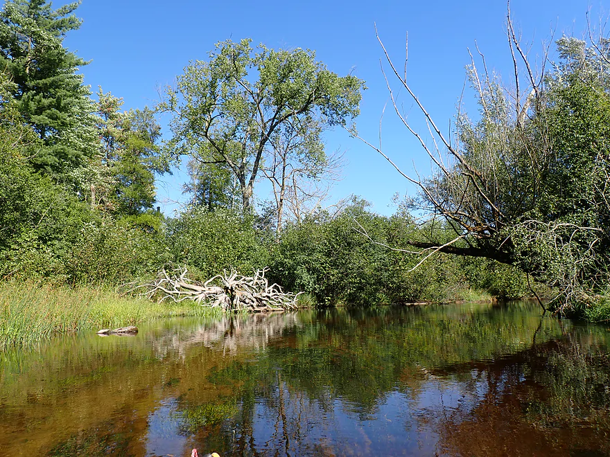
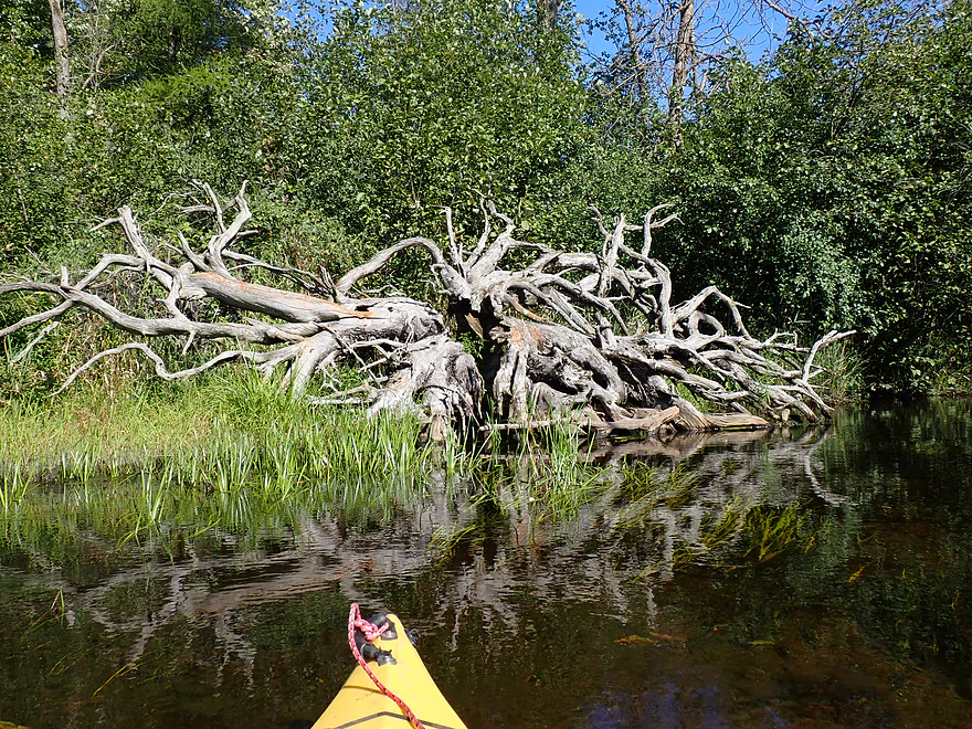
Octopus roots
Outlet stream of spring-fed Myklebust Lake, a State Natural Area
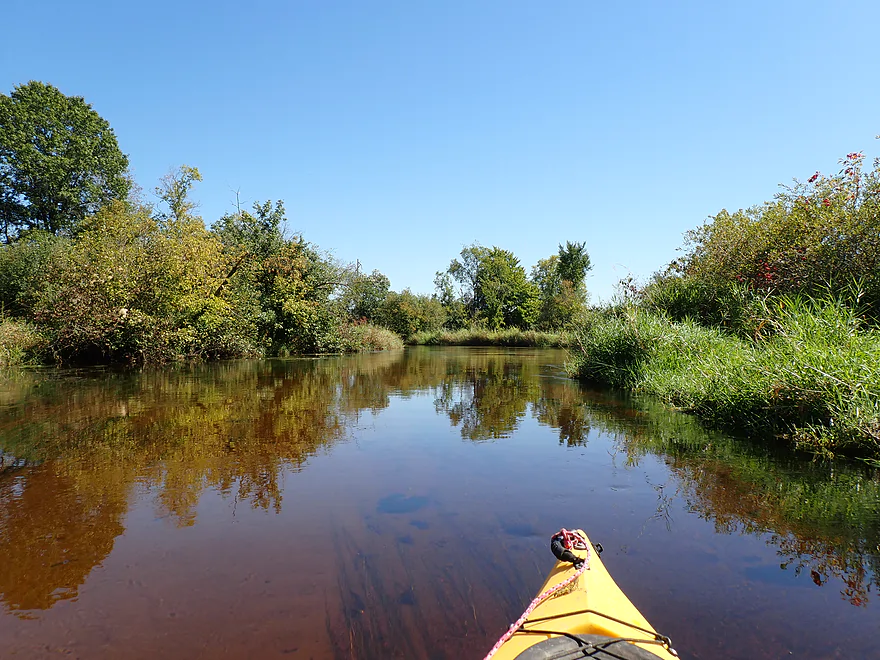
Final approach
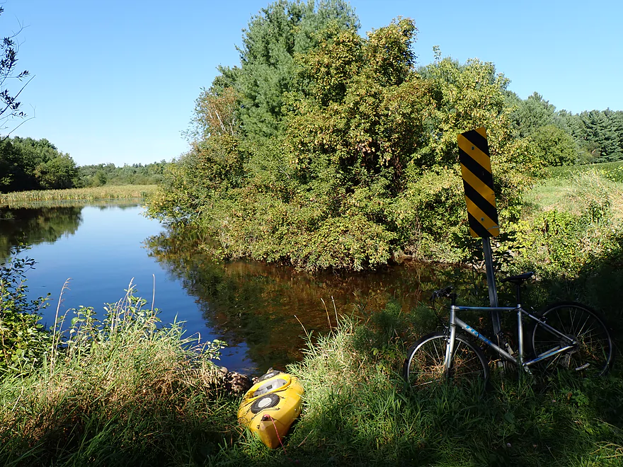
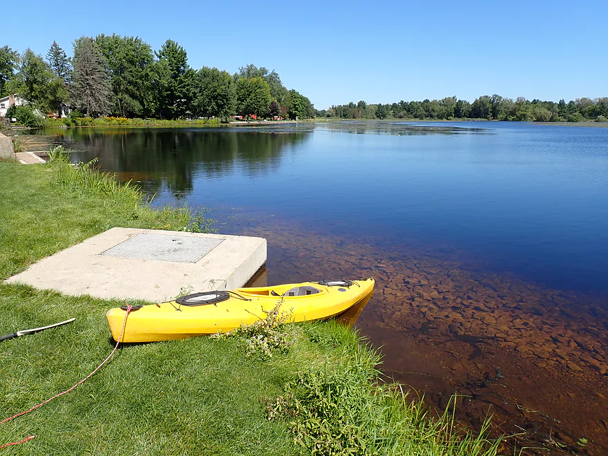
Taking out at Weinmann Road
Eating dinner after the trip at the Iolas Mills
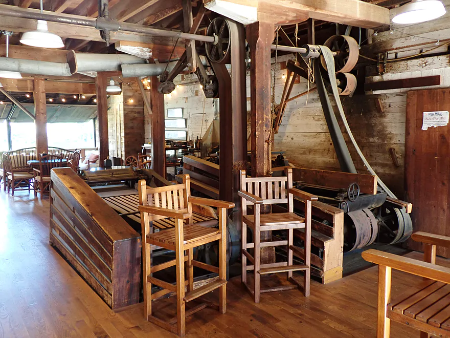
You can tour the the historic mill which is connected to the cafe
Scouting other options…this is the dam at Scandinavia
Rapids and attractive bridge just below the dam
Little Wolf – South Branch – Iola

The Little Wolf is a famous Central Wisconsin river known for its boulder gardens and fun rapids. Less well known is its much tamer sibling, the South Branch. I did a trip on its lower leg in 2020, which was nice, so my plan this time was to check out a stretch further upstream.
My initial plan was actually to paddle from Scandinavia to Q, but after scouting several bridges, I was a bit concerned about the deadfall, fast current, and high water (it had recently rained). I changed my plans on the spot and decided to paddle the preceding leg by Iola which looked more open. I launched by the Tresness Road bridge, which was a fantastic access. The low wooden bridge, backdropped by tamaracks and spruce, was incredibly scenic…very much reminding me of the Bois Brule.
The first half mile of the trip featured a narrow but attractive cattail corridor. Scenic conifers overlooked the marsh to the north with some nice “north woodsy” scenery. Current at this point was negligible…if you wanted to do round trips from Tresness you could (and I would later see two kayakers doing just that).
After this, the creek widened and spilled out into a millpond (Iola Lake). There were several huge islands which divided the lake in two, but weed growth was intense and neither channel seemed open, which had me worried. I opted to “bushwhack” south, but in hindsight going north of the islands might have been better. It wasn’t so terrible…there was enough depth to get through and my kayak cut through the plants, but I constantly had to dislodge weeds from my paddle, which grew tiresome. Close to Lake Shore Drive I passed a parked weed eater, and coincidentally thereafter the rest of the lake paddle was open and navigable. I suspect weeds are only an issue in later summer and fall…my Labor Day weekend paddle was likely just bad timing. Live and learn.
Past the large islands, I continued south down Iola Lake along water paths artificially cleared of weeds (like shoveled paths through the snow). Iola Lake had some nice marsh plants and good water clarity but honestly, wasn’t too exciting. The southwest bank was developed with small vacation homes and I saw a few motorboats, but they were mostly constrained by the aquatic weeds.
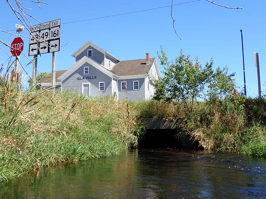
A series of flags marked Veterans Memorial Park, a dam, and the lake outlet. The portage proved pretty easy and I was soon back on moving water again. In hindsight I should have started my trip here to avoid the lake paddle. Again, live and learn. To the north was a small millrace which was backdropped by an old mill house(more on this later).
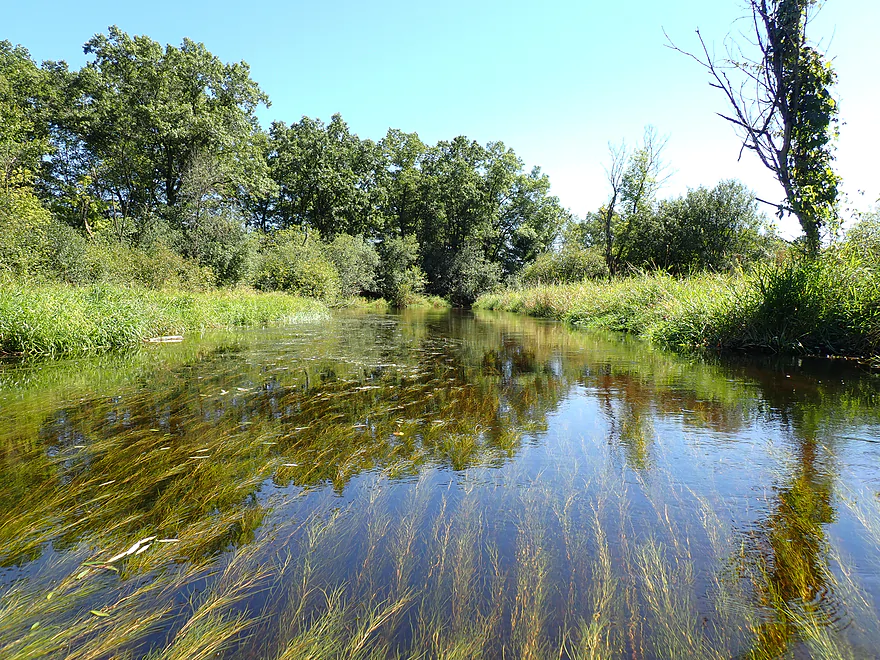
It was so nice to see a river (well, creek) again after so much uninteresting pond paddling. What impressed me now was the water clarity. It wasn’t just good, it was exceptional. It was great fun zipping over the red clear water and being able to see the sand-gravel substrate, snails, and minnows scurrying around below. The only downside was the excess weed growth (perhaps caused by upstream nutrient pollution), but even this proved attractive combined with the clear water and current.
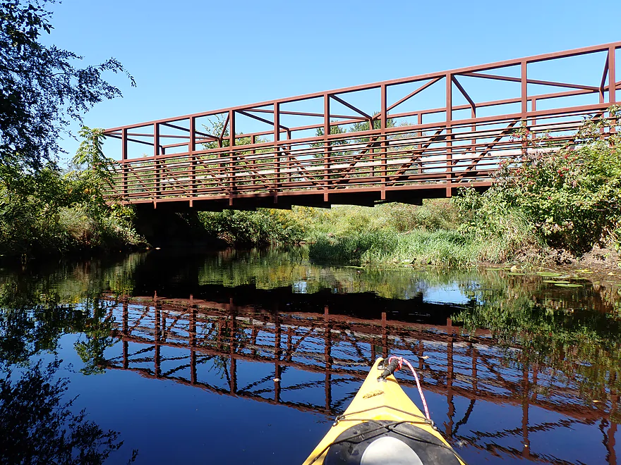
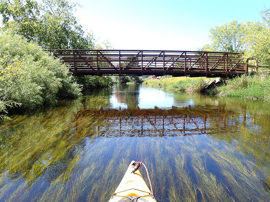
The other highlight were the attractive bridges that crossed the river. I’m not sure if there is another stream in the state that has so many postcard-caliber bridges. The five most photogenic bridges are Tresness Road, Town Line Road, Hwy G, Mill Street, and Bigalke Road.
Past the arched Town Line Road bridge, I left the town of Iola behind. The scenery became more remote and undeveloped (aside from nearby Hwy 161). Much of this reminded me of the Mecan River. The channel was small, but twisty with incredible clarity and occasional conifers in the distance. I was surprised to encounter two other kayakers (a father/son pair). I asked the father if you could get to Scandinavia without portaging, and he said there were low trees, but you could usually duck under them. He wasn’t so sure now though because of the recent rain.
Close to Hwy G, I started seeing large granite boulders in the water (likely glacial erratics). Hwy G itself was a gorgeous stone arch bridge and seemed like a viable alt access. The river really changed after Hwy G. The current picked up speed, narrowed, became more wooded, and small boulders started to become more common. I was worried that the tree cover would mean logjams, but the locals do a great job of keeping this stretch cleared out and open. There were some “duckers”, but nothing really that challenging. Water clarity was still terrific.
Near the end of the trip I passed the outlet stream for Myklebust Lake State Natural Area which seemed intriguing, but I assumed reaching the lake wasn’t viable because of congestion and weed growth. The lake is spring-fed and has a marl (calcium carbonate) bottom, so could be interesting.
I ended the day at Weimann Road, which was a decent bridge access. I was surprised to bump into a family fishing here as well as a kayaker taking out. I think this is more of a Labor Day exception, as typically I doubt that many people use the creek.
In summary this was a great trip…minus the Iola Lake paddle. Even Iola Lake wasn’t awful, aside from an annoying stretch of weeds. The highlight though was the river downstream from the Iola dam. In hindsight I should have launched there and taken out at the Scandinavia dam, which would have been a great trip. I awarded this trip five stars, despite being self-conscious about giving out too many five star reviews and creating star inflation. But water clarity this exceptional is rare, even for Central Wisconsin, and justified IMO a high ranking.
Sights included damselflies, cranes, lots of snails, some clams, one painted turtle, a great blue heron, and countless small fish (but no big fish). On Iola Lake there was a deer that had waded into the lake and was eating marsh plants, which I found amusing. The highlight were the green herons, which were very active along the river.
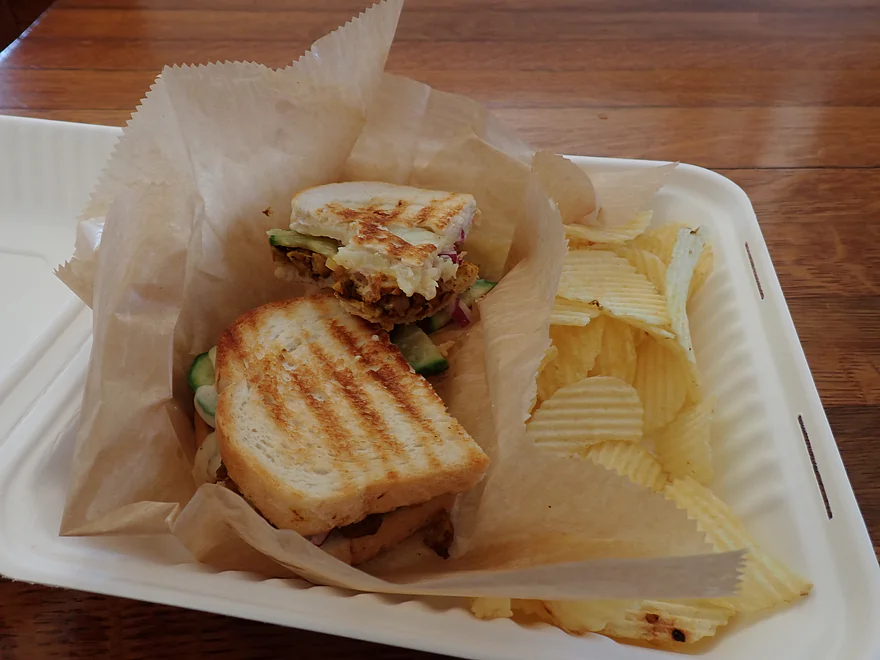
Iola Mills: At the bottom of Lake Iola is a dam and historic millhouse. The mill has been restored and the owners do allow the public to visit it. Here you can see the historical gear assembly and hear the millrace rumble under the building. The mill is connected to an adjacent cafe. I had their Moroccan panini and their basil gelato which was really good.
Tresness Road: This is a terrific shoulder access with evidence that other kayakers and fishermen use this spot. It’s also very scenic and reminded me of the Bois Brule. Note, you should only launch here if you want to include Lake Iola on your trip…most paddlers I suspect will find it a bit boring and will prefer to stick to the river instead.
Alternate Put-ins:
- Iola Veterans Memorial Park (2.2 miles downstream from Tresness Road): It would be easy to use the adjacent park as an access. There are a few rocks to climb down, but it’s not bad. Note, don’t park in the Post Office parking lot (customers only), but instead park on the street where there is shoulder access. I believe most paddlers will prefer to launch here to avoid the preceding lake, which isn’t as interesting.
Weinmann Road: This is a good bridge access. Note, don’t park in the northeast corner…that is reserved as a fire truck zone. Instead park along the northwest corner.
Alternate Take-outs:
- Hwy B (1.6 miles downstream of Weinmann): I didn’t scout this in depth, but I drove over and it seemed like a viable bridge access. This bonus leg should be a good prospect and I believe free of logjams.
- Scandinavia Dam (2.2 miles downstream of Weinmann): You can take out on the east shore by the library. This would include a half mile more of impoundment paddling which shouldn’t be bad. I suspect most paddlers will start their trips at the Iola Dam (Memorial Park) and take out at the Scandinavia Dam, which would be a great trip.
Bike Shuttle – Weinmann Road to Tresness Road: 4.9 miles with 102′ of ascent. I thought this was a relatively easy bike shuttle with only a few hills to deal with. Note, the cafe “Iola Mills” is on the shuttle route. Given 10-15 minute cook times, you could in theory order while bike shuttling north, and then pick up your food with your car when returning south.
Fences/Low Bridges: None.
Logjams: Nothing had to be portaged…the locals do a good job of keeping this stretch open. Note, there are a few situations in which you have to duck under downed trees, but I didn’t find this difficult (most “duckers” are located just downstream from Hwy G).
Rapids: There are some fast sections and light riffles below Hwy G, but nothing major. This is plenty suitable for beginners.
Gauge: Little Wolf @ Royalton
Trip Depth: 1.91′
Navigability Estimates: This gauge is located very far downstream on the Little Wolf River (combined branches) so may not be accurate. Take the following estimates with a grain of salt.
- < 1.4′: Very low depth…maybe not viable.
- 1.4′: Low depth…you might have to wade a few sections. Should be exceptional clarity.
- 1.5-1.6′: Good target range.
- 1.7-1.8′: A bit above normal. Fine for paddling.
- 1.9′: Relatively high depth but still good clarity and great for paddling.
- 2.0-2.21′: High depth…some of the clarity might be lost at this point.
- 2.22-2.23′: Very high depth…getting under some of the low-lying trees after Hwy G might be tricky.
- 2.24’+: This might be too high for kayaking.
- Upstream of Madison Road: I don’t know much, but suspect there are sections up here that can be paddled.
- Madison Road to Tresness Road: 1.2 miles. Narrow, wooded with perhaps some nice pine trees. I don’t know much…could be a logjam or two. Tresness Road bridge is too low to get under so would have to be portaged.
- Tresness Road to Weinmann Road: 6.5 miles.
- Tresness Road to Veterans Memorial Park: 2.2 miles. This is mostly Lake Iola. It’s a mediocre lake with some nice marshy spots, but is nothing special. In later summer and fall, the upper portions can experience abundant weed growth which can make navigation difficult.
- Veterans Memorial Park to Town Line Road: 0.5 miles. Attractive stretch flowing through the outskirts of Iola. Highlights included nice bridges and great water clarity.
- Town Line Road to Hwy G: 2.0 miles. River opens up. This is a great stretch with exceptional water clarity.
- Hwy G to Weinmann Road: 1.6 miles. Good stretch that is more wooded, but still has great clarity. Some deadfall, but locals keep it navigable and no portaging is required. This leg features some faster current and some large granite boulders.
- Weinmann Road to Hwy B: 1.9 miles. From my scouting this looked really really nice. For those wanting to start in Iola, this would be a great bonus leg to include.
- Hwy B to Scandinavia Dam: 0.6 miles. This is Scandinavia Mill Pond, which is a generic impoundment…not super interesting, but not awful.
- Scandinavia Dam to Hwy Q: 1.9 miles. This is more wooded with some faster current, some rapids, and boulder gardens. Has a ton of potential, but there are likely a few logjams to deal with.
- Hwy Q to Hwy 49: 0.5 miles. Scenic leg, but maybe 1-2 logjams. Peterson Creek adds significant volume to the South Branch.
- Hwy 49 to Elm Valley Road1st Bridge: 3.4 miles. A really neat prospect with some boulders and rapids. Pretty wooded with perhaps 2-3 logjams.
- Elm Valley Road1st Bridge to Elm Valley Road2nd Bridge: 0.8 miles. A more wooded and congested section…with maybe 7 logjams.
- Elm Valley Road2nd Bridge to Elm Valley Road3rd Bridge: 0.9 miles. Maybe 2 logjams.
- Elm Valley Road3rd Bridge to Granite Quarry Road: 2.0 miles. Maybe 15 logjams.
- Granite Quarry Road to Casey Road: 2.1 miles. Maybe 18 logjams.
- Casey Road1st Bridge to Casey Road2nd Bridge: 3.5 miles. Maybe 8-12 logjams.
- Casey Road2nd Bridge to Sunny View Road: 1.3 miles. Maybe 1-2 logjams.
- Sunny View Road to Hwy K: 3.4 miles. A more wooded stretch with maybe 3-4 logjams.
- Hwy K to Hwy 22/110: 6.2 miles
- Hwy K to N. Military Road: 1.3 miles. Nice stretch that is more wooded. No portages, but four downed trees require some tight fits.
- N. Military Road to Bigalke Road: 3.3 miles. More open with no logjams. This is a very nice stretch with good scenery.
- Bigalke Road to Hwy 22: 1.6 miles. Maybe the best section on the river with good scenery. There is a Class 3 chute, but this can be portaged.
- Hwy 22 to Mouth on Main Branch: 3.2 miles. Likely a few nice rapids and boulder gardens, but not too many. A good prospect…maybe one logjam.
- Mouth to Royalton Canoe Access: 2.9 miles. Now on the main branch of the Little Wolf. Mostly slow, but there is one really nice section of rapids and boulder gardens.
Trip Map
Overview Map
Video
Photos Size: