
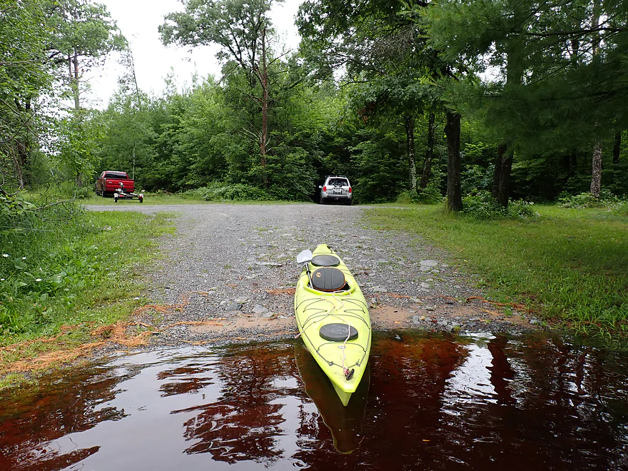
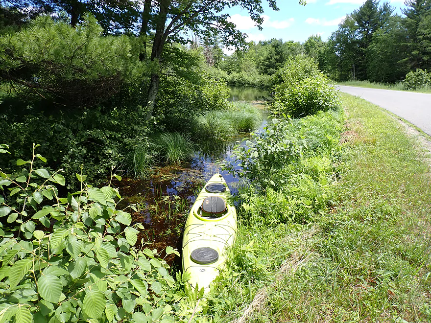
Starting the trip at Larb Lane Landing
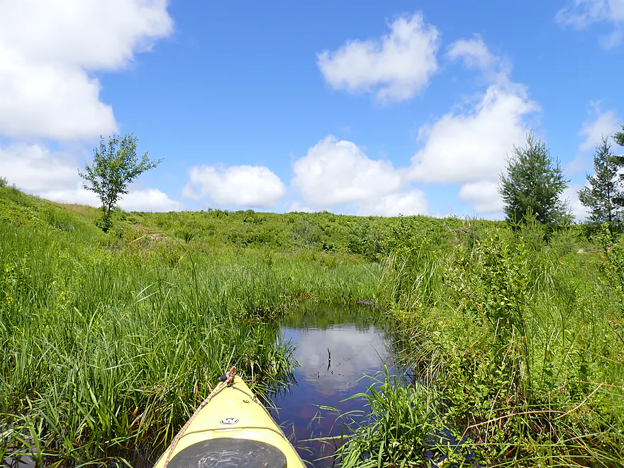
Checking out a nice gulley located nearby
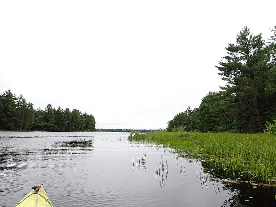
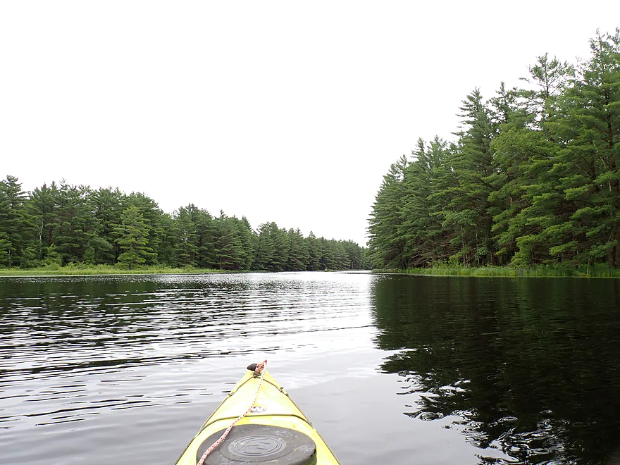
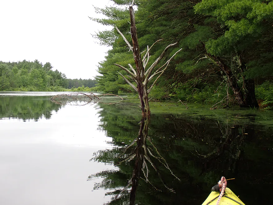
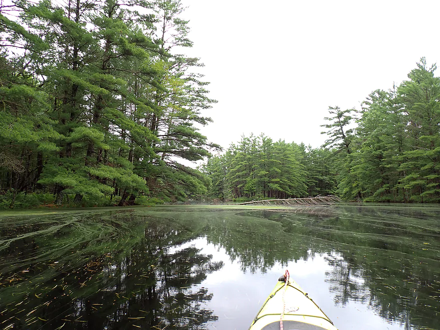
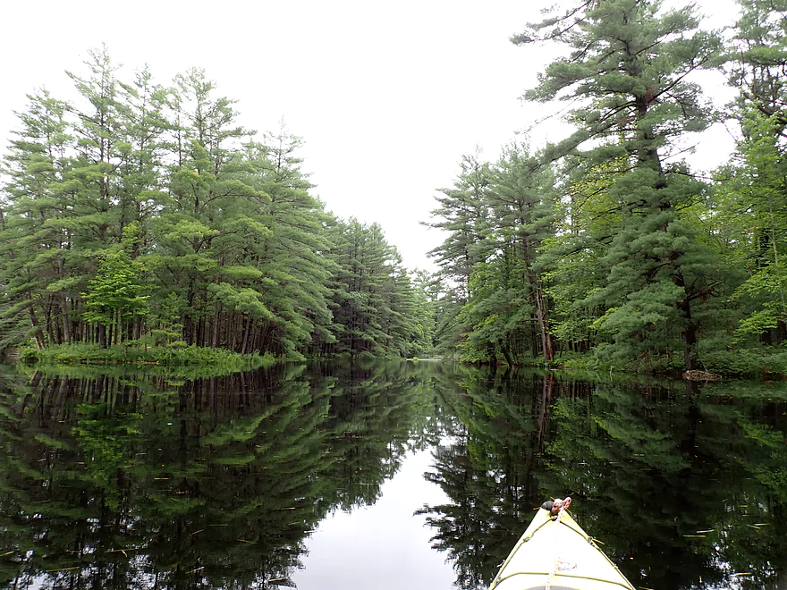
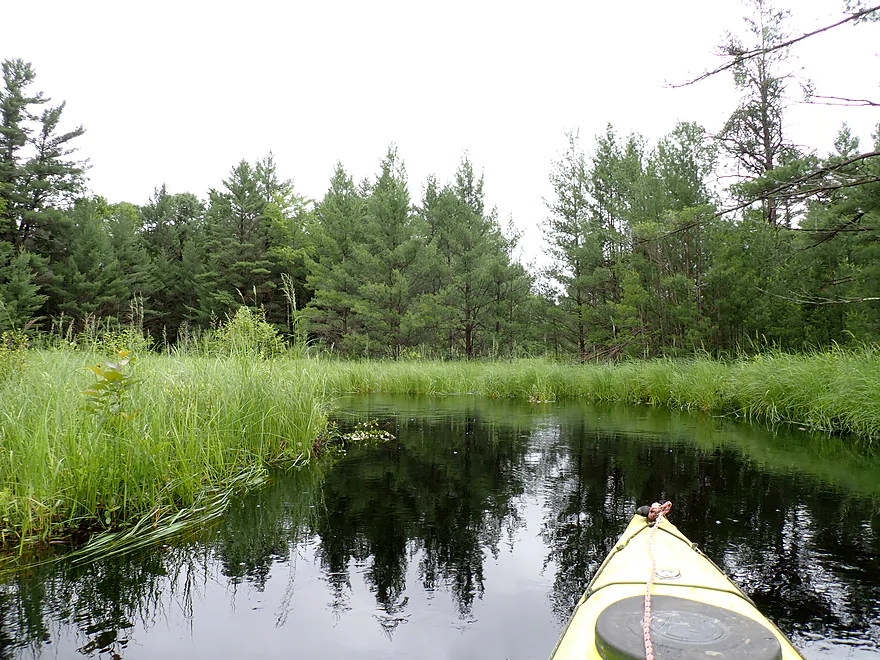
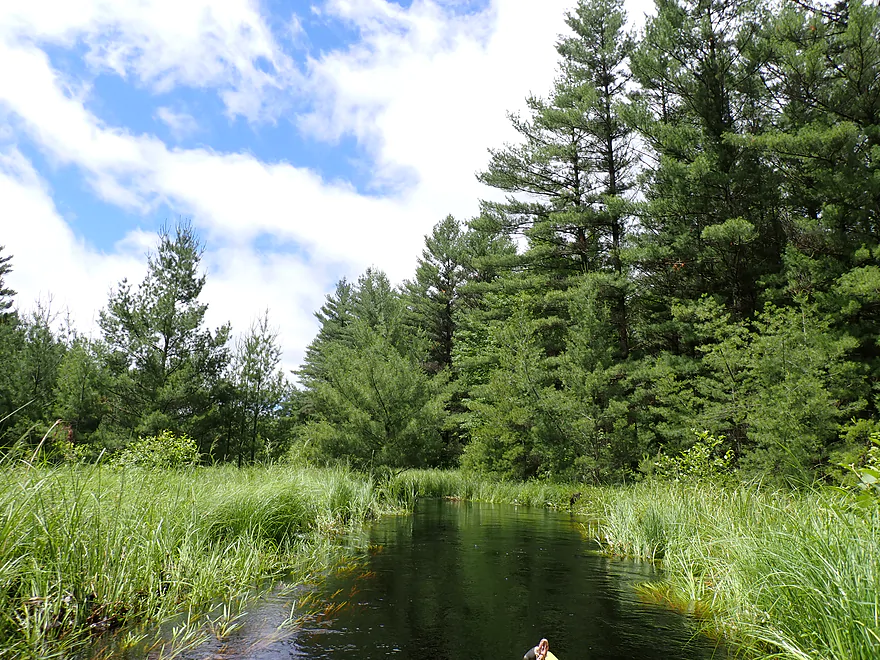
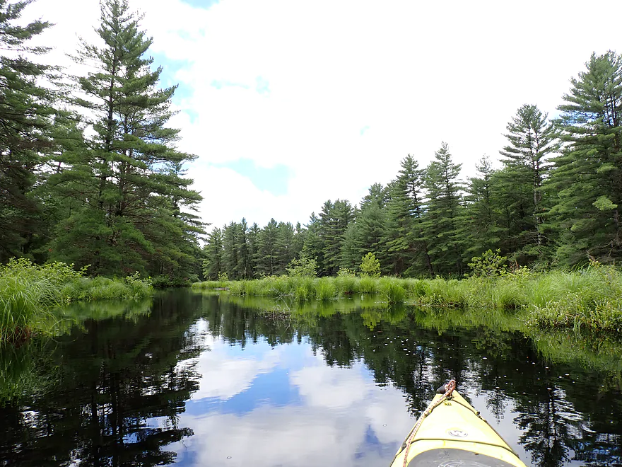
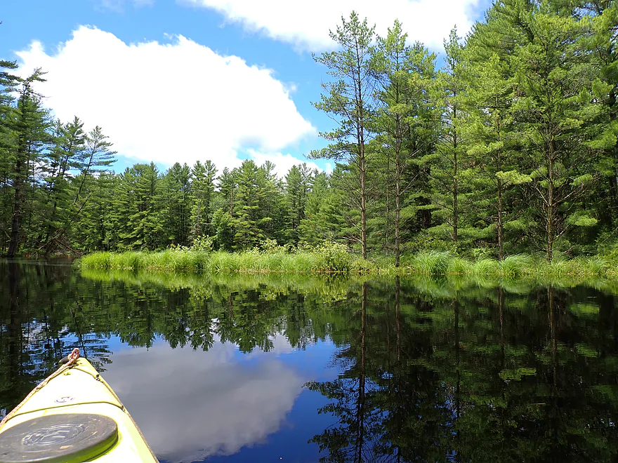
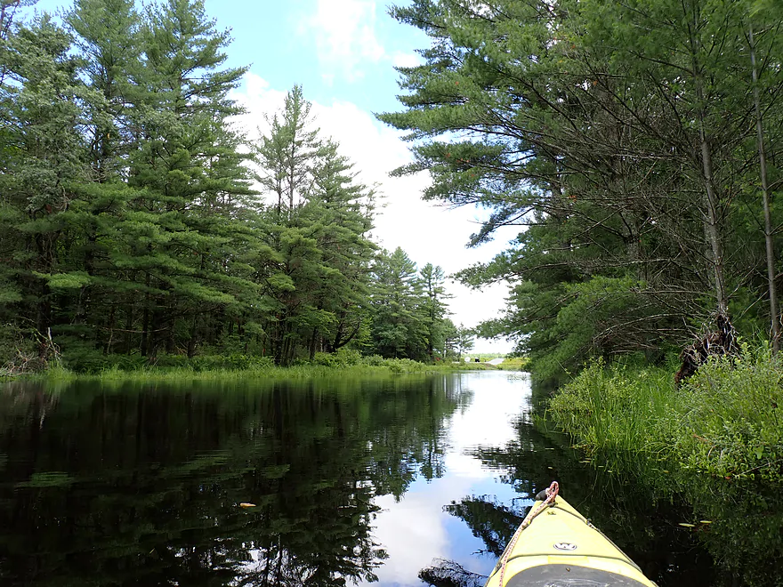
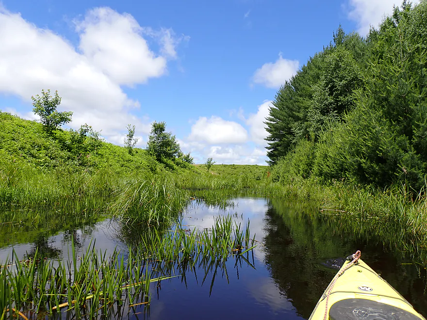
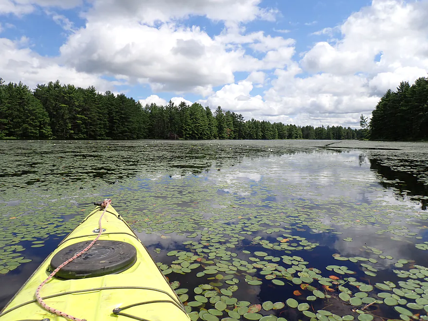
Heading north toward the main flowage
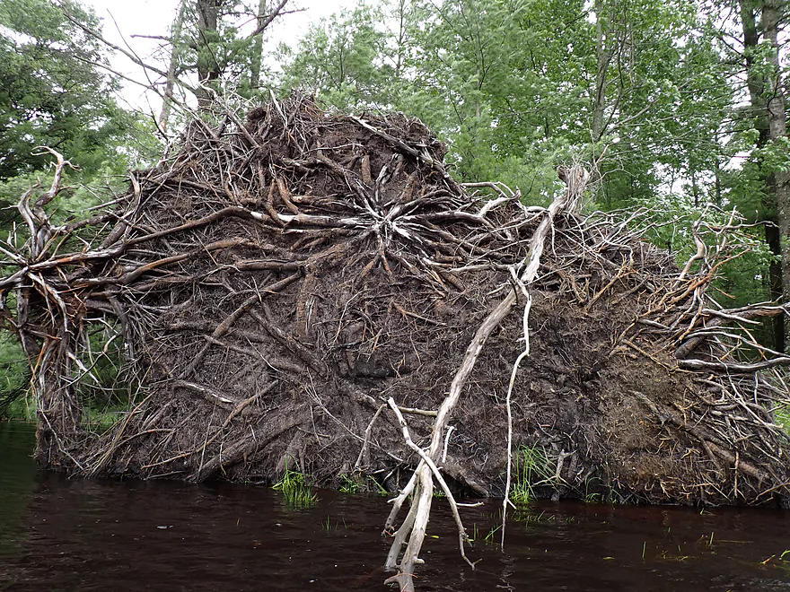
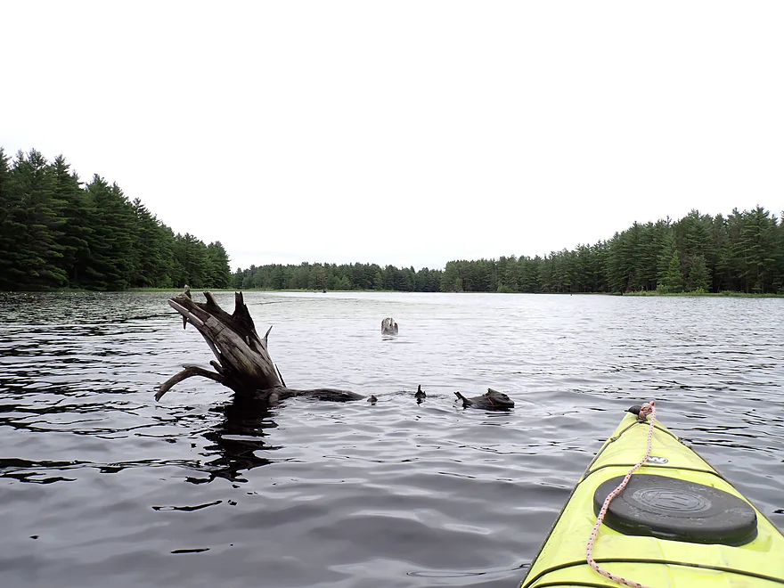
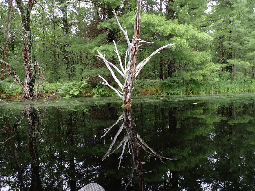
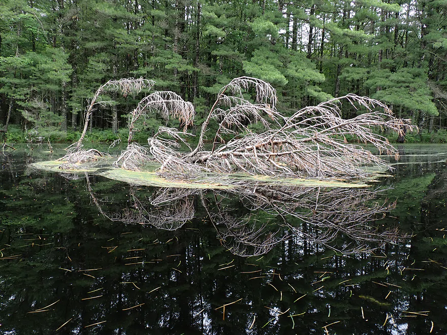
Impressive root network
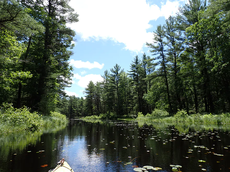
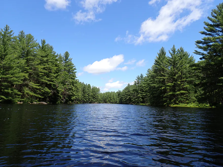
Now on the core of Potter Flowage
Heading to the east end
Some kayak campers
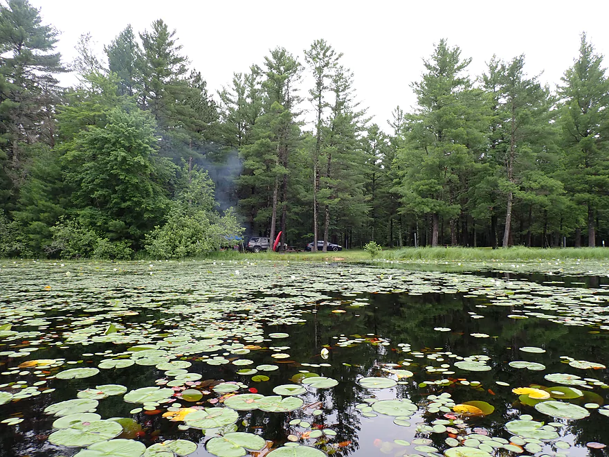
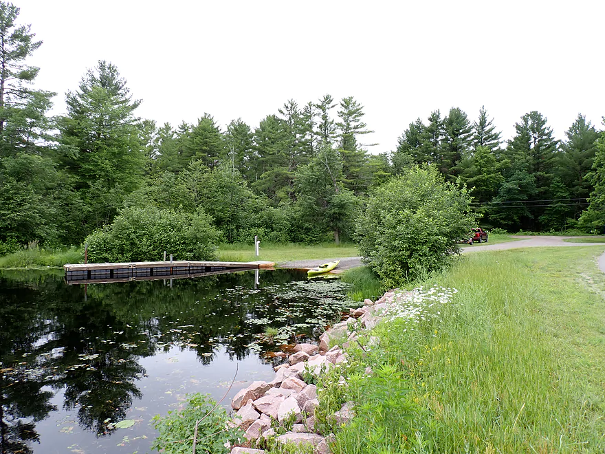
Merlin Lambert County Park has some great shoreside campsites
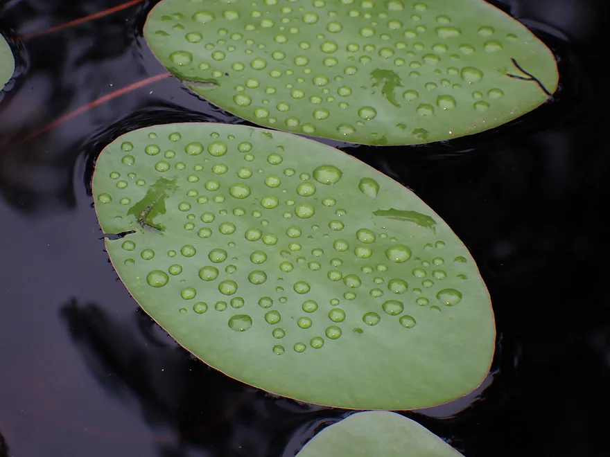
Watershield leaves covered with water droplets
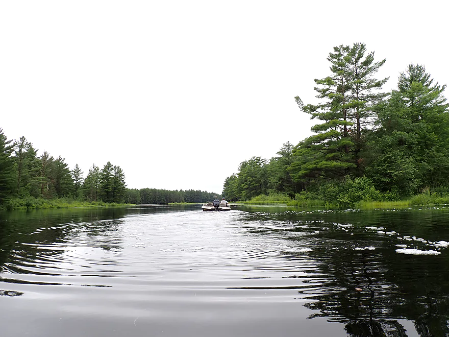
Saw some motorboats on the flowage
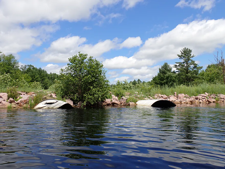
McKenna Road and submerged culverts block my passage east
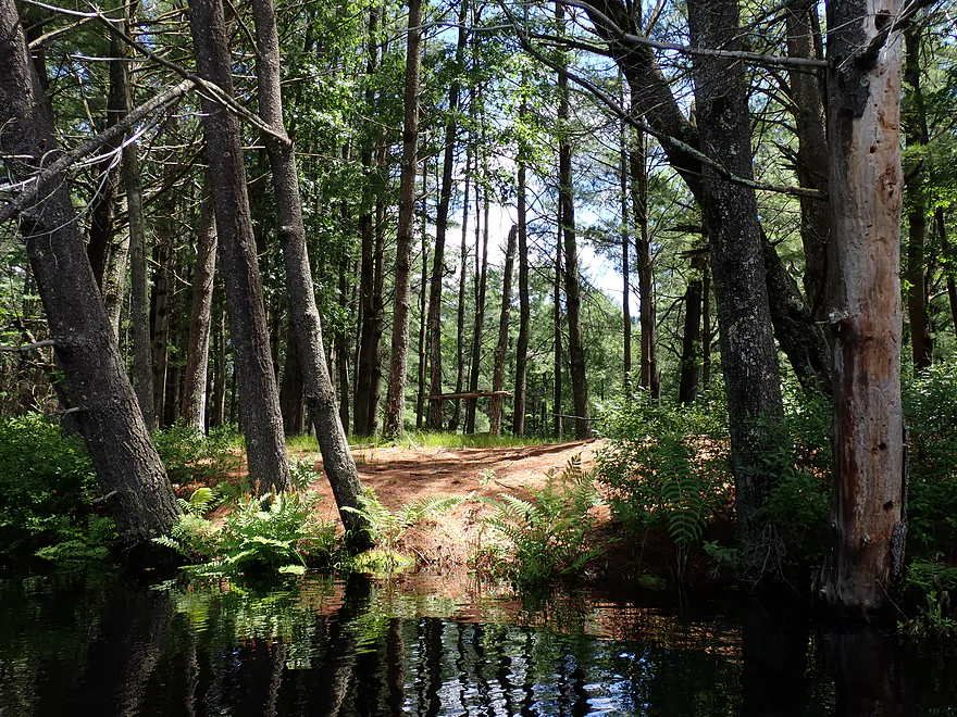
Not a problem…I was able to portage by the Merlin Landing
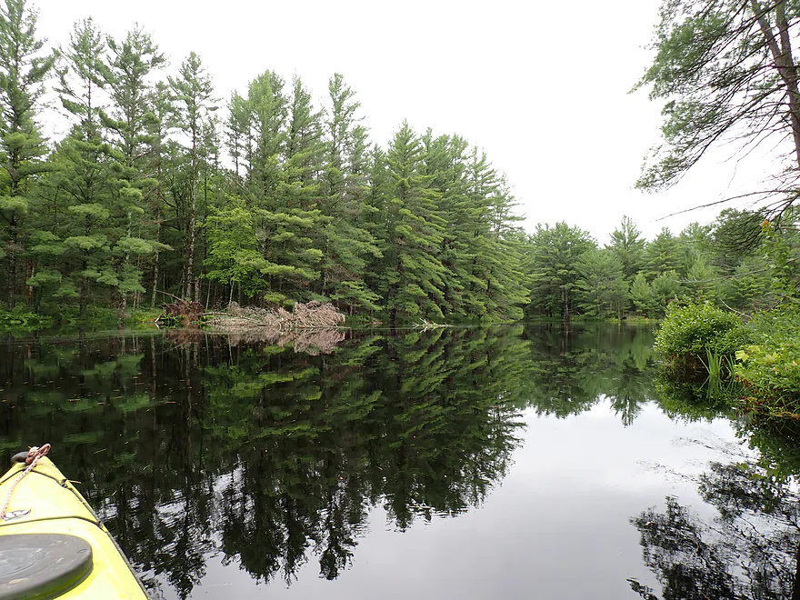
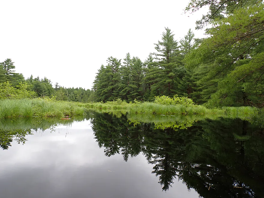
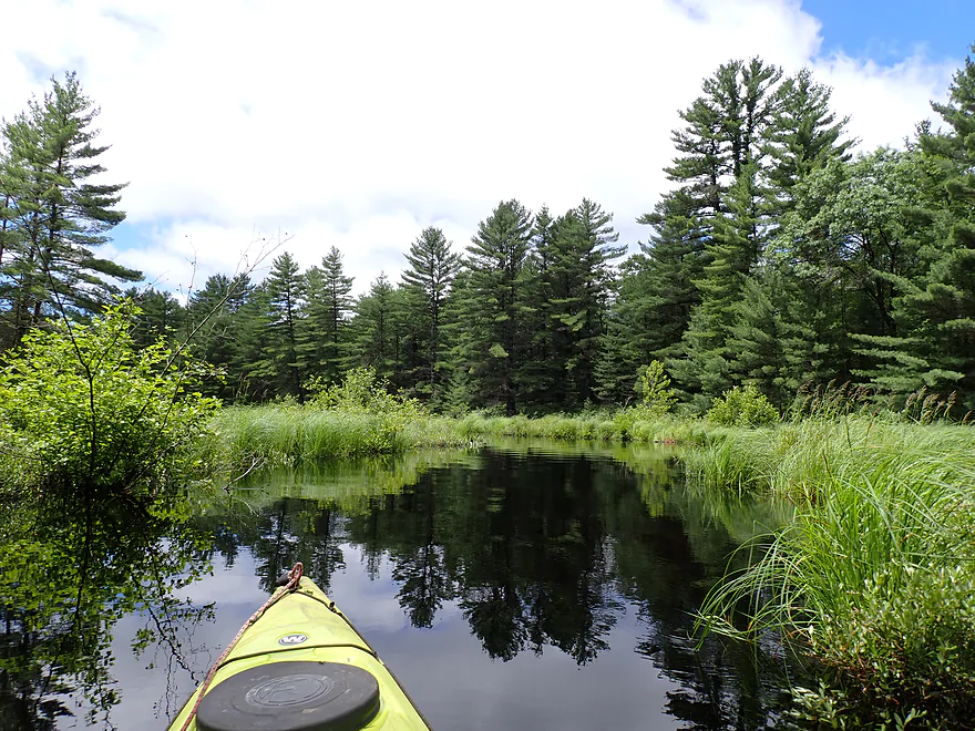
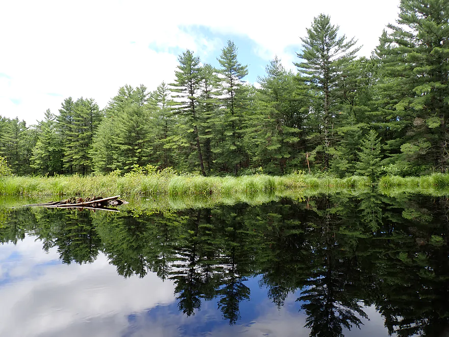
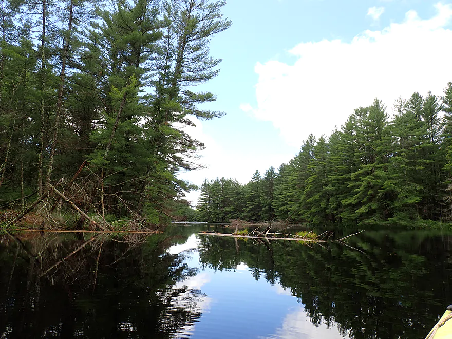
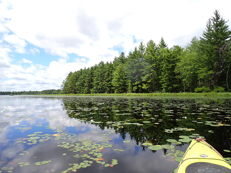
This was a great section for reflections
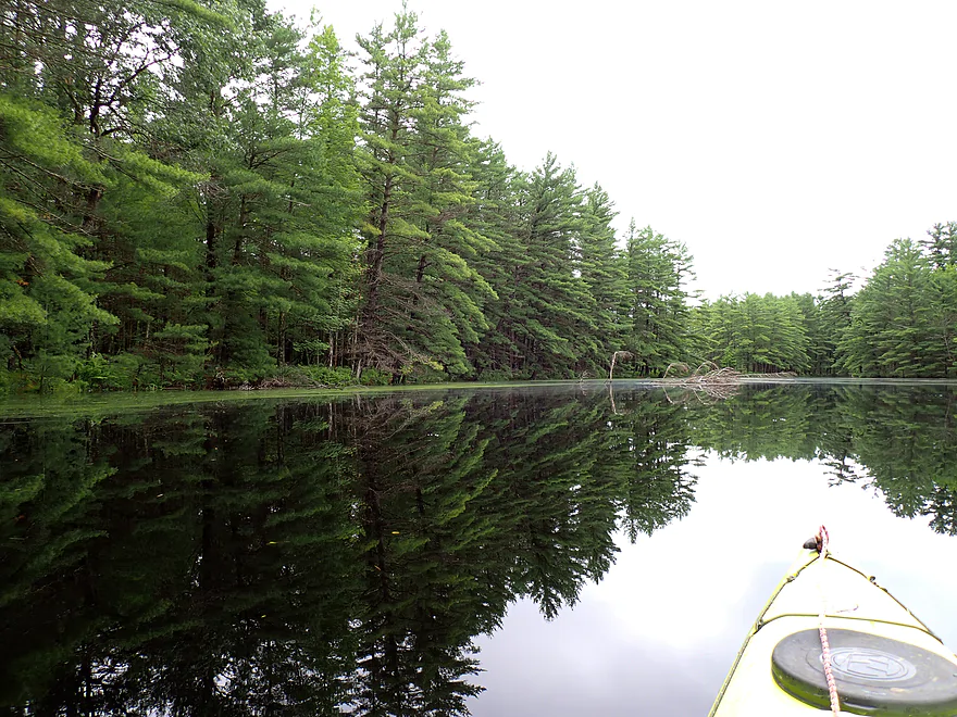
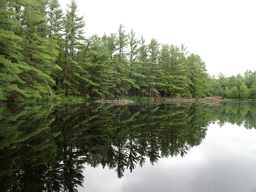
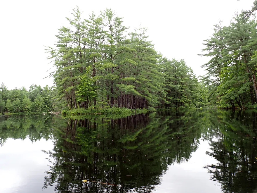
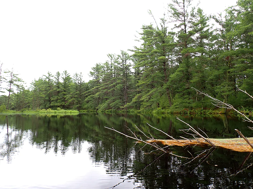
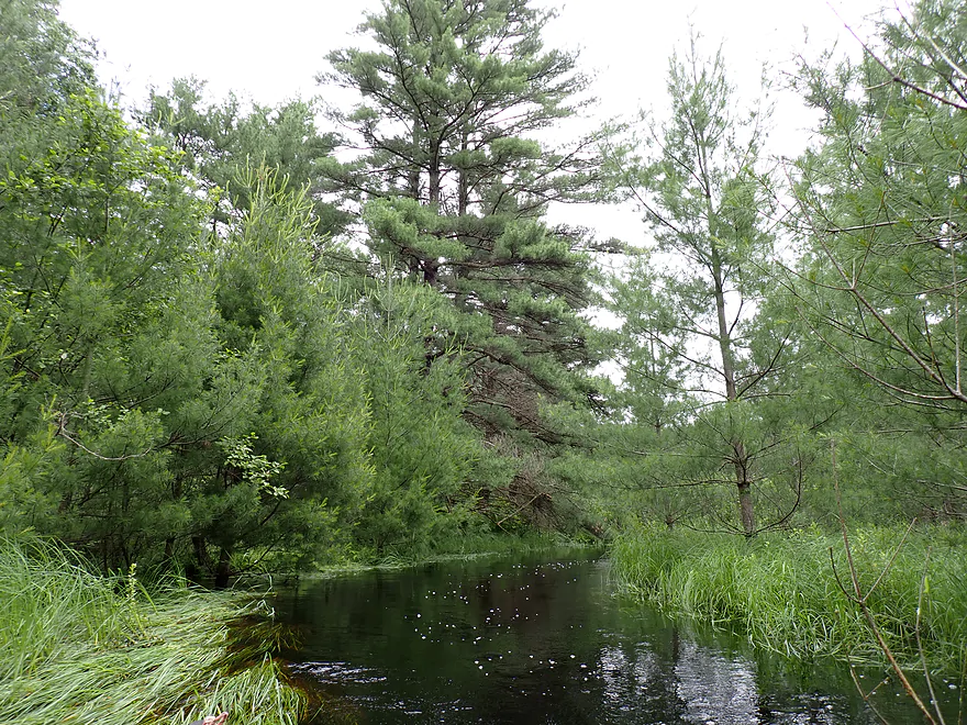
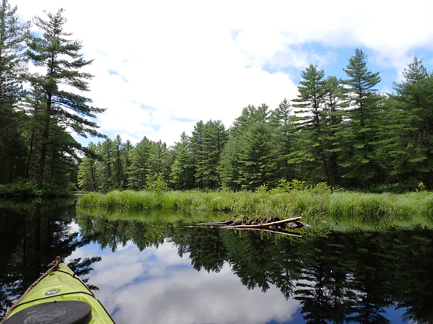
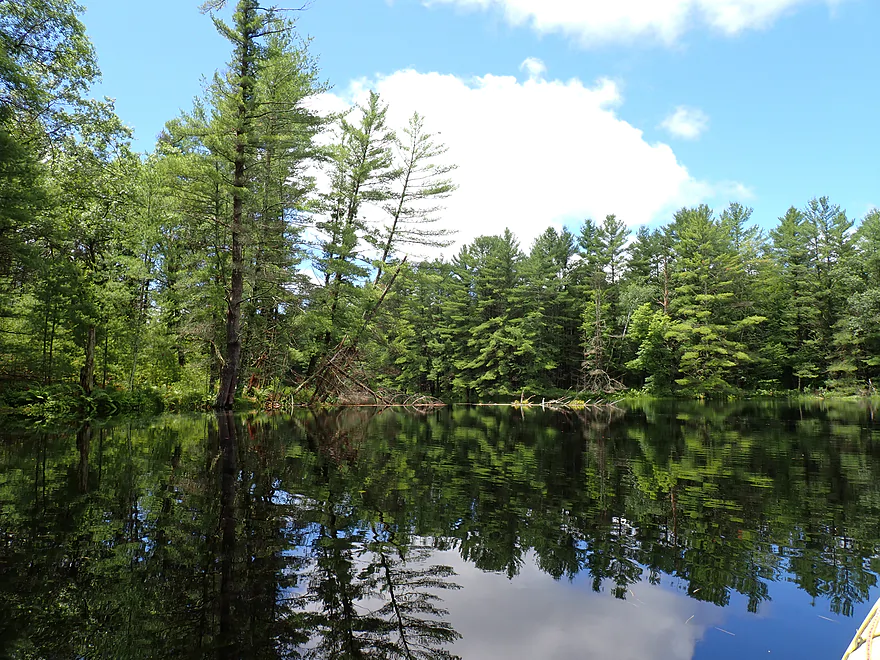
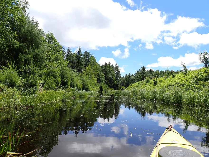
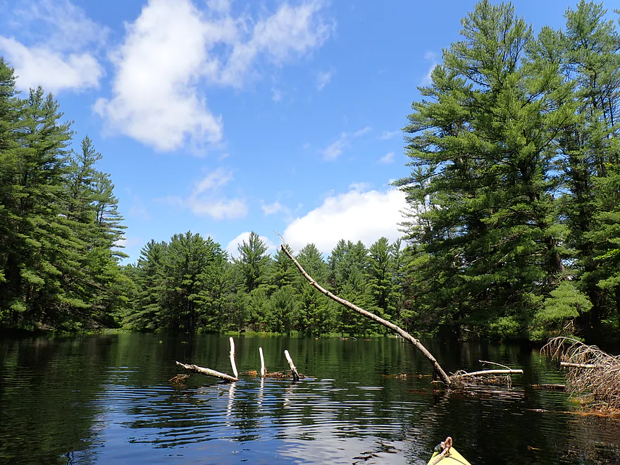
Approaching an impressive pine stand
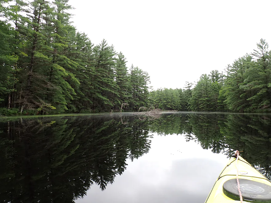
Cool reflection
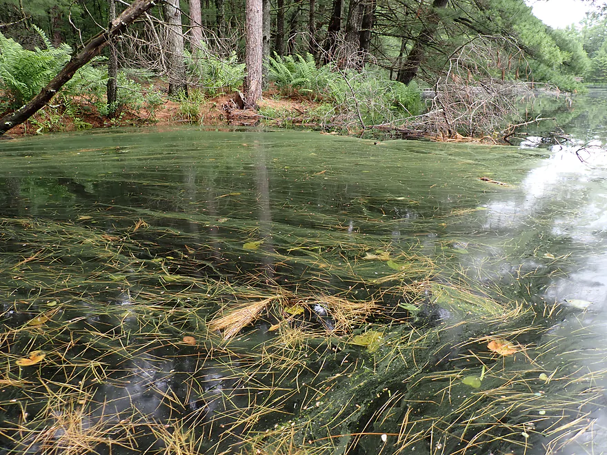
Interesting combination of needles and pine pollen
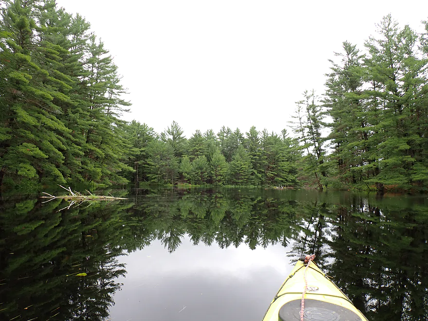
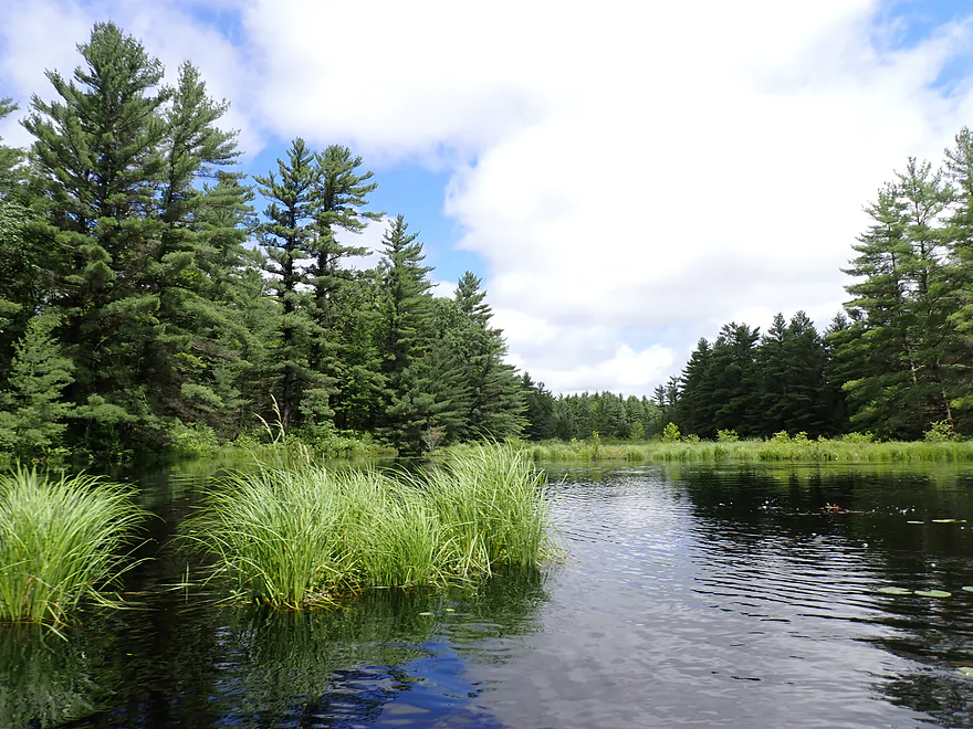
Nice peninsula
Dead-end bay to the right
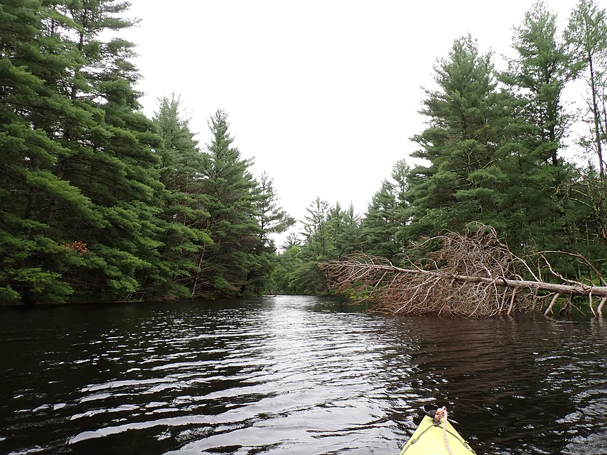
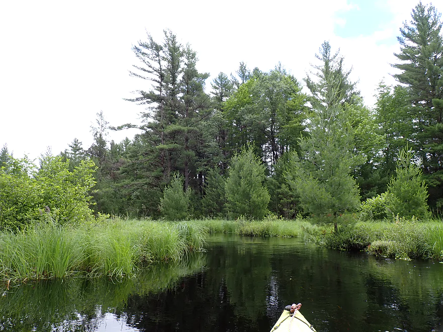
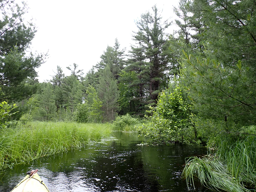
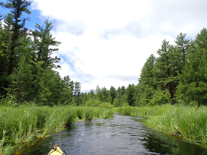
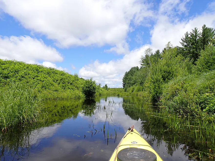
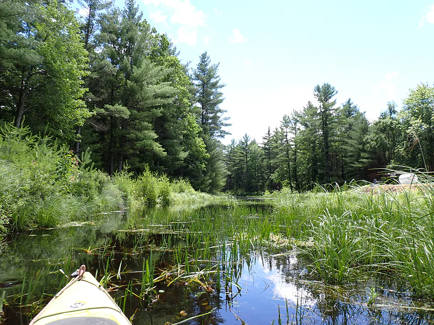
Continuing upstream on Morrison Creek
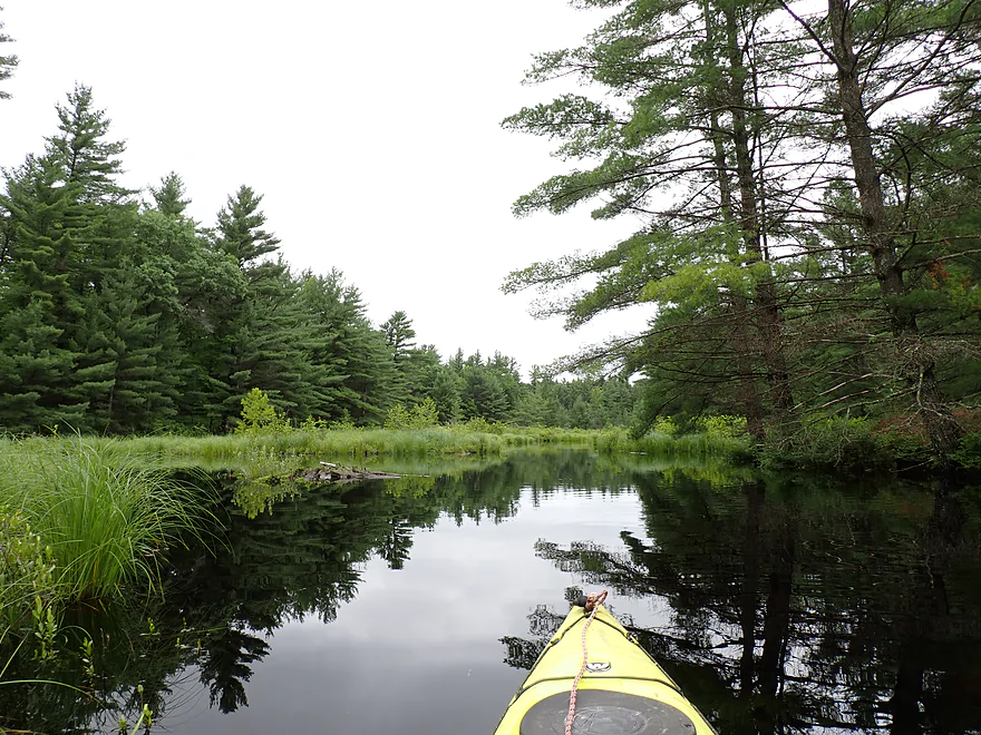
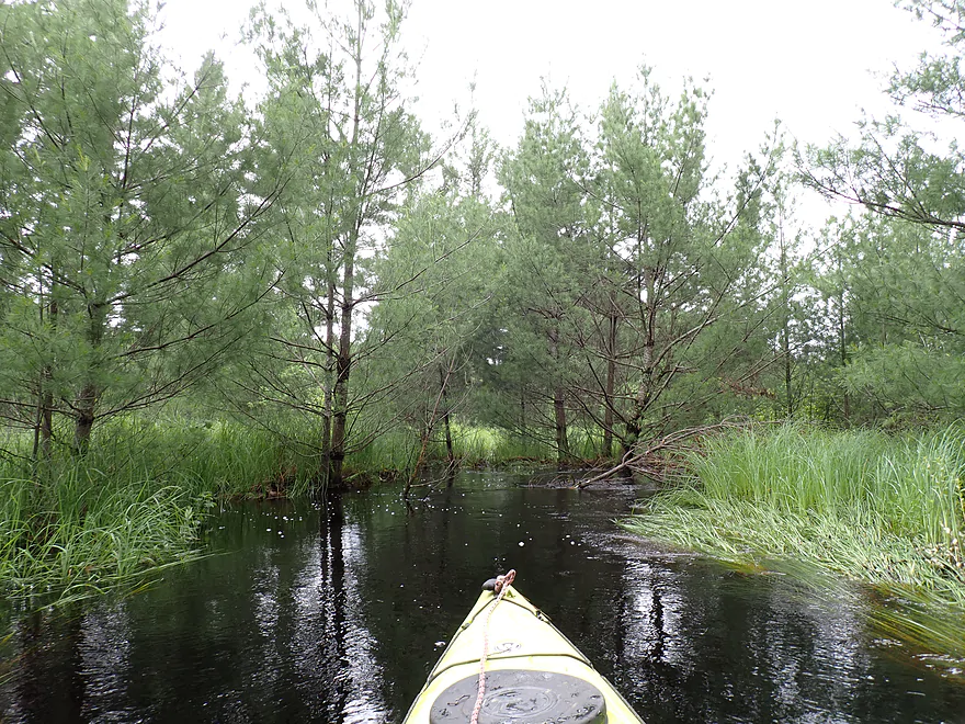
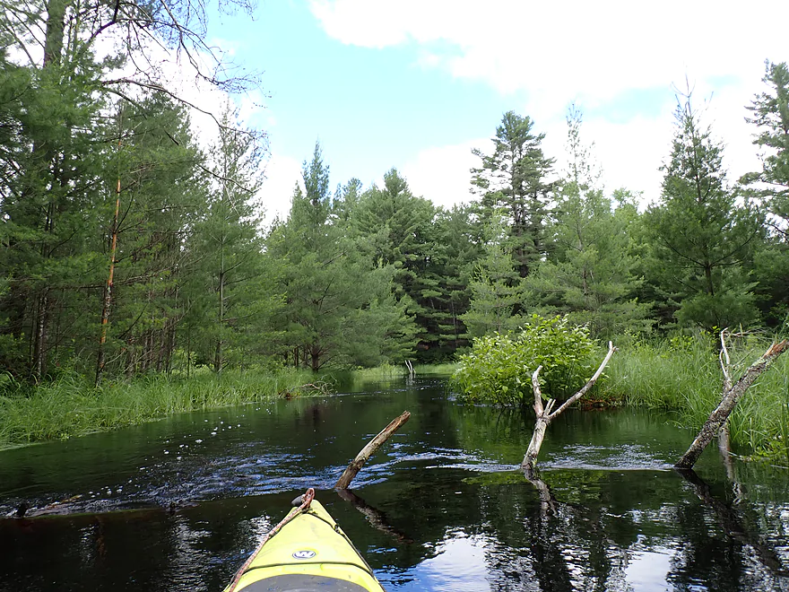
Creek starts to narrow
Starting to see more sedges
Paddling upstream against the current
Getting a bit congested…time to turn around
Backtracking downstream (going west)
Much faster going downstream than up
Easy logjam to get over because of the high water
Reflections were terrific
Great to have the sun come out
Heading north up a side gulley
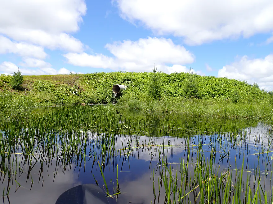
On the other side of this dike is a cranberry bog
Continuing up the ditch
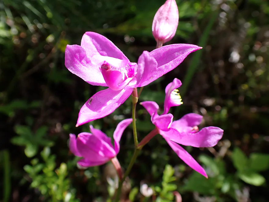
A wild orchid
Blocked by cranberry dikes…time to turn around
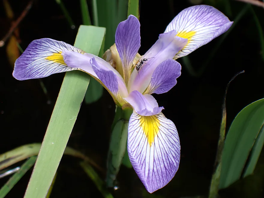
A blue flag flower (and ant)
Back on Morrison Creek/Potter Flowage
A rustic work bench…dispersed camping might happen here
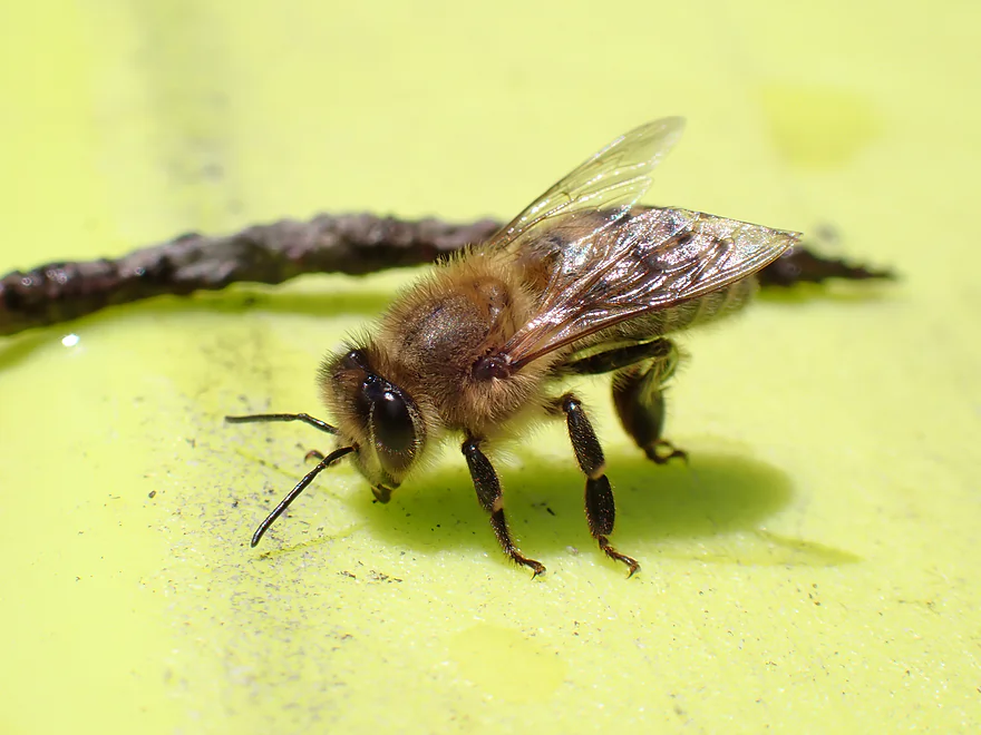
Friendly bee drying off his wet wings
One last vista of the great pine stands
Portaging McKenna Road again
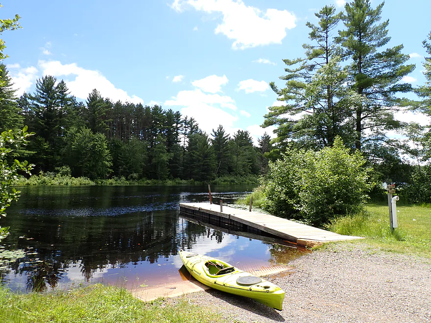
Easy re-entry by the ramp
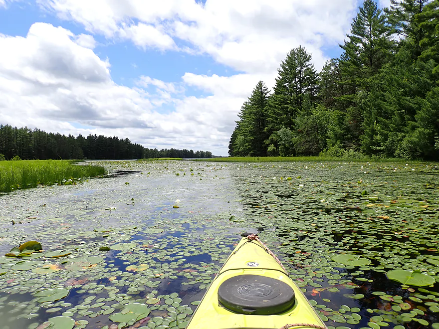
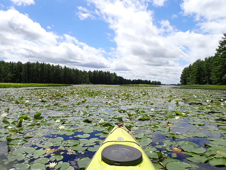
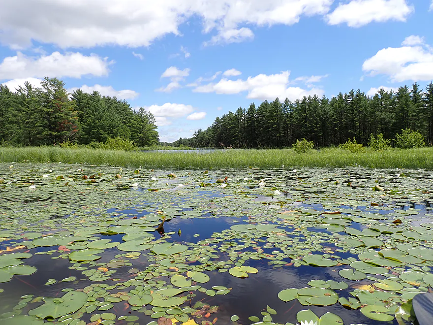
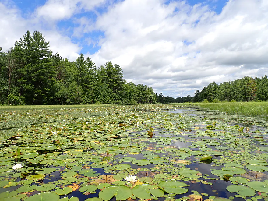
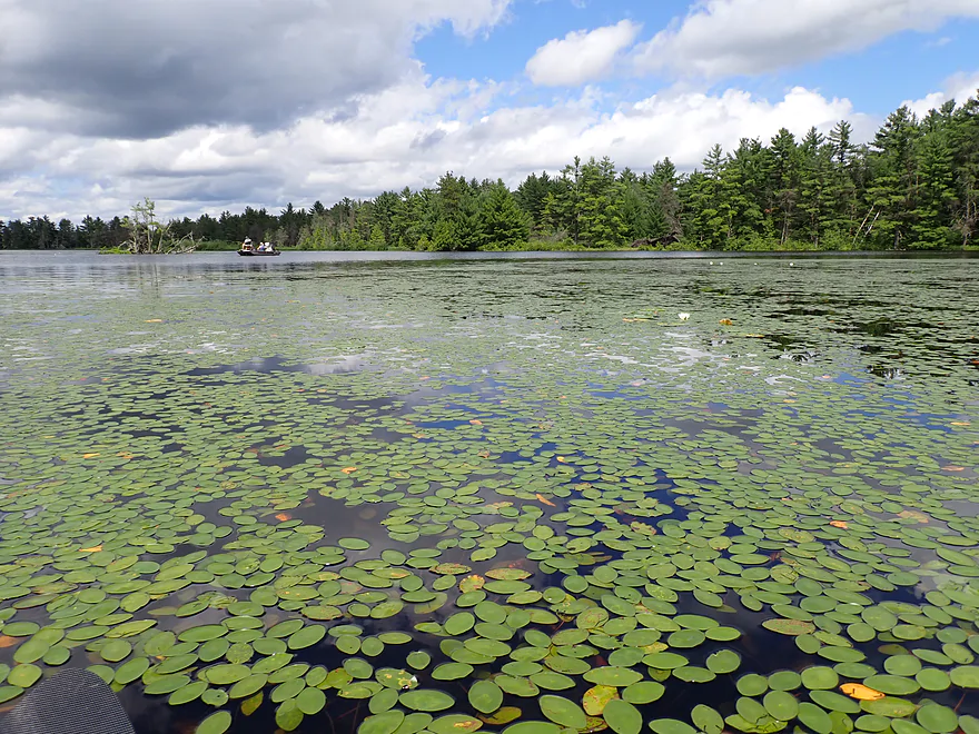
Paddling a terrific lily field on the north side of the flowage
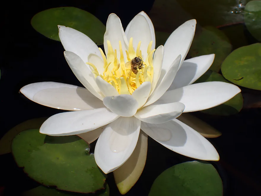
White waterlily
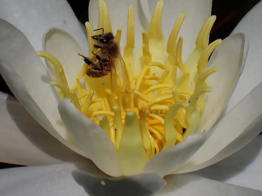
Bees loved the inside of the lily flowers
Looking north…a motor boat is hidden in a gully
Reverse view
The lighting really changed in the afternoon
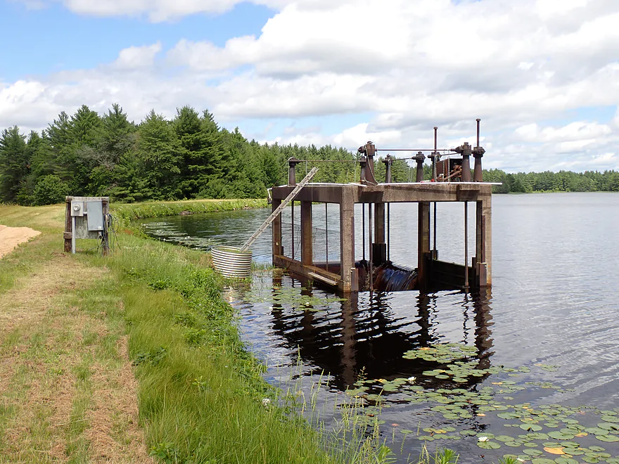
An open pit dam
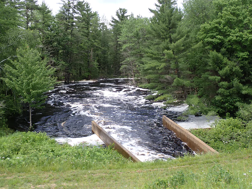
Out the other side roars Morrison Creek
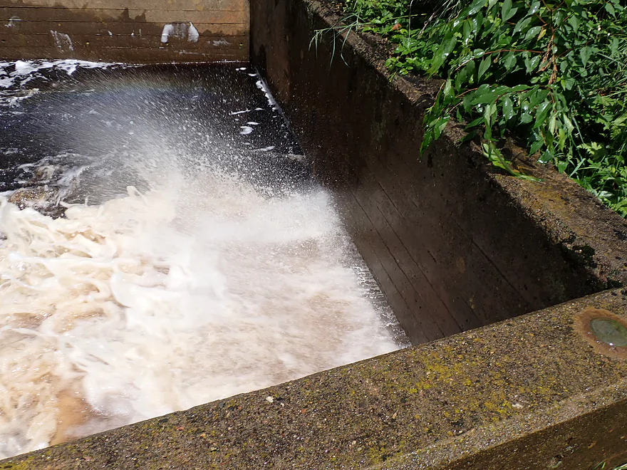
The outlet was submerged…air explosions would send sprays of water shooting downstream
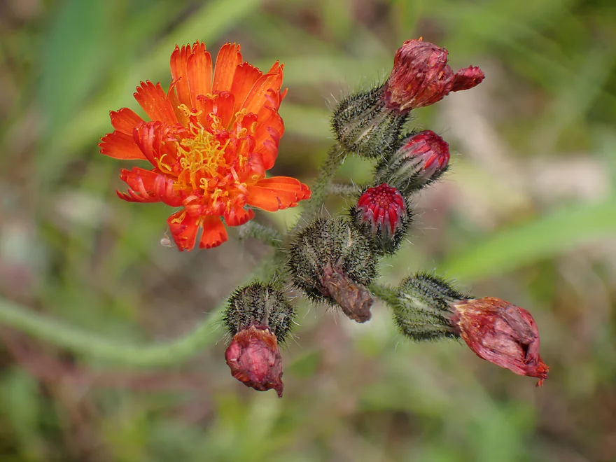
Hawkweed
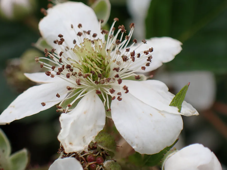
A white flower of some sort
Heading back to the south end of Potter Flowage
Starting to see more motorboats
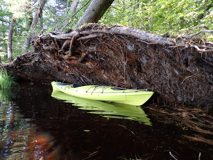
Tree roots eating my kayak
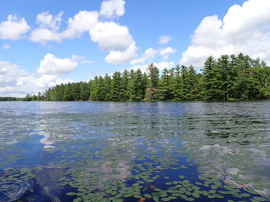
One last picture of Potter Flowage
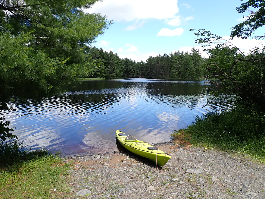
Taking out where I started…Larb Lane Landing
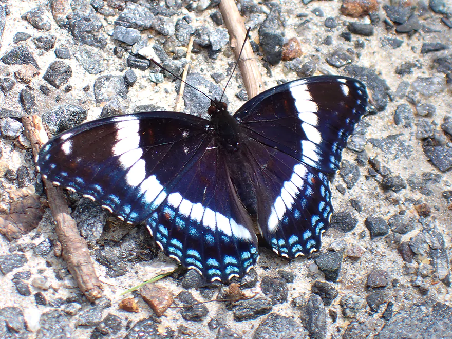
A white admiral butterfly
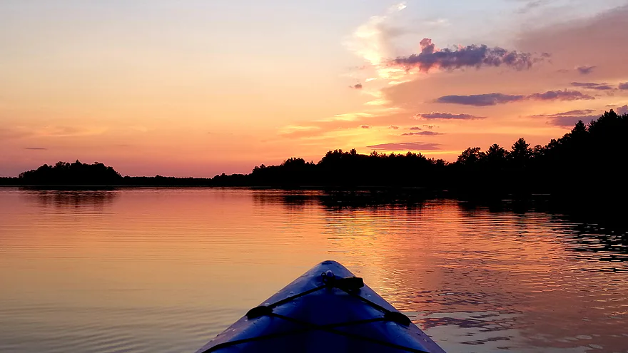
Sunsets on Potter Flowage can be really nice (pic reused with permission)
Potter Flowage


Potter Flowage is a somewhat obscure impounded lake located east of Black River Falls. With so many rivers and streams at flood stage, I decided to roll the dice on a lake I didn’t know much about, but appeared to have potential from satellite view.
My initial plan was to launch from Merlin Lambert County Park. But my Nuvi (GPS navigator) misbehaved and had me approach from the west and then drive north of the flowage on a private and sandy cranberry road (that wasn’t going to work). The roads in this area aren’t direct and driving to Merlin would have required a lot of backtracking, so I decided to launch instead from the closer Larb Lane Boat Ramp, which worked out fine.
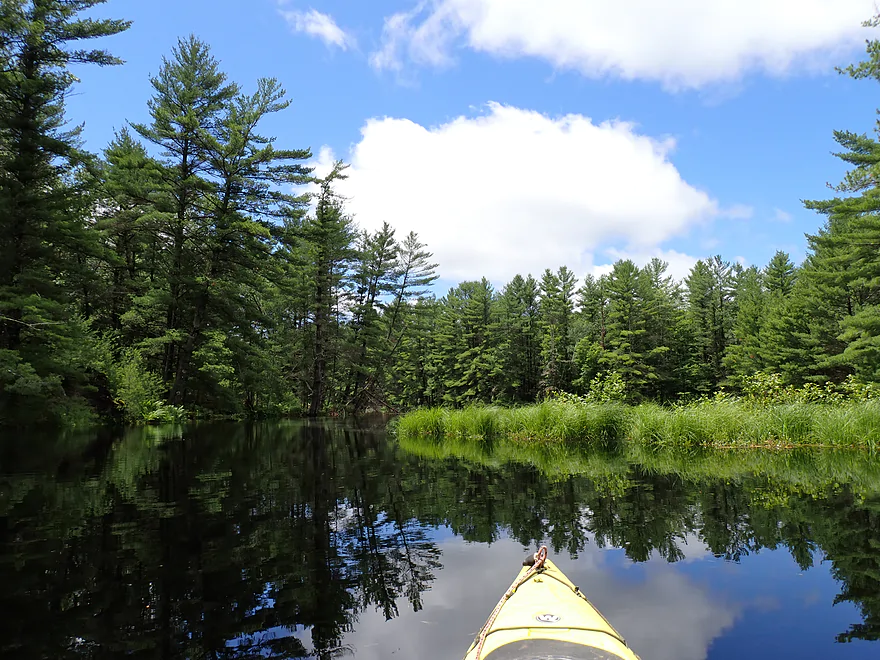
If you imagine Potter Flowage as a giant “T”, Larb Lane Ramp is at the southwest corner where the lake is relatively narrow as it transitions from McKenna Creek to the impoundment. I was impressed right away with the shoreline and its many pine trees. They looked great, smelled great and sounded great (when the wind blew). There was a gully opposite of the landing which I checked out and then continued north into the main flowage.
On the main pond a headwind picked up, which was a bit annoying. I was surprised to see so many (~7) motorboats on the lake. Most were peacefully fishing in one of the many side nooks and crannies of the lake.
From the junction of the “T”, I then headed east and followed the smell of sweet pine smoke to Merlin Lambert County Park. It’s a small park, but nice with a boat ramp, outhouse, and campsites. Some of the campsites were located by the water, and I saw one group had parked their kayaks by the tent, which was convenient.
My plan was to continue east as far as I could go, but was blocked by the McKenna Road dike and culverts that were almost underwater. While water levels were high, I’m not sure these culverts are ever passable. Not a problem though…as there is literally a boat ramp next door, which made portaging the road very easy.
I doubt most kayakers and certainly no motorboats continue east of McKenna Road, but that’s their loss as this was the best part of the trip. Technically speaking I was on Morrison Creek. In kayaking circles the lower portion of Morrison Creek is famous for its outcrops and rapids. I did a trip on it in 2014 which I enjoyed. But Upper Morrison Creek has a very different character. There were no boulders, rapids, or outcrops. But it was still scenic because of the dense and tall pine trees which created a proverbial canyon around the creek. The pines, side gullies, and reflections on the water created fantastic ambiance. It very much reminded me of Mirror Lake State Park (minus the outcrops).
The further upstream I went, the more the creek narrowed and the faster the current got. The terrain changed slightly as the pines receded a bit from the creek and I paddled through a flooded sedge corridor. Water levels were very high, but I suspect when lower the channel would have been very different, with clear red water and small sandbars. Eventually the channel became too narrow and obstructed, so I turned around.
On my way back, I checked out a northern gully which led to a large cranberry farm. I was stopped by a dike wall and micro-culvert, so had to turn around. I’m sure in the fall little cranberries escape through the culvert and get into Potter Flowage and Morrison Creek. That would be cute…what wouldn’t be cute are the pesticides that get washed off the bogs and end up in the creek and flowage.
I continued to backtrack west with the idea of exploring the northwest portion of the flowage. At the top center of the “T” was an open pit dam, which honestly looked a bit dangerous. A lot of water was rushing in because of the floods, and on the other side of the dike, Morrison Creek came roaring out. The exit area was completely submerged with no air openings, so little explosions of air would occur periodically which sent massive sprays shooting downstream. Lower Morrison Creek was a roiling cauldron…glad I wasn’t on it.
I thought about paddling to the far western edge of the “T”, but decided not to as there appeared to be just a generic dike and inaccessible cranberry bog on the other side. I wouldn’t have been able to see much from the boat.
From the dam, I backtracked south past some nice lily fields and returned to the Larb Lane Landing. I actually debated heading much further south and exploring the upper reaches of McKenna Creek, which could have been scenic, but I decided to call it a day.
In summary, this was a nice trip. To be clear, the main flowage itself is boring (minus the nice lily fields). The strength of Potter Flowage is its two inlets and its many small bays. These hidden pine corridors were fantastic and again reminiscent of Mirror Lake State Park. The best part of the trip was Morrison Creek east of McKenna Road, which is absolutely worth exploring despite the required road portage (not difficult). My only regret was maybe not exploring McKenna Creek in depth. I doubt Potter Flowage will ever be a destination paddle, but it’s a nice plan B paddle if you’re in the Black River area and your main prospects have water level issues.
There were a lot of neat insects including damselflies, bees, dragonflies, and butterflies. Not so neat were the mosquitoes…bring your Deet-free repellent. I heard, but didn’t see an owl. There were a lot of flopping fish (which maybe explains the many fishermen).
Black River State Forest – Ski Trails: There is a really nice cross country ski network located just south of Potter Flowage. I’ve used it before and it is attractive with a lot of pine trees. A state trail pass is required to use the trails. Sadly, the trail does go through some sections with heavy logging. The DNR does a poor job of letting private logging happen on public land.
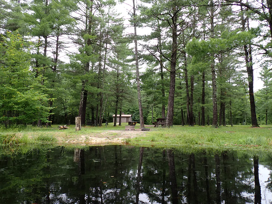
Merlin Lambert County Park: This is a really cool camping option. The campground has 30 first come, first served campsites. A registration fee is required, but is payable via a self-service station. Outhouses are available to the north. While I saw one camping group, I didn’t see others…I suspect this is an under-utilized campground, so you should have your choice of campsites with few neighbors.
The strength of the campground though is its shore-side campsites. This means you can kayak Potter Flowage from your campsite. A camp/kayak combo would make an early morning fog paddle very viable. But even better would be a late evening paddle to see a sunset. Potter Flowage has an open west end so sunsets should be good (here is a sample I found online). When done you could simply paddle back to your tent. Don’t know if there will be a good sunset that day or not? Check out this sunset forecasting website.
Larb Lane Landing: This was a secluded boat landing and a nice spot to start the trip. This landing has no fees, but does get occasional boat traffic, so be careful when parking so you don’t block trailers.
Alternate Put-ins:
- Merlin Lambert County Park: This is a larger and nicer landing than Larb Lane, but also more popular and less secluded. Outhouses are available west of the landing.
This is a simple round trip so shuttling isn’t needed.
Wind: The coves are protected, but the main lake is open and vulnerable to the wind.
Gauge: Black River @ Neillsville
Trip Depth: 7000 CFS or 10.33′
Navigability Estimates: Roughly speaking this won’t matter. You can do Potter Flowage high or low.
- 0-500 CFS: Relatively low/average depth.
- 501-1500 CFS: High depth.
- 1501-4000 CFS: Very High depth.
- 4001+ CFS: A lot of local rivers will be flooded. Potter Flowage will still be fine for paddling.
Click here to see an overview map.
- Potter Flowage:
- East End/Morrison Creek:
- East Turn-Around Point to Merlin Lambert County Park: 1.5 miles. Very scenic stretch with nice pines. The further upstream you go, the narrower and faster the Creek gets before you have to turn around.
- Merlin Lambert County Park to Dam: 1.2 miles. Mostly open paddling and not super interesting. However, the lily beds on the north shore are attractive and there are inviting side gullies you can explore. This is a good lake to kayak for sunsets because of the open west end.
- South End/McKenna Creek:
- South Turn-Around Point to Larb Lane Landing: 1.7 miles. Attractive stretch of McKenna Creek with lots of pine trees. The further southeast you go, the better the scenery, but the creek does get progressively narrower until you have to turn around.
- Larb Lane Landing to Dam: 0.8 miles. Mostly open paddling and not super interesting, but the pines on the shoreline are really nice.
- East End/Morrison Creek:
- Potter Flowage Dam to Hwy 54: 7.4 miles. Not viable because of deadfall issues.
- Hwy 54 to Cemetery Road: 10.9 miles. Likely not as many rapids/boulders, but should still be scenic. First half is more marshy and the second half should be more rugged. Reviewed by Rick Kark who had a positive experience on it and described several outcrops. He said there were some logjams, but he didn’t seem to mind them…from satellite view the creek looks very open.
- Cemetery Road to Public Forest Access/Mouth on Black River: 7.4 miles.
- Cemetery Road to Oxbow Road Landing: 0.8 miles. Scenic stretch with nice pines, some Class 1-2 rapids, and a few small outcrops.
- Oxbow Road Landing to Hwy K: 1.4 miles. This leg is a bit more open but still scenic with many Class 1-2 rapids. There is a Class 3 ledge that should be handled carefully.
- Hwy K to Oxbow Road Landing: 5.2 miles. Last stretch has tamer rapids, but also much nicer outcrops. This is more wooded and 1-2 logjam portages might be required.
Morrison Creek Tributaries:
- Dickey Creek: A scenic creek, but just has too many logjams.
- Mollies Creek: This is a small creek and would be a short 2(-)mile trip from Cemetery to K. But apparently American Whitewater did it and provided some really cool photos. I suspect there might be some logjams and a few Class 3+ rapids. If you’re willing to portage all this, it could be a scenic adventure but with possible challenges.
- Unnamed Creek (by Hwy 54 and the Correctional Center): From Dike 17 Wildlife area to Hwy 54 Upstream from hwy 54 is a series of canals and small flowages that might be a fun little adventure (but with possible obstacles). Downstream from Hwy 54, the creek is narrow and windy. Not sure the Correction Center is an access option, so Morrison Creek or Staffon Road might have to be your end-game options.
Trip Map
Overview Map
Video
Photos Size: