
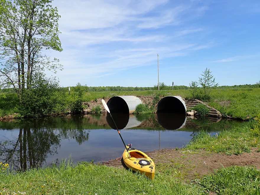
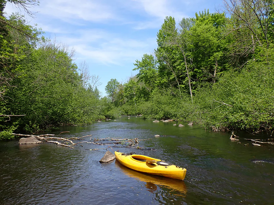
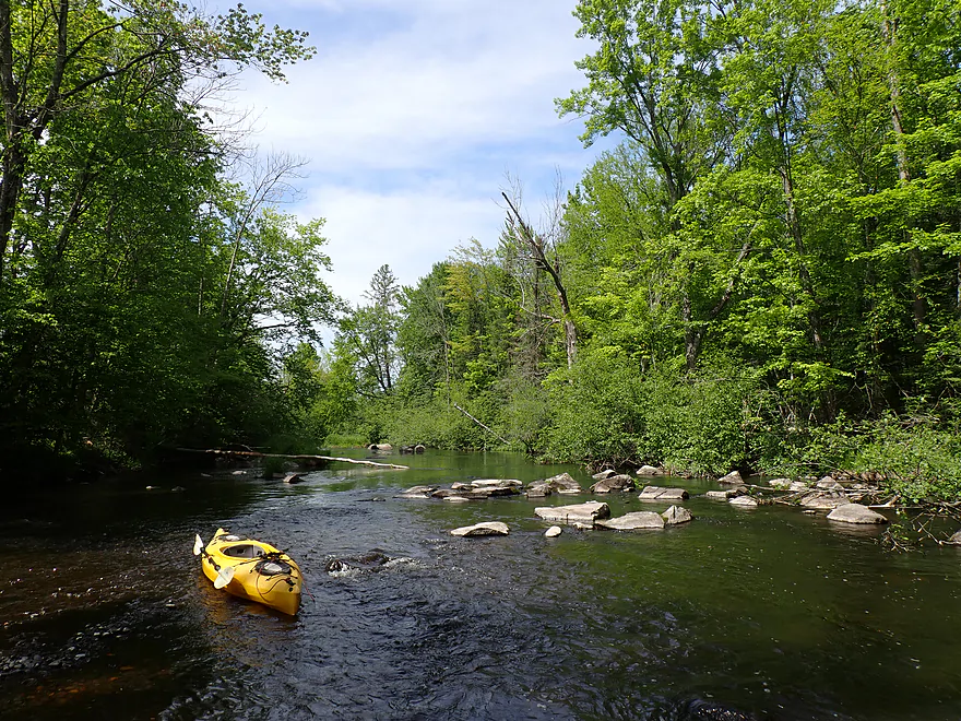
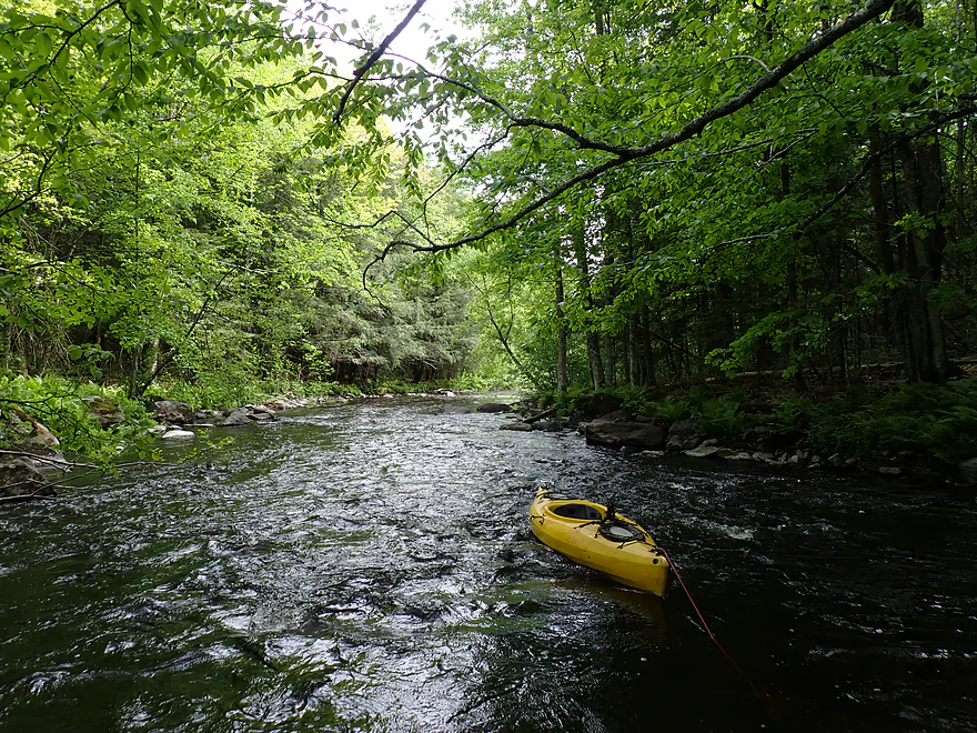
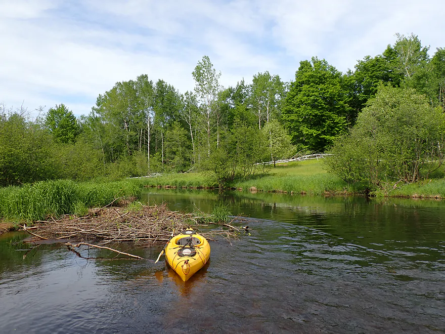
Cty Road I…a very good put-in
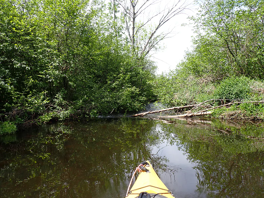
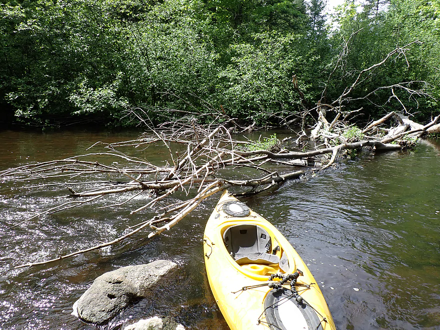
The trip started with a partial logjam to hop over
Lots of alders and brush
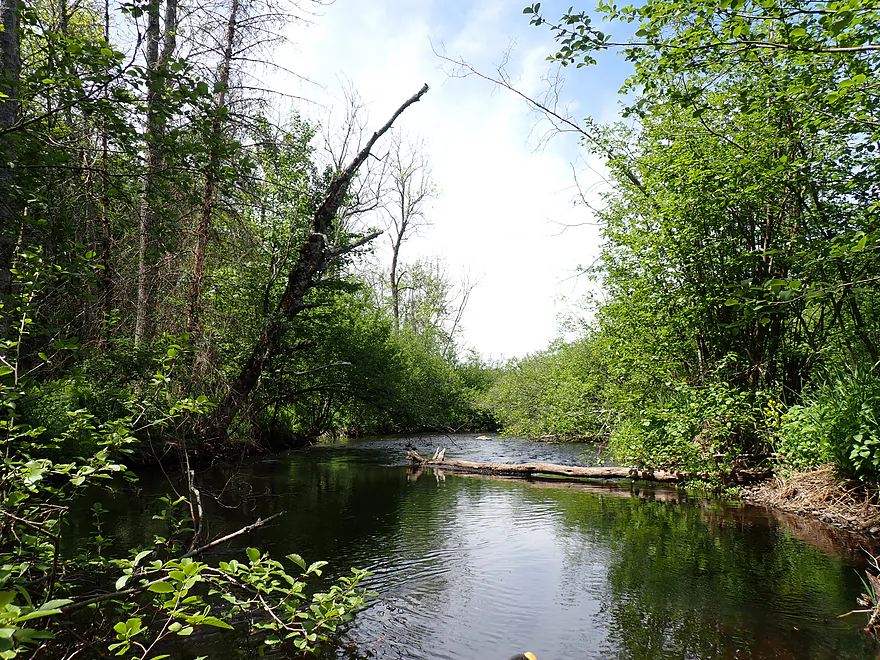
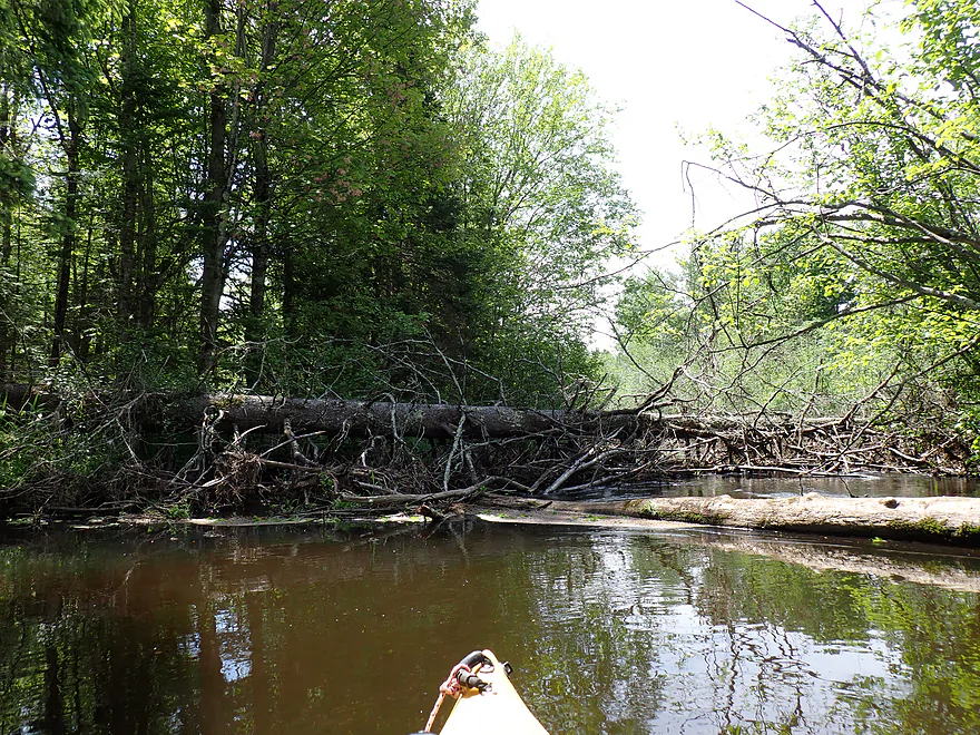
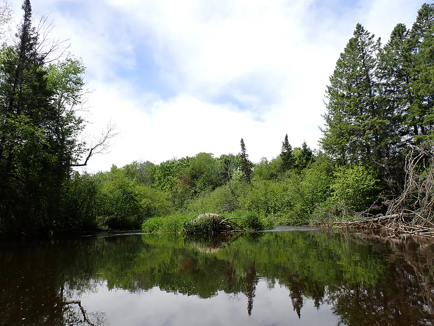
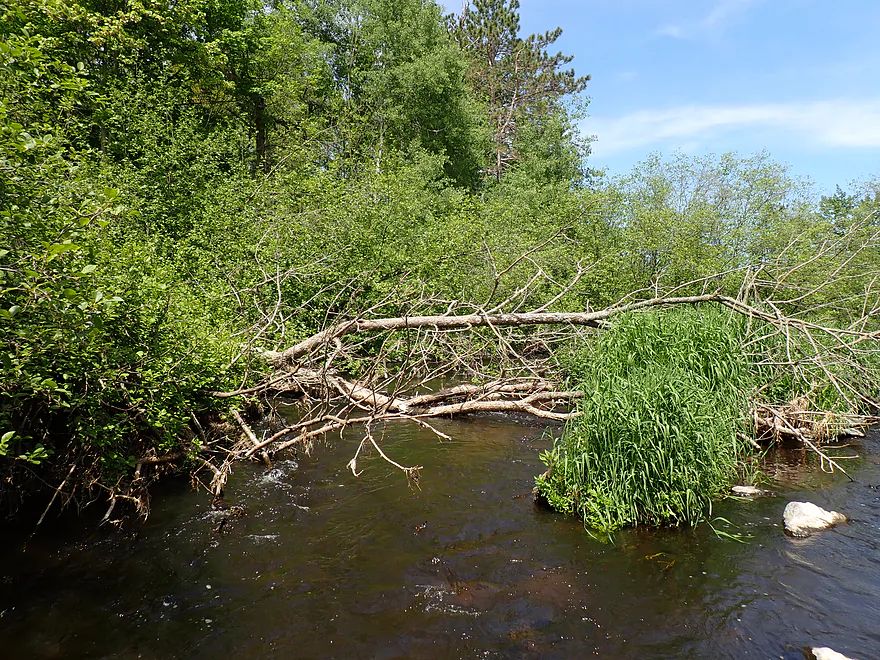
Major logjam
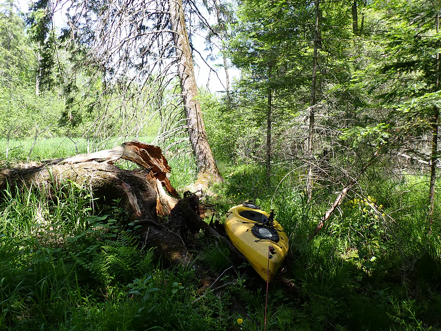
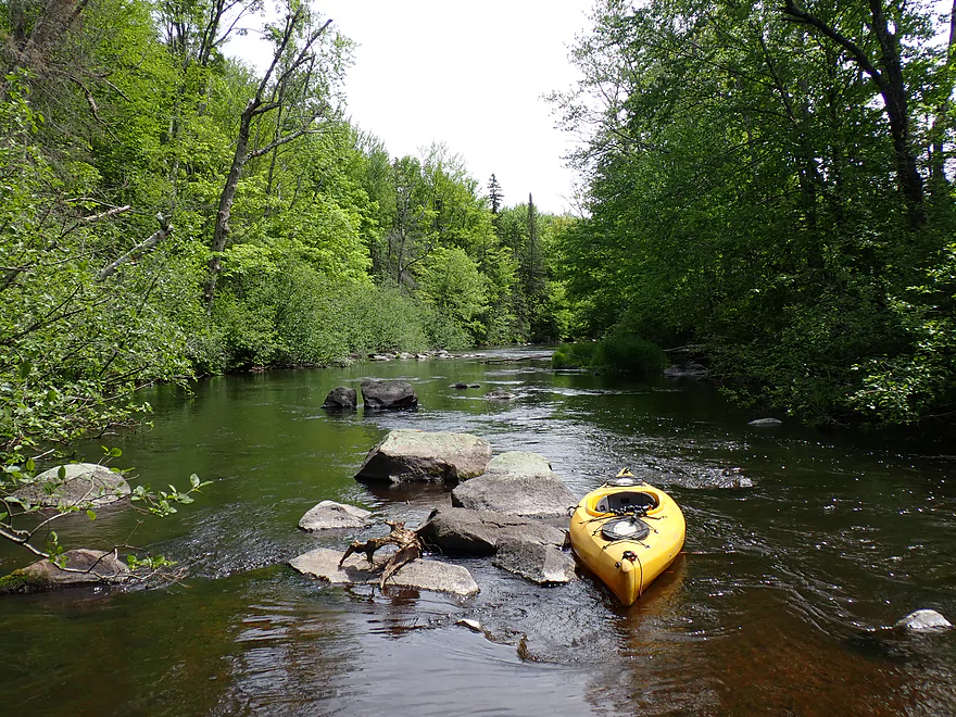
Required a medium portage on the left bank
Some evergreen trees
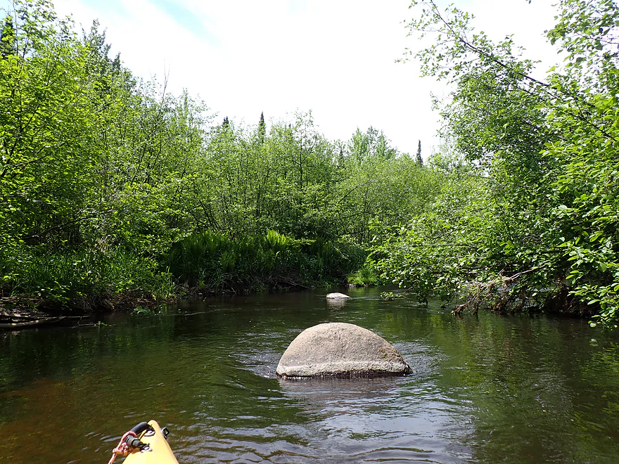
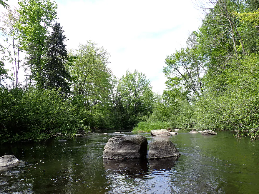
A few small boulder fields
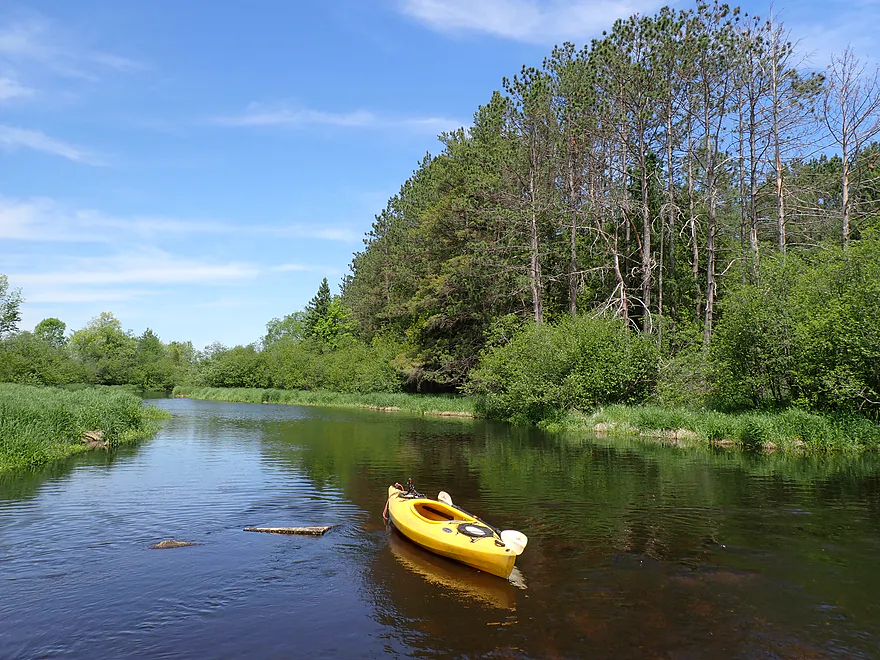
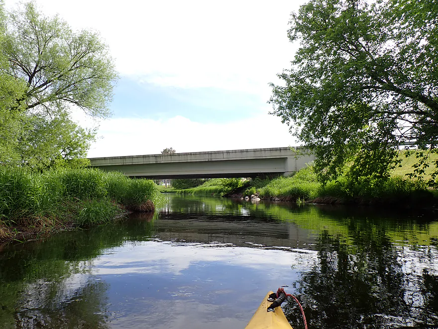
River Road is an access option
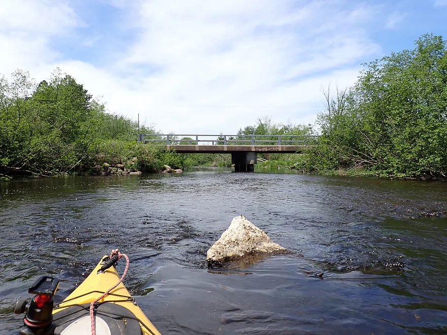
View from bridge
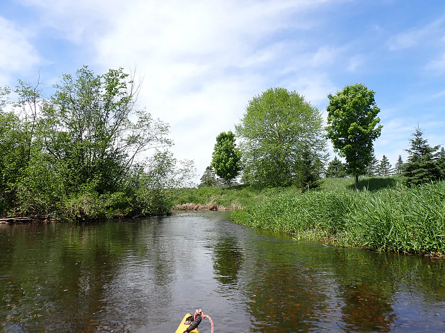
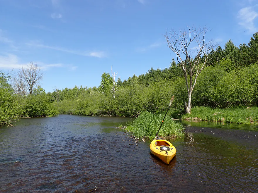
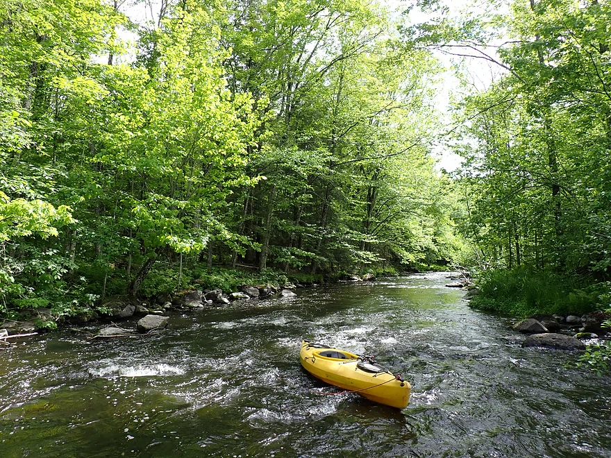
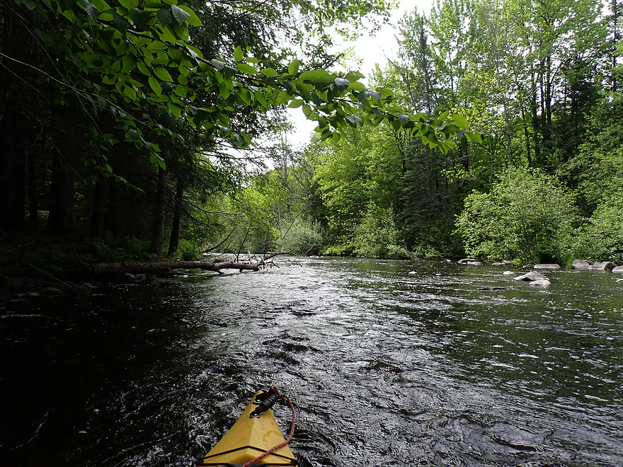
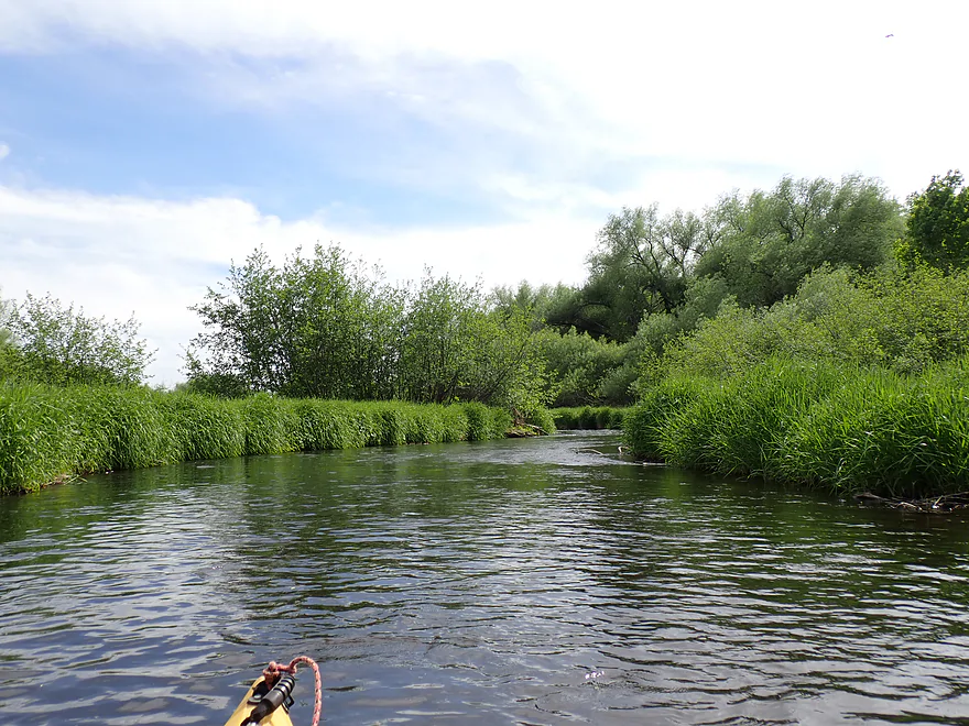
Next leg was a bit more open
Few light riffles
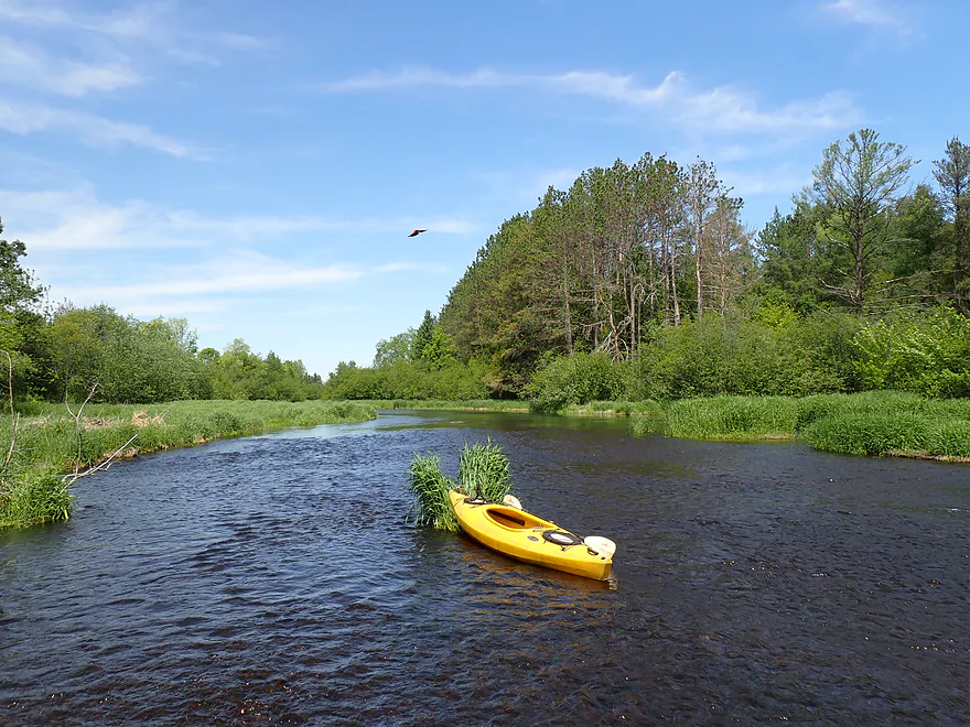
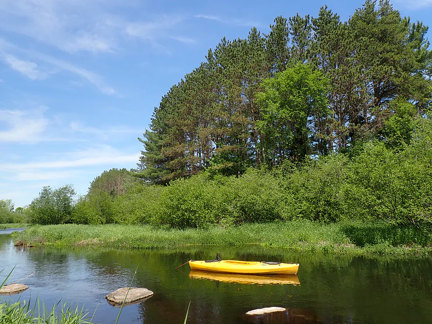
NIce stretch of red pines
Hwy H is an access option
Reverse view of a second red pine stand

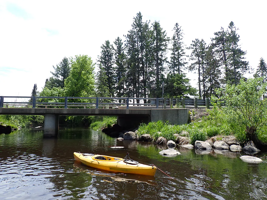
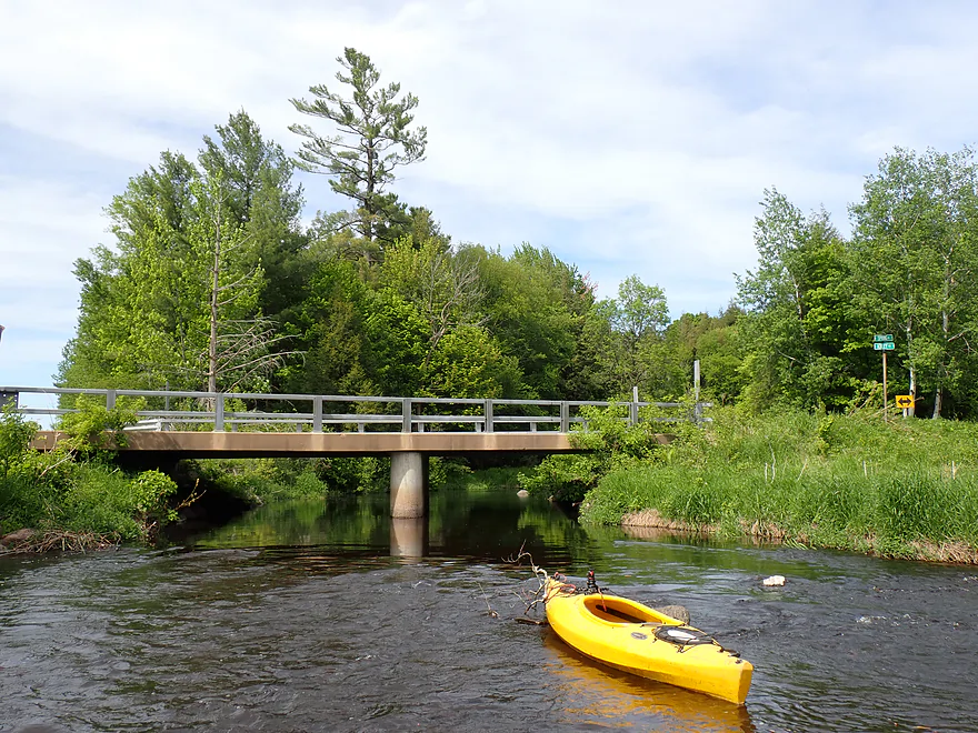
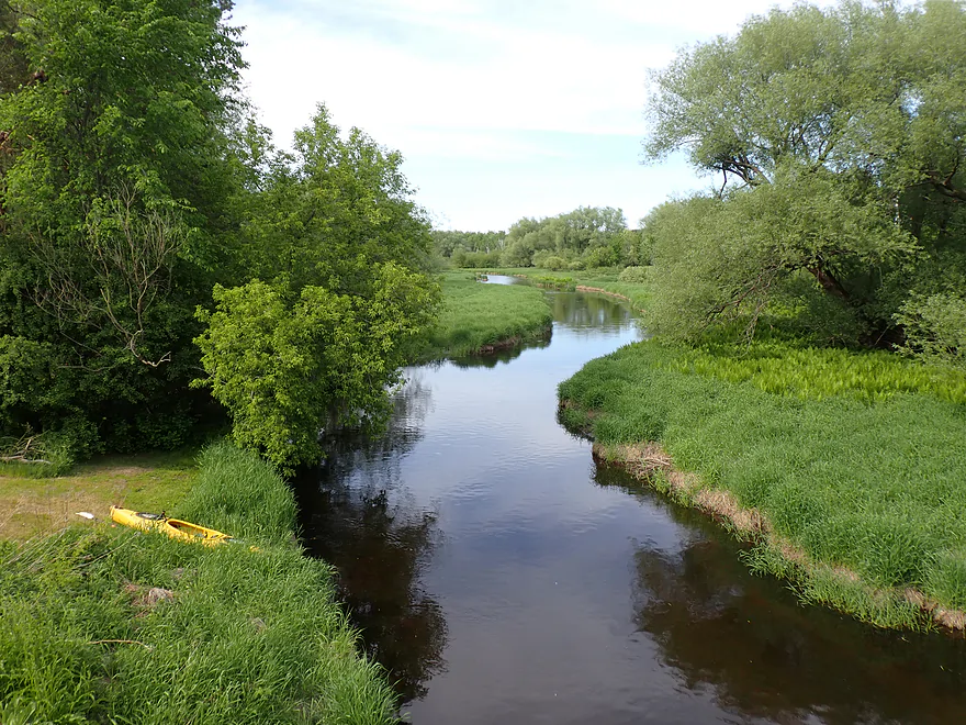
View from bridge
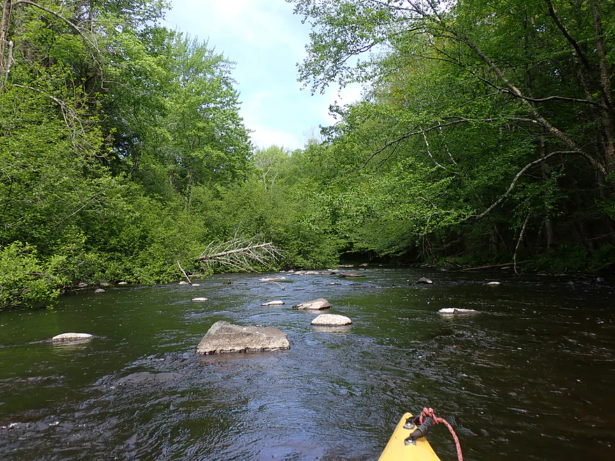
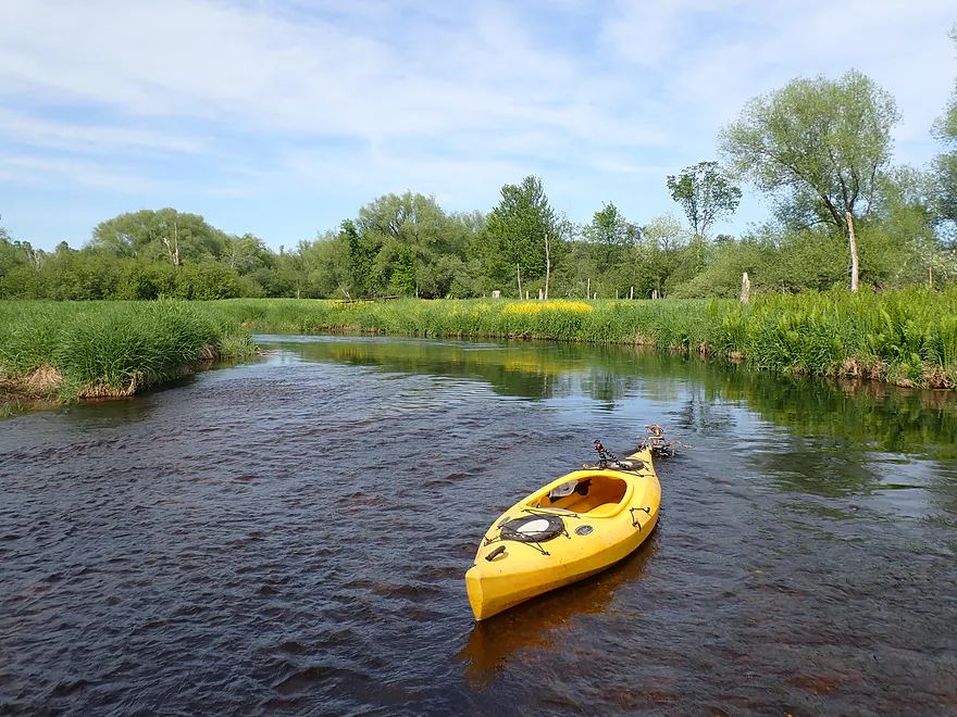
Third leg was my favorite
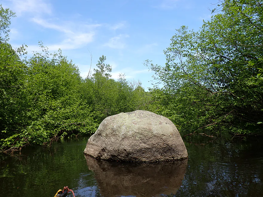
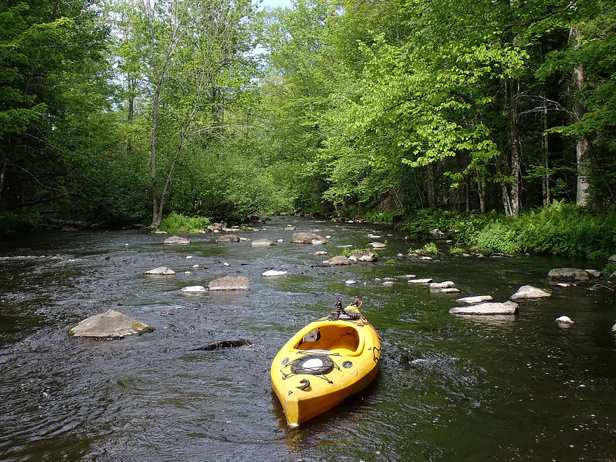
Boulders starting to get bigger
And more frequent
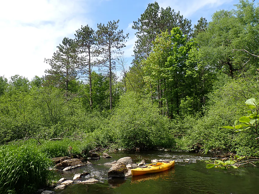
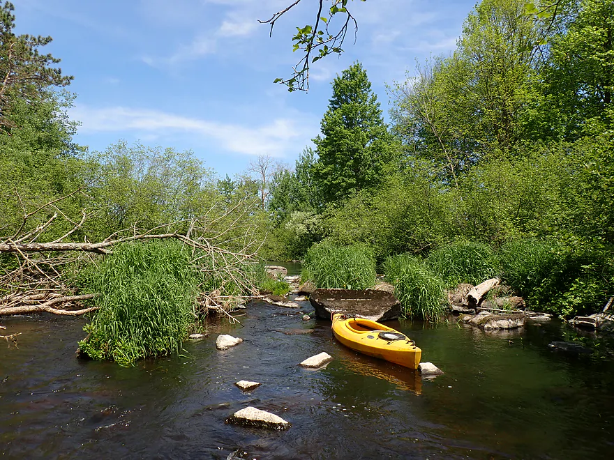
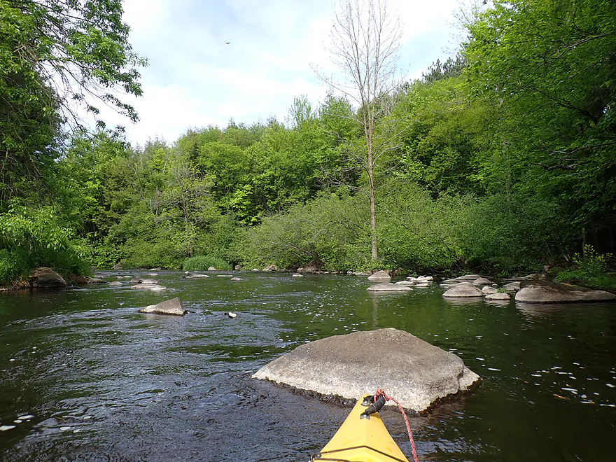
A unique boulder field/logjam combo
Not getting past the downed tree
But I was able to wade past the boulders
In high water, this section could get interesting…
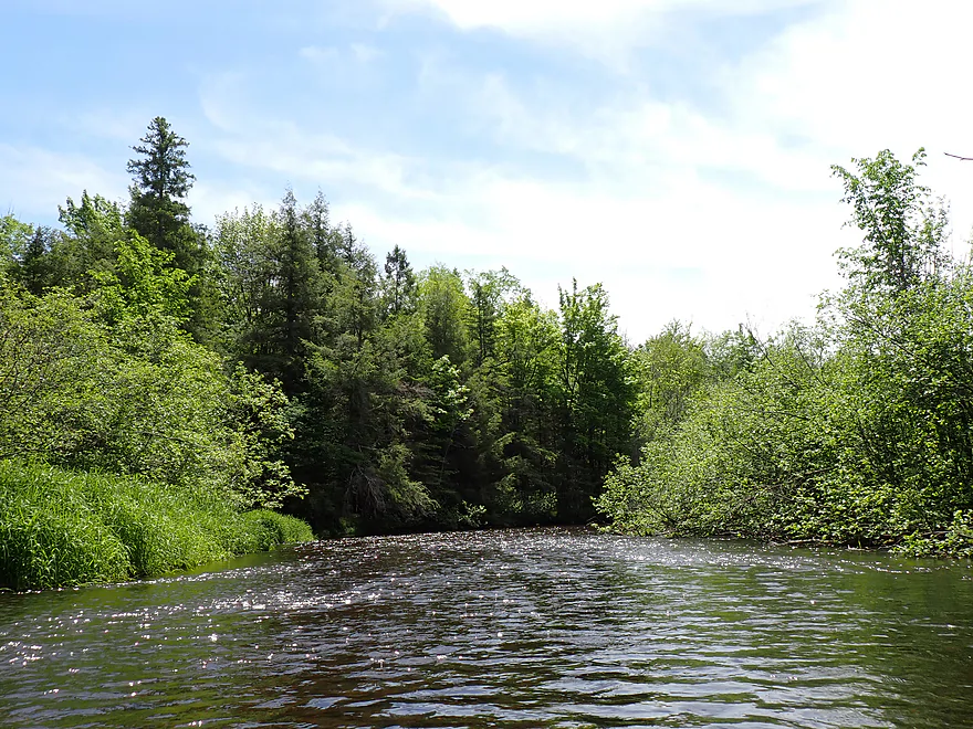
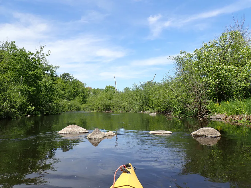
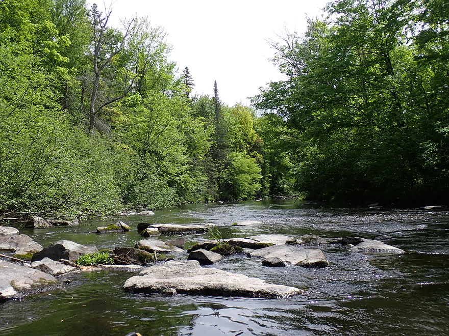
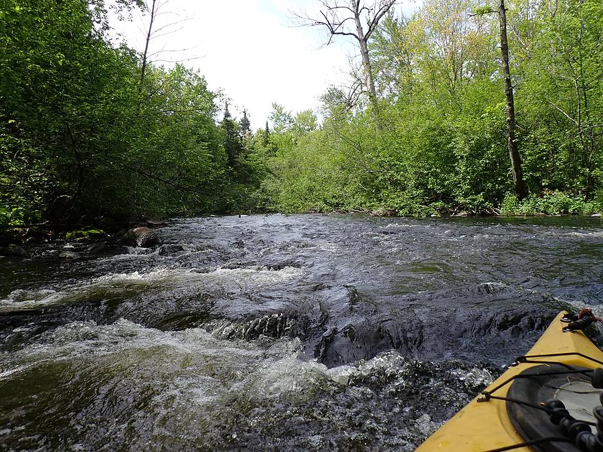
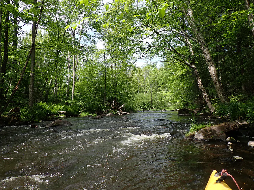
River really starts to get rocky
Entering a great stretch
Reminded me of the Upper Plover
Minor logjam…easy to wade around
Fun rapids
Reverse view
Woods get denser and ferns become common
A little bumpy but scenic
Another pitch of rapids
Last major boulder field of the trip
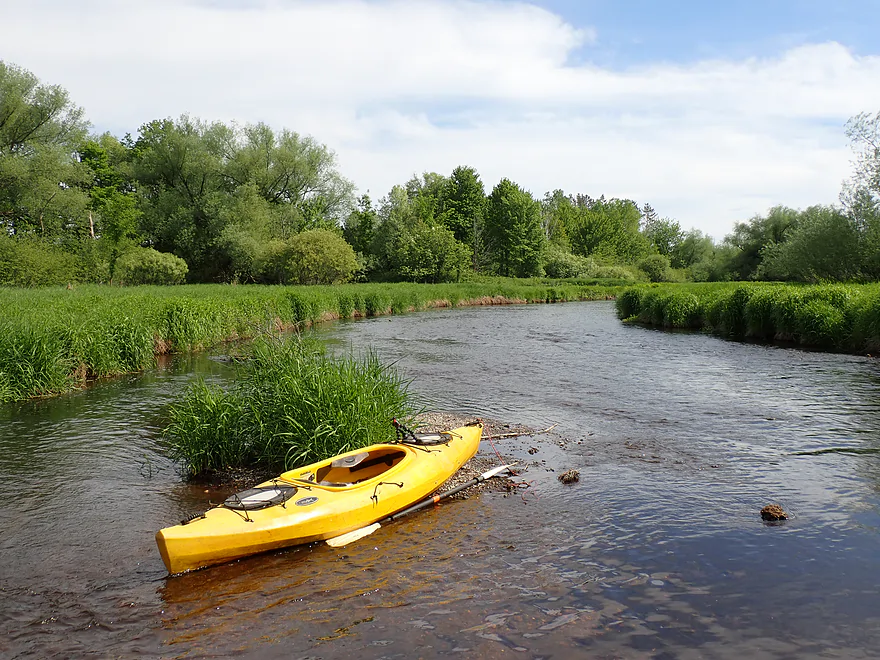
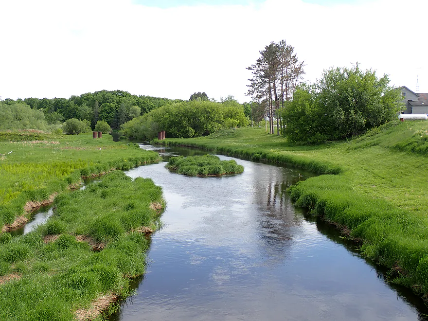
Spring Road is an access option
Not quite visible, but there is a coyote hiding in the grass
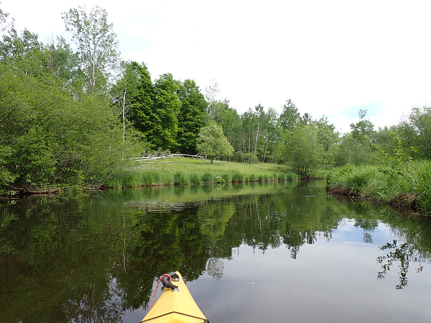
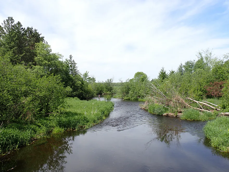
Fourth and final section is much more open but still nice
Getting out for pictures
Nice grassy meadows
Reminded me of a Southern Wisconsin river
Hwy 64
Good access with a scenic vista from atop the bridge
Downstream view
Eau Claire River – East Branch – Cty Road I


In 2025, I paddled a stretch of the Upper East Branch of the Eau Claire River near Deerbrook and Antigo. It was pleasant, but not “elite,” leaving me curious if the downstream leg would be better. This follow-up trip was meant to find out. I launched from County Road I, where a terrific fishing wayside made getting onto the water a breeze. Because this trip passed under five bridges, I’ve organized this review into subsections divided by each bridge access point.
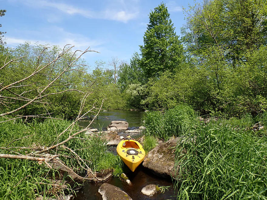
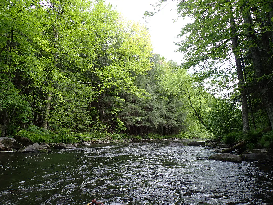
Cty Road I to River Road (1.1 miles): The “river” here felt more like a creek—narrow, twisty, and brushy, with a rocky bottom and occasional small boulders. While there were a few decent spots, the scenery wasn’t particularly impressive. Alders were everywhere, and in a few cases “alder gauntlets” forced me to duck to get through. I also had to hop over a snag right at the put-in and later portage around a major logjam where I ran into two trout fishermen. The East Branch is a popular trout stream and River Road is another well-utilized access point featuring a handy pull-off.
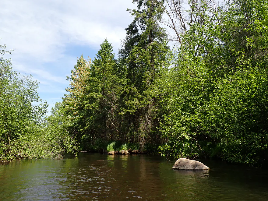
River Road to Cty H (1.1 miles): This second leg was a nicer, more open stretch that featured occasional firs and spruces with zero logjams, though a few sections were a bit shallow. The highlight was the photogenic approach to the Hwy H bridge, where tall red pines provided a beautiful 🌲backdrop🌲 to the tannin-stained river as it curved like a ribbon between green sedge meadows and boulders. This wide-angle Google Street View image actually does a better job of conveying the view than my own descriptions or photos.
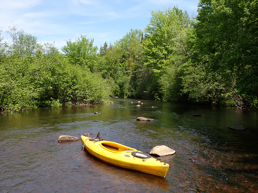
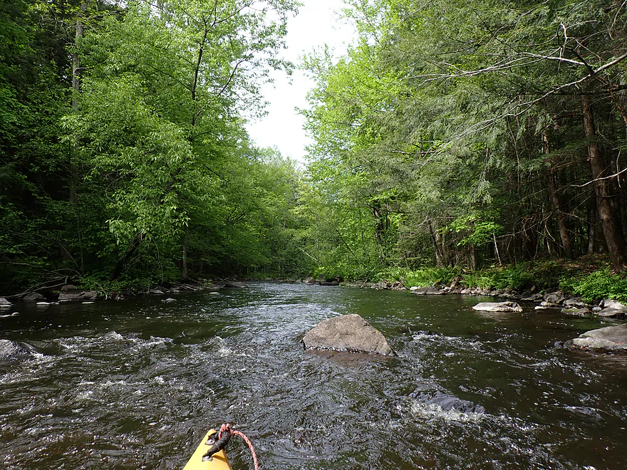
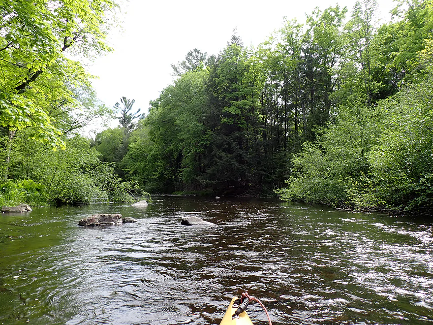
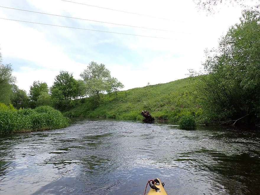
Hwy H to Spring Road (2.0 miles): This leg wasn’t interesting initially and featured unsightly scrubby, shrubby alders and occasional gauntlets that required a bit of dodging (although nothing too awful). Most of the trees were small, making me suspect the area had been logged not that long ago. However, in the second mile, the river really came alive as the boulders grew larger and more frequent. Eventually the sound of rushing water led to an impenetrable boulder field on the left and a logjam on the right. Wading and portaging through the rocks was doable, but in high water, this spot could easily transform into rowdy rapids.
Shortly after, I entered the Mills Recreation Area, an obscure Langlade County conservation area that was easily the best part of the trip. The forest (which I suspect has been protected from logging) became much nicer, with bigger trees and denser stands. The trees grew close to the shoreline and hugged the river to form tall corridors. Occasional skyscraper balsam firs poked their pointy tops above the tree line, while ferns and boulders lined the water’s edge. Class I rapids and boulder gardens were common throughout the recreation area, including some longer and more scenic stretches.
Spring Road to Hwy 64 (1.5 miles): This final leg was the most open and alder-free part of the trip. Here the river was separated from adjacent farm fields by a thin (sometimes too-thin) strip of undeveloped wilderness. The highlight was a coyote that watched me from atop a high bank before bounding off into the adjacent field, leaping like a deer to avoid the dense vegetation. This leg very much reminded me of a Southern Wisconsin creek, but in a good way, as the tidy grasses formed scenic and beautiful meadows. Hwy 64 proved to be a good bridge access where somebody had conveniently mowed a path from the bank right to the water. From atop the bridge, there was a perfect parting vista of the river meandering gracefully through the vibrant green grass.
Was the two-hour and 20-minute drive north worth it for this “Southerner”? Mostly not… at least for the first half, which had too many alders and uninspiring banks. But the second half of the trip, including the Mills Recreation Area, was surprisingly nice. With its terrific boulder gardens, wooded corridors, and open meadows, it almost made this a marquee paddle. As is, I would recommend Eau Claire River “newbs” focus on other sections first (like the main branch legs) which are just more scenic. But for locals looking for a new adventure, you can have a good time here—just be mindful of the few logjams and fickle water levels. A cool thing about the East Branch is that with so many bridges and trout access points, it’s incredibly easy to customize an à la carte, choose-your-own-adventure trip focusing only on the sections you want to do.
Sights included a coyote 🐺, many dragonflies ≽༏≼, and an annoying leech 🐛 I picked up wading in a mucky area.
Cty Rd I: Southeast of the bridge there is a public DNR access and pull-off. This was a terrific access option.
Alternate Put-ins:
- Cty Rd B (3.8 miles upstream from Cty Rd I): This is a decent bridge access. The leg between B and Bluebell Road is very wooded and one of the nicer legs on the East Branch.
- Bluebell Rd (2.1 miles upstream from Cty Rd I): This is an excellent bridge access used by fishermen. The leg between Bluebell Road and Cty Rd I is a solid stretch.
- River Road (1.1 miles downstream from Cty Rd I): This is a good bridge access popular with anglers. The leg between Cty Rd I and River Road is brushy and IMO not that interesting. It also has one major logjam.
- Hwy H (2.2 miles downstream from Cty Rd I): H is a bit close to a home, but it should be easy to use the east bank as an access. The leg between River Road and H is ok but not terrific.
Hwy 64: Despite being a busy road, this is a good bridge access point. The bank northwest of the bridge is mowed, making it easy to exit the river (although you do have to drag your boat up a bit of an embankment). The view from the bridge itself is very scenic.
Alternate Take-outs:
- Spring Road (1.5 miles upstream from Hwy 64): This is a decent bridge access option. If you don’t want to park on the shoulder, there is a Mills Recreation Area parking lot just 400 feet to the east. The stretch between Spring Road and Hwy 64 is nice—open and filled with attractive meadows.
- Cty Rd Y (2.7 miles downstream from Hwy 64): The bridge here is a bit close to a private home, but the west bank works well for access. Between Hwy 64 and Cty Y, the river undergoes a dramatic transformation as it joins the West Branch, which effectively doubles the size of the river. Below the confluence, the alders and meadows make way for a dense, bottomland forest. There could be some logjams through here, and I’m honestly not sure if this leg is worth paddling.
- Hansen Road (4.4 miles downstream from Hwy 64): There appears to be a nice access pull-off just east of the bridge. Between Cty Y and Hanson Road, you are completely on the Eau Claire River proper (no more branches). I suspect this stretch is mostly dense, messy floodplain woods with a few minor rapids and the potential for a logjam.
Bike Shuttle – Hwy 64 to Cty Rd I: 5.9 miles with 62′ of ascent. This was an easy bike shuttle. Your route options are flexible, but I recommend staying as close to the water as possible. Shuttling along the roads nearest the river allows you to cross all five bridges, offering some excellent bonus views of the Eau Claire River along the way.
Logjams:
- Partial Jam – Within sight of the put-in, there was a partly downed branch in fast current that I had to hop over. It was a bit tricky but doable.
- Jam #1 – Located about a half mile downstream from the Cty I put-in, there was a large, downed pine tree that required a moderately difficult portage.
- Jam #2 – Roughly halfway between Hwy H and Spring Road was a logjam and boulder-field combination. The boulders were too dense to paddle through, but I was able to carefully wade through them. In high water this boulder field would be completely over-topped, creating tricky Class 2 rapids.
- Jam #3 – Located about a half mile downstream from Jam #2, this one was easy to wade past.
Current/Rapids: The current was mostly lazy with an occasional stretch of riffles. The main exception was the leg between Hwy H and Spring Road where there were numerous Class I rapids. In high water these could easily turn into Class 2s.
Closest Gauge: Eau Claire River @ Kelly
My Trip Depth: 140 cfs of 7.5′
Gauge Guide: Note that this gauge is located far downstream, so it may not always perfectly reflect conditions on this upper stretch.
- < 120 CFS: This might be too shallow, resulting in far too much scraping and wading, though water clarity should be excellent.
- 121-150 CFS: A shallow depth. Expect a handful of spots where you will have to get out and wade.
- 151-200 CFS: An average depth and likely the ideal target range for a mostly smooth trip.
- 201-300 CFS: Above-average depth where the rocks will be well-padded, though water clarity won’t be quite as good.
- 301-450 CFS: High water levels, but should still be navigable. The river likely won’t be as enjoyable and the rapids in the Mills Recreation Area might become a bit rowdy.
- 451-900 CFS: Very high water. This is likely viable for expert paddlers only.
- 901+ CFS: This likely indicates a major flood stage.
Detailed Overview
Click here to see an overview of the Eau Claire River.
East Branch:
- Upstream from Wayside Park: The river this far upstream might be small and brushy, but should be mostly navigable.
- Hwy 45/Wayside Park to Cty I: 5.1 miles.
- Wayside Park to Cty B: 1.3 miles. Upstream from Cty C the river flows through an attractive residential area with a few nice boulder gardens. There is one logjam to portage. Downstream from Cty C the river is more brushy and less attractive. This is the weakest part of the East Branch IMO.
- Cty B to Bluebell Road: 1.7 miles. This is a nice wooded stretch with some alders, but also some pines and spruce.
- Bluebell Road to Cty I: 2.1 miles. This leg starts narrow and deep, flowing past mostly submerged boulders, then widens out and becomes more shallow. This is a solid stretch that is popular with trout fishermen.
- Cty I to Hwy 64: 6.1 miles.
- Cty I to River Road: 1.1 miles. This is brushy and IMO not that interesting with one major logjam.
- River Road to Cty H: 1.1 miles. A bit more open than the preceding stretch, but still brushy and not super interesting.
- Cty H to Spring Road: 2.0 miles. The first half is a bit overgrown, but the second half is really nice with some boulder gardens, attractive woods, and fun rapids.
- Spring Road to Hwy 64: 1.5 miles. More open and not as rocky as the previous sections, but nice with attractive meadows.
Main Branch:
- Hwy 64 to Cty Y: 2.7 miles. West Branch joins up, significantly enlarging the river. Thick woods and canopies crowd the river. There might be some logjams on this stretch.
- Cty Y to Hanson Road: 1.7 miles. A very dense and wooded section. Maybe a few light rapids but nothing major.
- Hanson Road to Hwy G: 4.3 miles. More dense woods and some light rapids. Possibly a logjam....otherwise should be a nice stretch.
- Cty G to Bear Lake Road: 3.0 miles. A good prospect, but I don't believe there are rapids.
- Bear Lake Road to Hwy 52: 3.6 miles. A great five star section with many boulder gardens and rapids (a few Class 2s and one Class 3).
- Hwy 52 to Dells of the Eau Claire Park: 4.1 miles. Really neat section with rapids and fantastic rock walls. Rapids are less serious than the upstream leg, but do include a Class 2 I believe.
- Dells of the Eau Claire Park to Cty Y: 0.2 miles. This section is called "The Ledges" and is typically Class 2, but is Class 3 in higher water. The dam should be portaged river right (there are downed trees in the water to contend with below the dam).
- Cty Y to Cty N: 6.6 miles.
- Cty Y to Cty Z: 2.0 miles. This starts with the famous Dells that should be portaged. There is a portage path (right/north) but it is steep. I recommend instead launching from either the south or north trails. After the Dells is a great section which includes very scenic rock walls and Class 2 rapids.
- Cty Z to Cty N: 4.6 miles. More flatwater, but still many rapids, including a Class 3 by Lower Dells Island. Badger Road is a steep but alternate access point.
- Cty N to Clubhouse Road (aka Edwin's Park): 3.5 miles. Pleasant, but I suspect this lacks any serious rapids. Popular with locals and the liveries.
- Edwin's Park to Ross Ave: 7.8 miles.
- Edwin's Park to Cty J: 4.1 miles. A nice section with a few rapids and boulder gardens. The Mountain-Bay State Trail pull-off is an alternate access option.
- Hwy J to Ross Ave: 3.7 miles. A great section with more rapids and boulder gardens.
- Ross Ave to Yellowbanks Park: 2.7 miles. I don't know much about this section...there are some rapids.
- Yellowbanks Park to Eau Claire River Conservancy: 2.7 miles. A narrow wooded section. Not sure if the Conservancy is accessible during low water.
- Eau Claire River Conservancy to the Brooks & Ross Dam (aka Drott Street): 1.5 miles. Probably boring flowage paddling. After the dam you are on the Wisconsin River (and another flowage).
Trip Map
Overview Map
Video
Photos Size: