
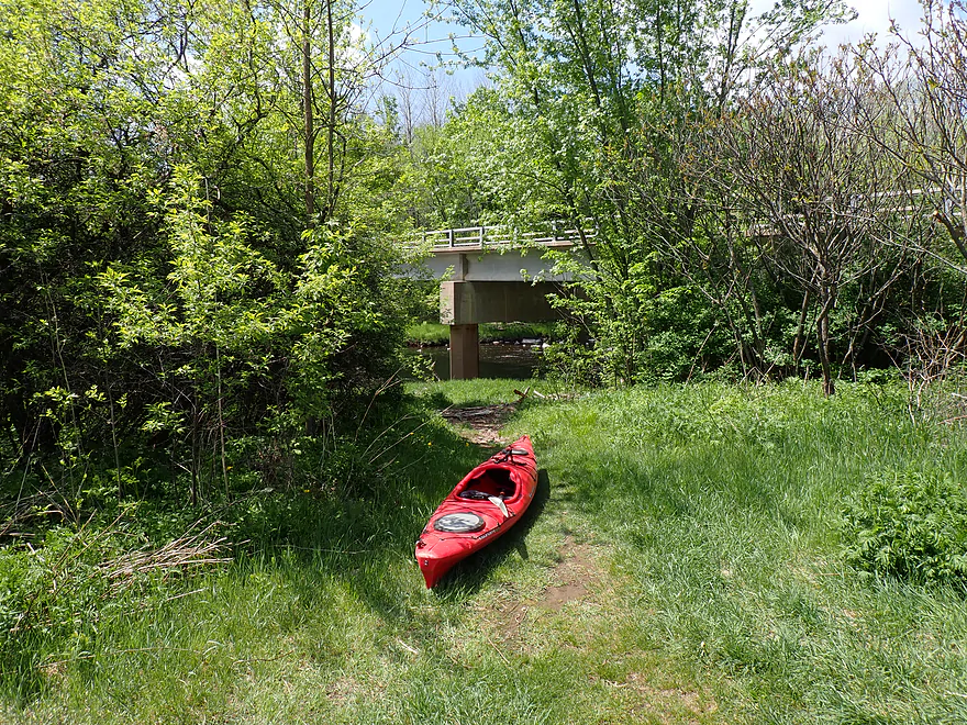
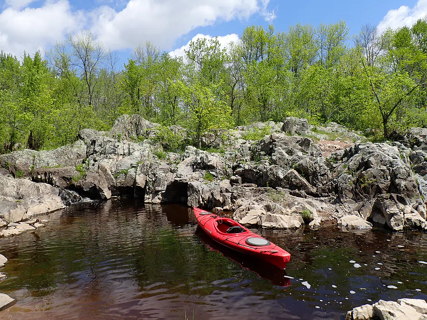
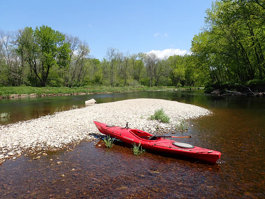
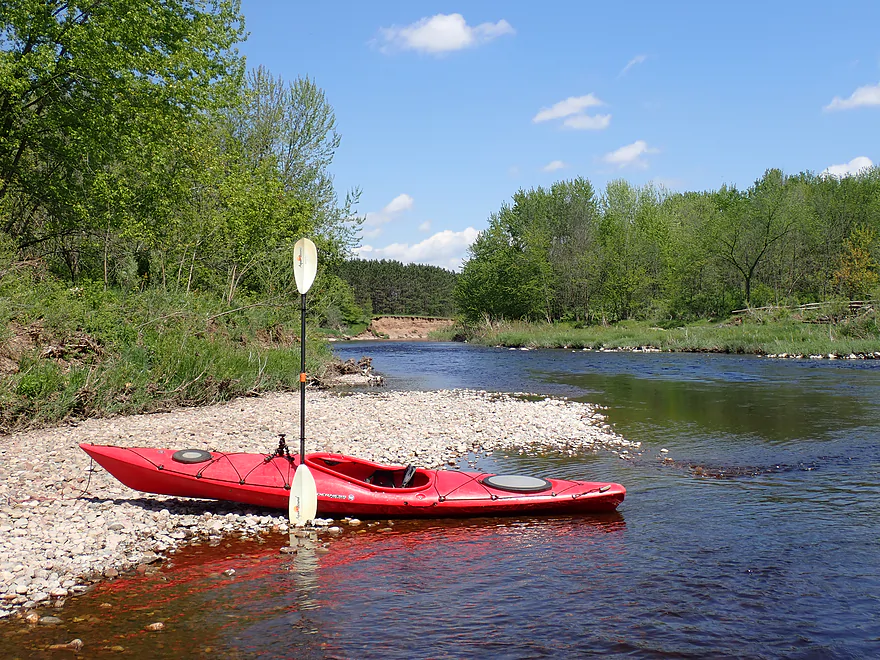
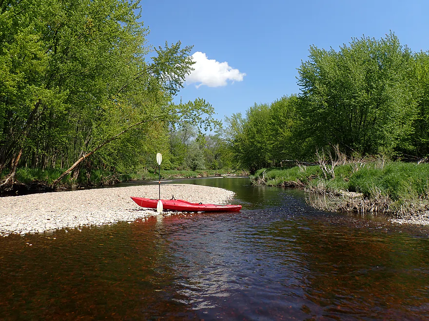
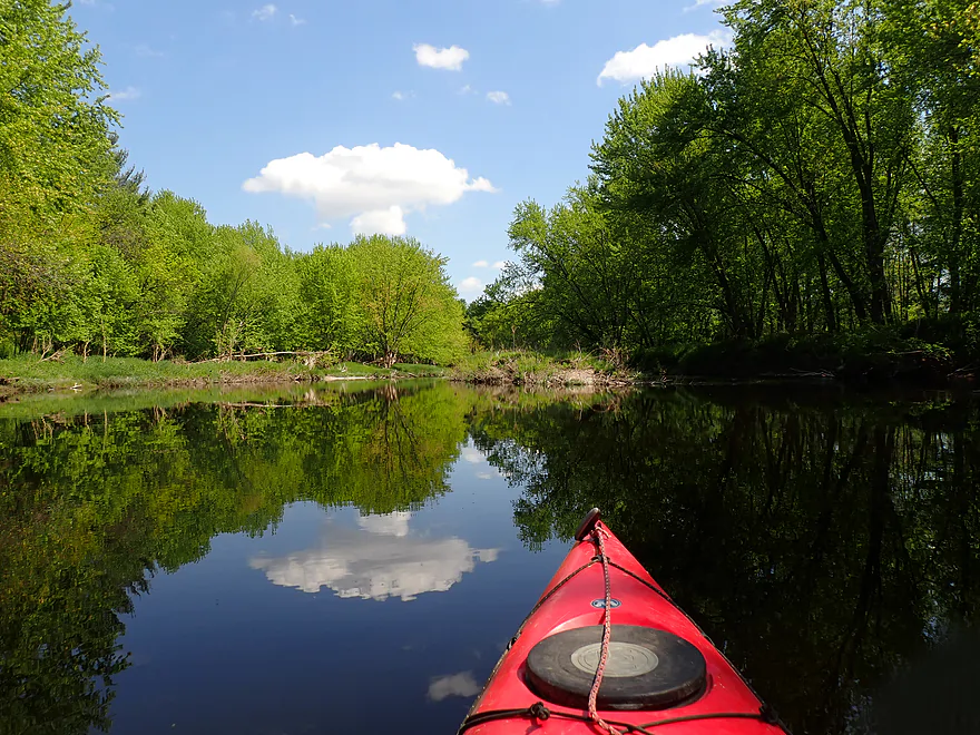
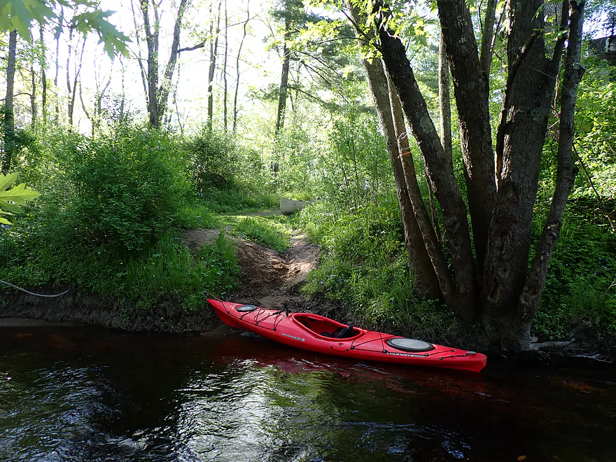
Starting the trip at a hidden landing northeast of the Cty Rd S bridge
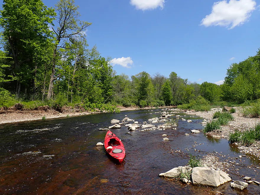
Great access

Heading upstream to check out Rib Falls
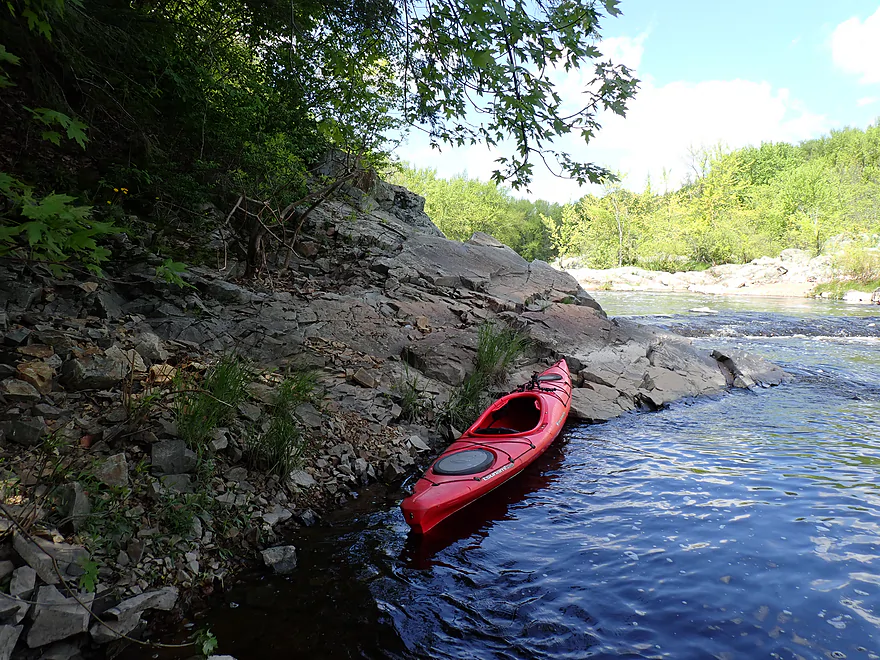
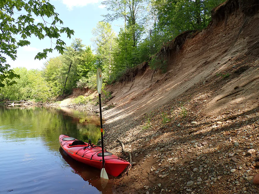
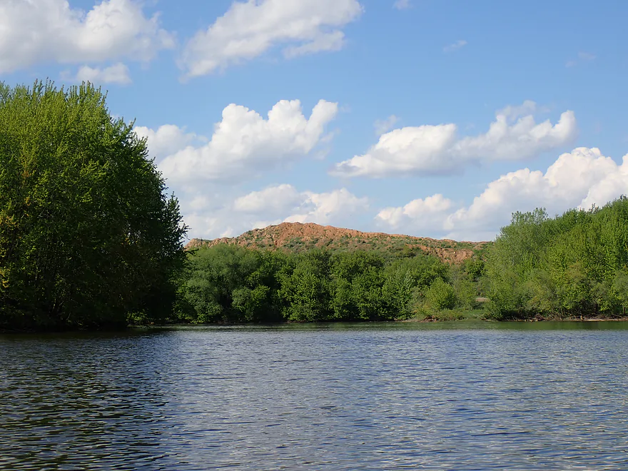
Scenic outcrop

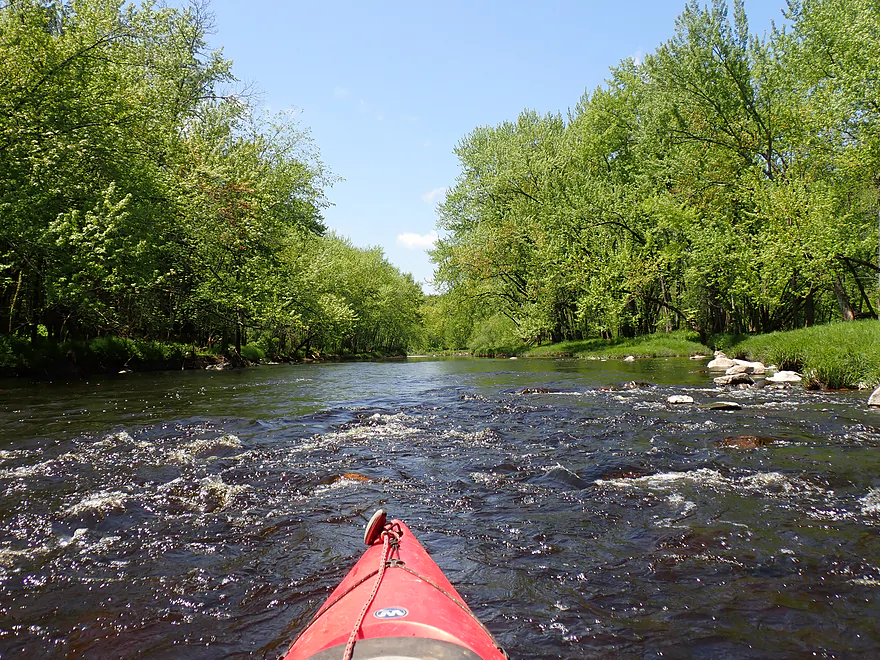
These aren’t the main rapids
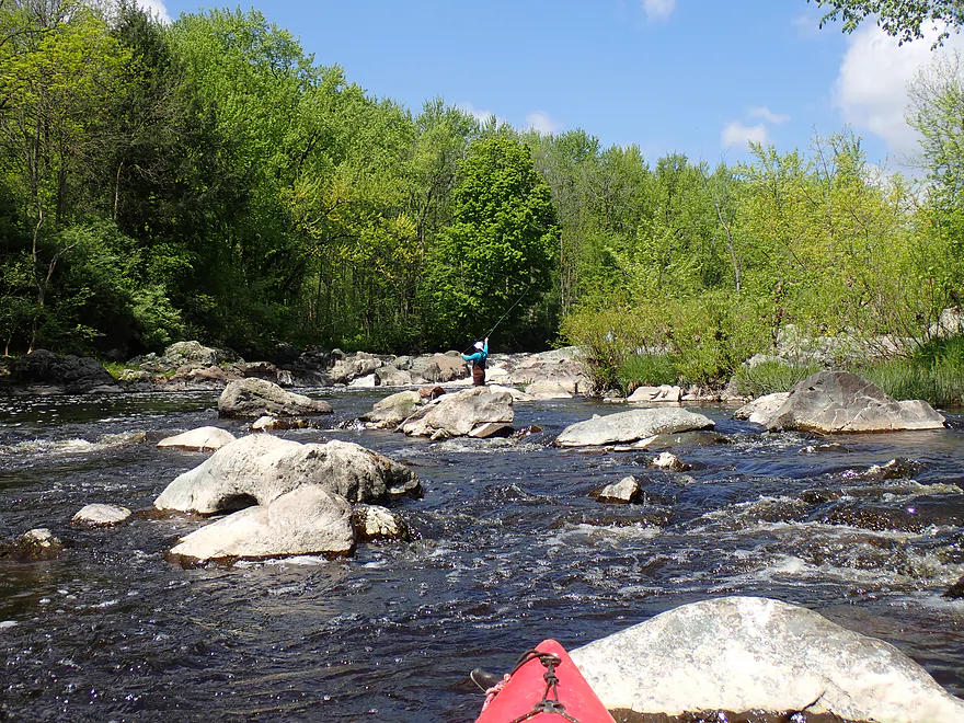
Attractive boulder field
Exposed granite bedrock

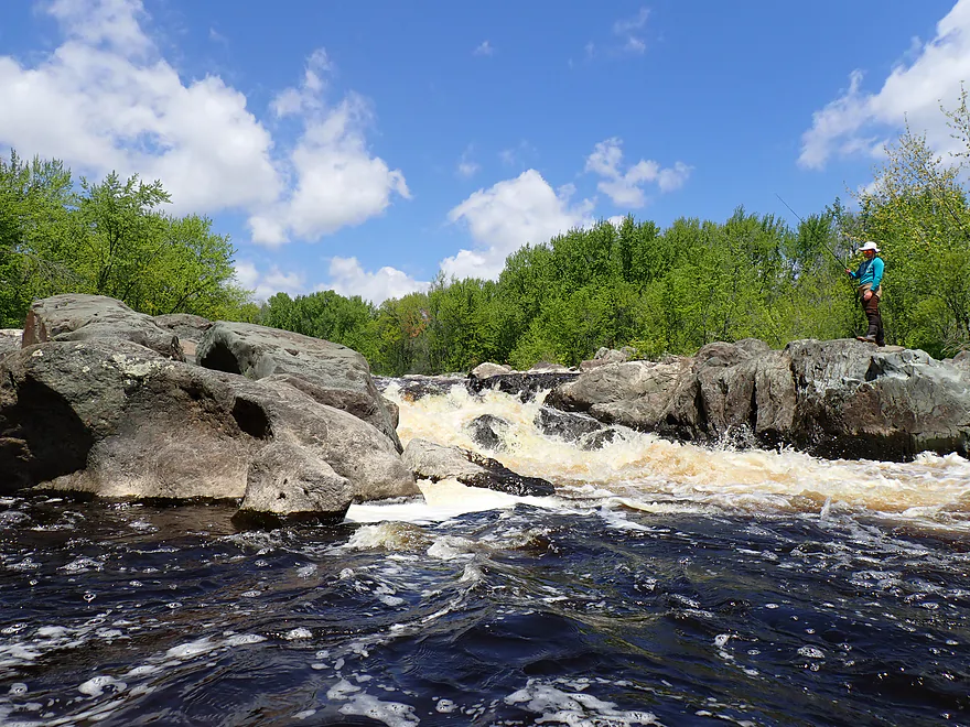
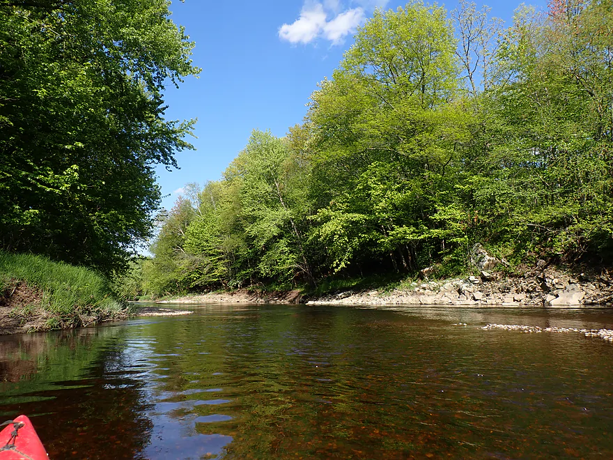
Rib Falls
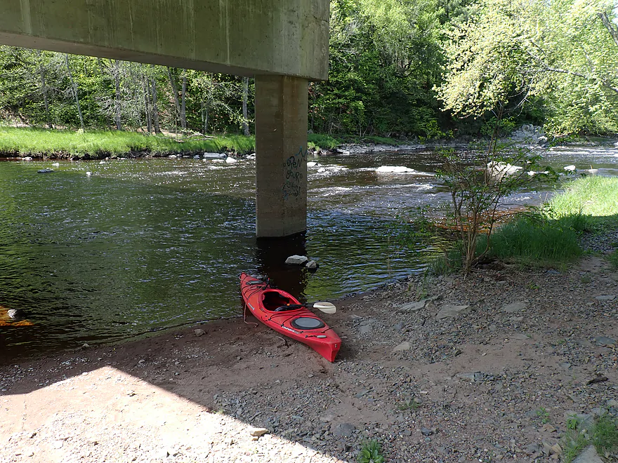
Getting in for a closer shot
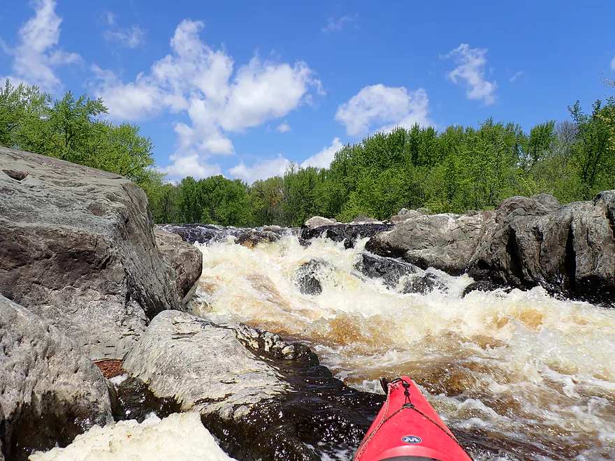
This is a dangerous Class 4 (note the boulder at the base, followed by a hole)
Heading back downstream
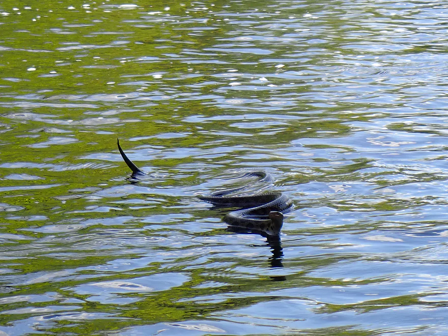
Friendly water snake (terrific swimmer)
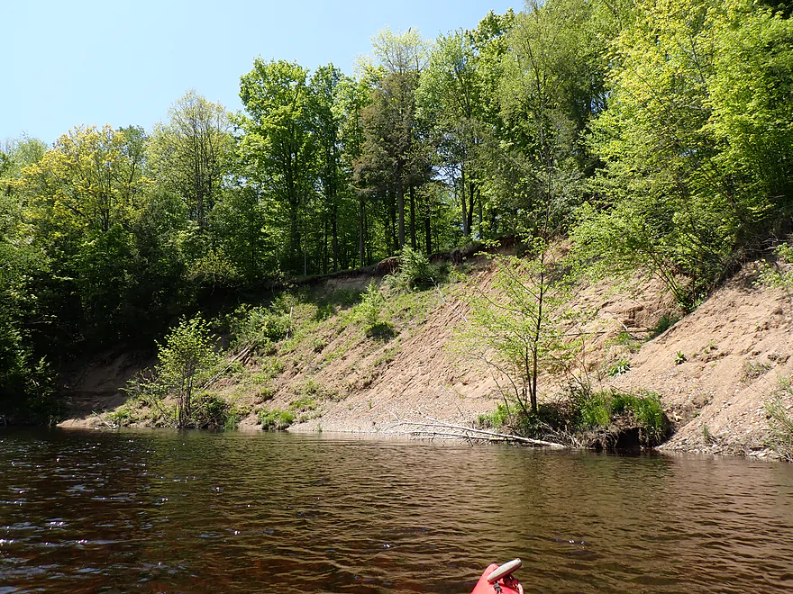
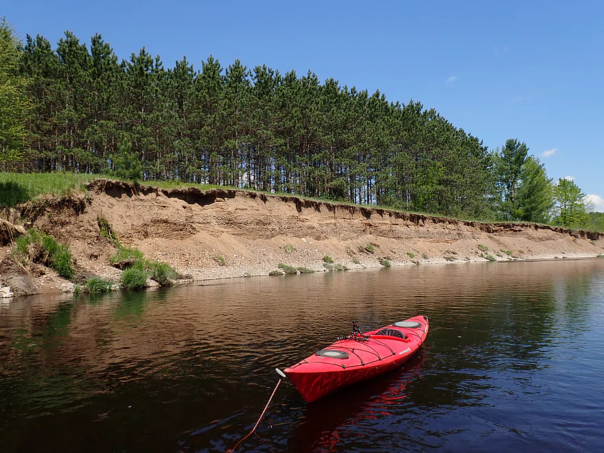
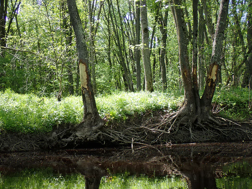
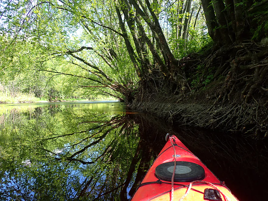
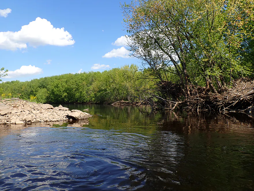
Interesting bank…looks like an artificial dike
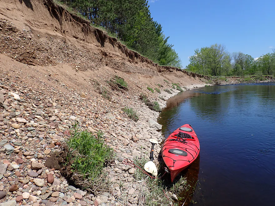
Still cool looking
Reverse view
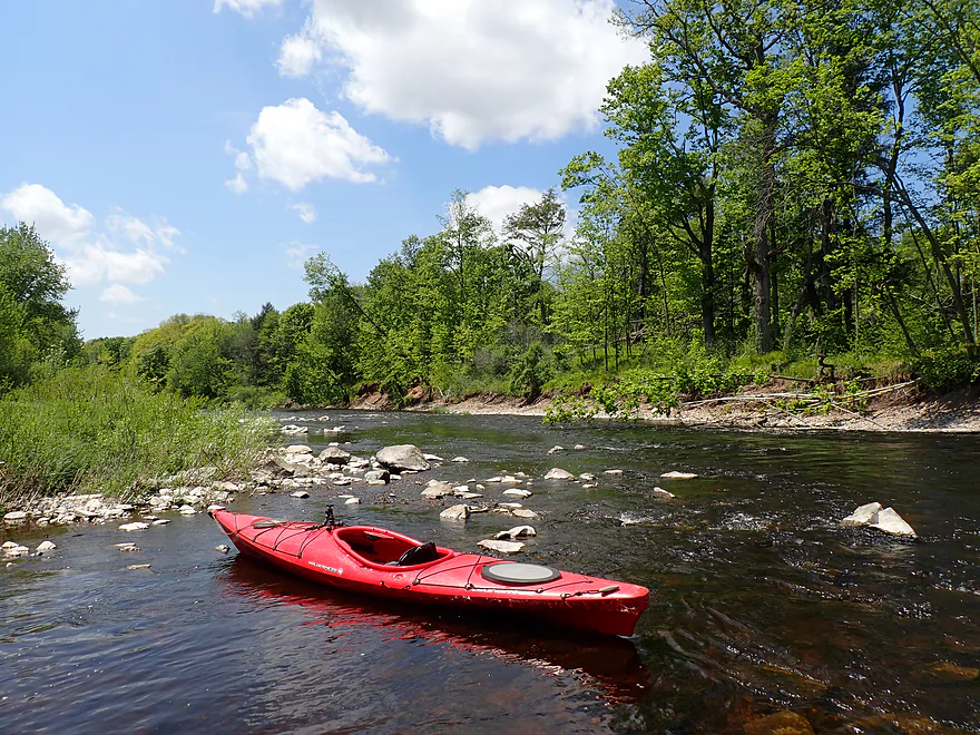
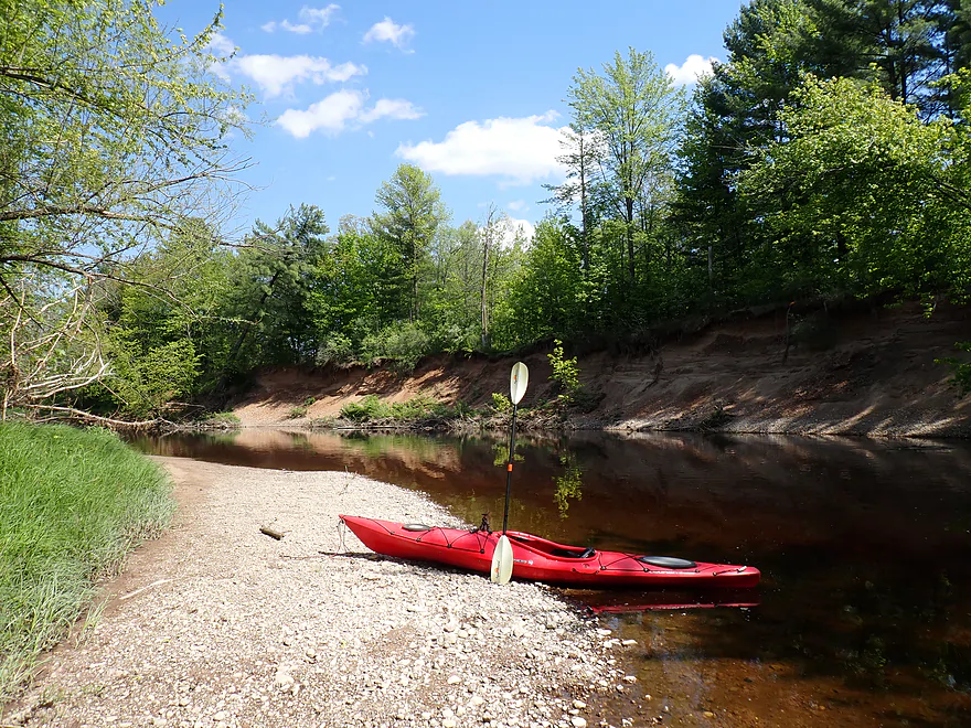
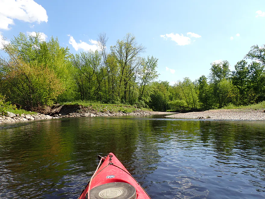
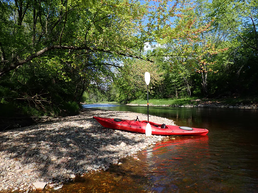
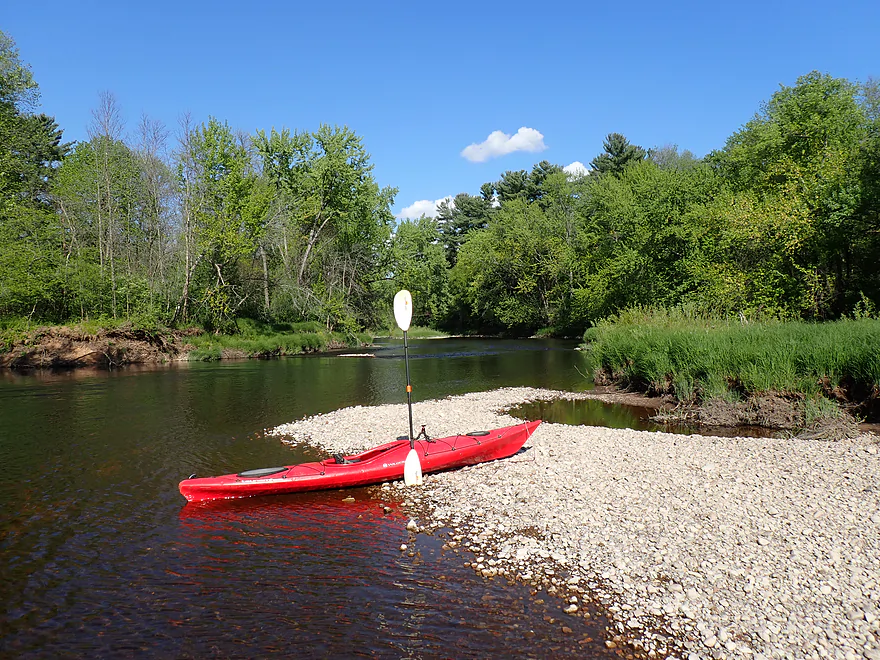
One of many nice gravel bars
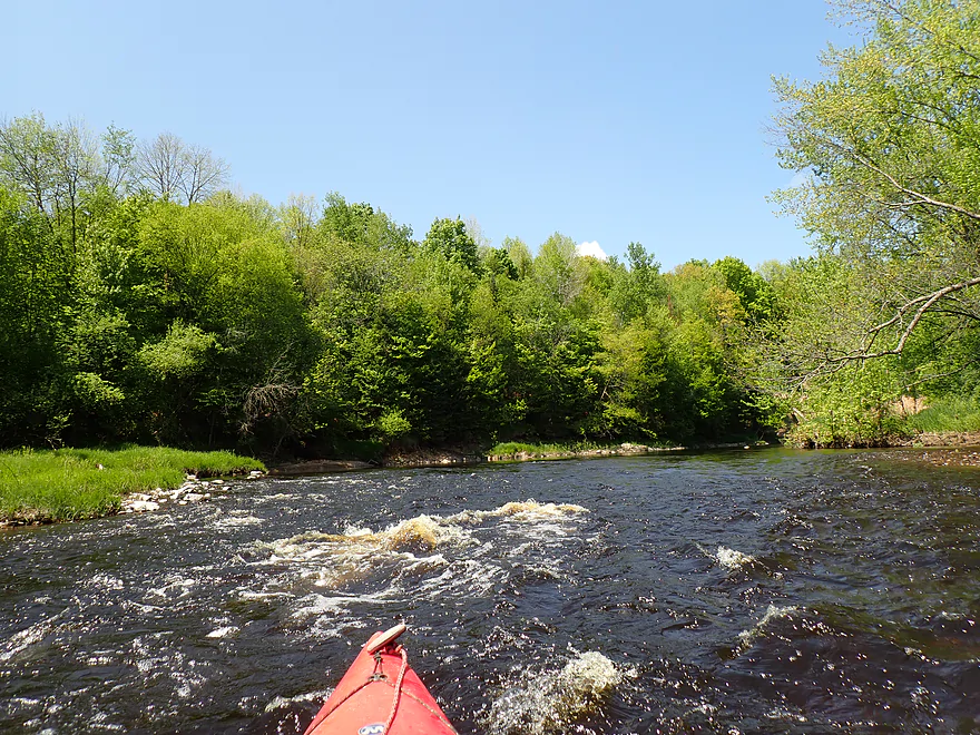
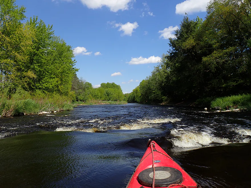
One of a handful of minor Class I rapids

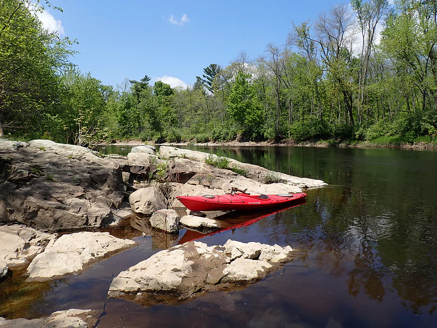
More exposed bedrock
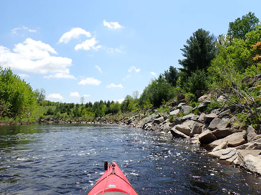
Approaching a longer boulder field and pitch of rapids

Very scenic
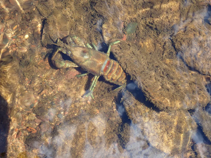
Some crayfish
You can’t see it, but there is a guy sitting on top of the bank
Taking another picture break
One of the nicer sand banks

Reverse view
A strainer in fast current (not too difficult to dodge)
Exploring a side channel around an island
Not as many pines in the second half of the trip, but still some
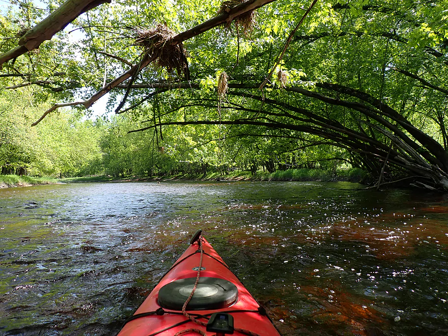
Lots of great tree canopies
Last of the main sand banks
A thin dike wall separates the Big Rib from a gravel pit lake
Skinned knees (like from ice)
Fun rapids
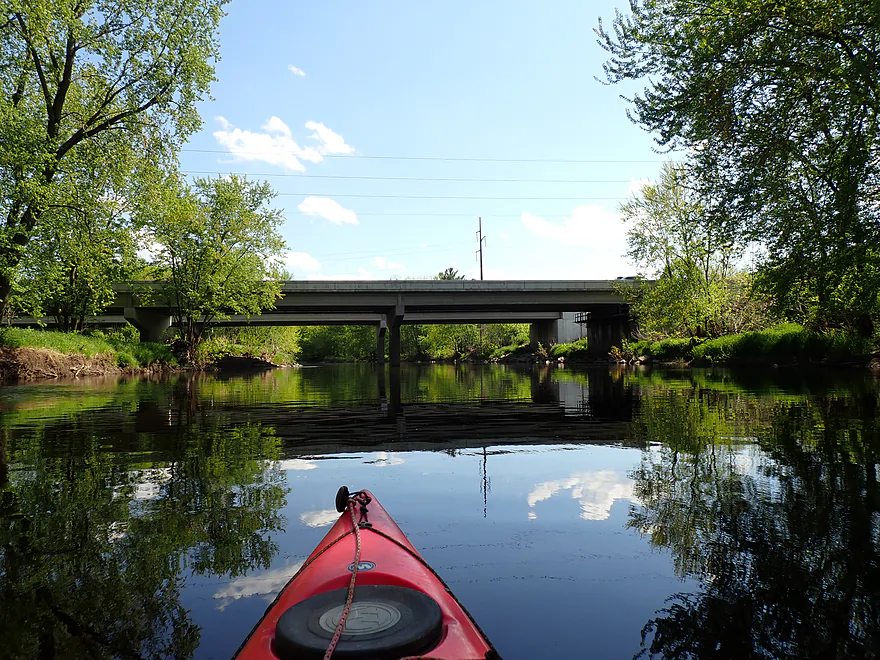
Noisy Hwy 29
A surprise “hole” in the river bank…

Leads to a another gravel pit lake
Excavated quarry material in the distance
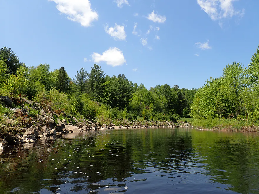
Back on the river…another great gravel bar
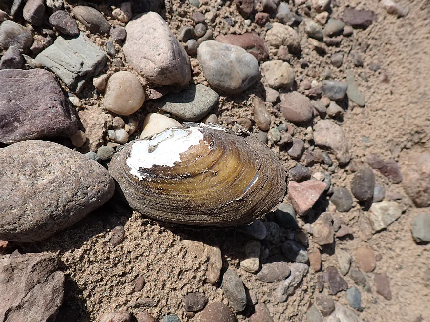
This is a decent clam river
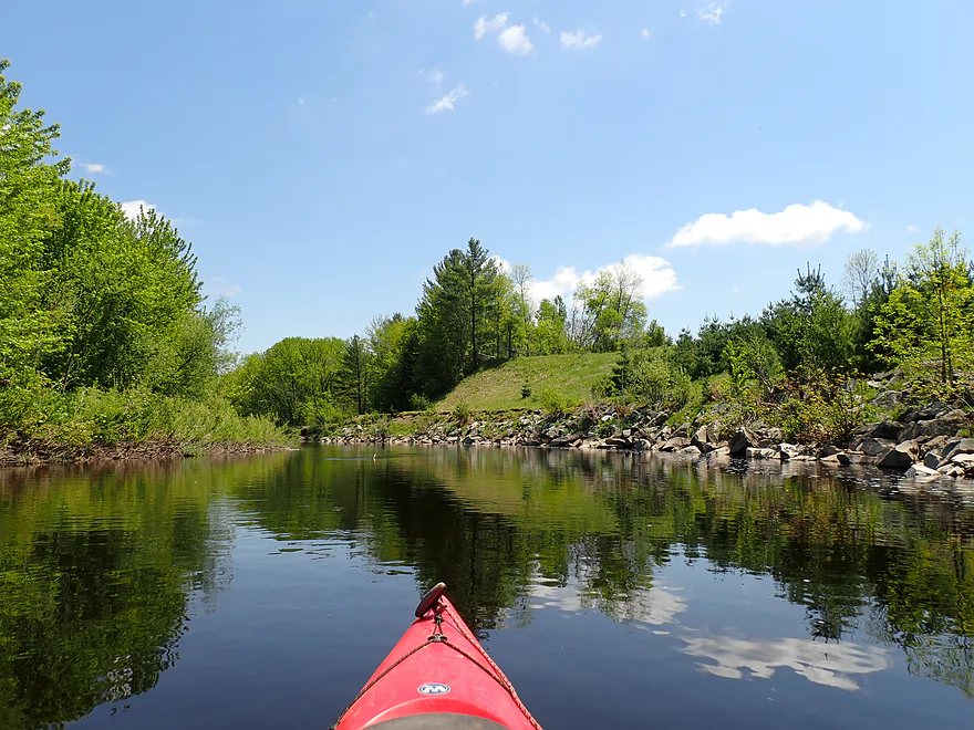
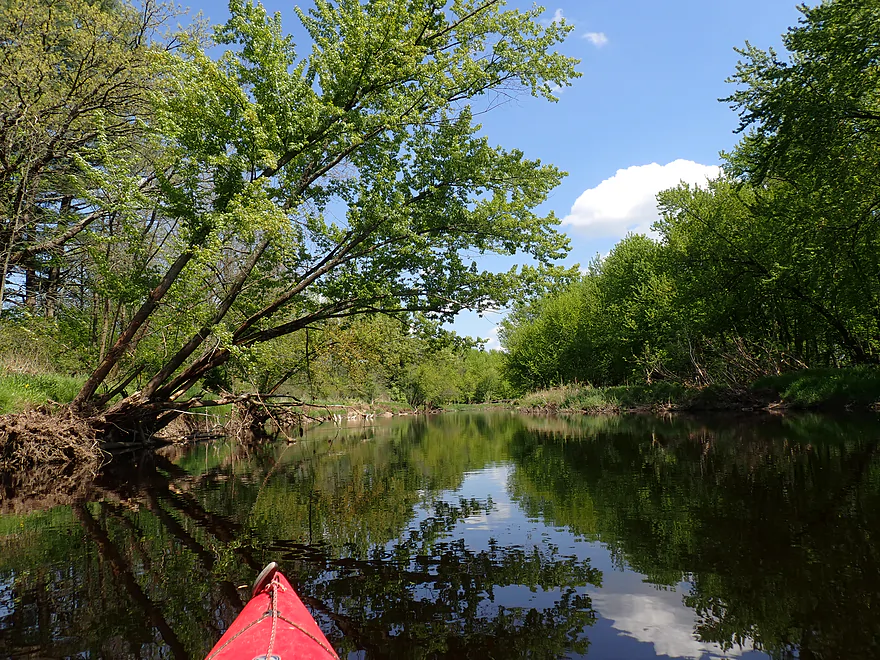
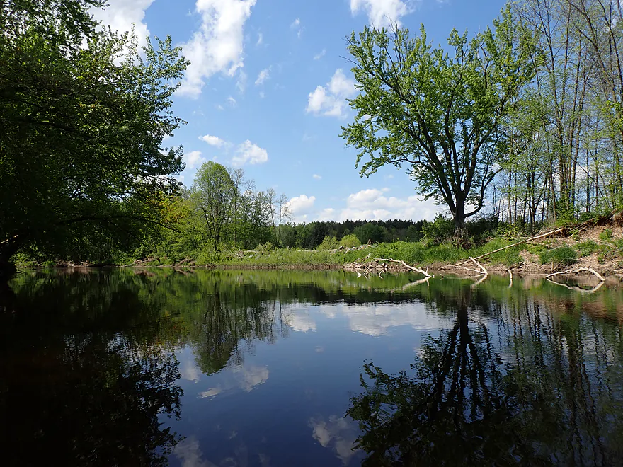
Scenic river bend
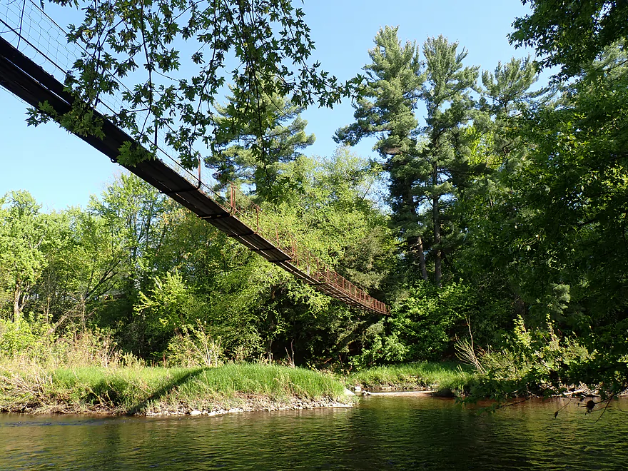
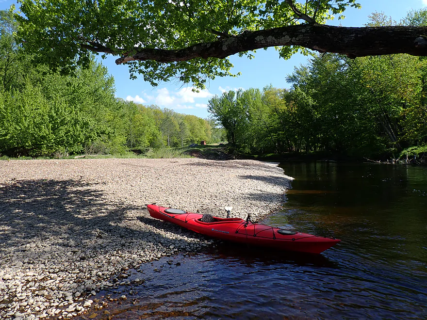
Suspension walk bridge marks the take-out
Marathon Lions Riverside Park is a good access
Big Rib River – Marathon City


The Big Rib is a great little tributary to the Wisconsin River just west of Wausau. It is also a popular paddling stretch for locals. Picking up where my 2023 trip ended at Rib Falls, this journey explores the next leg downstream, a more obscure section of the river.
Rib Falls at the put-in was the highlight of the entire trip. Here the river drops 4-5 feet over a beautiful outcrop of exposed bedrock. There is a public park along the east bank, but it is a long, rough haul with a boat to get to the water (and was crowded with fishermen during my trip). For a much easier put-in, bypass the main park and launch directly under the Cty Rd S bridge (there is a hidden public parking area to the north).
The only catch with the bridge launch is that you start downstream of the main action. Interested in photos, I paddled and waded upstream toward Rib Falls. Even though the gauge officially matched my 2023 trip at 2.6′, the river was oddly, significantly higher and the falls were roaring. Running them would have been reckless; it’s a deceptively steep drop into a hole and misplaced boulders, and even the outwash below the rapids was incredibly rambunctious.
On a safety note, I suspect many paddlers are using AI these days for water trail research, but it’s a dangerous habit. For this stretch, AI claims Rib Falls is only 1 to 3 feet high with basic Class I–II rock hopping and “no steep vertical waterfall.” In reality, it’s twice that height and easily a Class IV hazard. Trusting blind advice like that can get you killed.
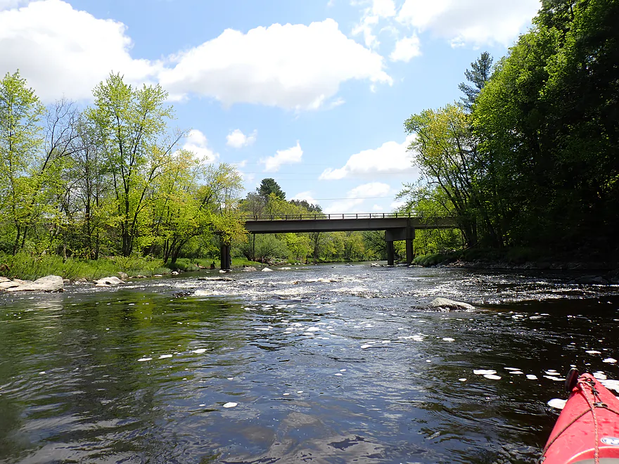
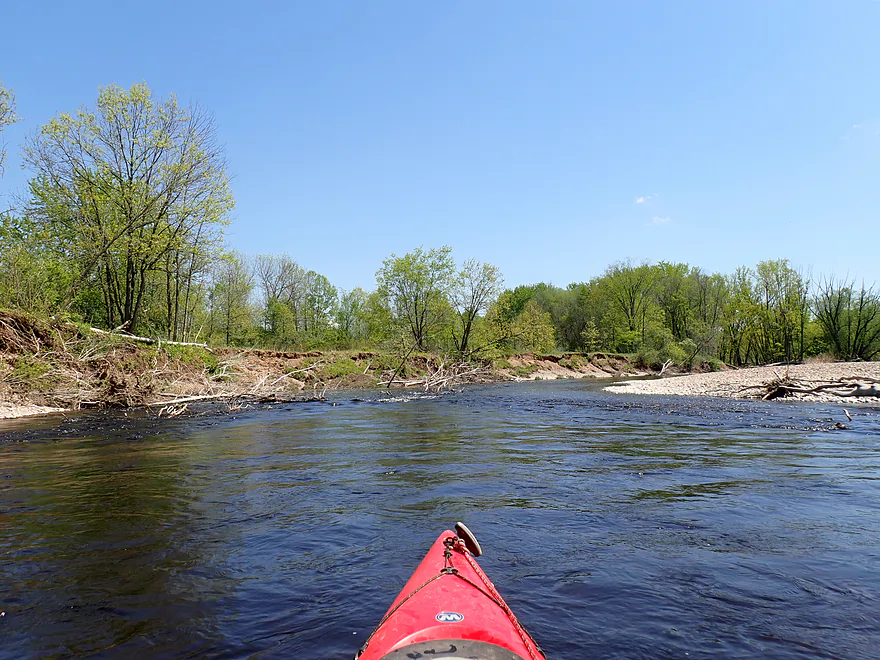
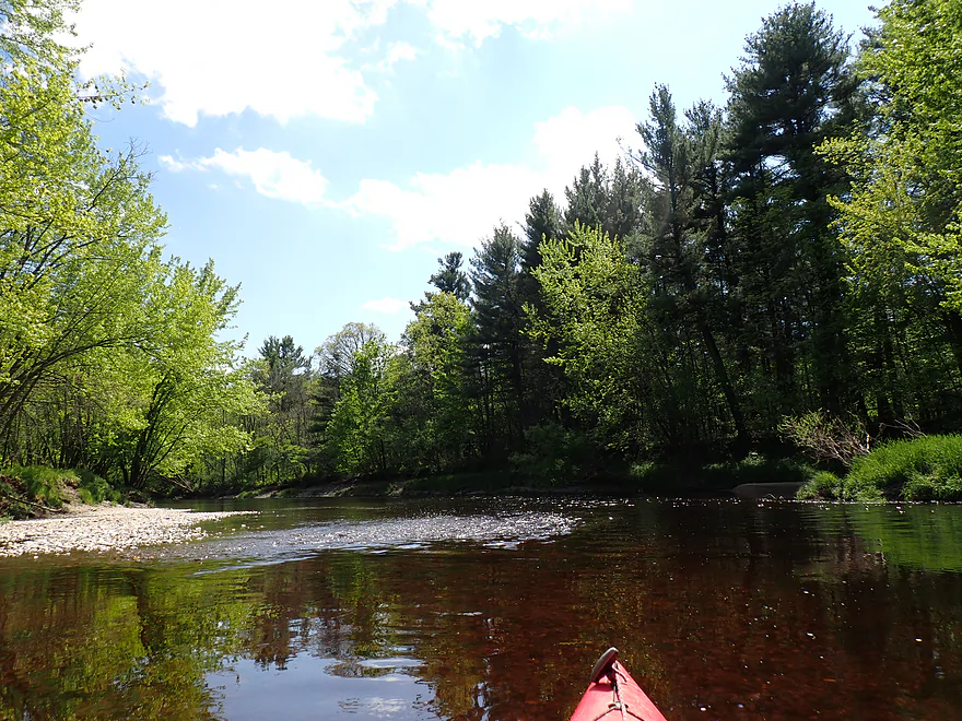
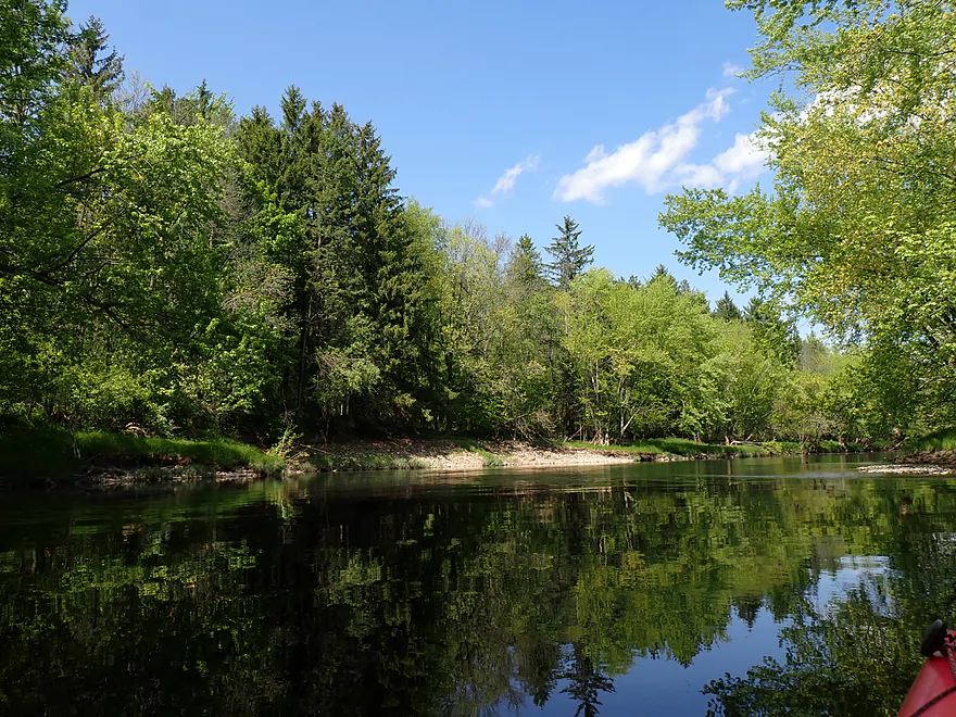
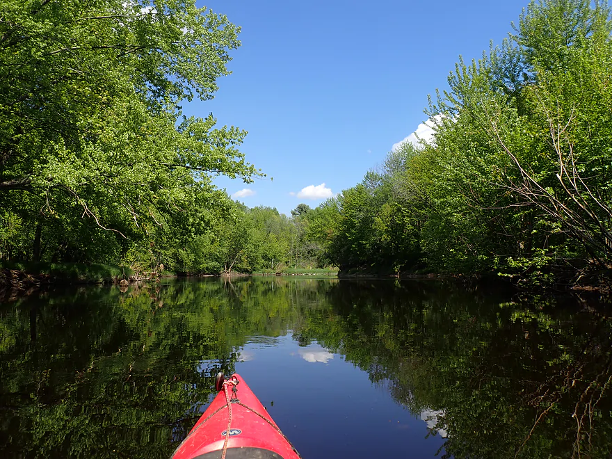
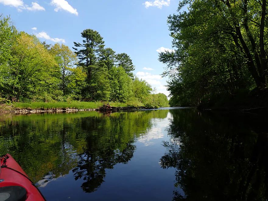
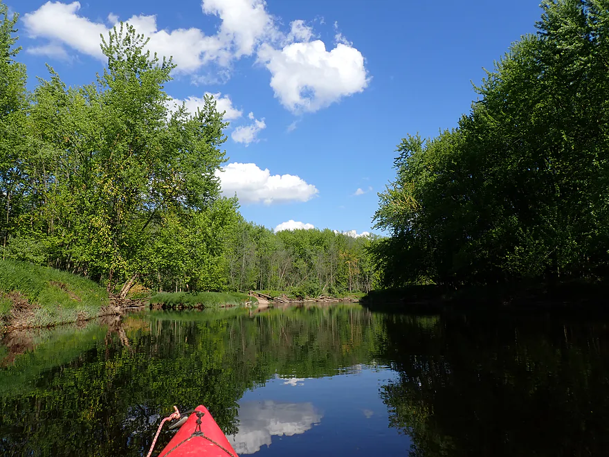
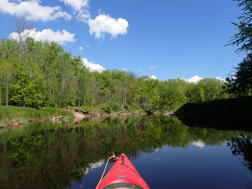
After shooting plenty of photos, while fishermen watched from the shore like stadium spectators, I headed downstream. The first half of the trip consisted of slow sections interrupted by occasional rapids. A recent rain meant water levels were a smidge higher than normal, knocking down the river’s usual good clarity. Wooded banks of silver maples, hardwoods, and pines lined the river, accented by numerous scenic gravel bars. These, together with the exposed sand banks, reminded me of the Red Cedar River.
Passing one particularly massive sand bank, I spotted a man sitting on a bench at the top waving at me. It was a surreal sight in an otherwise middle-of-nowhere wilderness. A later map check confirmed there are no roads or houses nearby, meaning he hiked a significant distance to reach that hidden bench overlooking the river.
Looking at a satellite map of this route, one of the first things you notice is the cluster of roughly ten gravel pit lakes lining the river. Local construction companies over the years heavily quarried the area for its gravel, and from the water you can still see gaps in the treeline, heavy equipment, and artificial dikes. They aren’t as active today, as operators faced scrutiny for digging so close to the river. If you’re interested in learning more, you can read this 1992 DNR study which examined the impact of these riverside “wet pits” on the Big Rib River.
The second half of the trip was much different. As the river slowed and deepened, it featured fewer rapids, gravel bars, pines, boulder gardens, and exposed banks. Instead, peaceful lowland silver maples took over. Although less scenic, they often draped over the river, creating cool canopies to paddle under.
Passing noisy Highway 29, the river slowed and the woods became denser, perhaps a sign this area was better protected from loggers. I noticed quite a few silver maples with “skinned knees” where ice jams up to four feet high had scraped off the bark. There was also one last massive quarry lake that surprisingly connected right to the river. I paddled in to check it out, but it wasn’t too exciting, so I soon turned back.
After passing a few final gravel bars, I took out at Lions Riverside Park in Marathon City. Because the landing isn’t at a road bridge, it might be hard to spot, but a cool pedestrian suspension bridge hangs right over the water to mark the exact location. I wanted to walk across, but it was currently closed for “safety reasons”…hopefully the park restores it in the future.
Overall, this was an easy and great paddle with fun rapids and a mostly undeveloped shoreline (minus the quarry lakes). I highly recommend it to locals. If I had to compare it to my previous trip on the upstream leg, that section was slightly better, thanks to more rock outcrops, but this stretch was still very good. It also serves as a perfect alternative to the popular Eau Claire River to the east. While the Eau Claire is more scenic, it frequently runs too shallow, making the somewhat deeper lower Big Rib a reliable backup paddle.
Trip sights included a large watersnake, lots of songbirds, and an eagle that got a little close to a heron, causing it to squawk loudly. There were also a number of clam shells along the river.
Wausau Whitewater Park: The state’s largest artificial whitewater course sits on a side channel of the Wisconsin River. It includes bankside seating for spectators to watch kayakers. Because recreational water levels rely entirely on scheduled dam releases, checking the park’s operational calendar before arriving is required.
Rib Falls County Park: There is a public park north of the falls, but it’s a long hike (400′) over rocky terrain to reach the water. For launching, instead go a bit downstream and launch directly under the Cty Rd S bridge (there is a public fishing trail and parking area northeast of the bridge). This was an excellent access.
Alternate Put-ins:
- Cty Rd A (7.7 miles upstream from Rib Falls County Park): This is a bit of a weedy bridge access, but is doable. The stretch between Cty A and Rib Falls is very nice and features several outcrops.
Marathon Lions Riverside Park/Hwy 107: This is a very good public access. Note that the landing itself isn’t well marked from the road or from Google Maps (it’s kind of new). To find it, take Krautkramer Lane to River Road, then drive to the far west end of the park where you will find an obscure paddling launch right by the pedestrian suspension bridge.
Alternate Take-outs:
- Sunnyvale County Park (9.7 miles downstream from Marathon): Sunnyvale Park would be a tricky, highly speculative access point. Hypothetically, you could portage over the dike separating the river from the man-made Sunnyvale Lake, paddle north across the open water, and take out at the public swimming beach. I haven’t scouted this specific stretch myself, but I suspect it is quite scenic with a slow, flat channel winding through a dense floodplain forest with the potential for some massive gravel bars.
Bike Shuttle – Marathon to Rib Falls: 5.9 miles with 135′ of ascent. This bike shuttle was somewhat hilly but very manageable and paved. Note that Google might route you onto the Highway 29 freeway; avoid that by taking Hwy 107 north and Cty Rd U west, which is your best bet.
Logjams/Strainers: There are no logjams, but there are a few strainers. Paddlers who stay alert and don’t paddle during flood conditions should be fine though.
Rapids/Current: There are a handful of Class I rapids located mostly in the first half of the trip. They’re fairly easy, but two pitches do have strainers to dodge. In theory, you could launch above Rib Falls to run the drop, but this is a dangerous set of Class IV rapids with an ill-placed boulder and a nasty hole at the base. You should only run the falls if you have advanced whitewater experience.
Gauge: Big Rib River @ Rib Falls
Trip Depth: 180 CFS or 2.69′
Navigability Estimates: The following are rough estimates.
- 0-100 CFS: A very low depth. Many of the riffles would likely be too bumpy to be enjoyable.
- 101-200 CFS: Some of the riffles will be bumpy, but I believe this would be a doable depth as most of the river (outside of the rapids) is plenty deep.
- 201-300 CFS: A common average flow rate and a good target range, although clarity will not be as good.
- 301-400 CFS: The river is above normal but likely still quite doable. Clarity would likely be poor.
- 401-500 CFS: This would be a pretty high level. Some of the snags could be difficult to circumvent at this depth.
- 501+ CFS: These are very high levels and not recommended for casual paddlers.
Detailed Overview
- Upstream of Cty M: Likely navigable paddling, I just don’t know much more.
- Cty M to Lemke Drive: 4.5 miles. An unknown prospect…might be interesting. Could be some downed trees.
- Lemke Drive to Hwy 64: 4.6 miles. Pleasant, but not a special trip.
- Hwy 64 to Silver Fox Road/Greiner Road: 3.7 miles. Famous section that contains the dells, the most rapids and a tough section with Class 3 rapids. Likely 5 stars. Note, the bike shuttle for this section is poor. Reviewed by AmericanWhitewater.org, but note that their flow estimates are very aggressive.
- Silver Fox Road to Cty F/Amco Park: 3.3 Miles. A pleasant section with some light rapids.
- Amco Park to Cty A: 4.5 miles. Slower than upstream sections but pleasant and wooded with a few small outcrops.
- Cty A to Big Rib Falls County Park: 7.7 Miles. A great stretch and maybe the best leg on the entire Big Rib River. Highlights include attractive hemlocks, light rapids, boulders, and seven separate sets of gorgeous granite outcrops. This section ends with a bang with Rib Falls, which is very scenic.
- Big Rib Falls Park to Marathon Lion's Riverside Park/Hwy 107: 6.6 miles. Attractive stretch with exposed sand banks, small boulder gardens, gravel bars, and a handful of Class I rapids. The second half of the trip is more of a slower silver maple floodplain forest, but is still nice.
- Marathon Lion's Riverside Park to Sunnyvale Lake: 9.0 miles. Here the river flows through thick floodplain forest. There are no known rapids or rock formations, but the woods should be nice (especially in fall). Sunnyvale Lake is a speculative access: it is a man-made lake located by the river. You would need to portage the dike, and then paddle a third of a mile north on the lake to reach the beach and public park access.
- Sunnyvale Lake to Little Rib River Landing: 5.7 miles. A squiggly floodplain forest paddle with the highlight being massive sandbars. Technically speaking, the take-out is located on the Little Rib River (just a bit upstream from the mouth).
- Little Rib River Landing to Rookery View Park: 2.0 miles. Here the current finally dies (courtesy of the Rothschild Dam). This is still a nice wooded paddle. There are multiple take-out options on the Wisconsin River. Here is a really cool video taken during fall color.
Not listed are several of the Big Rib tributaries. The most interesting one is Black Creek, running from Erbach Park/Athens to Meridian Road (5.8 miles). This contains neat boulder gardens and rocky gorges but could also have unknown hazards. This creek has been paddled before, with the most popular section being a whitewater stretch by Athens per reviewer Rick Kark. Also reviewed by AmericanWhitewater.org. The Little Rib River should be partially navigable by the mouth as part of a round trip, but if you go too far upstream, you'll likely face logjams.
Trip Map
Overview Map
Video
Photos Size: