
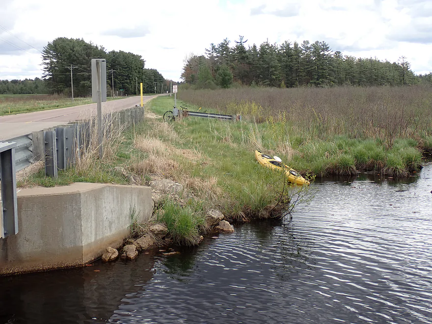
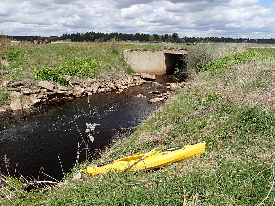
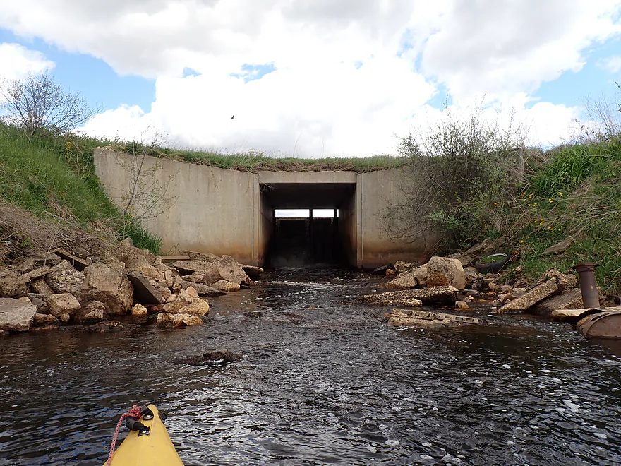
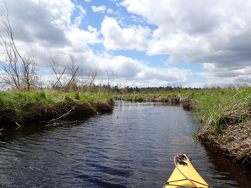
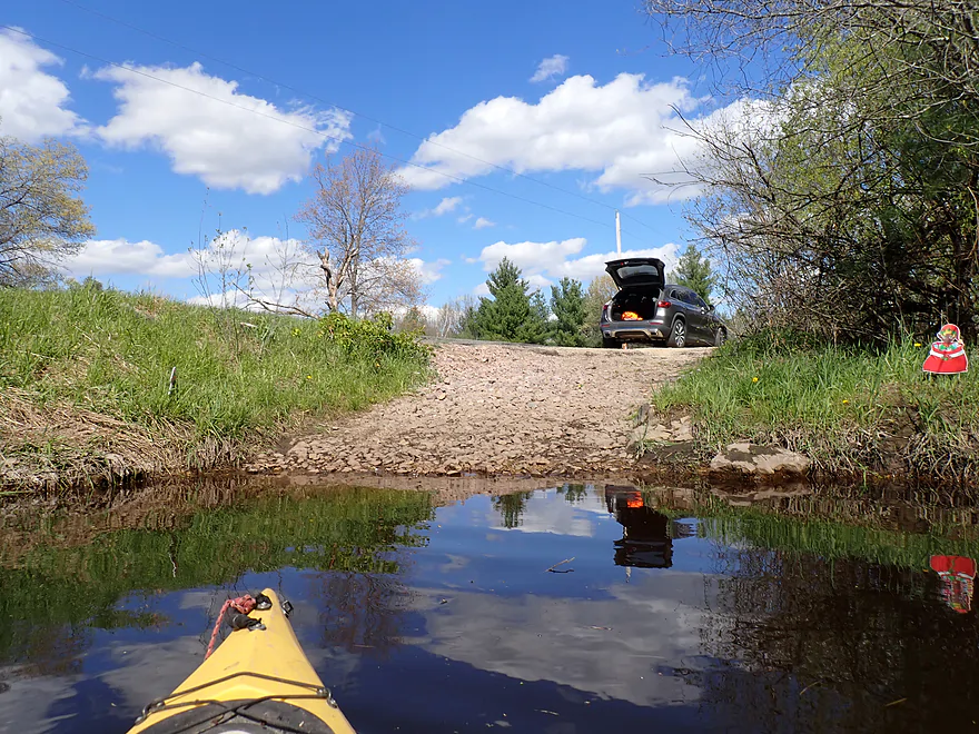
Starting the trip at Cty Rd EW
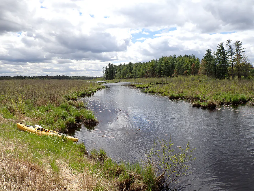
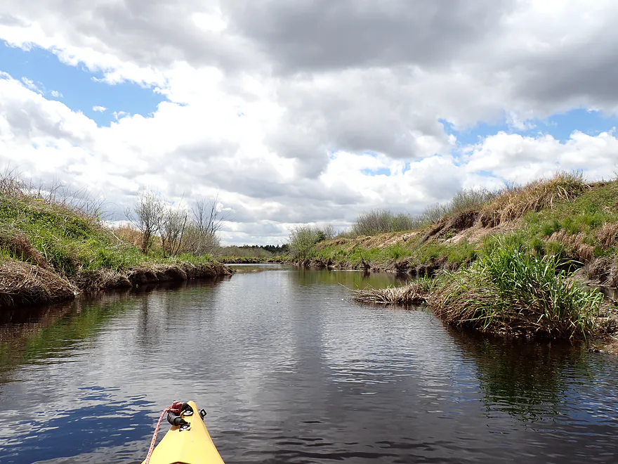
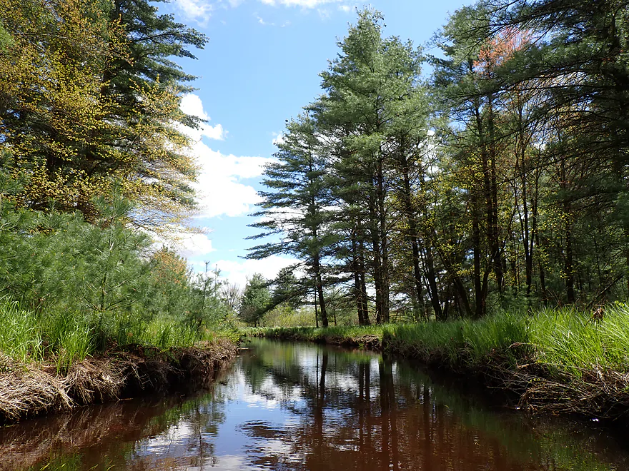
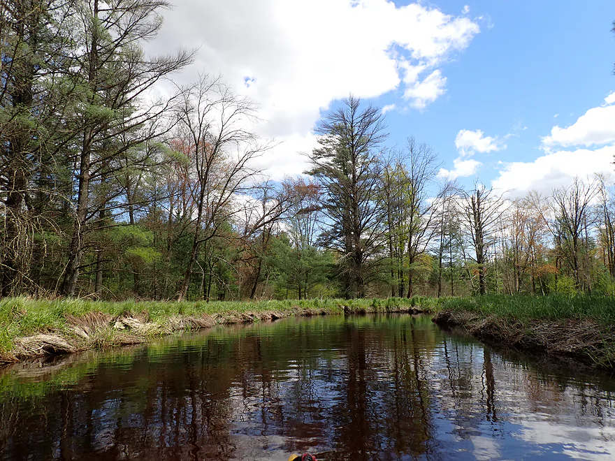
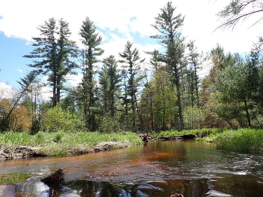
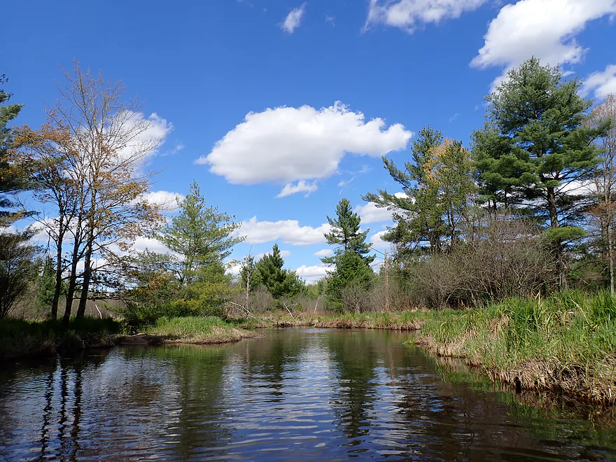
Scenic part of the river
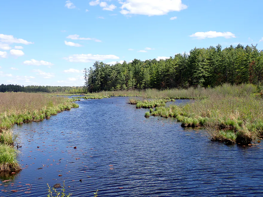
Looks different when the sun is out
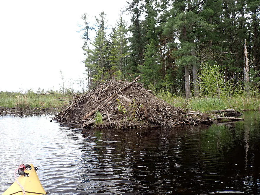
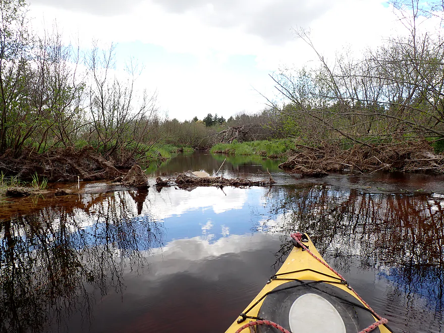
Large beaver lodge
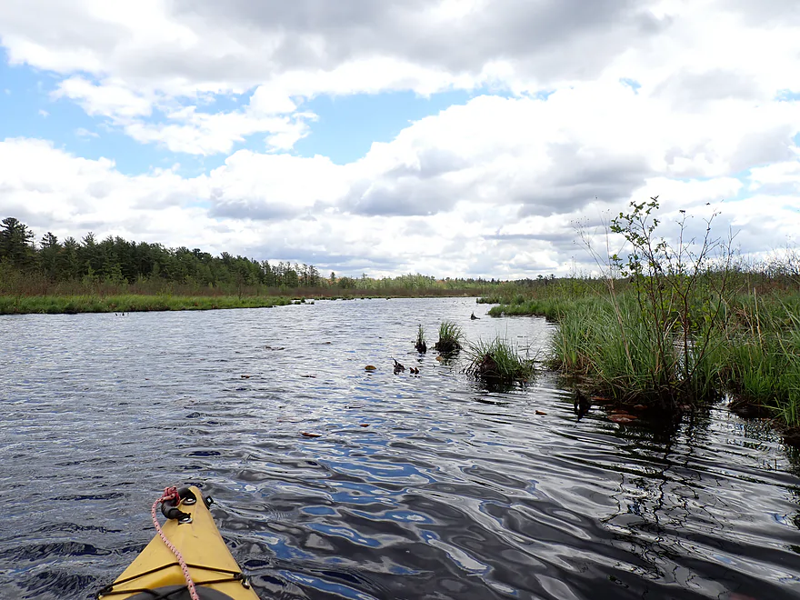
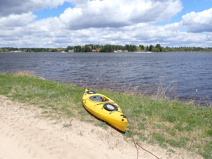
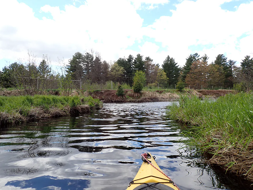
River slows and widens into a millpond
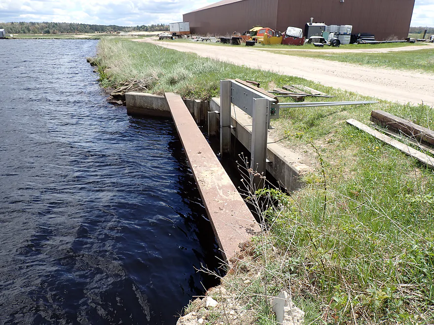
Stopped by a dike
Didn’t see a route to the south
So I double backed and portaged
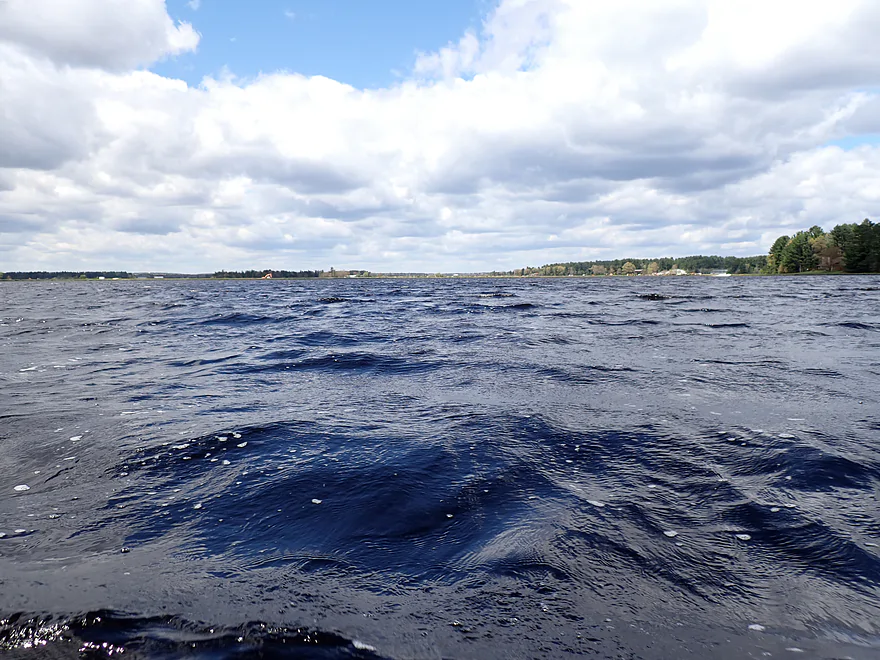
Now on a second pond…this one was choppy with strong winds
Getting out to portage the dam
Upstream view
Downstream view
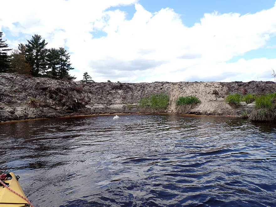
Suprisingly steep banks by the dam
View from the bottom
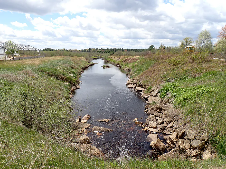
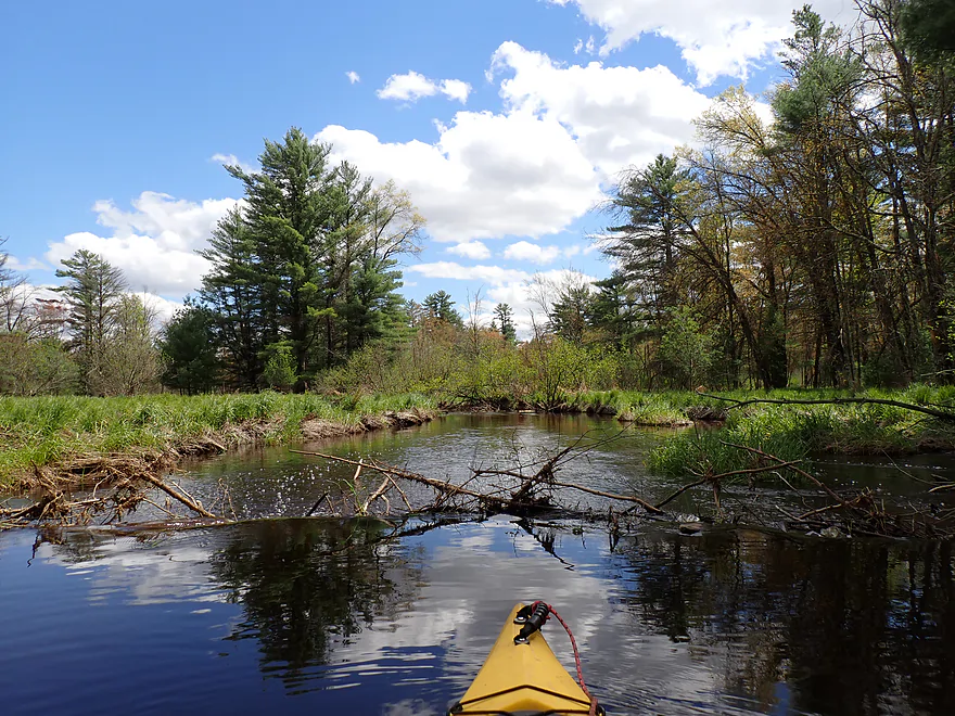
Great to finally be on a moving river again
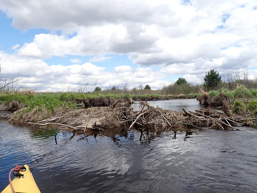
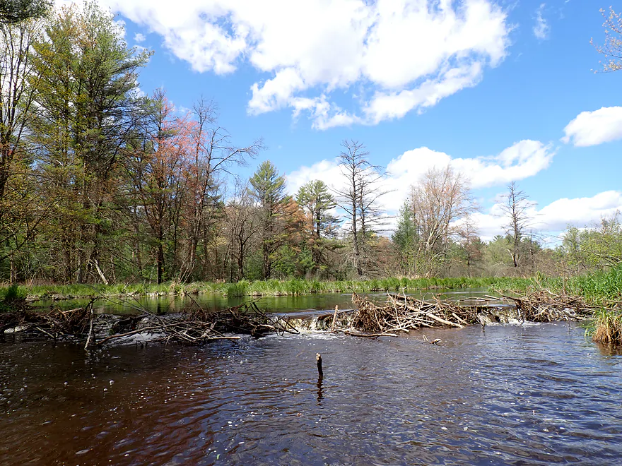
One of three beaver dams on the trip
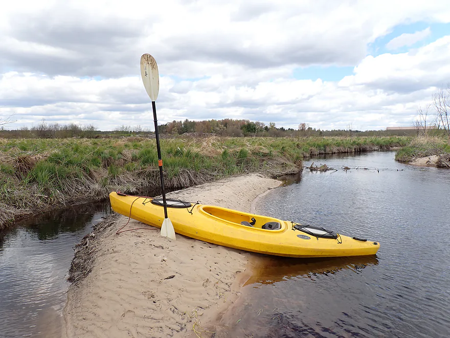
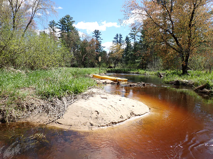
Surprised to see sandbars
Remnants of a former beaver dam
Approaching another dike
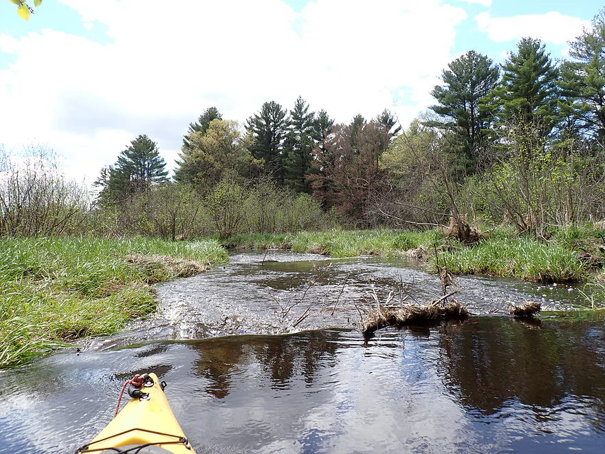
Strange bubbling gusher
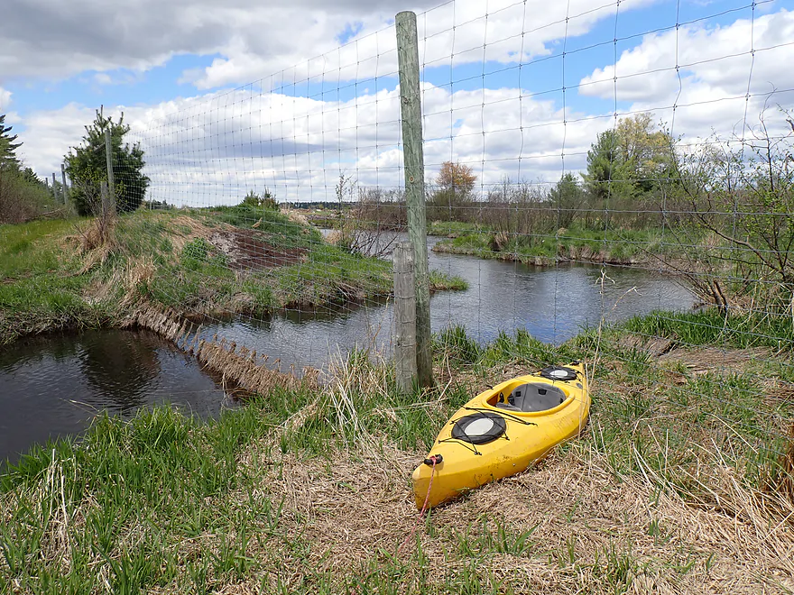
Portaging a tall deer fence (there is a gap at the bottom)
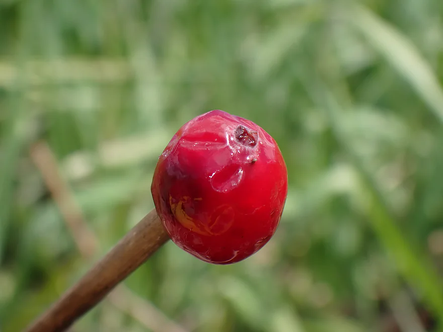
A reminder that we’re in cranberry country
Another beaver dam
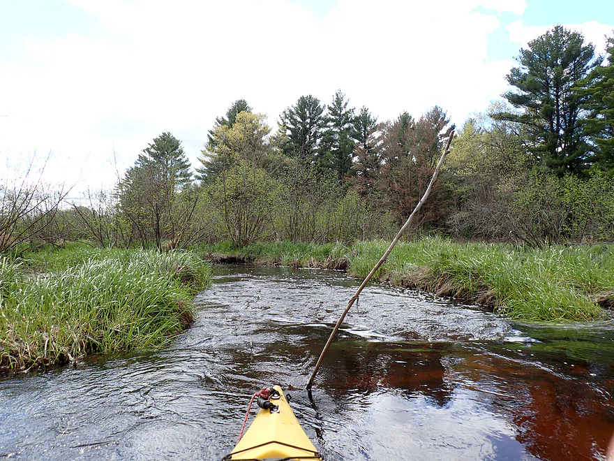
One of the rare fast spots
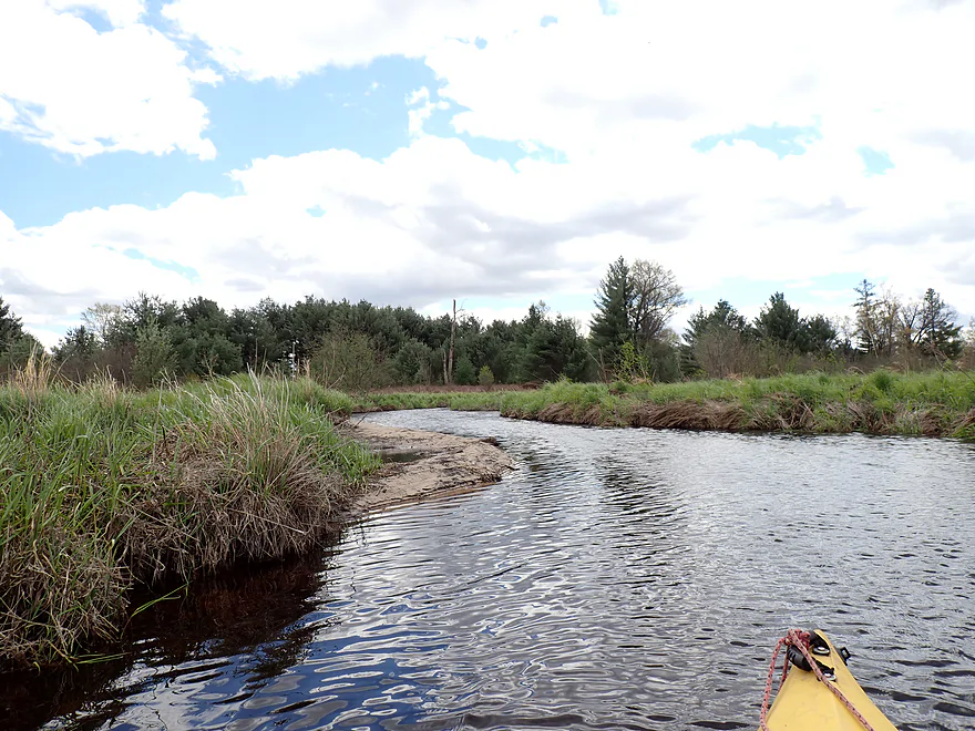
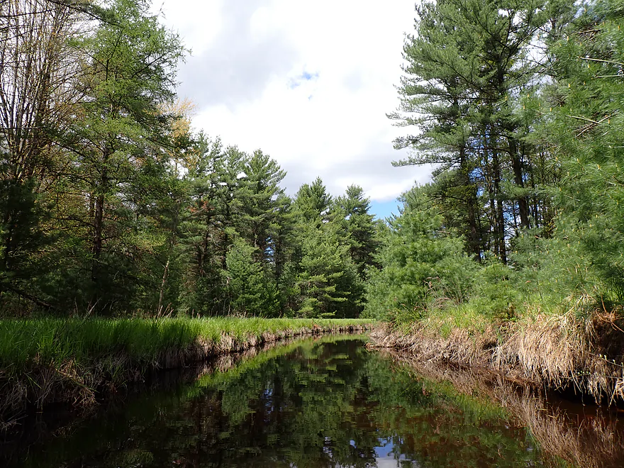
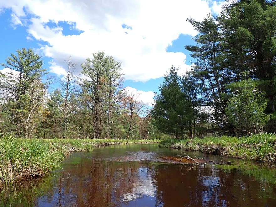
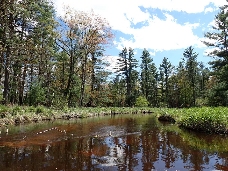
Creek changes as white pines now become more common
Exploring a side creek
I think this is part of Jay Creek, which eventually leads to a cranberry bog
Stopped by a logjam…time to head back downstream
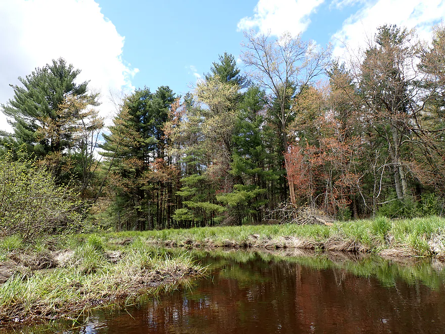
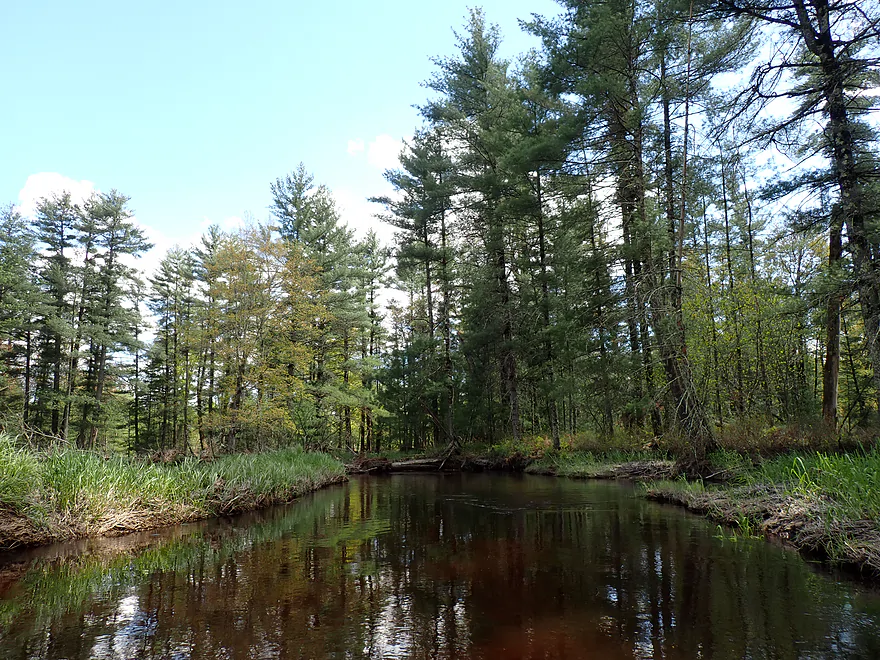
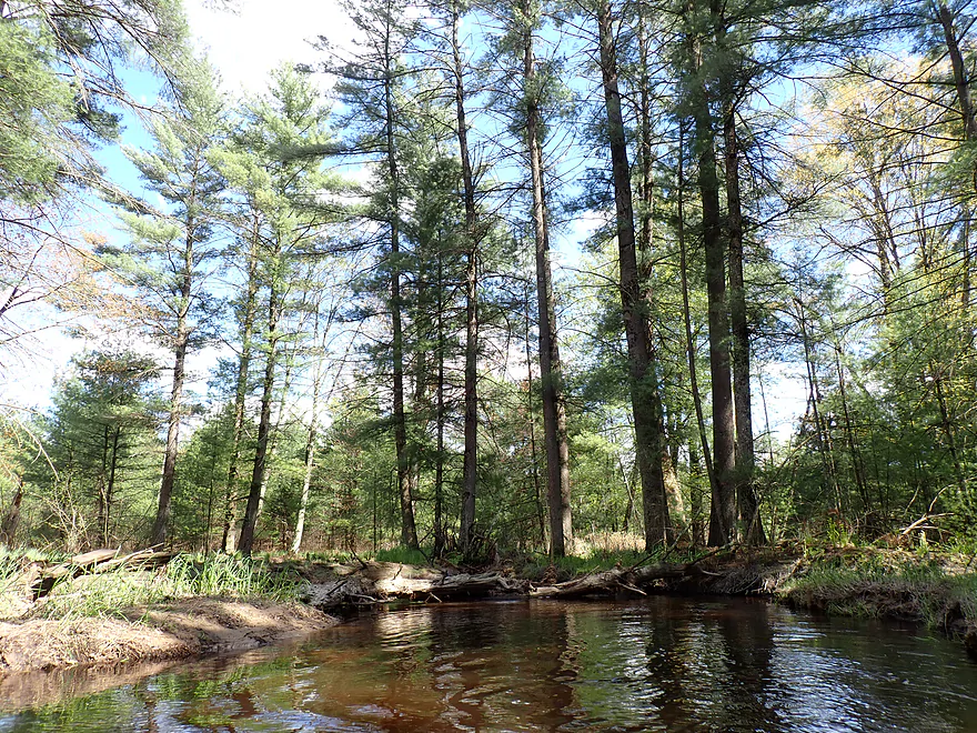
Returning back…terrific white pines
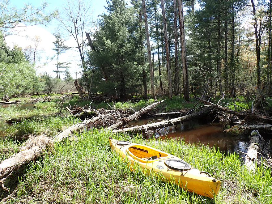
Getting out for pictures
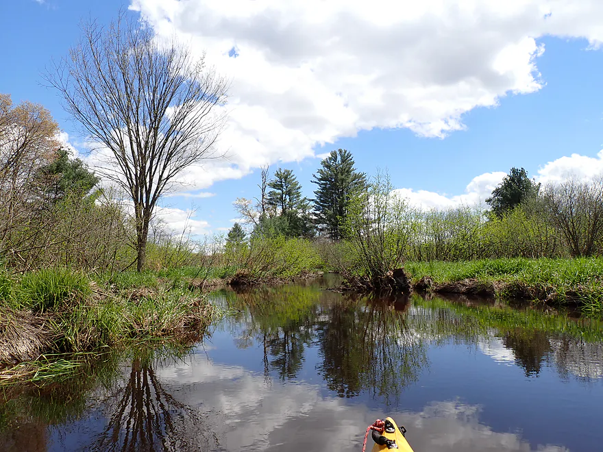
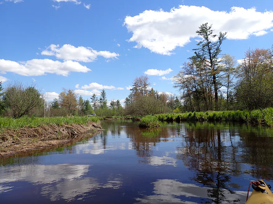
Back on the Lemonweir
Yet another cranberry dike
Yet another beaver dam
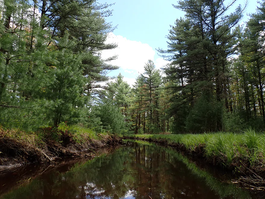
This one was my favorite
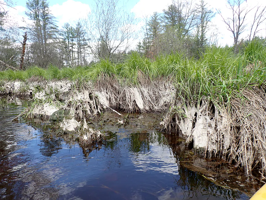
Mud-covered sedges–evidence of April’s mega floods
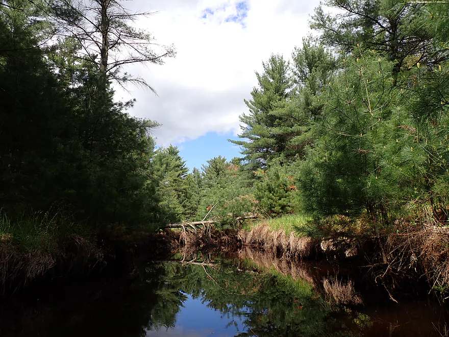
Scenic and terrific part of the trip
Getting out for pictures
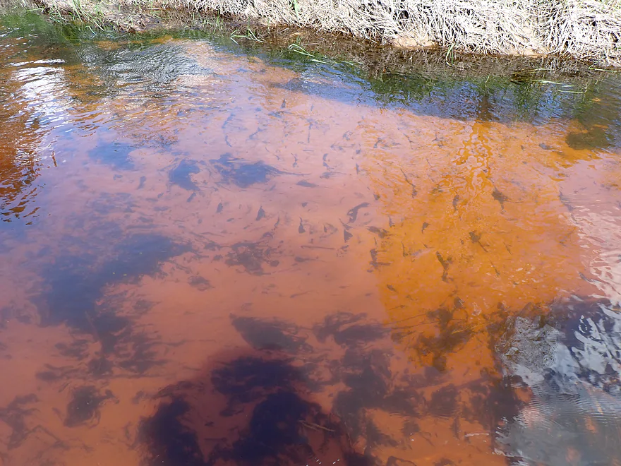
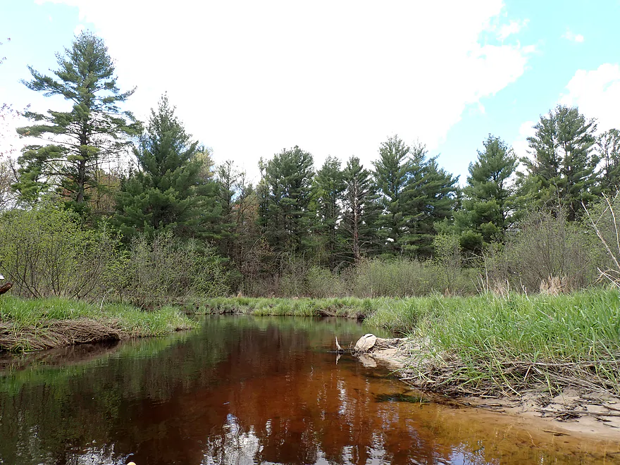
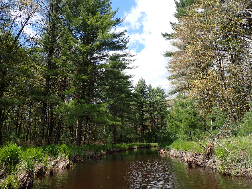
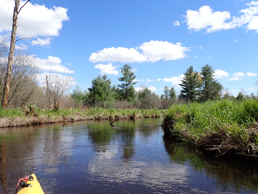
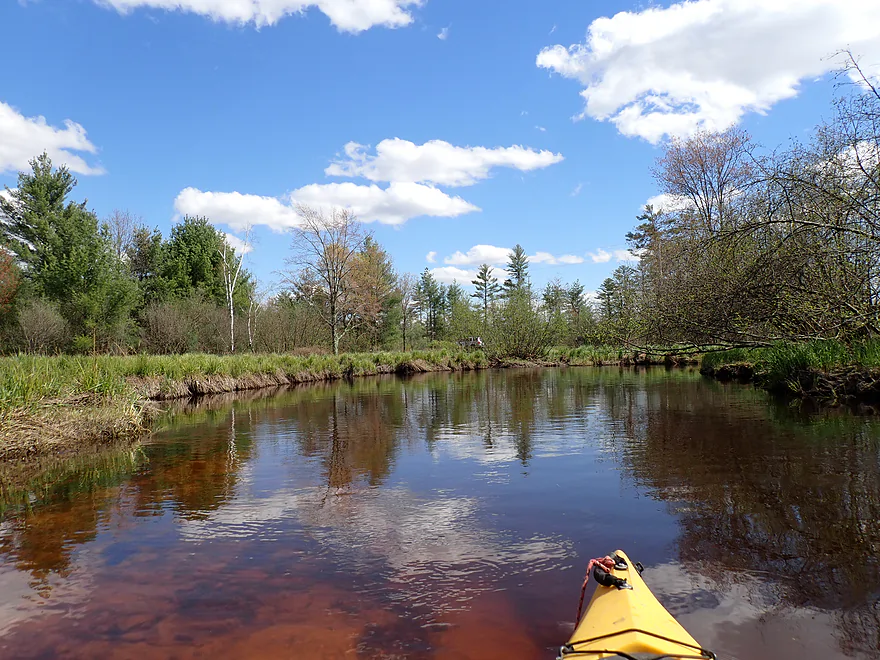
Fantastic clear red water–caused by tannins from the decomposition of wetland plants

Favorite scene of the trip
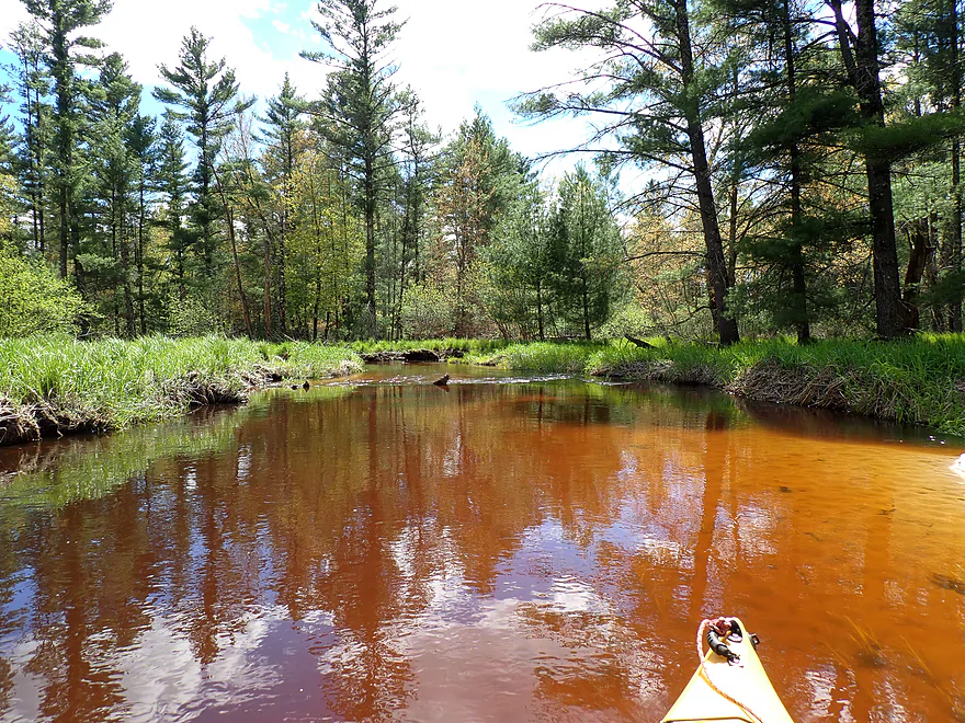
Love the red color
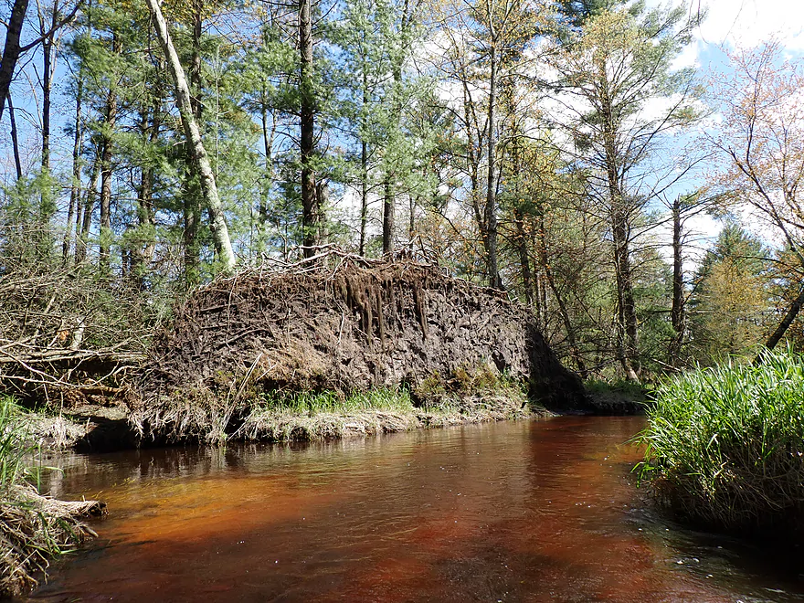
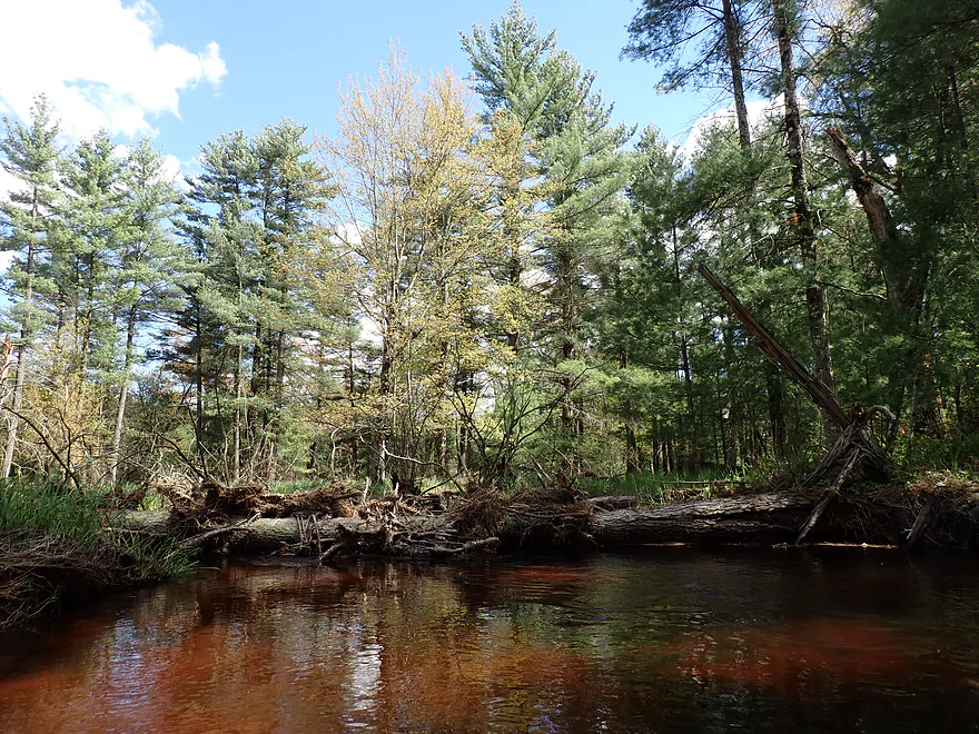
Massive root wall

Logjam #1 (easy portage)
Huge white pines
Logjam #2 (medium difficult portage)
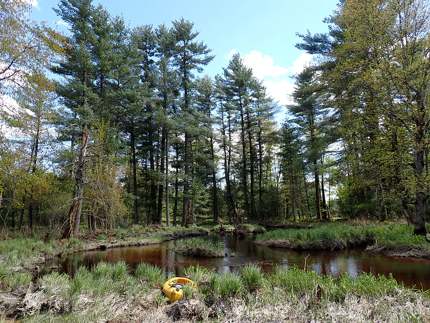
Scenic re-entry
Logjam #3 (easy portage)
Logjam #4 (easy portage)

Logjam 4.5 (I was able to squiggle past)
No more logjams as the creek opens up
Nice to see blue skies after the overcast morning
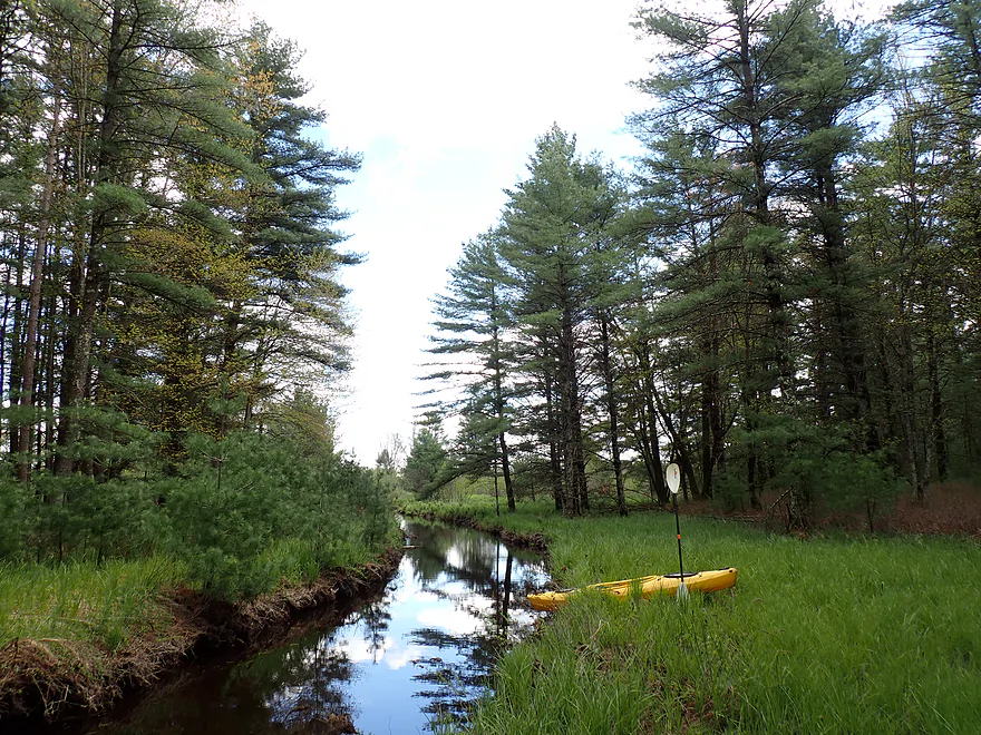
Buckley Ave
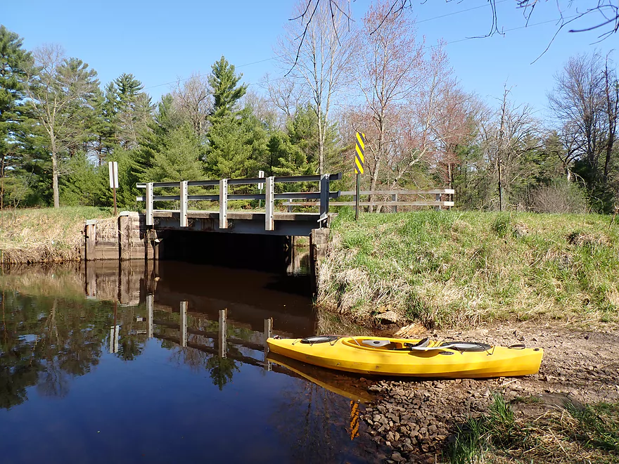
A good take-out with a surprise boat ramp
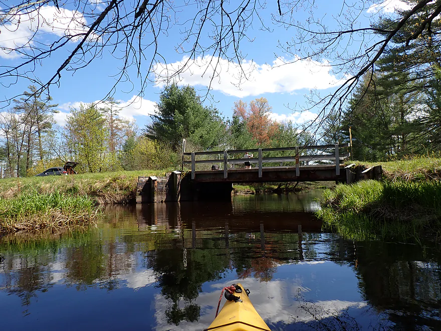
Very scenic bridge access
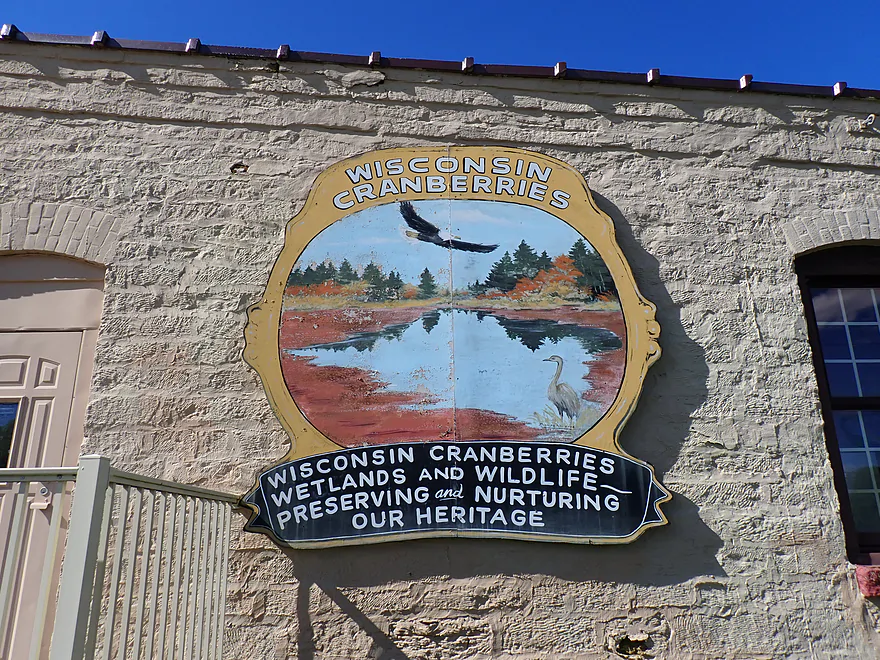
Nice mural on the nearby cranberry museum…unfortunately it’s now permanently closed
Lemonweir River – East Fork – Warrens


While the lower Lemonweir is well-known to paddlers, the East Fork is a mystery of maze-like cranberry bogs and logjams. I launched at Cty Rd EW, the northern limit before the river turns into ditched canals and cranberry flowages. Despite “No Parking” signs, the bridge offered a convenient pull-off and an easy launch.
The first 1,000 feet were promising: a marshy creek with lilies and white pines, but the river soon broadened into a sprawling cranberry complex covering roughly eight square miles. Navigating the dozen ponds and countless canals was confusing. After following a long dike south into a dead end ditch, I had to backtrack and portage over the embankment to find the main channel.
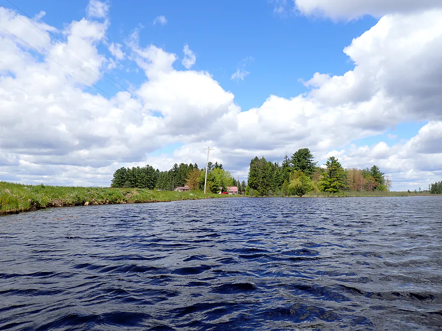
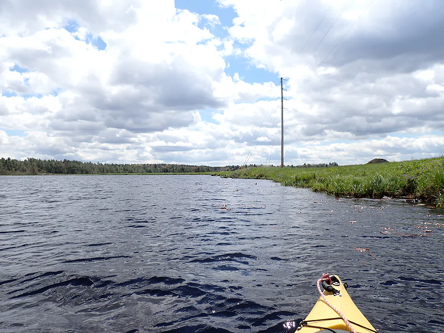
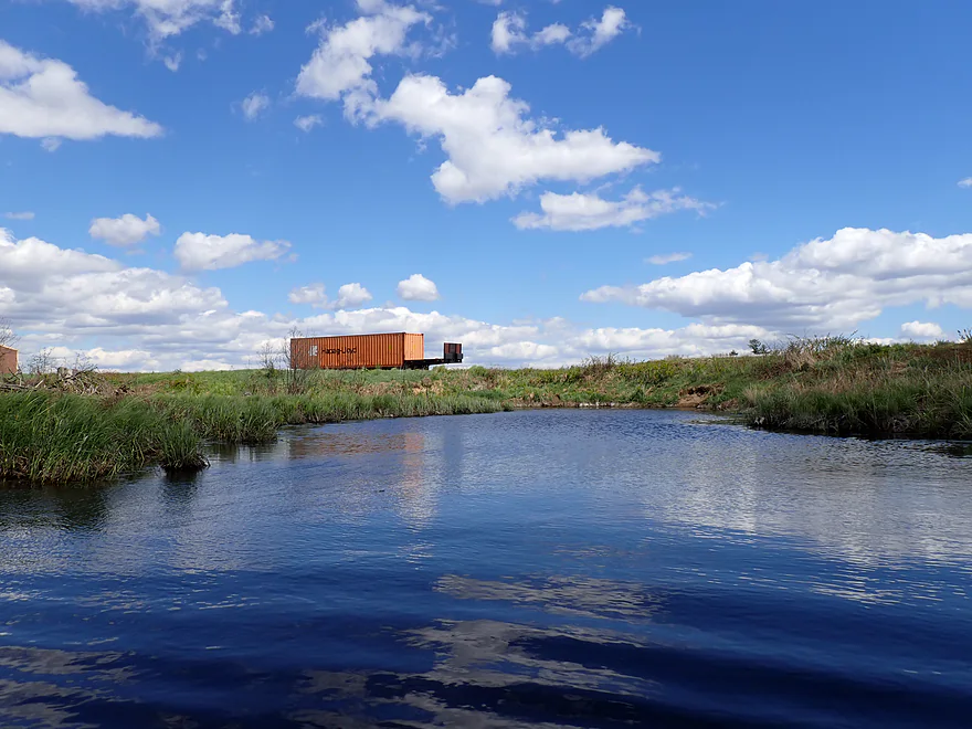
After the dike portage, I hit a second impounded lake that marked the low point of the day. Strong winds whipped up whitecaps, turning the open water into an arduous slog as waves occasionally splashed into my cockpit. Between the heavy equipment on the banks and a house overlooking the bog, the stretch felt more like a private industrial site than a public river.
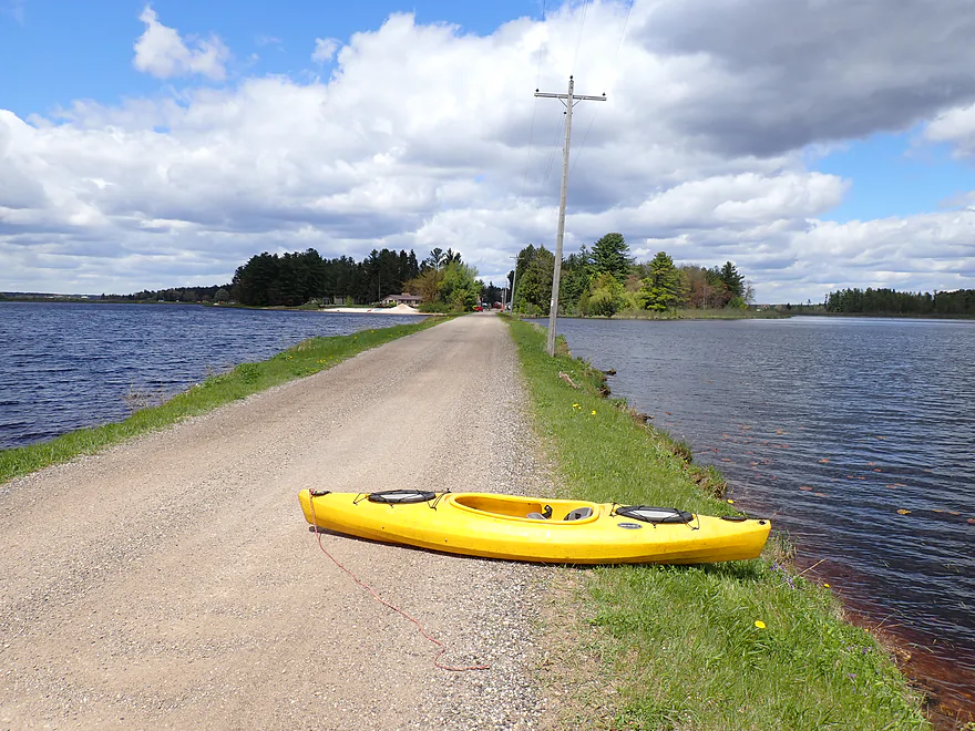
I finally crossed the pond to reach the dam, an open spillway with a deceptively high drop and no warning signs. I got out early to portage down a steep, towering embankment. At the bottom, the wind was strong enough to push waves directly over the spillway, likely spiking local depth gauges with the overflow.
Finally finding moving current was a huge relief. The next half mile was a mediocre, sandy creek with sedge-topped banks, mud-stained by recent mega floods. Floating berries and bog outlets served as constant reminders that I was in cranberry country, with heavy machinery and huge dikes always visible in the distance.
A fun surprise was a small beaver dam that I was able to get past. A not-so-fun surprise was a massive 10-foot high fence that ran perpendicular across the creek, hanging too low to duck under. I assume it’s a deer fence to keep them out of the bogs, but it completely blocked my kayak. Thankfully, I found a narrow one-foot gap on land and was able to belly-crawl underneath it, dragging my boat behind me. It wasn’t pretty, but it was actually not too difficult, and I was soon back on the river.
After the fence, the scenery improved as the sedges gave way to towering white pines. The sun finally broke through the gloom – a welcome change after a cold and windy morning. The highlight was a side adventure up an unnamed tributary, likely a branch of Jay Creek, flanked so tightly by dense pines that it felt like a skyscraper corridor made of timber. I paddled upstream into this timber canyon as far as I could, enjoying the best scenery of the trip before a logjam forced me back to the Lemonweir.
Passing the second mouth of Jay Creek marked a final shift in the trip. While the scenery remained excellent, with clear red water and white pines, logjams finally became a factor. Compared to the steep muddy banks I usually deal with in the Driftless Area, these banks were flat and the handful of portages were easy. I ended the trip at the Buckley Avenue landing. It is a bit funny to find a boat ramp on such a narrow river (more of a creek), but based on the number of trailers I have seen there, it is a well used hangout for local fishermen.
In summary, this was a highly inconsistent trip. The upper bogs were a slog and the middle sections were “mid” at best, but the white pine stands were incredible… some of the finest scenery on the Lemonweir. This is only a trip for the adventurous–the ones who don’t mind beaver dams, dike portages, a steep dam, a crazy deer fence, and about 4-5 noteworthy logjams.
Sights included cranes, a dead snapping turtle, a swan, and several fish. Beaver activity was everywhere, from chewed trees and lodges to active dams. I managed to slide over three of them, but a word of caution – if you open the structure too much during your pass, you’ll have a deluge of water chasing you downstream.
Warrens: As a major cranberry hub, this nearby community hosts a massive festival every last weekend of September. This is when tiny Warrens (population 360-400) explodes with up to 146,000 visitors. The event features a parade, exhibits, an arts and crafts festival, cranberry bog tours, and cranberry pies. I intended to stop by the local cranberry museum after my trip, but was disappointed to find it is now permanently closed.
Cty Rd EW: Along the southeast corner of the bridge, you will find a perfect grassy area for launching. “No Parking” signs are oddly situated right at the bridge and extend several hundred feet in both directions. While locals often ignore these restrictions, I suggest playing it safe: unload at the water, move your car further down the road beyond the signs, and then hike back.
Alternate Put-ins: There aren’t many other options. In theory, you could launch further west on Jay Creek. While this would be very scenic, it would require navigating several large, confusing, and private-feeling cranberry lakes and canals.
Buckley Ave: An excellent and scenic spot used frequently by local anglers. Look for the small, obscure boat ramp next to the bridge for an easy exit. When parking, ensure you leave plenty of space along the shoulder so others have enough room to back their trailers into the ramp.
Alternate Take-outs:
- Hwy 173 (4.7 miles downstream from Buckley Ave): While Hwy 173 is a busy road, the bridge access is doable. This stretch is highly diverse, featuring marshes, a lake, cranberry bogs, sandbars, and pine stands. Be aware that a handful of logjams appear near the end of the trip.
Bike Shuttle – Buckley Ave to Cty Rd EW: 5.6 miles with 30′ of ascent. This is normally an easy ride, provided you don’t run into the brutal headwinds I encountered. Just make sure you stay west of the river. You want to avoid Copper Road to the east, as it is made of loose gravel and is poorly suited for biking.
Current/Rapids: There was almost no current near the cranberry fields. After the dam, the flow picked up slightly, but it was never strong.
Human Dams: The main dam requires a portage over steep dikes. It is doable, but choose your landing and launch points with care.
Beaver Dams: There were three significant dams roughly a foot high. I slid over them easily. Other old, broken-down dams were present but did not require effort to pass.
Dikes: One dike portage is necessary before the dam to keep you from getting redirected into a maze of irrigation ditches. A quick look at the trip map will clarify the issue.
Wind: Avoid this trip on windy days. The 25+ mph gusts I encountered made the open water portions an exhausting slog.
Logjams: The creek was surprisingly open for most of the trip. The exception was the final half-mile stretch containing four or five major logjams. Fortunately, the flat banks made the portages relatively easy, even if getting out of the boat is never ideal.
River Gauge: Lemonweir River @ New Lisbon
River Trip Depth: 477 CFS or 5.1′
River Navigability Estimates: These are just rough guesses.
- 0-150 CFS: Likely too shallow for a comfortable trip.
- 151-400 CFS: Ideal levels with great clarity and many exposed sandbars.
- 401-600 CFS: A good depth with decent clarity and visible sandbars.
- 601-1000 CFS: High water with poor clarity, but suitable for paddling. You might be able to float over some logjams at this depth.
- 1001-1800 CFS: Very high depth with murky water, but still viable for experienced paddlers.
- 1801+ CFS: Banks are likely overtopping. Based on previous scouting, the river is probably too unattractive and potentially unsafe for paddling at this level.
Detailed Overview
Lemonweir River - Main Branch:
- East/South Fork Confluence to Cty PP: 1.0 miles. Likely around 3 logjams.
- Cty PP to Funnel Road: 2.0 miles. Very straight channel with roughly 6 logjams.
- Funnel Road to 2nd Ave: 1.2 miles. Highly channelized and straight with about 3 logjams.
- 2nd Ave to Cty H: 1.8 miles. Roughly 4 logjams. The channel can be poorly defined at times.
- Cty H to River Road: 2.3 miles. Expect 4-6 logjams and confusing side channels where navigation is a challenge.
- River Road to 6th Ave: 5.4 miles. Likely navigable, but expect a high volume of logjams.
- 6th Ave to 37th Street Landing: 4.4 miles. Occasionally paddled but contains several logjams.
- 37th Street Landing to New Lisbon: 6.6 miles. A long, slow stretch that feels more like a lake than a river. While somewhat monotonous, the rock outcroppings, white pines, and fall colors provide some redeeming beauty.
- New Lisbon Dam to Hwy 12/16 Shoulder: 7.9 miles. A promising prospect featuring a “Little Dells” rock outcrop, though hampered by about 6 logjams. The Hwy 12/16 shoulder is a speculative but potentially an access point.
- Hwy 12/16 Shoulder to Riverside Park in Mauston: 4.6 miles. Mostly slow, open paddling through river flowages.
- Mauston Dam to 19th Ave: 4.5 miles. One of the premier stretches on the river.
- 19th Ave to Cty HH: 13.1 miles. Less engaging with a noticeably slower current.
- Cty HH to the Mouth: 3.3 miles. An excellent section with beautiful rock outcrops that serve as a prelude to the Wisconsin Dells.
Lemonweir River - East Fork:
- Cty EW to Buckley Ave: 3.4 miles. Begins in cranberry bogs before transitioning into a sedge-lined creek and concluding with a spectacular corridor of towering white pines. Expect roughly five logjams, mostly near the end.
- Buckley Ave to Hwy 173: 4.7 miles. One of the most scenic and diverse stretches of the Lemonweir, featuring marshes, a lake, cranberry bogs, sandbars, and towering pines. A handful of easy-to-portage logjams are located near the end.
- Hwy 173 to Cooper Road/Dam:
- Hwy 173 to Dove Ave: 0.9 miles. A lovely, open leg with clear red water and numerous small sandbars. Includes one minor, easy portage.
- Dove Ave to Cooper Road: 2.4 miles. A mediocre stretch flanked by frac sand mines and cranberry bogs; much of the channel is ditched and straightened. The half mile below Dove Ave contains several logjams, some requiring difficult portages.
- Cooper Road to Backwater Bar Dam: 0.2 miles. A short but scenic flowage set against attractive pines. The dam is not a practical take-out due to trespassing restrictions and proximity to the spillway.
- Backwater Bar and Grill to Hwy 21: 0.5 miles. Likely congested with near-constant logjams.
- Hwy 21 to East/South Fork Confluence: 0.3 miles. Expect 2-3 logjams.
Lemonweir River - South Fork:
- Butts Park/Lake Tomah to Forbes Road: 4.5 miles.
- Butts Park to Lake Tomah Dam: 0.2 miles. A quick paddle across Lake Tomah to reach the spillway.
- Lake Tomah Dam to Memorial Park: 1.2 miles. A narrow, sandy stretch with a high number of downed trees.
- Memorial Park to Tomah Dog Park: 0.6 miles. Mostly pleasant and open, though one large logjam requires a very difficult portage.
- Tomah Dog Park to Forbes Road: 2.5 miles. The first half is heavily obstructed; the second half is more open but still requires two logjam portages.
- Forbes Road to County N: 6.9 miles.
- Forbes Road to Cty ET: 1.6 miles. A high-quality stretch with good clarity, a sandy bottom, and one manageable logjam portage.
- Cty ET to Cty N: 5.3 miles. Scenic and clear, passing through grasslands, frac sand mines, and a massive cranberry bog. Includes three logjam portages.
- County N to Excelsior Ave: 3.0 miles. Open through the golf course, but the wooded sections likely contain 6-8 logjams.
- Excelsior Ave to East/South Fork Confluence: 0.5 miles. Likely riddled with countless logjams.
Trip Map
Overview Map
Photos Size: