
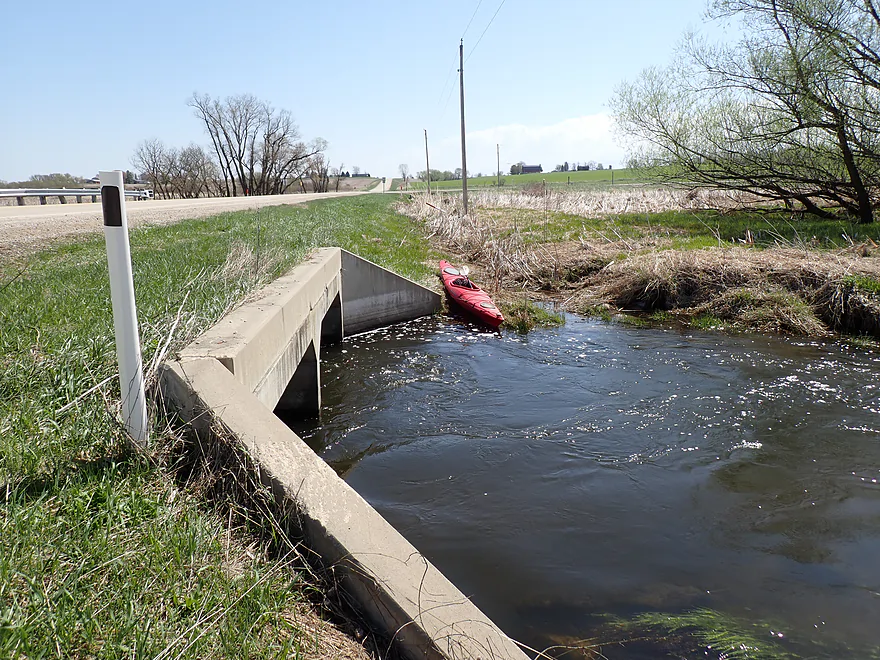
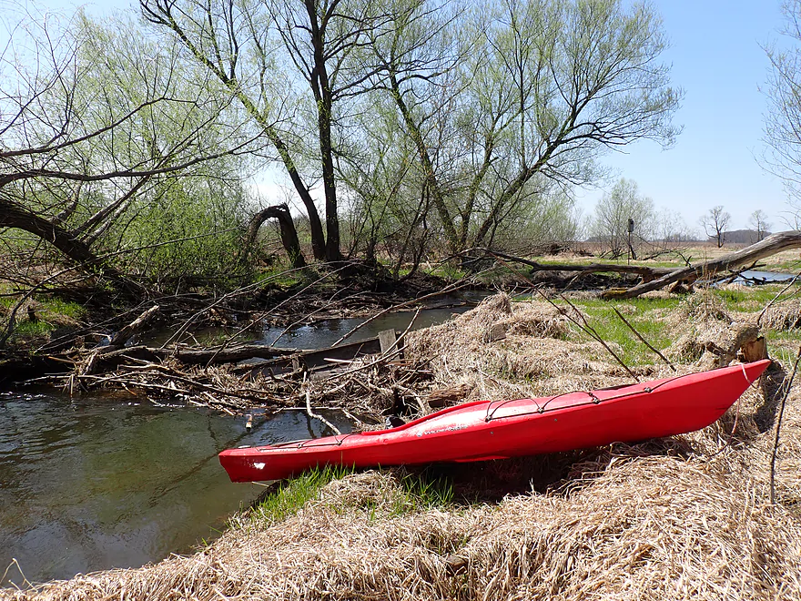
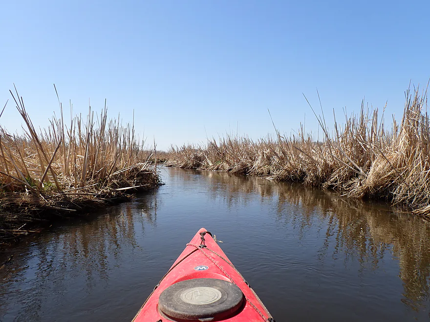
Starting the trip downstream of Cty F
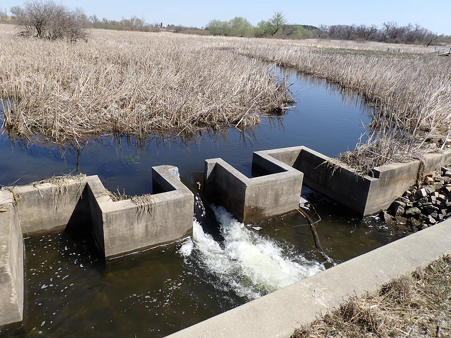
A weird half-dam (labyrinth weir) upstream from the highway
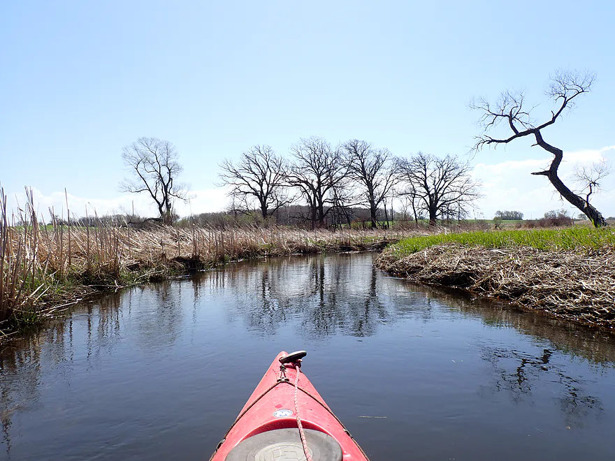
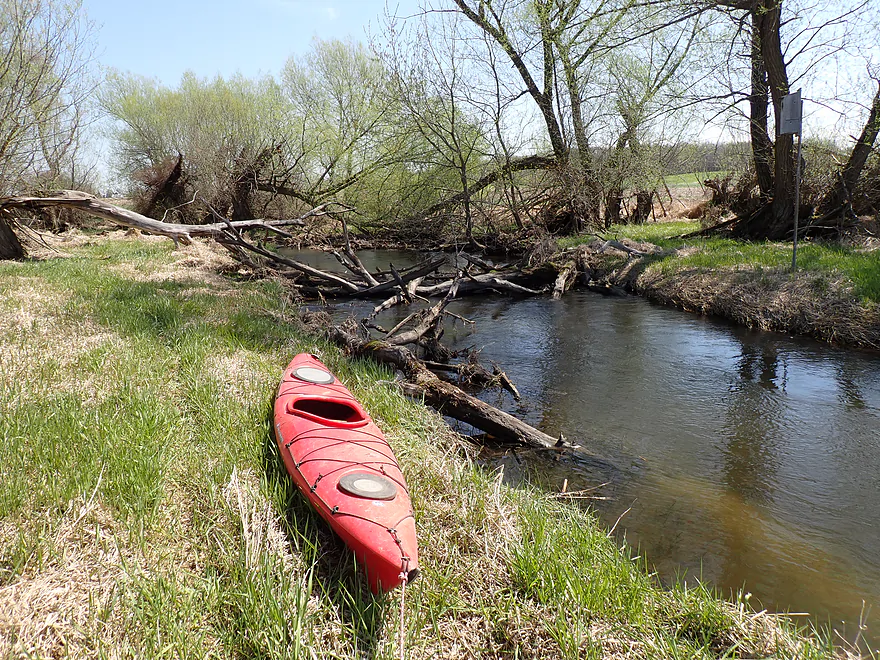
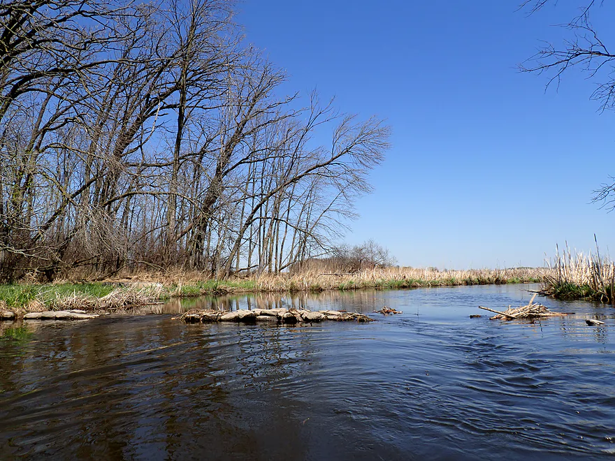
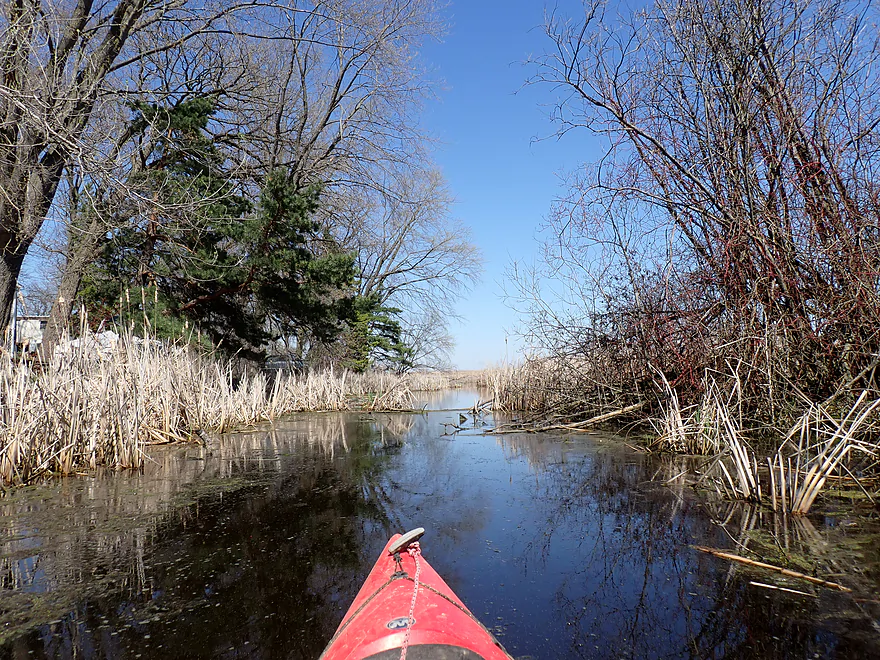
Alto Creek is open and attractive to start
Only portage of the trip
There are actually a pair of logjams here, but you can portage both at the same time (easy)

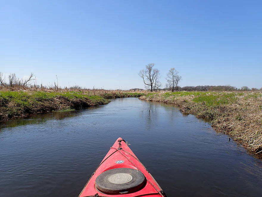
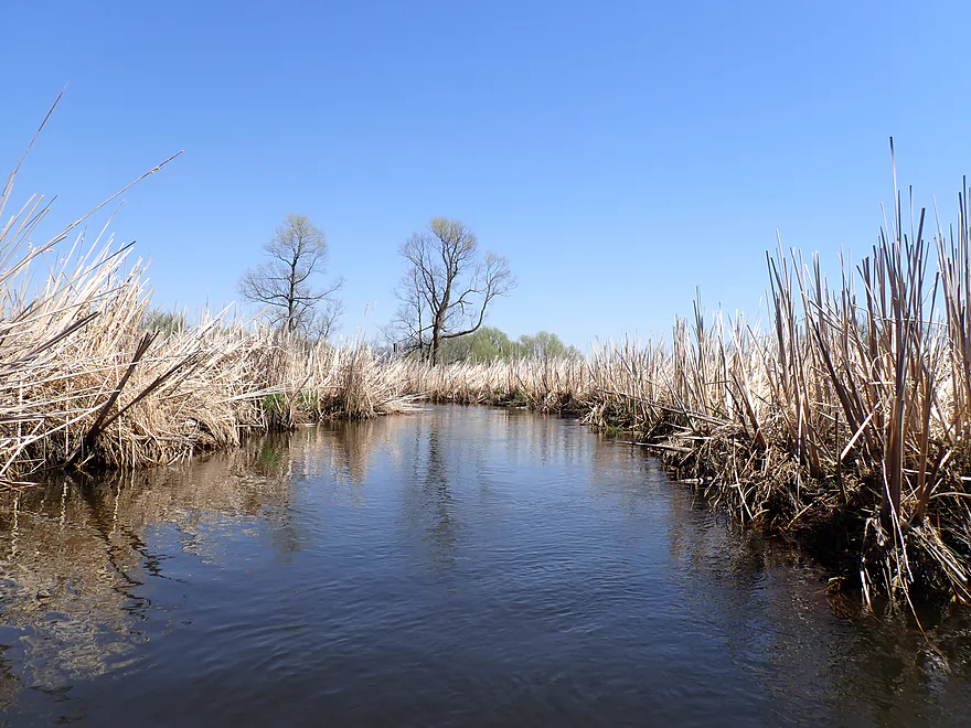
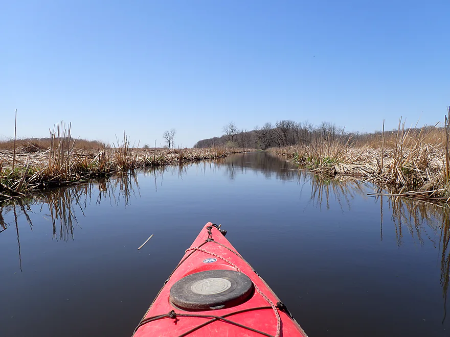
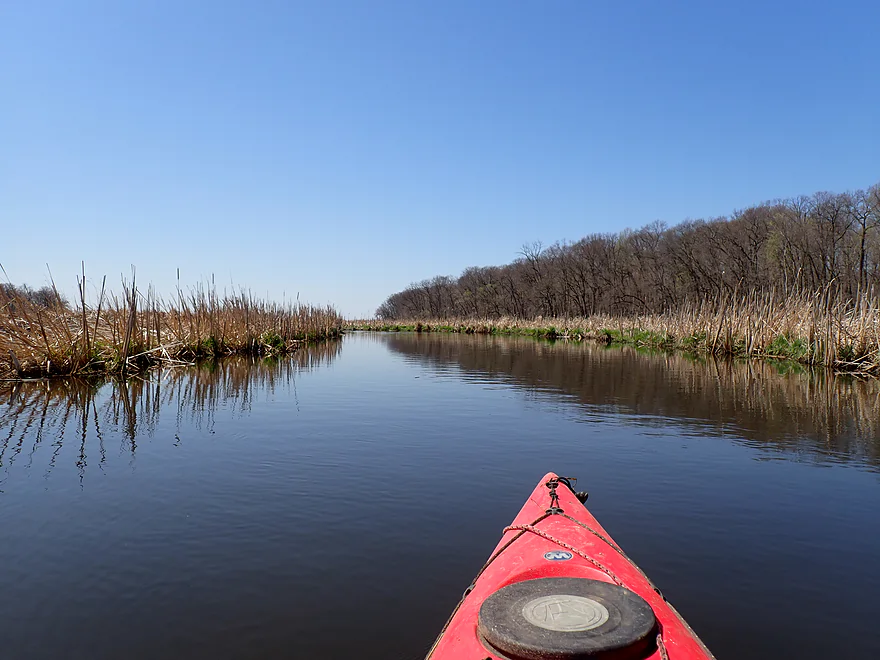
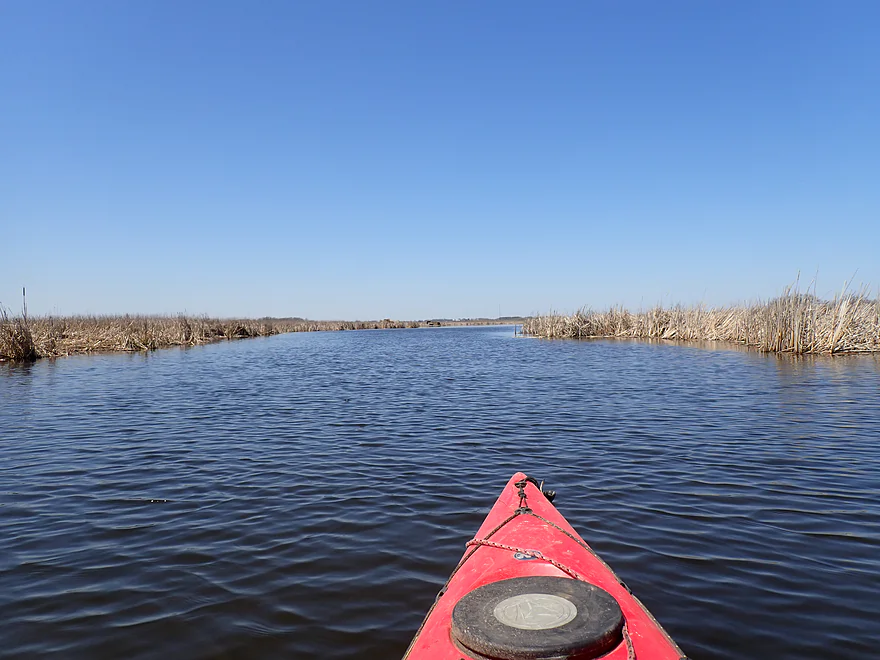
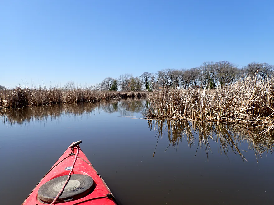
Nice downstream view
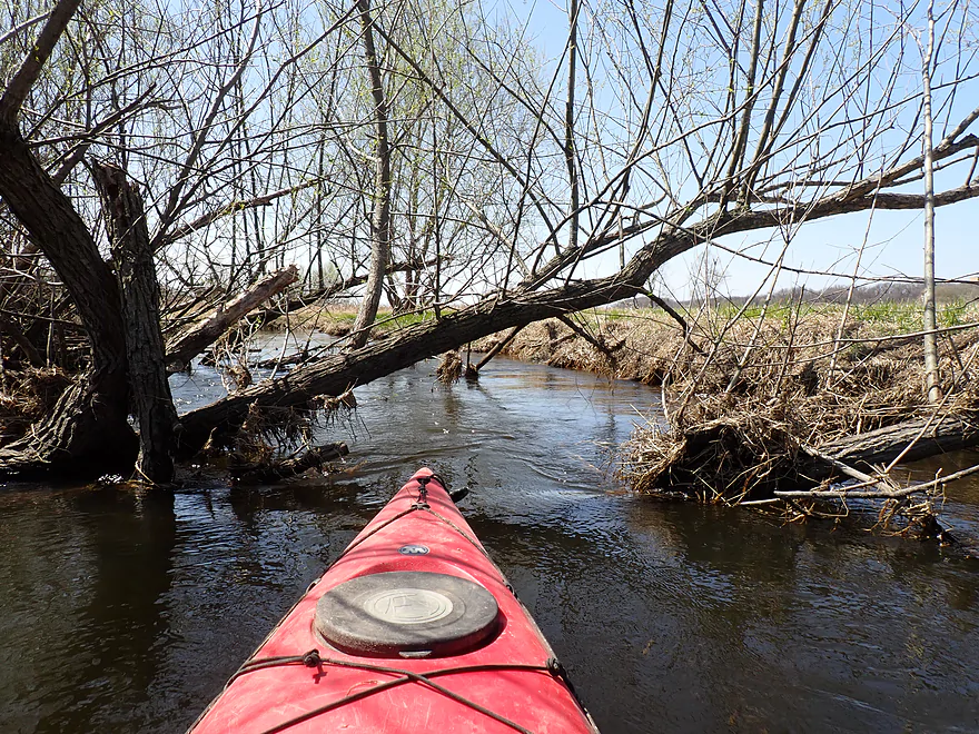
Easy snag to get through
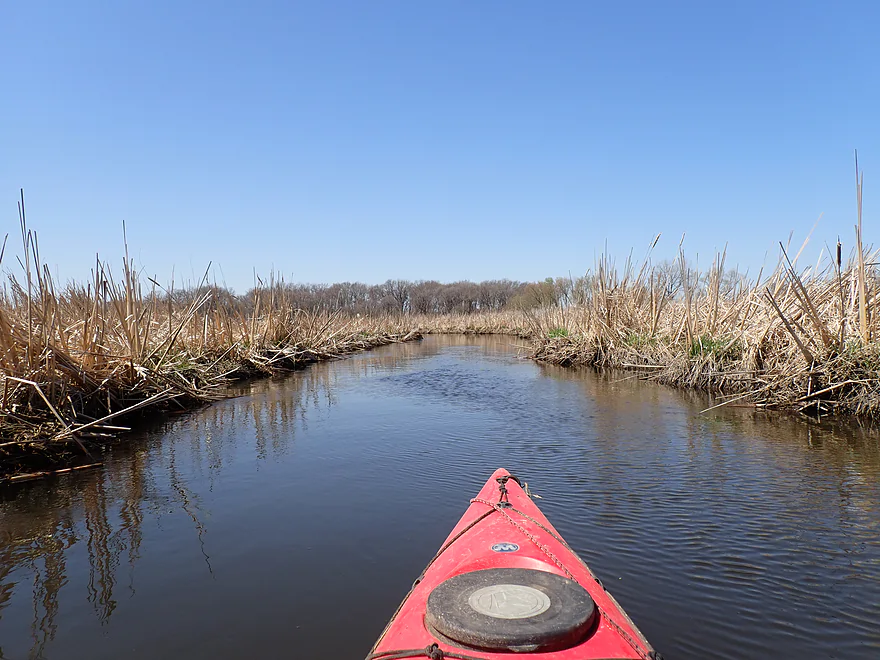
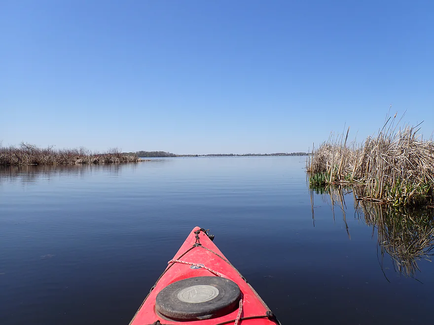
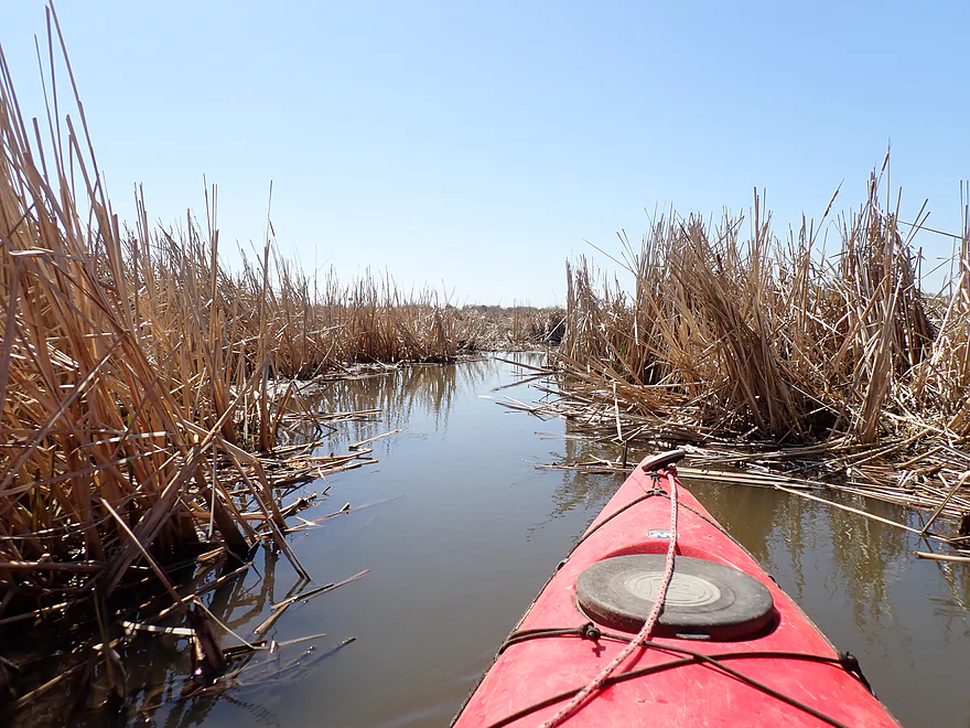
Wetgrass gives way to cattails
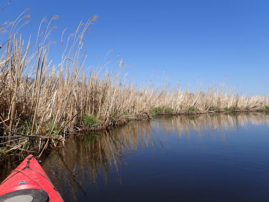
Some of these phragmites (common reed) stalks were huge–over 12′
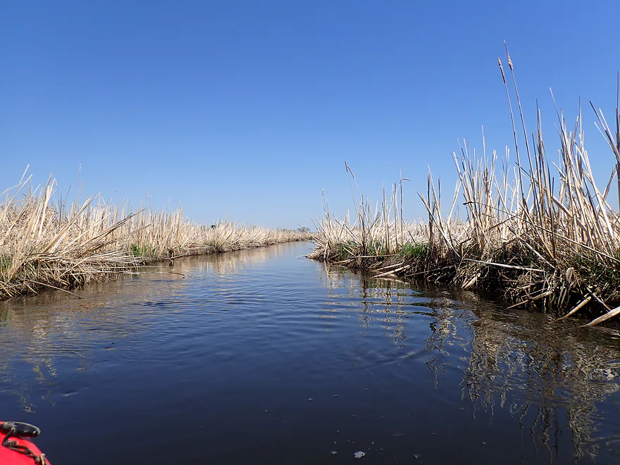
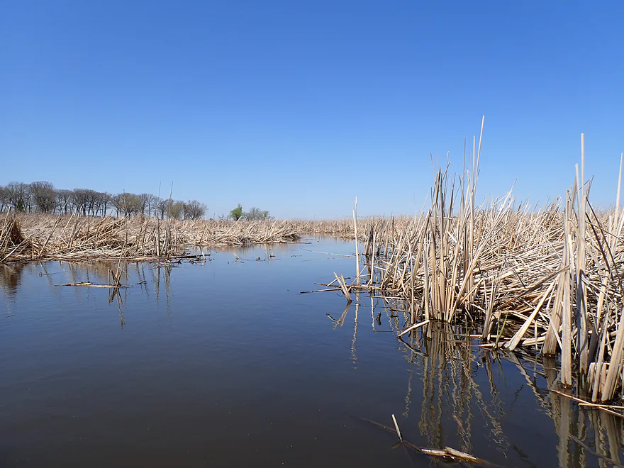
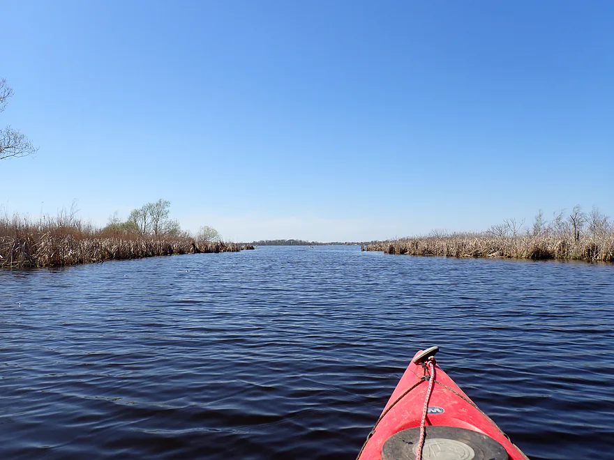
Creek starts to really widen and slow
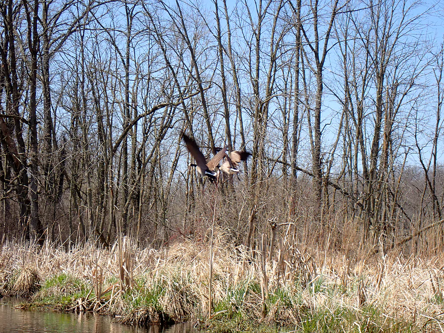
Saw lots of geese
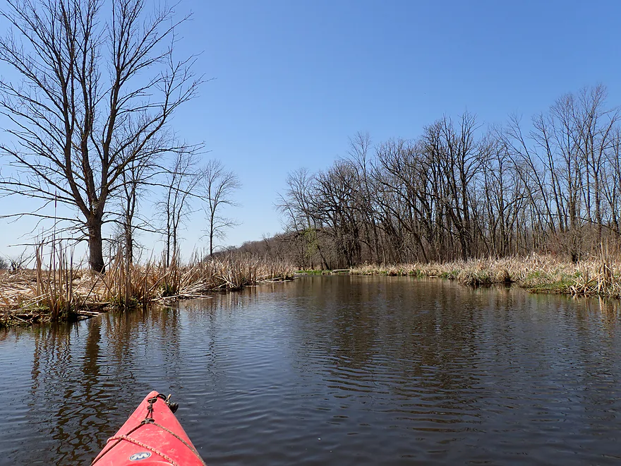
Rare woods (with another drumlin in the back)
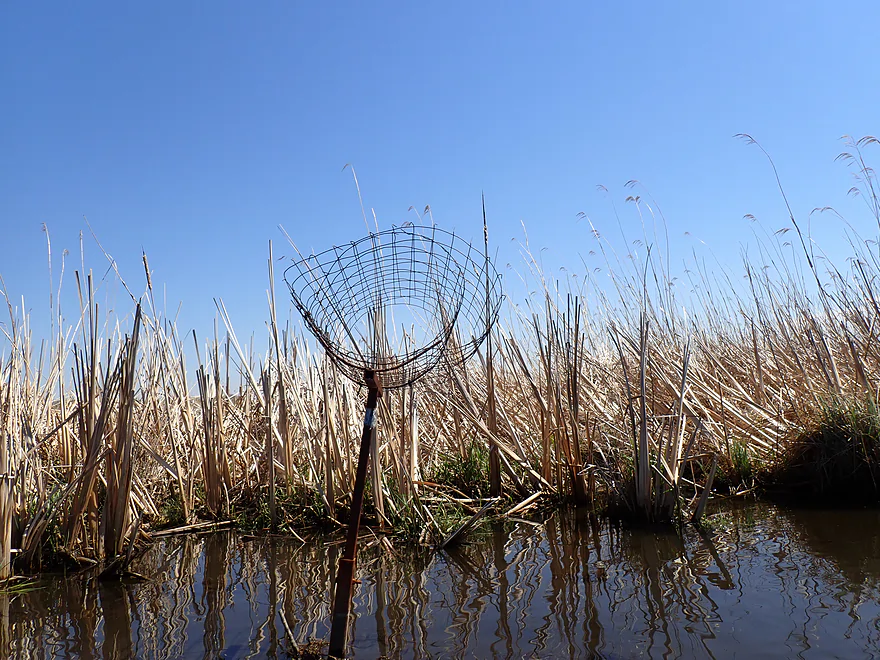
Not sure what this is
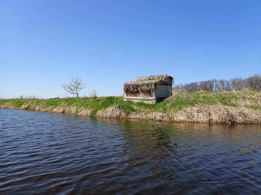
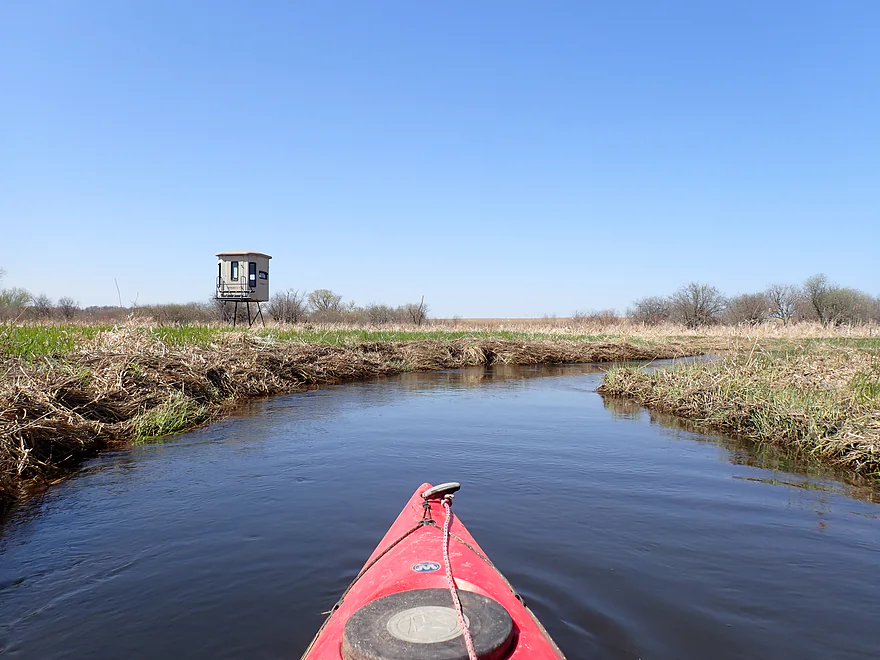
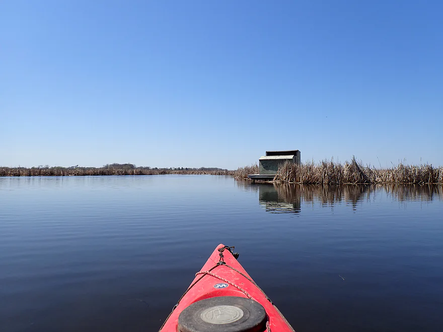
A duck blind
And another…there were so many
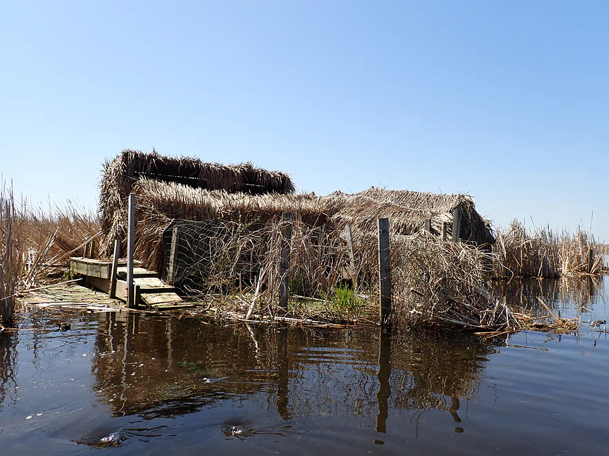
This was one of the nicer ones
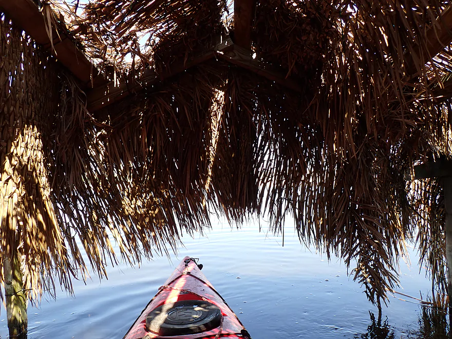
Feels like I’m in Tahiti
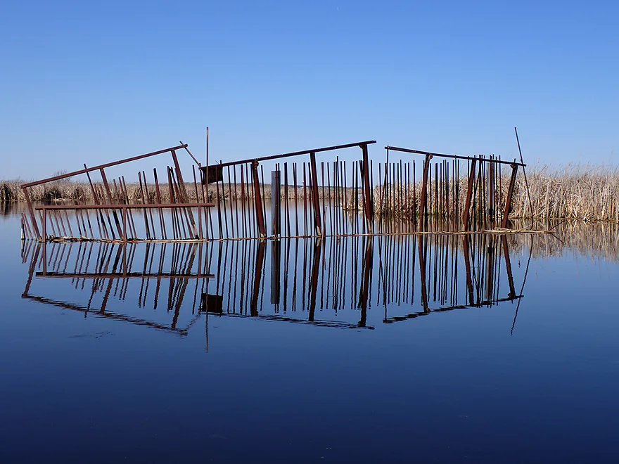
Somebody put a weird carp gate on Alto Creek (easy to paddle past)
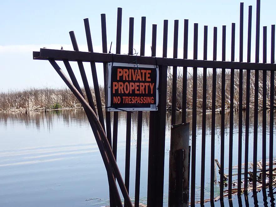
This is not accurate…Alto Creek is a public water way
An attractive bay
This is private and there is no public access here
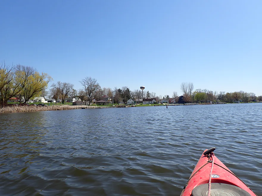
The mouth of the creek and the start of Fox Lake
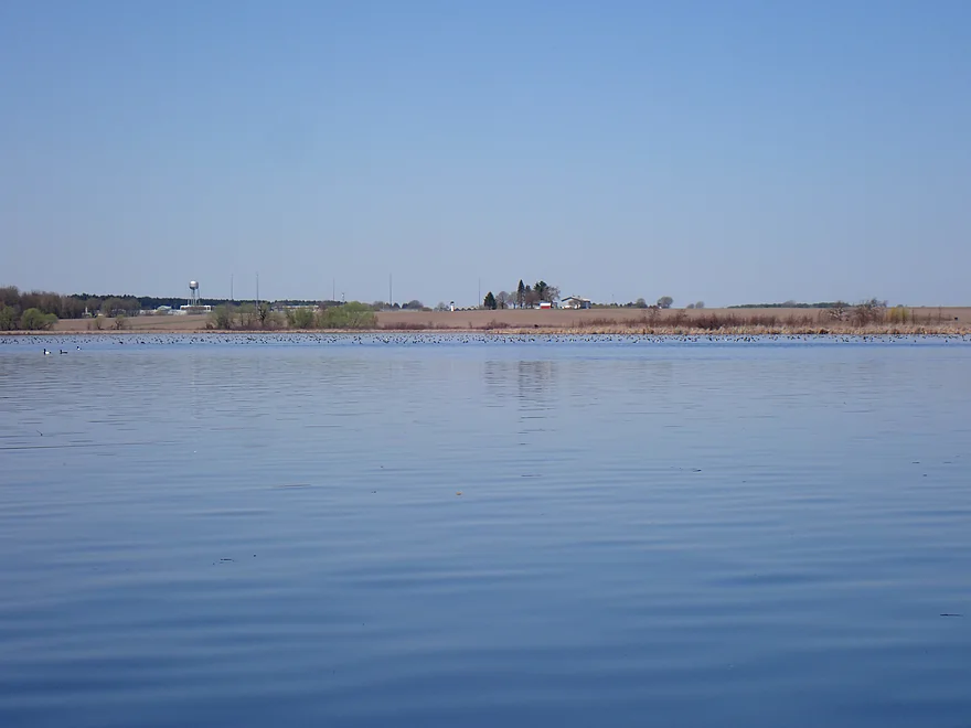
The largest flock of ducks I’ve ever seen
Paddling upstream on an unnamed creek
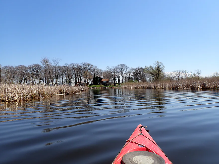
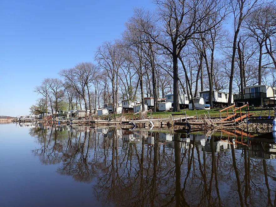
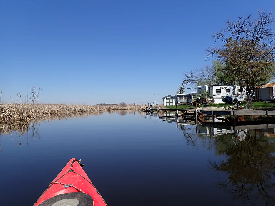
On the right is Sager Island–currently the location of a trailer park
Kind of scenic
Paddling around the north end of the island
Past the island I’m continuing east up the creek (bit congested)
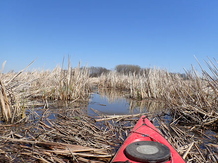
Exploring a small hidden pond
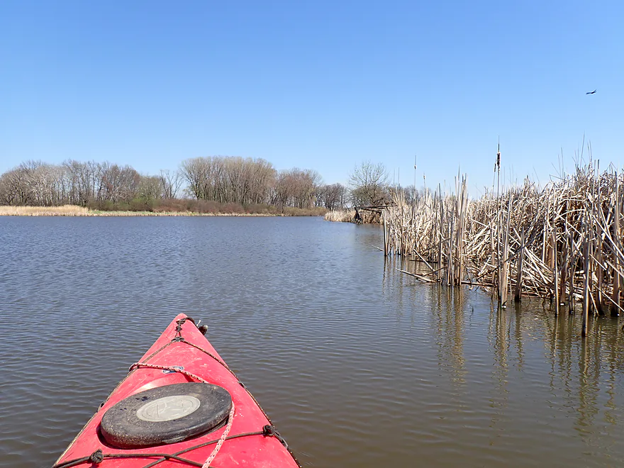
Heading back west toward Sager Island
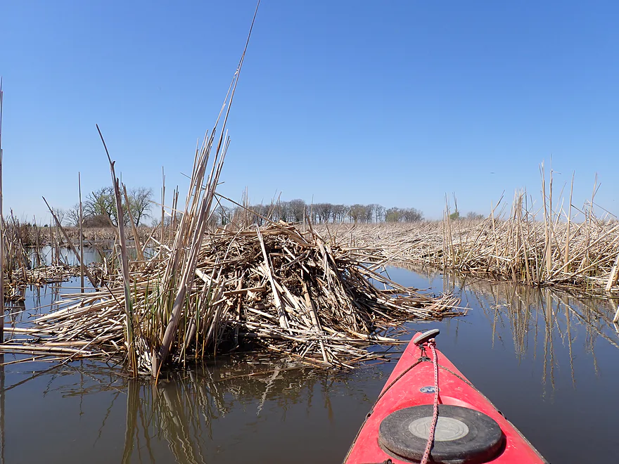
Cool muskrat lodge
I tried wrapping around the south end of Sager Island but it was blocked by cattails…heading back
Heading back to Fox Lake
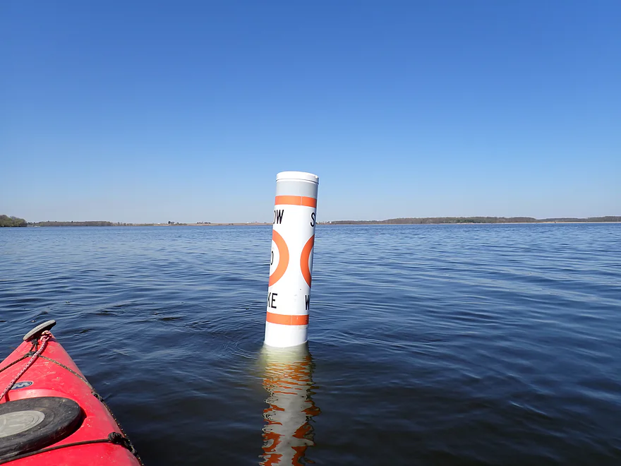
A slow wake buoy protects the eastern shore from waves
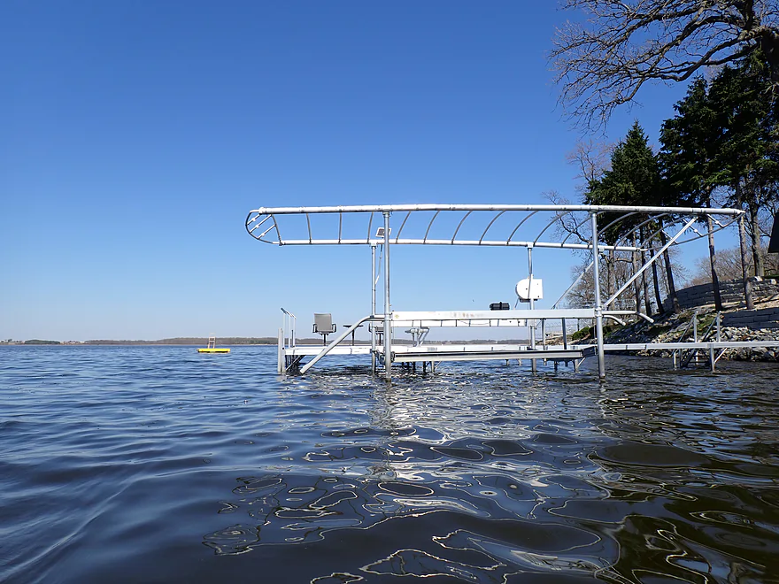
A lot of homes and piers on the lake
Paddling the outlet of Fox Lake (start of the Beaver Dam River)
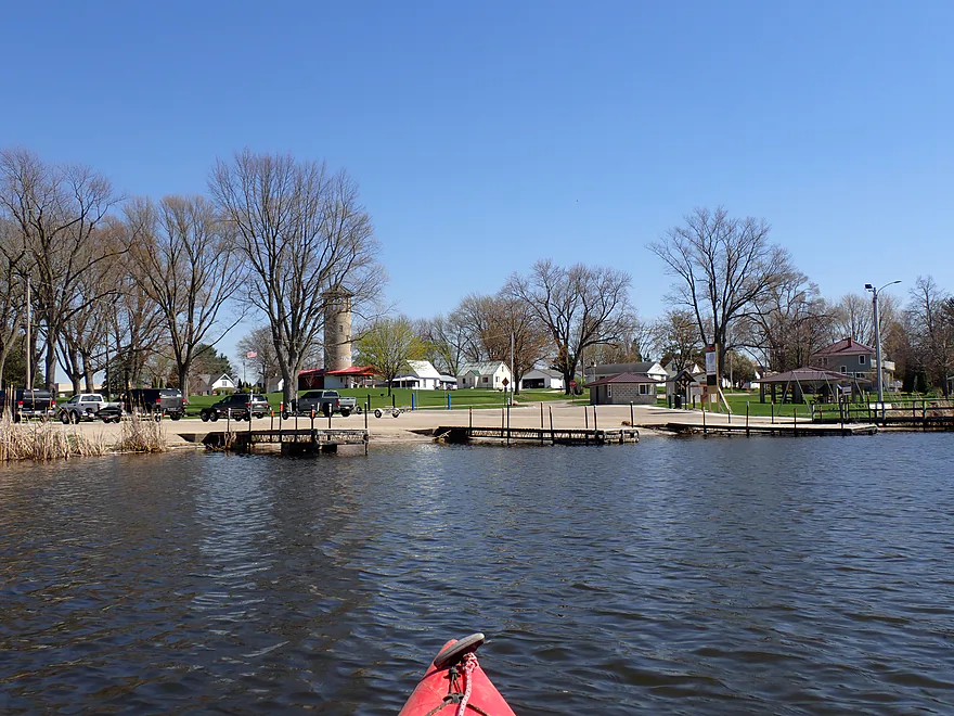
Ending the trip at Clausen Park in the city of Fox Lake
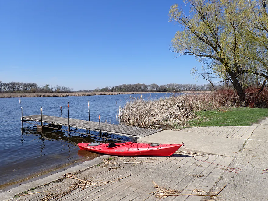
Scenic boat ramp
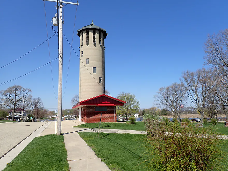
Memorial Tower (aka the “Singing Silo”)–an observation tower that is open to the public
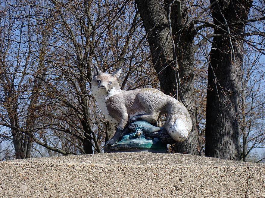
There are foxes everywhere in the community of Fox Lake
Alto Creek

Alto Creek is the upper portion of the Beaver Dam River and a branch of the greater Crawfish and Rock River systems. It’s a small, marshy stream that feeds Fox Lake, and it has been on my to-do list for quite some time. With water levels being bonkers high this week, it was actually the perfect choice. While most area rivers were running too fast or too dangerous to be enjoyable, marsh-fed streams like this tend to stay manageable and viable when everything else is blown out.
I started at Cty F, which provided a solid bridge access. The upstream side featured a strange folded half-dam with a surprisingly strong outlet current, so I played it safe and put in on the downstream side, which was easy enough.
Right from the start, the creek was narrow, swift, and meandering, with an average depth of about three feet. The banks were mostly thick wetgrass, while the substrate was a mix of marsh muck, sand, and an occasional patch of glacial gravel. This was my favorite part of the trip.
Despite the high water from recent rains, the clarity was surprisingly decent. There were a few logjams to navigate, but I was able to sneak past all of them except for one pair, which required a quick and easy double portage.
At roughly the two-mile mark, the creek began to straighten, trading its meandering banks for endless walls of cattails. I know many paddlers find cattails a bit monotonous, but I’ve always enjoyed them. There is something uniquely immersive about paddling through these “walled” corridors, especially here, where the occasional phragmites towered over twelve feet high. It creates a sense of isolation that you just don’t get on open water.
As I neared Fox Lake, the current slowed to a crawl and the channel began to widen. I was struck by the sheer number of duck blinds tucked into the vegetation, but the real surprise was a literal “gate” across the creek, complete with “No Trespassing” signs facing the lake. This appears to have been an original DNR carp fence and locals tacked on the “No Trespassing” sign. Regardless the creek is a public waterway and it wasn’t a difficult obstacle to paddle past.
Soon the banks of Alto Creek pulled back to reveal the vastness of Fox Lake. I’m generally not a big-lake paddler–I prefer small, sheltered water, and I won’t argue that Fox Lake is a premier destination for those who hate open water. It’s big, and it feels like it. However, the lake does have a unique character that makes the transition interesting. The views are expansive: scenic rolling farm fields sit on a drumlin to the north, windmills spin to the southeast, and while the far western shore is heavily developed with homes, the eastern edge remains mostly wild, with a protective wall of cattails and the largest flocks of ducks I’ve ever seen.
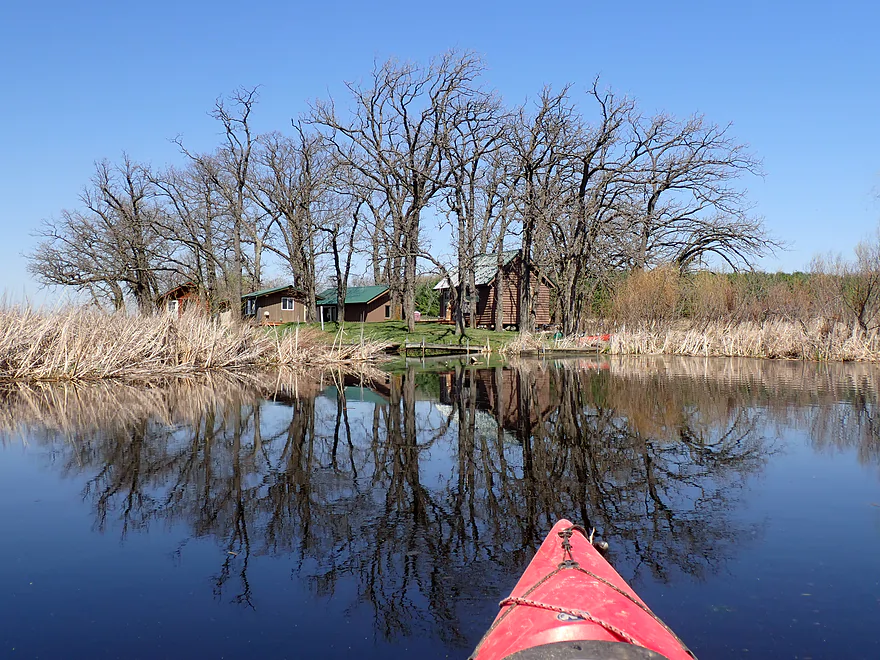
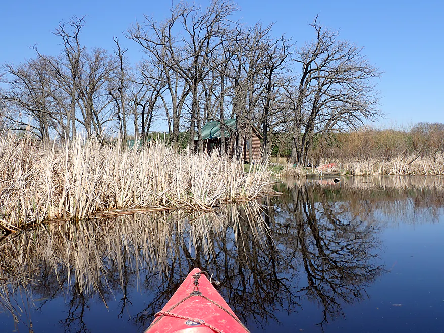
Fox Lake is dotted with six occupied islands that dominate the center of the view. While it’s tempting to explore them, they appear to be entirely private. Elmwood Island is perhaps the most intriguing; it has no bridge, meaning residents rely entirely on boats or winter ice trails to reach the mainland.
There is “deep” history beneath these waters, too. Before a dam raised the water level by eleven feet in 1845, the lake was a much shallower glacial kettle, and these islands were significantly larger. They were home to major Ho-Chunk settlements, a place they called “Hosh-a-rac-ah-tah” (Good Land). In fact, one of Wisconsin’s largest archaeological discoveries was made here in 1983, proving these islands have been a home for Native people for centuries.
For a kayaker, Fox Lake is a “tale of two lakes” where timing is everything. At its worst–midday on a summer weekend–the main body is a chaotic hub of motorboats, water skiers, and noise from lakeside bars. However, if you time it for an early spring sunrise or a quiet fall evening, the lake becomes very peaceful. Fortunately, the eastern shore is designated as a no-wake zone, offering a relative sanctuary even when the center of the lake is busy. The shallow stretch of cattails by the mouth of Alto Creek also deters motorboats.
I followed the eastern shore south until I hit another creek outlet, which I decided to follow upstream. This led into a beautiful, protective cattail corridor that wrapped around Sager Island, a place that is easily the “cutest” mobile home park I’ve ever seen. It’s a fascinating geographic anomaly: a dense island of tiny homes completely surrounded by a fortress of cattails. I found myself wondering about the logistics of it all, where they get their drinking water and how they pump out waste, but from the seat of a kayak, it’s undeniably photogenic. Every little home seemed to take pride in its own private dock tucked into the reeds.
For those looking to extend the trip or escape the open water of Fox Lake, I highly recommend continuing past the island on this mysterious, unnamed creek. I kept paddling upstream as the path became increasingly congested and mucky, literally plowing my way through the cattails. My persistence paid off when I eventually reached a small, hidden glacial spring lake. It was a peaceful, isolated discovery that felt worlds away from the main lake. After a quick look around this quiet basin, I turned my boat around to head back toward the mouth.
After returning to Fox Lake, I resumed my journey south and hugged the shoreline past a massive golf course. To be honest, this was the low point of the outing. It was a bit of a slog that reminded me why I’m not a fan of open-water paddling. There wasn’t much to look at, and my focus shifted from the scenery to the sheer repetition of the movement. I felt more like a marathon runner focusing on each individual stroke toward the finish line rather than just enjoying the trip.
My only saving grace was the lack of a headwind, which would have made the distance feel twice as long. One major takeaway for anyone planning this route is that Fox Lake is surprisingly sparse when it comes to break locations. Between the private islands, the long stretches of cattail shoreline, and private homes, there are almost no spots to pull over for a rest. There are certainly no public outhouses until you reach the parks. If you’re heading out, plan your pit stops accordingly.
Finding the exit proved a bit tricky. The Beaver Dam River outlet is tucked away and I actually mistook it for just a side bay at first. If you’re looking for a landmark, the Singing Tower (a public memorial) marks the general area of the take-out. Once I found the channel, it led me into Clausen Park. This turned out to be a surprisingly scenic landing framed by a dense fringe of cattails. While the park is likely a chaotic hub during the summer, it was quiet when I arrived. My only complaint was that the public restrooms were all inexplicably locked.
In summary, this was a pleasant trip, even if it wasn’t an “elite” destination. Alto Creek and Fox Lake are great alternatives to the Beaver Dam River when it is flooded or its rapids are running too strong to be safe. The outing was really a story of three different experiences. Alto Creek was easily the highlight with its narrow winding path. Fox Lake was a bit large for my taste, but it has redeeming qualities if you catch it during quiet times like sunrise or sunset. Finally, that hidden side creek was a great exploratory bonus that got me away from the open water. As long as you stay in the no-wake zones and focus on the sheltered side channels, Fox Lake can be worth exploring from a kayak.
Wildlife on Alto Creek included schools of small fish, many small snails, geese, songbirds, cranes, and a muskrat. Once on Fox Lake, the sightings shifted to pelicans, huge carp, and the largest flock of ducks I’ve ever seen, likely a massive group of migrants. All in all, it is a great paddle for anyone looking to see waterfowl.
Hwy F: This is a decent bridge access option. Note that there is a dam with a strong outwash just upstream from the bridge. I advise launching from the downstream side, which is much easier.
Alternate Put-ins:
- Lake Emily Road: (2.0 miles upstream from Hwy F) This is a tempting option as parts of the upper creek look navigable. However, logjams are visible from the bridge, and I suspect this stretch might be challenging to navigate.
Clausen Park: This is an excellent public boat ramp. Note that there is a $5 launch fee (paper forms and online payment options are available). It is possible a kayaker could park in the overflow lot by the adjacent cemetery to avoid the fee, but don’t quote me on that. While there are outhouses at the site (and by the “Singing Tower”), they were locked during my visit, likely seasonally.
Alternate Take-outs:
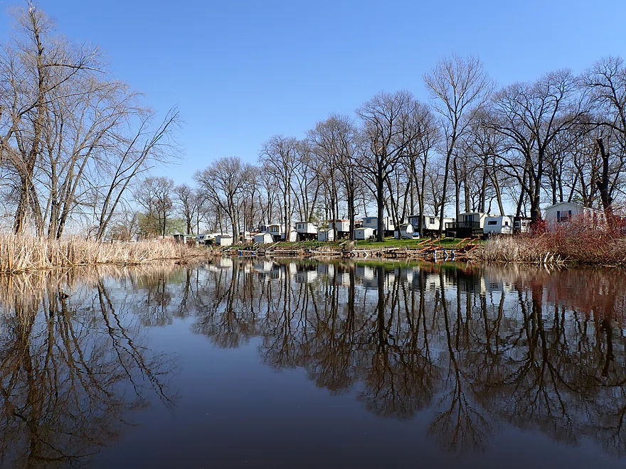
- Trenton Street Dam: (0.8 miles downstream from Clausen Park) You could portage the dam and take out by the bridge, which is a popular fishing spot. This stretch is a narrow flowage crowded with homes and piers, but it wouldn’t be a bad extension.
- Lake Drive Launch #1 (4.5 miles downstream from Clausen Park) This is an overlooked stretch of the Beaver Dam River that looks promising. There are likely a few rocky spots and maybe even some small rapids, but expect some strainers or logjams as well. It is definitely on my to-do list. The take-out is located at the river’s outlet into Beaver Dam Lake.
Bike Shuttle – Clausen Park to Hwy F: 4.4 miles with 52′ of ascent. This was an easy bike shuttle.
Dams: There is a weird half-dam upstream from Hwy F with a strong outwash that could push you awkwardly under a low bridge. You can easily avoid this by launching downstream from the bridge.
Logjams: This was mostly an open trip. Near the start, there were a few downed trees that required dodging, but nothing difficult. There was one spot with two logjams back-to-back that required a portage, though I found it to be an easy pull-over.
Current: The current is brisk at first but soon slows down. By the time you hit the cattail corridors, there is essentially no current.
Lack of Restrooms: This is a major factor to consider. There are no facilities at the put-in and none on Fox Lake. While there are outhouses at Clausen Park, they were locked during my trip. There are a few “break areas” on the upper half of Alto Creek, but once you enter the cattail fields and Fox Lake, there are almost no spots to get out. Plan accordingly.
Closest Gauge: Beaver Dam River @ Beaver Dam
Trip Depth: 650 CFS or 842.12′
Navigability Estimates:
- < 100 CFS: This is a relatively shallow level, but I suspect both Alto Creek and Fox Lake would remain navigable. There might be one shallow section close to the mouth, however.
- 101-300 CFS: Average depth. Fine for paddling and likely offers great clarity on Alto Creek.
- 301-500 CFS: High depth. Perfectly fine for paddling.
- 501-800 CFS: Very high depth. Still fine for paddling.
- 801-1100 CFS: Extremely high depth. Some of the creek banks might overflow, but the channel should still be navigable (most marsh paddles are quite flood-resilient).
- 1101+ CFS: This would be a “mega flood” and likely not ideal for paddling. However, Fox Lake might have special “emergency no-wake” rules in place during floods, which could actually make it a surprisingly calm time to be on the main lake.
- Lake Emily Road to Hwy F: 2.0 miles. Parts of this look open and attractive. But I suspect there are a few major logjams that might make navigation difficult.
- Hwy F to Clausen Park: 4.7 to 7 miles. First half of the trip is on Alto Creek. This is a small marshy prospect that is pleasant but does have one logjam. The second half of the trip is Fox Lake which is less interesting, but can have good waterfowl. You can extend the trip by exploring the Sager Island inlet.
- Clausen Park to Lake Drive Launch #1/Beaver Dam Lake: 4.5 miles.
- Clausen Park to Trenton Street Dam: 0.9 miles. This is a narrow flowage flanked by many homes and piers.
- Trenton Street Dam to Lake Drive Launch #1: 3.6 miles. An intriguing prospect that is surprisingly rocky and could have a few rapids. However, there also might be strainers and a few logjams. Definitely on my to-do list.
- Beaver Dam Lake Entrance to Dam/Cotton Mill Park: 8.7 miles. An uninteresting flowage paddle with many motorboats. However, each summer there is a paddle festival on the lake.
- Dam/Cotton Mill Park to Hwy J: 5.7 miles. A whitewater stretch with good potential but tricky to time. Reviewed April 2017.
- Cotton Mill Park to Riverside Park/W. David Street: 0.8 miles. A neat urban paddle through downtown Beaver Dam with the strongest rapids on the river.
- Riverside Park to Hwy S: 4.3 miles. A mixture of woods and rapids. Make sure to launch south of W. Davis Street and not north. You could take out at Canary Road if you really wanted to.
- Hwy S to Hwy J: 0.6 miles. No more rapids. A peaceful paddle through a mixture of farmland and wetgrass.
- Hwy J to Meadow Road: 2.9 miles. Slower current, wide channel, and fewer trees. Pleasant but not special.
- Meadow Road to Low Road: 2.4 miles. A mediocre prospect. There appears to be a canoe launch by Meadow Road, but you need to park away from the launch and on the shoulder.
- Low Road to Sock Road: 2.9 miles. Another mediocre prospect. Low Road I’m not sure about for access.
- Sock Road to Dam/Fishing Whole Park: 3.0 miles. Likely an uninteresting flowage paddle. Sock Road is doable but not ideal.
- Dam to Hwy 60: 0.8 miles. Neat little section with some rapids.
- Hwy 60 to Hwy J: 2.8 miles. Probably a weak section. Seems muddy, broad and slow. Hwy 60 is doable for an access, but will require some boat dragging to reach the water.
- Hwy J to Mud Lake Road: 6.3 miles. Probably an uninteresting cattail marsh segment. Note, the river splits for several miles and the take-out is on the west channel. Hwy J is a decent put-in.
- Mud Lake Road to Crawfish River: 5.9 miles. Probably more uninteresting cattail paddling. Just after you reach the mouth on the Crawfish, you’ll need to paddle a couple hundred yards upstream to reach the canoe launch at Hwy G.
Trip Map
Overview Map
Video
Photos Size: