
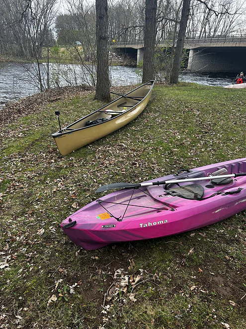
Put in at Wayside Park
Downstream view from Wayside Park
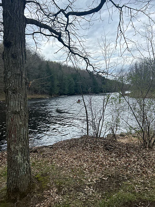
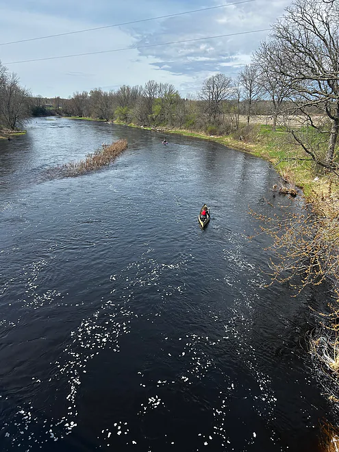
Downstream view from the H bridge

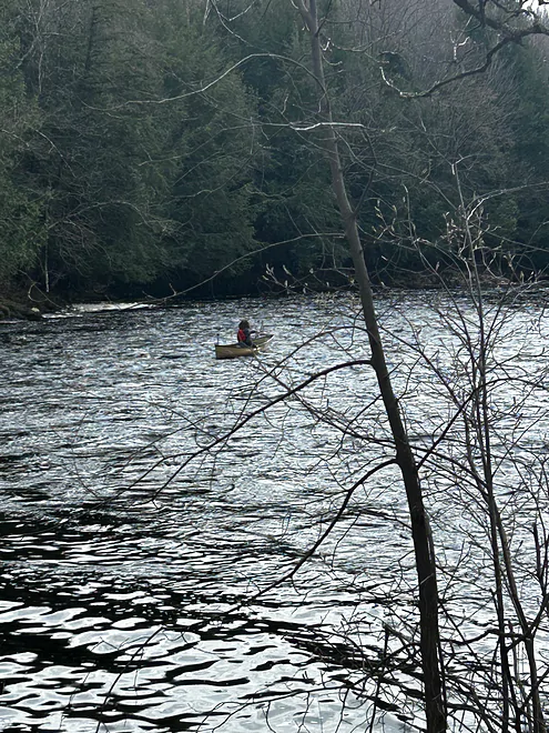
Kayakers downstream of the bridge
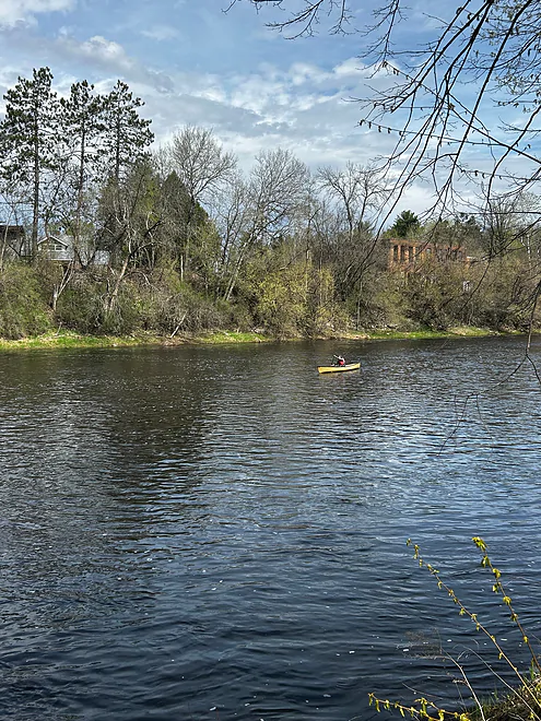
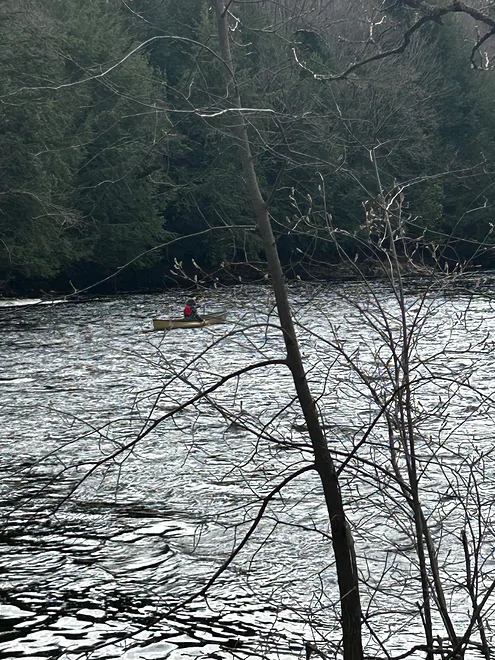
View from Haley Park
Jump River – Wayside Park to Sheldon

This stretch of the Jump is quite similar to the rest, though the scenery wasn’t as nice with the many houses and farms along the shore. I happened to be participating in the annual Sheldon Canoe Race for this trip, which is held every year on the last Sunday in April. The trip started at Wayside Park off Highway 73. The put-in is very nice and free of obstructions. Right after the put-in there are small rapids, though they might be less prevalent in lower water levels. These small rapids were very frequent throughout the whole section, though there were some slightly larger rapids too. None of them were above a Class 1 or 2. There were almost no rocks to dodge (besides a few very large and easy to see boulders) because of the high water level. At lower levels, there would be significantly more rocks and other obstacles to navigate. The take-out at Haley Park was also a great access with few obstructions. Overall, this section of the Jump isn’t as nice as the upper stretches, but it is still a good stretch with good rapids and great water clarity.
Thank you Angus for the review! I recommend readers check out the video which gives a nice feel for the river. It should be noted that water levels during the race were extremely high at 2200 CFS. For comparison my trip last year (just below this stretch) was done at 63 CFS.
WisconsinRiverTrips.com is always very appreciative of guest reviews, and if you, the reader, is ever interested in submitting one, you can use this online form.
Click here to see an overview map of the Jump River.
South Fork:
- Upstream from Luke Heights Lane: Much of the river looks navigable, but there could be strainers and deadfall to deal with. I just don’t know.
- Luke Heights Lane to Copper Dam Campground: 2.0 miles. A good stretch that includes high banks, a rocky bottom, minor rapids, and some white pines.
- Copper Dam Campground to Cty N: 6.8 miles. A scenic leg with more white pines, boulders, and rapids. Best feature is Little Falls (200 yards of Class 2 rapids which can be portaged).
- Cty N to Big Falls County Park South Access: 1.3 miles. A short leg with some light rapids and boulder gardens.
- Big Falls Park South Access to North Access: An incredibly scenic stretch of dells, rock formations and rapids. Paddlers should be warned this contains Class 4 rapids and has killed people. Unless you are a professional whitewater paddler, you should portage this. There is a 900′ portage path to the right. Even if you don’t paddle the rapids, definitely consider checking them out (it’s a local tourist attraction). A trail system east of the river provides good views.
- Big Falls Park North Access to North/South Fork Confluence: 1.7 miles. Includes a mile-long stretch of boulder gardens and Class 2 rapids. Also includes numerous rock outcrops and a small waterfall from a feeder creek.
Main Branch:
- North/South Fork Confluence to Cty M Wayside: 5.0 miles. This section includes high sand and gravel banks and multiple Class 1 rapids.
- Cty M Wayside to Village Park Landing: 5.9 miles.
- Cty M Wayside to Wayside Park by Hwy 73: 5.1 miles. A pleasant stretch. There is no special scenery, but it is consistently good with pine trees, boulder gardens, and light rapids. Rapids are generally safe with none greater than Class 1. There is a short stretch of small but scenic outcrops.
- Wayside Park to Village Park Landing: 0.6 miles. A short stretch by the village of Jump River. There is a terrific series of outcrops along the south bank.
- Village Park to Sheldon: 10.2 miles.
- Village Park Landing to Cty H: 7.0 miles. I think this is one of the more popular legs on the Jump with paddlers. Highlights include Class 1 rapids, boulders, some outcrops, and attractive wooded banks. View from Cty H bridge is scenic.
- Cty H to Haley Park/Sheldon: 3.2 miles. Seems to be more boulder gardens and light rapids. There is a scenic railroad bridge by Sheldon.
- Haley Park to Cty G: 4.0 miles. A pleasant Northwoods stretch with frequent shallow rapids and boulder gardens.
- Cty G to Whispering Pines Drive Ramp: 5.1 miles. First half is nice with large gravel bars and more boulder gardens. Second half is impounded by the Holcombe Dam and is likely slow and less interesting.
- Whispering Pines Drive Ramp to Wayside Boat Landing: 1.7 miles. Likely uninteresting lake paddling.
- Wayside Boat Landing to Sportsman Club Park/Mouth on Chippewa River: 3.7 miles. Likely uninteresting lake paddling.
North Fork:
- Upstream from Hwy 8: There could be navigable sections, but I don’t know. Snags and strong rapids could be issues.
- Hwy 8 to Hwy 1: 10.9 miles. The guide book “Wisconsin’s North Central Canoe Trails” describes this as a mix of minor rapids and quiet water by “meadow-like” sections. Note: this guide is outdated and was likely done at low water. The snags and rapids difficulty may now be worse.
- Hwy I to Riley Road: 4.4 miles. First half has some longer stretches of rapids including what I think are Class 2+ (piecing together clues from Rick Kark).
- Riley Road to W. Forest Lane: 1.7 miles. A few more rapids, but not as many nor as intense (I think).
- W. Forest Lane to Cty N: 2.0 miles. Good leg with what I believe are some longer stretches of Class 1 rapids.
- Cty N to South/North Fork Confluence: 4.3 miles. Rick Kark paddled this when high. He described it as being wooded and fast, but lacking in noteworthy rapids.
Mondeaux River (a tributary to the South Fork): The section north of the dam to the mouth on the Jump is likely too congested to run, but the lake itself (the Mondeaux Flowage) is a nice paddle. You can read a review on the Mondeaux here.
Trip Map
Overview Map
Video
Photos Size: