
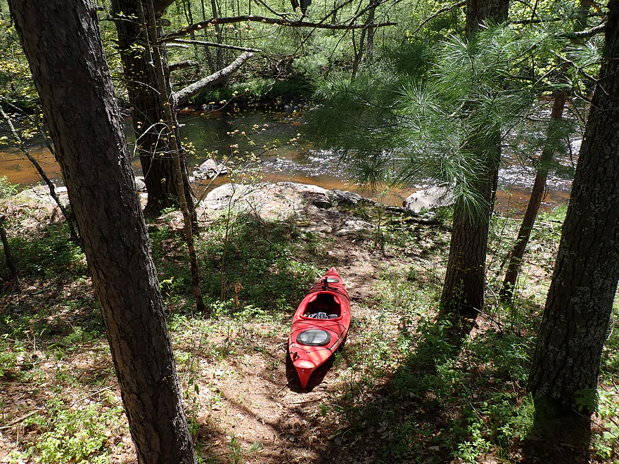
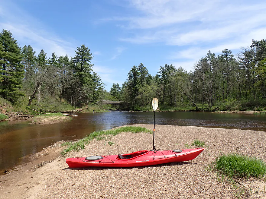
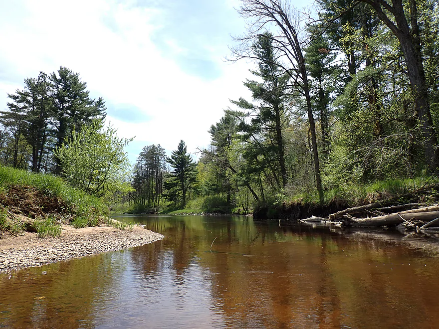
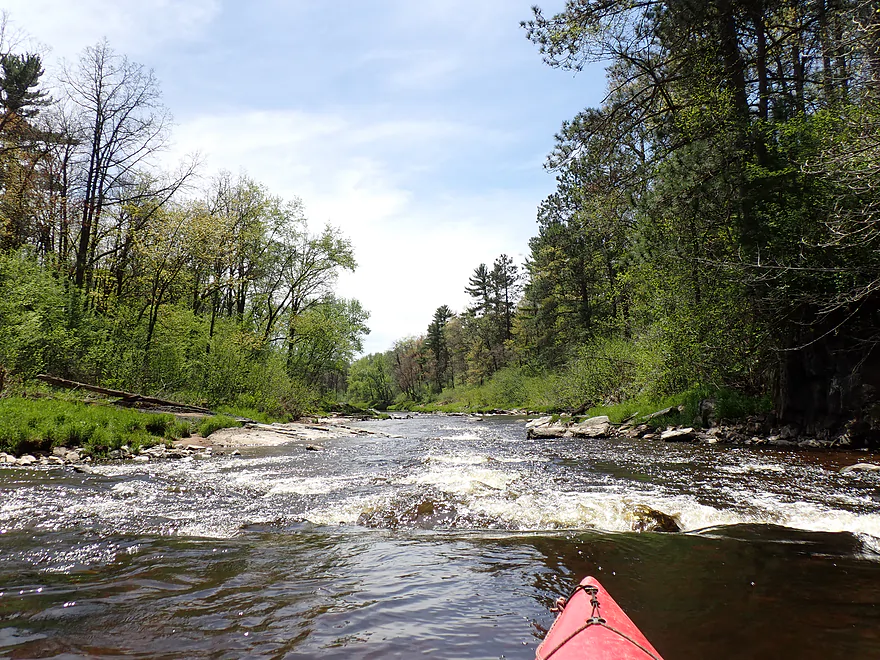
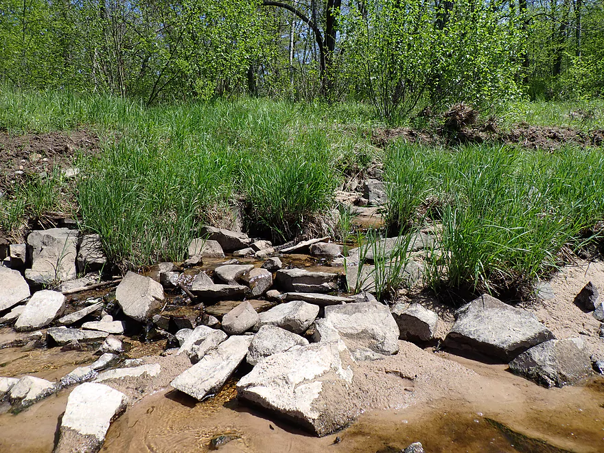
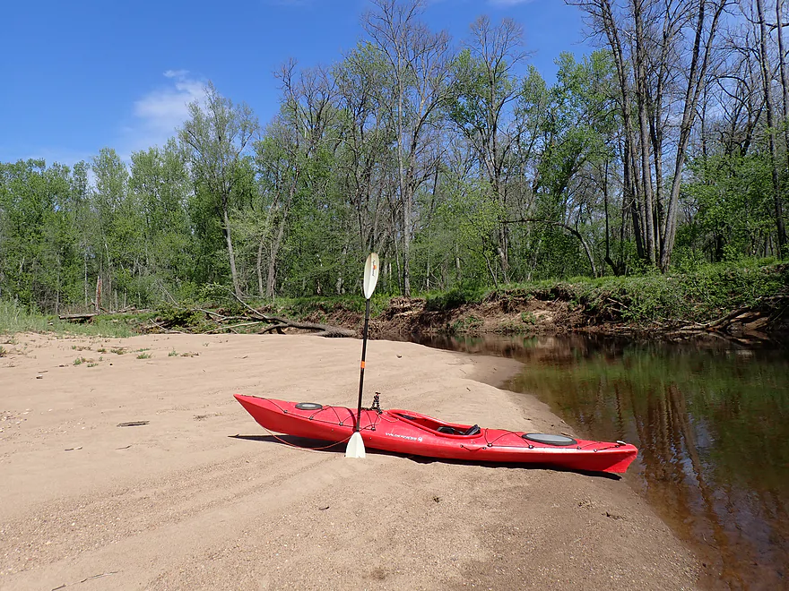
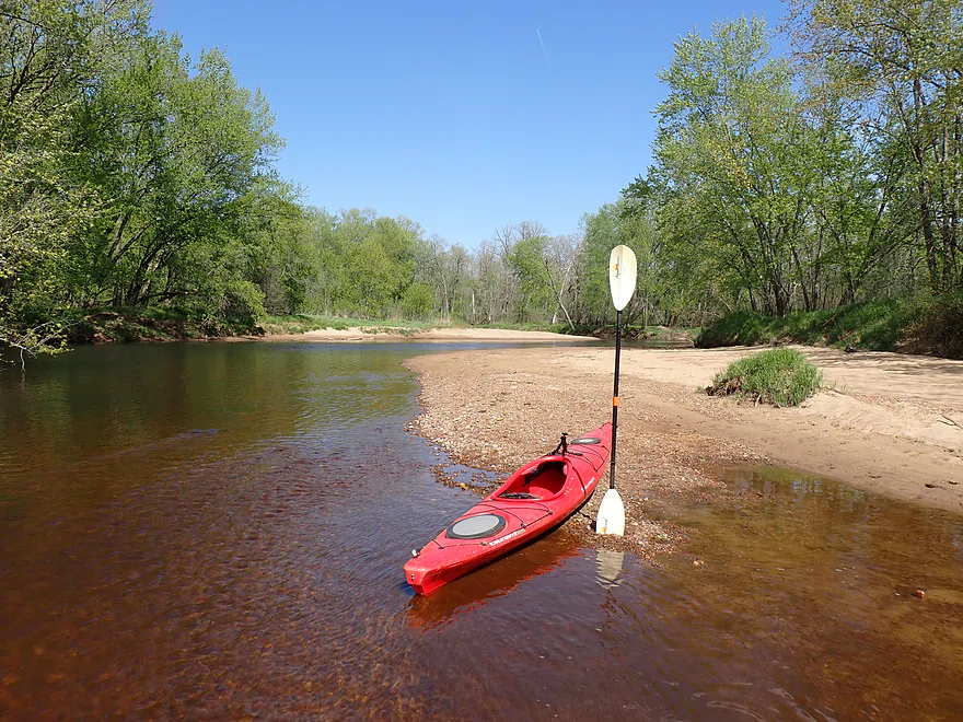
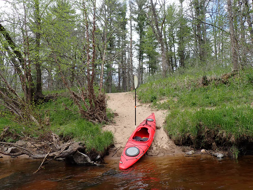
Starting the North Fork trip at a secret access

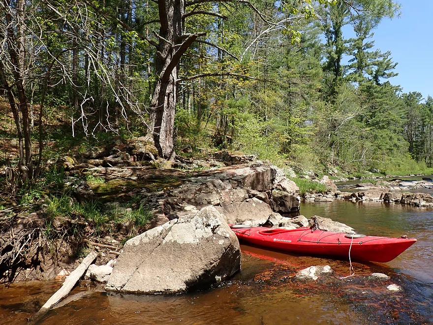
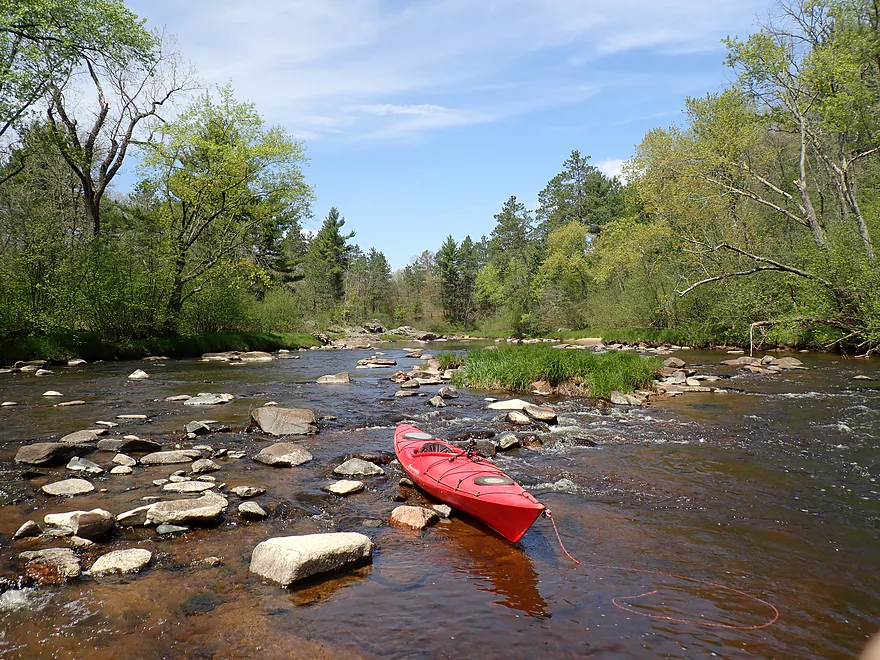
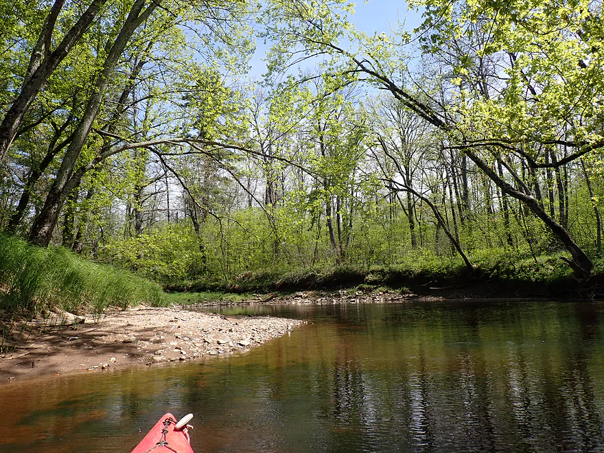
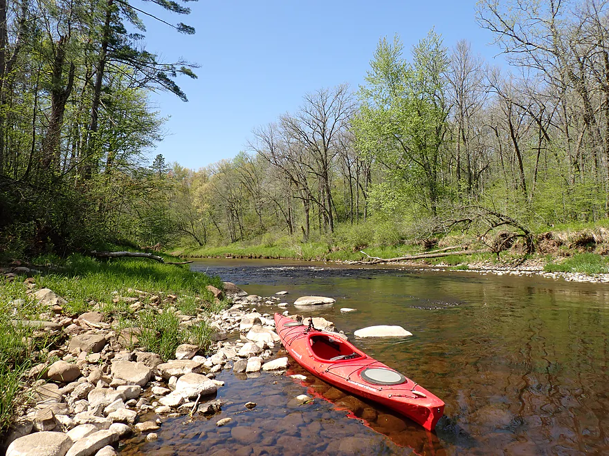
Terrific scene at the put-in
Nice little outcrop

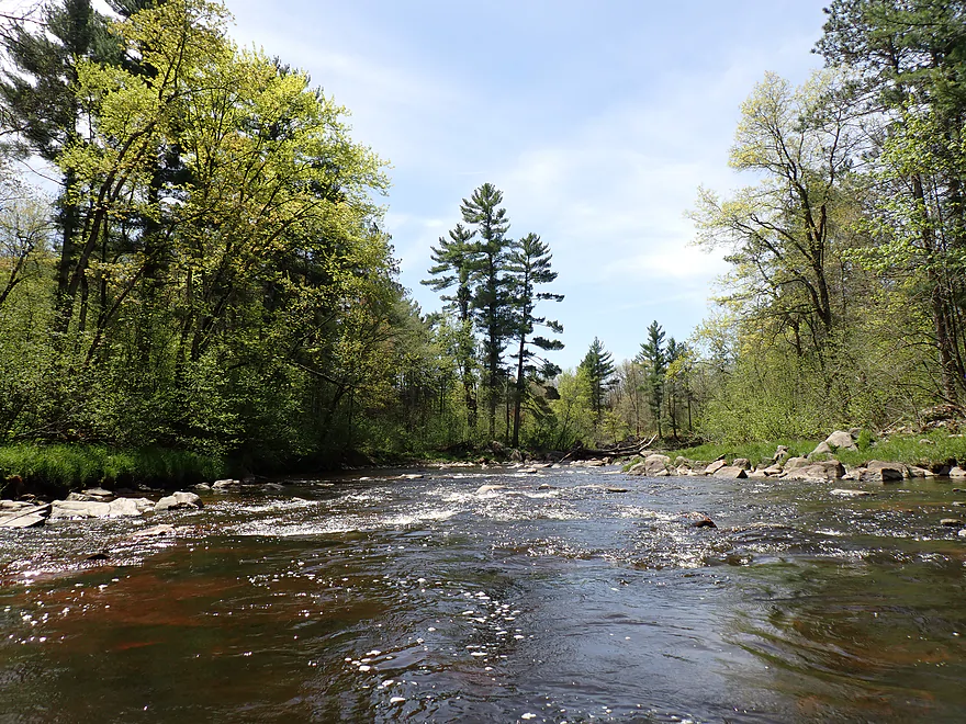
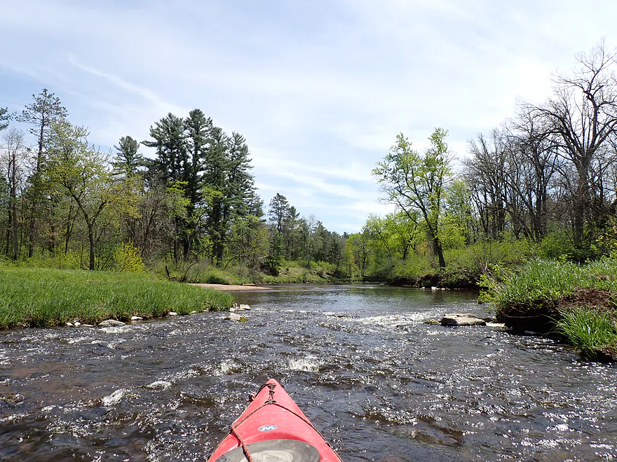
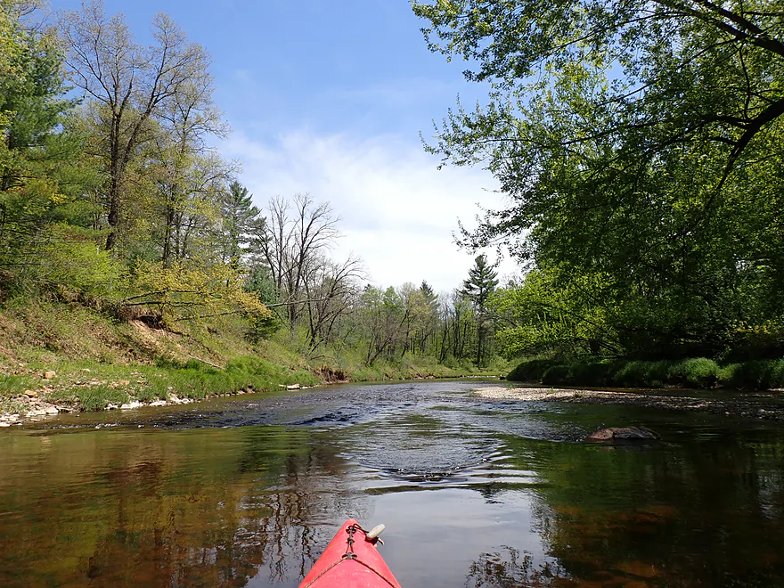
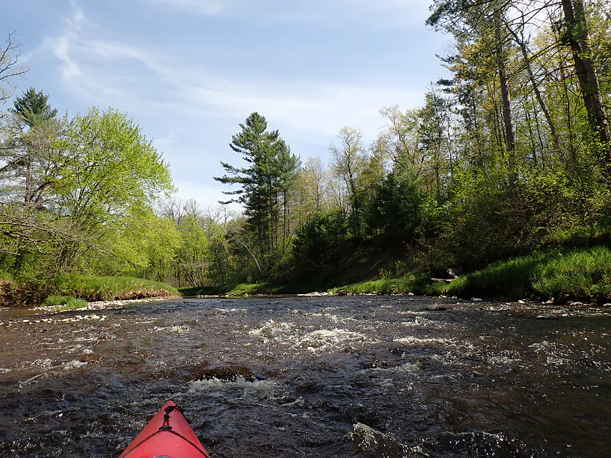
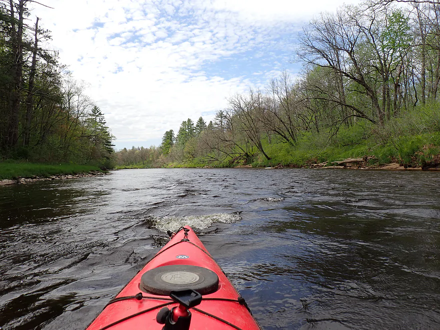
View upstream of the first pitch
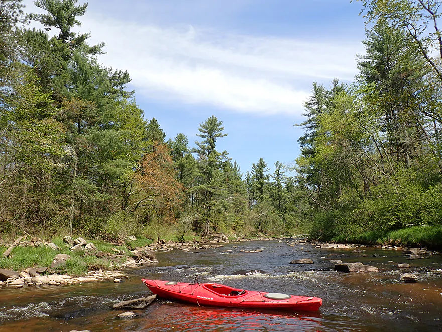
Second pitch
Reverse view
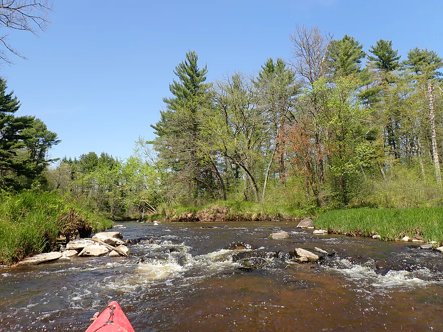
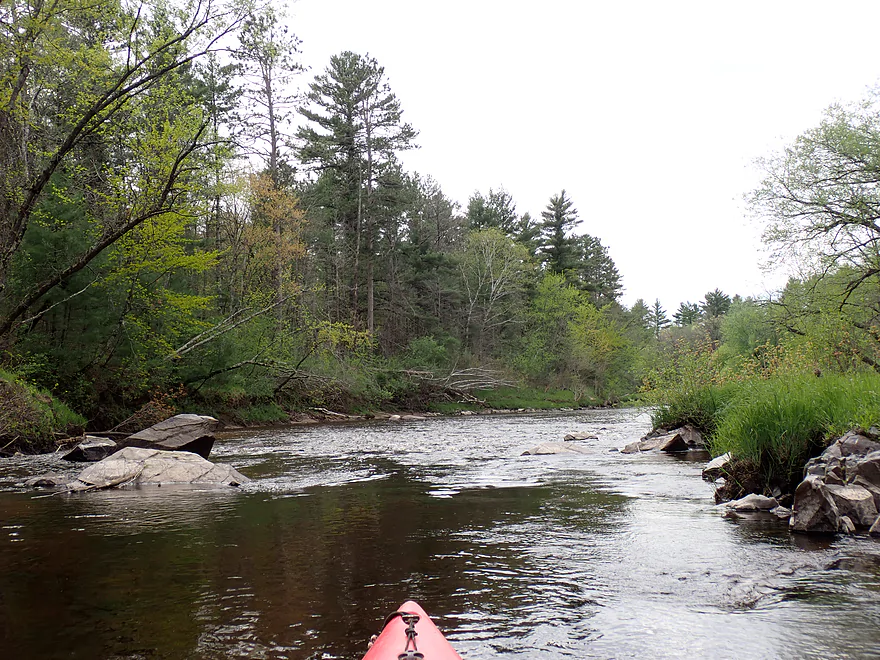
Third pitch and boulder garden
Reverse view
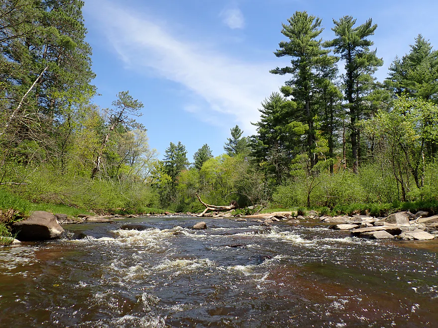
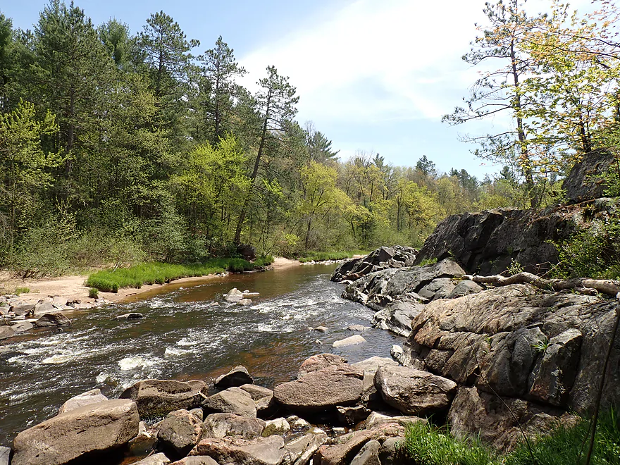
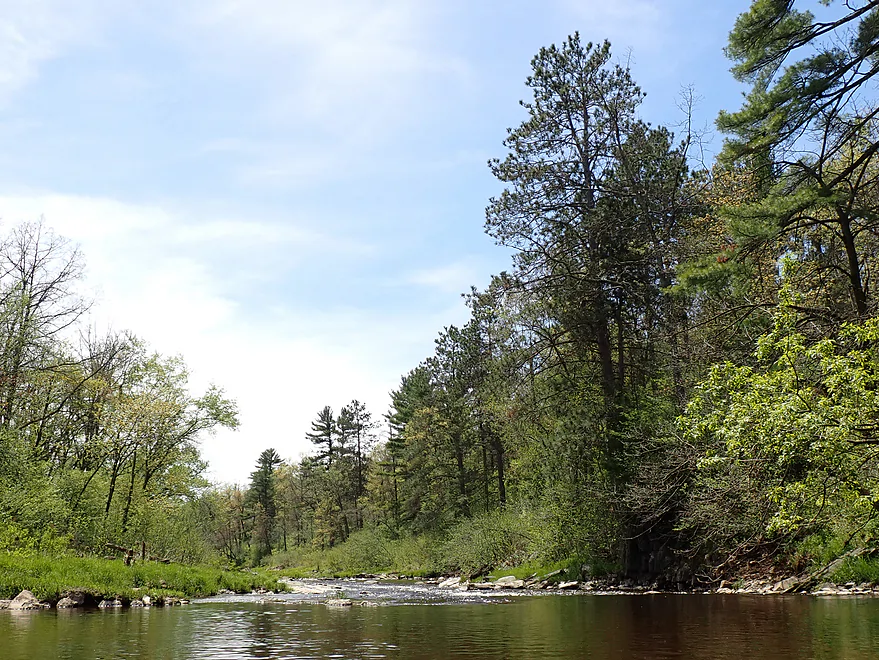
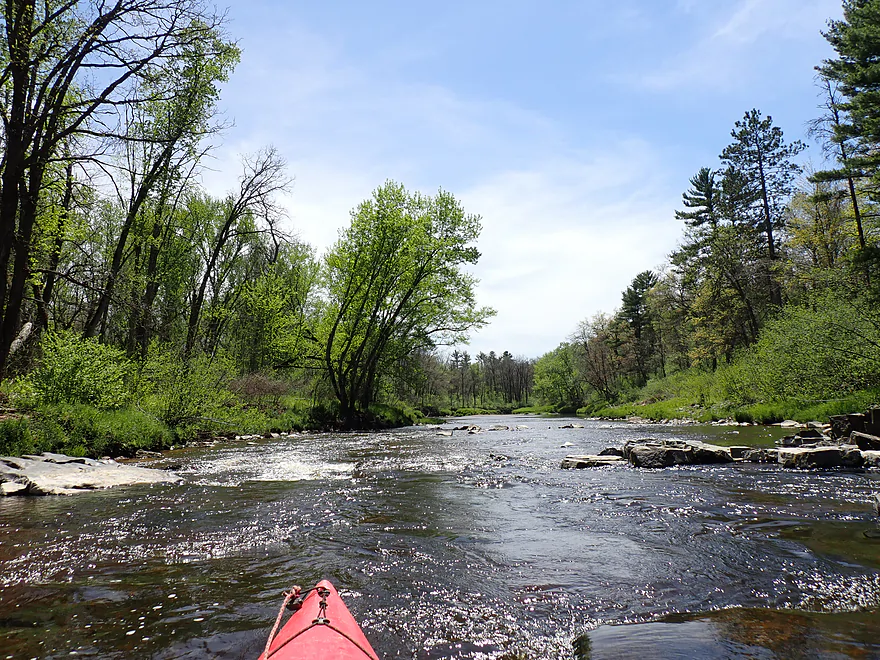
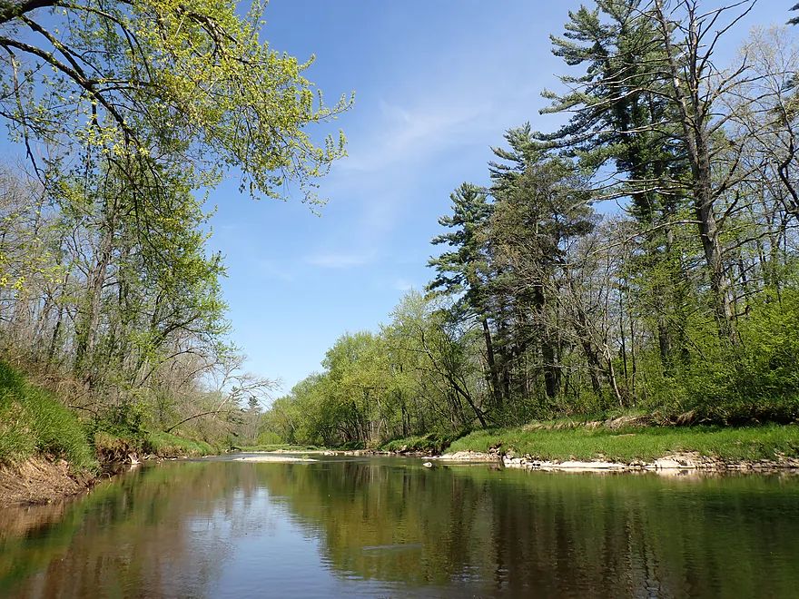
Super scenic
Fourth pitch
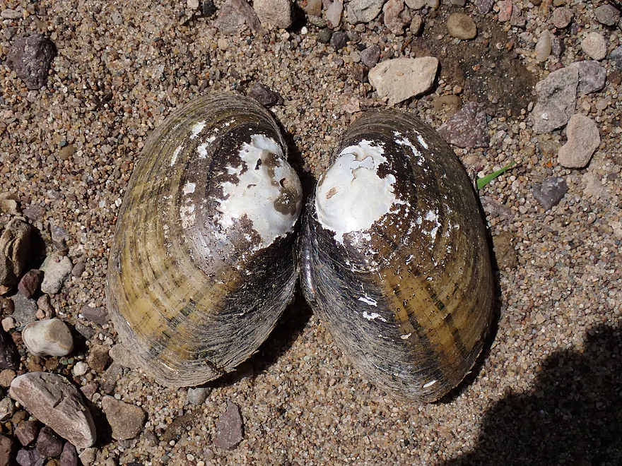
Tons of clam shells

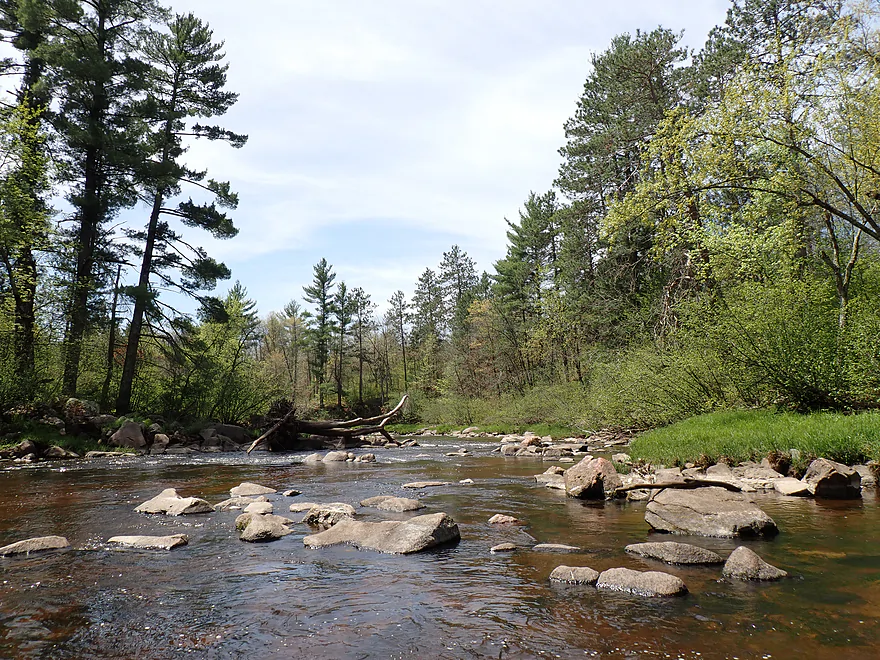
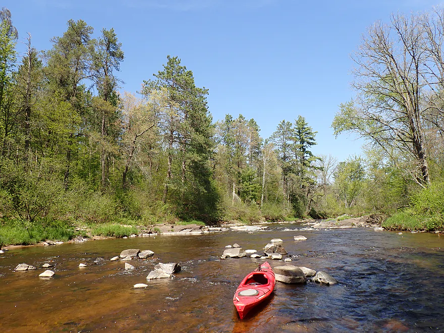
Exposed bedrock and granite…the highlight of the trip
View downstream

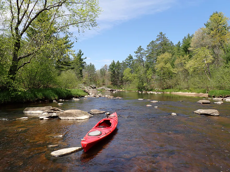
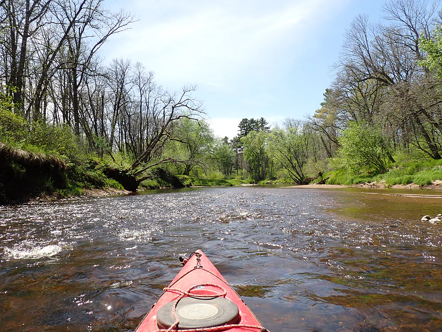
This is low water…in high water the rapids would be stronger

Close-up view
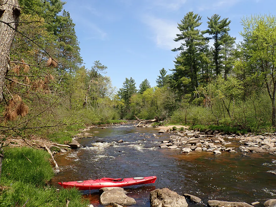
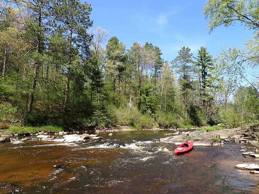
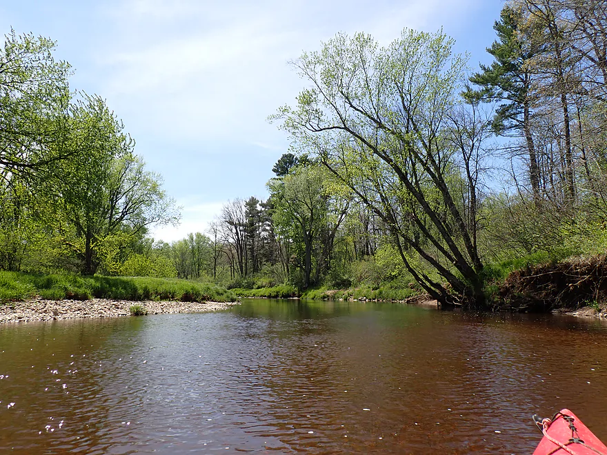
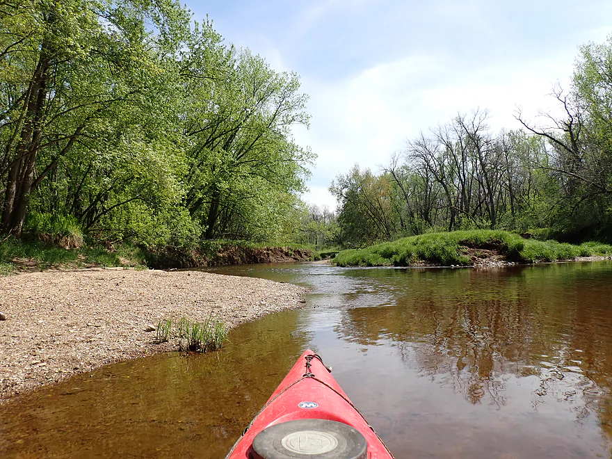
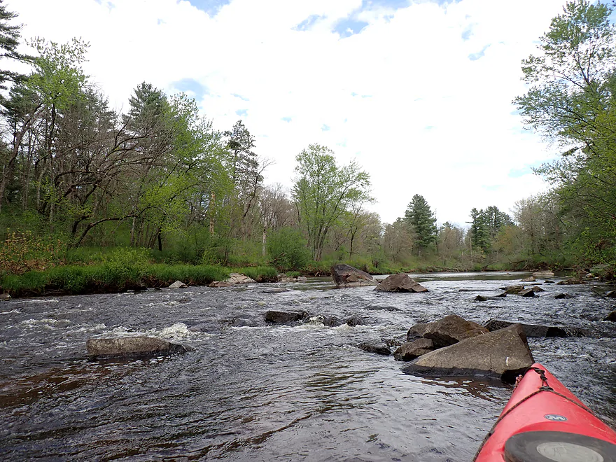
Approaching another boulder field
Reverse view
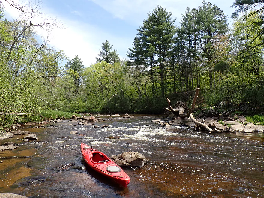
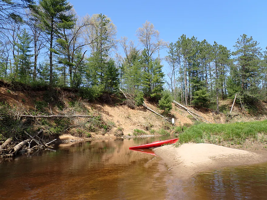
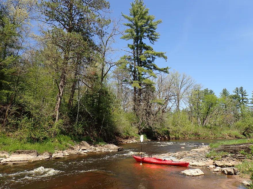
Shallowest part of the trip…I had to get out
Approaching Channey Road
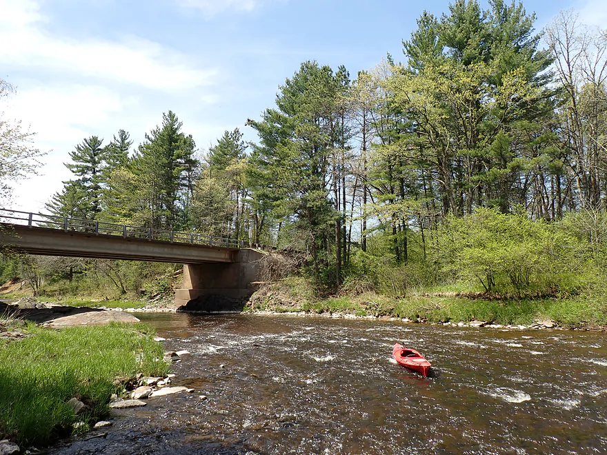
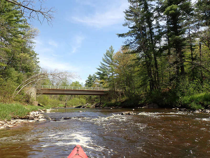
Fast rapids by the bridge
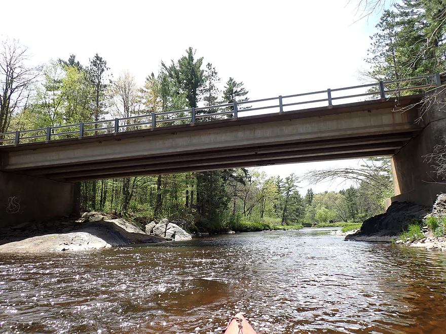
Bridge was built on a former dells formation
Upstream view from bridge
Downstream view from bridge
Approaching “Knight’s Pool”
Reverse view
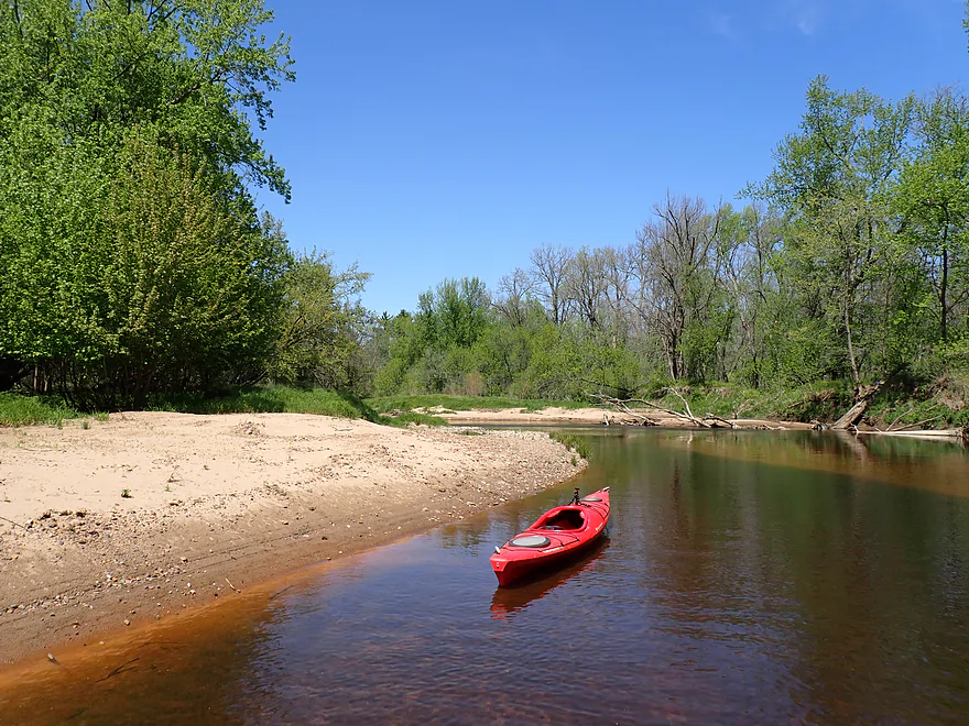
Fantastic gravel bar
That doesn’t belong here…
Exposed sand bank
Reverse view
Fun rapids around a small island
Reverse view
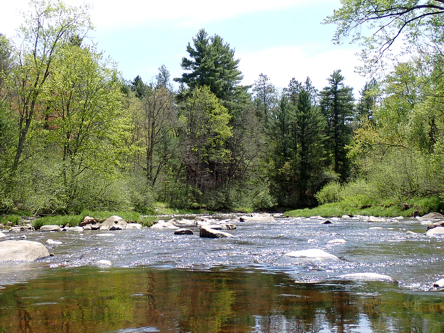
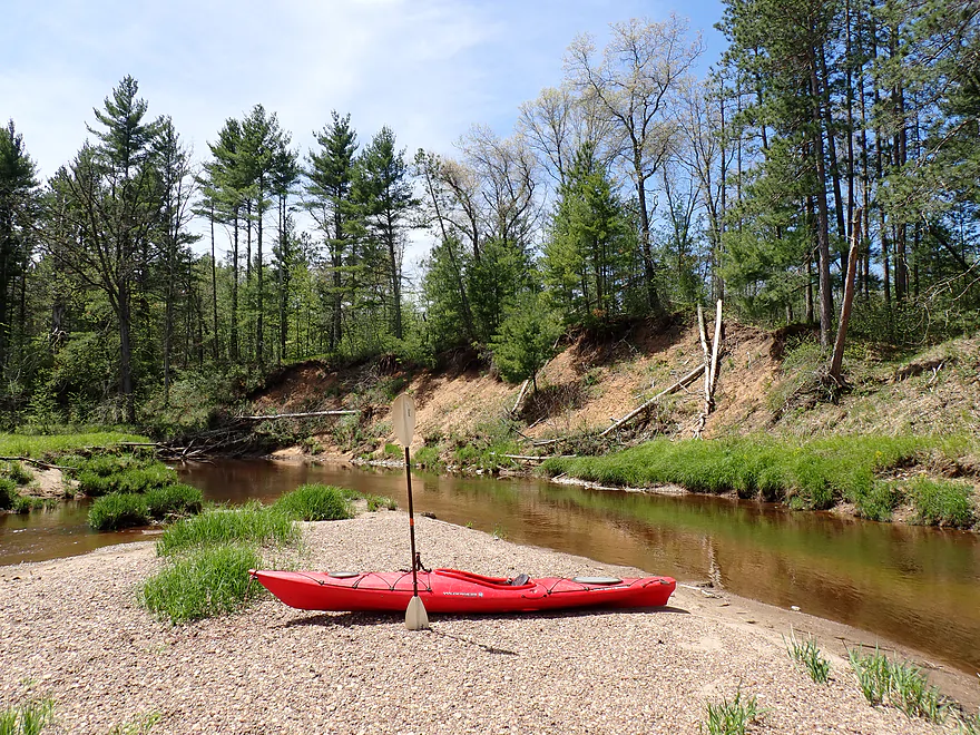
Approaching another scenic stretch of the river
First pitch

Reverse view
Second pitch
Reverse view
That wraps up the Tier 1 scenery for the trip
One of many nice sandbars
Lot of white pines
A surprising number of springs

Another exposed sand bank
Getting out for pictures
Reverse view of the rapids
Taking a sandbar break
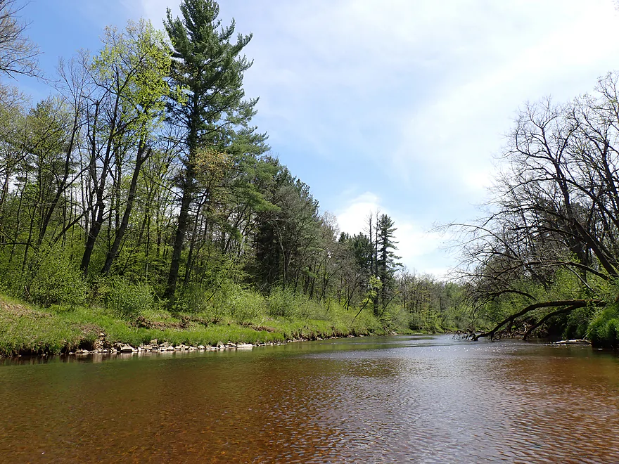
Great clear red water
Confluence of the North Fork (left) and the South Fork (right)
We’re now on the Eau Claire River proper
Not as interesting as the North Fork but still nice
Last rapids of the trip
Reverse view
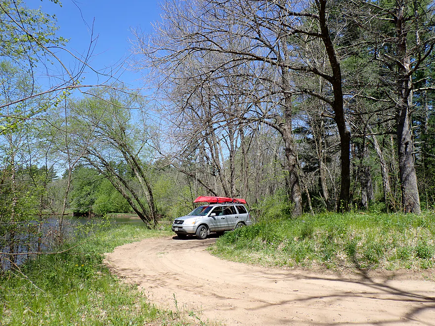
Ending the trip at Eisberner Landing
Good access
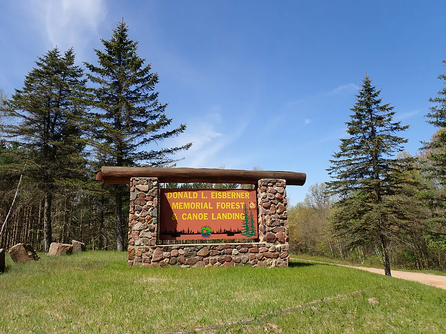
Fantastic rustic sign marking the take-out
Eau Claire River – North Fork

The Eau Claire is one of West Central Wisconsin’s finest rivers, celebrated for its frequent sandbars, occasional rapids, and beautiful, clear, tannin-stained red water. Having paddled multiple legs of the middle and lower sections, I wanted this time to explore the North Fork, a stretch often overlooked by paddlers.
Typically, North Fork paddlers choose between a long trip starting at Hamilton Falls or a short run from Channey Forest Road. I wasn’t in the mood for a grueling gravel bike shuttle up to Hamilton Falls, but launching at Channey Road meant missing a highly scenic section upstream. Instead, I drove half a mile north of Channey and discovered a ‘secret’ logging road leading straight to the water. It proved to be the perfect makeshift launch.
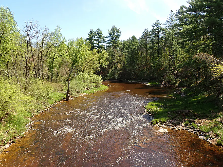
The river right by my put-in was easily one of the highlights of the entire trip. After dragging my boat down a short hill and onto exposed bedrock, I was treated to a terrific view of towering pines, Class I rapids, and an attractive boulder garden.
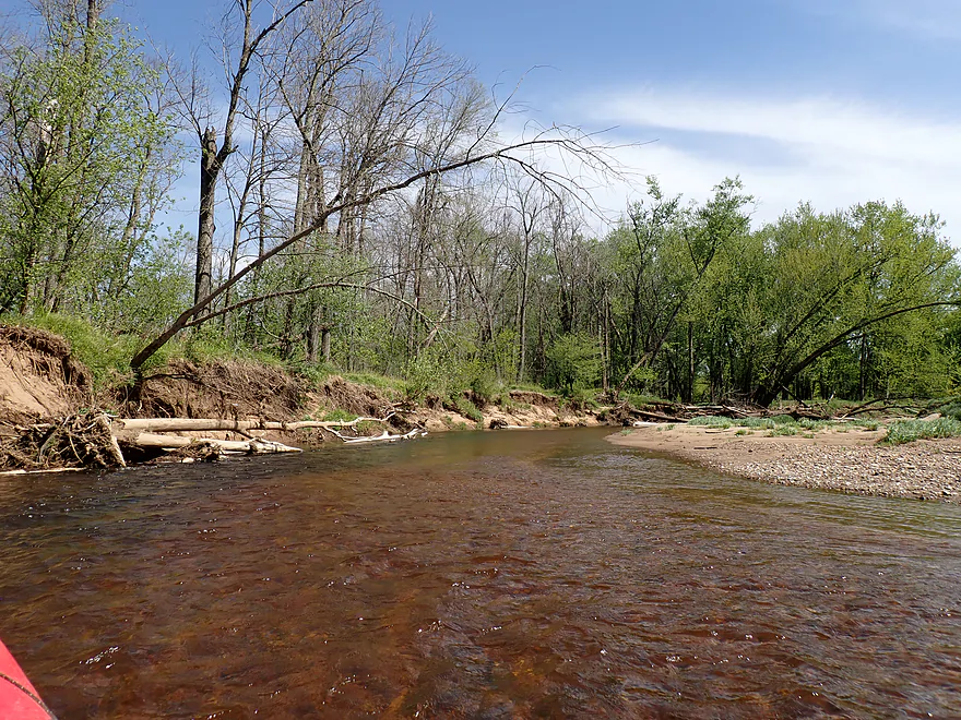
The scenery stayed top-notch as the river veered right and then hooked sharply left, redirected by an impressive rock outcrop before flowing over some fun Class II rapids. Next came a lengthy boulder garden that proved a bit rocky. While I had to wade through a few low spots on the trip, it wasn’t very common, and getting out usually provided an opportunity to photograph the river from different views.
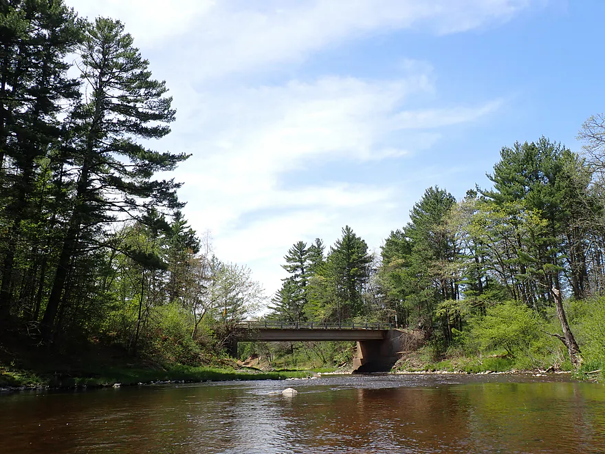
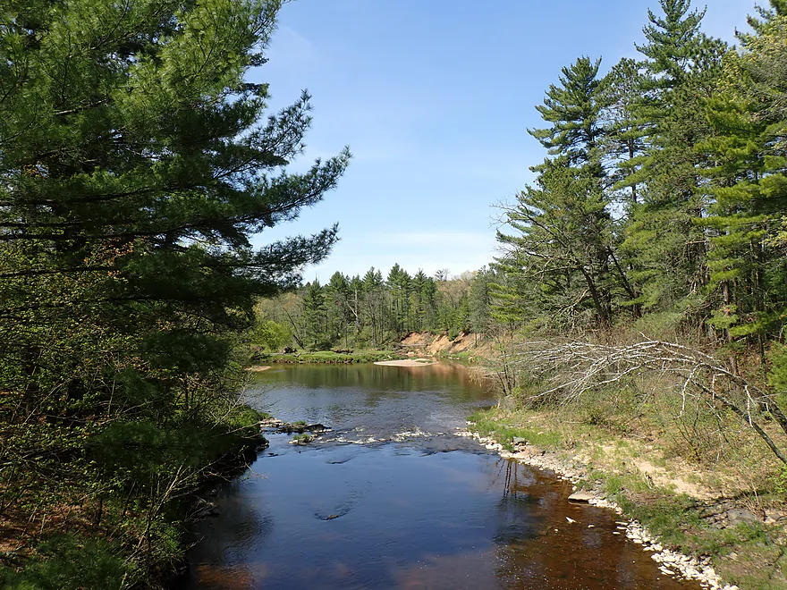
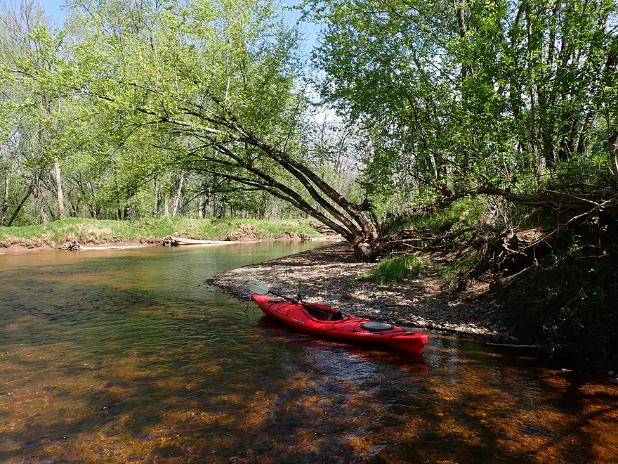
I soon rounded another bend and reached the Channey Road bridge, my original launch plan. Starting there where a faint trail leads down the upstream shore to the water, would have been perfectly doable. Looking back upstream, the river was remarkably picturesque—a classic scene of rapids, pines, and rugged boulder gardens.
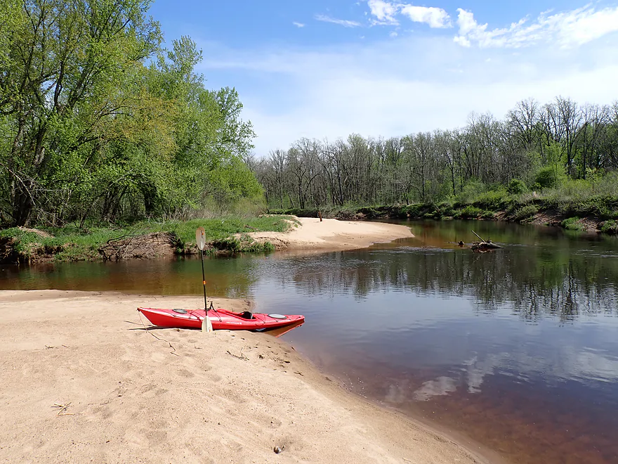
Directly under the bridge sat old rock dells, which were tragically defaced during the bridge’s construction. Downstream, a local fisherman was wading into the river just before it widened into “Knight’s Pool”, after which an exposed sandbank redirected the water out of view.
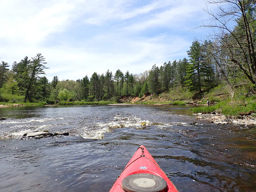
The scenic highlights weren’t over yet though. I soon faced two more photogenic pitches of rapids, constricted by exposed bedrock and backdropped by tall white pines. Beyond that, the major whitewater finally ended, giving way to a slower, less rocky, and somewhat less interesting paddle for the rest of the journey. This initial mile—spanning about half a mile upstream from Channey Road to half a mile downstream—is likely the finest part of the North Fork, if not the entire watershed.
The paddle continued pleasantly through beautiful, clear, tea-red water. Occasional springs bubbled from the banks as the river shifted between sandbars and gravel bars. Gradually, though, the landscape grew less dramatic as eroded sandbanks became more common, and generic hardwoods began replacing the towering white pines.
Most of this trip cut through the Eau Claire County Forest. Sadly, the county has largely mismanaged these public lands. When driving in, I was stunned to see vast tracts of land completely flattened by logging, and other stretches choked with small thickets and scrub indicating logging just a few years back. Fortunately, the immediate river corridor was mostly spared the worst of it.
Eventually, I reached the mouth of the South Fork, where massive sandbars flanked all three banks. This confluence marks the official start of the Eau Claire River proper. Because the two forks are roughly equal in size, the river effectively doubles in volume and deepens significantly here. While the South Fork is nice in its own right, its sandier, less rocky terrain simply doesn’t match the dramatic scenery of the North Fork.
By comparison, the main branch was a bit of a letdown, turning generic and less interesting, although it did offer one last scenic pitch of Class I rapids. Because Eisberner Landing wasn’t near a bridge, I got a little lost around looking for the take-out, but finally spotted it. Ironically, you’d expect a county forest to be empty. But between several kayakers’ cars, a car-camper, picnickers and anglers at Channey Road, and the frequent roar of ATVs, total solitude proved elusive—but that was okay.
In summary, this was a terrific trip, easily the best of my 2026 paddling season so far and the finest stretch I’ve done on the Eau Claire River. I highly recommend it, but with a couple of caveats for fellow paddlers: water levels here can be fickle, and the local gravel roads are surprisingly bad (especially for low-clearance vehicles).
Sights included small fish, turkey vultures, and tons of clam shells. The highlight were the singing frogs, which sounded really cool. Sometimes you could see them along the shore with their throats all puffed up from singing. The lowlight were the mosquitoes…there were a surprising number. Don’t forget your DEET-free repellent.
Thanks to its abundant sandbars, the Eau Claire River is a great paddle/camping combo river. Most banks along the Upper Eau Claire and North Fork are county-owned, meaning camping is allowed with a cheap county forest permit ($5 a night). However, the middle and lower stretches feature some private property. Cross-reference the Wisconsin Public Lands Map if you’re unsure about shoreline access. For the best sandbars, plan your trip during low water and scout satellite maps ahead of time. Finally, keep in mind that the Eau Claire County Forest is home to black bears and wolves; they likely won’t bother you, but store your food properly and pack bear spray just in case.
Beeman Creek Access: Located about a half mile north of the Channey Road bridge, this unnamed access drive off Hamilton Falls Road leads to a secluded, scenic, and terrific landing. Putting in here instead of at Channey Road lets you run the “Beeman Creek Rapids,” which was a highlight of the trip. There is a small area to turn around, and getting to the river is easy.
Be warned, though: the county locks a physical gate on Hamilton Falls Road from, I believe, late November to May 1st (the roads can be in bad shape). Even in the summer, conditions can be sketchy. Hamilton Falls Road is loose gravel and sand, while the grass-and-dirt access road has deep ruts (more suitable for cars with high-clearance). If your vehicle can handle it, putting in here is absolutely worth it.
Alternate Put-ins:
- Viking Pipeline Access (3.5 miles upstream from Beeman Creek Access): This spot offers a nice public pull-off and makeshift access where a natural gas pipeline was buried under the river. The 3.5-mile paddle down to Beeman Creek Access is a pleasant stretch featuring a few Class I rapids and scenic rock formations.
- Hamilton Falls Access (4.7 miles upstream from Beeman Creek Access): You can launch either upstream or downstream of the falls, where the main feature is a 2-to-3-foot ledge (video here). While the stretch between Hamilton Falls and the Viking Pipeline is mostly flatwater with maybe one set of rapids, it is still scenic and is, flanked by steeper, hillier terrain than the lower parts of the North Fork.
- Channey Road (0.4 miles downstream from Beeman Creek Access): Although the bridge sits on a steep rock ledge, a subtle path tucked into the northeast corner provides an easy launch.
Eisberner Landing: This was a very nice public landing, but because it isn’t by a bridge, take careful note of the surrounding terrain so you don’t overshoot it. Make sure to leave your vehicle in the small lot to the north so you don’t block the turnaround area; another paddler blocked me here when returning from my bike shuttle, forcing a very tight Y-turn just to turn around. The unpaved access road (Canoe Landing Forest Road) is a bit rough, but it’s honestly not that bad and is in much better shape than Channey Road.
Alternate Take-outs:
- County Road G (5.1 miles downstream from Eisberner): This is where most paddlers take out, utilizing the beach east of the bridge. While it’s on my to-do list, I’ve been hesitant to tackle it because of the loose gravel bike shuttle. However, it has great potential, offering large sandbars, an exposed sandbank, and 5 to 6 Class I and II rapids. That being said, I still suspect the North Fork is the more scenic stretch.
Bike Shuttle – Eisberner Landing to Beeman Creek Access: 2.2 miles with 75′ of ascent. The entire shuttle is gravel. While the first mile on Canoe Landing Forest Road wasn’t too bad, Channey Road gets tricky with a mix of sand, large gravel chunks, and occasional dust storms kicked up by passing ATV convoys—definitely not a fun combination on a bike. However, it was plenty doable and incredibly short; and at just two miles, you could easily turn it into a hiking shuttle.
Logjams/Strainers: None.
Rapids/Current: Expect a mix of lazy current, minor riffles, and a few easy-to-manage rapids. The best whitewater is a scenic half-mile mix of Class I and II rapids between Beeman Creek Access and Channey Road. Another half mile of doable Class I/II sections sits just downstream of Channey Road; these can be easily scouted or portaged. The river then tames down to minor Class I’s/riffles until the South Fork confluence. After the forks merge, the river stays flat, offering just one last fun stretch of Class I’s near the Eisberner Take-out.
Gauge: Eau Claire River @ Fall Creek
Trip Depth: 0.18′
- < 0.14′: Probably too shallow.
- 0.14′ to 0.20′: Scratchy baseline. While many paddlers would consider this too low, I found it manageable in a shallow-drafting boat. A handful of the rapids were bumpy and required brief wading, but the flats in between flowed fine. V-bottom boats should target higher water.
- 0.21′ to 0.5′: Ideal recreational range. Expect a few minor bumps, but this provides a great, clean cushion for most boats.
- 0.60′ to 1.3′: Above average. The water will lose its clarity and get turbid, but the rapids will be well-padded and highly runnable.
- 1.40′ to 2.20′: High water. The river will be fast, muddy, and splashy, but the North Fork remains navigable for experienced paddlers.
- 2.20 ’+: Very high / flood stage. The river becomes rambunctious and rowdy; only suitable for expert paddlers.
Disclaimer: These are rough estimates based on personal observations. Always use your own judgment. You can easily eye-ball scout key rapids at the put-in, take-out, and Eisberner Landing. If it looks too low, have a backup plan (such as paddling the lower Eau Claire, which will be much deeper).
Detailed Overview
North Fork:
- Upstream of Township Memorial Park: I'm not sure if the far upper reaches of the river are navigable.
- Township Memorial Park to Hamilton Falls: 2.9 miles. I think this leg would be sandy with 3-4 major logjams, and maybe one set of Class I rapids.
- Hamilton Falls to Viking Pipeline Access: 1.0 miles. A scenic mostly flat-water stretch with maybe one set of rapids. This part of the river has steeper terrain and more hills than the lower North Fork. Note, if you don't want to run Hamilton Falls (Class 3), you can portage them or launch just from the downstream side.
- Viking Pipeline Access to Beeman Creek Access: 3.5 miles. A nice remote prospect with nice woods, a few rapids and perhaps some rock formations.
- Beeman Creek Access to North/South Fork Confluence: 3.0 miles.
- Beeman Creek Access to Channey Road: 0.4 miles. A terrific stretch with scenic pines, several nice outcrops, boulder gardens and Class I and II rapids. This part of the river can get very shallow in summer.
- Channey Road to North/South Fork Confluence: 2.6 miles. Attractive wooded stretch with mostly lazy current, sandbars, and gravel bars. There are a handful of rapids, with the best and most scenic being closer to Channey Road.
South Fork:
- Upstream of Koehler Ford Lane:
- Dickerson Ave to Koehler Ford Lane (Main Branch): 7.3 miles. Very sandy stretch and likely has a handful of logjams. Probably nothing special about it.
- Rock Dam County Park to Koehler Ford Lane: 4.5 miles. Half this trip is on Hay Creek, which has some neat dells. Launch below the dam. Maybe some logjams but should be easy to portage on adjacent sandbars.
- Koehler Ford Lane to Hwy H: 5.1 miles. A pleasant stretch.
- Hwy H to North/South Confluence: 3.1 miles. A sandy segment I don’t know much about. Likely nice.
Main Channel:
- North/South Fork Confluence to Eisberner Memorial Park: 0.8 miles. Generic leg–not super interesting, but there are a few large sandbars and some minor rapids at the Eisberner access.
- Eisberner Memorial Park to Hwy G: 5.1 miles. Good prospect with nice sandbars, a large exposed sand bank, and maybe 5-6 Class I/II rapids.
- Hwy G to Lake Eau Claire Dam/Lake Eau Claire Park: 6.1 miles. Probably uninteresting flowage paddling. Alt access on the north shore by the county park. Note, the portage past the dam to Hwy 27 would be very difficult.
- Lake Eau Claire Park to Hwy 27: 0.3 miles. A scenic section with rapids and rock formations.
- Hwy 27 Landing to Harstad County Park: 1.7 miles. Launch on a newish landing under Hwy 27. Neat granite outcrops in the area.
- Harstad Park to Hwy D: 8.5 miles. Great section with epic sandbanks.
- Hwy D to Big Falls Park: 6.7 miles
- Hwy D to Hwy K Landing: 5.5 miles. Good section with a number of sandbars and one set of fun Class II rapids.
- Hwy K to Big Falls Park: 1.2 miles. A short stretch with one nice beach by Hwy K. Big Falls Park is very scenic but has some serious whitewater and falls.
- Big Falls Park to QQ Boat Ramp: 6.6 miles.
- Big Falls Park to North Shore Drive Wayside: 5.2 miles. A very sandy stretch with many sandbars and several significant sandbanks. It's an attractive and pleasant paddle, but lacking in the rapids and elite scenery of other sections on the Eau Claire.
- North Shore Drive Wayside to QQ Boat Ramp: 0.9 miles. A generic leg that isn't that interesting. Current really starts to slow down.
- QQ Boat Ramp to Altoona Lake Dam: 4.5 miles. Half of this flows through a broad, sandy channel and half through a flowage lake. There is an alternate take-out at Lake Altoona Park.
- Altoona Lake Dam to Mouth: 3.3 miles. A neat section through downtown Eau Claire with some Class II rapids.
- Eau Claire Mouth to Hobbs Landing: 1.9 miles. A short paddle on the Chippewa through the University of Eau Claire campus before reaching your take-out.
Coon Fork Creek:
This is a wild card prospect referred to me by canoe author Mike Svob and EC Adventures. The main route starts at Coon Fork County Park (by the dam). I checked it out and it actually looked really cool. The area is very rocky and it appears the creek flows partly through rocky dells and canyons before emptying into the Eau Claire (at which point you could take out at G). While shallow looking (when I scouted it), I thought it might be runnable as is (can’t be certain though). Reminds me of perhaps Robinson Creek or Spring Brook in the Dells. RiverDarter.com has a nice video of the creek here.
Bridge Creek:
This is a really cool tributary to the Eau Claire with rocky dells and striking sandbanks. Reviewed here.
Trip Map
Overview Map
Video
Photos Size: